River
Brisbane River
344 km from source to mouth · Australia.
 AustraliaFlows into Moreton Bay
In numbers
Length
344km
Average flow
48m³/s
Basin
13,600km²
Drop
174m
from 174 m to 0 m
Country
1
The journey
From source to mouth
344 km of river and 68 stops on the way: 59 towns and cities on its banks, dams, bridges and the tributaries that feed it.
- 0 kmGreat Dividing Rangeat 174 m
- 174 kmLake Wivenhoe103 km²
- 177 kmLockyer Creektributary
- 184 kmLowood4,106 people
- 222 kmLake Manchester2.0 km²
- 248 kmKarana Downs3,755 people
- 249 kmKaralee4,273 people
- 266 kmCollingwood Park7,022 people
- 269 kmMoggill4,582 people
- 274 kmGoodna10,432 people
- 281 kmBellbowrie5,366 people
- 282 kmRiverhills3,982 people
- 285 kmWestlake4,246 people
- 286 kmMiddle Park3,864 people
- 290 kmJindalee5,198 people
- 290 kmKenmore8,764 people
- 292 kmFig Tree Pocket3,963 people
- 294 kmSinnamon Park6,323 people
- 294 kmDarra4,280 people
- 295 kmOxley8,344 people
- 296 kmCorinda4,915 people
- 300 kmChapel Hill9,866 people
- 301 kmIndooroopilly11,987 people
- 301 kmTaringa8,145 people
- 303 kmGraceville4,515 people
- 304 kmMoggill Creektributary
- 306 kmMoorooka10,141 people
- 306 kmYeronga6,364 people
- 312 kmAnnerley11,158 people
- 312 kmGreenslopes9,197 people
- 314 kmHighgate Hill6,083 people
- 317 kmToowong10,780 people
- 317 kmAuchenflower6,196 people
- 317 kmBardon9,231 people
- 318 kmWest End9,269 people
- 319 kmPaddington8,315 people
- 319 kmRed Hill5,390 people
- 320 kmKelvin Grove7,766 people
- 320 kmSpring Hill7,213 people
- 322 kmSouth Brisbane8,658 people
- 323 kmBrisbane central business district9,460 people
- 323 kmBrisbane2,780,063 people
- 324 kmFortitude Valley9,708 people
- 324 kmStory Bridge
- 325 kmKangaroo Point8,398 people
- 326 kmWoolloongabba6,321 people
- 326 kmEast Brisbane5,735 people
- 327 kmOxley Creektributary
- 327 kmCoorparoo15,965 people
- 328 kmNew Farm12,256 people
- 328 kmNorman Park6,118 people
- 328 kmHawthorne4,786 people
- 330 kmTeneriffe5,067 people
- 331 kmBulimba6,612 people
- 332 kmNorman Creektributary
- 332 kmWindsor6,983 people
- 332 kmBowen Hills4,048 people
- 333 kmWooloowin3,857 people
- 333 kmLutwyche3,369 people
- 333 kmAscot5,773 people
- 333 kmClayfield10,323 people
- 334 kmHamilton7,144 people
- 334 kmHendra4,620 people
- 335 kmBalmoral3,787 people
- 337 kmMorningside10,176 people
- 338 kmCannon Hill5,481 people
- 338 kmMurarrie4,192 people
- 340 kmBreakfast Creektributary
- 343 kmBulimba Creektributary
- 344 kmMoreton Bayat 0 m
Water level along the river (RiverATLAS; the height is exaggerated). Towns: GeoNames and Wikidata; bridges, dams and tributaries: Wikidata.
River in Queensland, Australia
At the mouth it carries 48 m³/s on average: an Olympic pool every 52 seconds. It drops from 174 m to 0 m, 0.5 m per kilometre on average. Its basin covers 13,600 km², about the size of BS. 1.2 million people live in it. Highest water: from February to March; lowest: September. It is heavily dammed: reservoirs can hold 117% of a year's flow.
Where to start
- BrisbaneLargest city on its banks · 2,780,063 people
- Brisbane International Airport (BNE)Nearest airport with scheduled flights, 13 km from the cityCar hire at BNE airport (Brisbane)Discover Cars · Affiliate link↗
- On the water86 ferry piers, marinas, boat rentals and boat ramps along the river (OpenStreetMap)
- Kayak and canoe4 put-ins and rapids mapped (OpenStreetMap)
- From May to SeptemberThe best months to visit
Brisbane River, month by month
Highest water: from February to March
Lowest water: September. Best months to visit: from May to September.
From about 17 m³/s in the lowest month to 78 m³/s in the highest. An estimate: the monthly flow is modelled from the lowest and highest months of WaterGAP (RiverATLAS, 1971–2000) and the rain and snow along the river (WorldClim). Dams change the real rhythm. The chip is the average air temperature; below it, the month's rain.
Plan the trip
Plan the trip: boat trips, a bed by the river, a car
Some links above are affiliate links: if you book through them we may earn a commission, at no extra cost to you. It never changes what the data on this page says.
The basin
Brisbane River: the basin in numbers
13,651 km² of land send their water to this river. This is what lives on it.
- 1.2millionpeople live in the basin
- 87/km²people per km²
- 270maverage altitude of the basin
- 968mmof rain a year (basin average)
- 18.7°Caverage air temperature
- 8%protected areas
- 1.2%covered by lakes
- 1.8km³held in reservoirs
What covers the basin
- 46% Forest
- 2% Cropland
- 20% Pasture
- 5% Towns and cities
RiverATLAS (HydroATLAS v1.0, CC BY 4.0): land cover, people, protected areas, glaciers and dams over the whole basin upstream of the mouth.
Along the river
Brisbane River: what you find on the way
- 9WeirsLower Creessbook Weir, O'Reillys Weir and 7 more
- 3RapidsThe Marsh Rapid, Rocky Rapid, Broken Bridge Rapid
- 1Canoe put-insBurtons Bridge Put In
- 39Boat rampsBoat Ramp, Goodna Boat Ramp, Jindalee Boat Ramp and 36 more
- 42Ferry piersRiverview, Moggill, UQ St Lucia and 39 more
- 4MarinasGardens Point Boat Harbour and 3 more
From OpenStreetMap, within 1.9 km of the river. Not mapped is not the same as not there.
Cross-checked with our atlases
Brisbane River in our other atlases
What our sister atlases know about the waterfalls on this river, the lakes it flows through, the beaches at its mouth, the mountains where it rises and the islands off its mouth.
 2lakes on its wayLakeyas
 12beaches at the mouth and on the banksCoastya
 4mountains at the sourcePeakyas
 3islands off the mouthIslandyas
Lakes and reservoirs (2)
Lakes it flows through, by Lakeyas
- Lake Wivenhoekm 138103km²
- Lake Manchesterkm 1772.0km²
Lakeyas is coming soonOpen Lakeyas ↗
Beaches (12)
At the mouth (25 km) and on the banks, by Coastya
- Woody Point Beach19 km away26.5°C
- Clontarf Beach19 km away26.5°C
- Margate Beach21 km away26.5°C
- Pandanus Beach5.4 km away26.5°C
- Queens Beach24 km away26.5°C
- Queens Beach North24 km away26.5°C
- Queens Beach South23 km away26.5°C
- Redcliffe Beach22 km away26.5°C
4 more on CoastyaOpen Coastya ↗
Mountains at the source (4)
Within 15 km of the source, by Peakyas
- Mount Monsildale4.6 km away
- Diaper Mountain7.9 km away
- Mount Pascoe15 km away
- Jinker Hill14 km away
Islands off the mouth (3)
Within 30 km of the mouth, by Islandyas
- Coochiemudlo Island26 km away
- Peel Island24 km away
- Bulwer Island3.1 km away1.2km²
Islandyas is coming soonOpen Islandyas ↗
From space
The source and the mouth, seen from orbit
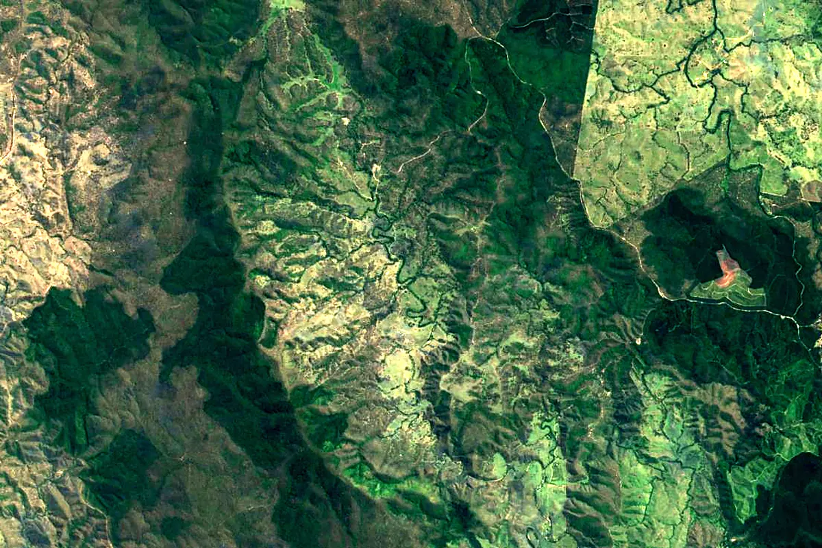
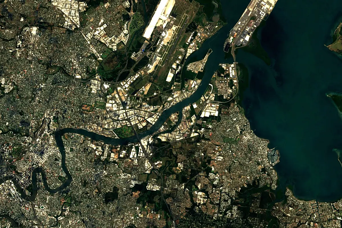
Sentinel-2 cloudless 2016 by EOX IT Services GmbH (contains modified Copernicus Sentinel data 2016), CC BY 4.0. The glowing line is the river as drawn by RiverATLAS.
Photos
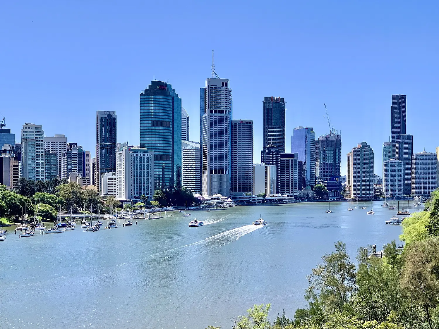
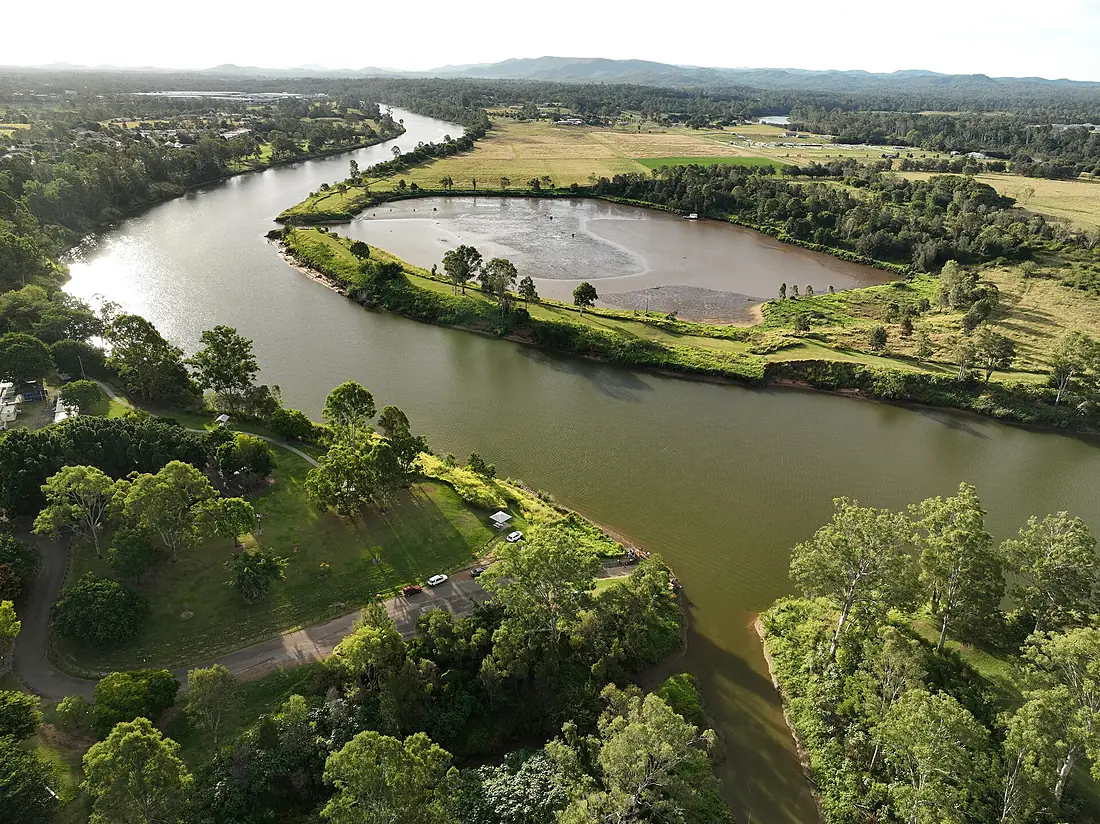
Brisbane River in pictures
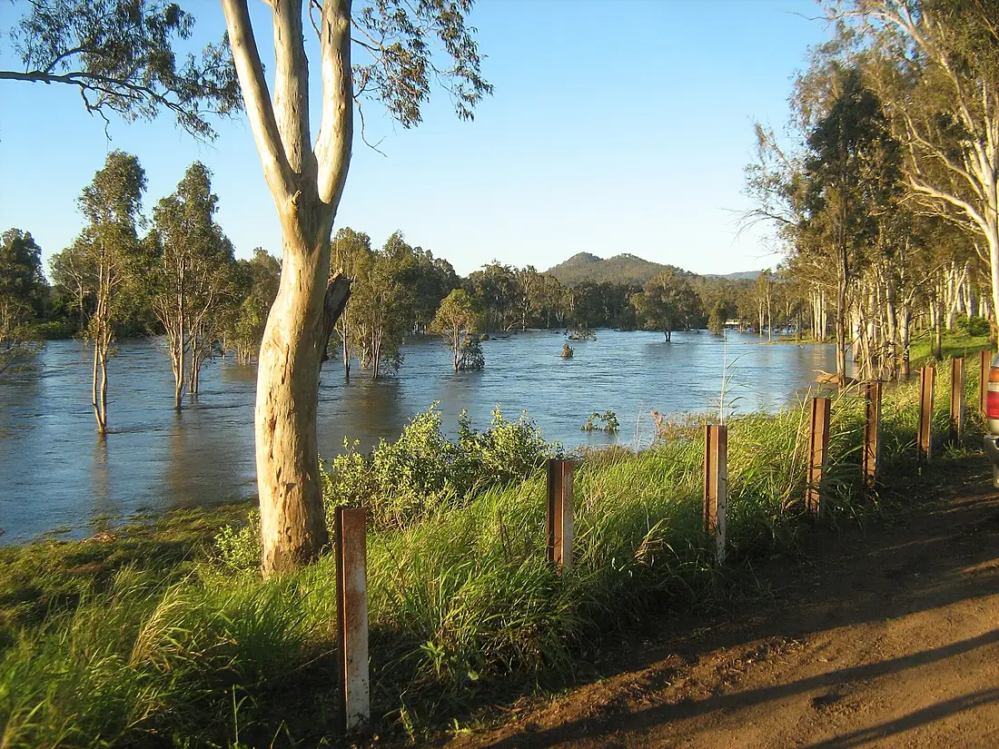
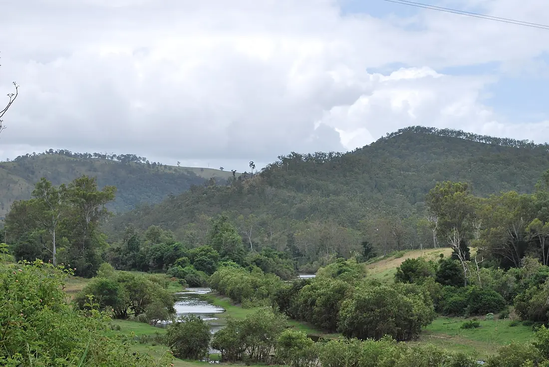
Tributaries
Where it flows, and what flows into it
Tributaries (8)
Also: Bremer River, Lockyer Creek, Stanley River, Breakfast Creek, Bulimba Creek, Moggill Creek, Oxley Creek, Norman Creek
Nearby
Rivers nearby
Where these numbers come from
| Name, length, places | Wikidata (Q905910) · CC0 |
|---|---|
| Course, profile, basin | RiverATLAS v1.0 (HydroATLAS, Linke et al. 2019) · CC BY 4.0 — followed from the source to the mouth given by Wikidata |
| Flow | WaterGAP (RiverATLAS), 1971–2000 · CC BY 4.0 |
| Climate along the river | WorldClim (RiverATLAS), 1970–2000 · CC BY 4.0 |
| Towns, bridges, dams | Wikidata · CC0; GeoNames · CC BY 4.0 |
| Along the river | © OpenStreetMap contributors · ODbL |
| Images | EOX Sentinel-2 cloudless 2016 · CC BY 4.0; Wikimedia Commons |
| Our other atlases | Lakeyas, Coastya, Peakyas, Islandyas — Wikidata · CC0; © OpenStreetMap contributors · ODbL; GeoNames · CC BY 4.0; HydroLAKES · CC BY 4.0; NOAA OISST |
Every source and licence is on the data sources page.
The family
Do you prefer beaches, lakes, mountains, waterfalls, islands, rivers or canyons?
Same idea, other landscapes: field atlases built on open data, month by month, in seven languages.
beaches Find your beach: sea temperature, sun and swimming month by month.Visit lakes
 Every lake on Earth: water temperature, ice, depth and the shore.Coming soonVisit mountains
 Every summit in 3D: summit weather, the 0 °C line, huts and trails.Visit
  waterfalls
 Every waterfall: height, flow month by month and when it roars.Coming soonVisit islands
 Every island from the sea up: size, sea temperature, ferries and 3D.Coming soonVisit
  rivers
 Every river from source to sea: the journey, the flow and the basin in numbers.You are here
 canyons
 Every canyon cut to scale: depth to the floor, rim and floor temperatures, trails and viewpoints.Coming soonVisit