River
Chao Phraya River
372 km from source to mouth · Thailand.
 ThailandFlows into Gulf of Thailand6th longest in Thailand
In numbers
Length
372km
Average flow
840m³/s
Basin
15,000km²
Drop
23m
from 23 m to 0 m
Country
1
The journey
From source to mouth
372 km of river and 68 stops on the way: 52 towns and cities on its banks, dams, bridges and the tributaries that feed it.
- 0 kmSourceat 23 m
- 0 kmLake Boraphet44 km²
- 0 kmNakhon Sawan82,305 people
- 3 kmNan Rivertributary
- 3 kmPing Rivertributary
- 13 kmWat Ko Hong
- 83 kmSakae Krang Rivertributary
- 100 kmChai Nat15,469 people
- 160 kmSing Buri20,046 people
- 190 kmChaiyo13,255 people
- 196 kmBan Thai Tan14,430 people
- 201 kmAng Thong13,738 people
- 242 kmPhra Ratchawang BoranUNESCO World Heritage
- 255 kmWat Niwet Thammaprawat
- 257 kmNoi Rivertributary
- 283 kmPathum Thani24,547 people
- 285 kmBan Bang Kadi27,911 people
- 290 kmWat Chinwararam
- 300 kmPak Kret190,272 people
- 301 kmWat Paramaiyikawat
- 302 kmWat Saeng Siritham
- 308 kmBang O24,225 people
- 310 kmMueang Nonthaburi254,375 people
- 313 kmWat Khangkhao
- 314 kmWat Khema Phirataram
- 315 kmWong Sawang43,005 people
- 316 kmBang Sue125,440 people
- 316 kmBang Sue subdistrict79,405 people
- 318 kmPhaya Thai70,238 people
- 319 kmBang Phlat92,325 people
- 319 kmDusit107,655 people
- 320 kmKhwaeng Bang Plat21,953 people
- 320 kmBan Bang Bamru18,514 people
- 321 kmPom Prap Sattru Phai51,006 people
- 322 kmRama VIII Bridge
- 322 kmPhra Nakhon51,231 people
- 323 kmBang Yi Khan24,745 people
- 323 kmBangkok Noi103,791 people
- 323 kmArun Amarin19,882 people
- 324 kmSiriraj13,458 people
- 324 kmBangkok5,104,476 people
- 324 kmBan Chang Lo29,122 people
- 324 kmBang Khun Si31,689 people
- 325 kmGrand Palace
- 325 kmWat Tha Phra53,111 people
- 325 kmWat Arun14,100 people
- 326 kmBangkok Yai72,321 people
- 326 kmThon Buri115,330 people
- 327 kmSathorn79,624 people
- 327 kmBangkok Riverside48,227 people
- 328 kmRatchathewi73,035 people
- 328 kmSamphanthawong24,150 people
- 328 kmPathum Wan53,263 people
- 329 kmKhlong San73,263 people
- 330 kmBang Rak99,273 people
- 331 kmSathon84,916 people
- 335 kmChom Thong158,005 people
- 336 kmBang Kho Laem22,697 people
- 337 kmBang Kho Laem subdistrict22,697 people
- 337 kmBang Khlo35,838 people
- 338 kmRat Burana86,695 people
- 339 kmRama IX Bridge
- 346 kmChong Nonsi48,277 people
- 346 kmYan Nawa81,521 people
- 350 kmWatthana171,150 people
- 350 kmKhlong Toei109,041 people
- 352 kmPhra Khanong90,354 people
- 362 kmPhra Pradaeng196,129 people
- 364 kmThung Khru116,473 people
- 372 kmGulf of Thailandat 0 m
Water level along the river (RiverATLAS; the height is exaggerated). Towns: GeoNames and Wikidata; bridges, dams and tributaries: Wikidata.
Largest river in Thailand
At the mouth it carries 836 m³/s on average: an Olympic pool every 3.0 seconds. It drops from 23 m to 0 m, 0.1 m per kilometre on average. Its basin covers 15,000 km², about the size of TL. 18.7 million people live in it. Highest water: from September to October; lowest: from January to April. It is heavily dammed: reservoirs can hold 117% of a year's flow.
Where to start
- BangkokLargest city on its banks · 5,104,476 people
- Don Mueang International Airport (DMK)Nearest airport with scheduled flights, 21 km from the cityCar hire at DMK airport (Bangkok)Discover Cars · Affiliate link↗
- On the water145 ferry piers, marinas, boat rentals and boat ramps along the river (OpenStreetMap)
- From December to JanuaryThe best months to visit
Chao Phraya River, month by month
Highest water: from September to October
Lowest water: from January to April. Best months to visit: from December to January.
From about 440 m³/s in the lowest month to 1,900 m³/s in the highest. An estimate: the monthly flow is modelled from the lowest and highest months of WaterGAP (RiverATLAS, 1971–2000) and the rain and snow along the river (WorldClim). Dams change the real rhythm. The chip is the average air temperature; below it, the month's rain.
Plan the trip
Plan the trip: boat trips, a bed by the river, a car
Some links above are affiliate links: if you book through them we may earn a commission, at no extra cost to you. It never changes what the data on this page says.
The basin
Chao Phraya River: the basin in numbers
144,308 km² of land send their water to this river. This is what lives on it.
- 18.7millionpeople live in the basin
- 131/km²people per km²
- 366maverage altitude of the basin
- 1,192mmof rain a year (basin average)
- 26.0°Caverage air temperature
- 20%protected areas
- 0.6%covered by lakes
- 31km³held in reservoirs
What covers the basin
- 27% Forest
- 27% Cropland
- 5% Towns and cities
RiverATLAS (HydroATLAS v1.0, CC BY 4.0): land cover, people, protected areas, glaciers and dams over the whole basin upstream of the mouth.
Along the river
Chao Phraya River: what you find on the way
- 24WeirsNoi River, Chao Phraya Dam and 22 more
- 9LocksNoi River, Lat Pho Canal Floodgate and 7 more
- 3Waterfalls
- 135Ferry piersPakkret, Wat Sanam Nuea Ferry Pier, Wat Pora Mai Yi Ka Wat Ferry Pier and 132 more
- 9MarinasHaven 69 @ Chaopraya River, Tha Wasukri, Siam Charoen Nakhon Marina and 6 more
- 1River beachesFather Rama Beach
From OpenStreetMap, within 2.5 km of the river. Not mapped is not the same as not there.
Cross-checked with our atlases
Chao Phraya River in our other atlases
What our sister atlases know about the waterfalls on this river, the lakes it flows through, the beaches at its mouth, the mountains where it rises and the islands off its mouth.
 1lake on its wayLakeyas
 8mountains at the sourcePeakyas
Lakes and reservoirs (1)
Lakes it flows through, by Lakeyas
- Lake Boraphetkm 044km²
Lakeyas is coming soonOpen Lakeyas ↗
Mountains at the source (8)
Within 15 km of the source, by Peakyas
- Khao Luk Chang13 km away
- Khao Kop1.8 km away
- Khao Khiao6.3 km away
- Khao Phra8.5 km away
- Khao Raet3.5 km away
- Khao Daowadueng2.6 km away
- Khao Wiwat13 km away
- Khao Musi10 km away
From space
The source and the mouth, seen from orbit
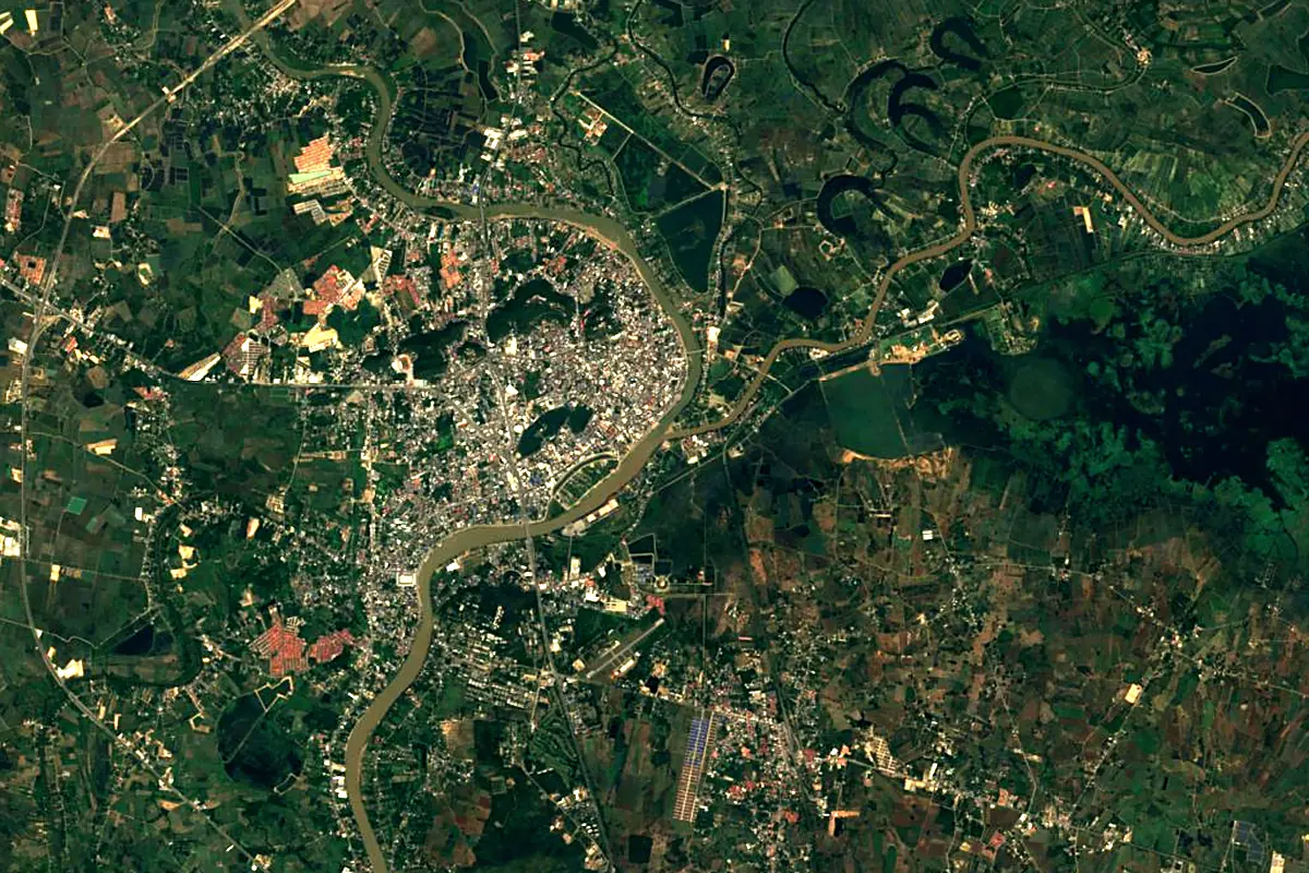
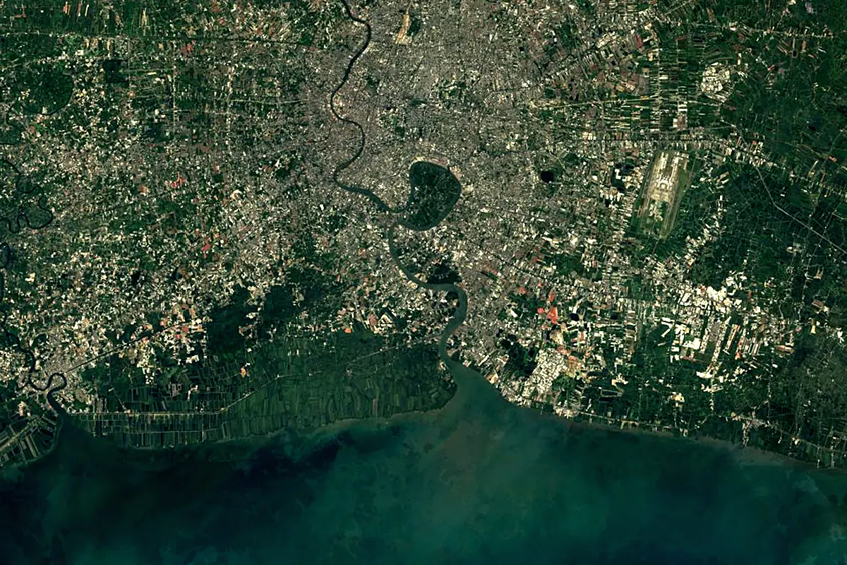
Sentinel-2 cloudless 2016 by EOX IT Services GmbH (contains modified Copernicus Sentinel data 2016), CC BY 4.0. The glowing line is the river as drawn by RiverATLAS.
Photos
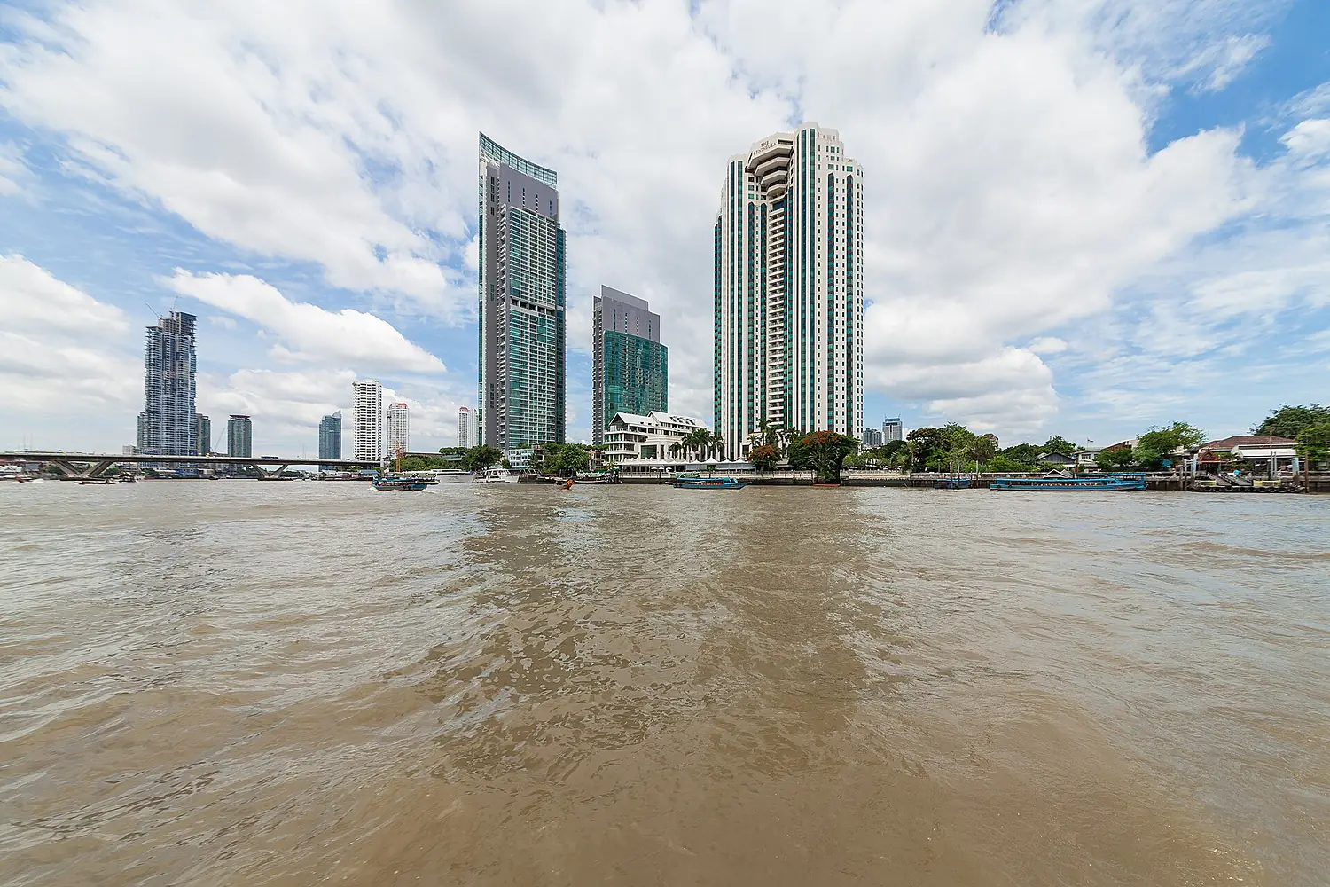
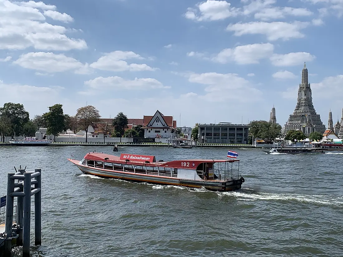
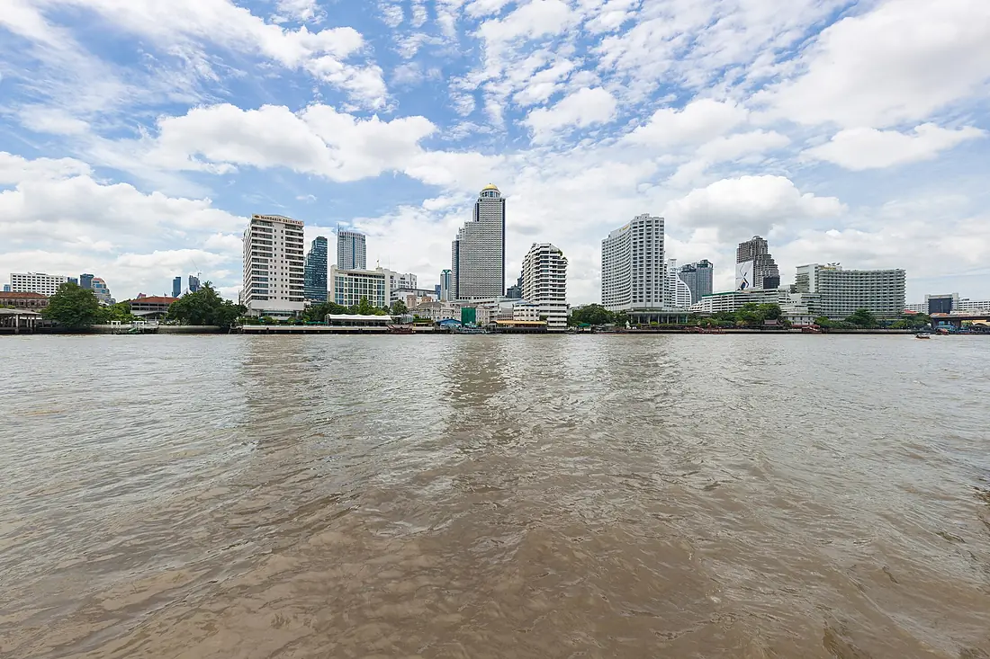
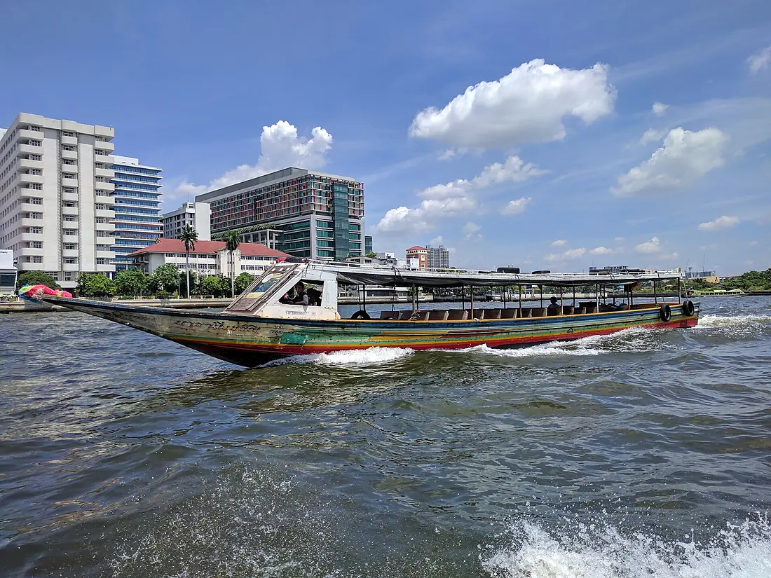
Chao Phraya River in pictures
Tributaries
Where it flows, and what flows into it
Tributaries (5)
Also: Nan River, Sakae Krang River, Noi River
In the same basin
 Myanmar
Where these numbers come from
| Name, length, places | Wikidata (Q118850) · CC0 |
|---|---|
| Course, profile, basin | RiverATLAS v1.0 (HydroATLAS, Linke et al. 2019) · CC BY 4.0 — followed from the source to the mouth given by Wikidata |
| Flow | WaterGAP (RiverATLAS), 1971–2000 · CC BY 4.0 |
| Climate along the river | WorldClim (RiverATLAS), 1970–2000 · CC BY 4.0 |
| Towns, bridges, dams | Wikidata · CC0; GeoNames · CC BY 4.0 |
| Along the river | © OpenStreetMap contributors · ODbL |
| Images | EOX Sentinel-2 cloudless 2016 · CC BY 4.0; Wikimedia Commons |
| Our other atlases | Lakeyas, Peakyas — Wikidata · CC0; © OpenStreetMap contributors · ODbL; GeoNames · CC BY 4.0; HydroLAKES · CC BY 4.0; NOAA OISST |
Every source and licence is on the data sources page.
The family
Do you prefer beaches, lakes, mountains, waterfalls, islands, rivers or canyons?
Same idea, other landscapes: field atlases built on open data, month by month, in seven languages.
 beaches
 Find your beach: sea temperature, sun and swimming month by month.Visit lakes
 Every lake on Earth: water temperature, ice, depth and the shore.Coming soonVisit mountains
 Every summit in 3D: summit weather, the 0 °C line, huts and trails.Visit
  waterfalls
 Every waterfall: height, flow month by month and when it roars.Coming soonVisit
  islands
 Every island from the sea up: size, sea temperature, ferries and 3D.Coming soonVisit
  rivers
 Every river from source to sea: the journey, the flow and the basin in numbers.You are here
 canyons
 Every canyon cut to scale: depth to the floor, rim and floor temperatures, trails and viewpoints.Coming soonVisit