River
Churchill River
1,609 km from source to mouth · Canada.
 CanadaFlows into Hudson Bay5th longest in Canada
In numbers
Length
1,609km
Average flow
1,200m³/s
Basin
281,300km²
Drop
414m
from 415 m to 1 m
Country
1
The journey
From source to mouth
1,609 km of river and 68 stops on the way: 0 towns and cities on its banks, dams, bridges and the tributaries that feed it.
- 0 kmChurchill Lakeat 415 m
- 0 kmSingleton Lake4.9 km²
- 2 kmFrobisher Lake427 km²
- 38 kmChurchill Lake544 km²
- 129 kmMoore Lake3.1 km²
- 141 kmLac Île-à-la-Crosse432 km²
- 153 kmShagwenaw Lake50 km²
- 162 kmForcier Lake11 km²
- 163 kmSpringman Lake2.5 km²
- 170 kmYoung Lake0.9 km²
- 176 kmMcEachern Lake1.7 km²
- 208 kmDipper Lake99 km²
- 235 kmKnee Lake121 km²
- 247 kmGoodfellow Lake5.5 km²
- 261 kmMacAllister Lake26 km²
- 275 kmSandy Lake35 km²
- 301 kmHanishewski Lake1.9 km²
- 306 kmPinehouse Lake379 km²
- 319 kmSandfly Lake88 km²
- 321 kmNeedle Falls
- 370 kmRowe Lake14 km²
- 385 kmBarrowman Lake3.5 km²
- 392 kmMcIntosh Lake62 km²
- 392 kmEasterby Lake211 km²
- 398 kmCrew Lake6.0 km²
- 398 kmMcMechan Lake1.0 km²
- 402 kmMountney Lake11 km²
- 407 kmFaultine Lake0.5 km²
- 415 kmKowalsky Lake0.6 km²
- 416 kmWeaver Lake6.8 km²
- 420 kmHolman Lake41 km²
- 421 kmWladyka Falls
- 422 kmBarker Lake3.0 km²
- 423 kmMurray Falls
- 426 kmDevil Lake4.2 km²
- 440 kmOtter Lake50 km²
- 444 kmRobertson Falls
- 444 kmTwin Falls
- 452 kmMasson Lake0.8 km²
- 459 kmHunt Lake9.3 km²
- 459 kmBradshaw Lake1.3 km²
- 460 kmLac la Ronge1,296 km²
- 470 kmCoghill Lake0.5 km²
- 473 kmIskwatikan Lake40 km²
- 479 kmMountain Lake117 km²
- 480 kmRebbeck Lake0.9 km²
- 490 kmBoland Lake17 km²
- 501 kmKeg Lake23 km²
- 503 kmKeg Falls
- 505 kmSadler Lake24 km²
- 533 kmTrade Lake72 km²
- 551 kmUskik Lake24 km²
- 552 kmKettle Falls
- 556 kmOurom Lake9.5 km²
- 558 kmPow Lake0.6 km²
- 569 kmIskwatam Lake21 km²
- 593 kmCameron Falls
- 603 kmPikoo Lake92 km²
- 608 kmTommy Lake5.0 km²
- 627 kmSokatisewin Lake42 km²
- 644 kmWasawakasik Lake8.8 km²
- 654 kmOkipwatsikew Lake15 km²
- 679 kmLoon Lake65 km²
- 684 kmBrew Lake0.7 km²
- 702 kmSisipuk Lake226 km²
- 702 kmBloodstone Falls
- 712 kmBonald Lake11 km²
- 731 kmPukatawagan Lake46 km²
- 731 kmPukatawagan Falls
- 1,609 kmHudson Bayat 1 m
Water level along the river (RiverATLAS; the height is exaggerated). Towns: GeoNames and Wikidata; bridges, dams and tributaries: Wikidata.
Tributary of Hudson Bay in Canada
At the mouth it carries 1,200 m³/s on average: an Olympic pool every 2.1 seconds. It drops from 415 m to 1 m, 0.3 m per kilometre on average. Its basin covers 281,300 km², about the size of EC. 96,000 people live in it. Highest water: from July to August; lowest: from January to April. It is heavily dammed: reservoirs can hold 171% of a year's flow.
Where to start
- ChurchillLargest city on its banks · 870 people
- Churchill Airport (YYQ)Nearest airport with scheduled flights, 7 km from the cityCar hire at YTH airport (Thompson)Discover Cars · Affiliate link↗
- Kayak and canoe44 put-ins and rapids mapped (OpenStreetMap)
- From June to AugustThe best months to visit
Churchill River, month by month
Highest water: from July to August
Lowest water: from January to April. Freezing months (average below −4 °C): from November to March. Best months to visit: from June to August.
From about 310 m³/s in the lowest month to 420 m³/s in the highest. An estimate: the monthly flow is modelled from the lowest and highest months of WaterGAP (RiverATLAS, 1971–2000) and the rain and snow along the river (WorldClim). Dams change the real rhythm. The chip is the average air temperature; below it, the month's rain.
Plan the trip
Plan the trip: boat trips, a bed by the river, a car
Some links above are affiliate links: if you book through them we may earn a commission, at no extra cost to you. It never changes what the data on this page says.
The basin
Churchill River: the basin in numbers
302,500 km² of land send their water to this river. This is what lives on it.
- 96,000people live in the basin
- 0/km²people per km²
- 415maverage altitude of the basin
- 476mmof rain a year (basin average)
- -2.3°Caverage air temperature
- 8%protected areas
- 16.1%covered by lakes
- 22%permafrost
- 19km³held in reservoirs
What covers the basin
- 53% Forest
- 2% Cropland
- 2% Pasture
RiverATLAS (HydroATLAS v1.0, CC BY 4.0): land cover, people, protected areas, glaciers and dams over the whole basin upstream of the mouth.
Along the river
Churchill River: what you find on the way
- 4WaterfallsNistowiak Falls and 3 more
- 44RapidsOtter Rapids, Sisipuk Rapids, Devil Rapid and 41 more
From OpenStreetMap, within 2.7 km of the river. Not mapped is not the same as not there.
Cross-checked with our atlases
Churchill River in our other atlases
What our sister atlases know about the waterfalls on this river, the lakes it flows through, the beaches at its mouth, the mountains where it rises and the islands off its mouth.
 12waterfalls on the riverCascadyas
 84lakes on its wayLakeyas
 2beaches at the mouth and on the banksCoastya
Waterfalls (12)
On the river, by Cascadyas
- Needle Fallskm 346
- Wladyka Fallskm 454
- Murray Fallskm 456
- Robertson Fallskm 479
- Twin Fallskm 479
- Keg Fallskm 542
- Kettle Fallskm 595
- Cameron Fallskm 639
4 more on CascadyasCascadyas is coming soonOpen Cascadyas ↗
Lakes and reservoirs (84)
Lakes it flows through, by Lakeyas
- Frobisher Lakekm 2427km²
- Churchill Lakekm 41 · 24 m deep544km²
- Lac Île-à-la-Crossekm 152432km²
- Pinehouse Lakekm 330379km²
- Lac la Rongekm 496 · 41 m deep1,296km²
- Flatrock Lakekm 868491km²
- Granville Lakekm 953420km²
- Mulcahy Lakekm 1,1372,307km²
76 more on LakeyasLakeyas is coming soonOpen Lakeyas ↗
Beaches (2)
At the mouth (25 km) and on the banks, by Coastya
- Sloop Cove11 km away · cove9.7°C
- Bird Cove20 km away · cove9.5°C
From space
The source and the mouth, seen from orbit
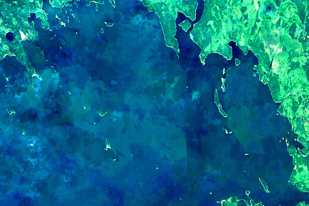
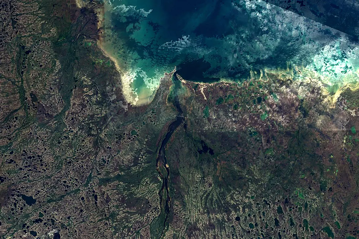
Sentinel-2 cloudless 2016 by EOX IT Services GmbH (contains modified Copernicus Sentinel data 2016), CC BY 4.0. The glowing line is the river as drawn by RiverATLAS.
Photos
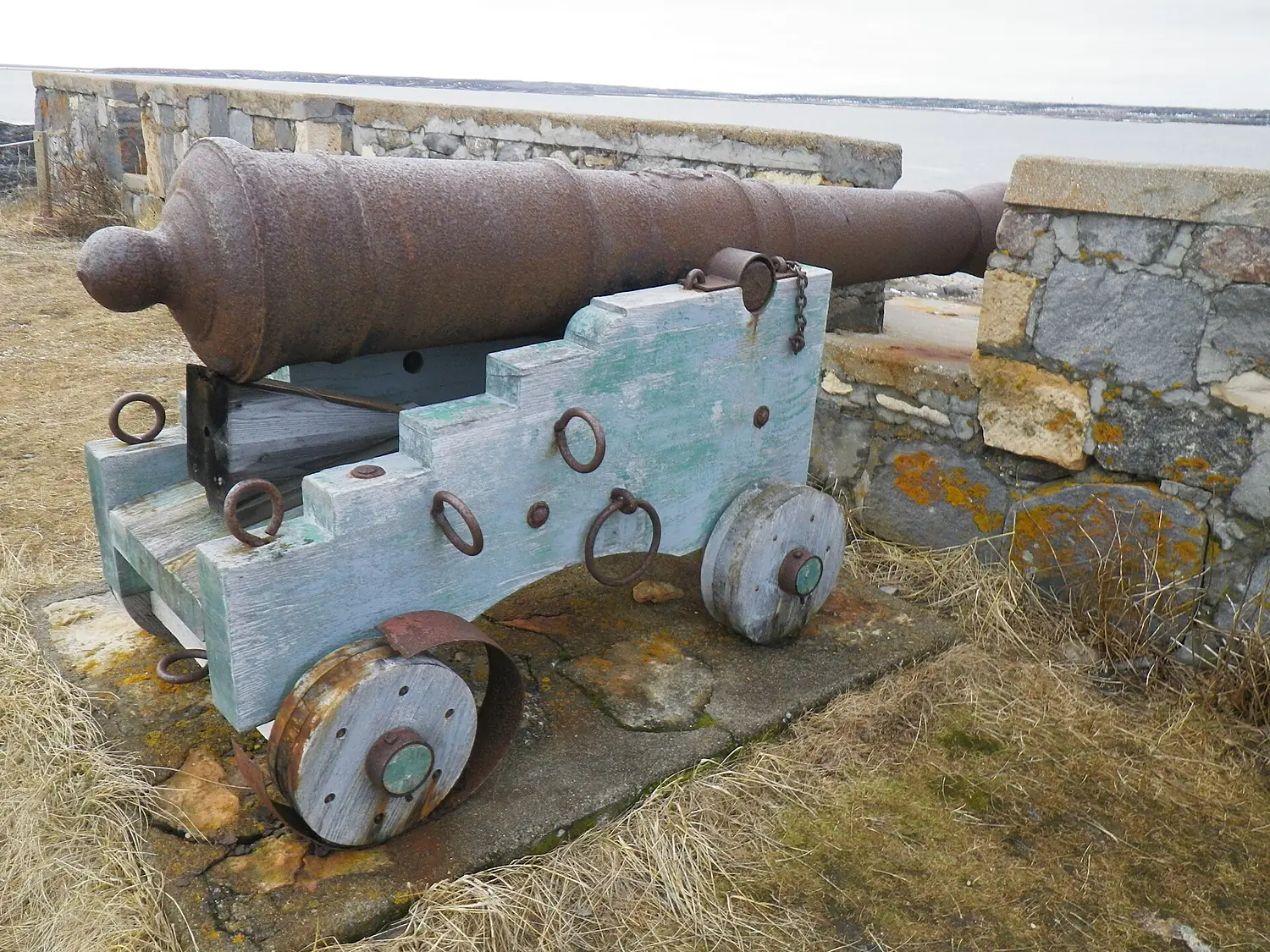
Churchill River in pictures
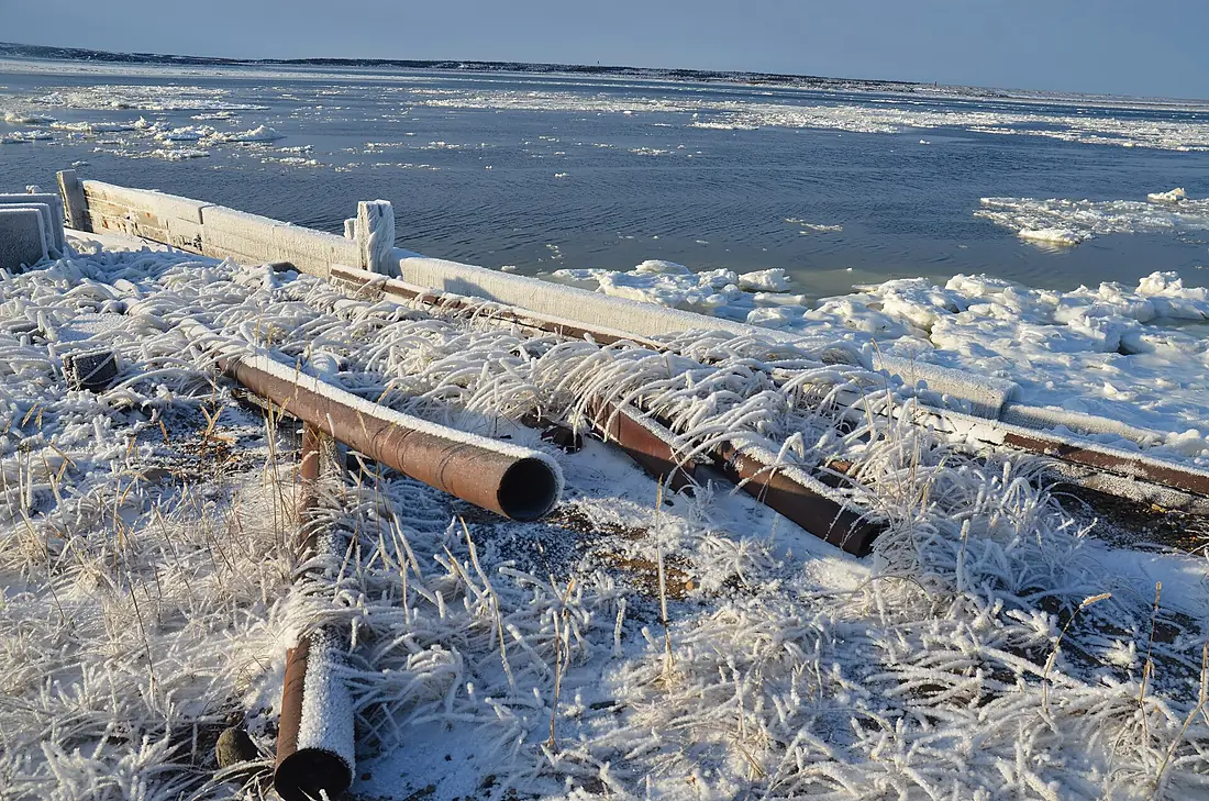
Tributaries
Where it flows, and what flows into it
Tributaries (10)
Also: Beaver River, Rapid River, Little Churchill River, Reindeer River, Smoothstone River, Dog River, Gauer River, Little Beaver River, Kazan River, Foster River
Where these numbers come from
| Name, length, places | Wikidata (Q3318) · CC0 |
|---|---|
| Course, profile, basin | RiverATLAS v1.0 (HydroATLAS, Linke et al. 2019) · CC BY 4.0 — followed from the source to the mouth given by Wikidata |
| Flow | WaterGAP (RiverATLAS), 1971–2000 · CC BY 4.0 |
| Climate along the river | WorldClim (RiverATLAS), 1970–2000 · CC BY 4.0 |
| Towns, bridges, dams | Wikidata · CC0; GeoNames · CC BY 4.0 |
| Along the river | © OpenStreetMap contributors · ODbL |
| Images | EOX Sentinel-2 cloudless 2016 · CC BY 4.0; Wikimedia Commons |
| Our other atlases | Cascadyas, Lakeyas, Coastya — Wikidata · CC0; © OpenStreetMap contributors · ODbL; GeoNames · CC BY 4.0; HydroLAKES · CC BY 4.0; NOAA OISST |
Every source and licence is on the data sources page.
The family
Do you prefer beaches, lakes, mountains, waterfalls, islands, rivers or canyons?
Same idea, other landscapes: field atlases built on open data, month by month, in seven languages.
beaches Find your beach: sea temperature, sun and swimming month by month.Visit lakes
 Every lake on Earth: water temperature, ice, depth and the shore.Coming soonVisit
  mountains
 Every summit in 3D: summit weather, the 0 °C line, huts and trails.Visit waterfalls
 Every waterfall: height, flow month by month and when it roars.Coming soonVisit
  islands
 Every island from the sea up: size, sea temperature, ferries and 3D.Coming soonVisit
  rivers
 Every river from source to sea: the journey, the flow and the basin in numbers.You are here
 canyons
 Every canyon cut to scale: depth to the floor, rim and floor temperatures, trails and viewpoints.Coming soonVisit