River
Colorado River
2,334 km from source to mouth · Mexico and United States.
 Mexico and United StatesFlows into Gulf of California1st longest in Mexico
In numbers
Length
2,334km
Average flow
640m³/s
Basin
637,137km²
Drop
2,703m
from 2,703 m to 0 m
Countries
2
The journey
From source to mouth
2,334 km of river and 68 stops on the way: 26 towns and cities on its banks, dams, bridges and the tributaries that feed it.
- 0 kmLa Poudre Passat 2,703 m
- 15 kmGrand Lake1.9 km²
- 16 kmOnahu Creektributary
- 23 kmShadow Mountain Lake5.1 km²
- 33 kmLake Granby25 km²
- 45 kmFraser Rivertributary
- 46 kmWindy Gap Reservoir0.3 km²
- 58 kmHot Sulphur Springs687 people
- 66 kmParshall42 people
- 68 kmWilliams Fork Reservoir5.3 km²
- 87 kmBlue Rivertributary
- 183 kmDotsero1,172 people
- 183 kmEagle Rivertributary
- 211 kmGlenwood Springs9,906 people
- 212 kmRoaring Fork Rivertributary
- 223 kmChacra331 people
- 233 kmElk Creektributary
- 243 kmSilt3,536 people
- 256 kmRifle9,563 people
- 284 kmBattlement Mesa5,438 people
- 305 kmDe Beque493 people
- 326 kmPlateau Creektributary
- 338 kmPalisade2,565 people
- 350 kmClifton20,413 people
- 356 kmOrchard Mesa6,688 people
- 358 kmGrand Junction60,358 people
- 362 kmGunnison Rivertributary
- 367 kmRedlands8,685 people
- 380 kmFruita12,795 people
- 435 kmLittle Dolores Rivertributary
- 469 kmDolores Rivertributary
- 491 kmProfessor Creektributary
- 520 kmMoab5,366 people
- 555 kmDead Horse Point State Park
- 601 kmGreen Rivertributary
- 607 kmDenis Julien Inscription
- 674 kmHite Crossing Bridge
- 675 kmDirty Devil Rivertributary
- 795 kmEscalante Rivertributary
- 808 kmSan Juan Rivertributary
- 885 kmLake Powell121 km²
- 885 kmGlen Canyon Dam Bridge
- 886 kmPage7,440 people
- 906 kmLee's Ferry
- 907 kmParia Rivertributary
- 1,010 kmLittle Colorado Rivertributary
- 1,045 kmBright Angel Creektributary
- 1,046 kmGrand Canyon
- 1,137 kmKanab Creektributary
- 1,156 kmHavasu Creektributary
- 1,463 kmLake Mead581 km²
- 1,463 kmHoover Dam
- 1,464 kmMike O'Callaghan–Pat Tillman Memorial Bridge
- 1,468 kmBoulder City14,885 people
- 1,571 kmLake Mohave99 km²
- 1,582 kmBullhead City41,348 people
- 1,584 kmLaughlin8,658 people
- 1,623 kmNeedles4,931 people
- 1,643 kmTopock2 people
- 1,683 kmLake Havasu City53,553 people
- 1,708 kmGene Wash Reservoir0.8 km²
- 1,709 kmBill Williams Rivertributary
- 1,929 kmMartinez Lake1.1 km²
- 1,937 kmSenator Wash Reservoir0.9 km²
- 1,947 kmMittry Lake0.6 km²
- 1,965 kmGila Rivertributary
- 1,972 kmYuma95,548 people
- 2,016 kmSan Luis31,520 people
- 2,077 kmDoctor Alberto Oviedo Mota8,064 people
- 2,334 kmGulf of Californiaat 0 m
Water level along the river (RiverATLAS; the height is exaggerated). Towns: GeoNames and Wikidata; bridges, dams and tributaries: Wikidata.
Major river in the western United States and Mexico
At the mouth it carries 640 m³/s on average: an Olympic pool every 3.9 seconds. It drops from 2,703 m to 0 m, 1.2 m per kilometre on average. Its basin covers 637,137 km², about the size of SO. 9.8 million people live in it. Highest water: from January to March; lowest: July. It is heavily dammed: reservoirs can hold 100% of a year's flow.
Where to start
- YumaLargest city on its banks · 95,548 people
- Yuma International Airport / Marine Corps Air Station Yuma (YUM)Nearest airport with scheduled flights, 8 km from the cityCar hire at MXL airport (Mexicali)Discover Cars · Affiliate link↗
- On the water238 ferry piers, marinas, boat rentals and boat ramps along the river (OpenStreetMap)
- Kayak and canoe214 put-ins and rapids mapped (OpenStreetMap)
- From April to June and from September to OctoberThe best months to visit
Colorado River, month by month
Highest water: from January to March
Lowest water: July. Best months to visit: from April to June and from September to October.
From about 0.0 m³/s in the lowest month to 130 m³/s in the highest. An estimate: the monthly flow is modelled from the lowest and highest months of WaterGAP (RiverATLAS, 1971–2000) and the rain and snow along the river (WorldClim). Dams change the real rhythm. The chip is the average air temperature; below it, the month's rain.
Plan the trip
Plan the trip: boat trips, a bed by the river, a car
Some links above are affiliate links: if you book through them we may earn a commission, at no extra cost to you. It never changes what the data on this page says.
The basin
Colorado River: the basin in numbers
620,424 km² of land send their water to this river. This is what lives on it.
- 9.8millionpeople live in the basin
- 16/km²people per km²
- 1,694maverage altitude of the basin
- 331mmof rain a year (basin average)
- 10.9°Caverage air temperature
- 14%protected areas
- 0.3%covered by lakes
- 81km³held in reservoirs
What covers the basin
- 33% Forest
- 2% Cropland
- 53% Pasture
- 1% Towns and cities
RiverATLAS (HydroATLAS v1.0, CC BY 4.0): land cover, people, protected areas, glaciers and dams over the whole basin upstream of the mouth.
Along the river
Colorado River: what you find on the way
- 73WeirsPrice-Stubb Diversion Dam, Grand Valley Canal Diversion Dam and 71 more
- 73WaterfallsMedieval Chamber, Echo Peaks Fall, Thunder River Falls and 70 more
- 214Rapids29th Street Rapid, Marble Canyon, Skull Rapids and 211 more
- 199Boat rampsSunset Point Boat Ramp, Two Bridges Boat Ramp, Cottonwood Island River Access and 196 more
- 5Ferry piersCharles Hall Marina Ferry Landing, Bullfrog Marina Ferry Landing, Arizona Dock - Riverside Casino and 2 more
- 24MarinasAntelope Point Marina, Callville Bay Marina, Lake Mead Marina and 21 more
- 8River beachesSurprise Beach, Paria Beach, Sandbar and 5 more
From OpenStreetMap, within 2.9 km of the river. Not mapped is not the same as not there.
Cross-checked with our atlases
Colorado River in our other atlases
What our sister atlases know about the waterfalls on this river, the lakes it flows through, the beaches at its mouth, the mountains where it rises and the islands off its mouth.
 12lakes on its wayLakeyas
 47mountains at the sourcePeakyas
 1island off the mouthIslandyas
Lakes and reservoirs (12)
Lakes it flows through, by Lakeyas
- Grand Lakekm 141.9km²
- Shadow Mountain Lakekm 215.1km²
- Lake Granbykm 3025km²
- Williams Fork Reservoirkm 635.3km²
- Lake Powellkm 822 · 150 m deep121km²
- Lake Meadkm 1,358 · 162 m deep581km²
- Lake Mohavekm 1,459 · 23 m deep99km²
- Senator Wash Reservoirkm 1,7990.9km²
4 more on LakeyasLakeyas is coming soonOpen Lakeyas ↗
Mountains at the source (47)
Within 15 km of the source, by Peakyas
- Fairchild Mountain14 km away · prominence 281 m4,116m
- Mount Richthofen5.8 km away3,946m
- Mount Chiquita12 km away · prominence 86 m3,985m
- Mount Ida12 km away3,921m
- Mount Julian13 km away3,942m
- Chief Cheley Peak12 km away · prominence 117 m3,906m
- Specimen Mountain3.4 km away · prominence 528 m3,808m
- Braddock Peak7.4 km away3,649m
39 more on PeakyasOpen Peakyas ↗
Islands off the mouth (1)
Within 30 km of the mouth, by Islandyas
- Montague Island29 km away133km²
Islandyas is coming soonOpen Islandyas ↗
From space
The source and the mouth, seen from orbit
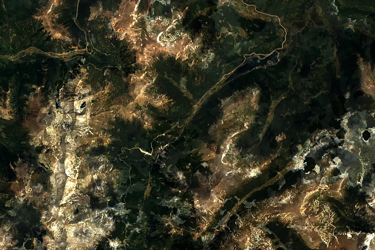
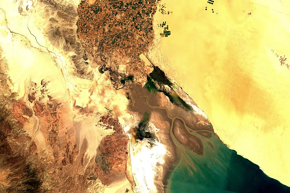
Sentinel-2 cloudless 2016 by EOX IT Services GmbH (contains modified Copernicus Sentinel data 2016), CC BY 4.0. The glowing line is the river as drawn by RiverATLAS.
Photos
Colorado River in pictures
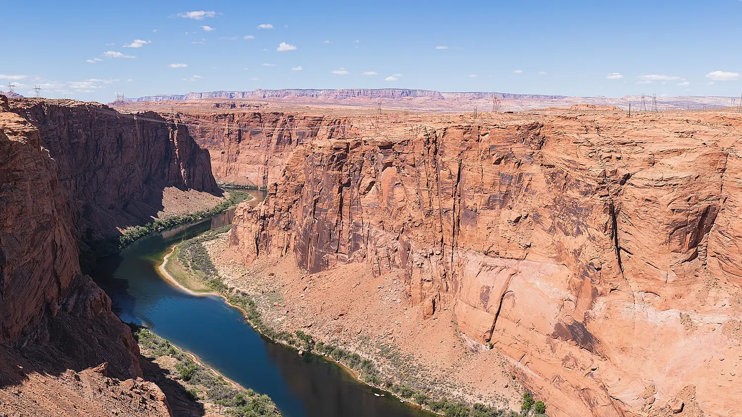
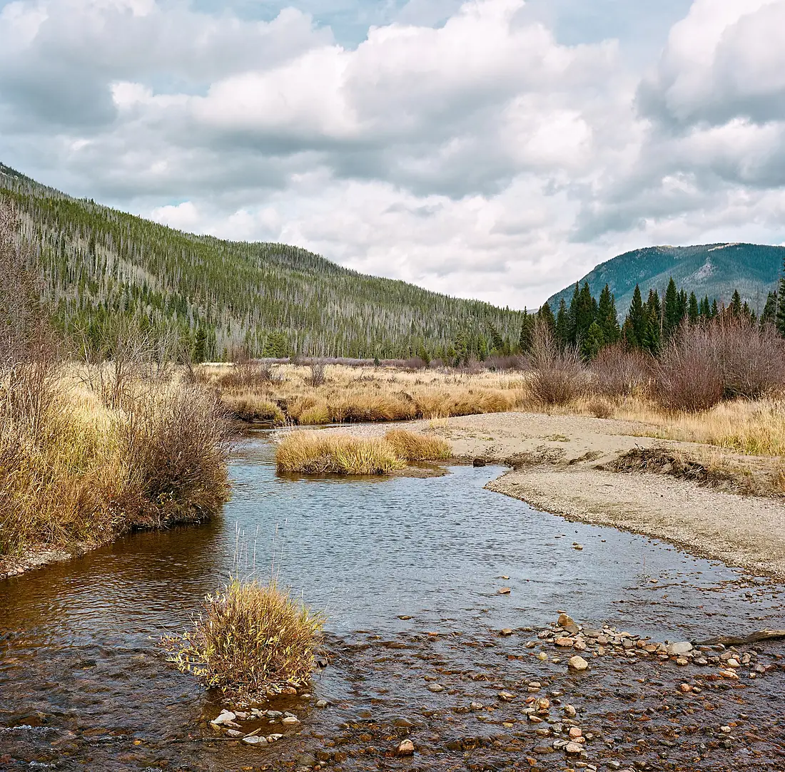
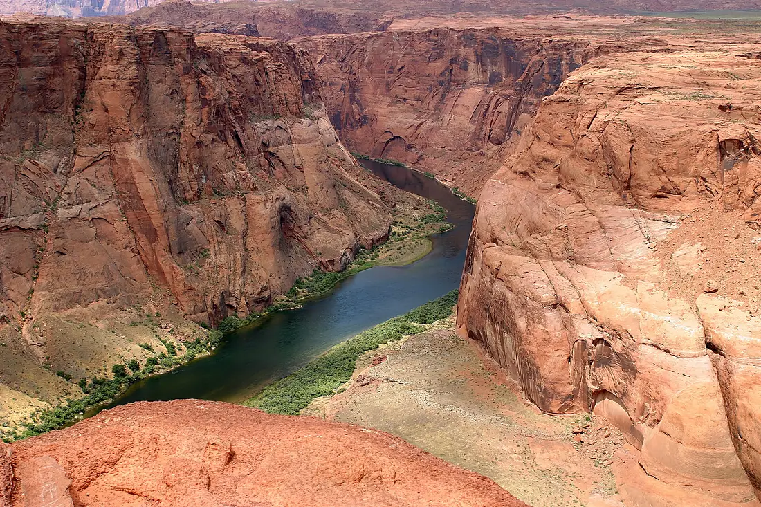
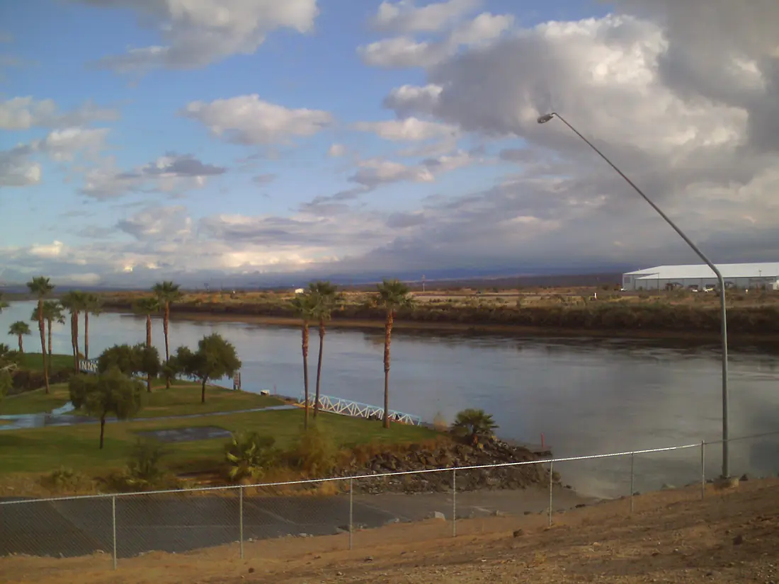
Tributaries
Where it flows, and what flows into it
Tributaries (33)
United States1,175 km170 m³/sjoins at km 558Gila RiverUnited States1,044 km170 m³/sjoins at km 1,824San Juan RiverUnited States616 km62 m³/sjoins at km 751Little Colorado RiverUnited States507 km150 m³/sjoins at km 938Virgin RiverUnited States261 km6.0 m³/sAlso: Gunnison River, Dolores River, Escalante River, Paria River, Roaring Fork River, Eagle River, Dirty Devil River, Bill Williams River, Kanab Creek, Blue River, Havasu Creek, Range Creek, Tapeats Creek, Professor Creek, Bright Angel Creek, Hardy River, Little Dolores River, Piney River, Plateau Creek, Fraser River, Elk Creek, Onahu Creek, Muddy Creek, Roan Creek
Where these numbers come from
| Name, length, places | Wikidata (Q1265) · CC0 |
|---|---|
| Course, profile, basin | RiverATLAS v1.0 (HydroATLAS, Linke et al. 2019) · CC BY 4.0 — followed from the source to the mouth given by Wikidata |
| Flow | WaterGAP (RiverATLAS), 1971–2000 · CC BY 4.0 |
| Climate along the river | WorldClim (RiverATLAS), 1970–2000 · CC BY 4.0 |
| Towns, bridges, dams | Wikidata · CC0; GeoNames · CC BY 4.0 |
| Along the river | © OpenStreetMap contributors · ODbL |
| Images | EOX Sentinel-2 cloudless 2016 · CC BY 4.0; Wikimedia Commons |
| Our other atlases | Lakeyas, Peakyas, Islandyas — Wikidata · CC0; © OpenStreetMap contributors · ODbL; GeoNames · CC BY 4.0; HydroLAKES · CC BY 4.0; NOAA OISST |
Every source and licence is on the data sources page.
The family
Do you prefer beaches, lakes, mountains, waterfalls, islands, rivers or canyons?
Same idea, other landscapes: field atlases built on open data, month by month, in seven languages.
 beaches
 Find your beach: sea temperature, sun and swimming month by month.Visit lakes
 Every lake on Earth: water temperature, ice, depth and the shore.Coming soonVisit mountains
 Every summit in 3D: summit weather, the 0 °C line, huts and trails.Visit
  waterfalls
 Every waterfall: height, flow month by month and when it roars.Coming soonVisit islands
 Every island from the sea up: size, sea temperature, ferries and 3D.Coming soonVisit
  rivers
 Every river from source to sea: the journey, the flow and the basin in numbers.You are here
 canyons
 Every canyon cut to scale: depth to the floor, rim and floor temperatures, trails and viewpoints.Coming soonVisit