River
Guadalquivir
657 km from source to mouth · Spain.
 SpainFlows into Gulf of Cádiz2nd longest in Spain
In numbers
Length
657km
Average flow
160m³/s
Basin
56,978km²
Drop
671m
from 671 m to 0 m
Country
1
The journey
From source to mouth
657 km of river and 68 stops on the way: 35 towns and cities on its banks, dams, bridges and the tributaries that feed it.
- 0 kmSierra de Cazorlaat 671 m
- 11 kmCascada de Linarejos
- 25 kmCascada del Charco De La Cuna
- 41 kmCascada del Barranco De Los Frailes
- 49 kmEmbalse de El Tranco de Beas9.4 km²
- 96 kmAguascebas Rivertributary
- 96 kmCerezuelo Rivertributary
- 118 kmGuadiana Menortributary
- 129 kmJandulillatributary
- 142 kmCuadrostributary
- 152 kmBegíjar3,098 people
- 176 kmGuadalimartributary
- 185 kmMengibar9,927 people
- 188 kmGuadalbullóntributary
- 203 kmRumblar Rivertributary
- 206 kmVillanueva de la Reina3,373 people
- 225 kmAndújar35,610 people
- 232 kmJándula Rivertributary
- 239 kmMarmolejo7,643 people
- 249 kmArroyo Saladotributary
- 266 kmYeguas Rivertributary
- 268 kmVilla del Río7,407 people
- 280 kmMontoro9,436 people
- 288 kmArenosotributary
- 305 kmEl Carpio4,483 people
- 312 kmVillafranca de Córdoba3,799 people
- 320 kmSan Rafael de Navallana Reservoir6.9 km²
- 327 kmGuadalmellatotributary
- 349 kmCórdoba323,262 people
- 360 kmGuadajoztributary
- 381 kmAlmodóvar del Río7,486 people
- 388 kmLa Breña Reservoir3.5 km²
- 388 kmGuadiatotributary
- 393 kmPosadas7,364 people
- 409 kmBembézartributary
- 421 kmPalma del Río21,159 people
- 426 kmGeniltributary
- 426 kmRetortillotributary
- 429 kmPeñaflor3,688 people
- 453 kmGuadalbarcartributary
- 457 kmLora del Río19,352 people
- 476 kmAlcolea del Río3,339 people
- 479 kmCorbonestributary
- 482 kmVillanueva del Río y Minas5,213 people
- 484 kmTocina9,067 people
- 489 kmRivera de Hueznartributary
- 494 kmCantillana10,627 people
- 498 kmRiver Viartributary
- 499 kmVillaverde del Río6,703 people
- 501 kmBrenes12,460 people
- 517 kmAlcalá del Río10,869 people
- 524 kmLa Rinconada35,928 people
- 528 kmLa Algaba16,301 people
- 533 kmSantiponce7,561 people
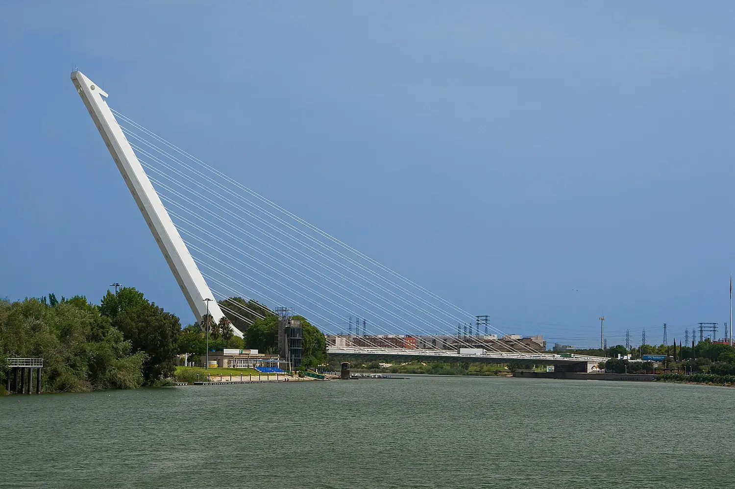
- 534 kmPuente del Alamillo
- 536 kmCamas28,620 people
- 537 kmSeville689,423 people
- 537 kmIsabel II Bridge
- 539 kmCastilleja de la Cuesta17,150 people
- 540 kmTomares22,772 people
- 541 kmSan Juan de Aznalfarache23,408 people
- 544 kmGelves7,897 people
- 549 kmPalomares del Río4,782 people
- 552 kmCoria del Río30,657 people
- 553 kmPudiotributary
- 555 kmLa Puebla del Río11,879 people
- 571 kmGuadaíratributary
- 620 kmGuadiamartributary
- 635 kmSanlúcar de Barrameda68,037 people
- 657 kmGulf of Cádizat 0 m
Water level along the river (RiverATLAS; the height is exaggerated). Towns: GeoNames and Wikidata; bridges, dams and tributaries: Wikidata.
River in Spain
At the mouth it carries 164 m³/s on average: an Olympic pool every 15 seconds. It drops from 671 m to 0 m, 1.0 m per kilometre on average. Its basin covers 56,978 km², about the size of TG. 4.4 million people live in it. Highest water: from December to March; lowest: from June to September. It is heavily dammed: reservoirs can hold 113% of a year's flow.
Where to start
- SevilleLargest city on its banks · 689,423 people
- Seville Airport (SVQ)Nearest airport with scheduled flights, 10 km from the cityCar hire at SVQ airport (Seville)Discover Cars · Affiliate link↗
- On the water11 ferry piers, marinas, boat rentals and boat ramps along the river (OpenStreetMap)
- From April to June and from September to OctoberThe best months to visit
Guadalquivir, month by month
Highest water: from December to March
Lowest water: from June to September. Best months to visit: from April to June and from September to October.
From about 23 m³/s in the lowest month to 580 m³/s in the highest. An estimate: the monthly flow is modelled from the lowest and highest months of WaterGAP (RiverATLAS, 1971–2000) and the rain and snow along the river (WorldClim). Dams change the real rhythm. The chip is the average air temperature; below it, the month's rain.
Plan the trip
Plan the trip: boat trips, a bed by the river, a car
Some links above are affiliate links: if you book through them we may earn a commission, at no extra cost to you. It never changes what the data on this page says.
The basin
Guadalquivir: the basin in numbers
56,430 km² of land send their water to this river. This is what lives on it.
- 4.4millionpeople live in the basin
- 79/km²people per km²
- 559maverage altitude of the basin
- 566mmof rain a year (basin average)
- 15.8°Caverage air temperature
- 18%protected areas
- 0.4%covered by lakes
- 6.8km³held in reservoirs
What covers the basin
- 18% Forest
- 52% Cropland
- 10% Pasture
- 3% Towns and cities
RiverATLAS (HydroATLAS v1.0, CC BY 4.0): land cover, people, protected areas, glaciers and dams over the whole basin upstream of the mouth.
Along the river
Guadalquivir: what you find on the way
- 20Weirs
- 8LocksNueva Esclusa and 7 more
- 6WaterfallsCascada Goterones, Cascada de Linarejos, Cascada del Águila and 3 more
- 6Ferry piersGuadalquivir Este, Coria del Río, Cruce del río Guadalquivir (Sanlúcar) and 3 more
- 5MarinasPuerto Gelves, Real Fernando Boat, Puerto de Bonanza and 2 more
- 1River beachesPlaya de Malandar
From OpenStreetMap, within 2.2 km of the river. Not mapped is not the same as not there.
Cross-checked with our atlases
Guadalquivir in our other atlases
What our sister atlases know about the waterfalls on this river, the lakes it flows through, the beaches at its mouth, the mountains where it rises and the islands off its mouth.
 3waterfalls on the riverCascadyas
 3lakes on its wayLakeyas
 20beaches at the mouth and on the banksCoastya
 8mountains at the sourcePeakyas
Waterfalls (3)
On the river, by Cascadyas
- Cascada de Linarejoskm 10
- Cascada del Charco De La Cunakm 22
- Cascada del Barranco De Los Fraileskm 36
Cascadyas is coming soonOpen Cascadyas ↗
Lakes and reservoirs (3)
Lakes it flows through, by Lakeyas
- Embalse de El Tranco de Beaskm 449.4km²
- San Rafael de Navallana Reservoirkm 2836.9km²
- La Breña Reservoirkm 3433.5km²
Lakeyas is coming soonOpen Lakeyas ↗
Beaches (20)
At the mouth (25 km) and on the banks, by Coastya
- Playa de Santa Catalina23 km away23.2°C
- La Playa de Regla11 km away23.2°C
- Playa de Malandar2.9 km away23.2°C
- Playa del Guapo9.1 km away23.2°C
- Platja Matanda19 km away23.2°C
- Playa de la Luz19 km away23.2°C
- Playa de Punta Candor18 km away23.2°C
- Playa del Bajokm 56223.2°C
12 more on CoastyaOpen Coastya ↗
Mountains at the source (8)
Within 15 km of the source, by Peakyas
- Pico Cabañas3.2 km away · prominence 575 m2,026m
- Rayal Peak6.0 km away1,834m
- Sierra del Pozo8.0 km away
- Peña de Quesada12 km away
- Loma del Rayal4.3 km away
- La Cabrilla14 km away
- Sierra Castril12 km away
- Cerro de Cuenca9.6 km away
From space
The source and the mouth, seen from orbit
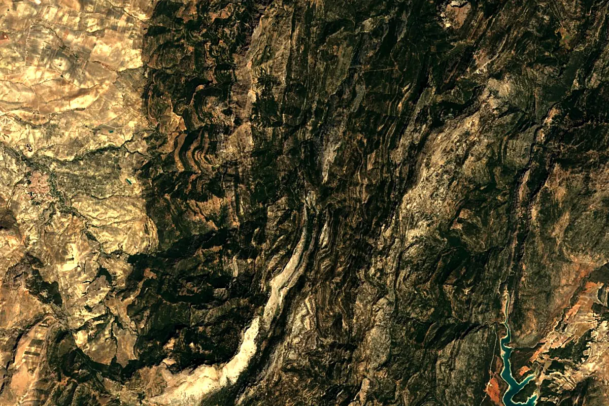
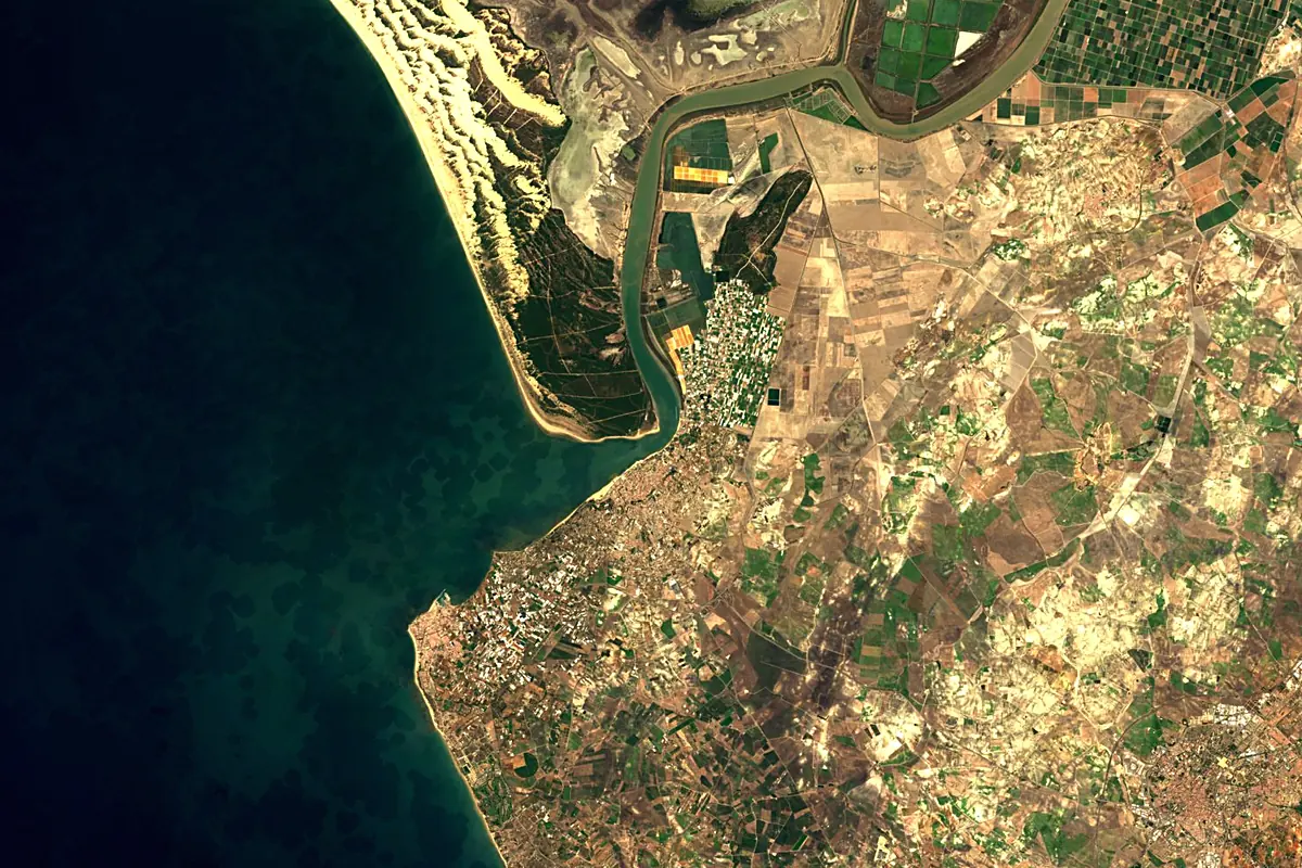
Sentinel-2 cloudless 2016 by EOX IT Services GmbH (contains modified Copernicus Sentinel data 2016), CC BY 4.0. The glowing line is the river as drawn by RiverATLAS.
Photos
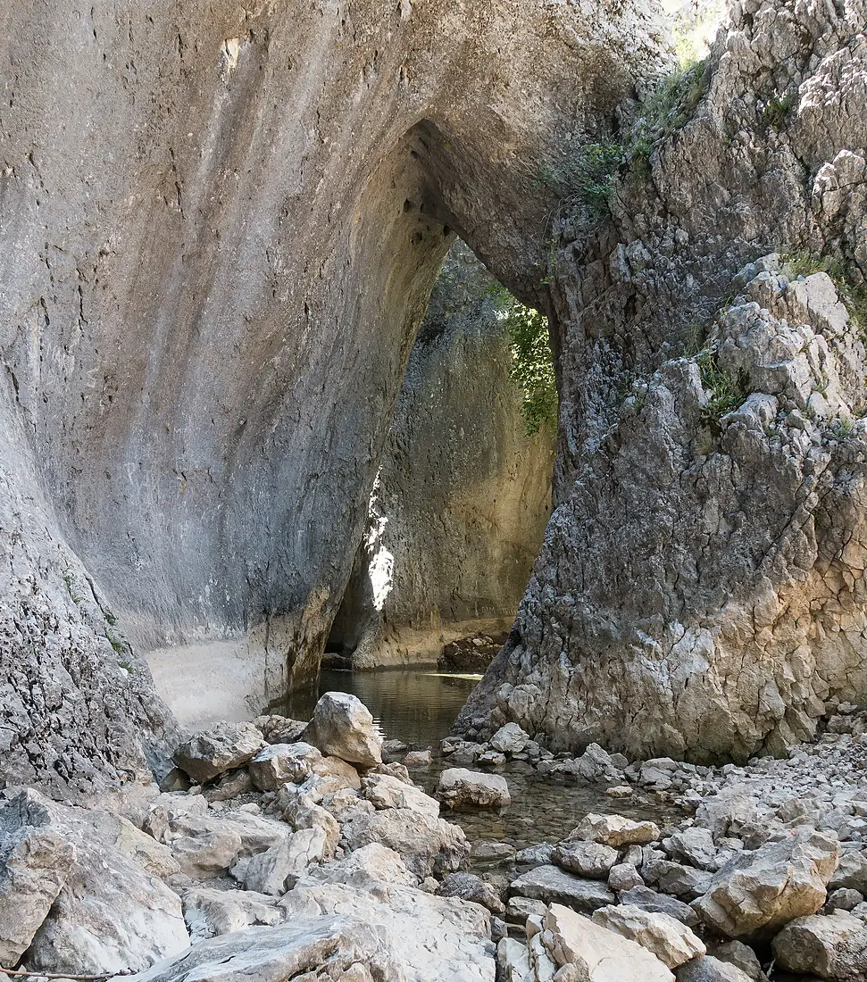
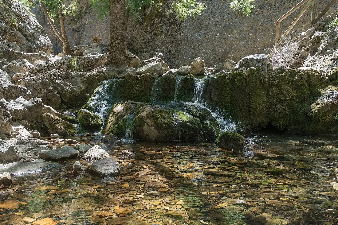
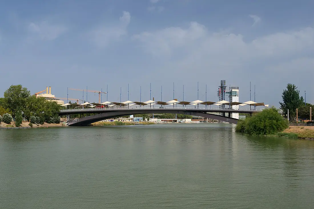
Guadalquivir in pictures
Tributaries
Where it flows, and what flows into it
Tributaries (32)
Also: Guadaíra, Guadiamar, Guadiana Menor, Guadalimar, Guadiato, Guadajoz, Corbones, Guadalbullón, Guadalmellato, River Viar, Cerezuelo River, Jándula River, Bembézar, Cañamares, Borosa River, Torres river, Rumblar River, Rivera de Hueznar, Yeguas River, Retortillo, Jandulilla, Arenoso, Cuadros, Aguamulas River
Nearby
Rivers nearby
Spain159 km20 m³/s26 km awayGuadiana Portugal778 km70 m³/s103 km awayTinto RiverSpain100 km14 m³/s70 km awayGenilSpain358 km40 m³/s134 km awayGuadalhorceSpain166 km8.0 m³/s170 km awayLoukkos River
 Morocco176 km50 m³/s178 km awaySado RiverPortugal180 km40 m³/s267 km awaySebou RiverMorocco458 km140 m³/s283 km away
Where these numbers come from
| Name, length, places | Wikidata (Q14309) · CC0 |
|---|---|
| Course, profile, basin | RiverATLAS v1.0 (HydroATLAS, Linke et al. 2019) · CC BY 4.0 — followed from the source to the mouth given by Wikidata |
| Flow | WaterGAP (RiverATLAS), 1971–2000 · CC BY 4.0 |
| Climate along the river | WorldClim (RiverATLAS), 1970–2000 · CC BY 4.0 |
| Towns, bridges, dams | Wikidata · CC0; GeoNames · CC BY 4.0 |
| Along the river | © OpenStreetMap contributors · ODbL |
| Images | EOX Sentinel-2 cloudless 2016 · CC BY 4.0; Wikimedia Commons |
| Our other atlases | Cascadyas, Lakeyas, Coastya, Peakyas — Wikidata · CC0; © OpenStreetMap contributors · ODbL; GeoNames · CC BY 4.0; HydroLAKES · CC BY 4.0; NOAA OISST |
Every source and licence is on the data sources page.
The family
Do you prefer beaches, lakes, mountains, waterfalls, islands, rivers or canyons?
Same idea, other landscapes: field atlases built on open data, month by month, in seven languages.
beaches Find your beach: sea temperature, sun and swimming month by month.Visit lakes
 Every lake on Earth: water temperature, ice, depth and the shore.Coming soonVisit mountains
 Every summit in 3D: summit weather, the 0 °C line, huts and trails.Visit waterfalls
 Every waterfall: height, flow month by month and when it roars.Coming soonVisit
  islands
 Every island from the sea up: size, sea temperature, ferries and 3D.Coming soonVisit
  rivers
 Every river from source to sea: the journey, the flow and the basin in numbers.You are here
 canyons
 Every canyon cut to scale: depth to the floor, rim and floor temperatures, trails and viewpoints.Coming soonVisit