River
Kura River
1,360 km from source to mouth · Azerbaijan, Georgia and Turkey.
 Azerbaijan, Georgia and TurkeyFlows into Caspian Sea1st longest in Azerbaijan
In numbers
Length
1,360km
Average flow
440m³/s
Basin
188,000km²
Drop
2,010m
from 1,979 m to -31 m
Countries
3
The journey
From source to mouth
1,360 km of river and 67 stops on the way: 17 towns and cities on its banks, dams, bridges and the tributaries that feed it.
- 0 kmArmenian Highlandsat 1,979 m
- 91 kmArdahan22,927 people
- 194 kmParavani Rivertributary
- 233 kmUravelitributary
- 237 kmPotskhovistskalitributary
- 255 kmAtskuri1,539 people
- 285 kmBorjomi11,194 people
- 289 kmGujaretistskalitributary
- 318 kmKhashuri23,949 people
- 344 kmSuramulatributary
- 344 kmDzama rivertributary
- 371 kmGori44,524 people
- 374 kmTana Rivertributary
- 374 kmGreat Liakhvi Rivertributary
- 383 kmKvakhvreli2,091 people
- 392 kmTedzamitributary
- 403 kmKaspi12,708 people
- 405 kmLekhuratributary
- 426 kmKsanitributary
- 438 kmMtskheta7,606 people
- 439 kmAragvi Rivertributary
- 450 kmGldaniskhevitributary
- 455 kmDigomistskalitributary
- 458 kmVakhushti Bagrationi Bridge
- 459 kmQueen Tamar Bridge
- 462 kmGuram Dochanashvili Bridge
- 462 kmVere Rivertributary
- 463 kmNikoloz Baratashvili Bridge
- 463 kmMukhrani Bridge
- 463 kmBridge of Peace
- 465 kmTbilisi1,049,498 people
- 465 kmdam of Ortachala HPP
- 465 kmSamasi Aragveli Bridge
- 481 kmLochinitributary
- 493 kmRustavi132,333 people
- 529 kmAlgeti Rivertributary
- 533 kmKhrami Rivertributary
- 541 kmKoghbtributary
- 569 kmAghstevtributary
- 581 kmVaragajurtributary
- 634 kmDzegamchaytributary
- 647 kmDzhagirchaytributary
- 658 kmShamkir reservoir74 km²
- 663 kmShamkirchaytributary
- 672 kmYenikend reservoir17 km²
- 692 kmGanjachaytributary
- 708 kmIori Rivertributary
- 717 kmAlazanitributary
- 759 kmMingachevir reservoir416 km²
- 760 kmMingechevir Hydro Power Plant
- 766 kmMingachevir106,048 people
- 783 kmAlidzhanchaytributary
- 786 kmOzero Akhmaz0.6 km²
- 796 kmYevlakh127,400 people
- 831 kmTartartributary
- 876 kmXaçınçaytributary
- 889 kmQarqar Rivertributary
- 916 kmZardob10,612 people
- 916 kmTuryantributary
- 934 kmMekhman4.9 km²
- 979 kmGirdimançaytributary
- 1,016 kmLake Sarysu20 km²
- 1,040 kmSabirabad30,612 people
- 1,052 kmAras Rivertributary
- 1,113 kmŞirvan70,220 people
- 1,176 kmOzero Duzdag5.0 km²
- 1,177 kmSalyan36,555 people
- 1,232 kmNeftçala18,661 people
- 1,360 kmCaspian Seaat -31 m
Water level along the river (RiverATLAS; the height is exaggerated). Towns: GeoNames and Wikidata; bridges, dams and tributaries: Wikidata.
River in South Caucasus
At the mouth it carries 443 m³/s on average: an Olympic pool every 5.6 seconds. It drops from 1,979 m to -31 m, 1.5 m per kilometre on average. Its basin covers 188,000 km², about the size of SY. 13.3 million people live in it. Highest water: May. It is heavily dammed: reservoirs can hold 90% of a year's flow.
Where to start
- TbilisiLargest city on its banks · 1,049,498 people
- Tbilisi International Airport (TBS)Nearest airport with scheduled flights, 10 km from the cityCar hire at TBS airport (Tbilisi)Discover Cars · Affiliate link↗
- On the water6 ferry piers, marinas, boat rentals and boat ramps along the river (OpenStreetMap)
- From May to SeptemberThe best months to visit
Kura River, month by month
Highest water: May
Best months to visit: from May to September.
From about 200 m³/s in the lowest month to 1,900 m³/s in the highest. An estimate: the monthly flow is modelled from the lowest and highest months of WaterGAP (RiverATLAS, 1971–2000) and the rain and snow along the river (WorldClim). Dams change the real rhythm. The chip is the average air temperature; below it, the month's rain.
Plan the trip
Plan the trip: boat trips, a bed by the river, a car
Some links above are affiliate links: if you book through them we may earn a commission, at no extra cost to you. It never changes what the data on this page says.
The basin
Kura River: the basin in numbers
188,377 km² of land send their water to this river. This is what lives on it.
- 13.3millionpeople live in the basin
- 71/km²people per km²
- 1,337maverage altitude of the basin
- 511mmof rain a year (basin average)
- 8.7°Caverage air temperature
- 8%protected areas
- 1.3%covered by lakes
- 20km³held in reservoirs
What covers the basin
- 8% Forest
- 26% Cropland
- 35% Pasture
- 3% Towns and cities
RiverATLAS (HydroATLAS v1.0, CC BY 4.0): land cover, people, protected areas, glaciers and dams over the whole basin upstream of the mouth.
Along the river
Kura River: what you find on the way
- 36Weirs
- 25WaterfallsLeghvtakhevi Waterfall and 24 more
- 3Boat rampsMtskheta Pier
- 1Ferry piersPriçal
- 1River beachesMingachevir Beach
From OpenStreetMap, within 2.6 km of the river. Not mapped is not the same as not there.
Cross-checked with our atlases
Kura River in our other atlases
What our sister atlases know about the waterfalls on this river, the lakes it flows through, the beaches at its mouth, the mountains where it rises and the islands off its mouth.
 7lakes on its wayLakeyas
 6mountains at the sourcePeakyas
Lakes and reservoirs (7)
Lakes it flows through, by Lakeyas
- Shamkir reservoirkm 55574km²
- Yenikend reservoirkm 56817km²
- Mingachevir reservoirkm 641 · 75 m deep416km²
- Ozero Akhmazkm 6640.6km²
- Mekhmankm 789 · 2 m deep4.9km²
- Lake Sarysukm 858 · 6 m deep20km²
- Ozero Duzdagkm 9935.0km²
Lakeyas is coming soonOpen Lakeyas ↗
Mountains at the source (6)
Within 15 km of the source, by Peakyas
- Zuğku14 km away
- Koyun Hill2.4 km away
- Kartal Hill14 km away
- Top Hill7.9 km away
- Kabak Hill15 km away
- Büyükboğa Hill11 km away
From space
The source and the mouth, seen from orbit
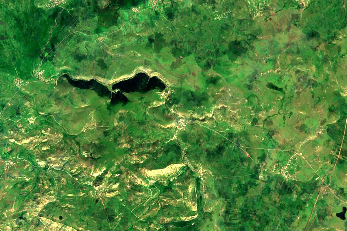
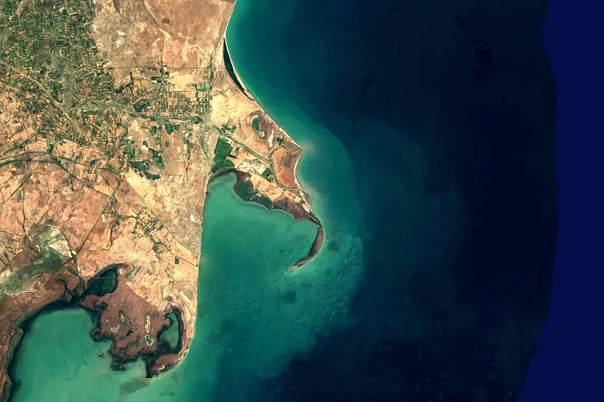
Sentinel-2 cloudless 2016 by EOX IT Services GmbH (contains modified Copernicus Sentinel data 2016), CC BY 4.0. The glowing line is the river as drawn by RiverATLAS.
Photos
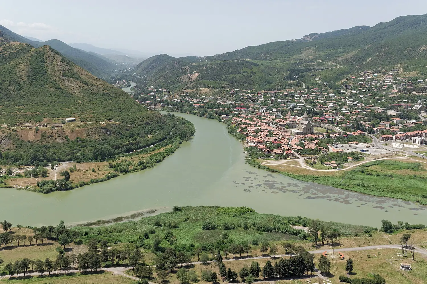
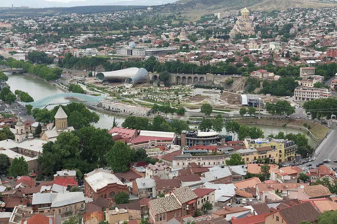
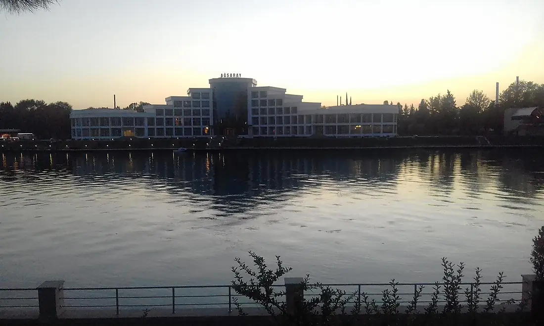
Kura River in pictures
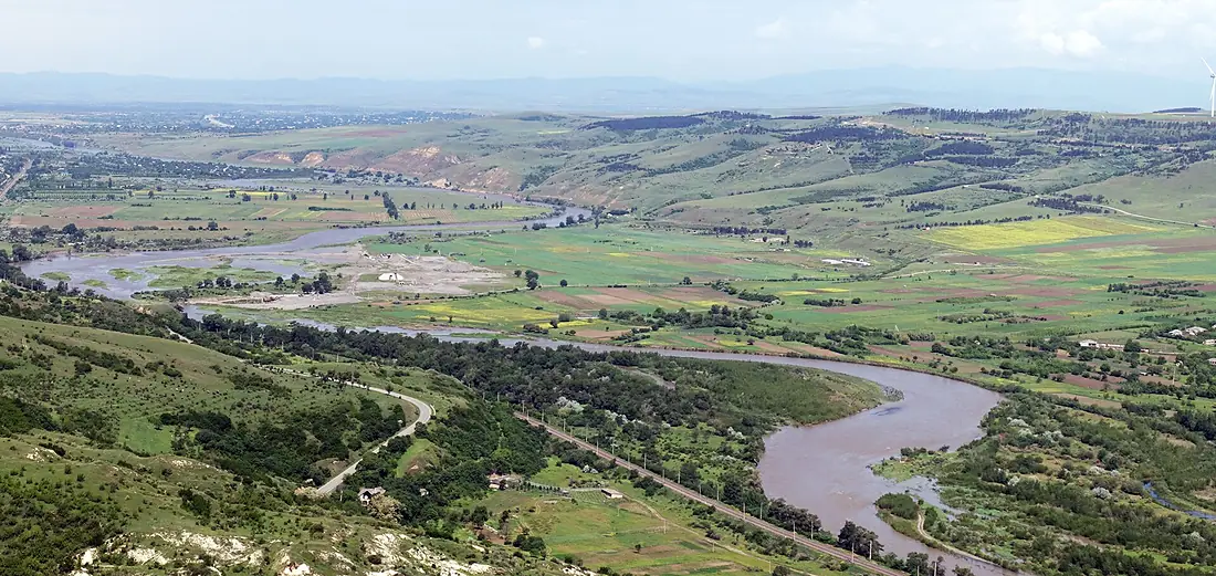
Tributaries
Where it flows, and what flows into it
Tributaries (44)
Azerbaijan1,072 km280 m³/sjoins at km 888AlazaniAzerbaijan351 km98 m³/sjoins at km 606Iori RiverAzerbaijan320 km120 m³/sjoins at km 598Khrami RiverAzerbaijan201 km51 m³/sjoins at km 450TartarAzerbaijan184 km23 m³/sjoins at km 702AghstevAzerbaijan133 km8.2 m³/sjoins at km 481Aragvi RiverGeorgia112 km33 m³/sjoins at km 370KsaniGeorgia84 km15 m³/sjoins at km 360Also: Great Liakhvi River, Algeti River, Qarqar River, Xaçınçay, Turyan, Vere River, Shamkirchay, Kürəkçay, Paravani River, Suramula, Ganjachay, Lekhura, Girdimançay, Podkumok, Potskhovistskali, Tedzami, Koghb, Dzama river, Digomistskali, Tavush, Dzegamchay, Uraveli, Aghsu River, Dzhagirchay
 Armenia
Nearby
Rivers nearby
Azerbaijan1,072 km280 m³/s112 km awaySefid Rud Iran670 km310 m³/s211 km awayVorotan RiverAzerbaijan178 km22 m³/s231 km awayTartarAzerbaijan184 km23 m³/s218 km awayHakari RiverAzerbaijan170 km16 m³/s222 km awayAlazaniAzerbaijan351 km98 m³/s295 km awayIori RiverAzerbaijan320 km120 m³/s309 km awayArpa RiverAzerbaijan128 km21 m³/s383 km away
Where these numbers come from
| Name, length, places | Wikidata (Q156557) · CC0 |
|---|---|
| Course, profile, basin | RiverATLAS v1.0 (HydroATLAS, Linke et al. 2019) · CC BY 4.0 — followed from the source to the mouth given by Wikidata |
| Flow | WaterGAP (RiverATLAS), 1971–2000 · CC BY 4.0 |
| Climate along the river | WorldClim (RiverATLAS), 1970–2000 · CC BY 4.0 |
| Towns, bridges, dams | Wikidata · CC0; GeoNames · CC BY 4.0 |
| Along the river | © OpenStreetMap contributors · ODbL |
| Images | EOX Sentinel-2 cloudless 2016 · CC BY 4.0; Wikimedia Commons |
| Our other atlases | Lakeyas, Peakyas — Wikidata · CC0; © OpenStreetMap contributors · ODbL; GeoNames · CC BY 4.0; HydroLAKES · CC BY 4.0; NOAA OISST |
Every source and licence is on the data sources page.
The family
Do you prefer beaches, lakes, mountains, waterfalls, islands, rivers or canyons?
Same idea, other landscapes: field atlases built on open data, month by month, in seven languages.
 beaches
 Find your beach: sea temperature, sun and swimming month by month.Visit lakes
 Every lake on Earth: water temperature, ice, depth and the shore.Coming soonVisit mountains
 Every summit in 3D: summit weather, the 0 °C line, huts and trails.Visit
  waterfalls
 Every waterfall: height, flow month by month and when it roars.Coming soonVisit
  islands
 Every island from the sea up: size, sea temperature, ferries and 3D.Coming soonVisit
  rivers
 Every river from source to sea: the journey, the flow and the basin in numbers.You are here
 canyons
 Every canyon cut to scale: depth to the floor, rim and floor temperatures, trails and viewpoints.Coming soonVisit