River
Liffey
125 km from source to mouth · Ireland.
 IrelandFlows into Irish Sea6th longest in Ireland
In numbers
Length
125km
Average flow
14m³/s
Basin
1,341km²
Drop
192m
from 192 m to 0 m
Country
1
The journey
From source to mouth
125 km of river and 51 stops on the way: 21 towns and cities on its banks, dams, bridges and the tributaries that feed it.
- 0 kmSourceat 192 m
- 8 kmBlessington5,520 people
- 17 kmPoulaphouca Reservoir19 km²
- 18 kmPoulaphouca
- 19 kmPollaphuca Waterfall
- 37 kmKilcullen3,710 people
- 42 kmAthgarvan1,176 people
- 47 kmDroichead Nua22,742 people
- 64 kmSallins5,283 people
- 70 kmAlexandra Bridge
- 70 kmClane7,280 people
- 87 kmCelbridge20,288 people
- 94 kmLeixlip15,504 people
- 94 kmConfey5,389 people
- 98 kmLucan15,269 people
- 99 kmLucan Bridge
- 106 kmWest-Link
- 107 kmPalmerstown11,130 people
- 108 kmFarmleigh Bridge
- 108 kmCastleknock8,301 people
- 111 kmAnna Livia Bridge
- 111 kmBallyfermot8,558 people
- 111 kmChapelizod5,296 people
- 111 kmWalkinstown6,819 people
- 114 kmIsland Bridge
- 115 kmLiffey Railway Bridge
- 115 kmGreenhills6,876 people
- 115 kmRialto3,652 people
- 116 kmSeán Heuston Bridge
- 116 kmFrank Sherwin Bridge
- 116 kmRory O'More Bridge
- 116 kmJames Joyce Bridge
- 117 kmMellows Bridge
- 117 kmFather Mathew Bridge
- 117 kmO'Donovan Rossa Bridge
- 118 kmGrattan Bridge
- 118 kmMillennium Bridge
- 118 kmHa'penny Bridge
- 118 kmDublin592,713 people
- 119 kmO'Connell Bridge
- 119 kmRosie Hackett Bridge
- 119 kmButt Bridge
- 119 kmLoopline Bridge
- 119 kmTalbot Memorial Bridge
- 120 kmSeán O'Casey Bridge
- 120 kmSamuel Beckett Bridge
- 120 kmFairview3,821 people
- 121 kmEast-Link
- 122 kmRingsend8,202 people
- 123 kmSandymount8,967 people
- 123 kmCamactributary
- 125 kmRiver Doddertributary
- 125 kmIrish Seaat 0 m
Water level along the river (RiverATLAS; the height is exaggerated). Towns: GeoNames and Wikidata; bridges, dams and tributaries: Wikidata.
River flowing through Dublin, Ireland
At the mouth it carries 14 m³/s on average: an Olympic pool every 181 seconds. It drops from 192 m to 0 m, 1.5 m per kilometre on average. Its basin covers 1,341 km², about the size of MQ. 814,000 people live in it. Highest water: from December to January. Dams and reservoirs hold back a large share of its water (21% of a year's flow).
Where to start
- DublinLargest city on its banks · 592,713 people
- Dublin Airport (DUB)Nearest airport with scheduled flights, 9 km from the cityCar hire at DUB airport (Dublin)Discover Cars · Affiliate link↗
- On the water28 ferry piers, marinas, boat rentals and boat ramps along the river (OpenStreetMap)
- Kayak and canoe1 put-ins and rapids mapped (OpenStreetMap)
- From June to SeptemberThe best months to visit
Liffey, month by month
Highest water: from December to January
Best months to visit: from June to September.
From about 10 m³/s in the lowest month to 51 m³/s in the highest. An estimate: the monthly flow is modelled from the lowest and highest months of WaterGAP (RiverATLAS, 1971–2000) and the rain and snow along the river (WorldClim). Dams change the real rhythm. The chip is the average air temperature; below it, the month's rain.
Plan the trip
Plan the trip: boat trips, a bed by the river, a car
Some links above are affiliate links: if you book through them we may earn a commission, at no extra cost to you. It never changes what the data on this page says.
The basin
Liffey: the basin in numbers
1,341 km² of land send their water to this river. This is what lives on it.
- 814,000people live in the basin
- 607/km²people per km²
- 171maverage altitude of the basin
- 922mmof rain a year (basin average)
- 8.8°Caverage air temperature
- 1.4%covered by lakes
- 0.2km³held in reservoirs
What covers the basin
- 7% Forest
- 10% Cropland
- 31% Pasture
- 20% Towns and cities
RiverATLAS (HydroATLAS v1.0, CC BY 4.0): land cover, people, protected areas, glaciers and dams over the whole basin upstream of the mouth.
Along the river
Liffey: what you find on the way
- 31WeirsMill Stream, Lucan Sluice, Lucan Weir and 28 more
- 82LocksGrand Canal - Naas Branch, Grand Canal, 5th Lock and 79 more
- 4WaterfallsPoulaphuca Waterfall, Leixlip Spa Waterfall and 2 more
- 1Canoe put-ins
- 14Boat rampsRusselstown Inlet and 13 more
- 12Ferry piersCruise Terminal (Berth 18), Terminal 4, Dublin Port Terminal 1 and 9 more
- 2MarinasDublin Moorings, Hanover Quay
- 2River beachesSandymount Strand
From OpenStreetMap, within 1.3 km of the river. Not mapped is not the same as not there.
Cross-checked with our atlases
Liffey in our other atlases
What our sister atlases know about the waterfalls on this river, the lakes it flows through, the beaches at its mouth, the mountains where it rises and the islands off its mouth.
 2waterfalls on the riverCascadyas
 1lake on its wayLakeyas
 9beaches at the mouth and on the banksCoastya
 47mountains at the sourcePeakyas
 7islands off the mouthIslandyas
Waterfalls (2)
On the river, by Cascadyas
- Poulaphoucakm 14
- Pollaphuca Waterfallkm 14
Cascadyas is coming soonOpen Cascadyas ↗
Lakes and reservoirs (1)
Lakes it flows through, by Lakeyas
- Poulaphouca Reservoirkm 1319km²
Lakeyas is coming soonOpen Lakeyas ↗
Beaches (9)
At the mouth (25 km) and on the banks, by Coastya
- Sandymount Strandkm 9215.1°C
- Merrion Strand3.2 km away15.1°C
- Sutton Strand6.8 km away15.1°C
- Velvet Strand9.9 km away15.1°C
- Portmarnock Beach9.4 km away15.1°C
- Coliemore Harbour10 km away · cove15.1°C
- Bullock Harbour8.7 km away · cove15.1°C
- Sandycove Harbour8.1 km away · cove15.1°C
1 more on CoastyaOpen Coastya ↗
Mountains at the source (47)
Within 15 km of the source, by Peakyas
- Kippure3.8 km away · prominence 262 m757m
- Mullaghcleevaun9.8 km away · prominence 374 m849m
- Tonelagee13 km away · prominence 204 m817m
- Djouce4.2 km away · prominence 200 m725m
- Duff Hill7.0 km away · prominence 65 m720m
- Gravale5.5 km away · prominence 123 m718m
- War Hill3.9 km away · prominence 71 m686m
- Moanbane13 km away · prominence 108 m703m
39 more on PeakyasOpen Peakyas ↗
Islands off the mouth (7)
Within 30 km of the mouth, by Islandyas
- Lambay Island20 km away2.4km²
- Ireland's Eye11 km away0.2km²
- Bull Island2.4 km away2.8km²
- Dalkey Island11 km away0.1km²
- St Patrick's Island28 km away
- Shenick Island26 km away
- Colt Island28 km away
Islandyas is coming soonOpen Islandyas ↗
From space
The source and the mouth, seen from orbit
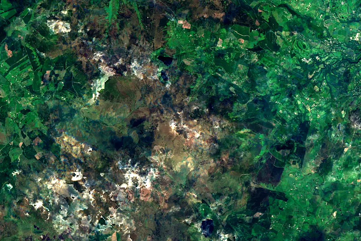
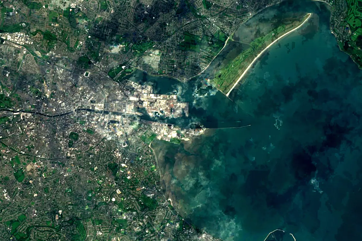
Sentinel-2 cloudless 2016 by EOX IT Services GmbH (contains modified Copernicus Sentinel data 2016), CC BY 4.0. The glowing line is the river as drawn by RiverATLAS.
Photos
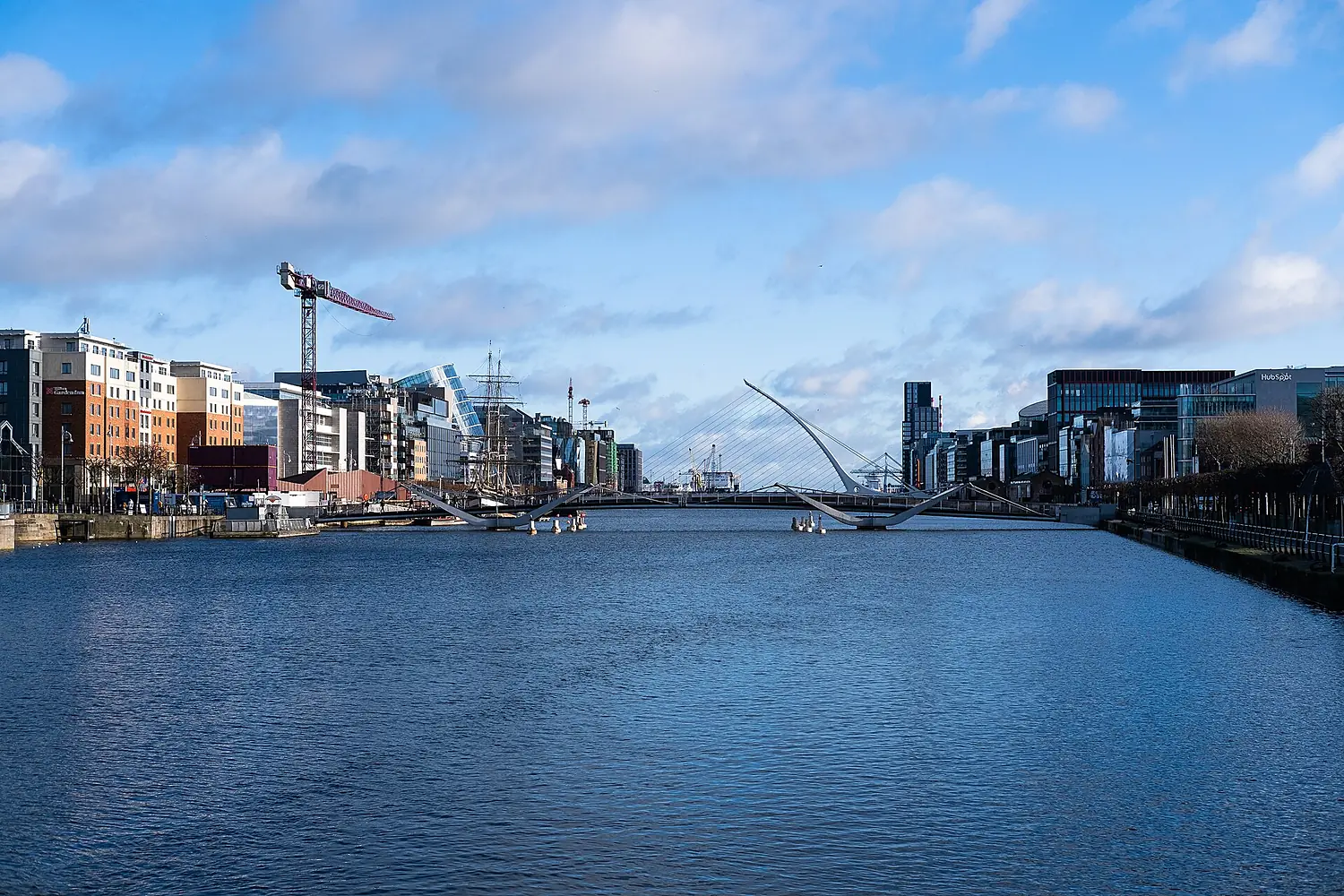
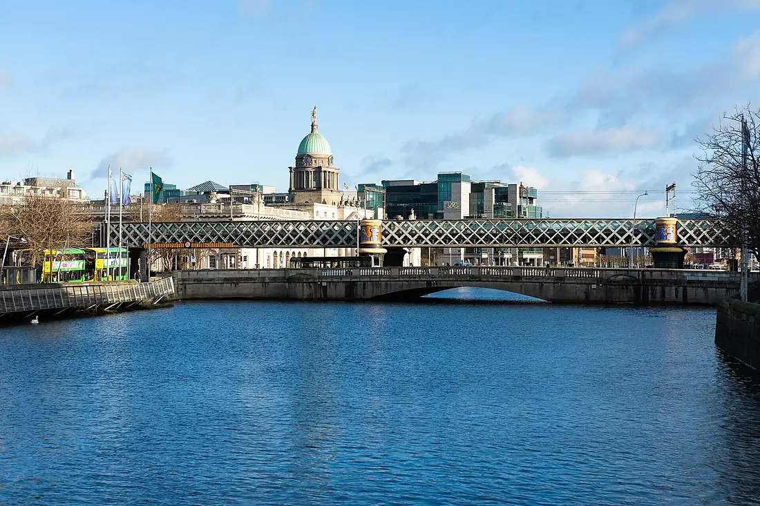
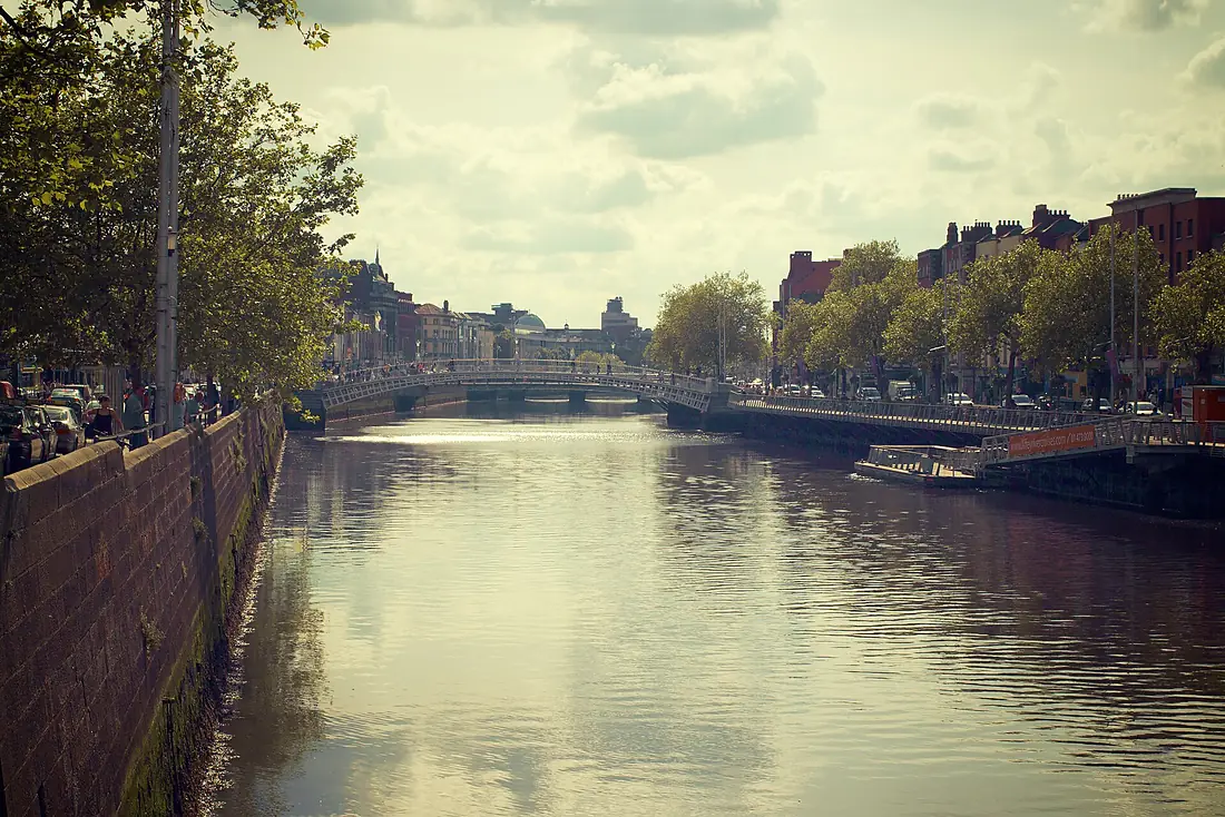
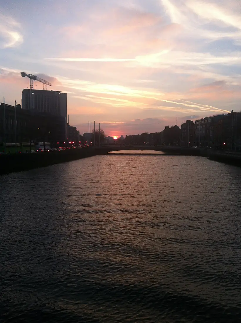
Liffey in pictures
Tributaries
Where it flows, and what flows into it
Tributaries (3)
Also: River Dodder, River Poddle, Camac
Nearby
Rivers nearby
Ireland112 km46 m³/s43 km awayRiver SlaneyIreland117 km40 m³/s112 km awayRiver NoreIreland140 km51 m³/s115 km awaySuirIreland184 km88 m³/s132 km awayBarrowIreland192 km110 m³/s129 km awayRiver ShannonIreland368 km200 m³/s185 km awayRiver Dee United Kingdom110 km30 m³/s207 km awayMunster BlackwaterIreland168 km89 m³/s188 km away
Where these numbers come from
| Name, length, places | Wikidata (Q208009) · CC0 |
|---|---|
| Course, profile, basin | RiverATLAS v1.0 (HydroATLAS, Linke et al. 2019) · CC BY 4.0 — followed from the source to the mouth given by Wikidata |
| Flow | WaterGAP (RiverATLAS), 1971–2000 · CC BY 4.0 |
| Climate along the river | WorldClim (RiverATLAS), 1970–2000 · CC BY 4.0 |
| Towns, bridges, dams | Wikidata · CC0; GeoNames · CC BY 4.0 |
| Along the river | © OpenStreetMap contributors · ODbL |
| Images | EOX Sentinel-2 cloudless 2016 · CC BY 4.0; Wikimedia Commons |
| Our other atlases | Cascadyas, Lakeyas, Coastya, Peakyas, Islandyas — Wikidata · CC0; © OpenStreetMap contributors · ODbL; GeoNames · CC BY 4.0; HydroLAKES · CC BY 4.0; NOAA OISST |
Every source and licence is on the data sources page.
The family
Do you prefer beaches, lakes, mountains, waterfalls, islands, rivers or canyons?
Same idea, other landscapes: field atlases built on open data, month by month, in seven languages.
beaches Find your beach: sea temperature, sun and swimming month by month.Visit lakes
 Every lake on Earth: water temperature, ice, depth and the shore.Coming soonVisit mountains
 Every summit in 3D: summit weather, the 0 °C line, huts and trails.Visit waterfalls
 Every waterfall: height, flow month by month and when it roars.Coming soonVisit islands
 Every island from the sea up: size, sea temperature, ferries and 3D.Coming soonVisit
  rivers
 Every river from source to sea: the journey, the flow and the basin in numbers.You are here
 canyons
 Every canyon cut to scale: depth to the floor, rim and floor temperatures, trails and viewpoints.Coming soonVisit