River
Magdalena River
1,528 km from source to mouth · Colombia.
 ColombiaFlows into Caribbean Sea1st longest in Colombia
In numbers
Length
1,528km
Average flow
7,200m³/s
Basin
260,000km²
Drop
2,969m
from 2,969 m to 0 m
Country
1
The journey
From source to mouth
1,528 km of river and 68 stops on the way: 21 towns and cities on its banks, dams, bridges and the tributaries that feed it.
- 0 kmColombian Massifat 2,969 m
- 49 kmPopayán318,059 people
- 127 kmLake Salvajina18 km²
- 182 kmPuerto Tejada46,215 people
- 192 kmPance Rivertributary
- 230 kmYumbo71,436 people
- 269 kmLaguna de Sonso7.1 km²
- 272 kmCiénaga Regina0.4 km²
- 342 kmRoldanillo27,561 people
- 417 kmLa Virginia25,900 people
- 910 kmCaucasia58,034 people
- 960 kmCiénaga Hoyo Grande0.4 km²
- 973 kmNechí24,066 people
- 1,036 kmCiénaga La Veta9.3 km²
- 1,095 kmCiénaga La Burra27 km²
- 1,100 kmCiénaga Manteguera11 km²
- 1,103 kmCauca Rivertributary
- 1,104 kmPinillos24,923 people
- 1,118 kmMargarita Island117,210 people
- 1,135 kmCiénaga Tolú130 km²
- 1,143 kmCiénaga Los Murciélagos25 km²
- 1,148 kmCiénaga Perico12 km²
- 1,151 kmSan Jorge Rivertributary
- 1,151 kmCiénaga Pinalito3.5 km²
- 1,155 kmCiénaga Chica3.0 km²
- 1,160 kmCiénaga la Puntalarga20 km²
- 1,164 kmMagangué123,982 people
- 1,166 kmCiénaga de Rabón0.9 km²
- 1,168 kmCiénaga el Sorro16 km²
- 1,181 kmCiénaga La Batea3.2 km²
- 1,184 kmCiénaga Guacamayo11 km²
- 1,193 kmCiénaga de la Rivera0.7 km²
- 1,200 kmCiénaga Pajarel2.5 km²
- 1,213 kmCiénaga Grande0.3 km²
- 1,214 kmCórdoba12,266 people
- 1,227 kmCiénaga Tortola2.3 km²
- 1,238 kmCiénaga El Silencio11 km²
- 1,243 kmPlato61,856 people
- 1,245 kmCiénaga de Zambrano5.8 km²
- 1,257 kmCiénaga de Zura9.9 km²
- 1,261 kmLaguna Tapegua0.5 km²
- 1,276 kmCienaga La Candelaria11 km²
- 1,284 kmCiénaga Doña Francisca8.0 km²
- 1,286 kmCiénaga de Jubilado2.1 km²
- 1,287 kmCiénaga Sapayán51 km²
- 1,291 kmCiénaga de Robles2.5 km²
- 1,295 kmCiénaga Cotoré6.6 km²
- 1,305 kmCiénaga de Moreno2.9 km²
- 1,310 kmCiénaga de Ortiz0.8 km²
- 1,315 kmCiénaga de Machado2.3 km²
- 1,319 kmCalamar24,573 people
- 1,327 kmCiénaga Cerro de San Antonio40 km²
- 1,364 kmCiénaga El Uvero1.8 km²
- 1,376 kmPonedera23,243 people
- 1,387 kmPalmar de Varela25,886 people
- 1,390 kmSanto Tomás35,000 people
- 1,390 kmCiénaga Santo Tomás4.1 km²
- 1,391 kmCiénaga Sabana Grande0.5 km²
- 1,392 kmSitionuevo26,777 people
- 1,395 kmSabanagrande34,369 people
- 1,399 kmCiénaga El Convento2.2 km²
- 1,400 kmCiénaga Malambo2.8 km²
- 1,402 kmMalambo99,058 people
- 1,405 kmCiénaga Bahía3.9 km²
- 1,409 kmCiénaga Juan Manuel2.0 km²
- 1,414 kmSoledad676,014 people
- 1,424 kmBarranquilla1,326,588 people
- 1,434 kmCiénaga Punta Faro2.6 km²
- 1,435 kmCiénaga San Nicolás8.3 km²
- 1,528 kmCaribbean Seaat 0 m
Water level along the river (RiverATLAS; the height is exaggerated). Towns: GeoNames and Wikidata; bridges, dams and tributaries: Wikidata.
River in Colombia
At the mouth it carries 7,200 m³/s on average: 2.9 Olympic pools every second. It drops from 2,969 m to 0 m, 1.9 m per kilometre on average. Its basin covers 260,000 km², about the size of GA. 30.6 million people live in it. Highest water: from October to November; lowest: March. Its dams hold back little of its water (3.2% of a year's flow).
Where to start
- BarranquillaLargest city on its banks · 1,326,588 people
- Ernesto Cortissoz International Airport (BAQ)Nearest airport with scheduled flights, 11 km from the cityCar hire at CTG airport (Cartagena)Discover Cars · Affiliate link↗
- On the water57 ferry piers, marinas, boat rentals and boat ramps along the river (OpenStreetMap)
- From December to FebruaryThe best months to visit
Magdalena River, month by month
Highest water: from October to November
Lowest water: March. Best months to visit: from December to February.
From about 3,700 m³/s in the lowest month to 10,500 m³/s in the highest. An estimate: the monthly flow is modelled from the lowest and highest months of WaterGAP (RiverATLAS, 1971–2000) and the rain and snow along the river (WorldClim). Dams change the real rhythm. The chip is the average air temperature; below it, the month's rain.
Plan the trip
Plan the trip: boat trips, a bed by the river, a car
Some links above are affiliate links: if you book through them we may earn a commission, at no extra cost to you. It never changes what the data on this page says.
The basin
Magdalena River: the basin in numbers
260,739 km² of land send their water to this river. This is what lives on it.
- 30.6millionpeople live in the basin
- 119/km²people per km²
- 1,131maverage altitude of the basin
- 2,078mmof rain a year (basin average)
- 22.1°Caverage air temperature
- 10%protected areas
- 1.6%covered by lakes
- 7.4km³held in reservoirs
What covers the basin
- 18% Forest
- 8% Cropland
- 58% Pasture
- 2% Towns and cities
RiverATLAS (HydroATLAS v1.0, CC BY 4.0): land cover, people, protected areas, glaciers and dams over the whole basin upstream of the mouth.
Along the river
Magdalena River: what you find on the way
- 2Weirs
- 16WaterfallsSegundo Pailón, Primer Pailón, Cascada El Mango and 13 more
- 7Boat ramps
- 45Ferry piersTerminal Ferry Arenal, Embalse La Union, Puerto de Magangue and 42 more
- 3Marinascentro de integración ciudadana, Club Veranillo
- 14River beachesPlaya Rica, Playón del Rio, Isla Del Cuatro and 11 more
From OpenStreetMap, within 2.6 km of the river. Not mapped is not the same as not there.
Cross-checked with our atlases
Magdalena River in our other atlases
What our sister atlases know about the waterfalls on this river, the lakes it flows through, the beaches at its mouth, the mountains where it rises and the islands off its mouth.
 44lakes on its wayLakeyas
 5beaches at the mouth and on the banksCoastya
 5mountains at the sourcePeakyas
Lakes and reservoirs (44)
Lakes it flows through, by Lakeyas
- Lake Salvajinakm 11518km²
- Laguna de Sonsokm 2447.1km²
- Ciénaga La Burrakm 99527km²
- Ciénaga Tolúkm 1,031130km²
- Ciénaga Los Murciélagoskm 1,03825km²
- Ciénaga la Puntalargakm 1,05420km²
- Ciénaga Sapayánkm 1,16951km²
- Ciénaga Cerro de San Antoniokm 1,20640km²
36 more on LakeyasLakeyas is coming soonOpen Lakeyas ↗
Beaches (5)
At the mouth (25 km) and on the banks, by Coastya
- Playa de Pradomar19 km away29.3°C
- Playa del Muerto13 km away29.1°C
- Playa de Los Pescadores4.6 km away29.1°C
- Ensenada de Trebal24 km away · cove29.3°C
- Ensenada Totumito24 km away · cove29.3°C
Mountains at the source (5)
Within 15 km of the source, by Peakyas
- Puracé15 km away4,756m
- Sierra Los Coconucos13 km away
- Pico de Paletará12 km away
- Cerro Pan de Azúcar12 km away
- Alto de Bordones14 km away
From space
The source and the mouth, seen from orbit
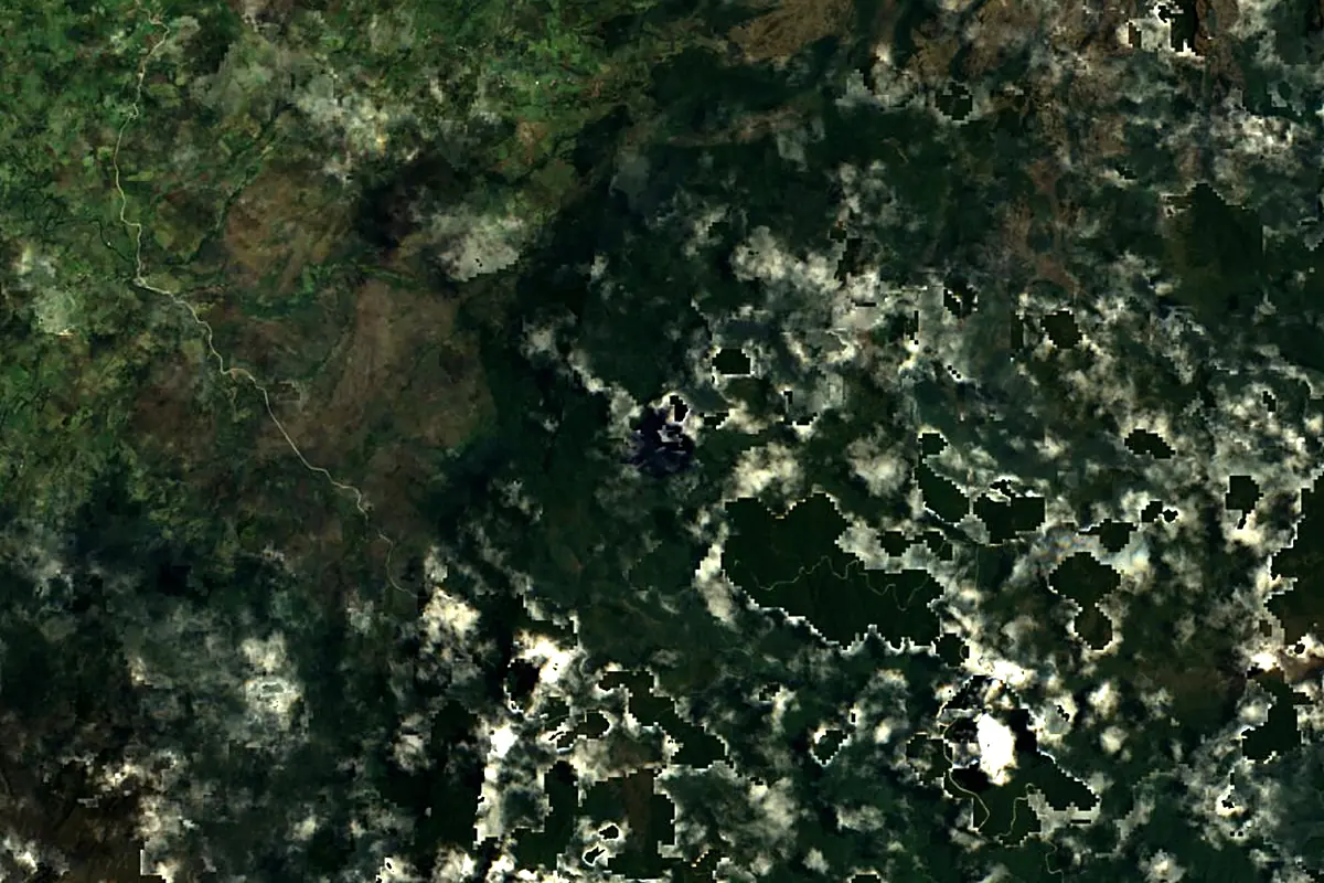
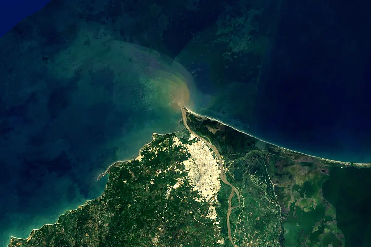
Sentinel-2 cloudless 2016 by EOX IT Services GmbH (contains modified Copernicus Sentinel data 2016), CC BY 4.0. The glowing line is the river as drawn by RiverATLAS.
Photos
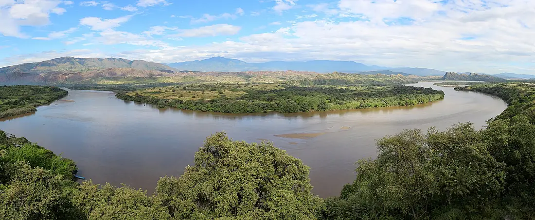
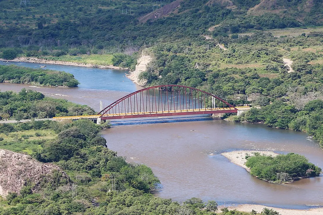
Magdalena River in pictures

Tributaries
Where it flows, and what flows into it
Tributaries (18)
Also: Bogotá River, San Jorge River, Nare River, Opon River, Sogamoso River, Saldaña River, Coello River, Páez River, Pance River, La Miel River, Negro River, Gualí River, Samaná Norte River, Río Grande, río Lagunilla, Río Guarinó, Río Bordones
 Venezuela
 Panama
Where these numbers come from
| Name, length, places | Wikidata (Q191829) · CC0 |
|---|---|
| Course, profile, basin | RiverATLAS v1.0 (HydroATLAS, Linke et al. 2019) · CC BY 4.0 — followed from the source to the mouth given by Wikidata |
| Flow | WaterGAP (RiverATLAS), 1971–2000 · CC BY 4.0 |
| Climate along the river | WorldClim (RiverATLAS), 1970–2000 · CC BY 4.0 |
| Towns, bridges, dams | Wikidata · CC0; GeoNames · CC BY 4.0 |
| Along the river | © OpenStreetMap contributors · ODbL |
| Images | EOX Sentinel-2 cloudless 2016 · CC BY 4.0; Wikimedia Commons |
| Our other atlases | Lakeyas, Coastya, Peakyas — Wikidata · CC0; © OpenStreetMap contributors · ODbL; GeoNames · CC BY 4.0; HydroLAKES · CC BY 4.0; NOAA OISST |
Every source and licence is on the data sources page.
The family
Do you prefer beaches, lakes, mountains, waterfalls, islands, rivers or canyons?
Same idea, other landscapes: field atlases built on open data, month by month, in seven languages.
beaches Find your beach: sea temperature, sun and swimming month by month.Visit lakes
 Every lake on Earth: water temperature, ice, depth and the shore.Coming soonVisit mountains
 Every summit in 3D: summit weather, the 0 °C line, huts and trails.Visit
  waterfalls
 Every waterfall: height, flow month by month and when it roars.Coming soonVisit
  islands
 Every island from the sea up: size, sea temperature, ferries and 3D.Coming soonVisit
  rivers
 Every river from source to sea: the journey, the flow and the basin in numbers.You are here
 canyons
 Every canyon cut to scale: depth to the floor, rim and floor temperatures, trails and viewpoints.Coming soonVisit