River
Murray River
2,530 km from source to mouth · Australia.
 AustraliaFlows into Indian Ocean1st longest in Australia
In numbers
Length
2,530km
Average flow
770m³/s
Basin
1,061,469km²
Drop
911m
from 908 m to -3 m
Country
1
The journey
From source to mouth
2,530 km of river and 67 stops on the way: 11 towns and cities on its banks, dams, bridges and the tributaries that feed it.
- 0 kmAustralian Alpsat 908 m
- 123 kmSwampy Plain Rivertributary
- 133 kmTowong Bridge
- 144 kmTooma Rivertributary
- 153 kmTintaldra Bridge
- 305 kmBethanga Bridge
- 310 kmLake Hume111 km²
- 327 kmKiewa Rivertributary
- 330 kmAlbury4,955 people
- 332 kmUnion Bridge
- 332 kmMurray River railway bridge
- 332 kmSpirit of Progress Bridge
- 334 kmWodonga20,259 people
- 335 kmWest Wodonga14,281 people
- 432 kmLake Moodemere0.5 km²
- 466 kmOvens Rivertributary
- 487 kmMulwala Bridge
- 488 kmLake Mulwala35 km²
- 539 kmBarooga1,817 people
- 542 kmOld Cobram-Barooga Bridge
- 544 kmCobram6,148 people
- 563 kmMurray River road and railway bridge, Tocumwal
- 663 kmBarmah Lake1.1 km²
- 684 kmBroken Creektributary
- 716 kmGoulburn Rivertributary
- 719 kmEchuca15,056 people
- 723 kmCampaspe Rivertributary
- 859 kmBarham Bridge over Murray River
- 945 kmLittle Murray Rivertributary
- 958 kmSwan Hill11,508 people
- 1,027 kmTooleybuc Bridge
- 1,057 kmWakool Rivertributary
- 1,097 kmMurrumbidgee Rivertributary
- 1,189 kmRobinvale3,497 people
- 1,403 kmKings Billabong1.2 km²
- 1,410 kmGol Gol1,956 people
- 1,416 kmGeorge Chaffey Bridge
- 1,432 kmLake Hawthorn1.9 km²
- 1,432 kmLake Ranfurly1.8 km²
- 1,432 kmMildura34,565 people
- 1,459 kmAbbotsford Bridge
- 1,488 kmDarling Rivertributary
- 1,501 kmGreat Darling Anabranchtributary
- 1,529 kmPink Lake1.3 km²
- 1,599 kmLake Victoria108 km²
- 1,619 kmRufus Rivertributary
- 1,704 kmHorseshoe Lagoon0.9 km²
- 1,722 kmParinga Bridge
- 1,765 kmCauseway Lagoon1.8 km²
- 1,839 kmYatco Lagoon2.7 km²
- 1,847 kmJoyner Lagoon2.6 km²
- 1,853 kmWachtels Lagoon6.4 km²
- 1,859 kmLoch Luna0.7 km²
- 1,922 kmRoss Lagoon0.3 km²
- 1,930 kmRamco Lagoon0.6 km²
- 2,020 kmMurbko Flat Lagoon1.3 km²
- 2,027 kmMurbpook Lagoon0.9 km²
- 2,035 kmDonald Flat Lagoon1.1 km²
- 2,130 kmMarne Rivertributary
- 2,132 kmRhine Flat1.0 km²
- 2,145 kmWalker Flat Lagoon0.7 km²
- 2,156 kmTapoo Lagoon0.6 km²
- 2,161 kmPurknong Lagoon0.5 km²
- 2,173 kmMaidment Lagoon0.5 km²
- 2,194 kmLake Carlet2.9 km²
- 2,267 kmMurray Bridge14,491 people
- 2,273 kmSwanport Bridge
- 2,322 kmLake Alexandrina863 km²
- 2,530 kmIndian Oceanat -3 m
Water level along the river (RiverATLAS; the height is exaggerated). Towns: GeoNames and Wikidata; bridges, dams and tributaries: Wikidata.
River in Australia
At the mouth it carries 767 m³/s on average: an Olympic pool every 3.3 seconds. It drops from 908 m to -3 m, 0.4 m per kilometre on average. Its basin covers 1,061,469 km², about the size of MR. 2.0 million people live in it. Highest water: from August to October; lowest: from February to March. It is heavily dammed: reservoirs can hold 290% of a year's flow.
Where to start
- MilduraLargest city on its banks · 34,565 people
- Mildura Airport (MQL)Nearest airport with scheduled flights, 5 km from the cityCar hire at MQL airport (Mildura)Discover Cars · Affiliate link↗
- On the water202 ferry piers, marinas, boat rentals and boat ramps along the river (OpenStreetMap)
- From December to AprilThe best months to visit
Murray River, month by month
Highest water: from August to October
Lowest water: from February to March. Best months to visit: from December to April.
From about 92 m³/s in the lowest month to 510 m³/s in the highest. An estimate: the monthly flow is modelled from the lowest and highest months of WaterGAP (RiverATLAS, 1971–2000) and the rain and snow along the river (WorldClim). Dams change the real rhythm. The chip is the average air temperature; below it, the month's rain.
Plan the trip
Plan the trip: boat trips, a bed by the river, a car
Some links above are affiliate links: if you book through them we may earn a commission, at no extra cost to you. It never changes what the data on this page says.
The basin
Murray River: the basin in numbers
775,219 km² of land send their water to this river. This is what lives on it.
- 2.0millionpeople live in the basin
- 3/km²people per km²
- 313maverage altitude of the basin
- 564mmof rain a year (basin average)
- 17.4°Caverage air temperature
- 5%protected areas
- 0.3%covered by lakes
- 23km³held in reservoirs
What covers the basin
- 17% Forest
- 13% Cropland
- 55% Pasture
RiverATLAS (HydroATLAS v1.0, CC BY 4.0): land cover, people, protected areas, glaciers and dams over the whole basin upstream of the mouth.
Along the river
Murray River: what you find on the way
- 42WeirsEdward River Regulator, Moira Regulator, Yarran Creek Regulator and 39 more
- 10LocksLock 26, Murray River, Lock 4 and 7 more
- 158Boat rampsTintaldra Boat Ramp, Walwa boat ramp, Kremur Street Boat Ramp and 155 more
- 26Ferry piersWymah Ferry (Free), Speewa (VIC), Speewa (NSW) and 23 more
- 18MarinasEchuca Wharf, Koondrook Wharf, Bruce's Bend Marina and 15 more
- 3River beachesFinns Beach, Rudd's Road Sandbar, Apex Beach
From OpenStreetMap, within 2.9 km of the river. Not mapped is not the same as not there.
Cross-checked with our atlases
Murray River in our other atlases
What our sister atlases know about the waterfalls on this river, the lakes it flows through, the beaches at its mouth, the mountains where it rises and the islands off its mouth.
 27lakes on its wayLakeyas
 10mountains at the sourcePeakyas
 1island off the mouthIslandyas
Lakes and reservoirs (27)
Lakes it flows through, by Lakeyas
- Lake Humekm 224111km²
- Lake Mulwalakm 35335km²
- Lake Hawthornkm 1,0361.9km²
- Lake Victoriakm 1,156108km²
- Joyner Lagoonkm 1,3362.6km²
- Wachtels Lagoonkm 1,3416.4km²
- Lake Carletkm 1,5872.9km²
- Lake Alexandrinakm 1,679863km²
19 more on LakeyasLakeyas is coming soonOpen Lakeyas ↗
Mountains at the source (10)
Within 15 km of the source, by Peakyas
- The Pilot4.8 km away
- Mount Cobberas8.2 km away
- Mount Enano8.4 km away
- Round Mountain8.8 km away
- Big Hill13 km away
- Rams Horn12 km away
- Forest Hill0.7 km away
- Davies Plain Ridge14 km away
2 more on PeakyasOpen Peakyas ↗
Islands off the mouth (1)
Within 30 km of the mouth, by Islandyas
- Pomanda Island10 km away0.3km²
Islandyas is coming soonOpen Islandyas ↗
From space
The source and the mouth, seen from orbit
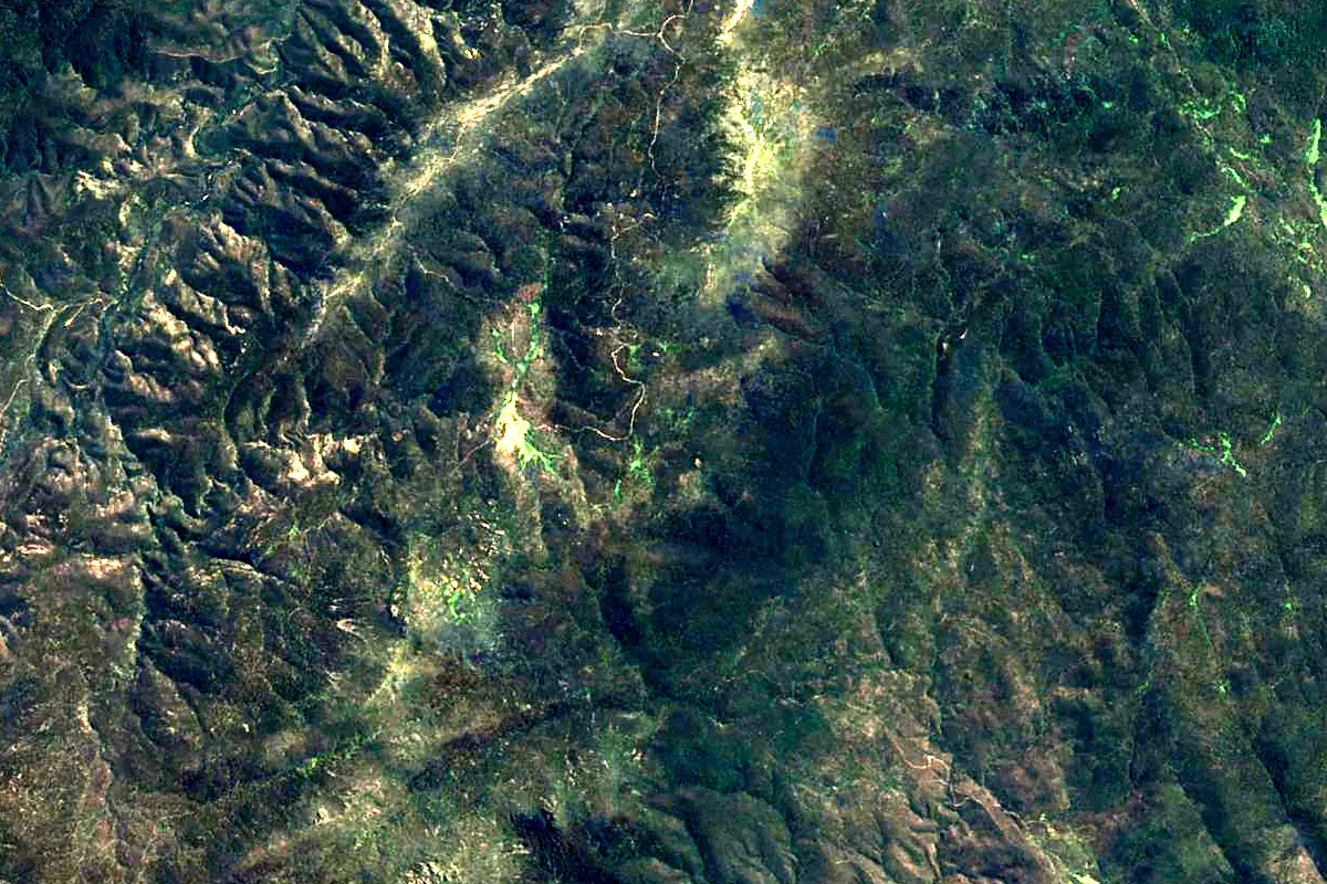
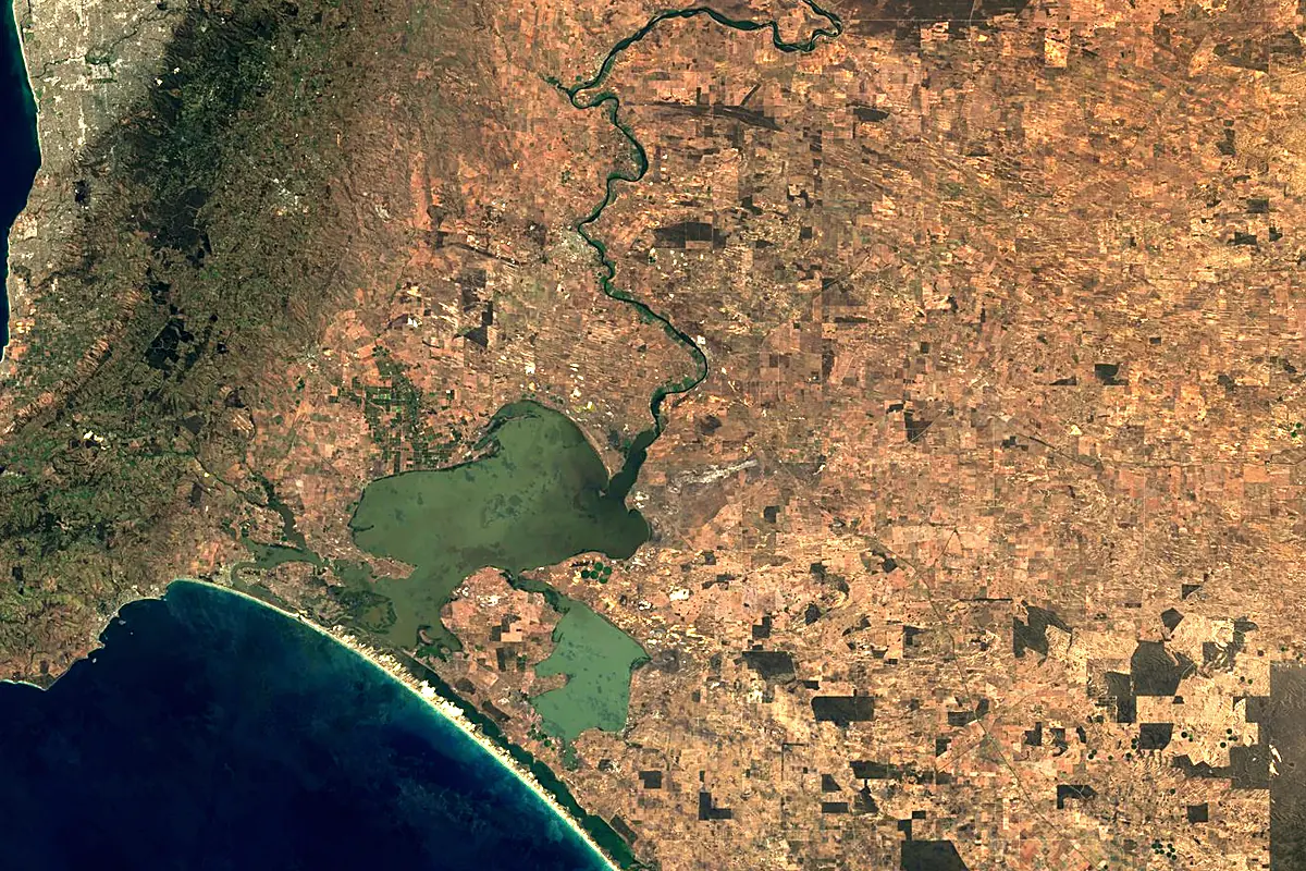
Sentinel-2 cloudless 2016 by EOX IT Services GmbH (contains modified Copernicus Sentinel data 2016), CC BY 4.0. The glowing line is the river as drawn by RiverATLAS.
Photos
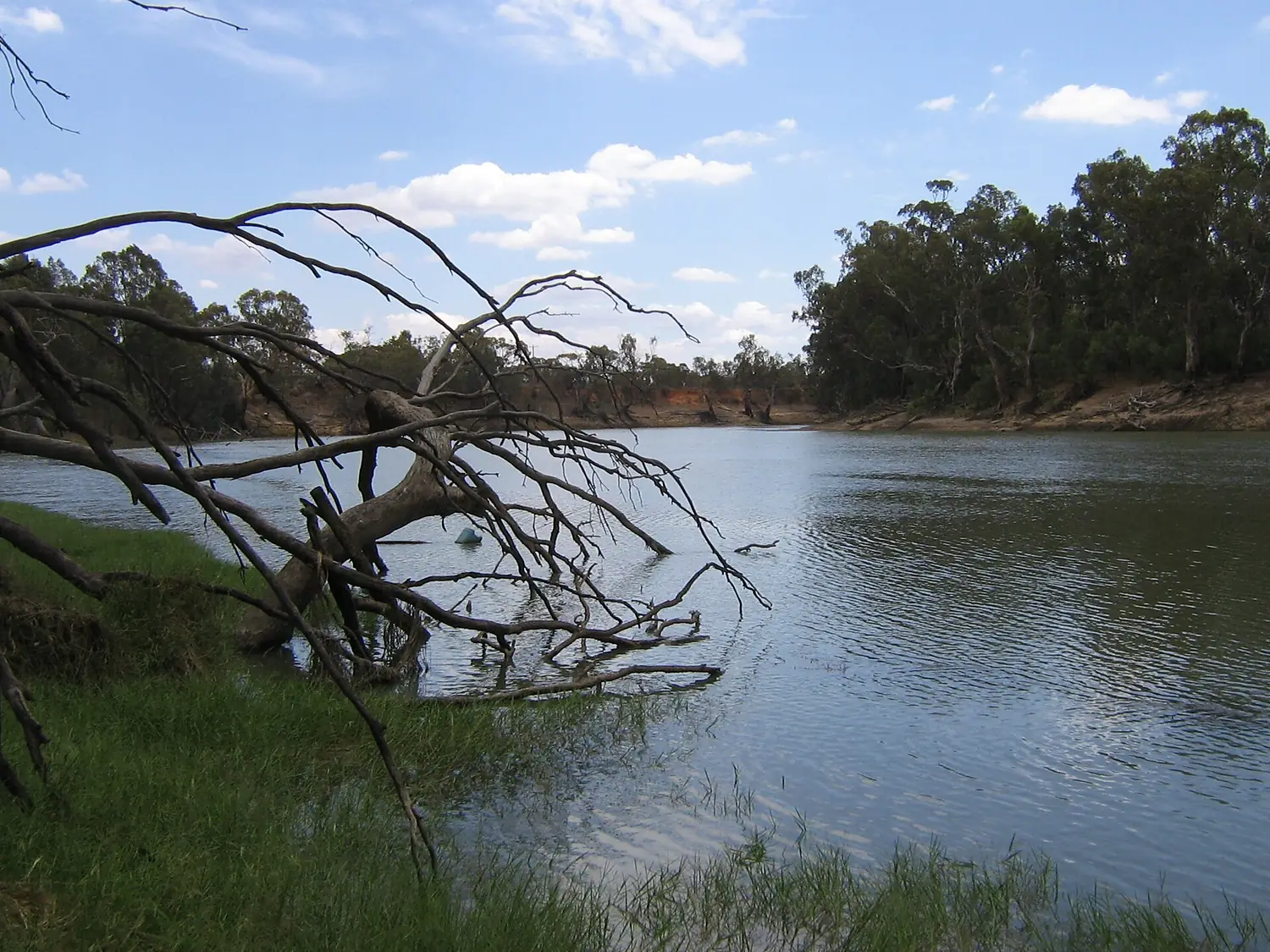
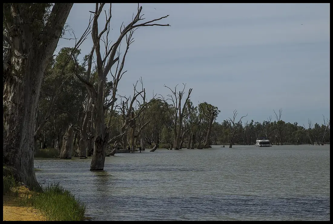
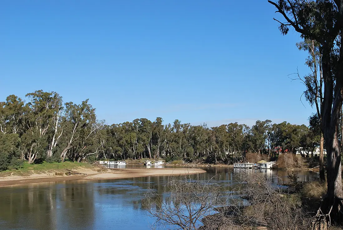
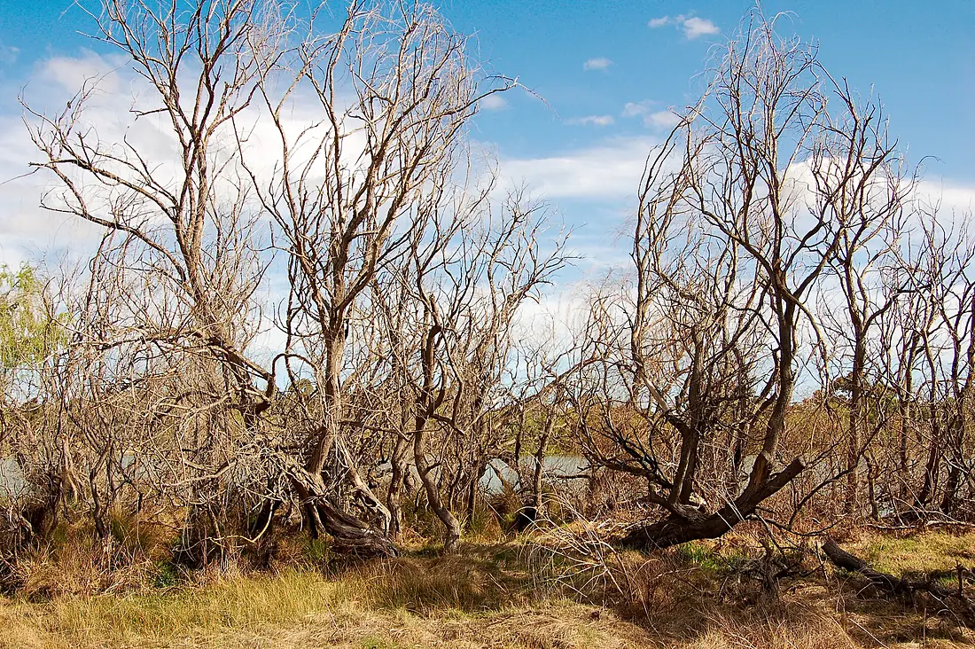
Murray River in pictures
Tributaries
Where it flows, and what flows into it
Tributaries (23)
Australia1,488 km140 m³/sjoins at km 794Darling RiverAustralia1,472 km100 m³/sjoins at km 1,077Also: Goulburn River, Campaspe River, Loddon River, Ovens River, Mitta Mitta River, Avoca River, Kiewa River, Edward River, River Angas, Marne River, Bremer River, Finniss River, Wakool River, Great Darling Anabranch, Little Murray River, Tooma River, Rufus River, Swampy Plain River, Little Murray River, Broken Creek, Pike River
In the same basin
Where these numbers come from
| Name, length, places | Wikidata (Q183078) · CC0 |
|---|---|
| Course, profile, basin | RiverATLAS v1.0 (HydroATLAS, Linke et al. 2019) · CC BY 4.0 — followed from the source to the mouth given by Wikidata |
| Flow | WaterGAP (RiverATLAS), 1971–2000 · CC BY 4.0 |
| Climate along the river | WorldClim (RiverATLAS), 1970–2000 · CC BY 4.0 |
| Towns, bridges, dams | Wikidata · CC0; GeoNames · CC BY 4.0 |
| Along the river | © OpenStreetMap contributors · ODbL |
| Images | EOX Sentinel-2 cloudless 2016 · CC BY 4.0; Wikimedia Commons |
| Our other atlases | Lakeyas, Peakyas, Islandyas — Wikidata · CC0; © OpenStreetMap contributors · ODbL; GeoNames · CC BY 4.0; HydroLAKES · CC BY 4.0; NOAA OISST |
Every source and licence is on the data sources page.
The family
Do you prefer beaches, lakes, mountains, waterfalls, islands, rivers or canyons?
Same idea, other landscapes: field atlases built on open data, month by month, in seven languages.
 beaches
 Find your beach: sea temperature, sun and swimming month by month.Visit lakes
 Every lake on Earth: water temperature, ice, depth and the shore.Coming soonVisit mountains
 Every summit in 3D: summit weather, the 0 °C line, huts and trails.Visit
  waterfalls
 Every waterfall: height, flow month by month and when it roars.Coming soonVisit islands
 Every island from the sea up: size, sea temperature, ferries and 3D.Coming soonVisit
  rivers
 Every river from source to sea: the journey, the flow and the basin in numbers.You are here
 canyons
 Every canyon cut to scale: depth to the floor, rim and floor temperatures, trails and viewpoints.Coming soonVisit