River
Neretva
225 km from source to mouth · Croatia and Bosnia and Herzegovina.
 Croatia and Bosnia and HerzegovinaFlows into Adriatic Sea4th longest in Croatia
In numbers
Length
225km
Average flow
380m³/s
Basin
5,581km²
Drop
779m
from 776 m to -3 m
Countries
2
The journey
From source to mouth
225 km of river and 29 stops on the way: 8 towns and cities on its banks, dams, bridges and the tributaries that feed it.
- 0 kmSourceat 776 m
- 55 kmŠištica waterfall12 m
- 56 kmRakitnica, Neretvatributary
- 65 kmCrni Vir
- 73 kmStara Ćuprija
- 73 kmKonjic25,148 people
- 98 kmJablaničko Lake10 km²
- 105 kmJablanica10,580 people
- 106 kmJablanica Bridge
- 113 kmMost Begića i Begovića
- 138 kmSalakovac Lake1.8 km²
- 138 kmMostarska Bijelatributary
- 138 kmSalakovac Hydroelectric Power Station
- 144 kmPotoci8,312 people
- 154 kmCim3,966 people
- 155 kmCarinski most
- 156 kmMusala bridge
- 156 kmMostar105,448 people
- 157 kmStari Most
- 158 kmRodoč5,159 people
- 186 kmHerzegovina bridge
- 192 kmČapljina28,122 people
- 192 kmFranjo Tuđman Bridge
- 193 kmTrebižattributary
- 193 kmBregavatributary
- 197 kmHutovo Blato
- 199 kmBridge on Neretva River near Gabela
- 203 kmLučki most
- 203 kmMetković15,235 people
- 222 kmRogotinski Bridge
- 225 kmAdriatic Seaat -3 m
Water level along the river (RiverATLAS; the height is exaggerated). Towns: GeoNames and Wikidata; bridges, dams and tributaries: Wikidata.
River in Bosnia and Herzegovina and in Croatia
At the mouth it carries 378 m³/s on average: an Olympic pool every 6.6 seconds. It drops from 776 m to -3 m, 3.5 m per kilometre on average. Its basin covers 5,581 km², about the size of BN. 313,000 people live in it. Highest water: from December to February; lowest: from July to September. Its dams hold back little of its water (9.6% of a year's flow).
Where to start
- MostarLargest city on its banks · 105,448 people
- Mostar International Airport (OMO)Nearest airport with scheduled flights, 8 km from the cityCar hire at SJJ airport (Sarajevo)Discover Cars · Affiliate link↗
- On the water3 ferry piers, marinas, boat rentals and boat ramps along the river (OpenStreetMap)
- From May to SeptemberThe best months to visit
Neretva, month by month
Highest water: from December to February
Lowest water: from July to September. Best months to visit: from May to September.
From about 49 m³/s in the lowest month to 360 m³/s in the highest. An estimate: the monthly flow is modelled from the lowest and highest months of WaterGAP (RiverATLAS, 1971–2000) and the rain and snow along the river (WorldClim). Dams change the real rhythm. The chip is the average air temperature; below it, the month's rain.
Plan the trip
Plan the trip: boat trips, a bed by the river, a car
Some links above are affiliate links: if you book through them we may earn a commission, at no extra cost to you. It never changes what the data on this page says.
The basin
Neretva: the basin in numbers
5,949 km² of land send their water to this river. This is what lives on it.
- 313,000people live in the basin
- 53/km²people per km²
- 805maverage altitude of the basin
- 1,186mmof rain a year (basin average)
- 9.9°Caverage air temperature
- 0.7%covered by lakes
- 0.6km³held in reservoirs
What covers the basin
- 25% Forest
- 24% Cropland
- 24% Pasture
- 2% Towns and cities
RiverATLAS (HydroATLAS v1.0, CC BY 4.0): land cover, people, protected areas, glaciers and dams over the whole basin upstream of the mouth.
Along the river
Neretva: what you find on the way
- 10WeirsBrvina and 9 more
- 22LocksLađanica Wellspring, Lađanica and 20 more
- 49WaterfallsŠištica Waterfall, Džajića vodopad, Džajića buk and 46 more
- 1Marinas
- 11River beachesKupalište Na Drežanki, Plaža Pijesak, Plaža Pehlivanuša Cernica MOSTAR and 8 more
From OpenStreetMap, within 1.7 km of the river. Not mapped is not the same as not there.
Cross-checked with our atlases
Neretva in our other atlases
What our sister atlases know about the waterfalls on this river, the lakes it flows through, the beaches at its mouth, the mountains where it rises and the islands off its mouth.
 2waterfalls on the riverCascadyas
 2lakes on its wayLakeyas
 32beaches at the mouth and on the banksCoastya
 78mountains at the sourcePeakyas
 23islands off the mouthIslandyas
Waterfalls (2)
On the river, by Cascadyas
- Šištica waterfallkm 5012m
- Crni Virkm 60
Cascadyas is coming soonOpen Cascadyas ↗
Lakes and reservoirs (2)
Lakes it flows through, by Lakeyas
- Jablaničko Lakekm 90 · 80 m deep10km²
- Salakovac Lakekm 1271.8km²
Lakeyas is coming soonOpen Lakeyas ↗
Beaches (32)
At the mouth (25 km) and on the banks, by Coastya
- Lopata14 km away · cove25.2°C
- Uvala Moračna14 km away · cove25.2°C
- Uvala Radić18 km away · cove25.2°C
- Uvala Krušica19 km away · cove25.2°C
- Uvala Dobrogošće7.3 km away · cove25.2°C
- Uvala Divna21 km away · cove24.8°C
- Uvala Perna23 km away · cove24.8°C
- Uvala Mala Višnjica4.0 km away · cove25.2°C
24 more on CoastyaOpen Coastya ↗
Mountains at the source (78)
Within 15 km of the source, by Peakyas
- Maglić14 km away · prominence 51 m2,386m
- Vlasulja13 km away2,314m
- Volujak14 km away · prominence 258 m2,336m
- Crnogorski Maglić14 km away · prominence 368 m2,388m
- Lebršnik11 km away1,985m
- Trebova14 km away1,872m
- Stanina Greda11 km away1,954m
- Crvene Prljage15 km away1,943m
70 more on PeakyasOpen Peakyas ↗
Islands off the mouth (23)
Within 30 km of the mouth, by Islandyas
- Badija26 km away1.0km²
- Vrnik26 km away
- Veliki Školj20 km away
- Mali Školj17 km away
- Gospin Školj9.4 km away
- Lirica18 km away
- Planjak26 km away
- Maisan23 km away
15 more on IslandyasIslandyas is coming soonOpen Islandyas ↗
From space
The source and the mouth, seen from orbit
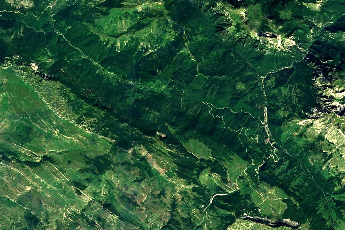
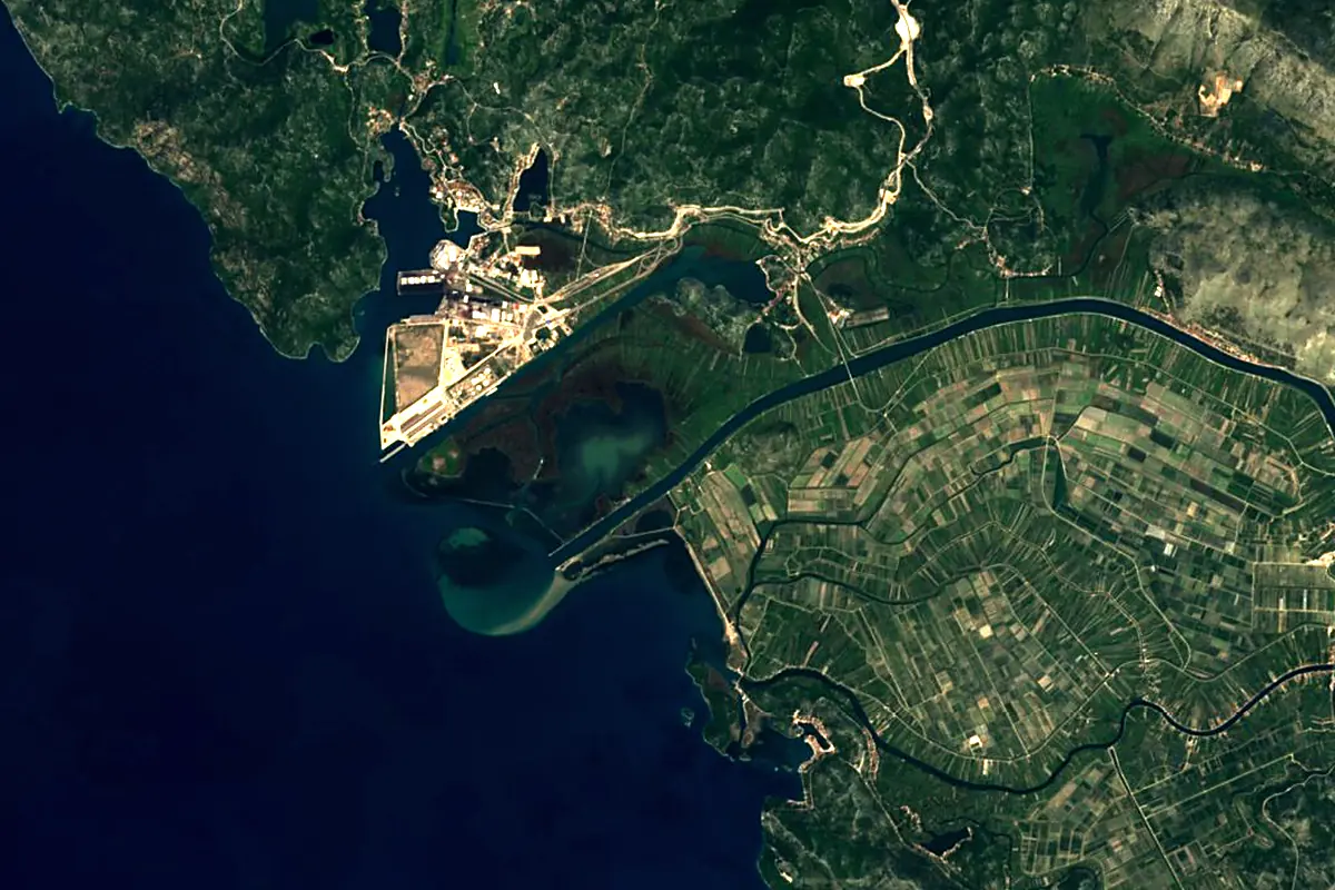
Sentinel-2 cloudless 2016 by EOX IT Services GmbH (contains modified Copernicus Sentinel data 2016), CC BY 4.0. The glowing line is the river as drawn by RiverATLAS.
Photos
Neretva in pictures
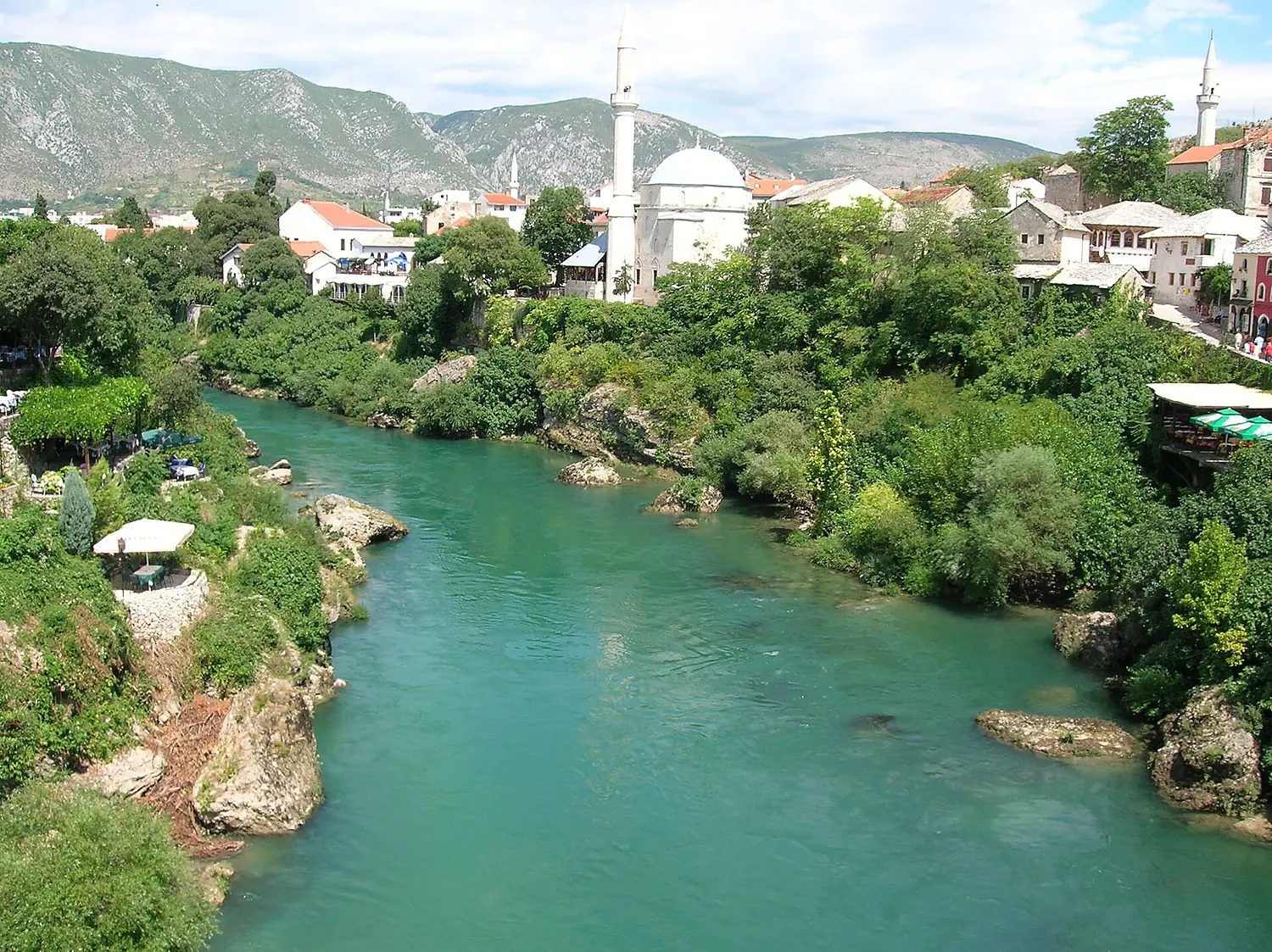
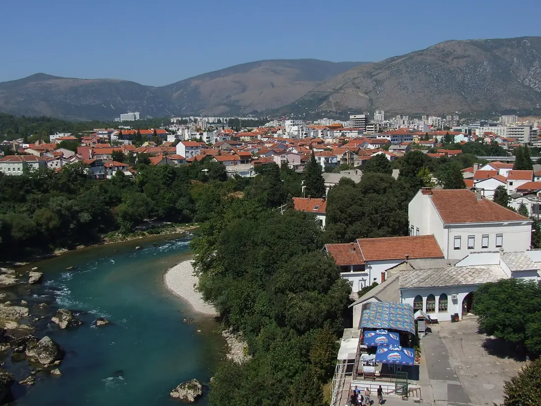
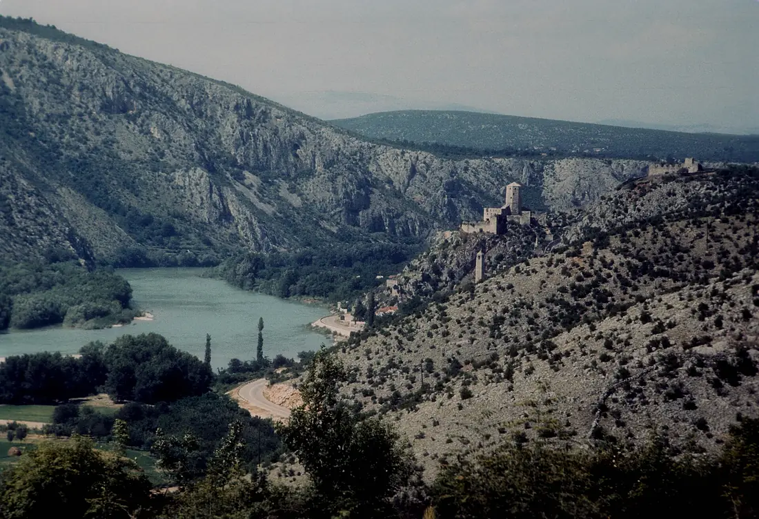
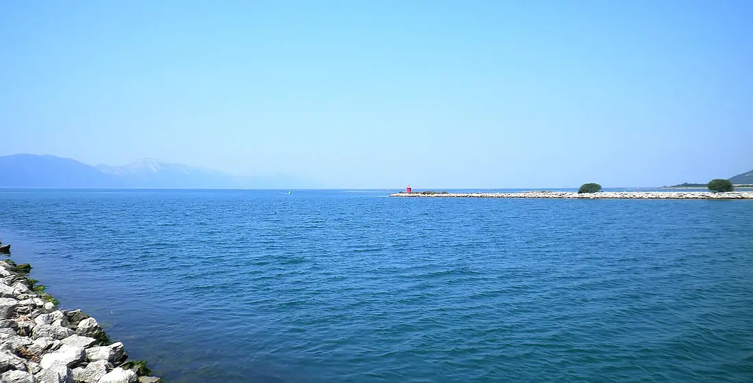
Tributaries
Where it flows, and what flows into it
Tributaries (11)
Also: Buna, Trebižat, Rakitnica, Neretva, Rama, Bregava, Krupa, Drežanka, Norin, Mostarska Bijela, Ljuta, Šištica
Nearby
Rivers nearby
Bosnia and Herzegovina187 km33 m³/s32 km awayCetinaCroatia105 km100 m³/s77 km awayTaraBosnia and Herzegovina144 km25 m³/s115 km awayPivaBosnia and Herzegovina34 km14 m³/s118 km awayKrkaCroatia73 km50 m³/s150 km awayLimBosnia and Herzegovina220 km860 m³/s162 km awayMorača Montenegro99 km15 m³/s165 km awayCem RiverMontenegro62 km260 m³/s161 km away
Where these numbers come from
| Name, length, places | Wikidata (Q190777) · CC0 |
|---|---|
| Course, profile, basin | RiverATLAS v1.0 (HydroATLAS, Linke et al. 2019) · CC BY 4.0 — followed from the source to the mouth given by Wikidata |
| Flow | WaterGAP (RiverATLAS), 1971–2000 · CC BY 4.0 |
| Climate along the river | WorldClim (RiverATLAS), 1970–2000 · CC BY 4.0 |
| Towns, bridges, dams | Wikidata · CC0; GeoNames · CC BY 4.0 |
| Along the river | © OpenStreetMap contributors · ODbL |
| Images | EOX Sentinel-2 cloudless 2016 · CC BY 4.0; Wikimedia Commons |
| Our other atlases | Cascadyas, Lakeyas, Coastya, Peakyas, Islandyas — Wikidata · CC0; © OpenStreetMap contributors · ODbL; GeoNames · CC BY 4.0; HydroLAKES · CC BY 4.0; NOAA OISST |
Every source and licence is on the data sources page.
The family
Do you prefer beaches, lakes, mountains, waterfalls, islands, rivers or canyons?
Same idea, other landscapes: field atlases built on open data, month by month, in seven languages.
beaches Find your beach: sea temperature, sun and swimming month by month.Visit lakes
 Every lake on Earth: water temperature, ice, depth and the shore.Coming soonVisit mountains
 Every summit in 3D: summit weather, the 0 °C line, huts and trails.Visit waterfalls
 Every waterfall: height, flow month by month and when it roars.Coming soonVisit islands
 Every island from the sea up: size, sea temperature, ferries and 3D.Coming soonVisit
  rivers
 Every river from source to sea: the journey, the flow and the basin in numbers.You are here
 canyons
 Every canyon cut to scale: depth to the floor, rim and floor temperatures, trails and viewpoints.Coming soonVisit