River
Orinoco River
2,140 km from source to mouth · Venezuela and Colombia.
 Venezuela and ColombiaFlows into Atlantic Ocean1st longest in Venezuela
In numbers
Length
2,140km
Average flow
30,000m³/s
Basin
989,000km²
Drop
680m
from 678 m to -2 m
Countries
2
The journey
From source to mouth
2,140 km of river and 50 stops on the way: 7 towns and cities on its banks, dams, bridges and the tributaries that feed it.
- 0 kmSourceat 678 m
- 290 kmOcamo Rivertributary
- 422 kmCunucunuma Rivertributary
- 632 kmVentuari Rivertributary
- 712 kmSan Fernando de Atabapo11,929 people
- 714 kmAtabapo Rivertributary
- 716 kmGuaviare Rivertributary
- 762 kmRaudal Hormiga
- 828 kmVichada Rivertributary
- 843 kmSipapo Rivertributary
- 882 kmTomo Rivertributary
- 1,011 kmPuerto Carreño16,763 people
- 1,014 kmMeta Rivertributary
- 1,095 kmCinaruco Rivertributary
- 1,118 kmSuapure Rivertributary
- 1,137 kmCapanaparo Rivertributary
- 1,221 kmLaguna Redonda0.4 km²
- 1,239 kmArauca Rivertributary
- 1,252 kmLaguna El Rey0.7 km²
- 1,262 kmApure Rivertributary
- 1,287 kmCaicara del Orinoco67,277 people
- 1,289 kmLaguna Castillero2.4 km²
- 1,291 kmPuente Mercosur
- 1,292 kmLaguna La Teja0.5 km²
- 1,322 kmCuchivero Rivertributary
- 1,342 kmLaguna Guararipal0.9 km²
- 1,385 kmLaguna Hueso de Pescado0.7 km²
- 1,469 kmLaguna Soto0.4 km²
- 1,469 kmCaura Rivertributary
- 1,484 kmMapire5,326 people
- 1,492 kmLaguna Caño Largo0.3 km²
- 1,495 kmLaguna Santa Crucera0.8 km²
- 1,566 kmLaguna La Virgen1.8 km²
- 1,570 kmLaguna Las Ánimas0.4 km²
- 1,572 kmLaguna Las Animas1.1 km²
- 1,604 kmAro Rivertributary
- 1,633 kmLaguna Los Médanos0.6 km²
- 1,656 kmLaguna Maldonado1.5 km²
- 1,676 kmAngostura Bridge
- 1,680 kmSoledad29,763 people
- 1,681 kmCiudad Bolívar567,953 people
- 1,698 kmLaguna La Piña2.1 km²
- 1,733 kmLaguna Los Totumitos0.8 km²
- 1,767 kmSecond Orinoco crossing
- 1,781 kmLaguna Pedregal1.8 km²
- 1,792 kmCaroní Rivertributary
- 1,793 kmCiudad Guayana751,331 people
- 1,801 kmLaguna Bombeadero0.9 km²
- 1,821 kmLaguna El Gallo0.4 km²
- 1,850 kmLaguna La Palambra0.3 km²
- 1,853 kmLaguna Matajey0.4 km²
- 2,140 kmAtlantic Oceanat -2 m
Water level along the river (RiverATLAS; the height is exaggerated). Towns: GeoNames and Wikidata; bridges, dams and tributaries: Wikidata.
River in South America
At the mouth it carries 30,000 m³/s on average: 12 Olympic pools every second. It drops from 678 m to -2 m, 0.3 m per kilometre on average. Its basin covers 989,000 km², about the size of EG. 12.1 million people live in it. Highest water: from July to September; lowest: from January to April. Dams and reservoirs hold back a large share of its water (13% of a year's flow).
Where to start
- Ciudad GuayanaLargest city on its banks · 751,331 people
- General Manuel Carlos Piar International Airport (PZO)Nearest airport with scheduled flights, 9 km from the cityCar hire at POS airport (Port of Spain)Discover Cars · Affiliate link↗
- On the water24 ferry piers, marinas, boat rentals and boat ramps along the river (OpenStreetMap)
- From December to FebruaryThe best months to visit
Orinoco River, month by month
Highest water: from July to September
Lowest water: from January to April. Best months to visit: from December to February.
From about 9,000 m³/s in the lowest month to 78,500 m³/s in the highest. An estimate: the monthly flow is modelled from the lowest and highest months of WaterGAP (RiverATLAS, 1971–2000) and the rain and snow along the river (WorldClim). Dams change the real rhythm. The chip is the average air temperature; below it, the month's rain.
Plan the trip
Plan the trip: boat trips, a bed by the river, a car
Some links above are affiliate links: if you book through them we may earn a commission, at no extra cost to you. It never changes what the data on this page says.
The basin
Orinoco River: the basin in numbers
938,384 km² of land send their water to this river. This is what lives on it.
- 12.1millionpeople live in the basin
- 13/km²people per km²
- 370maverage altitude of the basin
- 2,303mmof rain a year (basin average)
- 25.7°Caverage air temperature
- 40%protected areas
- 0.6%covered by lakes
- 151km³held in reservoirs
What covers the basin
- 48% Forest
- 3% Cropland
- 25% Pasture
RiverATLAS (HydroATLAS v1.0, CC BY 4.0): land cover, people, protected areas, glaciers and dams over the whole basin upstream of the mouth.
Along the river
Orinoco River: what you find on the way
- 1Waterfalls
- 2Boat rampsEmbarcadero
- 16Ferry piersChalana a Puerto Páez, Chalana a El Burro, Muelle de Cabruta and 13 more
- 6MarinasComando fluvial, Club Nautico Orinoco, Puerto de Los Frailes and 3 more
- 10River beachesIsla De Zama, Isla Priarama, Isla Patos and 7 more
From OpenStreetMap, within 3.0 km of the river. Not mapped is not the same as not there.
Cross-checked with our atlases
Orinoco River in our other atlases
What our sister atlases know about the waterfalls on this river, the lakes it flows through, the beaches at its mouth, the mountains where it rises and the islands off its mouth.
 1waterfall on the riverCascadyas
 21lakes on its wayLakeyas
Waterfalls (1)
On the river, by Cascadyas
- Raudal Hormigakm 708
Cascadyas is coming soonOpen Cascadyas ↗
Lakes and reservoirs (21)
Lakes it flows through, by Lakeyas
- Laguna Castillerokm 1,1972.4km²
- Laguna Guararipalkm 1,2470.9km²
- Laguna La Virgenkm 1,4551.8km²
- Laguna Las Animaskm 1,4601.1km²
- Laguna Maldonadokm 1,5381.5km²
- Laguna La Piñakm 1,5782.1km²
- Laguna Pedregalkm 1,6541.8km²
- Laguna Bombeaderokm 1,6730.9km²
13 more on LakeyasLakeyas is coming soonOpen Lakeyas ↗
From space
The source and the mouth, seen from orbit
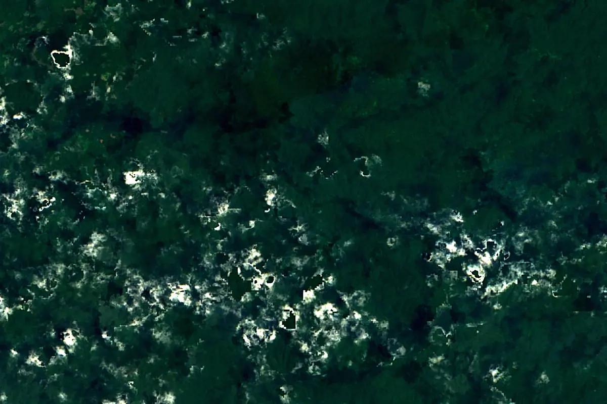
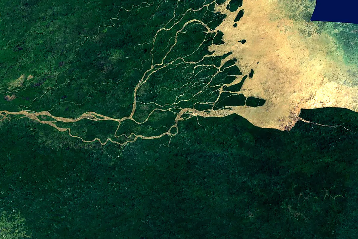
Sentinel-2 cloudless 2016 by EOX IT Services GmbH (contains modified Copernicus Sentinel data 2016), CC BY 4.0. The glowing line is the river as drawn by RiverATLAS.
Photos
Orinoco River in pictures
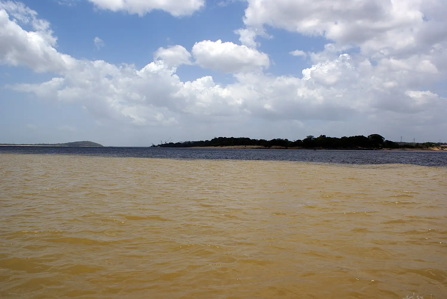
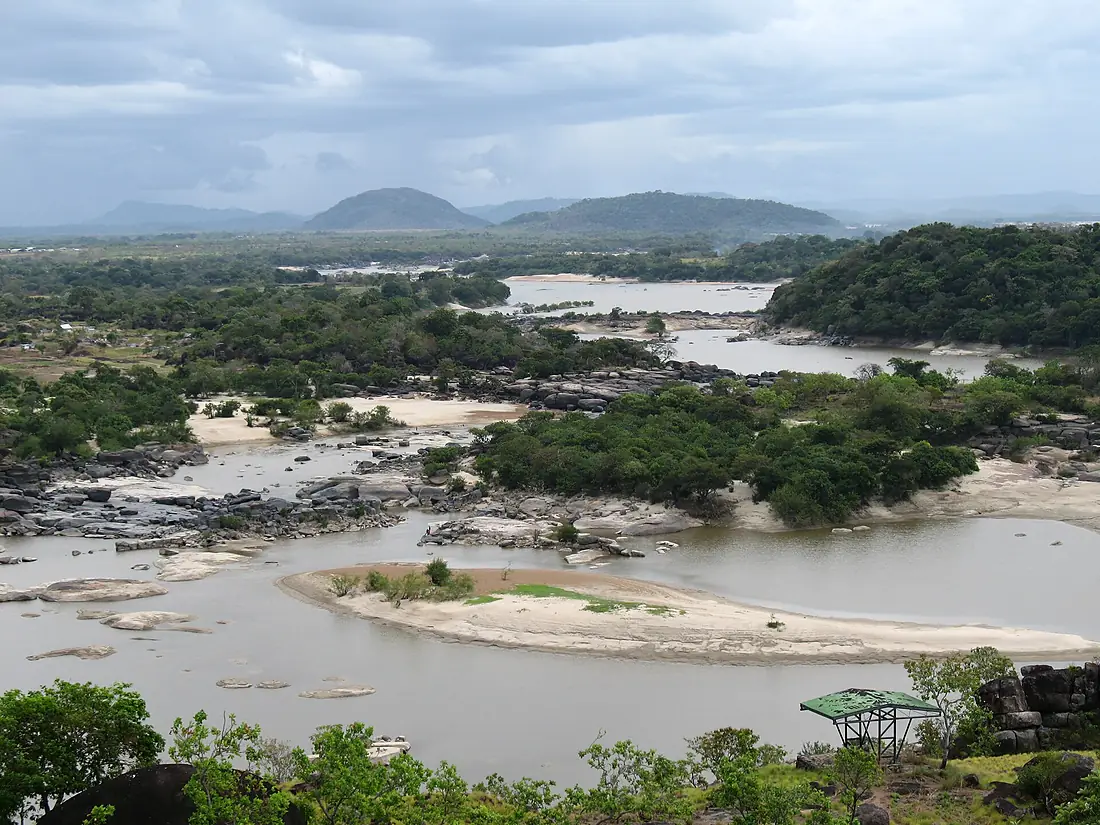
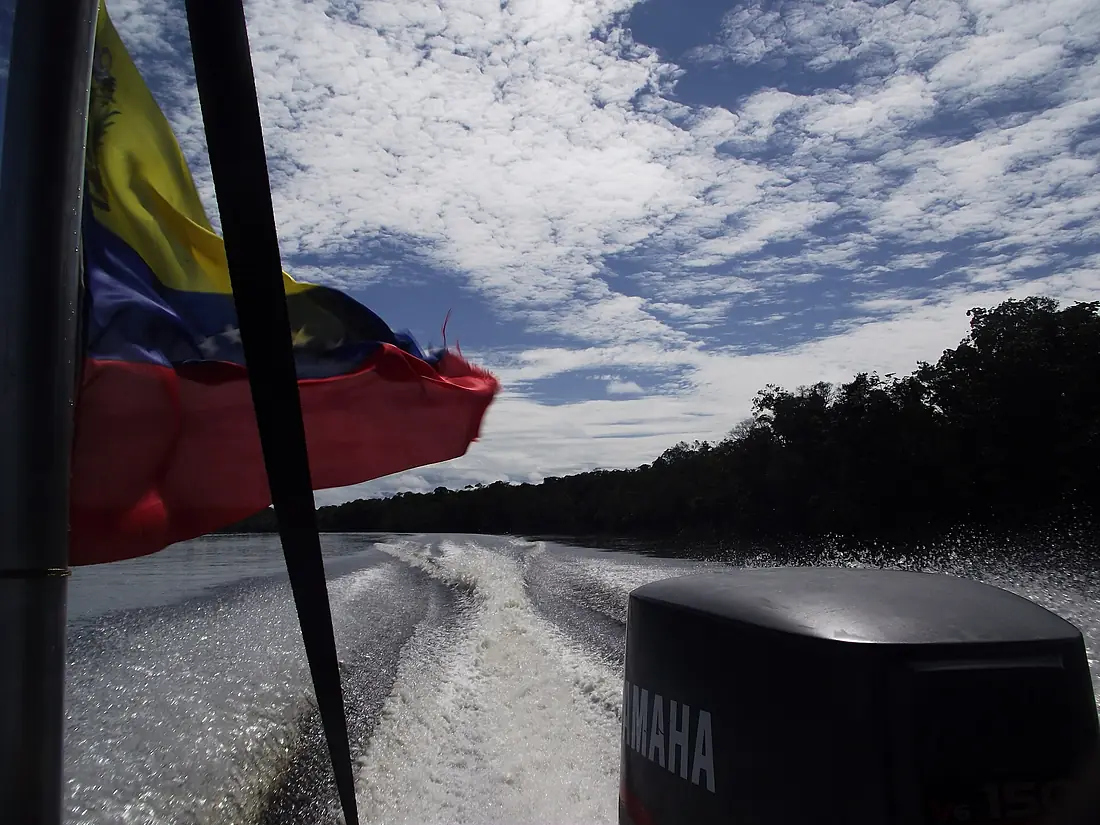
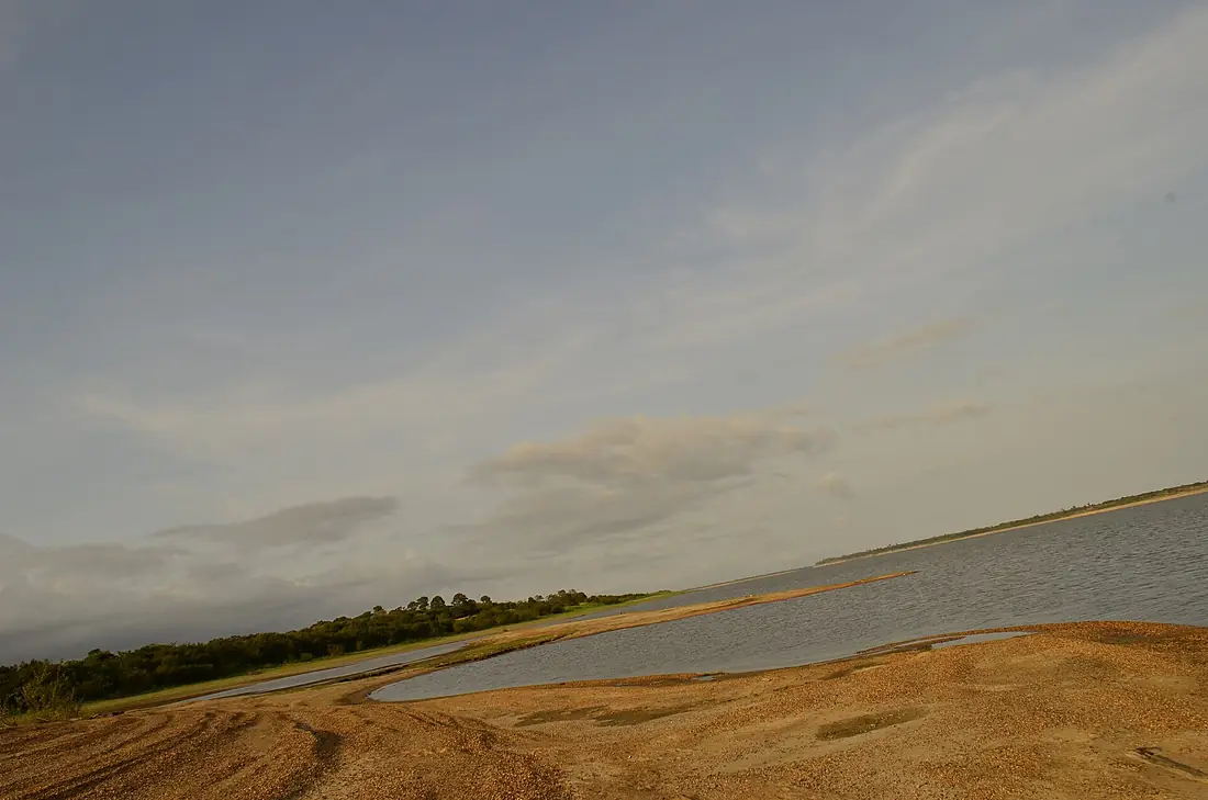
Tributaries
Where it flows, and what flows into it
Tributaries (25)
Venezuela1,580 km2,600 m³/sjoins at km 1,173Guaviare RiverColombia1,497 km8,200 m³/sjoins at km 665Meta RiverColombia1,000 km6,500 m³/sjoins at km 942Arauca RiverVenezuela900 km800 m³/sjoins at km 1,151Caroní RiverVenezuela765 km4,800 m³/sjoins at km 1,665Caura RiverVenezuela745 km3,500 m³/sjoins at km 1,365Ventuari RiverVenezuela520 km2,200 m³/sjoins at km 587Also: Atabapo River, Capanaparo River, Vichada River, Tomo River, Cinaruco River, Sipapo River, Aro River, Ocamo River, Cuchivero River, Cunucunuma River, Parguaza River, Mavaca River, Suapure River, Manaviche River, Padamo River, Río Iguapo, Río Padamo, Río Ugueto
Nearby
Rivers nearby
Venezuela765 km4,800 m³/s192 km awayOrtoire River Trinidad and Tobago42 km11 m³/s194 km awayCaroni RiverTrinidad and Tobago40 km17 m³/s234 km awayEssequibo River
 Guyana1,014 km2,100 m³/s354 km awayCuyuni RiverGuyana618 km2,100 m³/s354 km awayDemerara RiverGuyana350 km290 m³/s367 km awayCaura RiverVenezuela745 km3,500 m³/s434 km awayBerbice RiverGuyana595 km370 m³/s460 km away
Where these numbers come from
| Name, length, places | Wikidata (Q131792) · CC0 |
|---|---|
| Course, profile, basin | RiverATLAS v1.0 (HydroATLAS, Linke et al. 2019) · CC BY 4.0 — followed from the source to the mouth given by Wikidata |
| Flow | WaterGAP (RiverATLAS), 1971–2000 · CC BY 4.0 |
| Climate along the river | WorldClim (RiverATLAS), 1970–2000 · CC BY 4.0 |
| Towns, bridges, dams | Wikidata · CC0; GeoNames · CC BY 4.0 |
| Along the river | © OpenStreetMap contributors · ODbL |
| Images | EOX Sentinel-2 cloudless 2016 · CC BY 4.0; Wikimedia Commons |
| Our other atlases | Cascadyas, Lakeyas — Wikidata · CC0; © OpenStreetMap contributors · ODbL; GeoNames · CC BY 4.0; HydroLAKES · CC BY 4.0; NOAA OISST |
Every source and licence is on the data sources page.
The family
Do you prefer beaches, lakes, mountains, waterfalls, islands, rivers or canyons?
Same idea, other landscapes: field atlases built on open data, month by month, in seven languages.
 beaches
 Find your beach: sea temperature, sun and swimming month by month.Visit lakes
 Every lake on Earth: water temperature, ice, depth and the shore.Coming soonVisit
  mountains
 Every summit in 3D: summit weather, the 0 °C line, huts and trails.Visit waterfalls
 Every waterfall: height, flow month by month and when it roars.Coming soonVisit
  islands
 Every island from the sea up: size, sea temperature, ferries and 3D.Coming soonVisit
  rivers
 Every river from source to sea: the journey, the flow and the basin in numbers.You are here
 canyons
 Every canyon cut to scale: depth to the floor, rim and floor temperatures, trails and viewpoints.Coming soonVisit