River
Swan River
360 km from source to mouth · Australia.
 AustraliaFlows into Indian Ocean
In numbers
Length
360km
Average flow
140m³/s
Basin
141,000km²
Drop
234m
from 234 m to 0 m
Country
1
The journey
From source to mouth
360 km of river and 68 stops on the way: 53 towns and cities on its banks, dams, bridges and the tributaries that feed it.
- 0 kmSourceat 234 m
- 62 kmLake Yenyening0.4 km²
- 209 kmNortham6,517 people
- 303 kmAvon Rivertributary
- 303 kmThe Vines4,758 people
- 306 kmAveley9,952 people
- 308 kmEllen Brooktributary
- 310 kmBrabham3,239 people
- 315 kmStratton3,280 people
- 318 kmMidland6,105 people
- 321 kmCaversham5,182 people
- 322 kmLockridge3,390 people
- 322 kmEden Hill3,380 people
- 322 kmGuildford Railway Bridge
- 323 kmHelena Rivertributary
- 324 kmSouth Guildford3,248 people
- 325 kmBassendean10,837 people
- 327 kmMooro-Beeloo Bridge
- 328 kmRedcliffe4,904 people
- 329 kmBayswater14,236 people
- 329 kmGarratt Road Bridge
- 330 kmEmbleton3,124 people
- 331 kmBelmont6,799 people
- 332 kmCloverdale7,926 people
- 332 kmRivervale10,897 people
- 332 kmCarlisle6,296 people
- 333 kmLathlain3,287 people
- 335 kmMaylands13,199 people
- 335 kmInglewood5,529 people
- 335 kmBedford5,333 people
- 336 kmMount Lawley11,328 people
- 336 kmNorth Perth8,504 people
- 336 kmWindan Bridge
- 336 kmGoongoongup Bridge
- 337 kmMatagarup Bridge
- 338 kmVictoria Park8,493 people
- 338 kmBoorloo Bridges
- 338 kmEast Victoria Park9,854 people
- 339 kmEast Perth11,681 people
- 339 kmLangley Park
- 339 kmSouth Perth12,596 people
- 340 kmPerth2,141,834 people
- 341 kmPerth city centre13,670 people
- 341 kmSubiaco9,690 people
- 341 kmWest Perth5,776 people
- 341 kmWest Leederville3,901 people
- 341 kmLeederville3,686 people
- 341 kmNarrows Bridge
- 343 kmComo14,786 people
- 344 kmCanning Rivertributary
- 345 kmCrawley4,202 people
- 346 kmApplecross6,676 people
- 346 kmArdross4,165 people
- 347 kmNedlands10,949 people
- 349 kmDalkeith4,148 people
- 349 kmClaremont8,033 people
- 350 kmAttadale6,196 people
- 351 kmCottesloe7,136 people
- 351 kmMosman Park8,566 people
- 352 kmMelville5,583 people
- 352 kmBicton6,422 people
- 353 kmPalmyra6,737 people
- 354 kmEast Fremantle7,209 people
- 355 kmStirling Bridge
- 355 kmNorth Fremantle3,221 people
- 355 kmHilton3,861 people
- 355 kmBeaconsfield4,851 people
- 355 kmSouth Fremantle3,046 people
- 356 kmFremantle8,616 people
- 360 kmIndian Oceanat 0 m
Water level along the river (RiverATLAS; the height is exaggerated). Towns: GeoNames and Wikidata; bridges, dams and tributaries: Wikidata.
River in Perth, Western Australia
At the mouth it carries 140 m³/s on average: an Olympic pool every 18 seconds. It drops from 234 m to 0 m, 0.7 m per kilometre on average. Its basin covers 141,000 km², about the size of NP. 1.0 million people live in it. Highest water: from July to August; lowest: from December to March. Its dams hold back little of its water (5.3% of a year's flow).
Where to start
- PerthLargest city on its banks · 2,141,834 people
- Perth International Airport (PER)Nearest airport with scheduled flights, 10 km from the cityCar hire at PER airport (Perth)Discover Cars · Affiliate link↗
- On the water71 ferry piers, marinas, boat rentals and boat ramps along the river (OpenStreetMap)
- Kayak and canoe7 put-ins and rapids mapped (OpenStreetMap)
- From January to March and from October to NovemberThe best months to visit
Swan River, month by month
Highest water: from July to August
Lowest water: from December to March. Best months to visit: from January to March and from October to November.
From about 32 m³/s in the lowest month to 490 m³/s in the highest. An estimate: the monthly flow is modelled from the lowest and highest months of WaterGAP (RiverATLAS, 1971–2000) and the rain and snow along the river (WorldClim). Dams change the real rhythm. The chip is the average air temperature; below it, the month's rain.
Plan the trip
Plan the trip: boat trips, a bed by the river, a car
Some links above are affiliate links: if you book through them we may earn a commission, at no extra cost to you. It never changes what the data on this page says.
The basin
Swan River: the basin in numbers
99,518 km² of land send their water to this river. This is what lives on it.
- 1.0millionpeople live in the basin
- 11/km²people per km²
- 339maverage altitude of the basin
- 372mmof rain a year (basin average)
- 17.5°Caverage air temperature
- 6%protected areas
- 0.7%covered by lakes
- 0.2km³held in reservoirs
What covers the basin
- 16% Forest
- 33% Cropland
- 29% Pasture
- 1% Towns and cities
RiverATLAS (HydroATLAS v1.0, CC BY 4.0): land cover, people, protected areas, glaciers and dams over the whole basin upstream of the mouth.
Along the river
Swan River: what you find on the way
- 2WeirsExtracts Weir
- 7RapidsLeatherhead Rapid, Posselt's Ford, Supershoot and 4 more
- 35Boat rampsGuildford boat ramp, Leeuwin Boat Ramp and 33 more
- 20Ferry piersMandoon Jetty, Barrack Street Jetty, Catalina Adventures and Red Baron Seaplanes and 17 more
- 16MarinasMaylands Yacht Club, Royal Perth Yacht Club, South of Perth Yacht Club and 13 more
- 8River beachesPalm Tree Beach, Point Roe Beach, Bicton Baths and 5 more
From OpenStreetMap, within 2.4 km of the river. Not mapped is not the same as not there.
Cross-checked with our atlases
Swan River in our other atlases
What our sister atlases know about the waterfalls on this river, the lakes it flows through, the beaches at its mouth, the mountains where it rises and the islands off its mouth.
 1lake on its wayLakeyas
 35beaches at the mouth and on the banksCoastya
 11mountains at the sourcePeakyas
 12islands off the mouthIslandyas
Lakes and reservoirs (1)
Lakes it flows through, by Lakeyas
- Lake Yenyeningkm 620.4km²
Lakeyas is coming soonOpen Lakeyas ↗
Beaches (35)
At the mouth (25 km) and on the banks, by Coastya
- Kwinana Beach23 km away22.3°C
- City Beach11 km away22.3°C
- Scarborough Beach16 km away22.3°C
- Alfred Cove6.6 km away · cove22.3°C
- Leighton Beachkm 35222.3°C
- Shelly Beach14 km away22.3°C
- Mosman Beach2.4 km away22.3°C
- Como Beach12 km away22.3°C
27 more on CoastyaOpen Coastya ↗
Mountains at the source (11)
Within 15 km of the source, by Peakyas
- Jumperkine Hill6.2 km away
- Mount Mambup3.3 km away
- Cockman Bluff14 km away
- Smiths Mill Hill12 km away
- Moondyne Hill13 km away
- Mount Oakover10 km away
- Red Hill13 km away
- Millendon Hill3.3 km away
3 more on PeakyasOpen Peakyas ↗
Islands off the mouth (12)
Within 30 km of the mouth, by Islandyas
- Rottnest Island22 km away19km²
- Carnac Island12 km away
- Garden Island19 km away11km²
- Penguin Island30 km away0.1km²
- Heirisson Island15 km away
- Seal Island (Shoalwater, Western Australia)28 km away
- Bird Island27 km away
- Green Island23 km away
4 more on IslandyasIslandyas is coming soonOpen Islandyas ↗
From space
The source and the mouth, seen from orbit
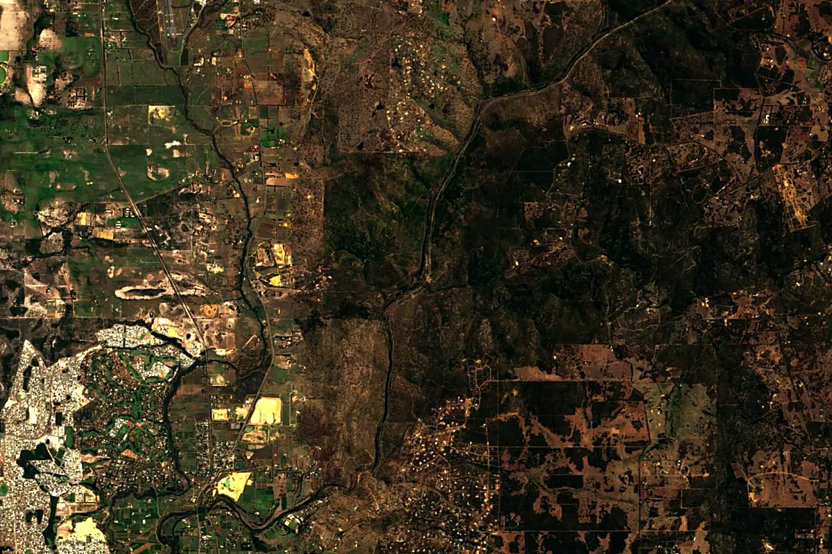
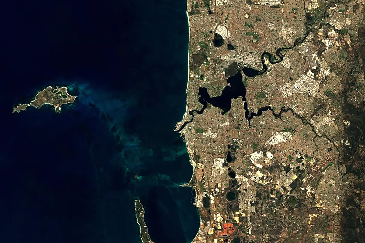
Sentinel-2 cloudless 2016 by EOX IT Services GmbH (contains modified Copernicus Sentinel data 2016), CC BY 4.0. The glowing line is the river as drawn by RiverATLAS.
Photos
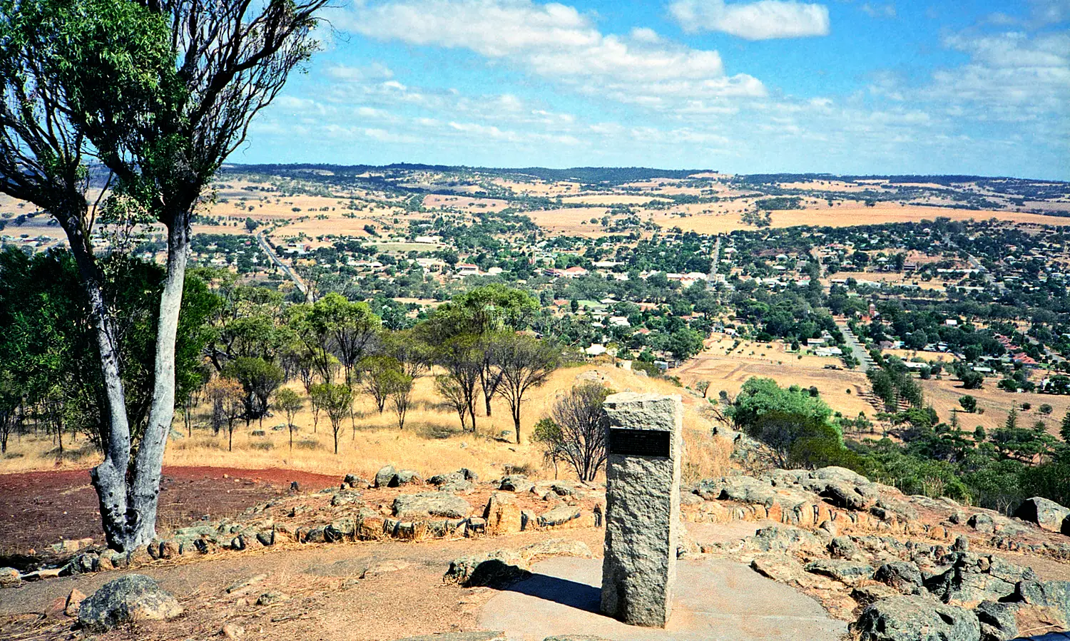
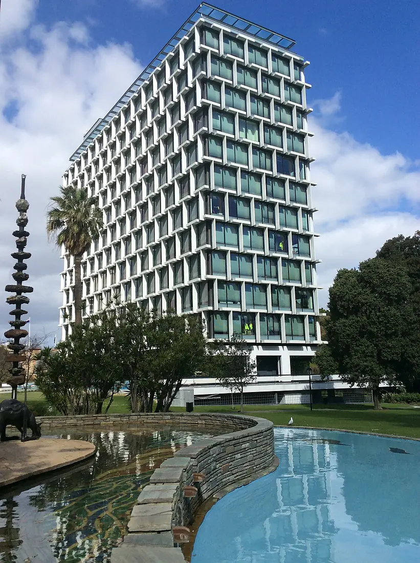
Swan River in pictures


Tributaries
Where it flows, and what flows into it
Tributaries (6)
Also: Canning River, Avon River, Helena River, Ellen Brook, Bennett Brook, Claise Brook
Where these numbers come from
| Name, length, places | Wikidata (Q1137387) · CC0 |
|---|---|
| Course, profile, basin | RiverATLAS v1.0 (HydroATLAS, Linke et al. 2019) · CC BY 4.0 — followed from the source to the mouth given by Wikidata |
| Flow | WaterGAP (RiverATLAS), 1971–2000 · CC BY 4.0 |
| Climate along the river | WorldClim (RiverATLAS), 1970–2000 · CC BY 4.0 |
| Towns, bridges, dams | Wikidata · CC0; GeoNames · CC BY 4.0 |
| Along the river | © OpenStreetMap contributors · ODbL |
| Images | EOX Sentinel-2 cloudless 2016 · CC BY 4.0; Wikimedia Commons |
| Our other atlases | Lakeyas, Coastya, Peakyas, Islandyas — Wikidata · CC0; © OpenStreetMap contributors · ODbL; GeoNames · CC BY 4.0; HydroLAKES · CC BY 4.0; NOAA OISST |
Every source and licence is on the data sources page.
The family
Do you prefer beaches, lakes, mountains, waterfalls, islands, rivers or canyons?
Same idea, other landscapes: field atlases built on open data, month by month, in seven languages.
beaches Find your beach: sea temperature, sun and swimming month by month.Visit lakes
 Every lake on Earth: water temperature, ice, depth and the shore.Coming soonVisit mountains
 Every summit in 3D: summit weather, the 0 °C line, huts and trails.Visit
  waterfalls
 Every waterfall: height, flow month by month and when it roars.Coming soonVisit islands
 Every island from the sea up: size, sea temperature, ferries and 3D.Coming soonVisit
  rivers
 Every river from source to sea: the journey, the flow and the basin in numbers.You are here
 canyons
 Every canyon cut to scale: depth to the floor, rim and floor temperatures, trails and viewpoints.Coming soonVisit