River
Tigris
1,850 km from source to mouth · Iraq, Turkey and Syria.
 Iraq, Turkey and SyriaFlows into Shatt al-Arab2nd longest in Iraq
In numbers
Length
1,850km
Average flow
1,000m³/s
Basin
375,000km²
Drop
1,236m
from 1,238 m to 2 m
Countries
3
The journey
From source to mouth
1,850 km of river and 50 stops on the way: 22 towns and cities on its banks, dams, bridges and the tributaries that feed it.
- 0 kmLake Hazarat 1,238 m
- 1 kmLake Hazar77 km²
- 129 kmDiyarbakır1,833,684 people
- 134 kmDicle Bridge
- 178 kmBismil74,493 people
- 217 kmBatman Brooktributary
- 264 kmOld Bridge, Hasankeyf
- 302 kmBotan Rivertributary
- 383 kmCizre134,041 people
- 391 kmCizre Bridge
- 420 kmKhaburtributary
- 525 kmMosul Reservoir347 km²
- 589 kmBash Tapia Castle
- 589 kmFifth Bridge
- 589 kmAl Mawşil al Jadīdah2,065,597 people
- 590 kmMosul1,792,000 people
- 591 kmKhosr Rivertributary
- 643 kmGreat Zabtributary
- 706 kmAsh Sharqāt160,000 people
- 715 kmAssurUNESCO World Heritage
- 746 kmAlZwya15,000 people
- 750 kmLittle Zabtributary
- 796 kmBayjī173,677 people
- 829 kmAl-'Alam25,662 people
- 839 kmTikrīt42,477 people
- 892 kmBuḩayrat an Nāşirīyah0.3 km²
- 893 kmSāmarrā’158,508 people
- 1,055 kmAl-Quriaat Bridge
- 1,056 kmSaba Abkar57,000 people
- 1,058 kmAl-Aaimmah bridge
- 1,060 km14th Ramadan Bridge
- 1,062 kmAl-Sarafiya bridge
- 1,064 kmBab al-Mudham bridge
- 1,065 kmMartyrs Bridge
- 1,066 kmSinak Bridge
- 1,067 kmRepublic Bridge
- 1,071 km14th of July Bridge
- 1,072 kmBaghdad8,126,755 people
- 1,074 kmJadriya Bridge
- 1,084 kmDora Bridge
- 1,095 kmDiyala Rivertributary
- 1,098 kmSirwan Rivertributary
- 1,115 kmCtesiphon500,000 people
- 1,172 kmAş Şuwayrah77,200 people
- 1,210 kmAl ‘Azīzīyah44,751 people
- 1,290 kmAn Nu‘mānīyah110,000 people
- 1,363 kmAl-Kut315,162 people
- 1,470 km‘Alī al Gharbī19,711 people
- 1,590 kmAl ‘Amārah323,302 people
- 1,633 kmQal‘at Şāliḩ39,698 people
- 1,703 kmAl Qurnah134,174 people
- 1,850 kmShatt al-Arabat 2 m
Water level along the river (RiverATLAS; the height is exaggerated). Towns: GeoNames and Wikidata; bridges, dams and tributaries: Wikidata.
River flowing from Turkey through Iraq and Syria
At the mouth it carries 1,014 m³/s on average: an Olympic pool every 2.5 seconds. It drops from 1,238 m to 2 m, 0.7 m per kilometre on average. Its basin covers 375,000 km², about the size of JP. 23.2 million people live in it. Highest water: from February to March; lowest: from July to October. It is heavily dammed: reservoirs can hold 56% of a year's flow.
Where to start
- BaghdadLargest city on its banks · 8,126,755 people
- Baghdad International Airport / New Al Muthana Air Base (BGW)Nearest airport with scheduled flights, 14 km from the city
- On the water20 ferry piers, marinas, boat rentals and boat ramps along the river (OpenStreetMap)
- From March to May and from October to NovemberThe best months to visit
Tigris, month by month
Highest water: from February to March
Lowest water: from July to October. Best months to visit: from March to May and from October to November.
From about 170 m³/s in the lowest month to 3,900 m³/s in the highest. An estimate: the monthly flow is modelled from the lowest and highest months of WaterGAP (RiverATLAS, 1971–2000) and the rain and snow along the river (WorldClim). Dams change the real rhythm. The chip is the average air temperature; below it, the month's rain.
Plan the trip
Plan the trip: boat trips, a bed by the river, a car
Some links above are affiliate links: if you book through them we may earn a commission, at no extra cost to you. It never changes what the data on this page says.
The basin
Tigris: the basin in numbers
221,327 km² of land send their water to this river. This is what lives on it.
- 23.2millionpeople live in the basin
- 106/km²people per km²
- 787maverage altitude of the basin
- 487mmof rain a year (basin average)
- 17.6°Caverage air temperature
- 0.7%covered by lakes
- 27km³held in reservoirs
What covers the basin
- 1% Forest
- 26% Cropland
- 19% Pasture
- 3% Towns and cities
RiverATLAS (HydroATLAS v1.0, CC BY 4.0): land cover, people, protected areas, glaciers and dams over the whole basin upstream of the mouth.
Along the river
Tigris: what you find on the way
- 4WeirsSu Bendi and 3 more
- 3LocksNazim al Kassarah
- 3WaterfallsŞelale, stone bridge
- 2Boat ramps
- 16Ferry piersFeribot İskelesi, Balıkçılar Limanı, Kale Limanı and 13 more
- 2Marinas
- 1River beachesplaj
From OpenStreetMap, within 2.6 km of the river. Not mapped is not the same as not there.
Cross-checked with our atlases
Tigris in our other atlases
What our sister atlases know about the waterfalls on this river, the lakes it flows through, the beaches at its mouth, the mountains where it rises and the islands off its mouth.
 3lakes on its wayLakeyas
 4mountains at the sourcePeakyas
Lakes and reservoirs (3)
Lakes it flows through, by Lakeyas
- Lake Hazarkm 1 · 213 m deep77km²
- Mosul Reservoirkm 532347km²
- Buḩayrat an Nāşirīyahkm 9040.3km²
Lakeyas is coming soonOpen Lakeyas ↗
Mountains at the source (4)
Within 15 km of the source, by Peakyas
- Mihrap Dağı13 km away
- Mastar Dağı12 km away
- Haşdu Dağı13 km away
- Yaylım Dağı13 km away
From space
The source and the mouth, seen from orbit
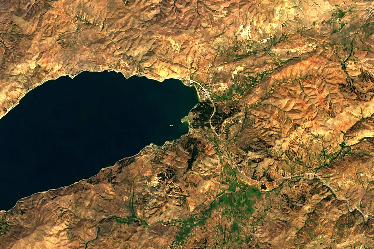
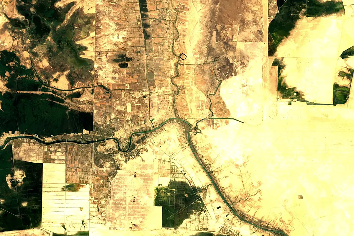
Sentinel-2 cloudless 2016 by EOX IT Services GmbH (contains modified Copernicus Sentinel data 2016), CC BY 4.0. The glowing line is the river as drawn by RiverATLAS.
Photos
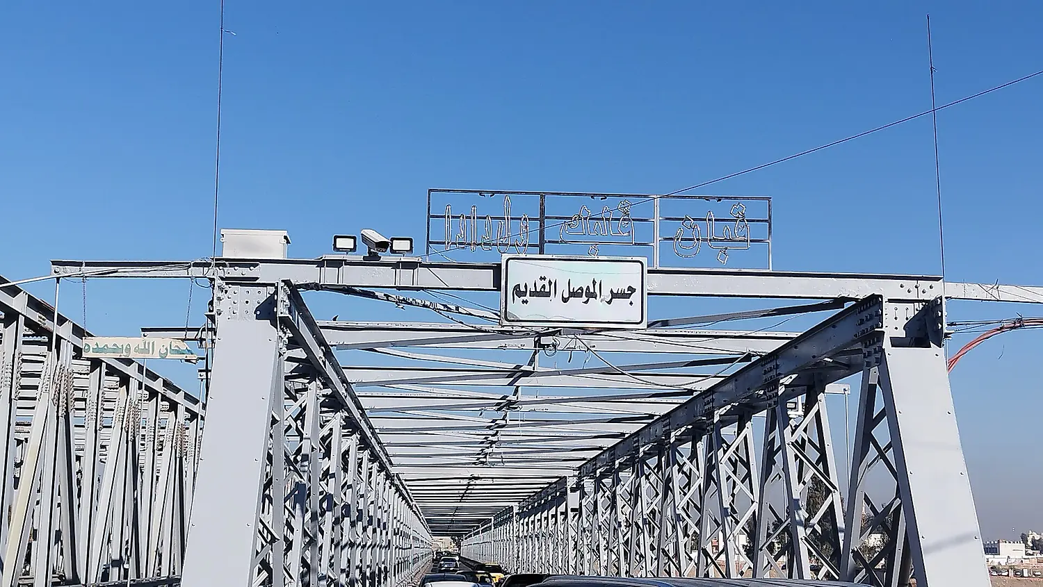
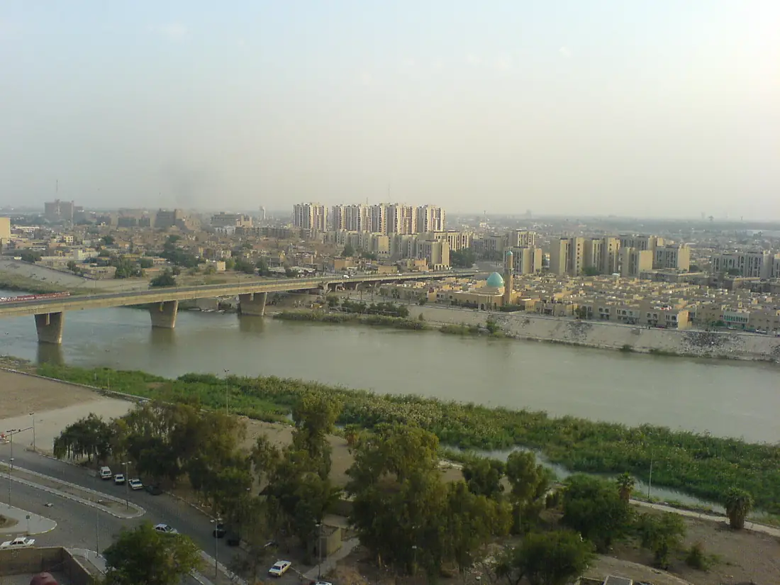
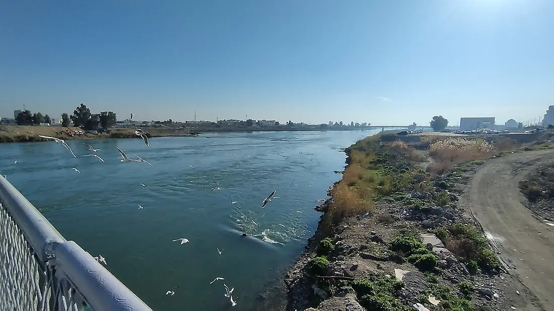
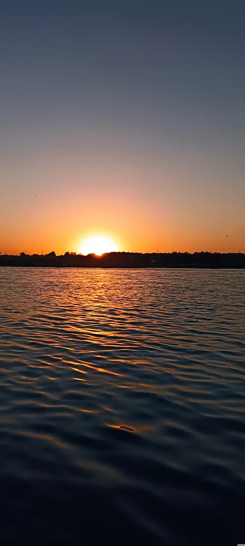
Tigris in pictures
Tributaries
Where it flows, and what flows into it
It flows into
Shatt al-ArabIraq200 km1,500 m³/sTributaries (15)
 Iran870 km220 m³/sGreat ZabIraq473 km810 m³/sjoins at km 651Little ZabIraq456 km220 m³/sjoins at km 760Diyala RiverIraq231 km130 m³/sjoins at km 1,110KhaburTurkey194 km150 m³/sjoins at km 425
Also: Batman Brook, Botan River, Khosr River, 'Adhaim, Sirwan River, Khasa River, Glory River, Bitlis Çayı, Godar Khosh River, Doiraj River
Where these numbers come from
| Name, length, places | Wikidata (Q35591) · CC0 |
|---|---|
| Course, profile, basin | RiverATLAS v1.0 (HydroATLAS, Linke et al. 2019) · CC BY 4.0 — followed from the source to the mouth given by Wikidata |
| Flow | WaterGAP (RiverATLAS), 1971–2000 · CC BY 4.0 |
| Climate along the river | WorldClim (RiverATLAS), 1970–2000 · CC BY 4.0 |
| Towns, bridges, dams | Wikidata · CC0; GeoNames · CC BY 4.0 |
| Along the river | © OpenStreetMap contributors · ODbL |
| Images | EOX Sentinel-2 cloudless 2016 · CC BY 4.0; Wikimedia Commons |
| Our other atlases | Lakeyas, Peakyas — Wikidata · CC0; © OpenStreetMap contributors · ODbL; GeoNames · CC BY 4.0; HydroLAKES · CC BY 4.0; NOAA OISST |
Every source and licence is on the data sources page.
The family
Do you prefer beaches, lakes, mountains, waterfalls, islands, rivers or canyons?
Same idea, other landscapes: field atlases built on open data, month by month, in seven languages.
 beaches
 Find your beach: sea temperature, sun and swimming month by month.Visit lakes
 Every lake on Earth: water temperature, ice, depth and the shore.Coming soonVisit mountains
 Every summit in 3D: summit weather, the 0 °C line, huts and trails.Visit
  waterfalls
 Every waterfall: height, flow month by month and when it roars.Coming soonVisit
  islands
 Every island from the sea up: size, sea temperature, ferries and 3D.Coming soonVisit
  rivers
 Every river from source to sea: the journey, the flow and the basin in numbers.You are here
 canyons
 Every canyon cut to scale: depth to the floor, rim and floor temperatures, trails and viewpoints.Coming soonVisit