River
Tobol
1,591 km from source to mouth · Russia and Kazakhstan.
 Russia and KazakhstanFlows into Irtysh
In numbers
Length
1,591km
Average flow
800m³/s
Basin
426,000km²
Drop
241m
from 273 m to 32 m
Countries
2
The journey
From source to mouth
1,591 km of river and 50 stops on the way: 5 towns and cities on its banks, dams, bridges and the tributaries that feed it.
- 0 kmTurgay Plateauat 273 m
- 4 kmKayraktytributary
- 4 kmBozbiyetributary
- 4 kmKokpektysaytributary
- 104 kmOzero Ul'kenkopa5.4 km²
- 176 kmSintashtatributary
- 275 kmLisakovsk40,000 people
- 344 kmKaratomarskoe vodokhranilische68 km²
- 352 kmRudnyy124,000 people
- 411 kmKostanay210,000 people
- 590 kmUytributary
- 597 kmKocherdyktributary
- 601 kmOzero Chebach'ye0.7 km²
- 639 kmOzero Gor'koye (lanaw nga asin sa Rusya, Kurganskaya Oblast', lat 54,42, long 64,53)5.9 km²
- 652 kmUbagan Rivertributary
- 654 kmOzero Nikol'skoye (lanaw sa Rusya, Kurganskaya Oblast')0.6 km²
- 681 kmAlabugatributary
- 685 kmGorkorechenskayatributary
- 690 kmOzero Setovo0.5 km²
- 730 kmKurtamyshtributary
- 737 kmOzero Lebyazh'ye (lanaw sa Rusya, Kurganskaya Oblast', lat 54,95, long 64,93)2.6 km²
- 778 kmYurgamyshtributary
- 790 kmUtyaktributary
- 805 kmVodokhranilishche Orlovskoye7.8 km²
- 817 kmKurgan309,285 people
- 829 kmOzero Chërnoye (lanaw sa Rusya, Kurganskaya Oblast', lat 55,50, long 65,41)1.1 km²
- 830 kmSredny Utyaktributary
- 847 kmNizhny Utyaktributary
- 853 kmIktributary
- 915 kmSuyertributary
- 928 kmOzero Dolgoye108 km²
- 963 kmYemurtlatributary
- 968 kmNiyaptributary
- 995 kmUporovkatributary
- 1,026 kmUktributary
- 1,040 kmIsettributary
- 1,045 kmYalutorovsk35,892 people
- 1,048 kmYalutorovsk railway bridge
- 1,102 kmBochankatributary
- 1,174 kmYurgatributary
- 1,179 kmTaptributary
- 1,191 kmBobrovkatributary
- 1,191 kmTuratributary
- 1,256 kmVarvarinskayatributary
- 1,265 kmIskatributary
- 1,333 kmTavdatributary
- 1,367 kmShestakovkatributary
- 1,394 kmAtalyktributary
- 1,404 kmTurbatributary
- 1,458 kmSuklemkatributary
- 1,464 kmZaimkatributary
- 1,591 kmIrtyshat 32 m
Water level along the river (RiverATLAS; the height is exaggerated). Towns: GeoNames and Wikidata; bridges, dams and tributaries: Wikidata.
River in Kazakhstan and Russia
At the mouth it carries 805 m³/s on average: an Olympic pool every 3.1 seconds. It drops from 273 m to 32 m, 0.2 m per kilometre on average. Its basin covers 426,000 km², about the size of IQ. 8.3 million people live in it. Highest water: from May to July; lowest: from December to March. Its dams hold back little of its water (8.8% of a year's flow).
Where to start
- KurganLargest city on its banks · 309,285 people
- Kurgan Airport (KRO)Nearest airport with scheduled flights, 5 km from the city
- On the water15 ferry piers, marinas, boat rentals and boat ramps along the river (OpenStreetMap)
- From May to AugustThe best months to visit
Tobol, month by month
Highest water: from May to July
Lowest water: from December to March. Freezing months (average below −4 °C): from November to March. Best months to visit: from May to August.
From about 550 m³/s in the lowest month to 1,700 m³/s in the highest. An estimate: the monthly flow is modelled from the lowest and highest months of WaterGAP (RiverATLAS, 1971–2000) and the rain and snow along the river (WorldClim). Dams change the real rhythm. The chip is the average air temperature; below it, the month's rain.
Plan the trip
Plan the trip: boat trips, a bed by the river, a car
Some links above are affiliate links: if you book through them we may earn a commission, at no extra cost to you. It never changes what the data on this page says.
The basin
Tobol: the basin in numbers
385,658 km² of land send their water to this river. This is what lives on it.
- 8.3millionpeople live in the basin
- 22/km²people per km²
- 174maverage altitude of the basin
- 449mmof rain a year (basin average)
- 1.5°Caverage air temperature
- 7%protected areas
- 1.9%covered by lakes
- 2.6km³held in reservoirs
What covers the basin
- 44% Forest
- 22% Cropland
- 16% Pasture
- 1% Towns and cities
RiverATLAS (HydroATLAS v1.0, CC BY 4.0): land cover, people, protected areas, glaciers and dams over the whole basin upstream of the mouth.
Along the river
Tobol: what you find on the way
- 3Weirs
- 2Boat ramps
- 13Ferry piers
- 11River beachesCity Beach and 10 more
From OpenStreetMap, within 2.8 km of the river. Not mapped is not the same as not there.
Cross-checked with our atlases
Tobol in our other atlases
What our sister atlases know about the waterfalls on this river, the lakes it flows through, the beaches at its mouth, the mountains where it rises and the islands off its mouth.
 10lakes on its wayLakeyas
 1mountain at the sourcePeakyas
Lakes and reservoirs (10)
Lakes it flows through, by Lakeyas
- Ozero Ul'kenkopakm 885.4km²
- Karatomarskoe vodokhranilischekm 29268km²
- Ozero Chebach'yekm 5100.7km²
- Ozero Gor'koye (lanaw nga asin sa Rusya, Kurganskaya Oblast', lat 54,42, long 64,53)km 5425.9km²
- Ozero Lebyazh'ye (lanaw sa Rusya, Kurganskaya Oblast', lat 54,95, long 64,93)km 6262.6km²
- Vodokhranilishche Orlovskoyekm 6837.8km²
- Ozero Chërnoye (lanaw sa Rusya, Kurganskaya Oblast', lat 55,50, long 65,41)km 7041.1km²
- Ozero Dolgoyekm 788108km²
2 more on LakeyasLakeyas is coming soonOpen Lakeyas ↗
Mountains at the source (1)
Within 15 km of the source, by Peakyas
- Gora Auliyetas5.5 km away
From space
The source and the mouth, seen from orbit
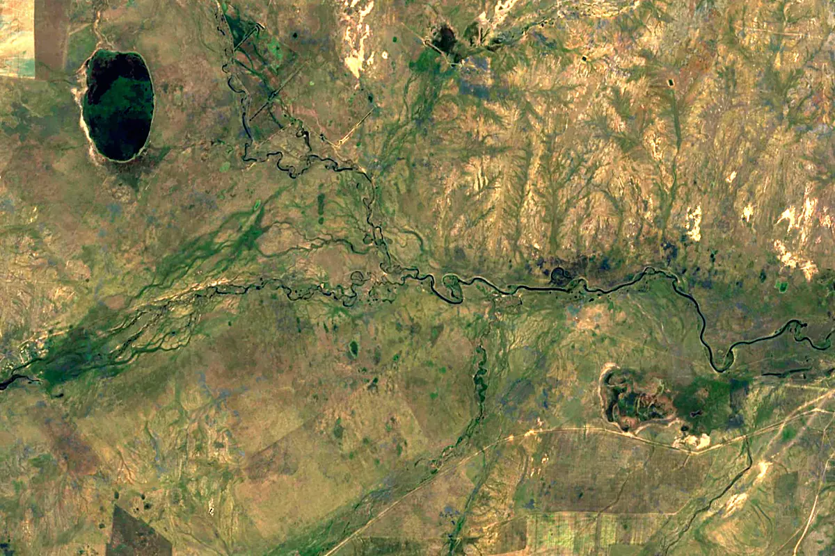
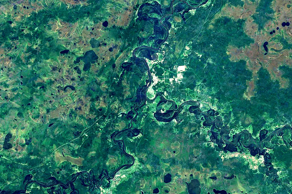
Sentinel-2 cloudless 2016 by EOX IT Services GmbH (contains modified Copernicus Sentinel data 2016), CC BY 4.0. The glowing line is the river as drawn by RiverATLAS.
Photos
Tobol in pictures
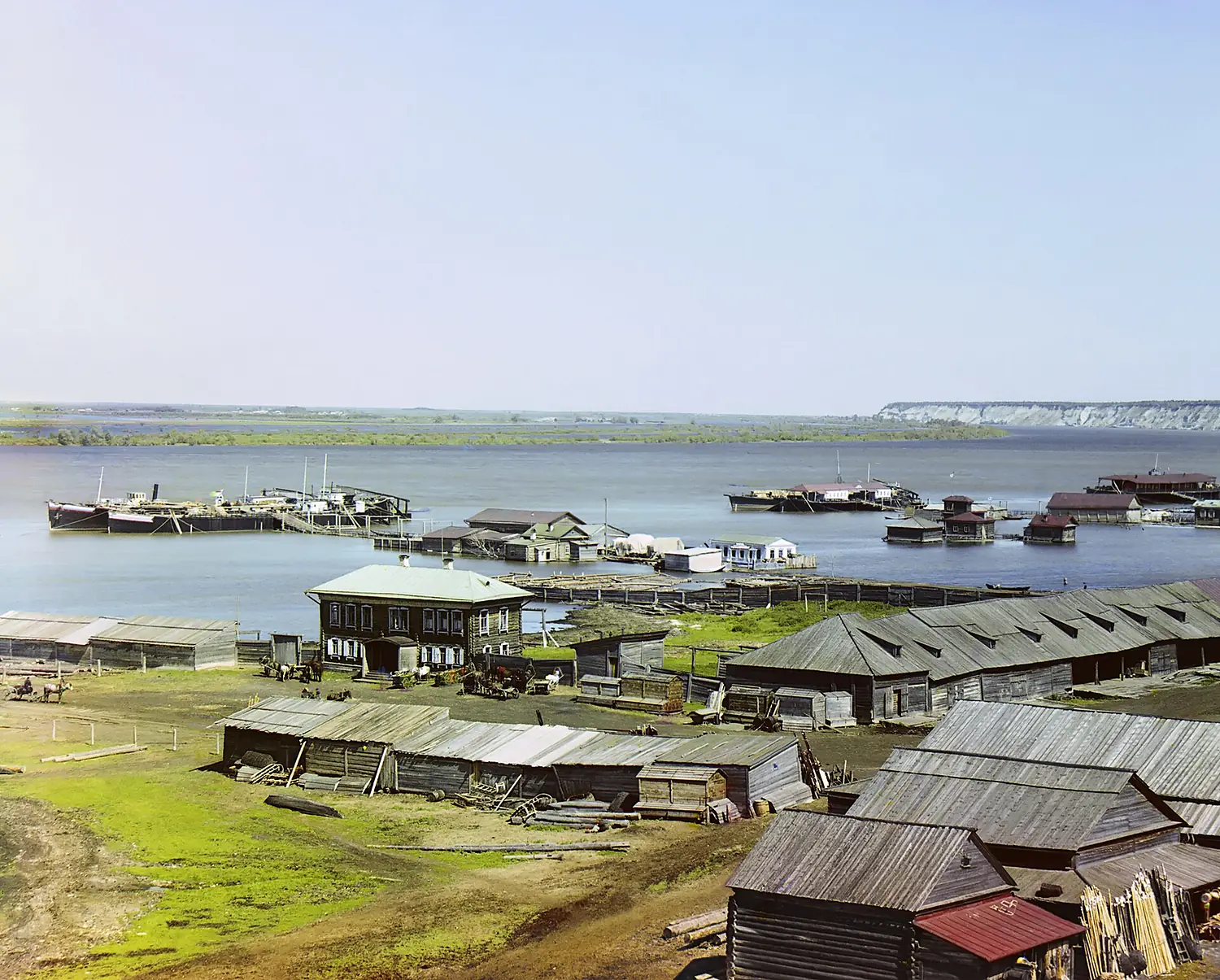
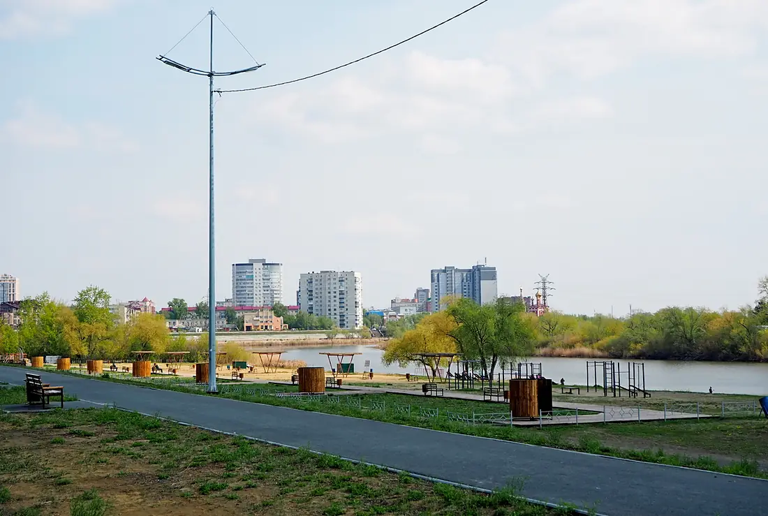
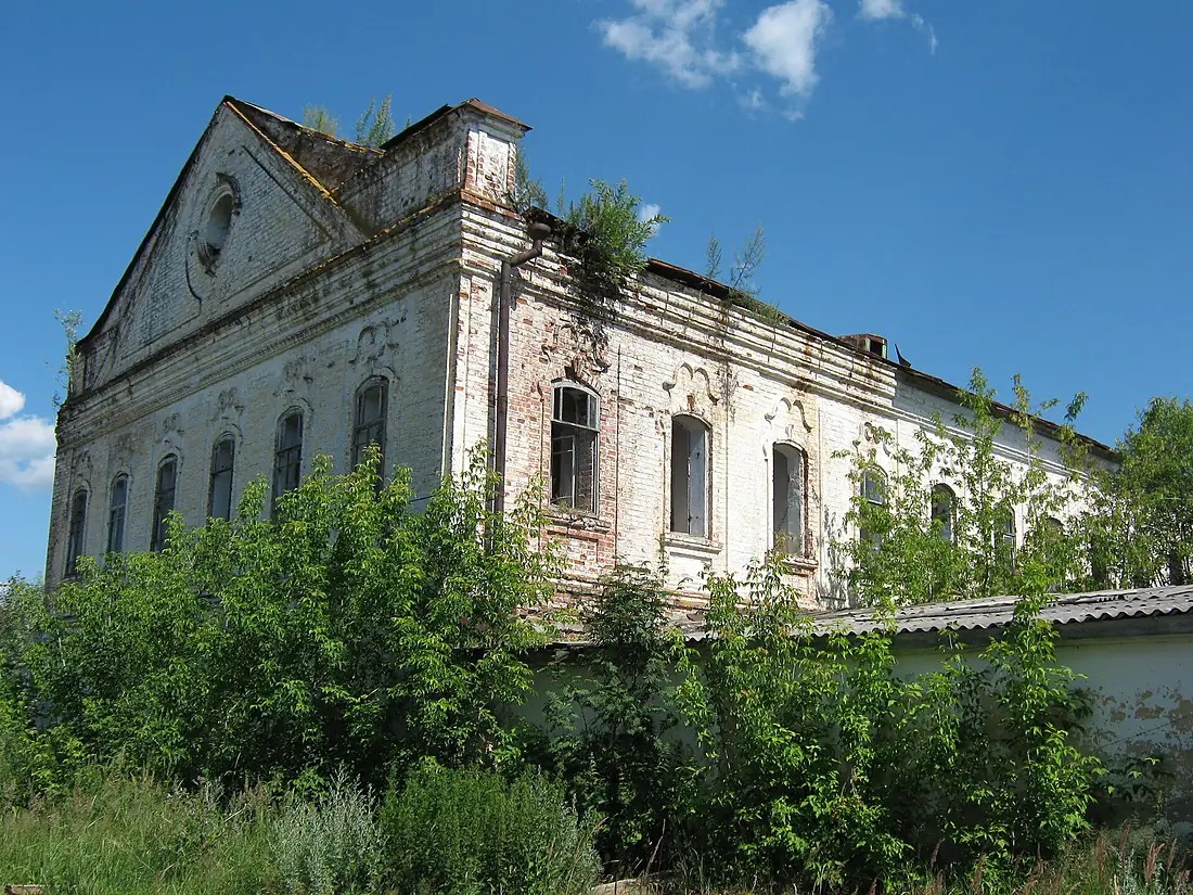
Tributaries
Where it flows, and what flows into it
It flows into
IrtyshRussia4,248 km3,000 m³/sTributaries (40)
Russia1,030 km200 m³/sjoins at km 1,011TavdaRussia719 km460 m³/sjoins at km 1,132IsetRussia606 km73 m³/sjoins at km 882Also: Uy, Ubagan River, Sintashta, Uk, Yemurtla, Yurga, Iska, Bochanka, Bozbiye, Niyap, Sredny Utyak, Kurtamysh, Yurgamysh, Kayrakty, Tap, Gorkorechenskaya, Nerda, Nizhny Utyak, Koktyul', Kokpektysay, Utyak, Shestakovka, Zaimka, Kulichek
Where these numbers come from
| Name, length, places | Wikidata (Q124653) · CC0 |
|---|---|
| Course, profile, basin | RiverATLAS v1.0 (HydroATLAS, Linke et al. 2019) · CC BY 4.0 — followed from the source to the mouth given by Wikidata |
| Flow | WaterGAP (RiverATLAS), 1971–2000 · CC BY 4.0 |
| Climate along the river | WorldClim (RiverATLAS), 1970–2000 · CC BY 4.0 |
| Towns, bridges, dams | Wikidata · CC0; GeoNames · CC BY 4.0 |
| Along the river | © OpenStreetMap contributors · ODbL |
| Images | EOX Sentinel-2 cloudless 2016 · CC BY 4.0; Wikimedia Commons |
| Our other atlases | Lakeyas, Peakyas — Wikidata · CC0; © OpenStreetMap contributors · ODbL; GeoNames · CC BY 4.0; HydroLAKES · CC BY 4.0; NOAA OISST |
Every source and licence is on the data sources page.
The family
Do you prefer beaches, lakes, mountains, waterfalls, islands, rivers or canyons?
Same idea, other landscapes: field atlases built on open data, month by month, in seven languages.
 beaches
 Find your beach: sea temperature, sun and swimming month by month.Visit lakes
 Every lake on Earth: water temperature, ice, depth and the shore.Coming soonVisit mountains
 Every summit in 3D: summit weather, the 0 °C line, huts and trails.Visit
  waterfalls
 Every waterfall: height, flow month by month and when it roars.Coming soonVisit
  islands
 Every island from the sea up: size, sea temperature, ferries and 3D.Coming soonVisit
  rivers
 Every river from source to sea: the journey, the flow and the basin in numbers.You are here
 canyons
 Every canyon cut to scale: depth to the floor, rim and floor temperatures, trails and viewpoints.Coming soonVisit