River
Vorskla
464 km from source to mouth · Ukraine and Russia.
 Ukraine and RussiaFlows into Dnieper10th longest in Ukraine
In numbers
Length
464km
Average flow
36m³/s
Basin
14,700km²
Drop
87m
from 149 m to 62 m
Countries
2
The journey
From source to mouth
464 km of river and 22 stops on the way: 18 towns and cities on its banks, dams, bridges and the tributaries that feed it.
- 0 kmBelgorod Oblastat 149 m
- 27 kmTomarovka7,916 people
- 53 kmBorisovka14,148 people
- 79 kmGolovchino5,356 people
- 89 kmDobroivanovka138 people
- 96 kmGrayvoron6,212 people
- 121 kmVelyka Pysarivka5,235 people
- 163 kmKyrykivka3,202 people
- 171 kmVorsklytsiatributary
- 179 kmBorimlyatributary
- 204 kmOkhtyrka46,660 people
- 245 kmKotelva12,122 people
- 260 kmKhizhniakivka3 people
- 277 kmMerla Rivertributary
- 319 kmPodil31,870 people
- 322 kmPoltava283,402 people
- 324 kmZaliznychne3,035 people
- 324 kmLevada13,990 people
- 363 kmTagamlyktributary
- 372 kmNovi Sanzhary8,179 people
- 385 kmBilyky4,913 people
- 408 kmKobelyaky9,772 people
- 421 kmPeregonivka376 people
- 464 kmDnieperat 62 m
Water level along the river (RiverATLAS; the height is exaggerated). Towns: GeoNames and Wikidata; bridges, dams and tributaries: Wikidata.
River in Russia and Ukraine
At the mouth it carries 36 m³/s on average: an Olympic pool every 69 seconds. It drops from 149 m to 62 m, 0.2 m per kilometre on average. Its basin covers 14,700 km², about the size of TL. 814,000 people live in it. Highest water: from April to June; lowest: from December to March. No large dam holds it back: it is one of the world's free-flowing rivers.
Where to start
- PoltavaLargest city on its banks · 283,402 people
- On the water6 ferry piers, marinas, boat rentals and boat ramps along the river (OpenStreetMap)
- From May to SeptemberThe best months to visit
Vorskla, month by month
Highest water: from April to June
Lowest water: from December to March. Freezing months (average below −4 °C): from January to February. Best months to visit: from May to September.
From about 12 m³/s in the lowest month to 170 m³/s in the highest. An estimate: the monthly flow is modelled from the lowest and highest months of WaterGAP (RiverATLAS, 1971–2000) and the rain and snow along the river (WorldClim). Dams change the real rhythm. The chip is the average air temperature; below it, the month's rain.
Plan the trip
Plan the trip: boat trips, a bed by the river, a car
Some links above are affiliate links: if you book through them we may earn a commission, at no extra cost to you. It never changes what the data on this page says.
The basin
Vorskla: the basin in numbers
14,306 km² of land send their water to this river. This is what lives on it.
- 814,000people live in the basin
- 57/km²people per km²
- 146maverage altitude of the basin
- 565mmof rain a year (basin average)
- 7.2°Caverage air temperature
- 2%protected areas
- 0.4%covered by lakes
What covers the basin
- 7% Forest
- 63% Cropland
- 12% Pasture
- 2% Towns and cities
RiverATLAS (HydroATLAS v1.0, CC BY 4.0): land cover, people, protected areas, glaciers and dams over the whole basin upstream of the mouth.
Along the river
Vorskla: what you find on the way
- 5Weirs
- 2Marinas
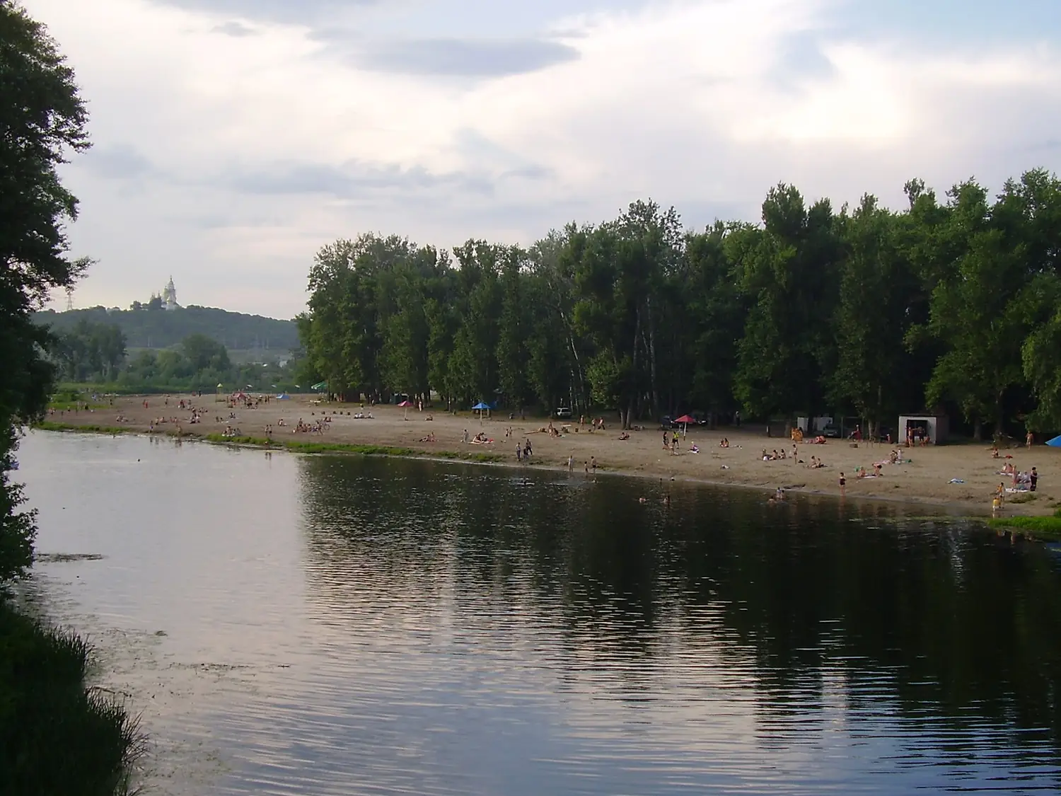
- 12River beachesWake'n'Fun, Beach and 10 more
From OpenStreetMap, within 1.9 km of the river. Not mapped is not the same as not there.
From space
The source and the mouth, seen from orbit
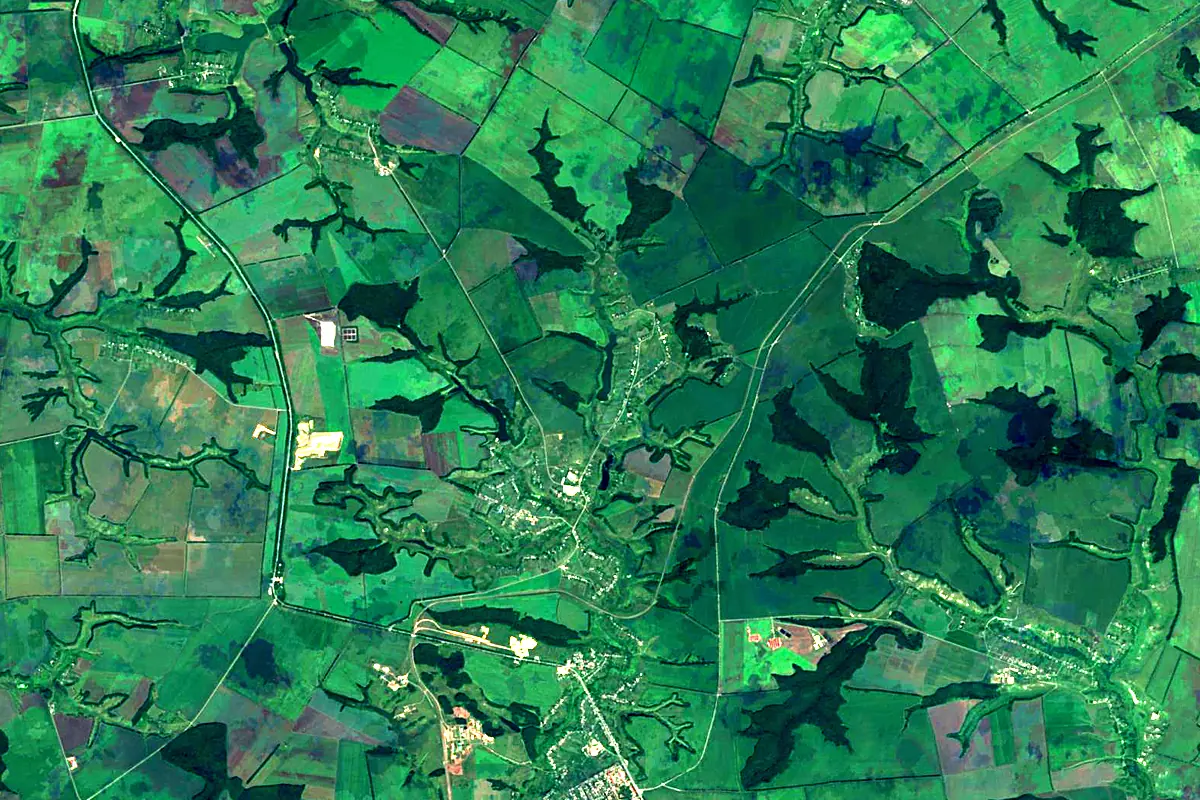
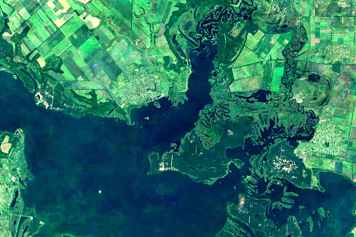
Sentinel-2 cloudless 2016 by EOX IT Services GmbH (contains modified Copernicus Sentinel data 2016), CC BY 4.0. The glowing line is the river as drawn by RiverATLAS.
Tributaries
Where it flows, and what flows into it
It flows into
DnieperUkraine2,285 km1,700 m³/sTributaries (22)
Also: Vorsklytsia, Merla River, Kolomak (rivière), Borimlya, Velikii Kobeljachok, Kotelva (rivière), Ivany, Bratenytsya, Kustolove, Oleschnja, Okhtyrka, Ryabina, Tagamlyk, Chuchra, Lozovaya, Poluzirja, Gusynka, Kovschischa, Bezymyanka, Vorskolets, Gotnya, Balka Platva
 Belarus
Nearby
Rivers nearby
Ukraine717 km55 m³/s43 km awaySamara RiverUkraine320 km17 m³/s88 km awayKhorol RiverUkraine308 km3.6 m³/s70 km awayOril RiverUkraine346 km13 m³/s73 km awaySula RiverUkraine363 km29 m³/s122 km awayVovchaUkraine336 km5.3 m³/s119 km awayUday RiverUkraine342 km9.4 m³/s151 km awayKonka RiverUkraine149 km10 m³/s162 km awayWhere these numbers come from
| Name, length, places | Wikidata (Q844041) · CC0 |
|---|---|
| Course, profile, basin | RiverATLAS v1.0 (HydroATLAS, Linke et al. 2019) · CC BY 4.0 — followed from the source to the mouth given by Wikidata |
| Flow | WaterGAP (RiverATLAS), 1971–2000 · CC BY 4.0 |
| Climate along the river | WorldClim (RiverATLAS), 1970–2000 · CC BY 4.0 |
| Towns, bridges, dams | Wikidata · CC0; GeoNames · CC BY 4.0 |
| Along the river | © OpenStreetMap contributors · ODbL |
| Images | EOX Sentinel-2 cloudless 2016 · CC BY 4.0; Wikimedia Commons |
Every source and licence is on the data sources page.
The family
Do you prefer beaches, lakes, mountains, waterfalls, islands, rivers or canyons?
Same idea, other landscapes: field atlases built on open data, month by month, in seven languages.
 beaches
 Find your beach: sea temperature, sun and swimming month by month.Visit
  lakes
lakes Every lake on Earth: water temperature, ice, depth and the shore.Coming soonVisit
  mountains
 Every summit in 3D: summit weather, the 0 °C line, huts and trails.Visit
  waterfalls
 Every waterfall: height, flow month by month and when it roars.Coming soonVisit
  islands
 Every island from the sea up: size, sea temperature, ferries and 3D.Coming soonVisit
  rivers
 Every river from source to sea: the journey, the flow and the basin in numbers.You are here
 canyons
 Every canyon cut to scale: depth to the floor, rim and floor temperatures, trails and viewpoints.Coming soonVisit