River
Willamette River
301 km from source to mouth · United States.
 United StatesFlows into Columbia River
In numbers
Length
301km
Average flow
900m³/s
Basin
29,730km²
Drop
139m
from 138 m to -1 m
Country
1
The journey
From source to mouth
301 km of river and 68 stops on the way: 20 towns and cities on its banks, dams, bridges and the tributaries that feed it.
- 0 kmSourceat 138 m
- 0 kmMiddle Fork Willamette Rivertributary
- 0 kmCoast Fork Willamette Rivertributary
- 4 kmSpringfield60,870 people
- 4 kmSpringfield Bridge
- 6 kmWhilamut Passage Bridge
- 6 kmKnickerbocker Bicycle Bridge
- 8 kmDave and Lynn Frohnmayer Pedestrian and Bicycle Bridge
- 9 kmEugene176,654 people
- 10 kmPeter DeFazio Bridge
- 10 kmFerry Street Bridge
- 19 kmMcKenzie Rivertributary
- 40 kmHarrisburg3,704 people
- 59 kmLong Tom Rivertributary
- 84 kmMarys Rivertributary
- 85 kmVan Buren Street Bridge
- 86 kmCorvallis59,922 people
- 103 kmCalapooia Rivertributary
- 104 kmEllsworth Street Bridge
- 104 kmAlbany52,175 people
- 104 kmLyon Street Bridge
- 124 kmSantiam Rivertributary
- 129 kmLuckiamute Rivertributary
- 144 kmIndependence9,227 people
- 156 kmRickreall Creektributary
- 163 kmCenter Street Bridge
- 163 kmMarion Street Bridge
- 163 kmSalem175,535 people
- 163 kmUnion Street Railroad Bridge
- 168 kmKeizer37,895 people
- 182 kmWillamette Mission Site
- 210 kmYamhill Rivertributary
- 214 kmDundee3,200 people
- 217 kmNewberg22,780 people
- 224 kmChampoeg
- 236 kmWilsonville22,729 people
- 237 kmBoone Bridge
- 242 kmMolalla Rivertributary
- 246 kmCanby17,271 people
- 252 kmTualatin Rivertributary
- 256 kmWillamette Falls
- 257 kmOregon City35,831 people
- 257 kmOregon City Bridge
- 258 kmAbernethy Bridge
- 258 kmWest Linn26,593 people
- 259 kmClackamas Rivertributary
- 259 kmGladstone11,986 people
- 261 kmJennings Lodge7,315 people
- 265 kmOswego Lake1.3 km²
- 265 kmOak Grove16,629 people
- 266 kmLake Oswego38,496 people
- 266 kmLake Oswego Railroad Bridge
- 269 kmTryon Creektributary
- 269 kmMilwaukie20,830 people
- 271 kmSellwood Bridge
- 276 kmRoss Island Bridge
- 276 kmTilikum Crossing, Bridge of the People
- 276 kmUSS Blueback
- 276 kmMarquam Bridge
- 277 kmMadison Street Bridge
- 277 kmHawthorne Bridge
- 277 kmPortland652,503 people
- 277 kmMorrison Bridge
- 278 kmBurnside Bridge
- 278 kmSteel Bridge
- 279 kmBroadway Bridge
- 280 kmFremont Bridge
- 287 kmBurlington Northern Railroad Bridge 5.1
- 289 kmSt. Johns Bridge
- 301 kmColumbia Riverat -1 m
Water level along the river (RiverATLAS; the height is exaggerated). Towns: GeoNames and Wikidata; bridges, dams and tributaries: Wikidata.
Major river in northwest Oregon
At the mouth it carries 900 m³/s on average: an Olympic pool every 2.8 seconds. It drops from 138 m to -1 m, 0.5 m per kilometre on average. Its basin covers 29,730 km², about the size of AM. 2.4 million people live in it. Highest water: from January to February; lowest: from June to September. Its dams hold back little of its water (9.7% of a year's flow).
Where to start
- PortlandLargest city on its banks · 652,503 people
- Portland International Airport (PDX)Nearest airport with scheduled flights, 10 km from the cityCar hire at PDX airport (Portland)Discover Cars · Affiliate link↗
- On the water80 ferry piers, marinas, boat rentals and boat ramps along the river (OpenStreetMap)
- Kayak and canoe7 put-ins and rapids mapped (OpenStreetMap)
- From June to SeptemberThe best months to visit
Willamette River, month by month
Highest water: from January to February
Lowest water: from June to September. Best months to visit: from June to September.
From about 260 m³/s in the lowest month to 1,800 m³/s in the highest. An estimate: the monthly flow is modelled from the lowest and highest months of WaterGAP (RiverATLAS, 1971–2000) and the rain and snow along the river (WorldClim). Dams change the real rhythm. The chip is the average air temperature; below it, the month's rain.
Plan the trip
Plan the trip: boat trips, a bed by the river, a car
Some links above are affiliate links: if you book through them we may earn a commission, at no extra cost to you. It never changes what the data on this page says.
The basin
Willamette River: the basin in numbers
28,949 km² of land send their water to this river. This is what lives on it.
- 2.4millionpeople live in the basin
- 83/km²people per km²
- 566maverage altitude of the basin
- 1,612mmof rain a year (basin average)
- 9.0°Caverage air temperature
- 7%protected areas
- 0.5%covered by lakes
- 3.4km³held in reservoirs
What covers the basin
- 69% Forest
- 17% Cropland
- 8% Pasture
- 5% Towns and cities
RiverATLAS (HydroATLAS v1.0, CC BY 4.0): land cover, people, protected areas, glaciers and dams over the whole basin upstream of the mouth.
Along the river
Willamette River: what you find on the way
- 16WeirsMillrace Diversion Dam, Mill Race Dam and 14 more
- 1LocksWillamette Falls Canal
- 9WaterfallsCoffee Creek Falls, Willamette Falls, Singer Falls and 6 more
- 7RapidsKeizer Rapids, Walnut Eddy, Fish Eddy and 4 more
- 66Boat rampsCrystal Lake Boat Ramp, Michael's Landing, Takena Landing and 63 more
- 6Ferry piersBuena Vista Ferry, Wheatland Ferry (West), Wheatland Ferry (East) and 3 more
- 7MarinasBoones Ferry Marina, Waverly Marina Association, Oregon Yacht Club and 4 more
- 5River beachesSan Salvador Beach, Poet's Beach, Lindbergh’s Beach and 2 more
From OpenStreetMap, within 2.1 km of the river. Not mapped is not the same as not there.
Cross-checked with our atlases
Willamette River in our other atlases
What our sister atlases know about the waterfalls on this river, the lakes it flows through, the beaches at its mouth, the mountains where it rises and the islands off its mouth.
 1waterfall on the riverCascadyas
 1lake on its wayLakeyas
 12mountains at the sourcePeakyas
Waterfalls (1)
On the river, by Cascadyas
- Willamette Fallskm 256
Cascadyas is coming soonOpen Cascadyas ↗
Lakes and reservoirs (1)
Lakes it flows through, by Lakeyas
- Oswego Lakekm 2651.3km²
Lakeyas is coming soonOpen Lakeyas ↗
Mountains at the source (12)
Within 15 km of the source, by Peakyas
- Gillespie Butte7.7 km away
- Kelly Butte3.4 km away
- Mount Pisgah5.2 km away
- Creswell Butte13 km away
- Rattlesnake Butte15 km away
- Sellers Butte10 km away
- Short Mountain6.3 km away
- Bailey Hill11 km away
4 more on PeakyasOpen Peakyas ↗
From space
The source and the mouth, seen from orbit
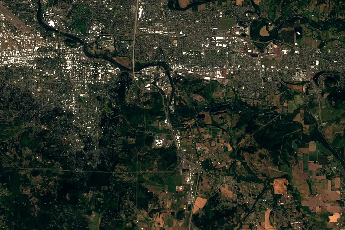
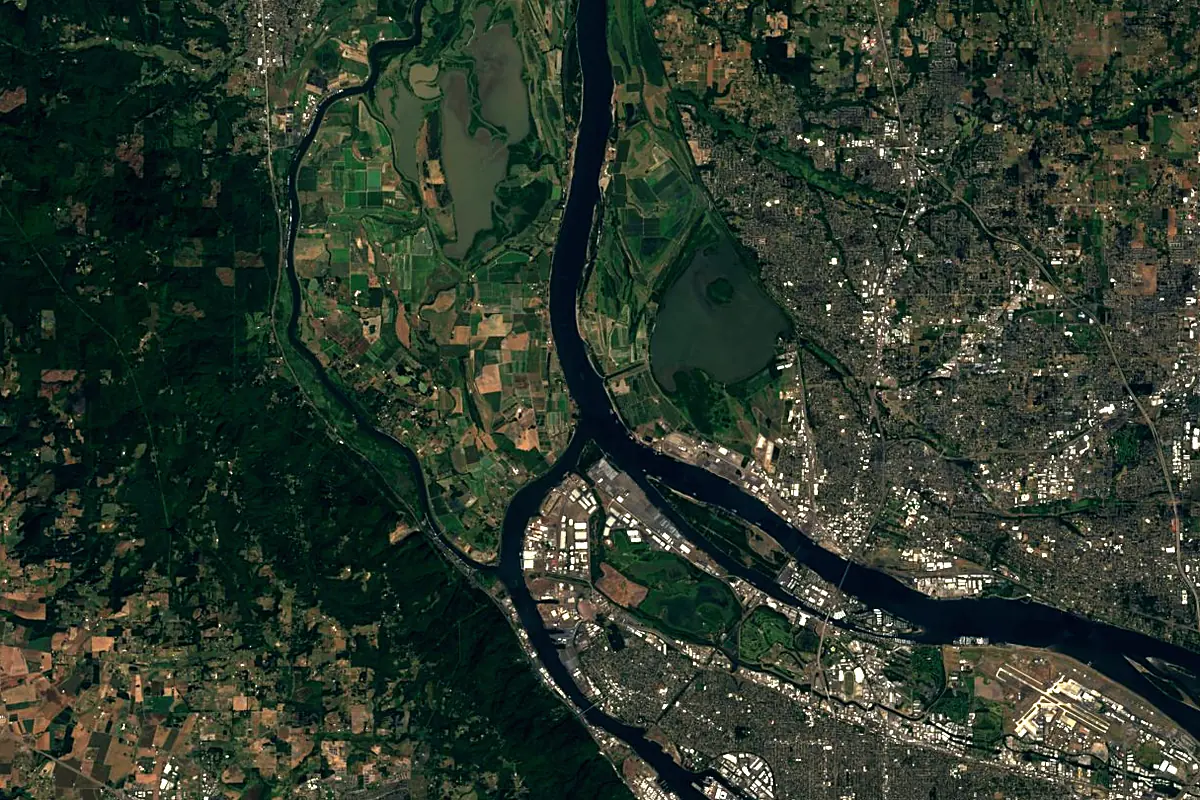
Sentinel-2 cloudless 2016 by EOX IT Services GmbH (contains modified Copernicus Sentinel data 2016), CC BY 4.0. The glowing line is the river as drawn by RiverATLAS.
Photos
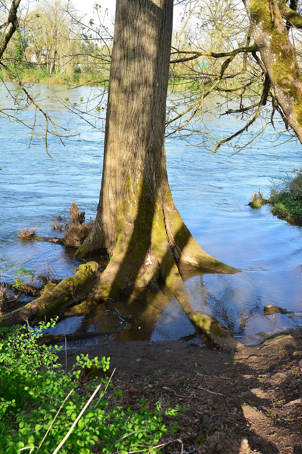
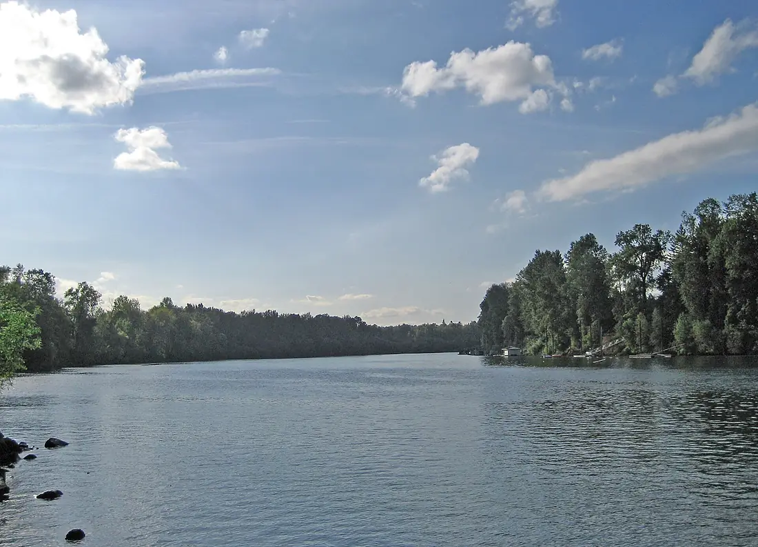
Willamette River in pictures
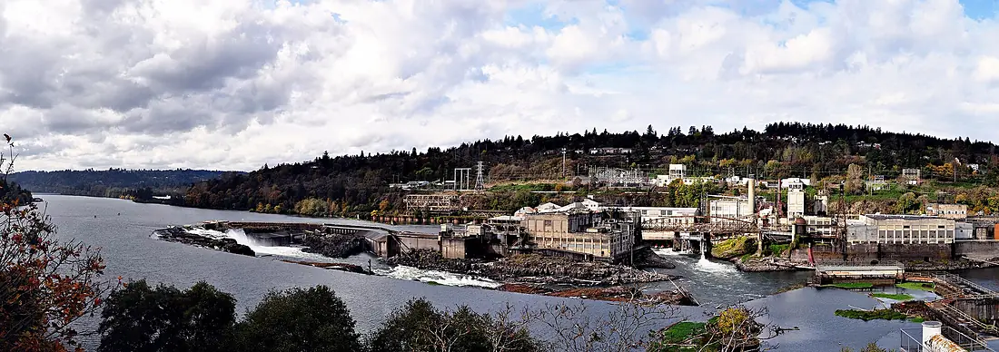
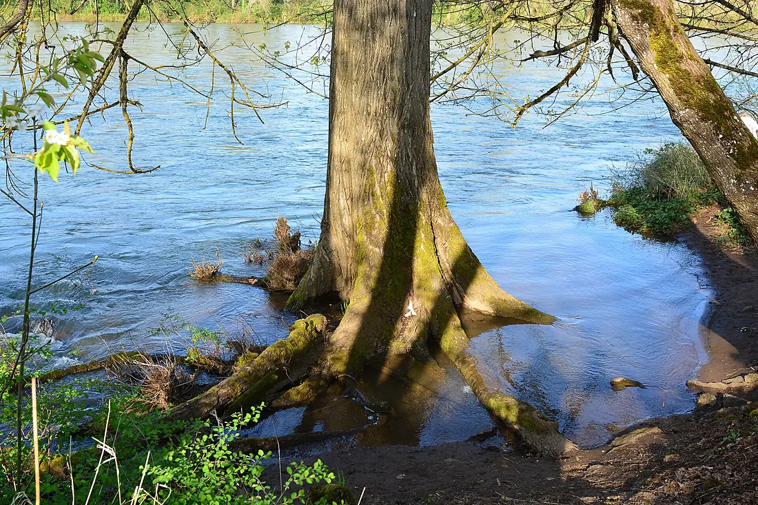
Tributaries
Where it flows, and what flows into it
It flows into
Columbia RiverUnited States2,000 km7,500 m³/sTributaries (28)
Also: McKenzie River, Clackamas River, Molalla River, Santiam River, Columbia Slough, Tualatin River, Balch Creek, Luckiamute River, Johnson Creek, Yamhill River, Calapooia River, Middle Fork Willamette River, Mill Creek, Long Tom River, Coast Fork Willamette River, Tryon Creek, Ash Creek, Marys River, Rickreall Creek, Kellogg Creek, Tanner Creek, Champoeg Creek, Dead River, Stephens Creek
 Canada
Where these numbers come from
| Name, length, places | Wikidata (Q131071) · CC0 |
|---|---|
| Course, profile, basin | RiverATLAS v1.0 (HydroATLAS, Linke et al. 2019) · CC BY 4.0 — followed from the source to the mouth given by Wikidata |
| Flow | WaterGAP (RiverATLAS), 1971–2000 · CC BY 4.0 |
| Climate along the river | WorldClim (RiverATLAS), 1970–2000 · CC BY 4.0 |
| Towns, bridges, dams | Wikidata · CC0; GeoNames · CC BY 4.0 |
| Along the river | © OpenStreetMap contributors · ODbL |
| Images | EOX Sentinel-2 cloudless 2016 · CC BY 4.0; Wikimedia Commons |
| Our other atlases | Cascadyas, Lakeyas, Peakyas — Wikidata · CC0; © OpenStreetMap contributors · ODbL; GeoNames · CC BY 4.0; HydroLAKES · CC BY 4.0; NOAA OISST |
Every source and licence is on the data sources page.
The family
Do you prefer beaches, lakes, mountains, waterfalls, islands, rivers or canyons?
Same idea, other landscapes: field atlases built on open data, month by month, in seven languages.
 beaches
 Find your beach: sea temperature, sun and swimming month by month.Visit lakes
 Every lake on Earth: water temperature, ice, depth and the shore.Coming soonVisit mountains
 Every summit in 3D: summit weather, the 0 °C line, huts and trails.Visit waterfalls
 Every waterfall: height, flow month by month and when it roars.Coming soonVisit
  islands
 Every island from the sea up: size, sea temperature, ferries and 3D.Coming soonVisit
  rivers
 Every river from source to sea: the journey, the flow and the basin in numbers.You are here
 canyons
 Every canyon cut to scale: depth to the floor, rim and floor temperatures, trails and viewpoints.Coming soonVisit