River
Yalu River
813 km from source to mouth · China and North Korea.
 China and North KoreaFlows into Korea Bay
In numbers
Length
813km
Average flow
600m³/s
Basin
39,800km²
Drop
1,312m
from 1,310 m to -2 m
Countries
2
The journey
From source to mouth
813 km of river and 22 stops on the way: 11 towns and cities on its banks, dams, bridges and the tributaries that feed it.
- 0 kmChangbai Korean Autonomous Countyat 1,310 m
- 65 kmChangbai58,266 people
- 67 kmHyesan-dong97,794 people
- 69 kmChangbai–Hyesan International Bridge
- 69 kmHyesan192,680 people
- 144 kmChangjin-gangtributary
- 313 kmLinjiang69,149 people
- 317 kmChunggang41,022 people
- 466 kmManp’o116,760 people
- 467 kmJi'an Yalu River Border Railway Bridge
- 475 kmJi’an67,673 people
- 505 kmChangja Rivertributary
- 525 kmWiwŏn-jŏsuji31 km²
- 563 kmHun Rivertributary
- 684 kmSupung Lake285 km²
- 745 kmUiju50,081 people
- 752 kmAi Rivertributary
- 765 kmSino-Korean Friendship Bridge
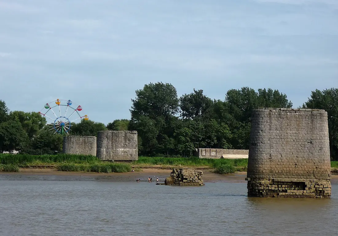
- 765 kmYalu River Broken Bridge
- 765 kmDandong2,444,697 people
- 766 kmSinŭiju288,112 people
- 775 kmLangtoucun59,046 people
- 778 kmNew Yalu River Bridge
- 813 kmKorea Bayat -2 m
Water level along the river (RiverATLAS; the height is exaggerated). Towns: GeoNames and Wikidata; bridges, dams and tributaries: Wikidata.
River on the border between North Korea and China
At the mouth it carries 596 m³/s on average: an Olympic pool every 4.2 seconds. It drops from 1,310 m to -2 m, 1.6 m per kilometre on average. Its basin covers 39,800 km², about the size of CH. 6.3 million people live in it. Highest water: August; lowest: from December to March. It is heavily dammed: reservoirs can hold 156% of a year's flow.
Where to start
- DandongLargest city on its banks · 2,444,697 people
- Dandong Langtou International Airport (DDG)Nearest airport with scheduled flights, 13 km from the city
- On the water16 ferry piers, marinas, boat rentals and boat ramps along the river (OpenStreetMap)
- Kayak and canoe5 put-ins and rapids mapped (OpenStreetMap)
- From May to June and SeptemberThe best months to visit
Yalu River, month by month
Highest water: August
Lowest water: from December to March. Freezing months (average below −4 °C): from December to February. Best months to visit: from May to June and September.
From about 76 m³/s in the lowest month to 1,900 m³/s in the highest. An estimate: the monthly flow is modelled from the lowest and highest months of WaterGAP (RiverATLAS, 1971–2000) and the rain and snow along the river (WorldClim). Dams change the real rhythm. The chip is the average air temperature; below it, the month's rain.
Plan the trip
Plan the trip: boat trips, a bed by the river, a car
Some links above are affiliate links: if you book through them we may earn a commission, at no extra cost to you. It never changes what the data on this page says.
The basin
Yalu River: the basin in numbers
62,209 km² of land send their water to this river. This is what lives on it.
- 6.3millionpeople live in the basin
- 102/km²people per km²
- 788maverage altitude of the basin
- 962mmof rain a year (basin average)
- 3.6°Caverage air temperature
- 5%protected areas
- 1.0%covered by lakes
- 1%permafrost
- 29km³held in reservoirs
What covers the basin
- 89% Forest
- 10% Cropland
- 9% Pasture
- 3% Towns and cities
RiverATLAS (HydroATLAS v1.0, CC BY 4.0): land cover, people, protected areas, glaciers and dams over the whole basin upstream of the mouth.
Along the river
Yalu River: what you find on the way
- 7Weirs
- 5Rapids
- 15Ferry piersNo.2 Tourism Port, No.1 Tourism Port and 13 more
- 1Marinas
From OpenStreetMap, within 2.3 km of the river. Not mapped is not the same as not there.
Cross-checked with our atlases
Yalu River in our other atlases
What our sister atlases know about the waterfalls on this river, the lakes it flows through, the beaches at its mouth, the mountains where it rises and the islands off its mouth.
 2lakes on its wayLakeyas
 6mountains at the sourcePeakyas
Lakes and reservoirs (2)
Lakes it flows through, by Lakeyas
- Wiwŏn-jŏsujikm 47131km²
- Supung Lakekm 613285km²
Lakeyas is coming soonOpen Lakeyas ↗
Mountains at the source (6)
Within 15 km of the source, by Peakyas
- Jong-il Peak14 km away1,798m
- Huasong Xiaoshan7.6 km away
- Wangchi Xiaoshan13 km away
- Kanbaek-san12 km away
- Tijin Shan6.2 km away
- Pai Yen6.5 km away
From space
The source and the mouth, seen from orbit
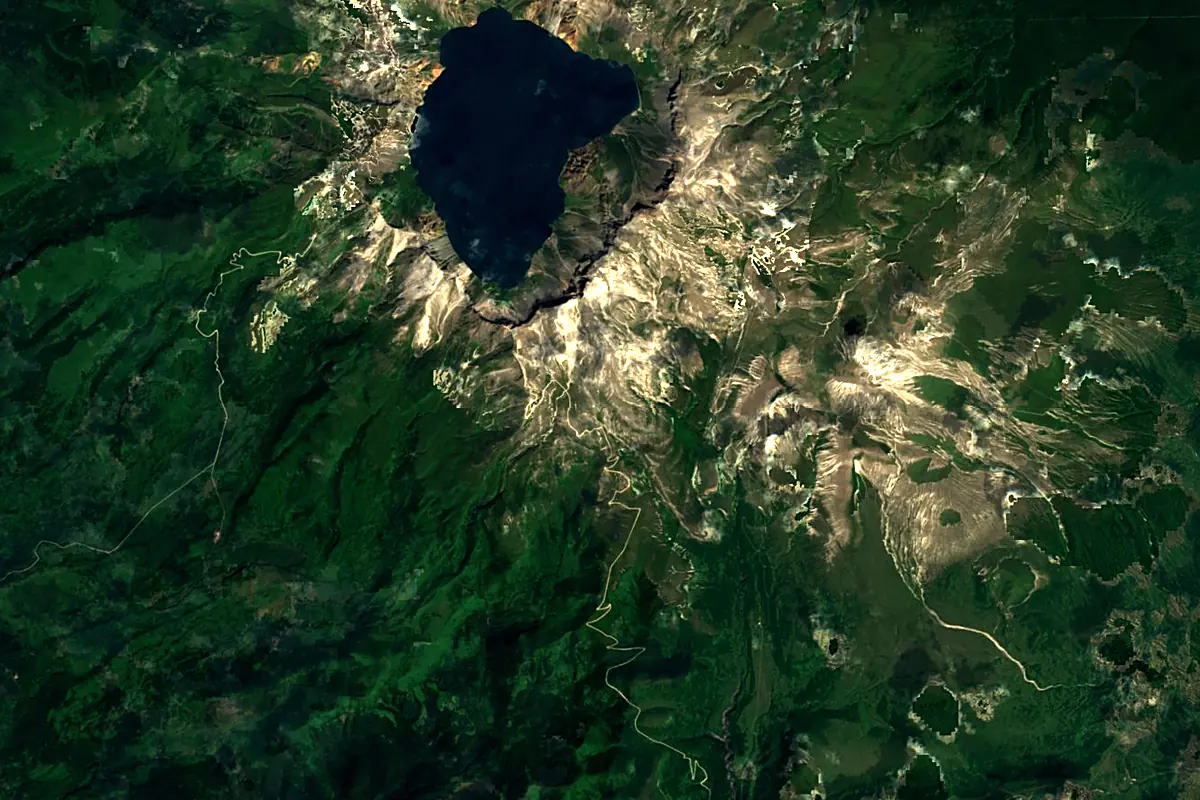
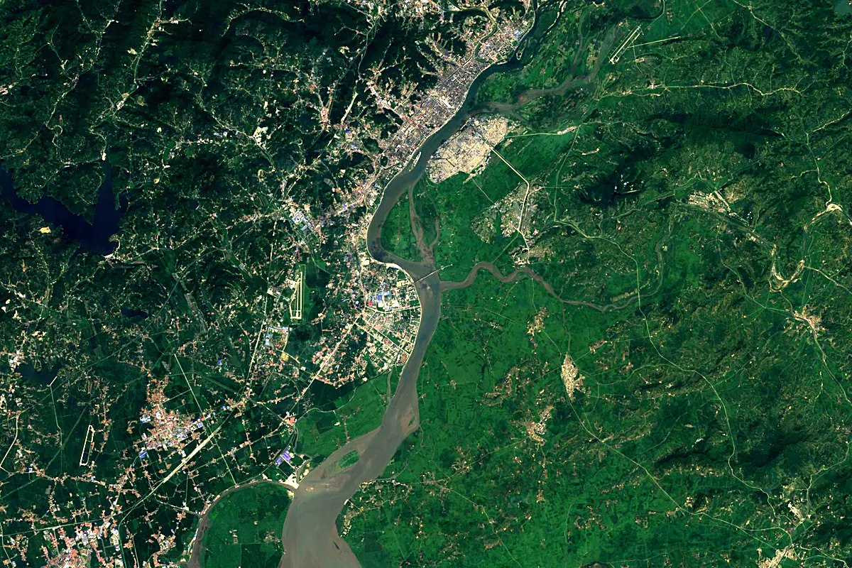
Sentinel-2 cloudless 2016 by EOX IT Services GmbH (contains modified Copernicus Sentinel data 2016), CC BY 4.0. The glowing line is the river as drawn by RiverATLAS.
Photos
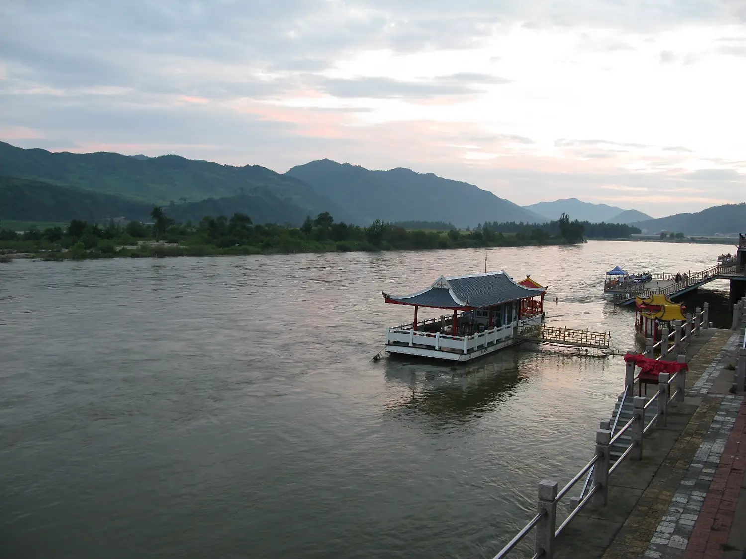
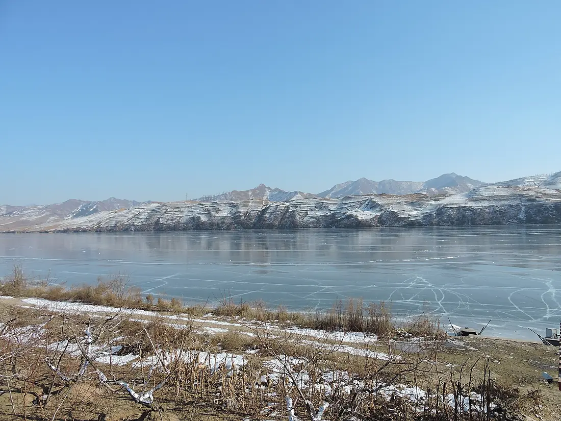
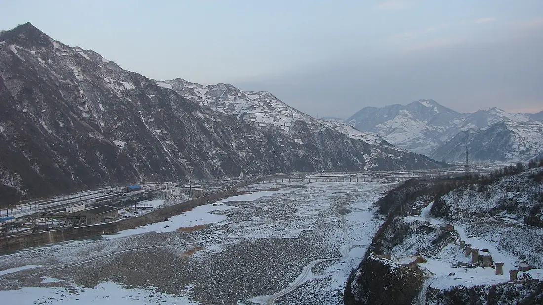
Yalu River in pictures
Tributaries
Where it flows, and what flows into it
Tributaries (5)
Also: Changja River, Hun River, Ai River, Changjin-gang, Hŏch'ŏn-gang
Nearby
Rivers nearby
North Korea217 km120 m³/s106 km awayTaedong RiverNorth Korea439 km310 m³/s180 km awayLiao RiverChina1,345 km630 m³/s238 km awayImjin River South Korea274 km180 m³/s316 km awayXiliao RiverChina829 km100 m³/s334 km awayBukhan RiverSouth Korea482 km200 m³/s378 km awayLuan RiverChina877 km140 m³/s442 km awayGeum RiverSouth Korea395 km210 m³/s493 km away
Where these numbers come from
| Name, length, places | Wikidata (Q55498) · CC0 |
|---|---|
| Course, profile, basin | RiverATLAS v1.0 (HydroATLAS, Linke et al. 2019) · CC BY 4.0 — followed from the source to the mouth given by Wikidata |
| Flow | WaterGAP (RiverATLAS), 1971–2000 · CC BY 4.0 |
| Climate along the river | WorldClim (RiverATLAS), 1970–2000 · CC BY 4.0 |
| Towns, bridges, dams | Wikidata · CC0; GeoNames · CC BY 4.0 |
| Along the river | © OpenStreetMap contributors · ODbL |
| Images | EOX Sentinel-2 cloudless 2016 · CC BY 4.0; Wikimedia Commons |
| Our other atlases | Lakeyas, Peakyas — Wikidata · CC0; © OpenStreetMap contributors · ODbL; GeoNames · CC BY 4.0; HydroLAKES · CC BY 4.0; NOAA OISST |
Every source and licence is on the data sources page.
The family
Do you prefer beaches, lakes, mountains, waterfalls, islands, rivers or canyons?
Same idea, other landscapes: field atlases built on open data, month by month, in seven languages.
 beaches
 Find your beach: sea temperature, sun and swimming month by month.Visit lakes
 Every lake on Earth: water temperature, ice, depth and the shore.Coming soonVisit mountains
 Every summit in 3D: summit weather, the 0 °C line, huts and trails.Visit
  waterfalls
 Every waterfall: height, flow month by month and when it roars.Coming soonVisit
  islands
 Every island from the sea up: size, sea temperature, ferries and 3D.Coming soonVisit
  rivers
 Every river from source to sea: the journey, the flow and the basin in numbers.You are here
 canyons
 Every canyon cut to scale: depth to the floor, rim and floor temperatures, trails and viewpoints.Coming soonVisit