River
Yellow River
5,464 km from source to mouth · China.
 ChinaFlows into Bohai Sea2nd longest in China
In numbers
Length
5,464km
Average flow
2,600m³/s
Basin
752,000km²
Drop
4,430m
from 4,466 m to 36 m
Country
1
The journey
From source to mouth
5,464 km of river and 51 stops on the way: 11 towns and cities on its banks, dams, bridges and the tributaries that feed it.
- 0 kmKariquat 4,466 m
- 144 kmGyaring Lake521 km²
- 208 kmNgoring Lake618 km²
- 1,060 kmBlack River (in Sichuan)tributary
- 1,068 kmNima17,820 people
- 1,377 kmBanduo Hydropower Station
- 1,531 kmLongyangxia Reservoir285 km²
- 1,532 kmLongyangxia Dam
- 1,632 kmLijiaxia Reservoir32 km²
- 1,639 kmZhiganglaka Dam
- 1,653 kmKangyang Dam
- 1,675 kmJianzha Yellow River Bridge
- 1,684 kmHaihuang Bridge
- 1,701 kmGongboxia Dam
- 1,752 kmJishixia Dam
- 1,811 kmDaxia Rivertributary
- 1,828 kmTao Rivertributary
- 1,830 kmLiujiaxia Reservoir116 km²
- 1,860 kmYanguoxia Dam
- 1,871 kmHuangshui Rivertributary
- 1,925 kmZhongshan Bridge
- 1,927 kmLanzhou4,359,446 people
- 2,273 kmZhongwei1,174,600 people
- 2,382 kmQingtongxia Shuiku54 km²
- 2,405 kmWuzhong7,202,654 people
- 2,429 kmWanghong30,943 people
- 2,429 kmWutongshu20,506 people
- 2,448 kmLinhe16,723 people
- 2,577 kmHuinong136,570 people
- 2,610 kmWuda122,696 people
- 2,635 kmWuhai218,427 people
- 3,217 kmDaheihetributary
- 3,279 kmJungar Yellow River Bridge
- 3,279 kmXiaoshawan Yellow River Bridge
- 3,736 kmWuding Rivertributary
- 3,881 kmHukou Waterfalls
- 3,945 kmYumenkou Yellow River Road Bridge
- 3,990 kmFen Rivertributary
- 4,085 kmWei Rivertributary
- 4,203 kmSanmenxia669,307 people
- 4,219 kmSanmenxia Dam
- 4,437 kmYiluo Rivertributary
- 4,476 kmQin Hetributary
- 4,483 kmTaohuayu Yellow River Bridge
- 4,487 kmPing-Han Railway Zhengzhou Yellow River Bridge
- 4,487 kmJiayingguan Yellow River Railway Bridge
- 4,487 kmZhengzhou-Jiaozuo Intercity Railway Yellow River Bridge
- 4,503 kmZhengzhou Yellow River Bridge
- 4,512 kmZhengxin Yellow River Bridge
- 4,520 kmLiujiang Yellow River Bridge
- 4,597 kmKaifeng Yellow River Bridge (Daguang Expressway)
- 4,879 kmDongping Lake140 km²
- 5,464 kmBohai Seaat 36 m
Water level along the river (RiverATLAS; the height is exaggerated). Towns: GeoNames and Wikidata; bridges, dams and tributaries: Wikidata.
Major river in China
At the mouth it carries 2,571 m³/s on average: 1.0 Olympic pools every second. It drops from 4,466 m to 36 m, 0.8 m per kilometre on average. Its basin covers 752,000 km², about the size of ZM. 109 million people live in it. Highest water: from August to September; lowest: from January to April. It is heavily dammed: reservoirs can hold 150% of a year's flow.
Where to start
- WuzhongLargest city on its banks · 7,202,654 people
- Yinchuan Hedong International Airport (INC)Nearest airport with scheduled flights, 41 km from the city
- On the water70 ferry piers, marinas, boat rentals and boat ramps along the river (OpenStreetMap)
- From May to SeptemberThe best months to visit
Yellow River, month by month
Highest water: from August to September
Lowest water: from January to April. Freezing months (average below −4 °C): from December to February. Best months to visit: from May to September.
From about 570 m³/s in the lowest month to 2,800 m³/s in the highest. An estimate: the monthly flow is modelled from the lowest and highest months of WaterGAP (RiverATLAS, 1971–2000) and the rain and snow along the river (WorldClim). Dams change the real rhythm. The chip is the average air temperature; below it, the month's rain.
Plan the trip
Plan the trip: boat trips, a bed by the river, a car
Some links above are affiliate links: if you book through them we may earn a commission, at no extra cost to you. It never changes what the data on this page says.
The basin
Yellow River: the basin in numbers
744,966 km² of land send their water to this river. This is what lives on it.
- 109millionpeople live in the basin
- 147/km²people per km²
- 1,982maverage altitude of the basin
- 465mmof rain a year (basin average)
- 5.9°Caverage air temperature
- 19%protected areas
- 0.4%covered by lakes
- 5%permafrost
- 68km³held in reservoirs
What covers the basin
- 10% Forest
- 23% Cropland
- 54% Pasture
- 4% Towns and cities
RiverATLAS (HydroATLAS v1.0, CC BY 4.0): land cover, people, protected areas, glaciers and dams over the whole basin upstream of the mouth.
Along the river
Yellow River: what you find on the way
- 25Weirs
- 6Locks
- 1WaterfallsHukou Waterfall
- 7Boat ramps
- 58Ferry piersBingling Temple, Donggan Pier, Bingling Si Speedboat Harbour and 55 more
- 5Marinas
From OpenStreetMap, within 2.9 km of the river. Not mapped is not the same as not there.
Cross-checked with our atlases
Yellow River in our other atlases
What our sister atlases know about the waterfalls on this river, the lakes it flows through, the beaches at its mouth, the mountains where it rises and the islands off its mouth.
 1waterfall on the riverCascadyas
 7lakes on its wayLakeyas
Waterfalls (1)
On the river, by Cascadyas
- Hukou Waterfallskm 3,570
Cascadyas is coming soonOpen Cascadyas ↗
Lakes and reservoirs (7)
Lakes it flows through, by Lakeyas
- Gyaring Lakekm 132 · 8 m deep521km²
- Ngoring Lakekm 191 · 8 m deep618km²
- Longyangxia Reservoirkm 1,409285km²
- Lijiaxia Reservoirkm 1,50132km²
- Liujiaxia Reservoirkm 1,683116km²
- Qingtongxia Shuikukm 2,19154km²
- Dongping Lakekm 4,487140km²
Lakeyas is coming soonOpen Lakeyas ↗
From space
The source and the mouth, seen from orbit
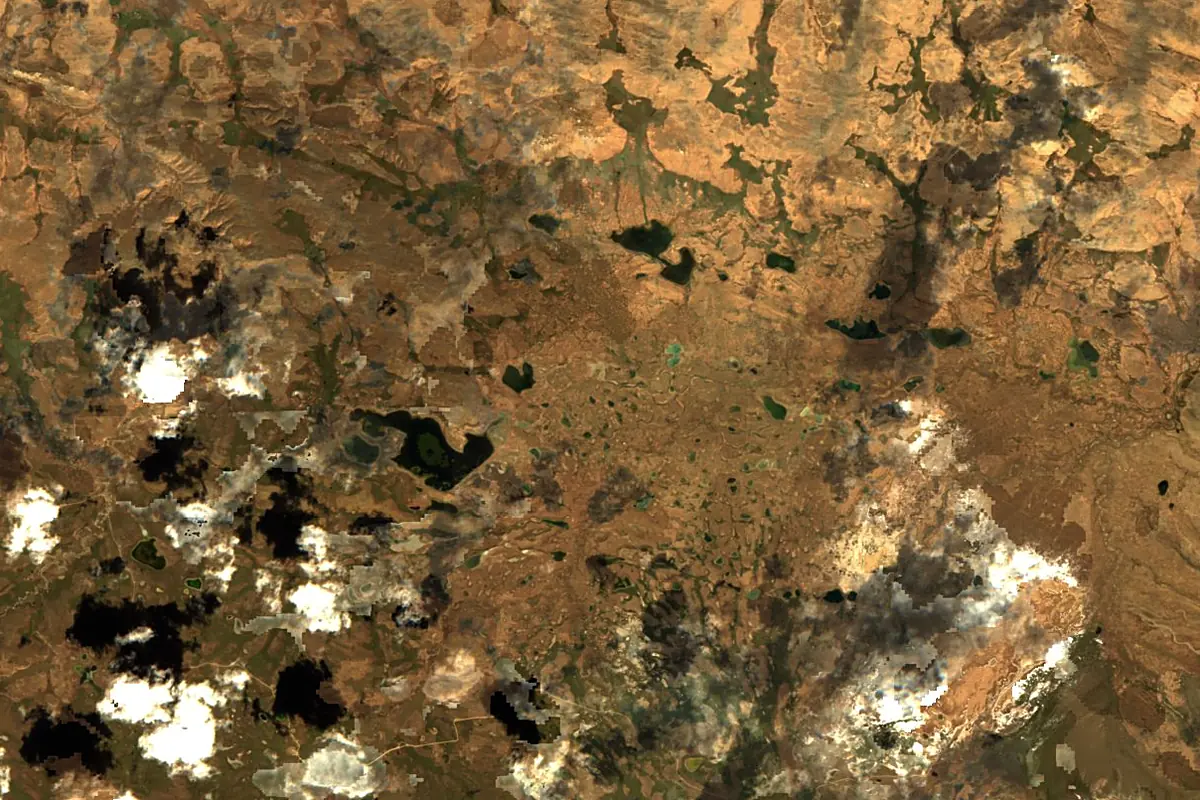
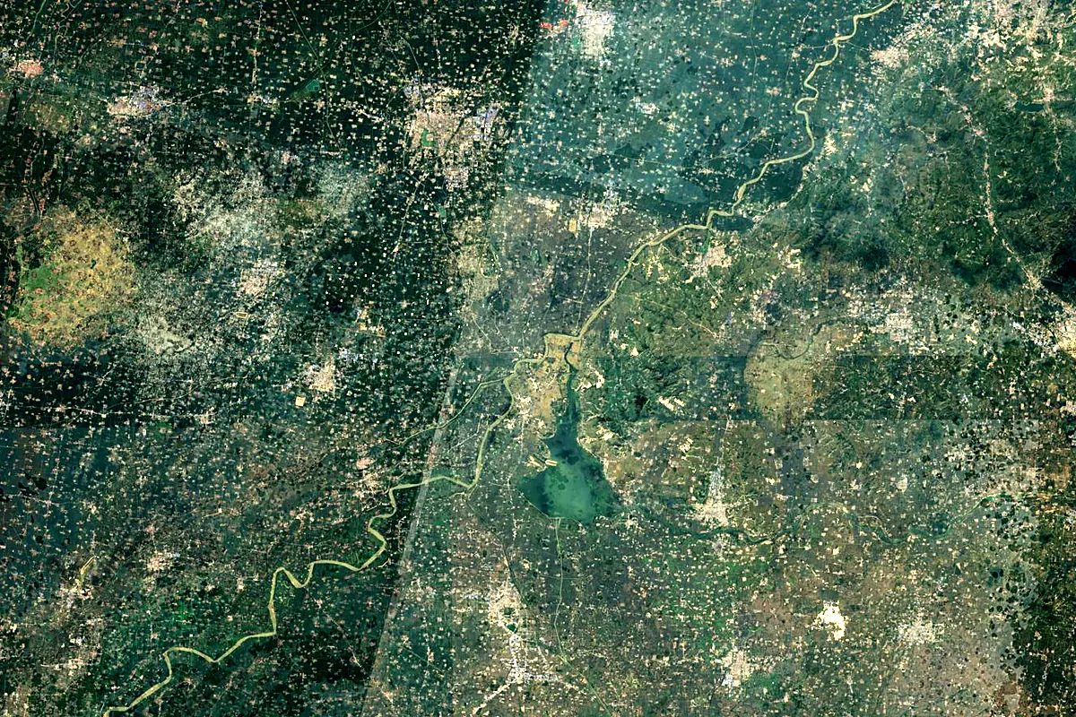
Sentinel-2 cloudless 2016 by EOX IT Services GmbH (contains modified Copernicus Sentinel data 2016), CC BY 4.0. The glowing line is the river as drawn by RiverATLAS.
Photos
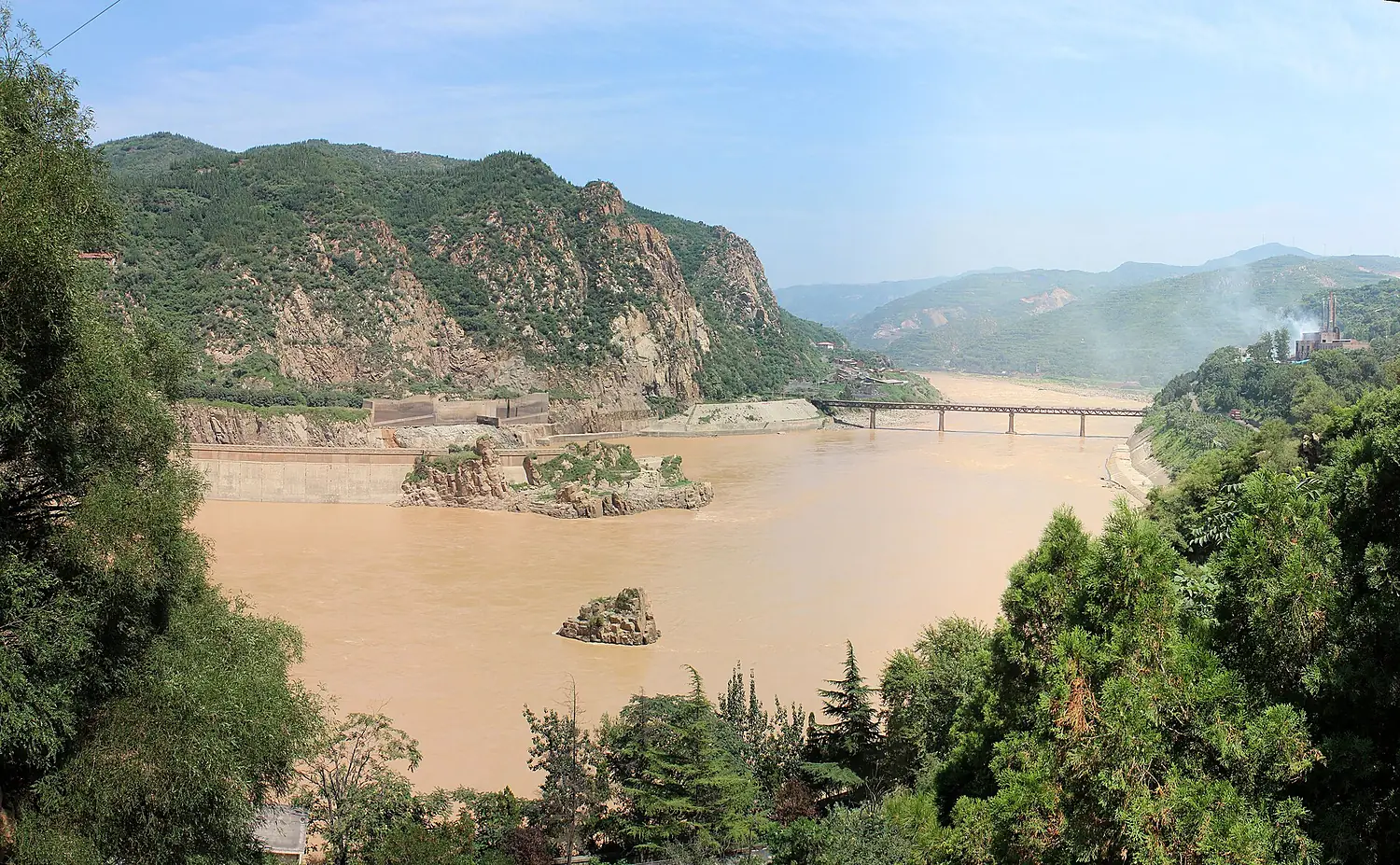
Yellow River in pictures
Tributaries
Where it flows, and what flows into it
Tributaries (23)
Also: Tao River, Jishui, Daxia River, Dawen River, Datong River, Huangshui River, Wuding River, Qin He, Yiluo River, Black River (in Sichuan), Daheihe, Yan River, Jindi He, Sushui He, Wujia River, Zhuanglang He, Zuli He, Daqing River, Dustin He, Qingshui River, Bai River
In the same basin
Where these numbers come from
| Name, length, places | Wikidata (Q7355) · CC0 |
|---|---|
| Course, profile, basin | RiverATLAS v1.0 (HydroATLAS, Linke et al. 2019) · CC BY 4.0 — followed along the river network from the point given by Wikidata |
| Flow | WaterGAP (RiverATLAS), 1971–2000 · CC BY 4.0 |
| Climate along the river | WorldClim (RiverATLAS), 1970–2000 · CC BY 4.0 |
| Towns, bridges, dams | Wikidata · CC0; GeoNames · CC BY 4.0 |
| Along the river | © OpenStreetMap contributors · ODbL |
| Images | EOX Sentinel-2 cloudless 2016 · CC BY 4.0; Wikimedia Commons |
| Our other atlases | Cascadyas, Lakeyas — Wikidata · CC0; © OpenStreetMap contributors · ODbL; GeoNames · CC BY 4.0; HydroLAKES · CC BY 4.0; NOAA OISST |
Every source and licence is on the data sources page.
The family
Do you prefer beaches, lakes, mountains, waterfalls, islands, rivers or canyons?
Same idea, other landscapes: field atlases built on open data, month by month, in seven languages.
 beaches
 Find your beach: sea temperature, sun and swimming month by month.Visit lakes
 Every lake on Earth: water temperature, ice, depth and the shore.Coming soonVisit
  mountains
 Every summit in 3D: summit weather, the 0 °C line, huts and trails.Visit waterfalls
 Every waterfall: height, flow month by month and when it roars.Coming soonVisit
  islands
 Every island from the sea up: size, sea temperature, ferries and 3D.Coming soonVisit
  rivers
 Every river from source to sea: the journey, the flow and the basin in numbers.You are here
 canyons
 Every canyon cut to scale: depth to the floor, rim and floor temperatures, trails and viewpoints.Coming soonVisit