River
Yukon River
3,190 km from source to mouth · Canada and United States.
 Canada and United StatesFlows into Bering Sea1st longest in Canada
In numbers
Length
3,190km
Average flow
6,400m³/s
Basin
832,000km²
Drop
816m
from 648 m to -168 m
Countries
2
The journey
From source to mouth
3,190 km of river and 68 stops on the way: 21 towns and cities on its banks, dams, bridges and the tributaries that feed it.
- 0 kmJuneau Icefieldat 648 m
- 3 kmMarsh Lake95 km²
- 45 kmWhitehorse28,201 people
- 63 kmTakhini Rivertributary
- 129 kmLake Laberge198 km²
- 169 kmTeslin Rivertributary
- 214 kmBig Salmon Rivertributary
- 306 kmCoal Mine Lake0.4 km²
- 417 kmPelly Rivertributary
- 580 kmWhite Rivertributary
- 593 kmStewart Rivertributary
- 630 kmSixty Mile Rivertributary
- 661 kmIndian Rivertributary
- 700 kmKlondike Rivertributary
- 701 kmDawson City1,577 people
- 865 kmEagle Village53 people
- 869 kmEagle83 people
- 885 kmFord Lake0.7 km²
- 911 kmTatonduk Rivertributary
- 946 kmNation Rivertributary
- 998 kmKandik Rivertributary
- 1,022 kmCharley Rivertributary
- 1,036 kmSlaven's Cabin
- 1,127 kmCircle91 people
- 1,168 kmBirch Creektributary
- 1,249 kmFort Yukon428 people
- 1,256 kmPorcupine Rivertributary
- 1,273 kmChristian Rivertributary
- 1,293 kmTeedriinjik Rivertributary
- 1,347 kmHadweenzic Rivertributary
- 1,372 kmBeaver48 people
- 1,390 kmBeaver Creektributary
- 1,396 kmHodzana Rivertributary
- 1,412 kmBig Lake0.8 km²
- 1,415 kmWhite Fox Lake0.6 km²
- 1,481 kmStevens Village37 people
- 1,483 kmTwin Lakes0.5 km²
- 1,497 kmDall Rivertributary
- 1,537 kmRay Rivertributary
- 1,576 kmHess Creektributary
- 1,610 kmLush Lake0.8 km²
- 1,613 kmMinook Creektributary
- 1,614 kmRampart57 people
- 1,718 kmTwelvemile Lake0.4 km²
- 1,734 kmTanana246 people
- 1,744 kmTanana Rivertributary
- 1,754 kmTozitna Rivertributary
- 1,867 kmNowitna Rivertributary
- 1,936 kmMelozitna Rivertributary
- 1,937 kmRuby139 people
- 1,975 kmYuki Rivertributary
- 2,020 kmGalena472 people
- 2,080 kmKoyukuk Rivertributary
- 2,115 kmNulato239 people
- 2,125 kmNulato Rivertributary
- 2,174 kmVillage of Kaltag158 people
- 2,377 kmGrayling210 people
- 2,407 kmAnvik Rivertributary
- 2,410 kmAnvik70 people
- 2,423 kmBonasila Rivertributary
- 2,473 kmHoly Cross176 people
- 2,479 kmInnoko Rivertributary
- 2,594 kmRussian Mission421 people
- 2,682 kmMarshall655 people
- 2,738 kmReindeer Rivertributary
- 2,742 kmAtchuelinguk Rivertributary
- 2,744 kmPilot Station615 people
- 2,783 kmAndreafsky Rivertributary
- 2,807 kmMountain Village621 people
- 3,190 kmBering Seaat -168 m
Water level along the river (RiverATLAS; the height is exaggerated). Towns: GeoNames and Wikidata; bridges, dams and tributaries: Wikidata.
River in the Yukon Territory, Canada and Alaska, United States of America
At the mouth it carries 6,428 m³/s on average: 2.6 Olympic pools every second. It drops from 648 m to -168 m, 0.3 m per kilometre on average. Its basin covers 832,000 km², about the size of NA. 147,000 people live in it. Highest water, with the snowmelt: from July to August; lowest: from January to April. No large dam holds it back: it is one of the world's free-flowing rivers.
Where to start
- WhitehorseLargest city on its banks · 28,201 people
- Whitehorse / Erik Nielsen International Airport (YXY)Nearest airport with scheduled flights, 1 km from the cityCar hire in WhitehorseDiscover Cars · Affiliate link↗
- On the water17 ferry piers, marinas, boat rentals and boat ramps along the river (OpenStreetMap)
- Kayak and canoe4 put-ins and rapids mapped (OpenStreetMap)
- From June to JulyThe best months to visit
Yukon River, month by month
Highest water: from July to August
Lowest water: from January to April. Freezing months (average below −4 °C): from October to March. Melting snow makes up much of its water. Best months to visit: from June to July.
From about 2,600 m³/s in the lowest month to 12,300 m³/s in the highest. An estimate: the monthly flow is modelled from the lowest and highest months of WaterGAP (RiverATLAS, 1971–2000) and the rain and snow along the river (WorldClim). Dams change the real rhythm. The chip is the average air temperature; below it, the month's rain.
Plan the trip
Plan the trip: boat trips, a bed by the river, a car
Some links above are affiliate links: if you book through them we may earn a commission, at no extra cost to you. It never changes what the data on this page says.
The basin
Yukon River: the basin in numbers
830,182 km² of land send their water to this river. This is what lives on it.
- 147,000people live in the basin
- 0/km²people per km²
- 695maverage altitude of the basin
- 320mmof rain a year (basin average)
- -6.3°Caverage air temperature
- 31%protected areas
- 1.4%covered by lakes
- 60%permafrost
- 0.3km³held in reservoirs
What covers the basin
- 24% Forest
RiverATLAS (HydroATLAS v1.0, CC BY 4.0): land cover, people, protected areas, glaciers and dams over the whole basin upstream of the mouth.
Along the river
Yukon River: what you find on the way
- 2Weirs
- 4RapidsFive Finger Rapids, Rink Rapids and 2 more
- 14Boat ramps
- 2Ferry piers
From OpenStreetMap, within 3.0 km of the river. Not mapped is not the same as not there.
Cross-checked with our atlases
Yukon River in our other atlases
What our sister atlases know about the waterfalls on this river, the lakes it flows through, the beaches at its mouth, the mountains where it rises and the islands off its mouth.
 9lakes on its wayLakeyas
 1mountain at the sourcePeakyas
Lakes and reservoirs (9)
Lakes it flows through, by Lakeyas
- Marsh Lakekm 295km²
- Lake Labergekm 115198km²
- Ford Lakekm 7900.7km²
- Big Lakekm 1,2600.8km²
- White Fox Lakekm 1,2620.6km²
- Twin Lakeskm 1,3220.5km²
- Lush Lakekm 1,4360.8km²
- Twelvemile Lakekm 1,5320.4km²
1 more on LakeyasLakeyas is coming soonOpen Lakeyas ↗
Mountains at the source (1)
Within 15 km of the source, by Peakyas
- Mount Lorne13 km away
From space
The source and the mouth, seen from orbit
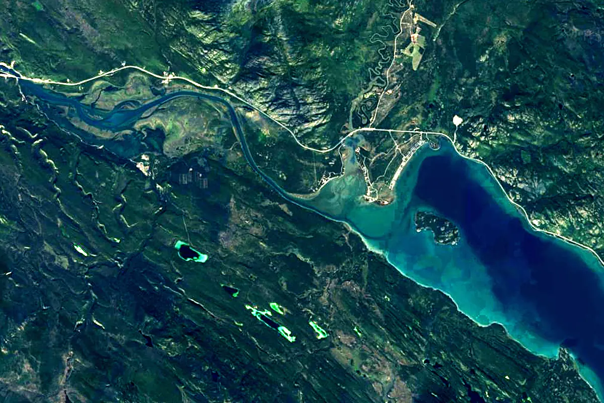
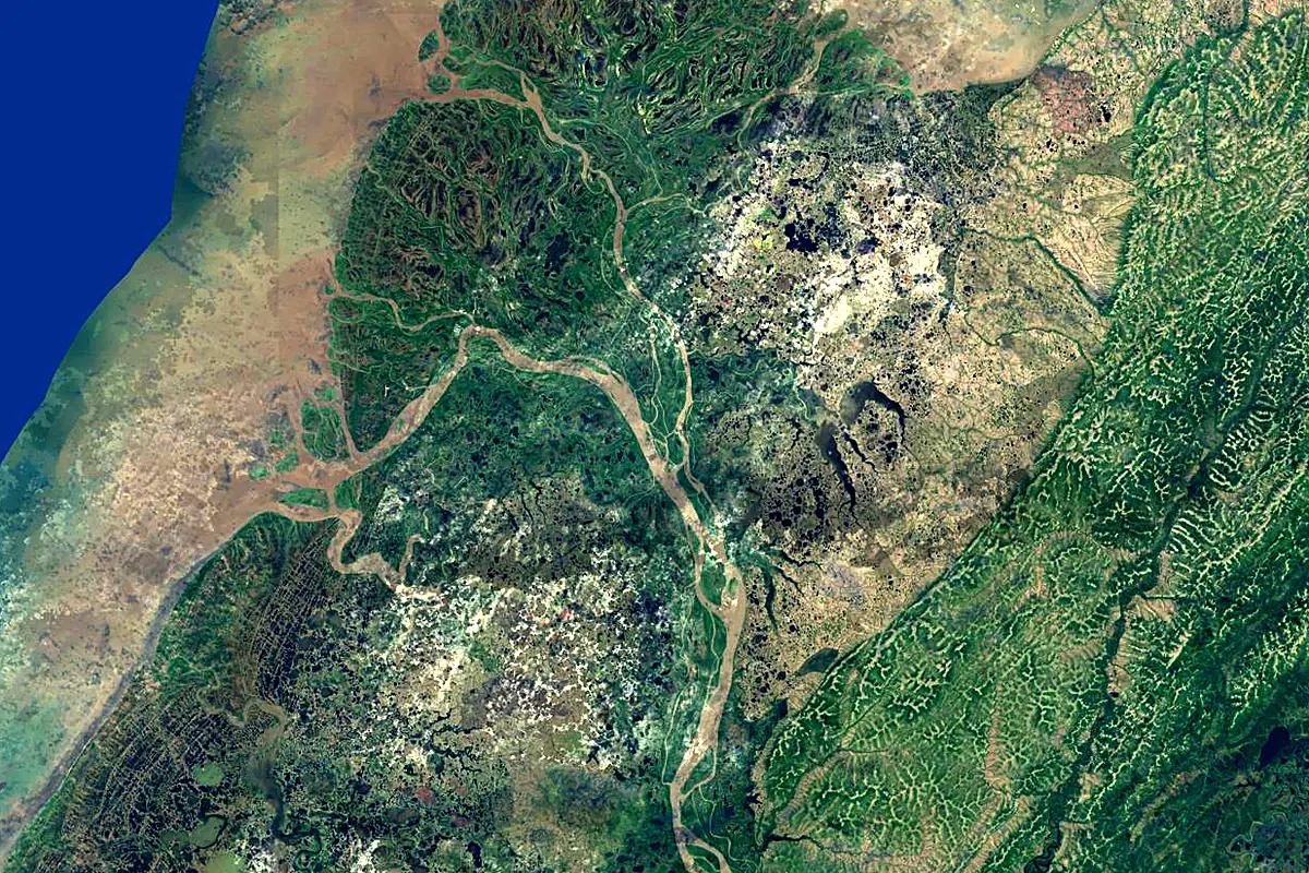
Sentinel-2 cloudless 2016 by EOX IT Services GmbH (contains modified Copernicus Sentinel data 2016), CC BY 4.0. The glowing line is the river as drawn by RiverATLAS.
Photos
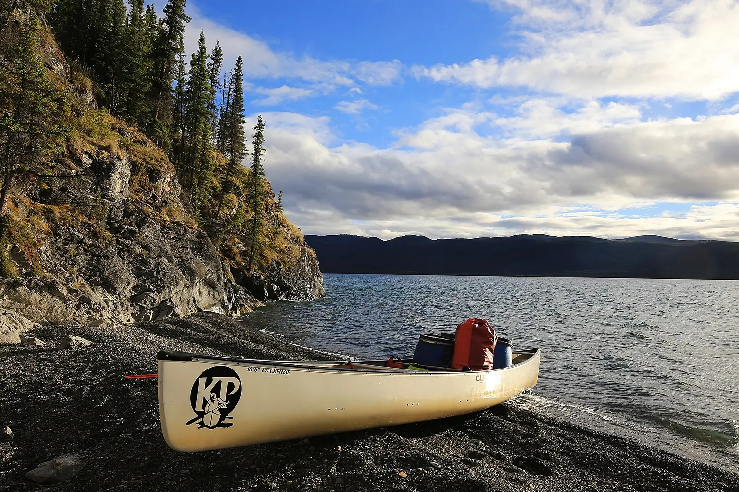
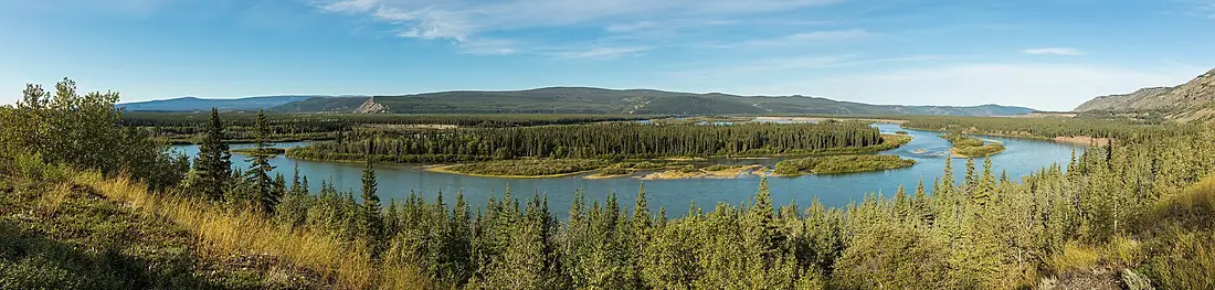
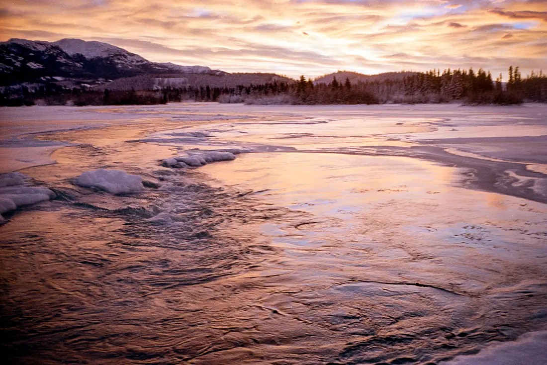
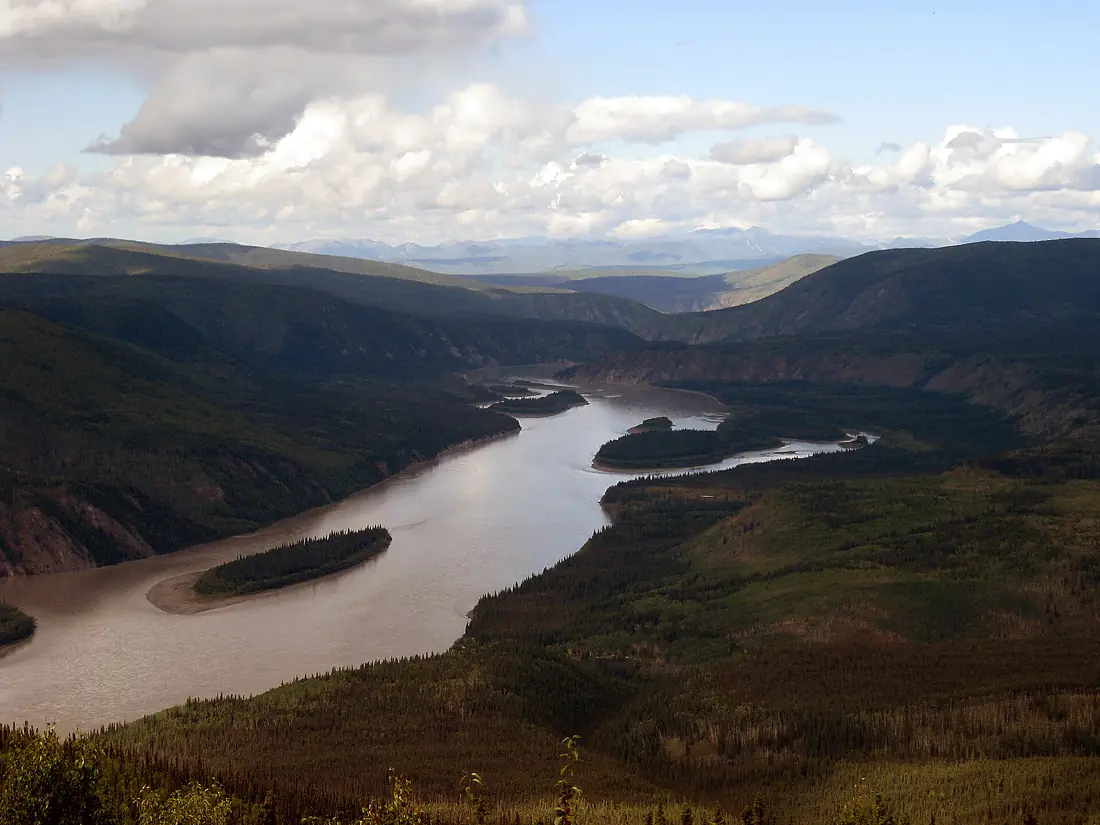
Yukon River in pictures
Tributaries
Where it flows, and what flows into it
Tributaries (47)
United States940 km1.2 m³/sjoins at km 1,556Porcupine RiverCanada916 km650 m³/sjoins at km 1,120Koyukuk RiverUnited States805 km400 m³/sjoins at km 1,856Teslin RiverCanada632 km300 m³/sjoins at km 151Pelly RiverCanada608 km410 m³/sjoins at km 372Klondike RiverCanada168 km62 m³/sjoins at km 625Also: Stewart River, Nowitna River, Innoko River, Fortymile River, White River, Teedriinjik River, Takhini River, Beaver Creek, Indian River, Anvik River, Big Salmon River, Andreafsky River, Birch Creek, Bonasila River, Charley River, Kandik River, Hodzana River, Atchuelinguk River, Christian River, Melozitna River, Sixty Mile River, Dall River, Nation River, Ray River
Where these numbers come from
| Name, length, places | Wikidata (Q104437) · CC0 |
|---|---|
| Course, profile, basin | RiverATLAS v1.0 (HydroATLAS, Linke et al. 2019) · CC BY 4.0 — followed from the source to the mouth given by Wikidata |
| Flow | WaterGAP (RiverATLAS), 1971–2000 · CC BY 4.0 |
| Climate along the river | WorldClim (RiverATLAS), 1970–2000 · CC BY 4.0 |
| Towns, bridges, dams | Wikidata · CC0; GeoNames · CC BY 4.0 |
| Along the river | © OpenStreetMap contributors · ODbL |
| Images | EOX Sentinel-2 cloudless 2016 · CC BY 4.0; Wikimedia Commons |
| Our other atlases | Lakeyas, Peakyas — Wikidata · CC0; © OpenStreetMap contributors · ODbL; GeoNames · CC BY 4.0; HydroLAKES · CC BY 4.0; NOAA OISST |
Every source and licence is on the data sources page.
The family
Do you prefer beaches, lakes, mountains, waterfalls, islands, rivers or canyons?
Same idea, other landscapes: field atlases built on open data, month by month, in seven languages.
 beaches
 Find your beach: sea temperature, sun and swimming month by month.Visit lakes
 Every lake on Earth: water temperature, ice, depth and the shore.Coming soonVisit mountains
 Every summit in 3D: summit weather, the 0 °C line, huts and trails.Visit
  waterfalls
 Every waterfall: height, flow month by month and when it roars.Coming soonVisit
  islands
 Every island from the sea up: size, sea temperature, ferries and 3D.Coming soonVisit
  rivers
 Every river from source to sea: the journey, the flow and the basin in numbers.You are here
 canyons
 Every canyon cut to scale: depth to the floor, rim and floor temperatures, trails and viewpoints.Coming soonVisit