River
Albany River
832 km from source to mouth · Canada.
 CanadaFlows into James Bay
In numbers
Length
832km
Average flow
1,400m³/s
Basin
135,200km²
Drop
366m
from 365 m to -1 m
Country
1
The journey
From source to mouth
832 km of river and 31 stops on the way: 0 towns and cities on its banks, dams, bridges and the tributaries that feed it.
- 0 kmLake St. Josephat 365 m
- 0 kmLake St. Joseph506 km²
- 14 kmOsnaburgh Lake43 km²
- 27 kmAtikokiwam Lake19 km²
- 43 kmKagami Falls
- 52 kmAchapi Lake12 km²
- 64 kmDe Palma Lake4.3 km²
- 69 kmRorabeck Lake0.6 km²
- 105 kmSnowflake Lake3.2 km²
- 117 kmPatte Lake2.5 km²
- 119 kmUpper Eskakwa Falls
- 123 kmEskakwa Falls
- 126 kmSnake Falls
- 127 kmAnger Lake16 km²
- 137 kmHowells Lake3.6 km²
- 153 kmMiminiska Lake59 km²
- 153 kmMiminiska Falls
- 163 kmGumuly Lake1.0 km²
- 176 kmPetawanga Lake38 km²
- 187 kmKawitos Lake12 km²
- 197 kmEabamet Lake93 km²
- 214 kmTriangular Lake36 km²
- 224 kmSchist Lake3.3 km²
- 229 kmAbazotikichuan Lake11 km²
- 263 kmMakokibatan Lake60 km²
- 282 kmWesterby Lake2.1 km²
- 308 kmKagiami Falls
- 320 kmTom Flett Falls
- 325 kmMartin Falls
- 390 kmOgoki Rivertributary
- 517 kmKenogami Rivertributary
- 534 kmHenley Rivertributary
- 832 kmJames Bayat -1 m
Water level along the river (RiverATLAS; the height is exaggerated). Towns: GeoNames and Wikidata; bridges, dams and tributaries: Wikidata.
River in Ontario, Canada
At the mouth it carries 1,420 m³/s on average: an Olympic pool every 1.8 seconds. It drops from 365 m to -1 m, 0.4 m per kilometre on average. Its basin covers 135,200 km², about the size of GR. 9,442 people live in it. Highest water, with the snowmelt: from June to August; lowest: from January to April. Its dams hold back little of its water (3.0% of a year's flow).
Where to start
- KashechewanLargest city on its banks · 3,309 people
- Moosonee Airport (YMO)Nearest airport with scheduled flights, 132 km from the cityCar hire at YTS airport (Timmins)Discover Cars · Affiliate link↗
- Kayak and canoe182 put-ins and rapids mapped (OpenStreetMap)
- From June to AugustThe best months to visit
Albany River, month by month
Highest water: from June to August
Lowest water: from January to April. Freezing months (average below −4 °C): from November to March. Melting snow makes up much of its water. Best months to visit: from June to August.
From about 980 m³/s in the lowest month to 1,500 m³/s in the highest. An estimate: the monthly flow is modelled from the lowest and highest months of WaterGAP (RiverATLAS, 1971–2000) and the rain and snow along the river (WorldClim). Dams change the real rhythm. The chip is the average air temperature; below it, the month's rain.
Plan the trip
Plan the trip: boat trips, a bed by the river, a car
Some links above are affiliate links: if you book through them we may earn a commission, at no extra cost to you. It never changes what the data on this page says.
The basin
Albany River: the basin in numbers
134,726 km² of land send their water to this river. This is what lives on it.
- 9,442people live in the basin
- 0/km²people per km²
- 263maverage altitude of the basin
- 741mmof rain a year (basin average)
- -0.5°Caverage air temperature
- 10%protected areas
- 7.5%covered by lakes
- 1%permafrost
- 1.2km³held in reservoirs
What covers the basin
- 74% Forest
RiverATLAS (HydroATLAS v1.0, CC BY 4.0): land cover, people, protected areas, glaciers and dams over the whole basin upstream of the mouth.
Along the river
Albany River: what you find on the way
- 182RapidsFrenchmans Rapids and 181 more
From OpenStreetMap, within 2.5 km of the river. Not mapped is not the same as not there.
Cross-checked with our atlases
Albany River in our other atlases
What our sister atlases know about the waterfalls on this river, the lakes it flows through, the beaches at its mouth, the mountains where it rises and the islands off its mouth.
 8waterfalls on the riverCascadyas
 20lakes on its wayLakeyas
Waterfalls (8)
On the river, by Cascadyas
- Kagami Fallskm 45
- Upper Eskakwa Fallskm 124
- Eskakwa Fallskm 128
- Snake Fallskm 131
- Miminiska Fallskm 160
- Kagiami Fallskm 320
- Tom Flett Fallskm 333
- Martin Fallskm 338
Cascadyas is coming soonOpen Cascadyas ↗
Lakes and reservoirs (20)
Lakes it flows through, by Lakeyas
- Lake St. Josephkm 0506km²
- Osnaburgh Lakekm 1443km²
- Atikokiwam Lakekm 2819km²
- Miminiska Lakekm 15959km²
- Petawanga Lakekm 18338km²
- Eabamet Lakekm 20593km²
- Triangular Lakekm 22336km²
- Makokibatan Lakekm 27360km²
12 more on LakeyasLakeyas is coming soonOpen Lakeyas ↗
From space
The source and the mouth, seen from orbit
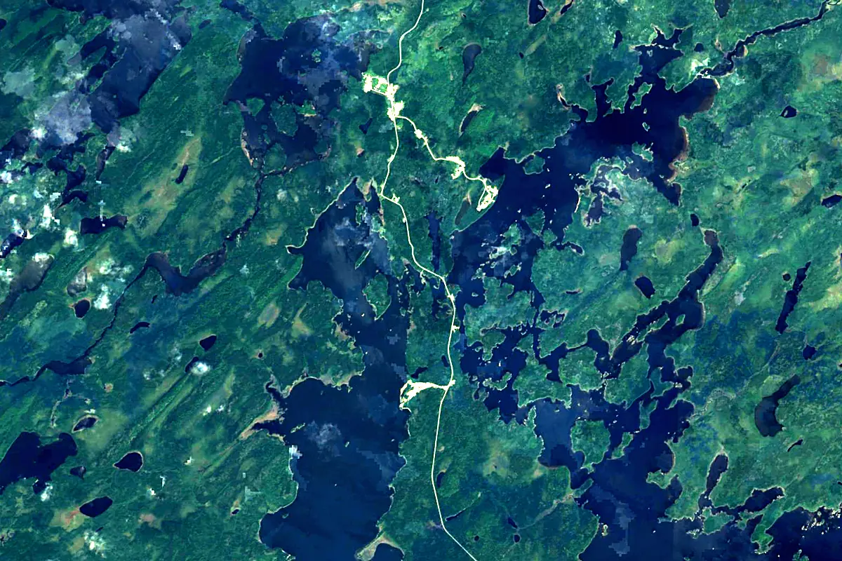
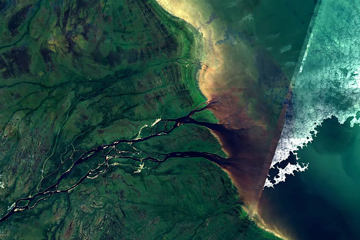
Sentinel-2 cloudless 2016 by EOX IT Services GmbH (contains modified Copernicus Sentinel data 2016), CC BY 4.0. The glowing line is the river as drawn by RiverATLAS.
Photos
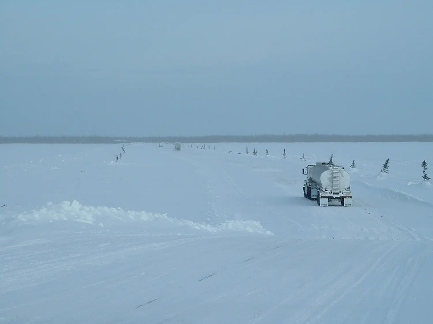
Albany River in pictures
Tributaries
Where it flows, and what flows into it
Tributaries (6)
Also: Kenogami River, Ogoki River, Cat River, Pagashi River, Cheepay River, Henley River
Nearby
Rivers nearby
Canada748 km630 m³/s89 km awayAbitibi RiverCanada540 km320 m³/s143 km awayHarricana RiverCanada533 km570 m³/s178 km awayRivière RupertCanada763 km900 m³/s217 km awayRivière NottawayCanada225 km1,200 m³/s219 km awayRivière EastmainCanada756 km1,000 m³/s214 km awayWinisk RiverCanada600 km690 m³/s406 km awayGreat Whale RiverCanada726 km680 m³/s416 km awayWhere these numbers come from
| Name, length, places | Wikidata (Q1241991) · CC0 |
|---|---|
| Course, profile, basin | RiverATLAS v1.0 (HydroATLAS, Linke et al. 2019) · CC BY 4.0 — followed from the source to the mouth given by Wikidata |
| Flow | WaterGAP (RiverATLAS), 1971–2000 · CC BY 4.0 |
| Climate along the river | WorldClim (RiverATLAS), 1970–2000 · CC BY 4.0 |
| Towns, bridges, dams | Wikidata · CC0; GeoNames · CC BY 4.0 |
| Along the river | © OpenStreetMap contributors · ODbL |
| Images | EOX Sentinel-2 cloudless 2016 · CC BY 4.0; Wikimedia Commons |
| Our other atlases | Cascadyas, Lakeyas — Wikidata · CC0; © OpenStreetMap contributors · ODbL; GeoNames · CC BY 4.0; HydroLAKES · CC BY 4.0; NOAA OISST |
Every source and licence is on the data sources page.
The family
Do you prefer beaches, lakes, mountains, waterfalls, islands, rivers or canyons?
Same idea, other landscapes: field atlases built on open data, month by month, in seven languages.
 beaches
 Find your beach: sea temperature, sun and swimming month by month.Visit lakes
 Every lake on Earth: water temperature, ice, depth and the shore.Coming soonVisit
  mountains
 Every summit in 3D: summit weather, the 0 °C line, huts and trails.Visit waterfalls
 Every waterfall: height, flow month by month and when it roars.Coming soonVisit
  islands
 Every island from the sea up: size, sea temperature, ferries and 3D.Coming soonVisit
  rivers
 Every river from source to sea: the journey, the flow and the basin in numbers.You are here
 canyons
 Every canyon cut to scale: depth to the floor, rim and floor temperatures, trails and viewpoints.Coming soonVisit