River
Amu Darya
2,620 km from source to mouth · 4 countries.
 Uzbekistan, Tajikistan, Turkmenistan and AfghanistanFlows into South Aral Sea1st longest in Uzbekistan
In numbers
Length
2,620km
Average flow
1,400m³/s
Basin
309,000km²
Drop
4,176m
from 4,205 m to 29 m
Countries
4
The journey
From source to mouth
2,620 km of river and 32 stops on the way: 19 towns and cities on its banks, dams, bridges and the tributaries that feed it.
- 0 kmPamir Riverat 4,205 m
- 280 kmIshqoshim26,000 people
- 373 kmKhorugh30,500 people
- 454 kmKōl-e Yārkh0.4 km²
- 779 kmChubek19,563 people
- 797 kmYangī Qal‘ah11,100 people
- 857 kmChīchkah8,792 people
- 869 kmDasht-e Archī8,263 people
- 882 kmPanj8,019 people
- 912 kmḨalqah Kōl0.9 km²
- 916 kmQarāwul24,544 people
- 965 kmVakhsh Rivertributary
- 965 kmPanj Rivertributary
- 981 kmKunduz Rivertributary
- 1,009 kmKofarnihon Rivertributary
- 1,075 kmOzero Tuzlakkul'0.9 km²
- 1,082 kmAfghanistan–Uzbekistan Friendship Bridge
- 1,094 kmSurxondaryotributary
- 1,095 kmTirmiz182,800 people
- 1,134 kmSherabad Rivertributary
- 1,202 kmpipeline bridge in Wilaya Balch – Köýtendag Distrikt
- 1,225 kmQarqīn15,018 people
- 1,307 kmDostluk13,655 people
- 1,321 kmAtamurat-Kerkichi Bridge
- 1,322 kmKerkiçi14,996 people
- 1,322 kmKerki33,242 people
- 1,358 kmHojambaz13,485 people
- 1,626 kmSeydi17,762 people
- 1,779 kmBirata13,777 people
- 1,853 kmAmu Daria River Bridge
- 1,912 kmGazojak21,021 people
- 1,919 kmDruzhba16,800 people
- 2,141 kmNukus332,500 people
- 2,620 kmSouth Aral Seaat 29 m
Water level along the river (RiverATLAS; the height is exaggerated). Towns: GeoNames and Wikidata; bridges, dams and tributaries: Wikidata.
Major river in Central Asia
At the mouth it carries 1,400 m³/s on average: an Olympic pool every 1.8 seconds. It drops from 4,205 m to 29 m, 1.6 m per kilometre on average. Its basin covers 309,000 km², about the size of PL. 23.5 million people live in it. Highest water: from March to May; lowest: from August to November. Dams and reservoirs hold back a large share of its water (29% of a year's flow).
Where to start
- NukusLargest city on its banks · 332,500 people
- Nukus International Airport (NCU)Nearest airport with scheduled flights, 4 km from the cityCar hire in SamarkandDiscover Cars · Affiliate link↗
- On the water14 ferry piers, marinas, boat rentals and boat ramps along the river (OpenStreetMap)
- From May to SeptemberThe best months to visit
Amu Darya, month by month
Highest water: from March to May
Lowest water: from August to November. Best months to visit: from May to September.
From about 350 m³/s in the lowest month to 4,500 m³/s in the highest. An estimate: the monthly flow is modelled from the lowest and highest months of WaterGAP (RiverATLAS, 1971–2000) and the rain and snow along the river (WorldClim). Dams change the real rhythm. The chip is the average air temperature; below it, the month's rain.
Plan the trip
Plan the trip: boat trips, a bed by the river, a car
Some links above are affiliate links: if you book through them we may earn a commission, at no extra cost to you. It never changes what the data on this page says.
The basin
Amu Darya: the basin in numbers
455,861 km² of land send their water to this river. This is what lives on it.
- 23.5millionpeople live in the basin
- 52/km²people per km²
- 1,856maverage altitude of the basin
- 412mmof rain a year (basin average)
- 8.2°Caverage air temperature
- 6%protected areas
- 0.6%covered by lakes
- 1%glaciers
- 12%permafrost
- 15km³held in reservoirs
What covers the basin
- 13% Cropland
- 45% Pasture
- 2% Towns and cities
- 1% Ice
RiverATLAS (HydroATLAS v1.0, CC BY 4.0): land cover, people, protected areas, glaciers and dams over the whole basin upstream of the mouth.
Along the river
Amu Darya: what you find on the way
- 16WeirsTakhiatash dam and 15 more
- 5Locks
- 22WaterfallsVrang water falls, Waterfall, visible from Tajikistan, Nasta and 19 more
- 12Ferry piersTermiz porti, Qıpshaq, Khojeyli Marina and 9 more
- 1Marinas
- 1River beachesZaton
From OpenStreetMap, within 2.8 km of the river. Not mapped is not the same as not there.
Cross-checked with our atlases
Amu Darya in our other atlases
What our sister atlases know about the waterfalls on this river, the lakes it flows through, the beaches at its mouth, the mountains where it rises and the islands off its mouth.
 3lakes on its wayLakeyas
 7mountains at the sourcePeakyas
Lakes and reservoirs (3)
Lakes it flows through, by Lakeyas
- Kōl-e Yārkhkm 4510.4km²
- Ḩalqah Kōlkm 9060.9km²
- Ozero Tuzlakkul'km 1,0690.9km²
Lakeyas is coming soonOpen Lakeyas ↗
Mountains at the source (7)
Within 15 km of the source, by Peakyas
- Takakamar14 km away1,347m
- Takhtakuvi4.7 km away817m
- Kŭhi Burutoy5.7 km away640m
- Kōh-e Sūrbaytal6.4 km away
- Bugor Kunduz6.9 km away
- Bugor Chaldavar10 km away
- Bugor Giyena10 km away
From space
The source and the mouth, seen from orbit
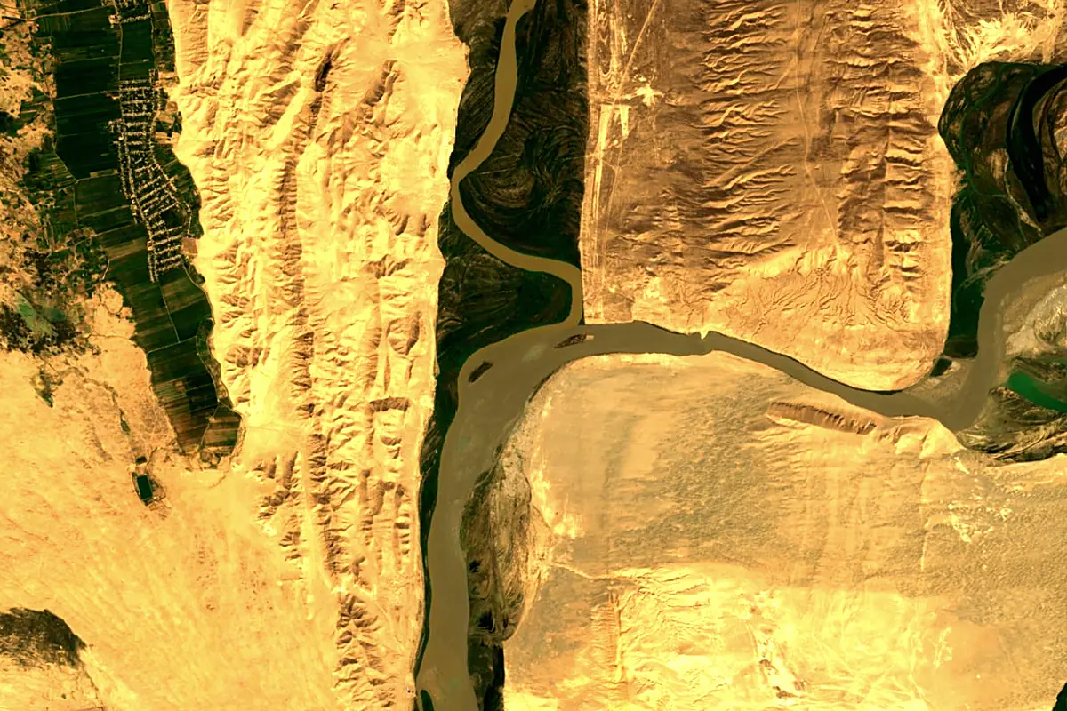
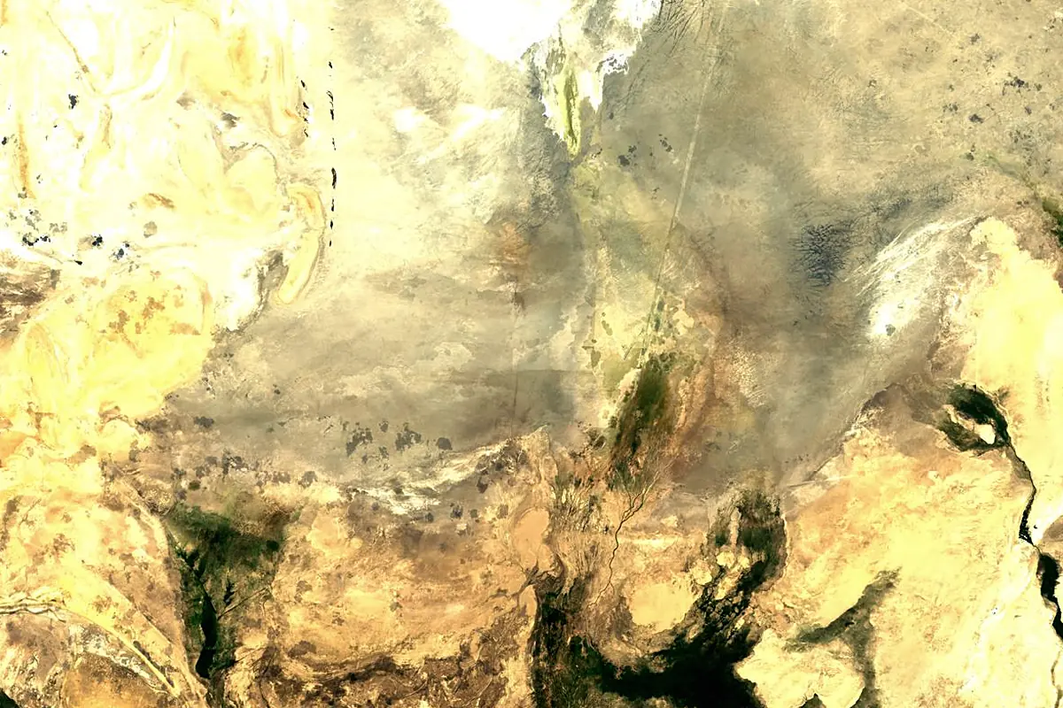
Sentinel-2 cloudless 2016 by EOX IT Services GmbH (contains modified Copernicus Sentinel data 2016), CC BY 4.0. The glowing line is the river as drawn by RiverATLAS.
Photos
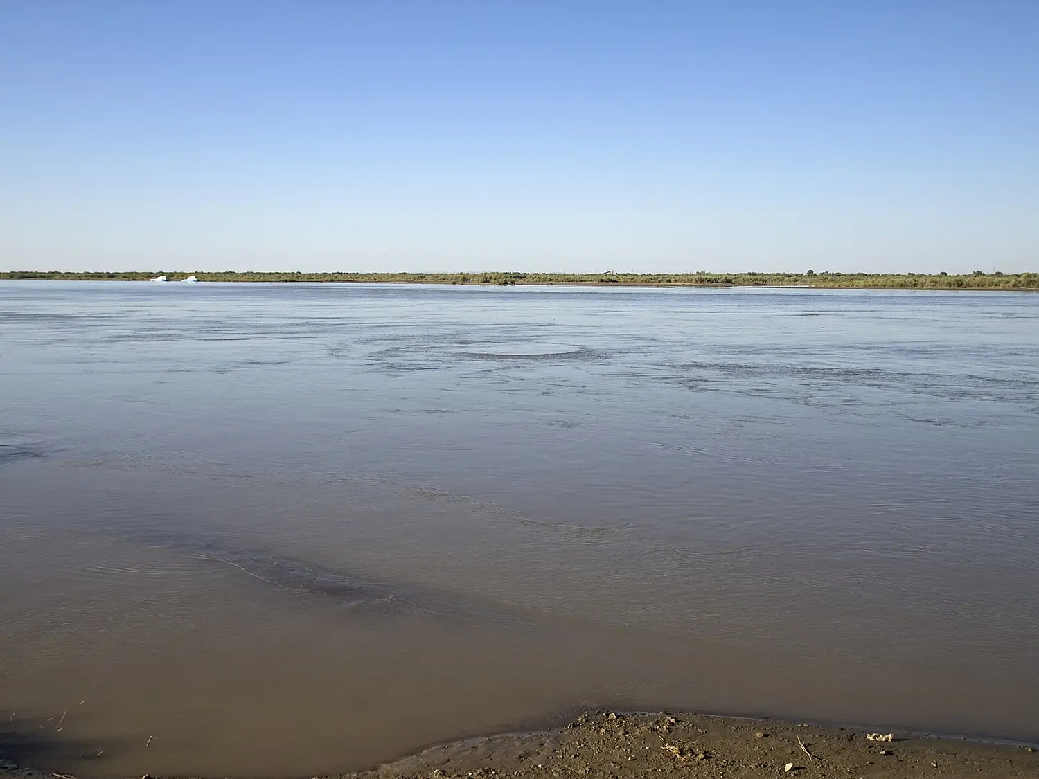
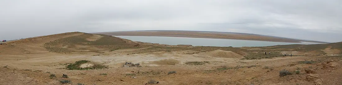
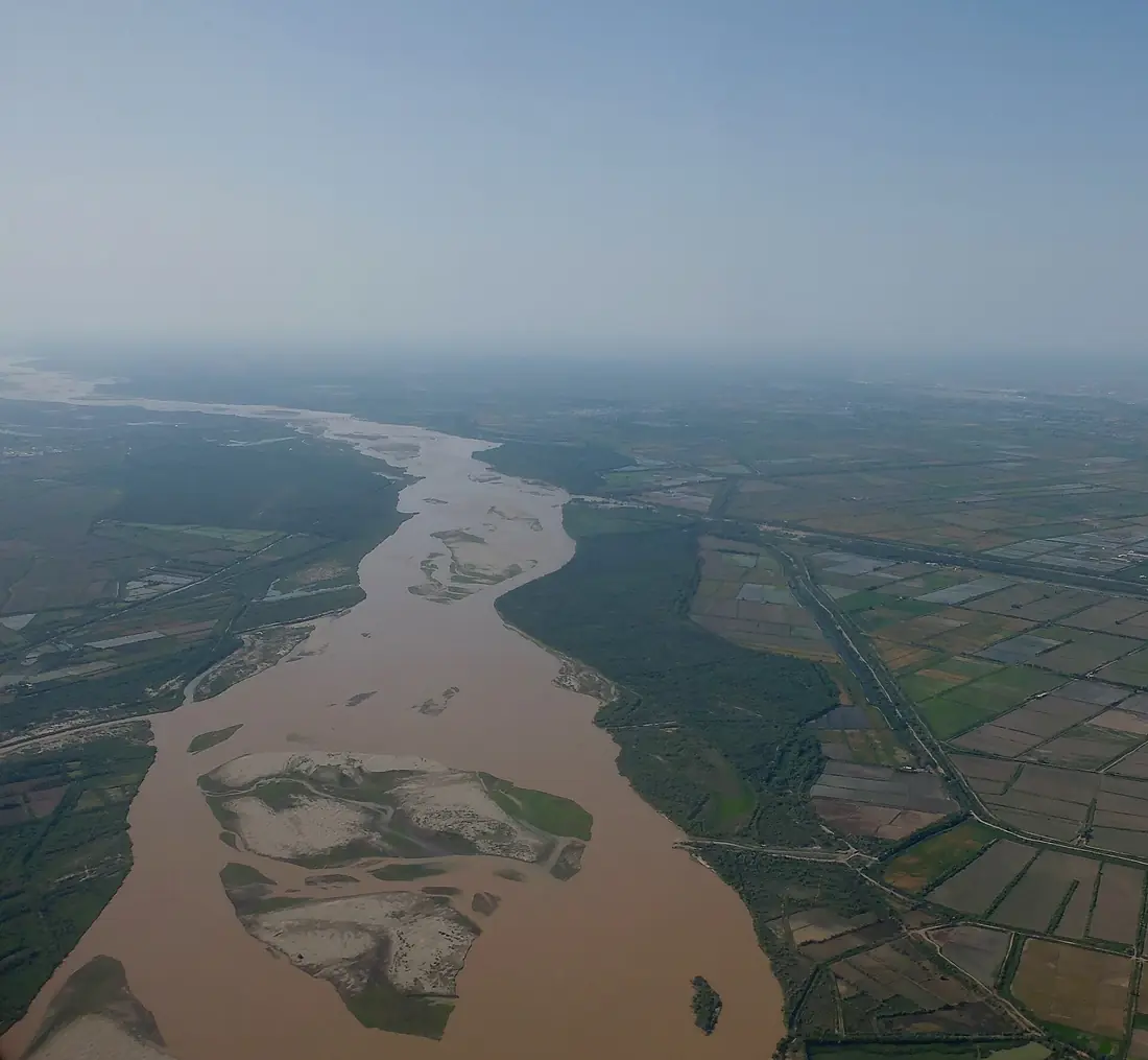
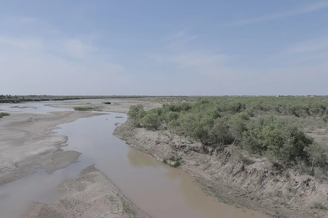
Amu Darya in pictures
Tributaries
Where it flows, and what flows into it
Tributaries (8)
Tajikistan921 km1,000 m³/sjoins at km 960ZeravshanUzbekistan877 km160 m³/sVakhsh RiverTajikistan524 km160 m³/sjoins at km 960Kunduz RiverAfghanistan420 km160 m³/sjoins at km 975Kofarnihon RiverTajikistan387 km160 m³/sjoins at km 1,003SurxondaryoUzbekistan175 km66 m³/sjoins at km 1,088Also: Sherabad River, Khulm River
 Kazakhstan
Where these numbers come from
| Name, length, places | Wikidata (Q8493) · CC0 |
|---|---|
| Course, profile, basin | RiverATLAS v1.0 (HydroATLAS, Linke et al. 2019) · CC BY 4.0 — followed from the source to the mouth given by Wikidata |
| Flow | WaterGAP (RiverATLAS), 1971–2000 · CC BY 4.0 |
| Climate along the river | WorldClim (RiverATLAS), 1970–2000 · CC BY 4.0 |
| Towns, bridges, dams | Wikidata · CC0; GeoNames · CC BY 4.0 |
| Along the river | © OpenStreetMap contributors · ODbL |
| Images | EOX Sentinel-2 cloudless 2016 · CC BY 4.0; Wikimedia Commons |
| Our other atlases | Lakeyas, Peakyas — Wikidata · CC0; © OpenStreetMap contributors · ODbL; GeoNames · CC BY 4.0; HydroLAKES · CC BY 4.0; NOAA OISST |
Every source and licence is on the data sources page.
The family
Do you prefer beaches, lakes, mountains, waterfalls, islands, rivers or canyons?
Same idea, other landscapes: field atlases built on open data, month by month, in seven languages.
 beaches
 Find your beach: sea temperature, sun and swimming month by month.Visit lakes
 Every lake on Earth: water temperature, ice, depth and the shore.Coming soonVisit mountains
 Every summit in 3D: summit weather, the 0 °C line, huts and trails.Visit
  waterfalls
 Every waterfall: height, flow month by month and when it roars.Coming soonVisit
  islands
 Every island from the sea up: size, sea temperature, ferries and 3D.Coming soonVisit
  rivers
 Every river from source to sea: the journey, the flow and the basin in numbers.You are here
 canyons
 Every canyon cut to scale: depth to the floor, rim and floor temperatures, trails and viewpoints.Coming soonVisit