River
Daugava
1,020 km from source to mouth · Latvia, Russia and Belarus.

 Latvia, Russia and BelarusFlows into Gulf of Riga1st longest in Latvia
In numbers
Length
1,020km
Average flow
680m³/s
Basin
87,900km²
Drop
215m
from 214 m to -1 m
Countries
3
The journey
From source to mouth
1,020 km of river and 68 stops on the way: 7 towns and cities on its banks, dams, bridges and the tributaries that feed it.
- 0 kmValdai Hillsat 214 m
- 0 kmOzero Marinitsa0.3 km²
- 8 kmOkhvat1.1 km²
- 73 kmKachevitskoe0.3 km²
- 98 kmOzero Verezhun6.1 km²
- 120 kmVelesatributary
- 146 kmToropatributary
- 192 kmMezhatributary
- 265 kmUsvyachatributary
- 268 kmKasplyatributary
- 316 kmLužasniankatributary
- 329 kmLučosatributary
- 329 kmVićbatributary
- 330 kmVitebsk357,899 people
- 348 kmŠevina0.4 km²
- 349 kmShevinkatributary
- 350 kmBielaje0.5 km²
- 365 kmOzero Sosna0.6 km²
- 393 kmBikložatributary
- 398 kmKryvinkatributary
- 431 kmUlatributary
- 435 kmKaraniova0.3 km²
- 439 kmVozera Usveja1.9 km²
- 460 kmObaĺtributary
- 464 kmSosnіcatributary
- 479 kmPolatsak79,105 people
- 483 kmPalata Rivertributary
- 491 kmNavapolack94,666 people
- 493 kmOzero Ljuchovo0.4 km²
- 497 kmViellie0.9 km²
- 505 kmUšačatributary
- 507 kmOzero Solonets0.3 km²
- 514 kmNačatributary
- 563 kmDrysatributary
- 568 kmVužycatributary
- 579 kmSarjatributary
- 584 kmVoltatributary
- 587 kmRosicatributary
- 587 kmMeritsatributary
- 589 kmViatatributary
- 598 kmDrujkatributary
- 606 kmIndricatributary
- 623 kmKrāslava6,678 people
- 642 kmPoguļankatributary
- 685 kmGubiščes ezers0.3 km²
- 690 kmLaucesatributary
- 690 kmŠuņezers0.7 km²
- 708 kmKoša ezers0.5 km²
- 710 kmLīksnatributary
- 737 kmEglonatributary
- 760 kmDubnatributary
- 771 kmLaukezers0.5 km²
- 775 kmNeretatributary
- 782 kmRadžu ūdenskrātuve1.8 km²
- 793 kmVīķu ezers0.8 km²
- 800 kmAiviekstetributary
- 818 kmStaburags
- 834 kmPērsetributary
- 839 kmAizkraukle6,626 people
- 841 kmPļaviņas Reservoir25 km²
- 885 kmĶegums Reservoir15 km²
- 896 kmOgre Rivertributary
- 914 kmSalaspils17,817 people
- 919 kmRiga Reservoir36 km²
- 934 kmRiga742,572 people
- 943 kmĶīšezers16 km²
- 946 kmHapaka grāvistributary
- 946 kmMārupītetributary
- 946 kmVecdaugava1.1 km²
- 1,020 kmGulf of Rigaat -1 m
Water level along the river (RiverATLAS; the height is exaggerated). Towns: GeoNames and Wikidata; bridges, dams and tributaries: Wikidata.
River in Latvia, Belarus and Russia
At the mouth it carries 678 m³/s on average: an Olympic pool every 3.7 seconds. It drops from 214 m to -1 m, 0.2 m per kilometre on average. Its basin covers 87,900 km², about the size of RS. 2.3 million people live in it. Highest water: from April to June; lowest: from January to March. Its dams hold back little of its water (4.3% of a year's flow).
Where to start
- RigaLargest city on its banks · 742,572 people
- Riga International Airport (RIX)Nearest airport with scheduled flights, 9 km from the cityCar hire at RIX airport (Riga)Discover Cars · Affiliate link↗
- On the water84 ferry piers, marinas, boat rentals and boat ramps along the river (OpenStreetMap)
- Kayak and canoe10 put-ins and rapids mapped (OpenStreetMap)
- From May to AugustThe best months to visit
Daugava, month by month
Highest water: from April to June
Lowest water: from January to March. Freezing months (average below −4 °C): from December to February. Best months to visit: from May to August.
From about 430 m³/s in the lowest month to 1,800 m³/s in the highest. An estimate: the monthly flow is modelled from the lowest and highest months of WaterGAP (RiverATLAS, 1971–2000) and the rain and snow along the river (WorldClim). Dams change the real rhythm. The chip is the average air temperature; below it, the month's rain.
Plan the trip
Plan the trip: boat trips, a bed by the river, a car
Some links above are affiliate links: if you book through them we may earn a commission, at no extra cost to you. It never changes what the data on this page says.
The basin
Daugava: the basin in numbers
85,612 km² of land send their water to this river. This is what lives on it.
- 2.3millionpeople live in the basin
- 28/km²people per km²
- 161maverage altitude of the basin
- 646mmof rain a year (basin average)
- 5.1°Caverage air temperature
- 13%protected areas
- 2.4%covered by lakes
- 1.0km³held in reservoirs
What covers the basin
- 52% Forest
- 23% Cropland
- 10% Pasture
- 1% Towns and cities
RiverATLAS (HydroATLAS v1.0, CC BY 4.0): land cover, people, protected areas, glaciers and dams over the whole basin upstream of the mouth.
Along the river
Daugava: what you find on the way
- 33Weirs
- 2Locks
- 11WaterfallsGļinovkas krāce, Pilāta krāce, Baltā krāce and 8 more
- 8RapidsGļinovkas krāce, Gārdes krāce, Pilāta krāce and 5 more
- 2Canoe put-ins
- 41Boat ramps
- 19Ferry piersKuģītis "Dinaburga", Pārceltuve Jaunjelgava - Skrīveri, Radio iela and 16 more
- 18MarinasAAGENOSTA, Ķīpsalas jahtu osta, Kīpsalas Jahtu Osta and 15 more
- 13River beachesCity beach, Zelta pludmale, Šuņezera pludmale and 10 more
From OpenStreetMap, within 2.4 km of the river. Not mapped is not the same as not there.
Cross-checked with our atlases
Daugava in our other atlases
What our sister atlases know about the waterfalls on this river, the lakes it flows through, the beaches at its mouth, the mountains where it rises and the islands off its mouth.
 1waterfall on the riverCascadyas
 23lakes on its wayLakeyas
 2beaches at the mouth and on the banksCoastya
 2islands off the mouthIslandyas
Waterfalls (1)
On the river, by Cascadyas
- Staburagskm 782
Cascadyas is coming soonOpen Cascadyas ↗
Lakes and reservoirs (23)
Lakes it flows through, by Lakeyas
- Okhvatkm 71.1km²
- Ozero Verezhunkm 946.1km²
- Ševinakm 3330.4km²
- Ozero Sosnakm 3490.6km²
- Gubiščes ezerskm 655 · 2 m deep0.3km²
- Pļaviņas Reservoirkm 804 · 47 m deep25km²
- Riga Reservoirkm 878 · 17 m deep36km²
- Ķīšezerskm 902 · 4 m deep16km²
15 more on LakeyasLakeyas is coming soonOpen Lakeyas ↗
Beaches (2)
At the mouth (25 km) and on the banks, by Coastya
- Vecaki beach5.0 km away18.6°C
- Lilastes Pludmale22 km away18.6°C
Islands off the mouth (2)
Within 30 km of the mouth, by Islandyas
- Buļļu sala5.0 km away13km²
- Mīlestības Saliņa1.4 km away
Islandyas is coming soonOpen Islandyas ↗
From space
The source and the mouth, seen from orbit
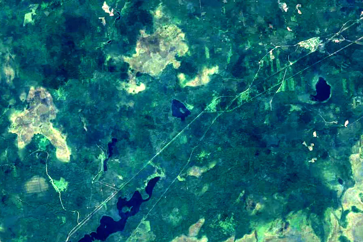
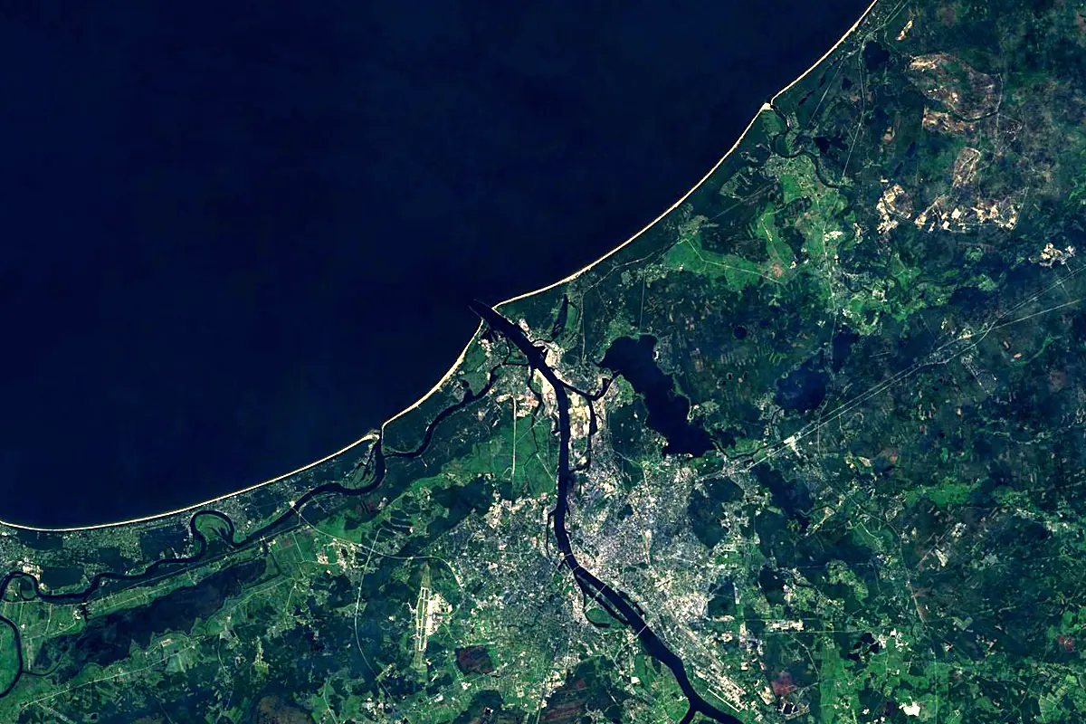
Sentinel-2 cloudless 2016 by EOX IT Services GmbH (contains modified Copernicus Sentinel data 2016), CC BY 4.0. The glowing line is the river as drawn by RiverATLAS.
Photos
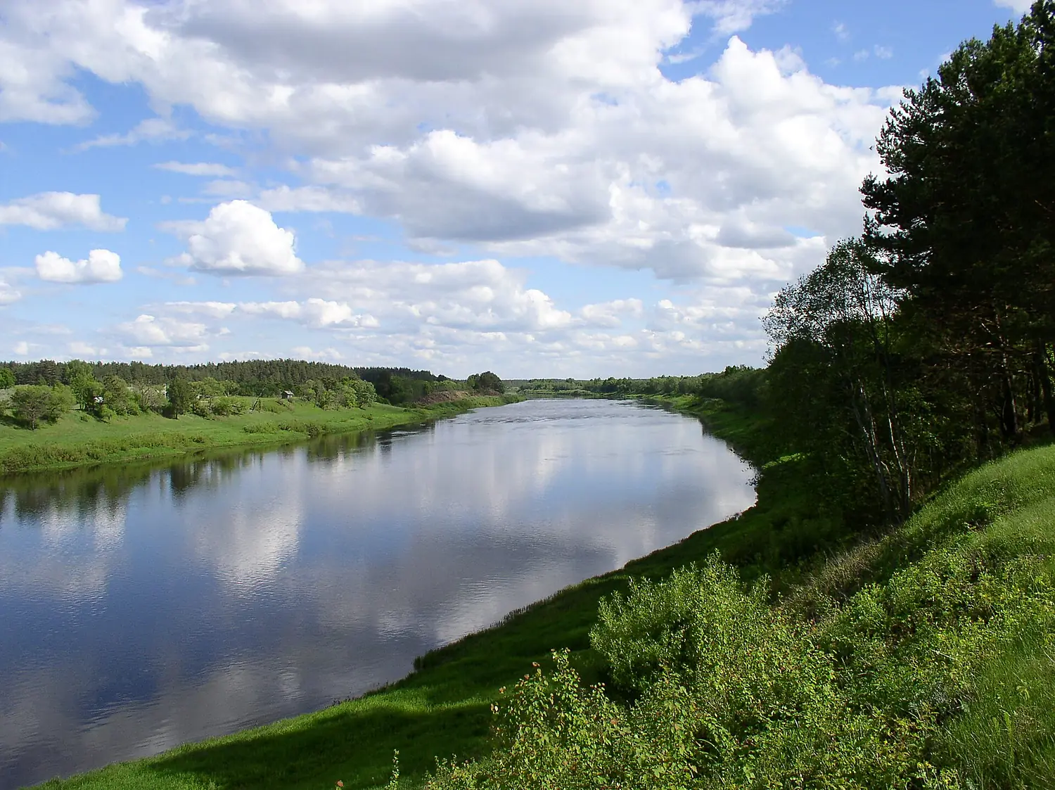
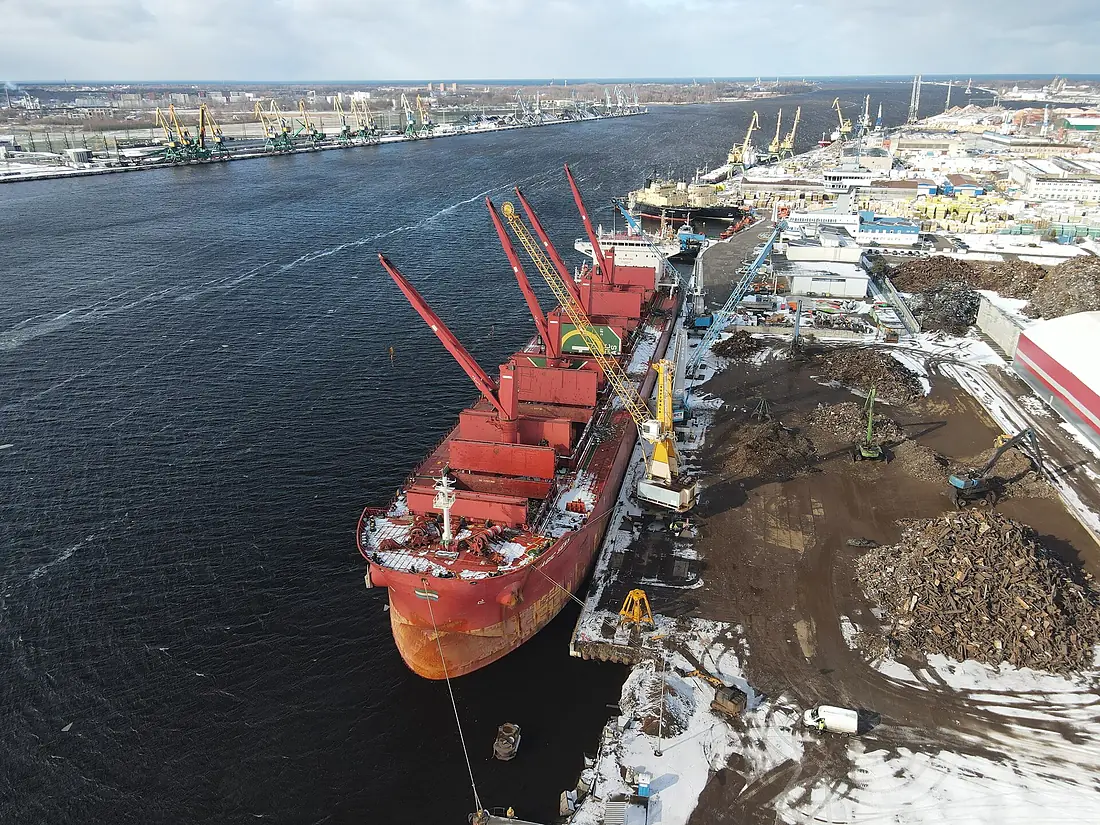
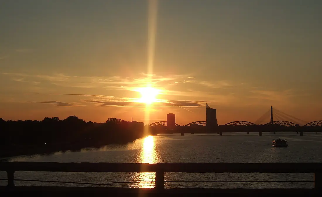
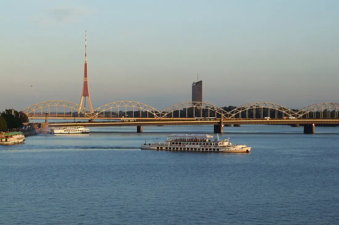
Daugava in pictures
Tributaries
Where it flows, and what flows into it
Tributaries (64)
Latvia203 km18 m³/sjoins at km 857DzisnaBelarus178 km52 m³/sjoins at km 502AivieksteLatvia114 km1.8 m³/sjoins at km 765Also: Kasplya, Mezha, Palata River, Obaĺ, Dubna, Drysa, Usvyacha, Ula, Lučosa, Toropa, Sarja, Ušača, Vićba, Drujka, Velesa, Pērse, Kryvinka, Laucesa, Lužasnianka, Rosica, Buļļupe, Vužyca, Shevinka, Nača
Nearby
Rivers nearby
 Estonia
Where these numbers come from
| Name, length, places | Wikidata (Q8197) · CC0 |
|---|---|
| Course, profile, basin | RiverATLAS v1.0 (HydroATLAS, Linke et al. 2019) · CC BY 4.0 — followed from the source to the mouth given by Wikidata |
| Flow | WaterGAP (RiverATLAS), 1971–2000 · CC BY 4.0 |
| Climate along the river | WorldClim (RiverATLAS), 1970–2000 · CC BY 4.0 |
| Towns, bridges, dams | Wikidata · CC0; GeoNames · CC BY 4.0 |
| Along the river | © OpenStreetMap contributors · ODbL |
| Images | EOX Sentinel-2 cloudless 2016 · CC BY 4.0; Wikimedia Commons |
| Our other atlases | Cascadyas, Lakeyas, Coastya, Islandyas — Wikidata · CC0; © OpenStreetMap contributors · ODbL; GeoNames · CC BY 4.0; HydroLAKES · CC BY 4.0; NOAA OISST |
Every source and licence is on the data sources page.
The family
Do you prefer beaches, lakes, mountains, waterfalls, islands, rivers or canyons?
Same idea, other landscapes: field atlases built on open data, month by month, in seven languages.
beaches Find your beach: sea temperature, sun and swimming month by month.Visit lakes
 Every lake on Earth: water temperature, ice, depth and the shore.Coming soonVisit
  mountains
 Every summit in 3D: summit weather, the 0 °C line, huts and trails.Visit waterfalls
 Every waterfall: height, flow month by month and when it roars.Coming soonVisit islands
 Every island from the sea up: size, sea temperature, ferries and 3D.Coming soonVisit
  rivers
 Every river from source to sea: the journey, the flow and the basin in numbers.You are here
 canyons
 Every canyon cut to scale: depth to the floor, rim and floor temperatures, trails and viewpoints.Coming soonVisit