River
Gauja
453 km from source to mouth · Latvia and Estonia.

 Latvia and EstoniaFlows into Gulf of Riga2nd longest in Latvia
In numbers
Length
453km
Average flow
71m³/s
Basin
8,900km²
Drop
190m
from 189 m to -1 m
Countries
2
The journey
From source to mouth
453 km of river and 27 stops on the way: 11 towns and cities on its banks, dams, bridges and the tributaries that feed it.
- 0 kmSourceat 189 m
- 0 kmIlzes ezers0.4 km²
- 5 kmTauriņu Ezers0.3 km²
- 90 kmVelēna91 people
- 101 kmSinole189 people
- 109 kmLejasciems460 people
- 110 kmTirza Rivertributary
- 176 kmMustjõgitributary
- 238 kmVijatributary
- 254 kmGauja River Railway Bridge
- 274 kmAbulstributary
- 282 kmValmiera22,812 people
- 289 kmJumara Rivertributary
- 329 kmCēsis14,899 people
- 344 kmAmata Rivertributary
- 352 kmLīgatetributary
- 364 kmBrasla Rivertributary
- 375 kmTuraida Castle
- 378 kmSigulda Bridge
- 379 kmSigulda14,784 people
- 411 kmLojatributary
- 412 kmVangaži3,192 people
- 431 kmKadaga2,518 people
- 434 kmĀdaži7,683 people
- 439 kmKadagas Ezers0.4 km²
- 442 kmSiguļi394 people
- 444 kmDzirnezers1.5 km²
- 446 kmCarnikava5,317 people
- 453 kmGulf of Rigaat -1 m
Water level along the river (RiverATLAS; the height is exaggerated). Towns: GeoNames and Wikidata; bridges, dams and tributaries: Wikidata.
River in Latvia and Estonia
At the mouth it carries 71 m³/s on average: an Olympic pool every 35 seconds. It drops from 189 m to -1 m, 0.4 m per kilometre on average. Its basin covers 8,900 km², about the size of PR. 172,000 people live in it. Highest water: from April to June; lowest: from January to March. No large dam holds it back: it is one of the world's free-flowing rivers.
Where to start
- ValmieraLargest city on its banks · 22,812 people
- Riga International Airport (RIX)Nearest airport with scheduled flights, 112 km from the cityCar hire at RIX airport (Riga)Discover Cars · Affiliate link↗
- On the water22 ferry piers, marinas, boat rentals and boat ramps along the river (OpenStreetMap)
- Kayak and canoe1 put-ins and rapids mapped (OpenStreetMap)
- From June to AugustThe best months to visit
Gauja, month by month
Highest water: from April to June
Lowest water: from January to March. Freezing months (average below −4 °C): from January to February. Best months to visit: from June to August.
From about 76 m³/s in the lowest month to 440 m³/s in the highest. An estimate: the monthly flow is modelled from the lowest and highest months of WaterGAP (RiverATLAS, 1971–2000) and the rain and snow along the river (WorldClim). Dams change the real rhythm. The chip is the average air temperature; below it, the month's rain.
Plan the trip
Plan the trip: boat trips, a bed by the river, a car
Some links above are affiliate links: if you book through them we may earn a commission, at no extra cost to you. It never changes what the data on this page says.
The basin
Gauja: the basin in numbers
9,160 km² of land send their water to this river. This is what lives on it.
- 172,000people live in the basin
- 19/km²people per km²
- 115maverage altitude of the basin
- 662mmof rain a year (basin average)
- 5.1°Caverage air temperature
- 21%protected areas
- 0.4%covered by lakes
What covers the basin
- 49% Forest
- 19% Cropland
- 7% Pasture
- 1% Towns and cities
RiverATLAS (HydroATLAS v1.0, CC BY 4.0): land cover, people, protected areas, glaciers and dams over the whole basin upstream of the mouth.
Along the river
Gauja: what you find on the way
- 8Weirs
- 1Locks
- 11WaterfallsJodupītes Lielais ūdenskritums, Jodupītes Mazais ūdenskritums, Ķiparu kaskāde and 8 more
- 1RapidsKazu krāces
- 6Boat rampsSlipway in Iļķene and 5 more
- 2Ferry piersLīgatnes pārceltuve
- 2Marinas
- 4River beachesDaliņu Pludmale, Sigulda beach and 2 more
From OpenStreetMap, within 1.8 km of the river. Not mapped is not the same as not there.
Cross-checked with our atlases
Gauja in our other atlases
What our sister atlases know about the waterfalls on this river, the lakes it flows through, the beaches at its mouth, the mountains where it rises and the islands off its mouth.
 4lakes on its wayLakeyas
 3beaches at the mouth and on the banksCoastya
 2islands off the mouthIslandyas
Lakes and reservoirs (4)
Lakes it flows through, by Lakeyas
- Ilzes ezerskm 0 · 14 m deep0.4km²
- Tauriņu Ezerskm 4 · 5 m deep0.3km²
- Kadagas Ezerskm 3330.4km²
- Dzirnezerskm 337 · 5 m deep1.5km²
Lakeyas is coming soonOpen Lakeyas ↗
Beaches (3)
At the mouth (25 km) and on the banks, by Coastya
- Saulkrastu pludmale18 km away18.6°C
- Vecaki beach13 km away18.6°C
- Lilastes Pludmale5.0 km away18.6°C
Islands off the mouth (2)
Within 30 km of the mouth, by Islandyas
- Buļļu sala22 km away13km²
- Mīlestības Saliņa18 km away
Islandyas is coming soonOpen Islandyas ↗
From space
The source and the mouth, seen from orbit
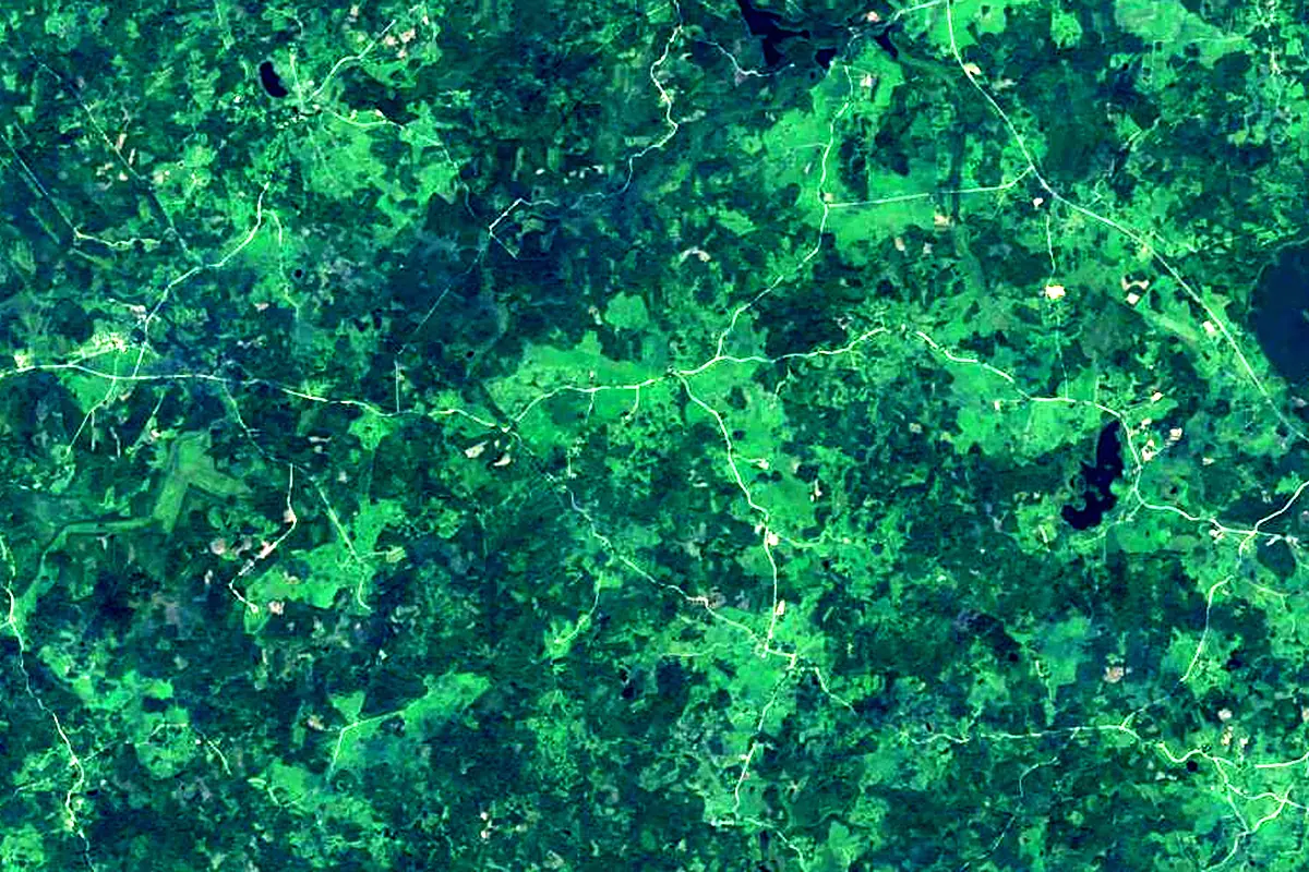
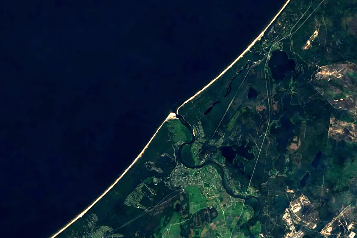
Sentinel-2 cloudless 2016 by EOX IT Services GmbH (contains modified Copernicus Sentinel data 2016), CC BY 4.0. The glowing line is the river as drawn by RiverATLAS.
Photos
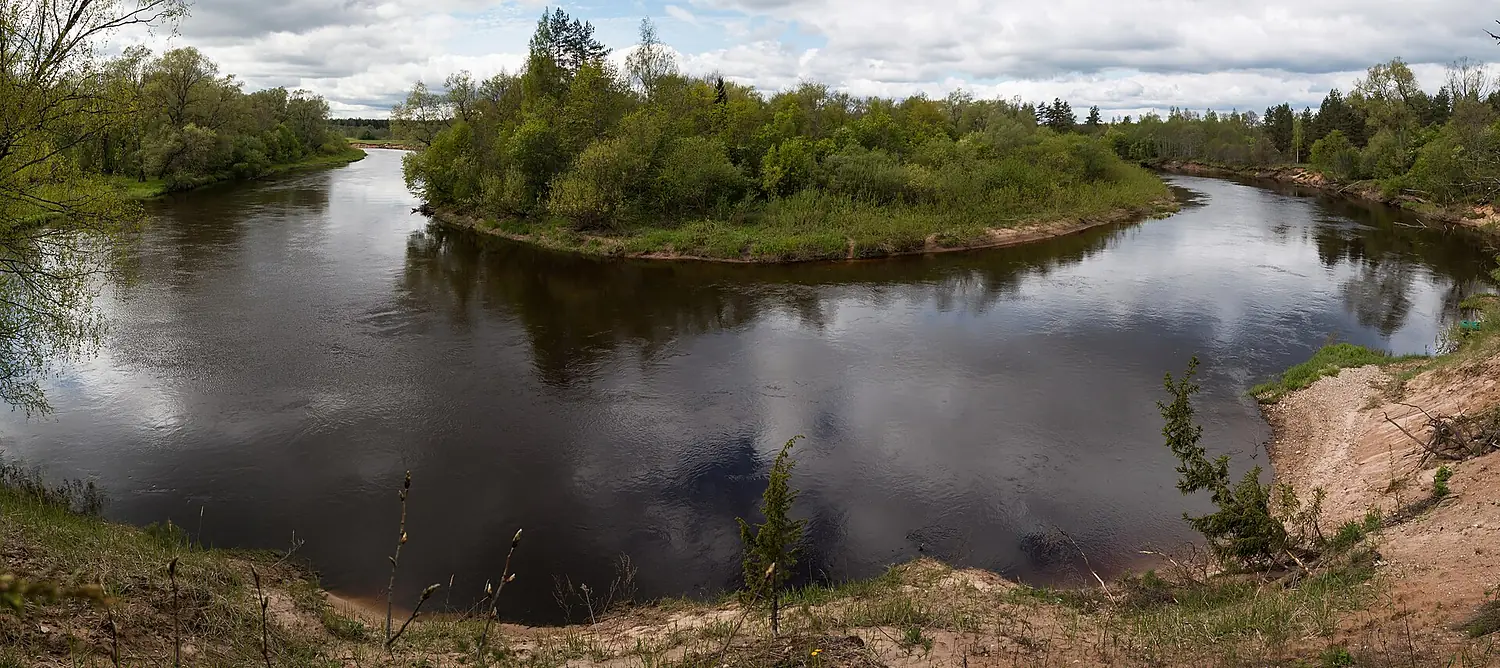
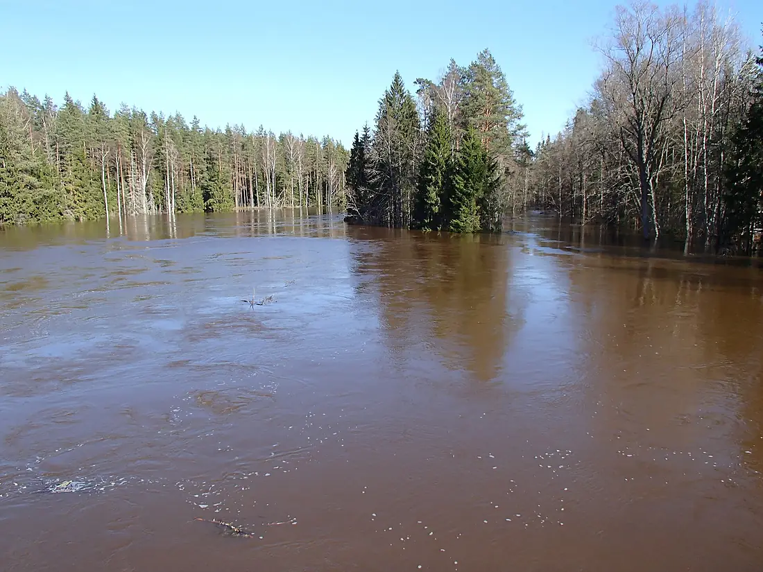
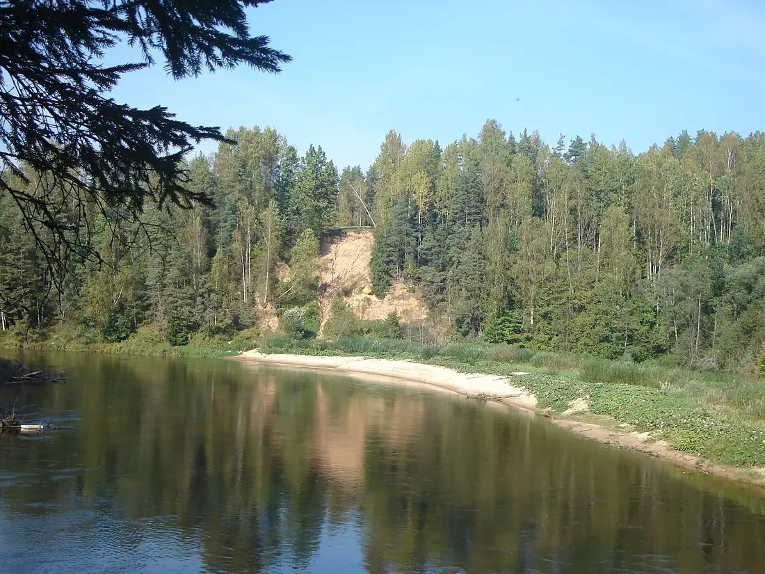
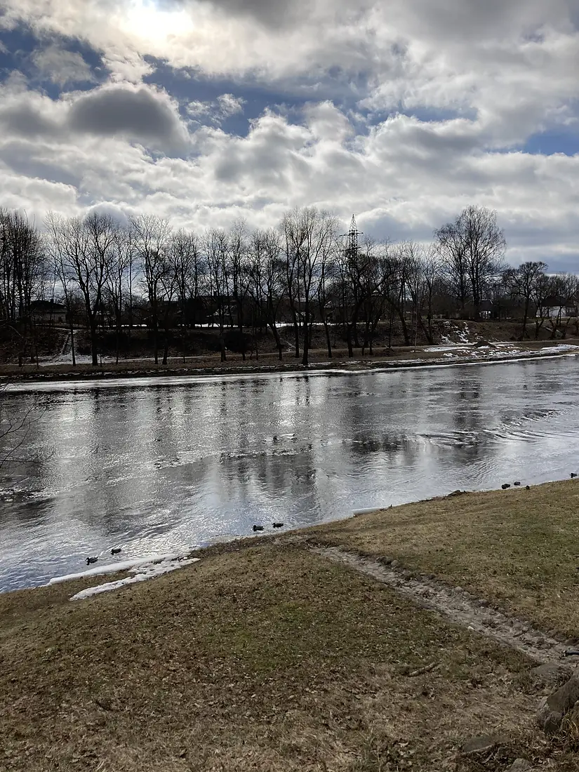
Gauja in pictures
Tributaries
Where it flows, and what flows into it
Tributaries (23)
Also: Mustjõgi, Brasla River, Amata River, Abuls, Rauna, Tirza River, Jumara River, Vija, Laanemetsa Stream, Strīķupe, Loja, Līgate, Kima Stream, Vildoga, Rātsupīte, Dauda, Vējupīte, Lorupe, Kaičupe, Melderupīte, Straujupīte, Egļupe, Vecgauja
Nearby
Rivers nearby
Latvia1,020 km680 m³/s18 km awayLielupeLatvia119 km110 m³/s33 km awayOgre RiverLatvia203 km18 m³/s44 km awaySalacaLatvia99 km31 m³/s67 km awayNemunėlisLatvia191 km95 m³/s78 km awayPärnu RiverEstonia145 km48 m³/s137 km awayAivieksteLatvia114 km1.8 m³/s108 km awayVentaLatvia346 km96 m³/s166 km awayWhere these numbers come from
| Name, length, places | Wikidata (Q207928) · CC0 |
|---|---|
| Course, profile, basin | RiverATLAS v1.0 (HydroATLAS, Linke et al. 2019) · CC BY 4.0 — followed from the source to the mouth given by Wikidata |
| Flow | WaterGAP (RiverATLAS), 1971–2000 · CC BY 4.0 |
| Climate along the river | WorldClim (RiverATLAS), 1970–2000 · CC BY 4.0 |
| Towns, bridges, dams | Wikidata · CC0; GeoNames · CC BY 4.0 |
| Along the river | © OpenStreetMap contributors · ODbL |
| Images | EOX Sentinel-2 cloudless 2016 · CC BY 4.0; Wikimedia Commons |
| Our other atlases | Lakeyas, Coastya, Islandyas — Wikidata · CC0; © OpenStreetMap contributors · ODbL; GeoNames · CC BY 4.0; HydroLAKES · CC BY 4.0; NOAA OISST |
Every source and licence is on the data sources page.
The family
Do you prefer beaches, lakes, mountains, waterfalls, islands, rivers or canyons?
Same idea, other landscapes: field atlases built on open data, month by month, in seven languages.
beaches Find your beach: sea temperature, sun and swimming month by month.Visit lakes
 Every lake on Earth: water temperature, ice, depth and the shore.Coming soonVisit
  mountains
 Every summit in 3D: summit weather, the 0 °C line, huts and trails.Visit
  waterfalls
 Every waterfall: height, flow month by month and when it roars.Coming soonVisit islands
 Every island from the sea up: size, sea temperature, ferries and 3D.Coming soonVisit
  rivers
 Every river from source to sea: the journey, the flow and the basin in numbers.You are here
 canyons
 Every canyon cut to scale: depth to the floor, rim and floor temperatures, trails and viewpoints.Coming soonVisit