River
Douro River
897 km from source to mouth · Portugal and Spain.

 Portugal and SpainFlows into Atlantic Ocean2nd longest in Portugal
In numbers
Length
897km
Average flow
680m³/s
Basin
97,290km²
Drop
1,079m
from 1,080 m to 1 m
Countries
2
The journey
From source to mouth
897 km of river and 68 stops on the way: 9 towns and cities on its banks, dams, bridges and the tributaries that feed it.
- 0 kmPicos de Urbiónat 1,080 m
- 0 kmCovaleda1,560 people
- 19 kmCuerda del Pozo Reservoir14 km²
- 51 kmSoria39,788 people
- 51 kmTera Rivertributary
- 82 kmRituerto Rivertributary
- 97 kmMazos rivertributary
- 118 kmIzana Rivertributary
- 142 kmEscalote Rivertributary
- 162 kmCaracena Rivertributary
- 165 kmUcero Rivertributary
- 184 kmPedro River, Soriatributary
- 232 kmBañuelostributary
- 248 kmGromejón Rivertributary
- 250 kmRiaza Rivertributary
- 276 kmDuratón rivertributary
- 312 kmArroyo Valcorbatributary
- 337 kmArroyo Jaramieltributary
- 341 kmCegatributary
- 352 kmAdaja rivertributary
- 352 kmPisuerga Rivertributary
- 386 kmTrabancostributary
- 408 kmHornija Rivertributary
- 408 kmRío Bajoztributary
- 414 kmGuareña Rivertributary
- 451 kmValderadueytributary
- 454 kmZamora61,827 people
- 455 kmZamora city59,150 people
- 499 kmEslatributary
- 530 kmMiranda do Douro7,482 people
- 531 kmMiranda Dam
- 536 kmFresno Rivertributary
- 549 kmPicote Reservoir0.5 km²
- 549 kmPicote Dam
- 569 kmBemposta Reservoir2.2 km²
- 569 kmBemposta Dam
- 571 kmTormestributary
- 582 kmPozo Airón
- 584 kmUcestributary
- 584 kmPozo de los Lirios
- 597 kmAldeadávila Reservoir2.2 km²
- 620 kmSaucelle Reservoir5.1 km²
- 622 kmHuebratributary
- 634 kmÁgueda Rivertributary
- 651 kmCôatributary
- 660 kmPocinho Dam
- 666 kmSabor rivertributary
- 694 kmValeira Dam
- 706 kmTua Rivertributary
- 713 kmAlto Douro Wine RegionUNESCO World Heritage
- 717 kmTorto Rivertributary
- 721 kmTávora Rivertributary
- 735 kmRégua Reservoir8.7 km²
- 735 kmRégua Dam
- 738 kmCorgo Rivertributary
- 738 kmVarosa Rivertributary
- 740 kmPeso da Régua17,131 people
- 771 kmBestança Rivertributary
- 775 kmCarrapatelo Reservoir8.0 km²
- 775 kmCarrapatelo Dam
- 788 kmPaiva Rivertributary
- 793 kmTâmega Rivertributary
- 810 kmArda Rivertributary
- 818 kmCrestuma-Lever Dam
- 821 kmSousa Rivertributary
- 832 kmSanto Ovídio38,544 people
- 833 kmLuiz I Bridge
- 833 kmPorto273,979 people
- 833 kmVila Nova de Gaia303,824 people
- 897 kmAtlantic Oceanat 1 m
Water level along the river (RiverATLAS; the height is exaggerated). Towns: GeoNames and Wikidata; bridges, dams and tributaries: Wikidata.
River in Spain and Portugal
At the mouth it carries 675 m³/s on average: an Olympic pool every 3.7 seconds. It drops from 1,080 m to 1 m, 1.2 m per kilometre on average. Its basin covers 97,290 km², about the size of KR. 3.8 million people live in it. Highest water: from December to February; lowest: from July to September. Dams and reservoirs hold back a large share of its water (41% of a year's flow).
Where to start
- Vila Nova de GaiaLargest city on its banks · 303,824 people
- Francisco de Sá Carneiro Airport (OPO)Nearest airport with scheduled flights, 14 km from the cityCar hire at OPO airport (Porto)Discover Cars · Affiliate link↗
- On the water170 ferry piers, marinas, boat rentals and boat ramps along the river (OpenStreetMap)
- From May to SeptemberThe best months to visit
Douro River, month by month
Highest water: from December to February
Lowest water: from July to September. Best months to visit: from May to September.
From about 110 m³/s in the lowest month to 1,500 m³/s in the highest. An estimate: the monthly flow is modelled from the lowest and highest months of WaterGAP (RiverATLAS, 1971–2000) and the rain and snow along the river (WorldClim). Dams change the real rhythm. The chip is the average air temperature; below it, the month's rain.
Plan the trip
Plan the trip: boat trips, a bed by the river, a car
Some links above are affiliate links: if you book through them we may earn a commission, at no extra cost to you. It never changes what the data on this page says.
The basin
Douro River: the basin in numbers
97,238 km² of land send their water to this river. This is what lives on it.
- 3.8millionpeople live in the basin
- 39/km²people per km²
- 880maverage altitude of the basin
- 640mmof rain a year (basin average)
- 11.2°Caverage air temperature
- 7%protected areas
- 0.3%covered by lakes
- 8.7km³held in reservoirs
What covers the basin
- 34% Forest
- 41% Cropland
- 15% Pasture
- 1% Towns and cities
RiverATLAS (HydroATLAS v1.0, CC BY 4.0): land cover, people, protected areas, glaciers and dams over the whole basin upstream of the mouth.
Along the river
Douro River: what you find on the way
- 70WeirsPresa Don Publio, Aceñas del Postigo, Açude do Assobio and 67 more
- 14LocksRio Douro, Eclusa da Valeira, Eclusa do Carrapatelo and 11 more
- 16WaterfallsCascada del Arroyo Lechoso, Cascada Peñoncito, Cascada Río Ojeda and 13 more
- 65Boat rampsClub Nautico de Soria, Cais de Sardoura, Rampa Publica de Melres Barcos / Motas Agua and 62 more
- 24Ferry piersLa Barca, Cogida, Muelle de Vega Terrón and 21 more
- 79MarinasEmbarcadero Club náutico, Fluvina de Barca de Alva, Marina da Ferradosa (Douro Fluvina) and 76 more
- 29River beachesPlaya fluvial La Barca, Playa del Rostro, Playa fluvial de Vilvestre and 26 more
From OpenStreetMap, within 2.4 km of the river. Not mapped is not the same as not there.
Cross-checked with our atlases
Douro River in our other atlases
What our sister atlases know about the waterfalls on this river, the lakes it flows through, the beaches at its mouth, the mountains where it rises and the islands off its mouth.
 2waterfalls on the riverCascadyas
 7lakes on its wayLakeyas
 84beaches at the mouth and on the banksCoastya
 3mountains at the sourcePeakyas
Waterfalls (2)
On the river, by Cascadyas
- Pozo Airónkm 558
- Pozo de los Lirioskm 559
Cascadyas is coming soonOpen Cascadyas ↗
Lakes and reservoirs (7)
Lakes it flows through, by Lakeyas
- Cuerda del Pozo Reservoirkm 1814km²
- Picote Reservoirkm 5260.5km²
- Bemposta Reservoirkm 5452.2km²
- Aldeadávila Reservoirkm 5722.2km²
- Saucelle Reservoirkm 5945.1km²
- Régua Reservoirkm 7048.7km²
- Carrapatelo Reservoirkm 7428.0km²
Lakeyas is coming soonOpen Lakeyas ↗
Beaches (84)
At the mouth (25 km) and on the banks, by Coastya
- Praia da Granja12 km away17.4°C
- Praia Fluvial do Areinhokm 79517.4°C
- Praia de Lavadores2.7 km away17.4°C
- Praia da Rua 3716 km away17.4°C
- Praia de Canide3.9 km away17.4°C
- Praia do Carneiro2.4 km away17.4°C
- Praia de Matosinhos4.9 km away17.4°C
- Praia da Memória11 km away17.4°C
76 more on CoastyaOpen Coastya ↗
Mountains at the source (3)
Within 15 km of the source, by Peakyas
- Pico Urbión3.7 km away2,228m
- Sierra del Portillo de Pinochos14 km away
- Sierra de las Hormazas13 km away
From space
The source and the mouth, seen from orbit
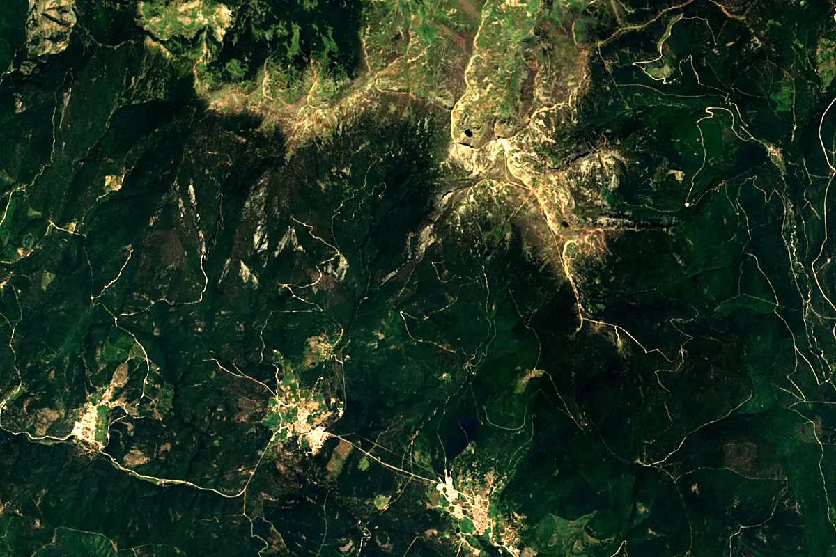
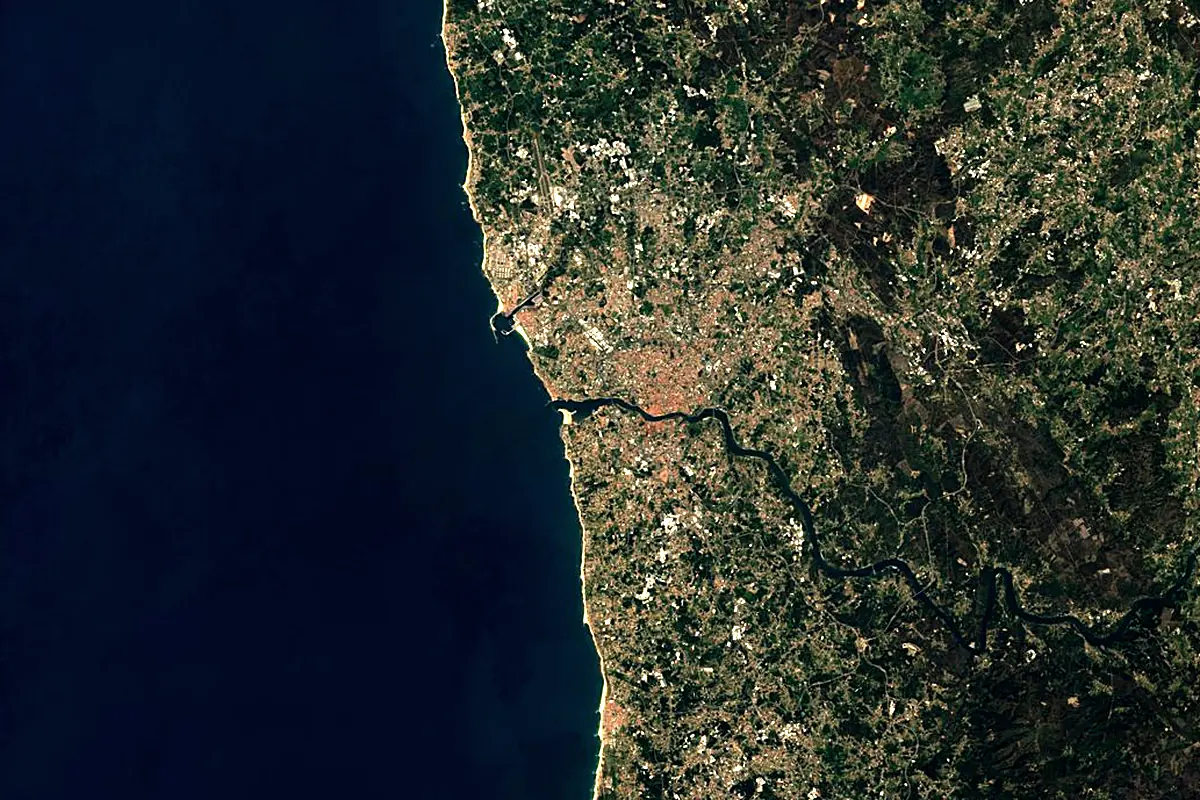
Sentinel-2 cloudless 2016 by EOX IT Services GmbH (contains modified Copernicus Sentinel data 2016), CC BY 4.0. The glowing line is the river as drawn by RiverATLAS.
Photos
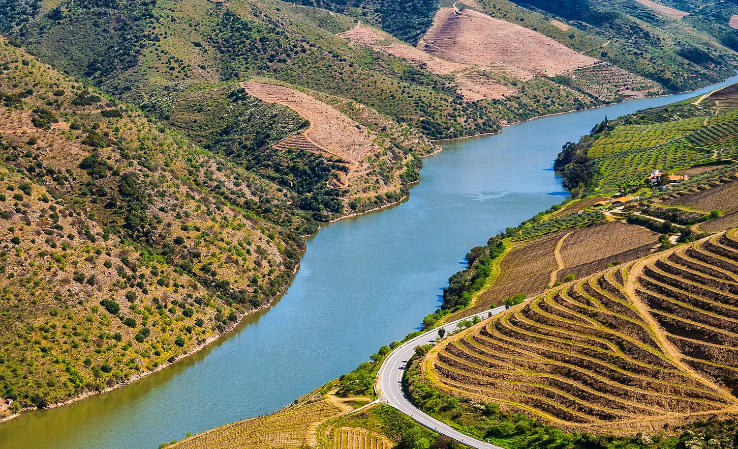
Douro River in pictures
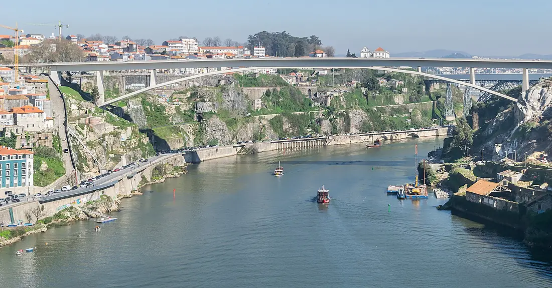
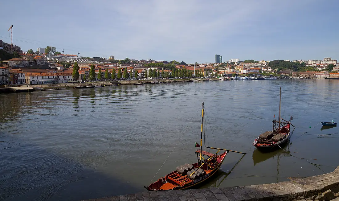
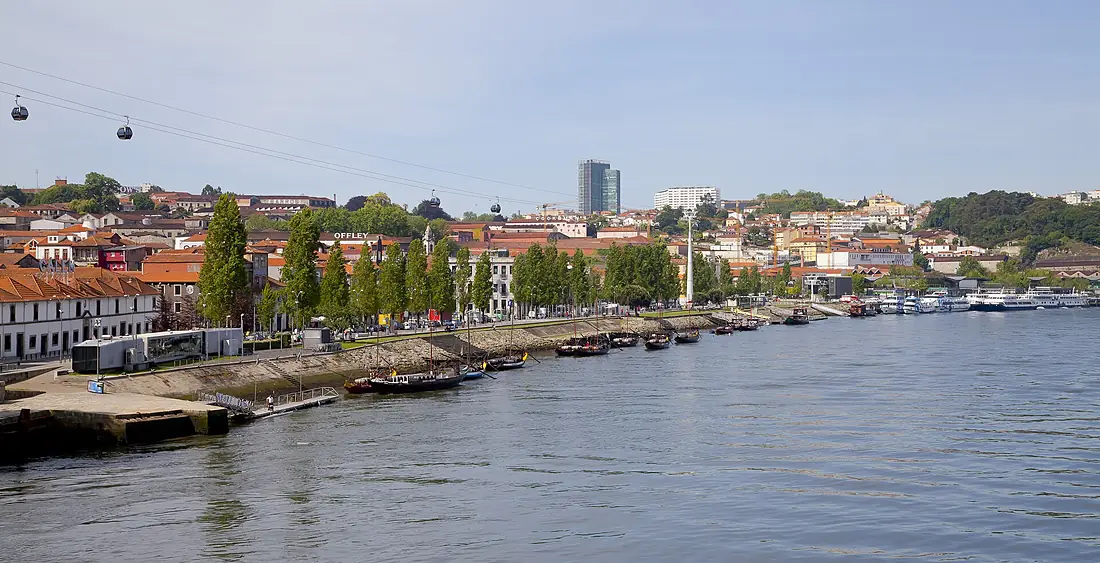
Tributaries
Where it flows, and what flows into it
Tributaries (54)
Spain285 km140 m³/sjoins at km 477TormesSpain284 km42 m³/sjoins at km 547Pisuerga RiverSpain283 km110 m³/sjoins at km 338Tâmega RiverPortugal184 km69 m³/sjoins at km 759Águeda RiverPortugal176 km23 m³/sjoins at km 607Also: Côa, Adaja river, Duratón river, Huebra, Trabancos, Tua River, Sabor river, Zapardiel River, Valderaduey, Corgo River, Arandilla, Uces, Cega, Paiva River, Távora River, Río Bajoz, Rituerto River, Guareña River, Arda River, Arroyo Valcorba, Bañuelos, Gromejón River, Caracena River, Riaza River
In the same basin
Nearby
Rivers nearby
Portugal184 km69 m³/s30 km awayMinho RiverPortugal315 km340 m³/s87 km awayVouga RiverPortugal148 km62 m³/s50 km awayLima RiverPortugal135 km75 m³/s62 km awayMondego RiverPortugal234 km110 m³/s114 km awayÁgueda RiverPortugal176 km23 m³/s144 km awaySilisSpain228 km240 m³/s163 km awayTormesSpain284 km42 m³/s182 km awayWhere these numbers come from
| Name, length, places | Wikidata (Q14299) · CC0 |
|---|---|
| Course, profile, basin | RiverATLAS v1.0 (HydroATLAS, Linke et al. 2019) · CC BY 4.0 — followed from the source to the mouth given by Wikidata |
| Flow | WaterGAP (RiverATLAS), 1971–2000 · CC BY 4.0 |
| Climate along the river | WorldClim (RiverATLAS), 1970–2000 · CC BY 4.0 |
| Towns, bridges, dams | Wikidata · CC0; GeoNames · CC BY 4.0 |
| Along the river | © OpenStreetMap contributors · ODbL |
| Images | EOX Sentinel-2 cloudless 2016 · CC BY 4.0; Wikimedia Commons |
| Our other atlases | Cascadyas, Lakeyas, Coastya, Peakyas — Wikidata · CC0; © OpenStreetMap contributors · ODbL; GeoNames · CC BY 4.0; HydroLAKES · CC BY 4.0; NOAA OISST |
Every source and licence is on the data sources page.
The family
Do you prefer beaches, lakes, mountains, waterfalls, islands, rivers or canyons?
Same idea, other landscapes: field atlases built on open data, month by month, in seven languages.
beaches Find your beach: sea temperature, sun and swimming month by month.Visit lakes
 Every lake on Earth: water temperature, ice, depth and the shore.Coming soonVisit mountains
 Every summit in 3D: summit weather, the 0 °C line, huts and trails.Visit waterfalls
 Every waterfall: height, flow month by month and when it roars.Coming soonVisit
  islands
 Every island from the sea up: size, sea temperature, ferries and 3D.Coming soonVisit
  rivers
 Every river from source to sea: the journey, the flow and the basin in numbers.You are here
 canyons
 Every canyon cut to scale: depth to the floor, rim and floor temperatures, trails and viewpoints.Coming soonVisit