River
Mondego River
234 km from source to mouth · Portugal.
 PortugalFlows into Atlantic Ocean6th longest in Portugal
In numbers
Length
234km
Average flow
110m³/s
Basin
6,644km²
Drop
770m
from 769 m to -1 m
Country
1
The journey
From source to mouth
234 km of river and 30 stops on the way: 19 towns and cities on its banks, dams, bridges and the tributaries that feed it.
- 0 kmMondeguinhoat 769 m
- 3 kmVidemonte388 people
- 37 kmCelorico da Beira7,693 people
- 72 kmCativelos610 people
- 91 kmNelas14,037 people
- 94 kmCascata da Pantanha
- 119 kmTábua12,071 people
- 134 kmDão Rivertributary
- 137 kmAguieira Dam
- 137 kmAguieira Reservoir11 km²
- 146 kmSazes do Lorvão713 people
- 148 kmRaiva Dam
- 149 kmAlva Rivertributary
- 154 kmPenacova15,251 people
- 161 kmLorvão4,158 people
- 174 kmCastelo Viegas11,858 people
- 175 kmAssafarge5,302 people
- 177 kmPonte Rainha Santa Isabel
- 179 kmSanto António dos Olivais41,150 people
- 179 kmSanta Clara9,637 people
- 179 kmCoimbra140,816 people
- 181 kmCeira Rivertributary
- 183 kmBairro do Loreto5,699 people
- 184 kmSão Martinho do Bispo15,315 people
- 188 kmRibeira de Frades15,315 people
- 210 kmMontemor-o-Velho3,154 people
- 210 kmArunca Rivertributary
- 231 kmEdgar Cardoso Bridge
- 232 kmTavarede8,586 people
- 233 kmFigueira da Foz62,125 people
- 233 kmSanta Catarina Lighthouse
- 234 kmAtlantic Oceanat -1 m
Water level along the river (RiverATLAS; the height is exaggerated). Towns: GeoNames and Wikidata; bridges, dams and tributaries: Wikidata.
River in Portugal
At the mouth it carries 108 m³/s on average: an Olympic pool every 23 seconds. It drops from 769 m to -1 m, 3.3 m per kilometre on average. Its basin covers 6,644 km², about the size of PS. 673,000 people live in it. Highest water: from January to February; lowest: from June to September. Dams and reservoirs hold back a large share of its water (16% of a year's flow).
Where to start
- CoimbraLargest city on its banks · 140,816 people
- Aerodromo Goncalves Lobato (Viseu Airport) (VSE)Nearest airport with scheduled flights, 73 km from the cityCar hire at OPO airport (Porto)Discover Cars · Affiliate link↗
- On the water17 ferry piers, marinas, boat rentals and boat ramps along the river (OpenStreetMap)
- Kayak and canoe2 put-ins and rapids mapped (OpenStreetMap)
- From May to SeptemberThe best months to visit
Mondego River, month by month
Highest water: from January to February
Lowest water: from June to September. Best months to visit: from May to September.
From about 22 m³/s in the lowest month to 230 m³/s in the highest. An estimate: the monthly flow is modelled from the lowest and highest months of WaterGAP (RiverATLAS, 1971–2000) and the rain and snow along the river (WorldClim). Dams change the real rhythm. The chip is the average air temperature; below it, the month's rain.
Plan the trip
Plan the trip: boat trips, a bed by the river, a car
Some links above are affiliate links: if you book through them we may earn a commission, at no extra cost to you. It never changes what the data on this page says.
The basin
Mondego River: the basin in numbers
6,655 km² of land send their water to this river. This is what lives on it.
- 673,000people live in the basin
- 101/km²people per km²
- 382maverage altitude of the basin
- 1,068mmof rain a year (basin average)
- 14.3°Caverage air temperature
- 9%protected areas
- 0.3%covered by lakes
- 0.6km³held in reservoirs
What covers the basin
- 84% Forest
- 10% Cropland
- 5% Pasture
- 4% Towns and cities
RiverATLAS (HydroATLAS v1.0, CC BY 4.0): land cover, people, protected areas, glaciers and dams over the whole basin upstream of the mouth.
Along the river
Mondego River: what you find on the way
- 53WeirsAçude de Coimbra, Estrutura de Controlo and 51 more
- 3Locks
- 4WaterfallsCascata do Ribeiro dos Moinhos, Cascata do Caldeirão and 2 more
- 2Rapids
- 9Boat ramps
- 3Ferry piersPasseios de Barco - O Basófias, Cais Norte (Figueira), Cais Sul (Cabedelo)
- 3MarinasMarina António Duarte Silva
- 12River beachesPraia Fluvial da Aldeia Viçosa, Praia Fluvial da Nossa Senhora da Ribeira de Parada, Praia Fluvial do Reconquinho and 9 more
From OpenStreetMap, within 1.7 km of the river. Not mapped is not the same as not there.
Cross-checked with our atlases
Mondego River in our other atlases
What our sister atlases know about the waterfalls on this river, the lakes it flows through, the beaches at its mouth, the mountains where it rises and the islands off its mouth.
 1waterfall on the riverCascadyas
 1lake on its wayLakeyas
 18beaches at the mouth and on the banksCoastya
 14mountains at the sourcePeakyas
Waterfalls (1)
On the river, by Cascadyas
- Cascata da Pantanhakm 83
Cascadyas is coming soonOpen Cascadyas ↗
Lakes and reservoirs (1)
Lakes it flows through, by Lakeyas
- Aguieira Reservoirkm 12111km²
Lakeyas is coming soonOpen Lakeyas ↗
Beaches (18)
At the mouth (25 km) and on the banks, by Coastya
- Praia do Forte de Santa Catarinakm 20518.4°C
- Praia do Cabedelinhokm 20518.4°C
- Praia da Cova1.6 km away18.4°C
- Praia do Relógio1.8 km away18.4°C
- Praia da Costa de Lavos5.7 km away18.4°C
- Praia de Buarcos2.9 km away18.4°C
- Praia da Tamargueira3.5 km away18.4°C
- Praia do Alto do Viso2.4 km away18.4°C
10 more on CoastyaOpen Coastya ↗
Mountains at the source (14)
Within 15 km of the source, by Peakyas
- Torre12 km away · prominence 1,204 m1,993m
- Cântaro Magro11 km away1,927m
- Alto do Espinheiro12 km away
- Alto da Malhoeira15 km away
- Serra do Gato13 km away
- Serra da Galega10 km away
- Lomba das Cancelas8.5 km away
- Serra da Azinha9.9 km away
6 more on PeakyasOpen Peakyas ↗
From space
The source and the mouth, seen from orbit
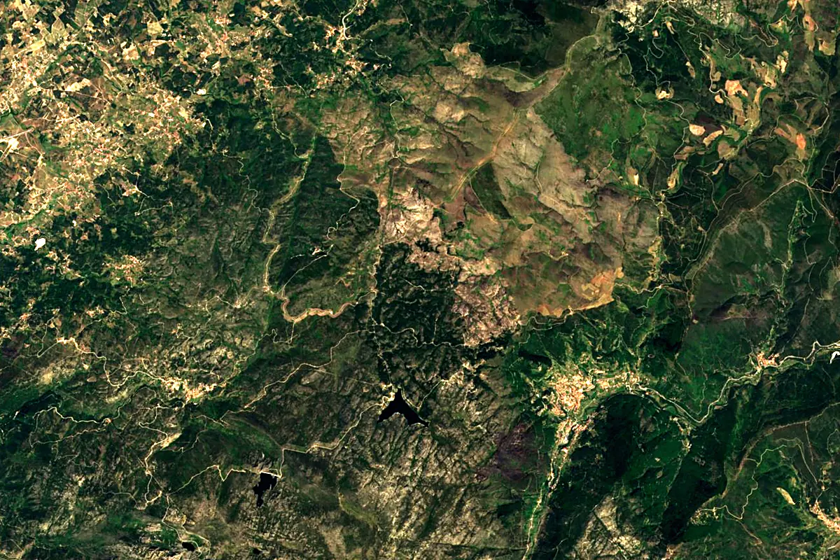
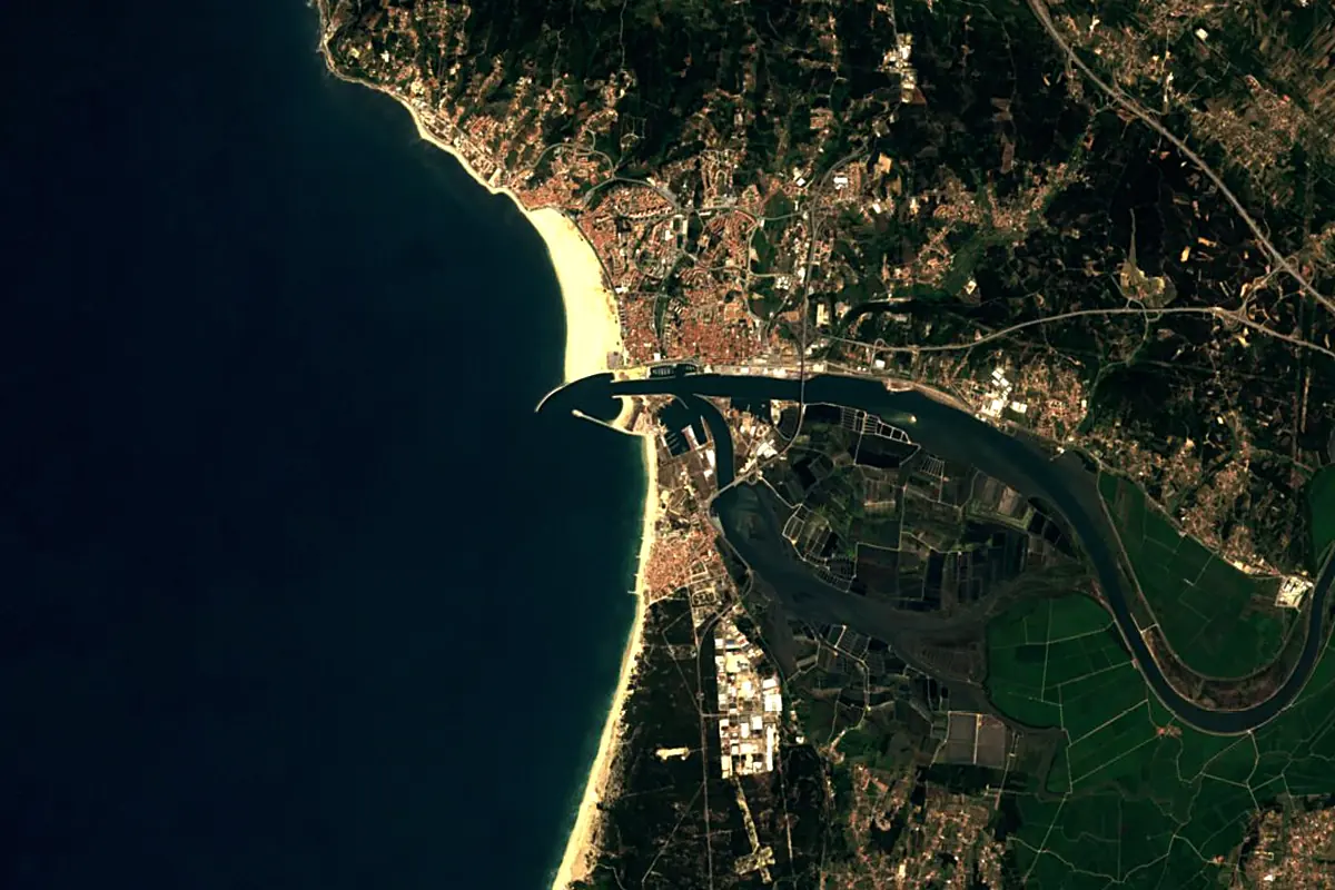
Sentinel-2 cloudless 2016 by EOX IT Services GmbH (contains modified Copernicus Sentinel data 2016), CC BY 4.0. The glowing line is the river as drawn by RiverATLAS.
Photos
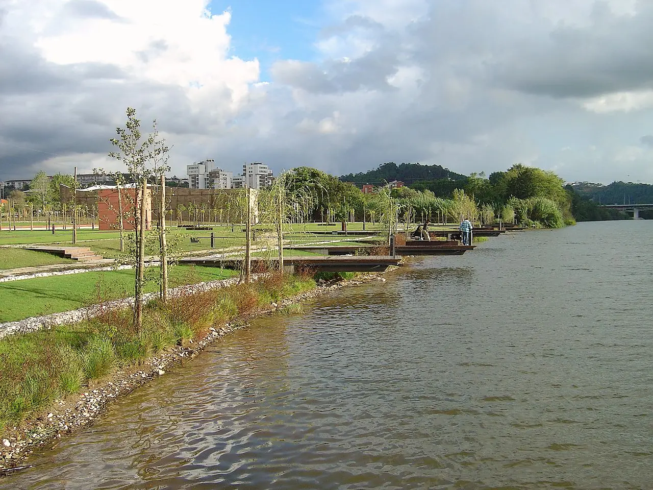
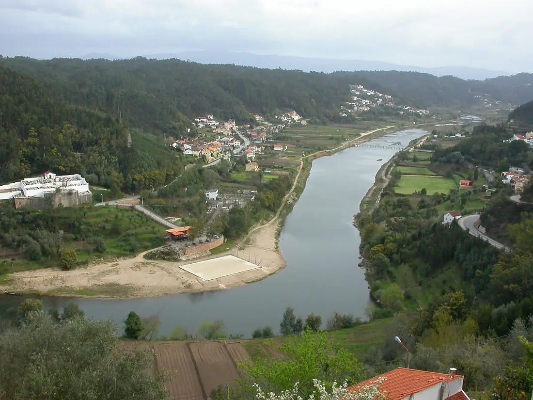
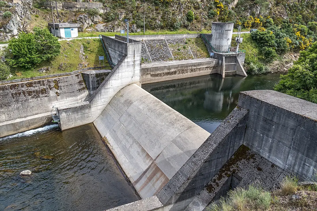
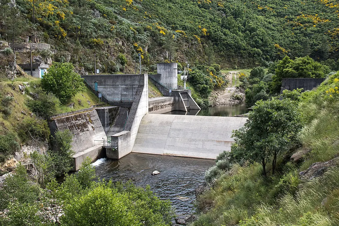
Mondego River in pictures
Tributaries
Where it flows, and what flows into it
Tributaries (4)
Also: Alva River, Dão River, Arunca River, Ceira River
Nearby
Rivers nearby
Portugal897 km680 m³/s114 km awayTagus RiverPortugal1,007 km500 m³/s134 km awayVouga RiverPortugal148 km62 m³/s64 km awayZêzere RiverPortugal248 km62 m³/s86 km awayTâmega RiverPortugal184 km69 m³/s114 km awayMinho RiverPortugal315 km340 m³/s198 km awaySado RiverPortugal180 km40 m³/s194 km awayLima RiverPortugal135 km75 m³/s173 km awayWhere these numbers come from
| Name, length, places | Wikidata (Q15656) · CC0 |
|---|---|
| Course, profile, basin | RiverATLAS v1.0 (HydroATLAS, Linke et al. 2019) · CC BY 4.0 — followed from the source to the mouth given by Wikidata |
| Flow | WaterGAP (RiverATLAS), 1971–2000 · CC BY 4.0 |
| Climate along the river | WorldClim (RiverATLAS), 1970–2000 · CC BY 4.0 |
| Towns, bridges, dams | Wikidata · CC0; GeoNames · CC BY 4.0 |
| Along the river | © OpenStreetMap contributors · ODbL |
| Images | EOX Sentinel-2 cloudless 2016 · CC BY 4.0; Wikimedia Commons |
| Our other atlases | Cascadyas, Lakeyas, Coastya, Peakyas — Wikidata · CC0; © OpenStreetMap contributors · ODbL; GeoNames · CC BY 4.0; HydroLAKES · CC BY 4.0; NOAA OISST |
Every source and licence is on the data sources page.
The family
Do you prefer beaches, lakes, mountains, waterfalls, islands, rivers or canyons?
Same idea, other landscapes: field atlases built on open data, month by month, in seven languages.
beaches Find your beach: sea temperature, sun and swimming month by month.Visit lakes
 Every lake on Earth: water temperature, ice, depth and the shore.Coming soonVisit mountains
 Every summit in 3D: summit weather, the 0 °C line, huts and trails.Visit waterfalls
 Every waterfall: height, flow month by month and when it roars.Coming soonVisit
  islands
 Every island from the sea up: size, sea temperature, ferries and 3D.Coming soonVisit
  rivers
 Every river from source to sea: the journey, the flow and the basin in numbers.You are here
 canyons
 Every canyon cut to scale: depth to the floor, rim and floor temperatures, trails and viewpoints.Coming soonVisit