River
Ebro
910 km from source to mouth · Spain.
 SpainFlows into Mediterranean Sea1st longest in Spain
In numbers
Length
910km
Average flow
430m³/s
Basin
86,800km²
Drop
913m
from 910 m to -3 m
Country
1
The journey
From source to mouth
910 km of river and 68 stops on the way: 33 towns and cities on its banks, dams, bridges and the tributaries that feed it.
- 0 kmFontibreat 910 m
- 21 kmEbro Reservoir54 km²
- 79 kmRudrón Rivertributary
- 122 kmTrueba Rivertributary
- 133 kmOcatributary
- 139 kmNela Rivertributary
- 169 kmSobrón-demningen0.8 km²
- 181 kmOmecillotributary
- 195 kmMiranda de Ebro39,264 people
- 197 kmBayas Rivertributary
- 197 kmOroncillo Rivertributary
- 200 kmZadorratributary
- 207 kmInglarestributary
- 218 kmTirón Rivertributary
- 247 kmNajerillatributary
- 282 kmLogroño152,150 people
- 285 kmIreguatributary
- 338 kmCalahorra24,787 people
- 350 kmEga rivertributary
- 366 kmAragóntributary
- 369 kmAlhamatributary
- 393 kmTudela38,903 people
- 396 kmQueilestributary
- 423 kmNovillas508 people
- 423 kmHuecha Rivertributary
- 440 kmRío Arbatributary
- 496 kmDelicias110,520 people
- 496 kmOliver-Valdefierro30,228 people
- 497 kmAlmozara25,767 people
- 499 kmZaragoza666,880 people
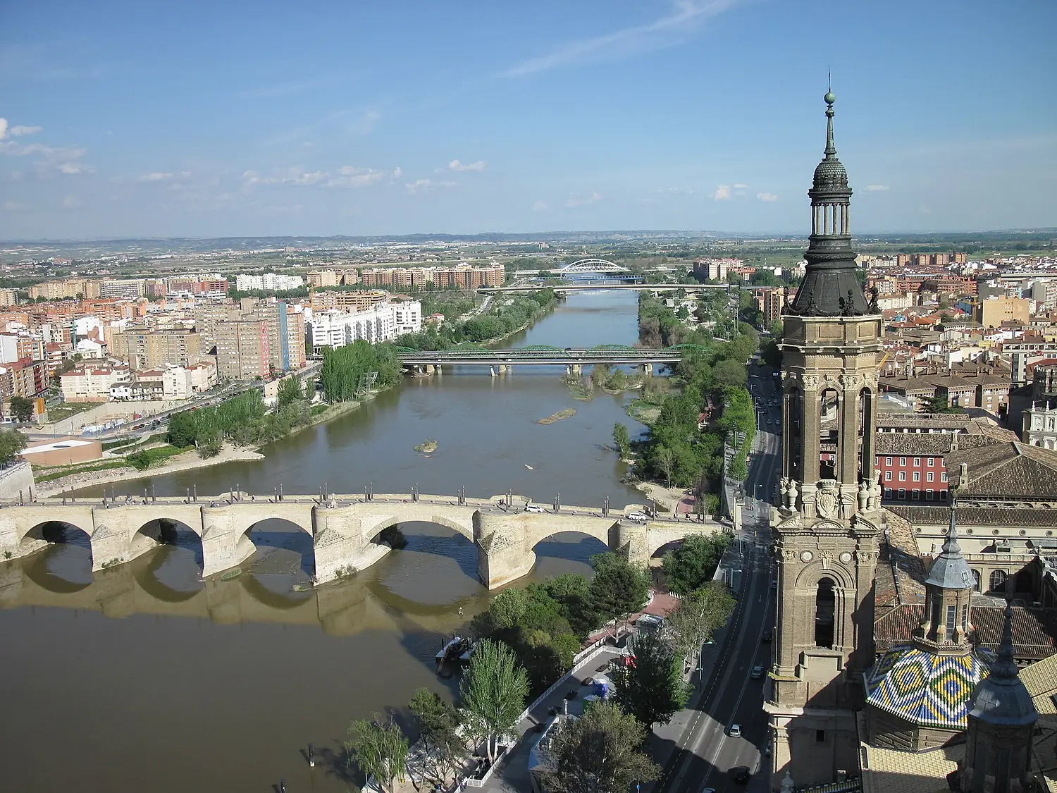
- 499 kmBasilica of Our Lady of the Pillar
- 501 kmAzud de Zaragoza
- 502 kmHuerva Rivertributary
- 502 kmGállegotributary
- 535 kmGinel Rivertributary
- 607 kmMartín Rivertributary
- 646 kmGuadalopetributary
- 701 kmReservoir of Mequinenza48 km²
- 704 kmMequinenza2,236 people
- 705 kmSegretributary
- 715 kmAlmatret292 people
- 726 kmMatarranya Rivertributary
- 726 kmLa Pobla de Massaluca344 people
- 733 kmRibarroja Reservoir14 km²
- 738 kmRiba-roja d'Ebre1,132 people
- 746 kmReservoir of Flix1.9 km²
- 747 kmFlix3,340 people
- 755 kmAscó1,589 people
- 757 kmVinebre427 people
- 764 kmGarcia551 people
- 768 kmSiurana Rivertributary
- 770 kmMóra la Nova3,350 people
- 770 kmMóra d'Ebre5,811 people
- 775 kmTivissa1,658 people
- 778 kmBenissanet1,186 people
- 778 kmGinestar800 people
- 782 kmMiravet703 people
- 786 kmRasquera786 people
- 794 kmBenifallet706 people
- 798 kmEl Canaletestributary
- 804 kmTivenys948 people
- 805 kmXerta1,180 people
- 809 kmAldover901 people
- 818 kmTortosa35,997 people
- 831 kmL'Aldea4,657 people
- 834 kmAmposta23,080 people
- 846 kmDeltebre12,041 people
- 847 kmSant Jaume d'Enveja3,745 people
- 857 kmDelta de l'Ebre Natural Park
- 910 kmMediterranean Seaat -3 m
Water level along the river (RiverATLAS; the height is exaggerated). Towns: GeoNames and Wikidata; bridges, dams and tributaries: Wikidata.
River in Spain
At the mouth it carries 426 m³/s on average: an Olympic pool every 5.9 seconds. It drops from 910 m to -3 m, 1.0 m per kilometre on average. Its basin covers 86,800 km², about the size of AZ. 3.3 million people live in it. Highest water: from December to January; lowest: August. It is heavily dammed: reservoirs can hold 55% of a year's flow.
Where to start
- ZaragozaLargest city on its banks · 666,880 people
- Zaragoza Airport (ZAZ)Nearest airport with scheduled flights, 14 km from the cityCar hire in ZaragozaDiscover Cars · Affiliate link↗
- On the water43 ferry piers, marinas, boat rentals and boat ramps along the river (OpenStreetMap)
- From June to OctoberThe best months to visit
Ebro, month by month
Highest water: from December to January
Lowest water: August. Best months to visit: from June to October.
From about 140 m³/s in the lowest month to 660 m³/s in the highest. An estimate: the monthly flow is modelled from the lowest and highest months of WaterGAP (RiverATLAS, 1971–2000) and the rain and snow along the river (WorldClim). Dams change the real rhythm. The chip is the average air temperature; below it, the month's rain.
Plan the trip
Plan the trip: boat trips, a bed by the river, a car
Some links above are affiliate links: if you book through them we may earn a commission, at no extra cost to you. It never changes what the data on this page says.
The basin
Ebro: the basin in numbers
84,762 km² of land send their water to this river. This is what lives on it.
- 3.3millionpeople live in the basin
- 39/km²people per km²
- 778maverage altitude of the basin
- 659mmof rain a year (basin average)
- 11.1°Caverage air temperature
- 13%protected areas
- 0.4%covered by lakes
- 7.5km³held in reservoirs
What covers the basin
- 35% Forest
- 38% Cropland
- 16% Pasture
- 1% Towns and cities
RiverATLAS (HydroATLAS v1.0, CC BY 4.0): land cover, people, protected areas, glaciers and dams over the whole basin upstream of the mouth.
Along the river
Ebro: what you find on the way
- 73WeirsPresa de Arrauri, Molino de Suso, Presa de la Central Hidroeléctrica and 70 more
- 10LocksCanal de Tauste, Compuerta and 8 more
- 16WaterfallsCascada del Tobazo, Cascada de Orbaneja del Castillo, Cascada de Valdelateja and 13 more
- 22Boat rampsRampa Monzalbarba, Rampa para Botes Helios, Embarcadero de Gelsa and 19 more
- 11Ferry piersBarca del Castellar, Barca de Candespina, El Puerto and 8 more
- 9MarinasEmbarcadero de Logroño, Embarcadero de Boquiñeni Virgen del Rosario, Puerto deportivo de Caspe and 6 more
- 8River beachesParque del Ebro, Playa de Utebo, Playa de Monzalbarba and 5 more
From OpenStreetMap, within 2.4 km of the river. Not mapped is not the same as not there.
Cross-checked with our atlases
Ebro in our other atlases
What our sister atlases know about the waterfalls on this river, the lakes it flows through, the beaches at its mouth, the mountains where it rises and the islands off its mouth.
 5lakes on its wayLakeyas
 11beaches at the mouth and on the banksCoastya
 5mountains at the sourcePeakyas
Lakes and reservoirs (5)
Lakes it flows through, by Lakeyas
- Ebro Reservoirkm 1954km²
- Sobrón-demningenkm 1550.8km²
- Reservoir of Mequinenzakm 645 · 60 m deep48km²
- Ribarroja Reservoirkm 67414km²
- Reservoir of Flixkm 6861.9km²
Lakeyas is coming soonOpen Lakeyas ↗
Beaches (11)
At the mouth (25 km) and on the banks, by Coastya
- Platja del Trabucador14 km away26.1°C
- Platja de Garbí25 km away26.1°C
- Platja Avellanes16 km away26.0°C
- Playa L'Ampolla15 km away26.0°C
- Platja Cap Roig15 km away26.0°C
- Platja Perelló15 km away26.0°C
- Morro de Gos15 km away26.0°C
- Playa Calafato22 km away26.0°C
3 more on CoastyaOpen Coastya ↗
Mountains at the source (5)
Within 15 km of the source, by Peakyas
- Peña Labra5.2 km away
- Pico Tres Mares2.7 km away
- Valdecebollas7.9 km away
- Sierra Hijar11 km away
- Tres Mares2.7 km away
From space
The source and the mouth, seen from orbit
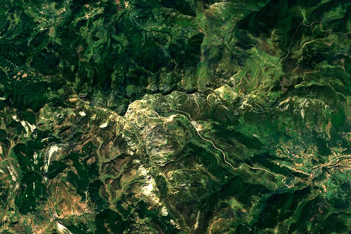
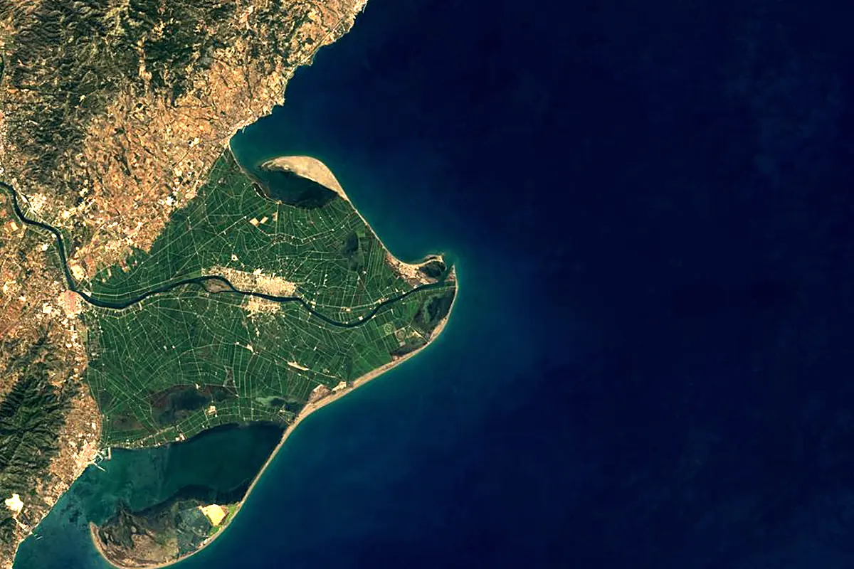
Sentinel-2 cloudless 2016 by EOX IT Services GmbH (contains modified Copernicus Sentinel data 2016), CC BY 4.0. The glowing line is the river as drawn by RiverATLAS.
Photos
Ebro in pictures
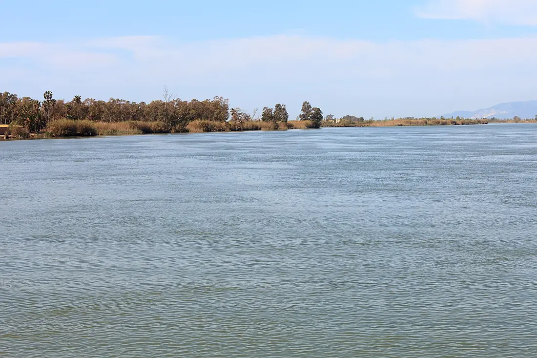
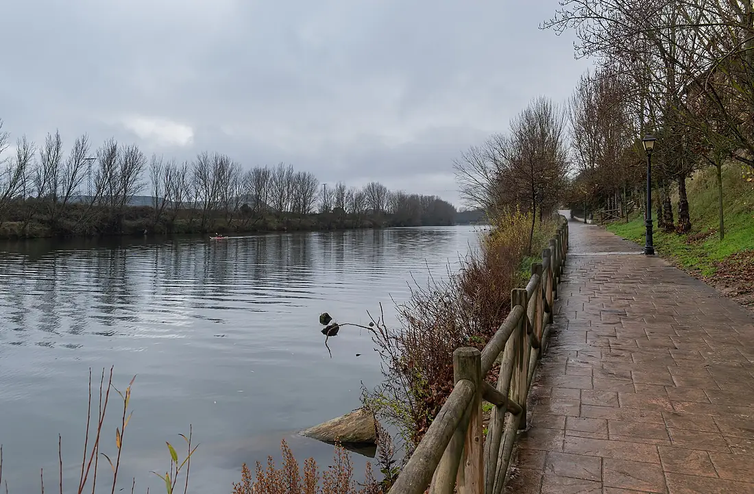
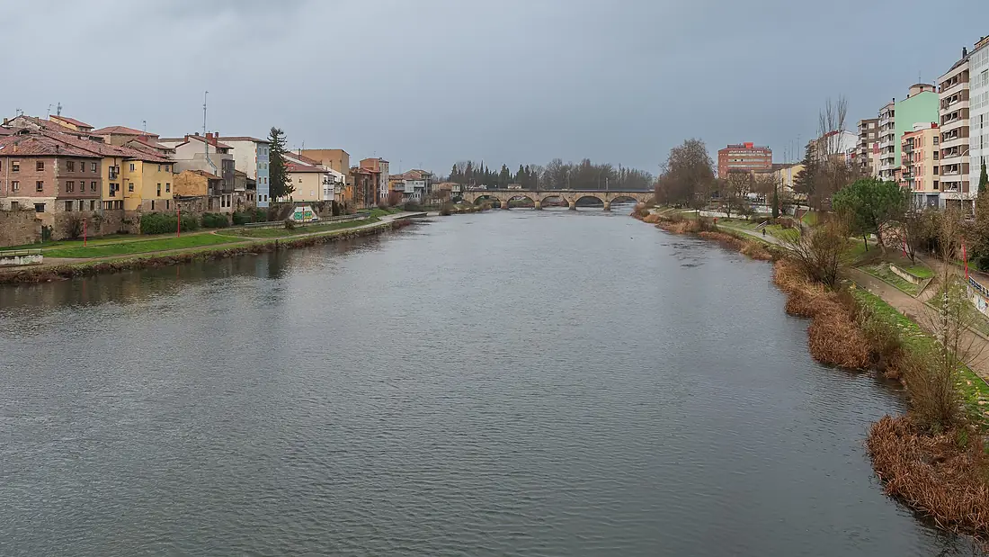
Tributaries
Where it flows, and what flows into it
Tributaries (38)
Spain265 km100 m³/sjoins at km 648Jalón RiverSpain224 km21 m³/sAragónSpain195 km41 m³/sjoins at km 336GállegoSpain193 km34 m³/sjoins at km 462GuadalopeSpain160 km4.8 m³/sjoins at km 594Also: Ega river, Tirón River, Cidacos, Matarranya River, Zadorra, Najerilla, Huerva River, Alhama, Leza River, Queiles, Nela River, Iregua, Río Arba, Bayas River, Martín River, Oca, Rio Aguasvivas, Rudrón River, Jerea, Huecha River, Trueba River, Oroncillo River, Siurana River, Linares River
Nearby
Rivers nearby
Where these numbers come from
| Name, length, places | Wikidata (Q10965) · CC0 |
|---|---|
| Course, profile, basin | RiverATLAS v1.0 (HydroATLAS, Linke et al. 2019) · CC BY 4.0 — followed from the source to the mouth given by Wikidata |
| Flow | WaterGAP (RiverATLAS), 1971–2000 · CC BY 4.0 |
| Climate along the river | WorldClim (RiverATLAS), 1970–2000 · CC BY 4.0 |
| Towns, bridges, dams | Wikidata · CC0; GeoNames · CC BY 4.0 |
| Along the river | © OpenStreetMap contributors · ODbL |
| Images | EOX Sentinel-2 cloudless 2016 · CC BY 4.0; Wikimedia Commons |
| Our other atlases | Lakeyas, Coastya, Peakyas — Wikidata · CC0; © OpenStreetMap contributors · ODbL; GeoNames · CC BY 4.0; HydroLAKES · CC BY 4.0; NOAA OISST |
Every source and licence is on the data sources page.
The family
Do you prefer beaches, lakes, mountains, waterfalls, islands, rivers or canyons?
Same idea, other landscapes: field atlases built on open data, month by month, in seven languages.
beaches Find your beach: sea temperature, sun and swimming month by month.Visit lakes
 Every lake on Earth: water temperature, ice, depth and the shore.Coming soonVisit mountains
 Every summit in 3D: summit weather, the 0 °C line, huts and trails.Visit
  waterfalls
 Every waterfall: height, flow month by month and when it roars.Coming soonVisit
  islands
 Every island from the sea up: size, sea temperature, ferries and 3D.Coming soonVisit
  rivers
 Every river from source to sea: the journey, the flow and the basin in numbers.You are here
 canyons
 Every canyon cut to scale: depth to the floor, rim and floor temperatures, trails and viewpoints.Coming soonVisit