Stream
Llobregat
175 km from source to mouth · Spain.
 SpainFlows into Mediterranean Sea
In numbers
Length
175km
Average flow
21m³/s
Basin
4,948km²
Drop
808m
from 808 m to 0 m
Country
1
The journey
From source to mouth
175 km of river and 68 stops on the way: 49 towns and cities on its banks, dams, bridges and the tributaries that feed it.
- 0 kmfonts del Llobregatat 808 m
- 0 kmCastellar de n'Hug166 people
- 0 kmPont de la Farga Vella
- 0 kmPont Vell de la Pobla de Lillet
- 0 kmLa Pobla de Lillet1,105 people
- 9 kmSant Julià de Cerdanyola234 people
- 11 kmGuardiola de Berguedà1,020 people
- 13 kmPont Vell de Guardiola
- 18 kmPont del Far
- 20 kmLa Nou de Berguedà163 people
- 23 kmCercs1,236 people
- 27 kmPantà de la Baells2.3 km²
- 29 kmPont de Pedret
- 33 kmBerga17,473 people
- 35 kmMergançoltributary
- 35 kmAvià2,267 people
- 36 kmPont d'Orniu
- 37 kmOlvan924 people
- 41 kmGironella5,083 people
- 41 kmPont Vell de Gironella
- 43 kmFàbrica de Cal Bassacs
- 44 kmCasserres1,660 people
- 50 kmPuig-reig4,565 people
- 57 kmRiera de Merlèstributary
- 58 kmGaià172 people
- 61 kmNavàs6,238 people
- 68 kmBalsareny3,380 people
- 74 kmSallent7,030 people
- 81 kmRiera Gavarresatributary
- 81 kmArtés6,225 people
- 85 kmNavarcles6,276 people
- 86 kmSant Fruitós de Bages9,333 people
- 87 kmTalamanca209 people
- 93 kmManresa80,974 people
- 93 kmEl Pont de Vilomara i Rocafort4,193 people
- 95 kmPont de Vilomara
- 101 kmCardenertributary
- 101 kmCastellgalí2,413 people
- 103 kmSant Vicenç de Castellet10,164 people
- 109 kmCastellbell i el Vilar4,159 people
- 112 kmPont sobre el Llobregat
- 112 kmMonistrol de Montserrat3,250 people
- 117 kmCollbató4,828 people
- 124 kmEsparreguera22,665 people
- 125 kmOlesa de Montserrat24,966 people
- 130 kmAbrera13,227 people
- 134 kmriera de Gaiàtributary
- 138 kmMartorell29,175 people
- 138 kmAnoiatributary
- 142 kmCastellbisbal13,061 people
- 145 kmSant Andreu de la Barca27,094 people
- 146 kmCorbera de Llobregat16,010 people
- 146 kmBaix Llobregat850,605 people
- 148 kmEl Papiol4,404 people
- 149 kmPallejà12,006 people
- 152 kmMolins de Rei27,300 people
- 154 kmSant Vicenç dels Horts28,746 people
- 158 kmSanta Coloma de Cervelló8,273 people
- 159 kmSant Feliu de Llobregat46,781 people
- 160 kmSant Joan Despí35,926 people
- 162 kmSant Boi de Llobregat85,610 people
- 163 kmSant Boi Bridge
- 165 kmCornellà de Llobregat92,237 people
- 167 kmL'Hospitalet de Llobregat289,510 people
- 170 kmEl Prat de Llobregat66,338 people
- 171 kmPont Nelson Mandela
- 172 kmSants-Montjuïc187,026 people
- 172 kmla Marina del Prat Vermell1,138 people
- 174 kmBarcelona1,731,649 people
- 175 kmMediterranean Seaat 0 m
Water level along the river (RiverATLAS; the height is exaggerated). Towns: GeoNames and Wikidata; bridges, dams and tributaries: Wikidata.
Second longest river in Catalonia, Spain
At the mouth it carries 21 m³/s on average: an Olympic pool every 120 seconds. It drops from 808 m to 0 m, 4.6 m per kilometre on average. Its basin covers 4,948 km², about the size of TT. 2.1 million people live in it. Highest water: from October to December. Dams and reservoirs hold back a large share of its water (13% of a year's flow).
Where to start
- BarcelonaLargest city on its banks · 1,731,649 people
- Josep Tarradellas Barcelona-El Prat Airport (BCN)Nearest airport with scheduled flights, 13 km from the cityCar hire at BCN airport (Barcelona)Discover Cars · Affiliate link↗
- On the water2 ferry piers, marinas, boat rentals and boat ramps along the river (OpenStreetMap)
- From April to AugustThe best months to visit
Llobregat, month by month
Highest water: from October to December
Best months to visit: from April to August.
From about 10 m³/s in the lowest month to 66 m³/s in the highest. An estimate: the monthly flow is modelled from the lowest and highest months of WaterGAP (RiverATLAS, 1971–2000) and the rain and snow along the river (WorldClim). Dams change the real rhythm. The chip is the average air temperature; below it, the month's rain.
Plan the trip
Plan the trip: boat trips, a bed by the river, a car
Some links above are affiliate links: if you book through them we may earn a commission, at no extra cost to you. It never changes what the data on this page says.
The basin
Llobregat: the basin in numbers
5,000 km² of land send their water to this river. This is what lives on it.
- 2.1millionpeople live in the basin
- 422/km²people per km²
- 641maverage altitude of the basin
- 727mmof rain a year (basin average)
- 12.7°Caverage air temperature
- 20%protected areas
- 0.1%covered by lakes
- 0.1km³held in reservoirs
What covers the basin
- 63% Forest
- 16% Cropland
- 6% Pasture
- 12% Towns and cities
RiverATLAS (HydroATLAS v1.0, CC BY 4.0): land cover, people, protected areas, glaciers and dams over the whole basin upstream of the mouth.
Along the river
Llobregat: what you find on the way
- 49WeirsResclosa del Bastareny, Resclosa del Canal Industrial de Berga, Resclosa de Cal Marçal and 46 more
- 1Locks
- 16WaterfallsSalt del Molí de Bellús, Sot Gran, Gorg de la Mola and 13 more
- 2Marinas
From OpenStreetMap, within 1.6 km of the river. Not mapped is not the same as not there.
Cross-checked with our atlases
Llobregat in our other atlases
What our sister atlases know about the waterfalls on this river, the lakes it flows through, the beaches at its mouth, the mountains where it rises and the islands off its mouth.
 1lake on its wayLakeyas
 17beaches at the mouth and on the banksCoastya
 146mountains at the sourcePeakyas
 1island off the mouthIslandyas
Lakes and reservoirs (1)
Lakes it flows through, by Lakeyas
- Pantà de la Baellskm 222.3km²
Lakeyas is coming soonOpen Lakeyas ↗
Beaches (17)
At the mouth (25 km) and on the banks, by Coastya
- Platja de la Barceloneta8.0 km away25.3°C
- Platja del Besòs13 km away25.3°C
- Platja de Badalona16 km away25.3°C
- Platja de Sant Miquel7.0 km away25.3°C
- Platja de Castelldefels16 km away25.8°C
- Platja de Morisca24 km away25.8°C
- Platja de Montgat20 km away25.3°C
- Platja de la Mar Bella10 km away25.3°C
9 more on CoastyaOpen Coastya ↗
Mountains at the source (146)
Within 15 km of the source, by Peakyas
- Puigmal14 km away · prominence 1,331 m2,910m
- Pic Petit de Segre15 km away · prominence 68 m2,810m
- La Tossa d'Alp11 km away · prominence 806 m2,536m
- Puigmal de Llo15 km away2,801m
- Puig de Dòrria11 km away2,547m
- Tossa del Pas dels Lladres12 km away · prominence 49 m2,661m
- Puigllançada massif6.7 km away · prominence 303 m2,409m
- Puig de Coma Dolça15 km away2,580m
138 more on PeakyasOpen Peakyas ↗
Islands off the mouth (1)
Within 30 km of the mouth, by Islandyas
- Maians8.1 km away
Islandyas is coming soonOpen Islandyas ↗
From space
The source and the mouth, seen from orbit
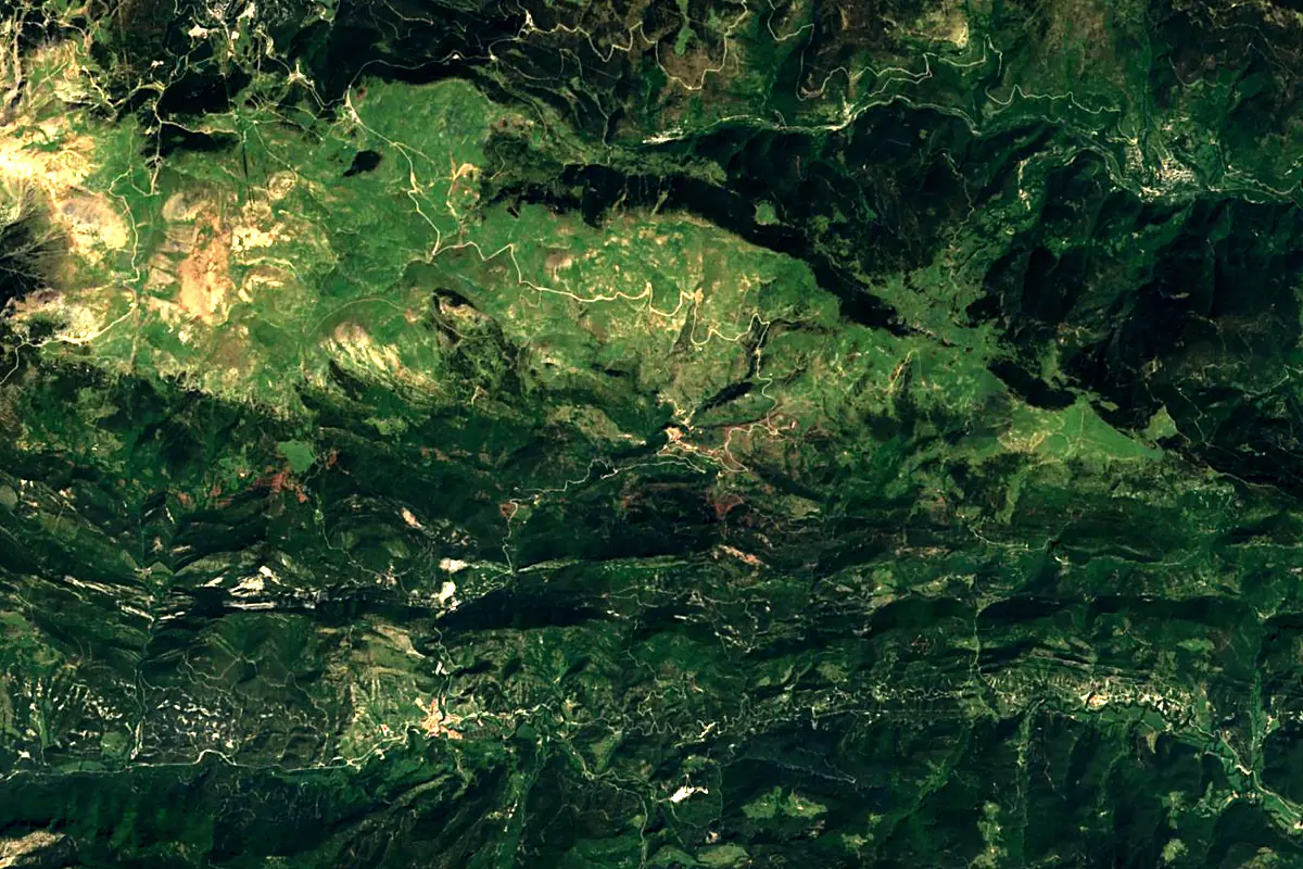
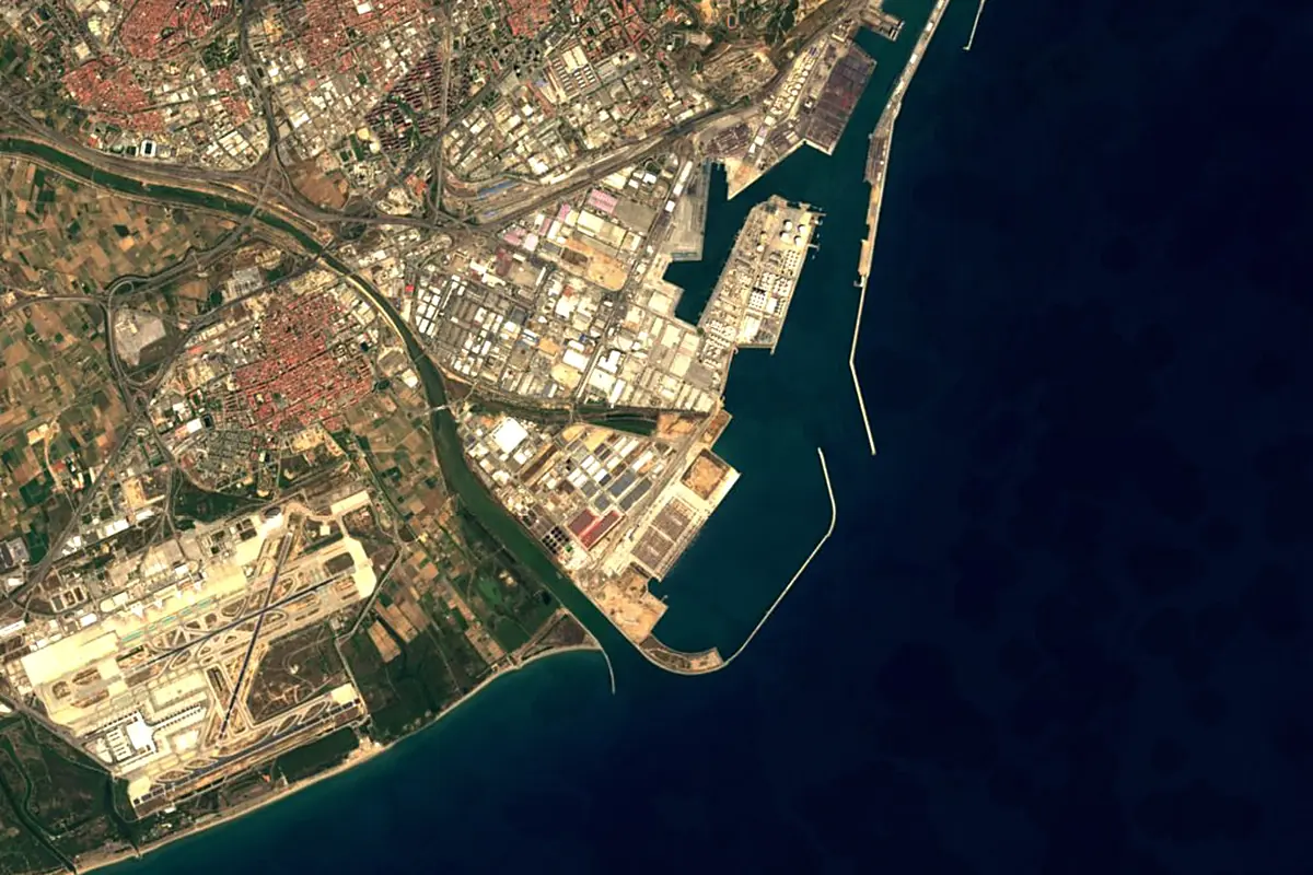
Sentinel-2 cloudless 2016 by EOX IT Services GmbH (contains modified Copernicus Sentinel data 2016), CC BY 4.0. The glowing line is the river as drawn by RiverATLAS.
Photos
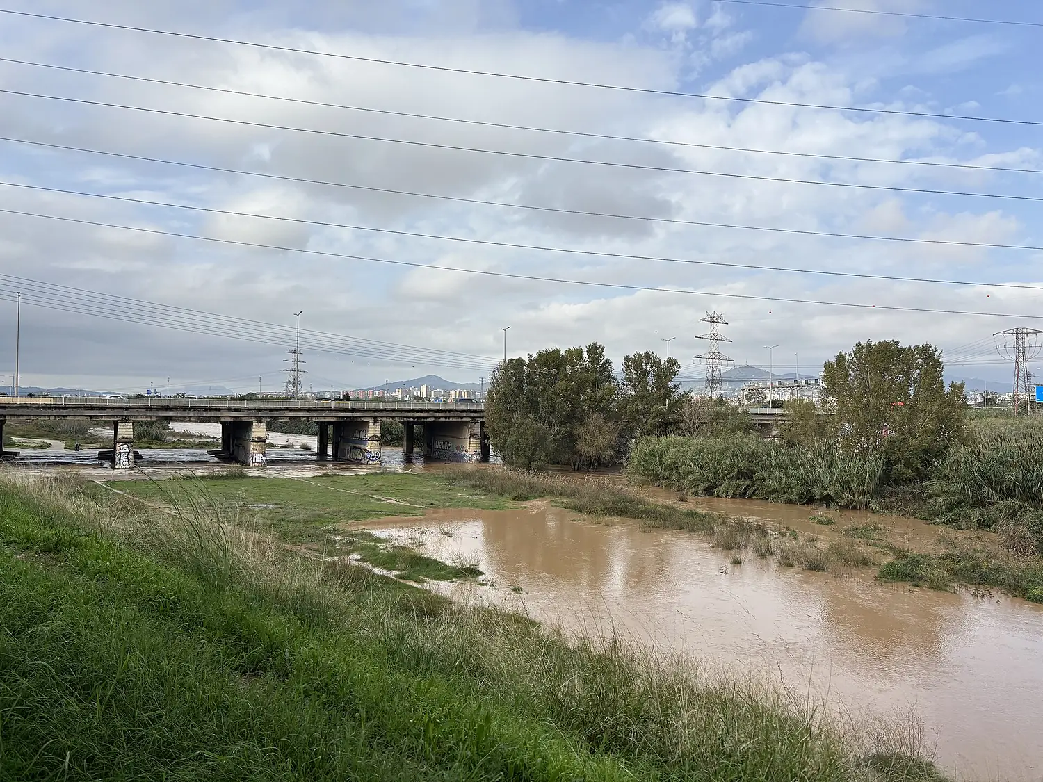
Llobregat in pictures
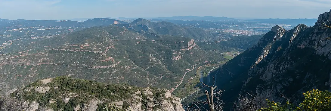
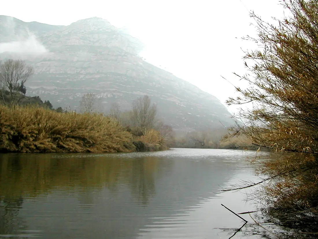
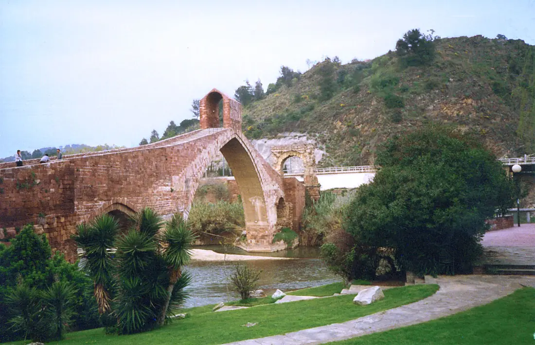
Tributaries
Where it flows, and what flows into it
Tributaries (19)
Also: Cardener, Anoia, Riera de Merlès, Riera de Rubí, Arija River, Riu Calders, Riera de Merola, riera de Gaià, riu de Saldes, El Bastareny, Riera Gavarresa, Mergançol, Riera de Vallvidrera, riera de Clarà, torrent de Pegueres, barranc de Turbians, Riera de Rellinars, riera de Mura, Riera de Castellet
Nearby
Rivers nearby
 France
Where these numbers come from
| Name, length, places | Wikidata (Q31424) · CC0 |
|---|---|
| Course, profile, basin | RiverATLAS v1.0 (HydroATLAS, Linke et al. 2019) · CC BY 4.0 — followed from the source to the mouth given by Wikidata |
| Flow | WaterGAP (RiverATLAS), 1971–2000 · CC BY 4.0 |
| Climate along the river | WorldClim (RiverATLAS), 1970–2000 · CC BY 4.0 |
| Towns, bridges, dams | Wikidata · CC0; GeoNames · CC BY 4.0 |
| Along the river | © OpenStreetMap contributors · ODbL |
| Images | EOX Sentinel-2 cloudless 2016 · CC BY 4.0; Wikimedia Commons |
| Our other atlases | Lakeyas, Coastya, Peakyas, Islandyas — Wikidata · CC0; © OpenStreetMap contributors · ODbL; GeoNames · CC BY 4.0; HydroLAKES · CC BY 4.0; NOAA OISST |
Every source and licence is on the data sources page.
The family
Do you prefer beaches, lakes, mountains, waterfalls, islands, rivers or canyons?
Same idea, other landscapes: field atlases built on open data, month by month, in seven languages.
beaches Find your beach: sea temperature, sun and swimming month by month.Visit lakes
 Every lake on Earth: water temperature, ice, depth and the shore.Coming soonVisit mountains
 Every summit in 3D: summit weather, the 0 °C line, huts and trails.Visit
  waterfalls
 Every waterfall: height, flow month by month and when it roars.Coming soonVisit islands
 Every island from the sea up: size, sea temperature, ferries and 3D.Coming soonVisit
  rivers
 Every river from source to sea: the journey, the flow and the basin in numbers.You are here
 canyons
 Every canyon cut to scale: depth to the floor, rim and floor temperatures, trails and viewpoints.Coming soonVisit