River
Kemijoki
550 km from source to mouth · Finland.
 FinlandFlows into Bothnian Bay1st longest in Finland
In numbers
Length
550km
Average flow
560m³/s
Basin
51,000km²
Drop
224m
from 224 m to 0 m
Country
1
The journey
From source to mouth
550 km of river and 36 stops on the way: 5 towns and cities on its banks, dams, bridges and the tributaries that feed it.
- 0 kmKemihaaraat 224 m
- 83 kmVärriöjokitributary
- 117 kmTenniöjokitributary
- 135 kmPikku Akanjärvi0.4 km²
- 142 kmIso Akanjärvi2.0 km²
- 170 kmKotakkojärvi0.5 km²
- 171 kmVuotosjokitributary
- 177 kmKitinentributary
- 186 kmAhvenjärvi0.4 km²
- 222 kmKostamojärvi0.9 km²
- 232 kmKemijärvi6,918 people
- 275 kmNeitijärvi0.6 km²
- 284 kmJuujärvi2.4 km²
- 304 kmPirttijärvi0.4 km²
- 309 kmJoutasjärvi7.2 km²
- 318 kmIso-Kaihua2.1 km²
- 362 kmJyrhämäjärvi3.0 km²
- 363 kmRaudanjokitributary
- 383 kmSaarenkylä9,000 people
- 383 kmSuutarinkorva railway bridge
- 383 kmOunasjokitributary
- 385 kmJätkänkynttilä
- 385 kmRovaniemi65,329 people
- 386 kmOunaskoski bridge
- 387 kmHarjulampi0.4 km²
- 404 kmValajaskosken voimalaitoksen yläallas12 km²
- 418 kmMuurola1,000 people
- 419 kmPasmajärvi0.6 km²
- 430 kmPetäjäskosken voimalaitoksen yläallas25 km²
- 452 kmOssauskosken voimalaitoksen yläallas11 km²
- 477 kmTervola Old Church
- 477 kmTervola Church
- 498 kmTaivalkosken voimalaitoksen yläallas19 km²
- 519 kmKeminmaa Old Church
- 520 kmKeminmaa7,591 people
- 521 kmIsohaara kraftverksdamm14 km²
- 521 kmIsohaara Power Plant
- 550 kmBothnian Bayat 0 m
Water level along the river (RiverATLAS; the height is exaggerated). Towns: GeoNames and Wikidata; bridges, dams and tributaries: Wikidata.
River of Lapland region, Finland
At the mouth it carries 556 m³/s on average: an Olympic pool every 4.5 seconds. It drops from 224 m to 0 m, 0.4 m per kilometre on average. Its basin covers 51,000 km², about the size of CR. 117,000 people live in it. Highest water, with the snowmelt: from May to July; lowest: from January to April. Dams and reservoirs hold back a large share of its water (24% of a year's flow).
Where to start
- RovaniemiLargest city on its banks · 65,329 people
- Rovaniemi Airport (RVN)Nearest airport with scheduled flights, 8 km from the cityCar hire at RVN airport (Rovaniemi)Discover Cars · Affiliate link↗
- On the water80 ferry piers, marinas, boat rentals and boat ramps along the river (OpenStreetMap)
- Kayak and canoe5 put-ins and rapids mapped (OpenStreetMap)
- JulyThe best months to visit
Kemijoki, month by month
Highest water: from May to July
Lowest water: from January to April. Freezing months (average below −4 °C): from November to March. Melting snow makes up much of its water. Best months to visit: July.
From about 180 m³/s in the lowest month to 1,600 m³/s in the highest. An estimate: the monthly flow is modelled from the lowest and highest months of WaterGAP (RiverATLAS, 1971–2000) and the rain and snow along the river (WorldClim). Dams change the real rhythm. The chip is the average air temperature; below it, the month's rain.
Plan the trip
Plan the trip: boat trips, a bed by the river, a car
Some links above are affiliate links: if you book through them we may earn a commission, at no extra cost to you. It never changes what the data on this page says.
The basin
Kemijoki: the basin in numbers
53,536 km² of land send their water to this river. This is what lives on it.
- 117,000people live in the basin
- 2/km²people per km²
- 227maverage altitude of the basin
- 511mmof rain a year (basin average)
- -1.0°Caverage air temperature
- 12%protected areas
- 3.2%covered by lakes
- 5%permafrost
- 4.4km³held in reservoirs
What covers the basin
- 74% Forest
RiverATLAS (HydroATLAS v1.0, CC BY 4.0): land cover, people, protected areas, glaciers and dams over the whole basin upstream of the mouth.
Along the river
Kemijoki: what you find on the way
- 4Weirs
- 5Rapids
- 65Boat rampsNarkiperän veneenlaskupaikka, Veneenlaskupaikka, Nätynginnokka and 62 more
- 14MarinasVenesatama, Kemijärven Venesatama, Narkiperän venesatama and 11 more
- 18River beachesKemijärven uimaranta, Uimaranta, Kalkonniemen uimaranta and 15 more
From OpenStreetMap, within 2.2 km of the river. Not mapped is not the same as not there.
Cross-checked with our atlases
Kemijoki in our other atlases
What our sister atlases know about the waterfalls on this river, the lakes it flows through, the beaches at its mouth, the mountains where it rises and the islands off its mouth.
 19lakes on its wayLakeyas
 30beaches at the mouth and on the banksCoastya
 2mountains at the sourcePeakyas
 9islands off the mouthIslandyas
Lakes and reservoirs (19)
Lakes it flows through, by Lakeyas
- Kemijärvikm 232 · 24 m deep226km²
- Juujärvikm 2362.4km²
- Joutasjärvikm 2577.2km²
- Jyrhämäjärvikm 3003.0km²
- Valajaskosken voimalaitoksen yläallaskm 33512km²
- Petäjäskosken voimalaitoksen yläallaskm 35725km²
- Taivalkosken voimalaitoksen yläallaskm 41319km²
- Isohaara kraftverksdammkm 43214km²
11 more on LakeyasLakeyas is coming soonOpen Lakeyas ↗
Beaches (30)
At the mouth (25 km) and on the banks, by Coastya
- Puidenpuuttuma10 km away15.4°C
- Kitiniemenhiekka18 km away15.4°C
- Röyttänhiekka18 km away15.4°C
- Ykskuusenhiekka19 km away15.5°C
- Länsihiekka18 km away15.5°C
- Tiironhiekka19 km away15.5°C
- Siikalahti9.1 km away · cove15.4°C
- Laiskanlahti16 km away · cove15.2°C
22 more on CoastyaOpen Coastya ↗
Mountains at the source (2)
Within 15 km of the source, by Peakyas
- Pirttinivat5.9 km away
- Naltiotunturi7.2 km away
Islands off the mouth (9)
Within 30 km of the mouth, by Islandyas
- Kataja19 km away0.7km²
- Röyttä16 km away1.3km²
- Keminkraaseli19 km away
- Selkä-Sarvi24 km away0.3km²
- Montaja24 km away0.9km²
- Inakari14 km away
- Pirkkiö15 km away
- Kuivanuoro3.8 km away6.5km²
1 more on IslandyasIslandyas is coming soonOpen Islandyas ↗
From space
The source and the mouth, seen from orbit
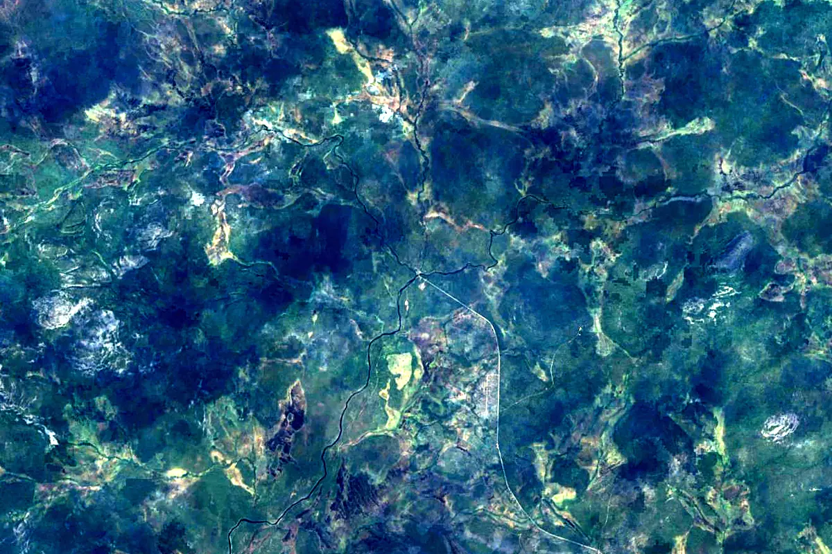
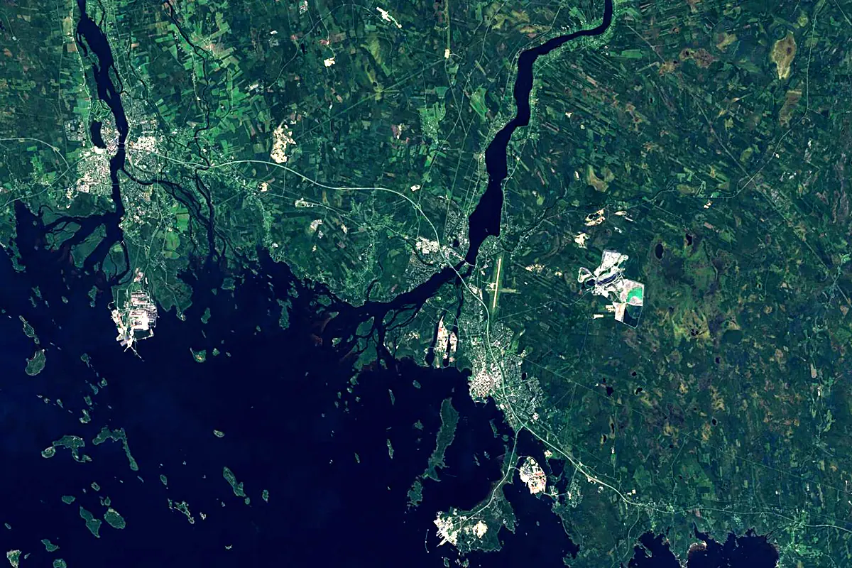
Sentinel-2 cloudless 2016 by EOX IT Services GmbH (contains modified Copernicus Sentinel data 2016), CC BY 4.0. The glowing line is the river as drawn by RiverATLAS.
Photos
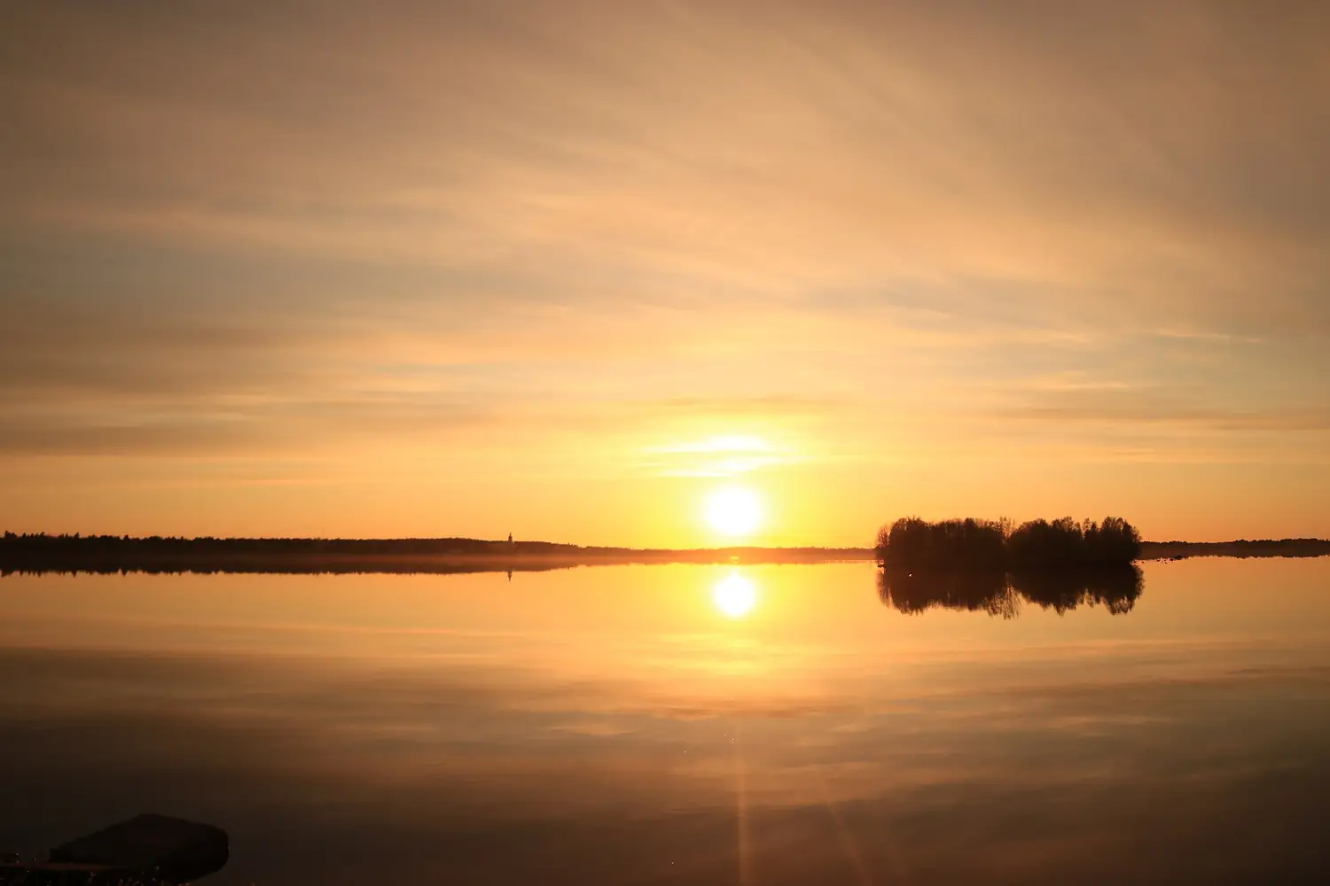
Kemijoki in pictures
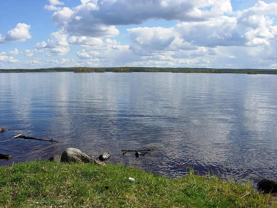
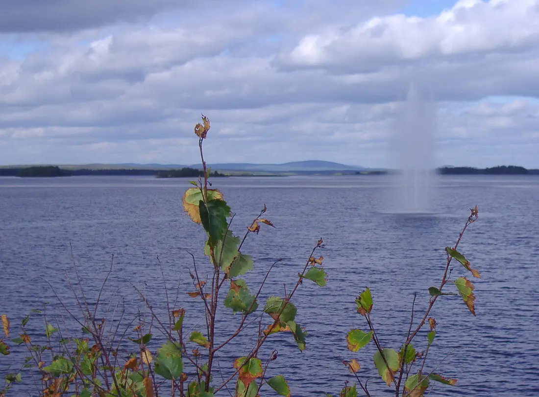
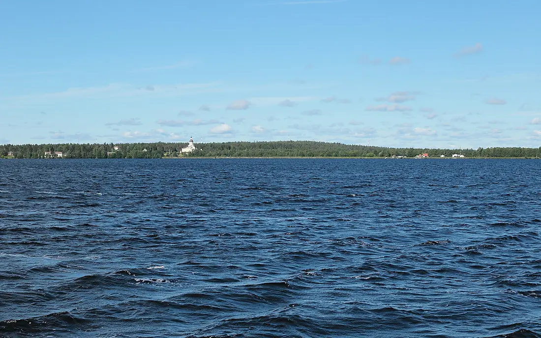
Tributaries
Where it flows, and what flows into it
Tributaries (9)
Also: Tenniöjoki, Raudanjoki, Värriöjoki, Vuotosjoki, Akkunusjoki, Pyhäjoki, Iso Akanjoki
Nearby
Rivers nearby
 Sweden470 km380 m³/s16 km awayKalix RiverSweden461 km290 m³/s67 km awayIijokiFinland370 km200 m³/s65 km awayOulujokiFinland107 km250 m³/s96 km awayOunasjokiFinland300 km160 m³/s99 km awayPite RiverSweden400 km160 m³/s154 km awayMuonio RiverSweden230 km160 m³/s159 km awaySkellefte RiverSweden410 km160 m³/s200 km away
Where these numbers come from
| Name, length, places | Wikidata (Q214779) · CC0 |
|---|---|
| Course, profile, basin | RiverATLAS v1.0 (HydroATLAS, Linke et al. 2019) · CC BY 4.0 — followed from the source to the mouth given by Wikidata |
| Flow | WaterGAP (RiverATLAS), 1971–2000 · CC BY 4.0 |
| Climate along the river | WorldClim (RiverATLAS), 1970–2000 · CC BY 4.0 |
| Towns, bridges, dams | Wikidata · CC0; GeoNames · CC BY 4.0 |
| Along the river | © OpenStreetMap contributors · ODbL |
| Images | EOX Sentinel-2 cloudless 2016 · CC BY 4.0; Wikimedia Commons |
| Our other atlases | Lakeyas, Coastya, Peakyas, Islandyas — Wikidata · CC0; © OpenStreetMap contributors · ODbL; GeoNames · CC BY 4.0; HydroLAKES · CC BY 4.0; NOAA OISST |
Every source and licence is on the data sources page.
The family
Do you prefer beaches, lakes, mountains, waterfalls, islands, rivers or canyons?
Same idea, other landscapes: field atlases built on open data, month by month, in seven languages.
beaches Find your beach: sea temperature, sun and swimming month by month.Visit lakes
 Every lake on Earth: water temperature, ice, depth and the shore.Coming soonVisit mountains
 Every summit in 3D: summit weather, the 0 °C line, huts and trails.Visit
  waterfalls
 Every waterfall: height, flow month by month and when it roars.Coming soonVisit islands
 Every island from the sea up: size, sea temperature, ferries and 3D.Coming soonVisit
  rivers
 Every river from source to sea: the journey, the flow and the basin in numbers.You are here
 canyons
 Every canyon cut to scale: depth to the floor, rim and floor temperatures, trails and viewpoints.Coming soonVisit