River
Oulujoki
107 km from source to mouth · Finland.
 FinlandFlows into Bothnian Bay7th longest in Finland
In numbers
Length
107km
Average flow
250m³/s
Basin
22,853km²
Drop
95m
from 100 m to 5 m
Country
1
The journey
From source to mouth
107 km of river and 54 stops on the way: 33 towns and cities on its banks, dams, bridges and the tributaries that feed it.
- 0 kmOulujärviat 100 m
- 0 kmNimisjärvi1.5 km²
- 1 kmOulujärvi890 km²
- 3 kmVaalankurkku railway bridge
- 3 kmVaala2,567 people
- 7 kmPyteränlampi1.2 km²
- 11 kmNuojuanlampi0.5 km²
- 25 kmKurtinlampi0.8 km²
- 36 kmUtosjokitributary
- 36 kmOilinginojatributary
- 39 kmUtajärvi2,447 people
- 39 kmUtajärvi Church
- 47 kmSotkajärvi1.8 km²
- 63 kmMontalampi0.9 km²
- 64 kmMontta power plant
- 64 kmMuhoslampi0.7 km²
- 65 kmMuhos Church
- 66 kmMuhos8,827 people
- 73 kmLaukka Bridge
- 79 kmPäivärinne Sanatorium
- 89 kmSanginjokitributary
- 90 kmTurkansaari Open Air Museum
- 92 kmSanki Bridge
- 95 kmHeikkilänkangas1,395 people
- 99 kmKaakkuri6,559 people
- 99 kmMaikkula3,478 people
- 100 kmSaarela1,255 people
- 101 kmKiviniemi1,550 people
- 101 kmHiironen2,056 people
- 101 kmMäntylä1,951 people
- 101 kmKaukovainio4,809 people
- 102 kmErkkola Bridge
- 102 kmHintta921 people
- 102 kmOulunsuu4,292 people
- 102 kmVärttö1,354 people
- 102 kmMyllyoja2,345 people
- 102 kmPeltola1,679 people
- 103 kmHöyhtyä2,426 people
- 104 kmKarjasilta3,838 people
- 104 kmRaksila1,770 people
- 105 kmLaanila1,500 people
- 105 kmRautasilta
- 105 kmVaara2,980 people
- 105 kmIntiö2,485 people
- 105 kmMyllytulli3,067 people
- 105 kmOulu217,469 people
- 105 kmPokkinen2,484 people
- 105 kmVanhatulli5,095 people
- 106 kmLeveri2,711 people
- 106 kmLimingantulli1,939 people
- 106 kmHollihaka2,716 people
- 107 kmTuira7,805 people
- 107 kmToppila7,656 people
- 107 kmAlppila2,587 people
- 107 kmVälivainio3,053 people
- 107 kmBothnian Bayat 5 m
Water level along the river (RiverATLAS; the height is exaggerated). Towns: GeoNames and Wikidata; bridges, dams and tributaries: Wikidata.
River of Finland
At the mouth it carries 250 m³/s on average: an Olympic pool every 10.0 seconds. It drops from 100 m to 5 m, 0.9 m per kilometre on average. Its basin covers 22,853 km², about the size of BZ. 170,000 people live in it. Highest water, with the snowmelt: from May to June; lowest: from December to March. Dams and reservoirs hold back a large share of its water (26% of a year's flow).
Where to start
- OuluLargest city on its banks · 217,469 people
- Oulu Airport (OUL)Nearest airport with scheduled flights, 11 km from the cityCar hire at OUL airport (Oulu / Oulunsalo)Discover Cars · Affiliate link↗
- On the water39 ferry piers, marinas, boat rentals and boat ramps along the river (OpenStreetMap)
- From June to AugustThe best months to visit
Oulujoki, month by month
Highest water: from May to June
Lowest water: from December to March. Freezing months (average below −4 °C): from December to March. Melting snow makes up much of its water. Best months to visit: from June to August.
From about 210 m³/s in the lowest month to 320 m³/s in the highest. An estimate: the monthly flow is modelled from the lowest and highest months of WaterGAP (RiverATLAS, 1971–2000) and the rain and snow along the river (WorldClim). Dams change the real rhythm. The chip is the average air temperature; below it, the month's rain.
Plan the trip
Plan the trip: boat trips, a bed by the river, a car
Some links above are affiliate links: if you book through them we may earn a commission, at no extra cost to you. It never changes what the data on this page says.
The basin
Oulujoki: the basin in numbers
25,804 km² of land send their water to this river. This is what lives on it.
- 170,000people live in the basin
- 7/km²people per km²
- 177maverage altitude of the basin
- 574mmof rain a year (basin average)
- 0.8°Caverage air temperature
- 5%protected areas
- 10.4%covered by lakes
- 2.3km³held in reservoirs
What covers the basin
- 86% Forest
- 1% Cropland
RiverATLAS (HydroATLAS v1.0, CC BY 4.0): land cover, people, protected areas, glaciers and dams over the whole basin upstream of the mouth.
Along the river
Oulujoki: what you find on the way
- 7Weirs
- 23Boat ramps
- 3Ferry piersM/S Alexandra lähtölaituri
- 13MarinasJuurusojan venesatama, Saarelan venesatama, Hollihaan venesatama and 10 more
- 10River beachesSahanranta, Järvikylän uimaranta, Junninojan uimaranta and 7 more
From OpenStreetMap, within 2.0 km of the river. Not mapped is not the same as not there.
Cross-checked with our atlases
Oulujoki in our other atlases
What our sister atlases know about the waterfalls on this river, the lakes it flows through, the beaches at its mouth, the mountains where it rises and the islands off its mouth.
 9lakes on its wayLakeyas
 29beaches at the mouth and on the banksCoastya
 19islands off the mouthIslandyas
Lakes and reservoirs (9)
Lakes it flows through, by Lakeyas
- Nimisjärvikm 01.5km²
- Oulujärvikm 2 · 38 m deep890km²
- Pyteränlampikm 81.2km²
- Kurtinlampikm 260.8km²
- Utajärvikm 371.3km²
- Sotkajärvikm 491.8km²
- Montalampikm 660.9km²
- Muhoslampikm 670.7km²
1 more on LakeyasLakeyas is coming soonOpen Lakeyas ↗
Beaches (29)
At the mouth (25 km) and on the banks, by Coastya
- Nallikari beach2.7 km away15.5°C
- Onganranta11 km away15.5°C
- Koppana13 km away15.3°C
- Mäntyranta13 km away15.5°C
- Sannanlahti19 km away · cove15.3°C
- Martinlahti24 km away · cove15.5°C
- Kaukoperä9.2 km away · cove15.5°C
- Ukonkaivos19 km away · cove15.5°C
21 more on CoastyaOpen Coastya ↗
Islands off the mouth (19)
Within 30 km of the mouth, by Islandyas
- Kraaseli10 km away5.0km²
- Kiikeli0.2 km away0.0km²
- Kahvankari6.9 km away0.0km²
- Kropsu19 km away0.3km²
- Hevossaari0.8 km away0.1km²
- Satakari30 km away0.8km²
- Varjakansaari7.4 km away0.6km²
- Iso-Miehikkä21 km away
11 more on IslandyasIslandyas is coming soonOpen Islandyas ↗
From space
The source and the mouth, seen from orbit
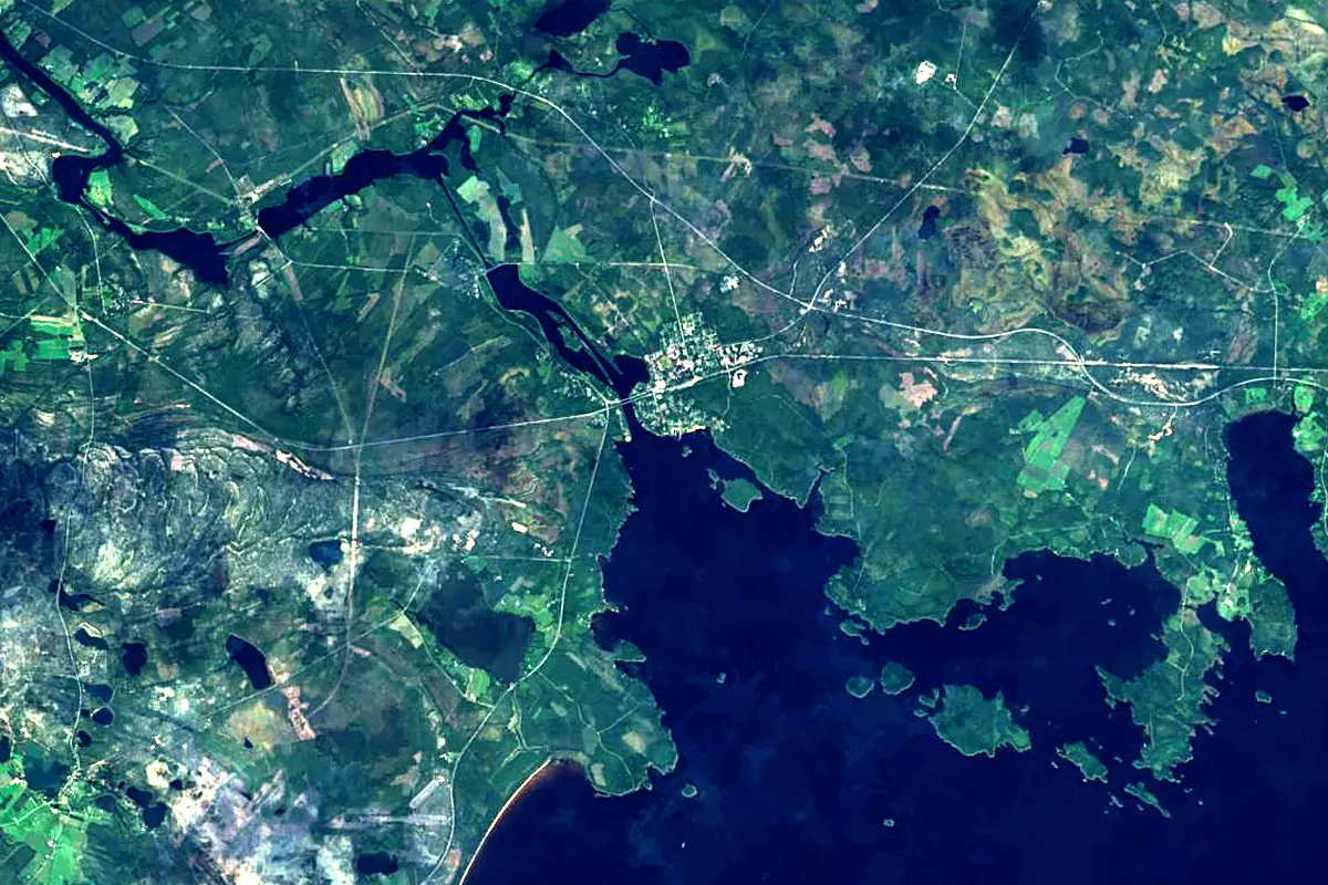
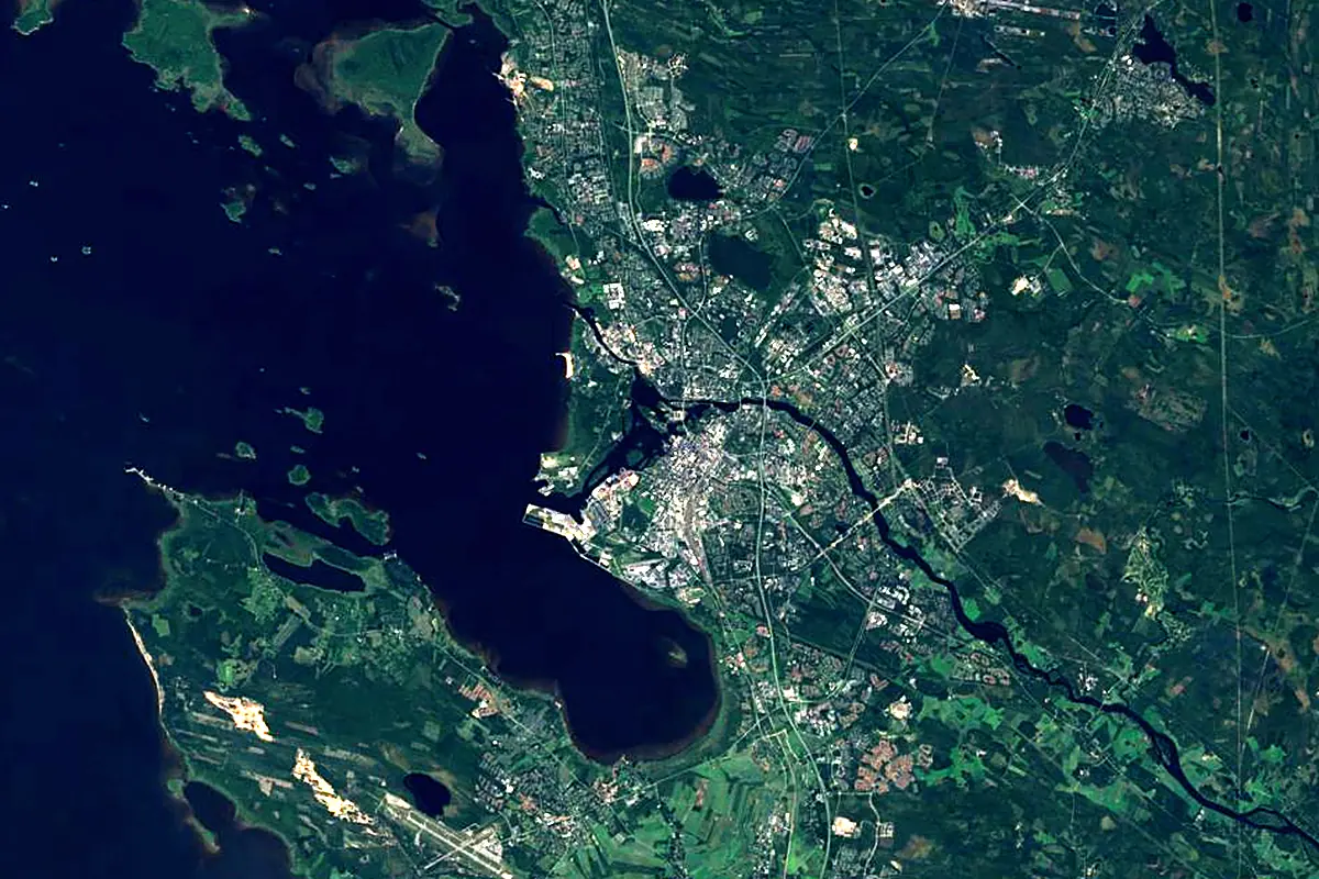
Sentinel-2 cloudless 2016 by EOX IT Services GmbH (contains modified Copernicus Sentinel data 2016), CC BY 4.0. The glowing line is the river as drawn by RiverATLAS.
Photos
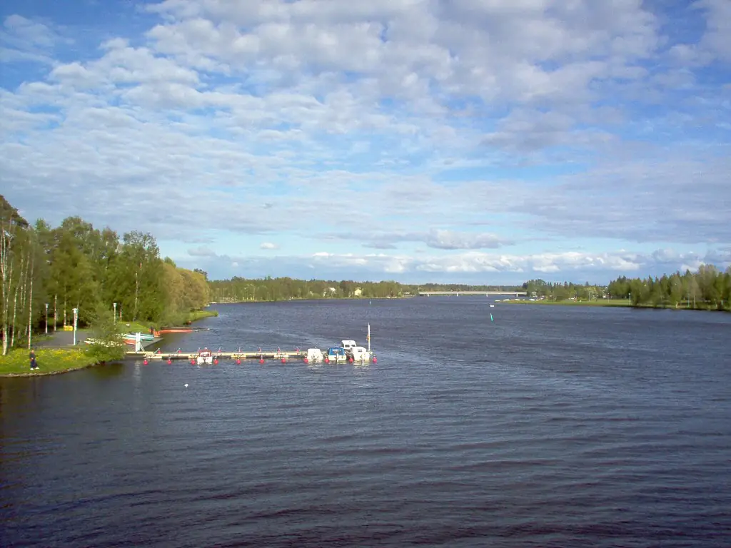
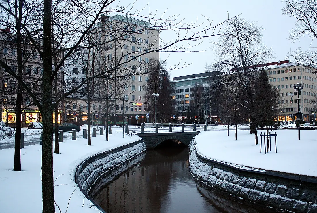
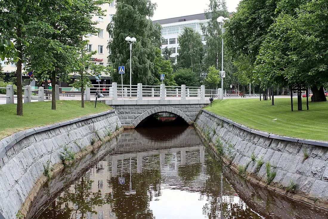
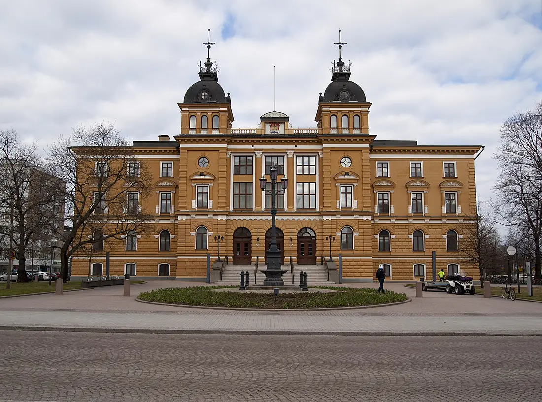
Oulujoki in pictures
Tributaries
Where it flows, and what flows into it
Tributaries (5)
Also: Muhosjoki, Sanginjoki, Oilinginoja, Kutujoki, Utosjoki
Nearby
Rivers nearby
Finland370 km200 m³/s34 km awayKemijokiFinland550 km560 m³/s96 km awayTorne River Sweden470 km380 m³/s107 km awayKalix RiverSweden461 km290 m³/s146 km awayOunasjokiFinland300 km160 m³/s167 km awayPite RiverSweden400 km160 m³/s198 km awaySkellefte RiverSweden410 km160 m³/s209 km awayMuonio RiverSweden230 km160 m³/s254 km away
Where these numbers come from
| Name, length, places | Wikidata (Q736575) · CC0 |
|---|---|
| Course, profile, basin | RiverATLAS v1.0 (HydroATLAS, Linke et al. 2019) · CC BY 4.0 — followed from the source to the mouth given by Wikidata |
| Flow | WaterGAP (RiverATLAS), 1971–2000 · CC BY 4.0 |
| Climate along the river | WorldClim (RiverATLAS), 1970–2000 · CC BY 4.0 |
| Towns, bridges, dams | Wikidata · CC0; GeoNames · CC BY 4.0 |
| Along the river | © OpenStreetMap contributors · ODbL |
| Images | EOX Sentinel-2 cloudless 2016 · CC BY 4.0; Wikimedia Commons |
| Our other atlases | Lakeyas, Coastya, Islandyas — Wikidata · CC0; © OpenStreetMap contributors · ODbL; GeoNames · CC BY 4.0; HydroLAKES · CC BY 4.0; NOAA OISST |
Every source and licence is on the data sources page.
The family
Do you prefer beaches, lakes, mountains, waterfalls, islands, rivers or canyons?
Same idea, other landscapes: field atlases built on open data, month by month, in seven languages.
beaches Find your beach: sea temperature, sun and swimming month by month.Visit lakes
 Every lake on Earth: water temperature, ice, depth and the shore.Coming soonVisit
  mountains
 Every summit in 3D: summit weather, the 0 °C line, huts and trails.Visit
  waterfalls
 Every waterfall: height, flow month by month and when it roars.Coming soonVisit islands
 Every island from the sea up: size, sea temperature, ferries and 3D.Coming soonVisit
  rivers
 Every river from source to sea: the journey, the flow and the basin in numbers.You are here
 canyons
 Every canyon cut to scale: depth to the floor, rim and floor temperatures, trails and viewpoints.Coming soonVisit