River
Kuban
870 km from source to mouth · Russia.
 RussiaFlows into Sea of Azov
In numbers
Length
870km
Average flow
420m³/s
Basin
57,900km²
Drop
1,357m
from 1,351 m to -6 m
Country
1
The journey
From source to mouth
870 km of river and 41 stops on the way: 23 towns and cities on its banks, dams, bridges and the tributaries that feed it.
- 0 kmMount Elbrusat 1,351 m
- 60 kmKarachayevsk20,264 people
- 61 kmTeberda Rivertributary
- 104 kmUst’-Dzheguta34,001 people
- 123 kmCherkessk122,395 people
- 135 kmAbazinkatributary
- 152 kmMaly Zelenchuktributary
- 182 kmBolshoi Zelenchuktributary
- 182 kmNevinnomyssk134,345 people
- 188 kmKochubeyevskoye28,491 people
- 255 kmUspenskoye11,843 people
- 285 kmUruptributary
- 287 kmArmavir199,548 people
- 304 kmNovokubansk36,401 people
- 335 kmGrigoropolisskaya9,310 people
- 388 kmKavkazskaya11,680 people
- 401 kmKropotkin79,599 people
- 422 kmKazanskaya10,794 people
- 447 kmTbilisskaya24,446 people
- 476 kmLadozhskaya14,904 people
- 485 kmZelenchuk Vtoroytributary
- 495 kmDvubratskiy10,272 people
- 509 kmLaba Rivertributary
- 512 kmUst’-Labinsk44,088 people
- 539 kmVasyurinskaya12,830 people
- 576 kmKrasnodar Reservoir269 km²
- 579 kmOld Kuban Lake0.8 km²
- 595 kmChibytributary
- 597 kmYablonovskiy33,431 people
- 598 kmYablonovskiy bridge
- 602 kmKrasnodar1,154,885 people
- 603 kmTurgenev Bridge
- 622 kmShapsug Reservoir31 km²
- 633 kmAfipstributary
- 635 kmYelizavetinskaya19,306 people
- 655 kmMar’yanskaya12,215 people
- 774 kmVarenikovskaya14,409 people
- 778 kmAdagumtributary
- 787 kmChekupstributary
- 794 kmLiman Kruglyy (lanaw)0.5 km²
- 811 kmTemryuk36,546 people
- 821 kmKurchanskiy Liman57 km²
- 870 kmSea of Azovat -6 m
Water level along the river (RiverATLAS; the height is exaggerated). Towns: GeoNames and Wikidata; bridges, dams and tributaries: Wikidata.
River in Russia, in the North Caucasus region
At the mouth it carries 425 m³/s on average: an Olympic pool every 5.9 seconds. It drops from 1,351 m to -6 m, 1.6 m per kilometre on average. Its basin covers 57,900 km², about the size of TG. 3.2 million people live in it. Highest water: from April to May; lowest: February. Dams and reservoirs hold back a large share of its water (21% of a year's flow).
Where to start
- KrasnodarLargest city on its banks · 1,154,885 people
- Krasnodar Pashkovsky International Airport (KRR)Nearest airport with scheduled flights, 15 km from the city
- On the water16 ferry piers, marinas, boat rentals and boat ramps along the river (OpenStreetMap)
- From May to SeptemberThe best months to visit
Kuban, month by month
Highest water: from April to May
Lowest water: February. Best months to visit: from May to September.
From about 230 m³/s in the lowest month to 890 m³/s in the highest. An estimate: the monthly flow is modelled from the lowest and highest months of WaterGAP (RiverATLAS, 1971–2000) and the rain and snow along the river (WorldClim). Dams change the real rhythm. The chip is the average air temperature; below it, the month's rain.
Plan the trip
Plan the trip: boat trips, a bed by the river, a car
Some links above are affiliate links: if you book through them we may earn a commission, at no extra cost to you. It never changes what the data on this page says.
The basin
Kuban: the basin in numbers
52,399 km² of land send their water to this river. This is what lives on it.
- 3.2millionpeople live in the basin
- 61/km²people per km²
- 696maverage altitude of the basin
- 800mmof rain a year (basin average)
- 9.1°Caverage air temperature
- 13%protected areas
- 1.1%covered by lakes
- 2%permafrost
- 3.0km³held in reservoirs
What covers the basin
- 35% Forest
- 35% Cropland
- 16% Pasture
- 3% Towns and cities
RiverATLAS (HydroATLAS v1.0, CC BY 4.0): land cover, people, protected areas, glaciers and dams over the whole basin upstream of the mouth.
Along the river
Kuban: what you find on the way
- 10Weirs
- 11Locks
- 6Waterfalls
- 5Boat ramps
- 10Ferry piers
- 4River beaches
From OpenStreetMap, within 2.2 km of the river. Not mapped is not the same as not there.
Cross-checked with our atlases
Kuban in our other atlases
What our sister atlases know about the waterfalls on this river, the lakes it flows through, the beaches at its mouth, the mountains where it rises and the islands off its mouth.
 5lakes on its wayLakeyas
 11mountains at the sourcePeakyas
Lakes and reservoirs (5)
Lakes it flows through, by Lakeyas
- Krasnodar Reservoirkm 517269km²
- Old Kuban Lakekm 5200.8km²
- Shapsug Reservoirkm 55831km²
- Liman Kruglyy (lanaw)km 7140.5km²
- Kurchanskiy Limankm 73857km²
Lakeyas is coming soonOpen Lakeyas ↗
Mountains at the source (11)
Within 15 km of the source, by Peakyas
- Gora Bekbashi14 km away
- Gora Shtymbashi12 km away
- Gora El'bashi7.8 km away
- Gora Sabyrlyar15 km away
- Gora Nykhytbashi3.8 km away
- Gora Kepurlibashi14 km away
- Gora Ekibekoras9.0 km away
- Gora Cherikkol15 km away
3 more on PeakyasOpen Peakyas ↗
From space
The source and the mouth, seen from orbit
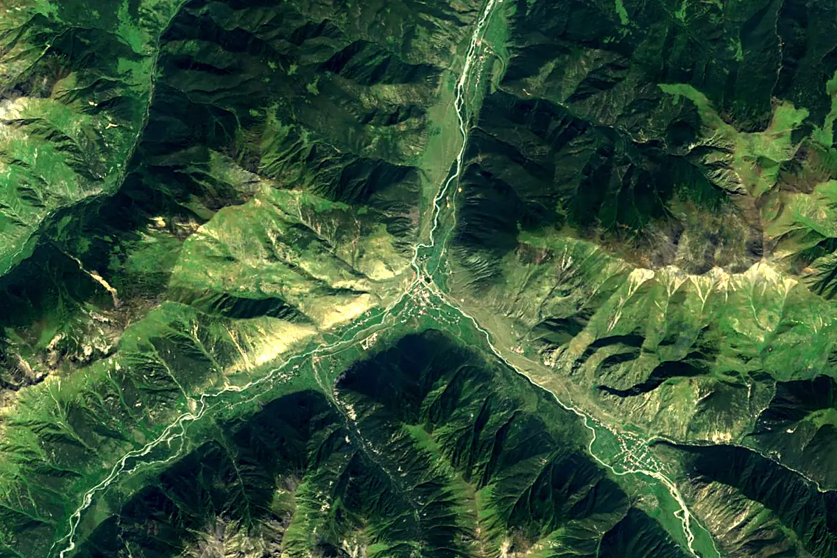
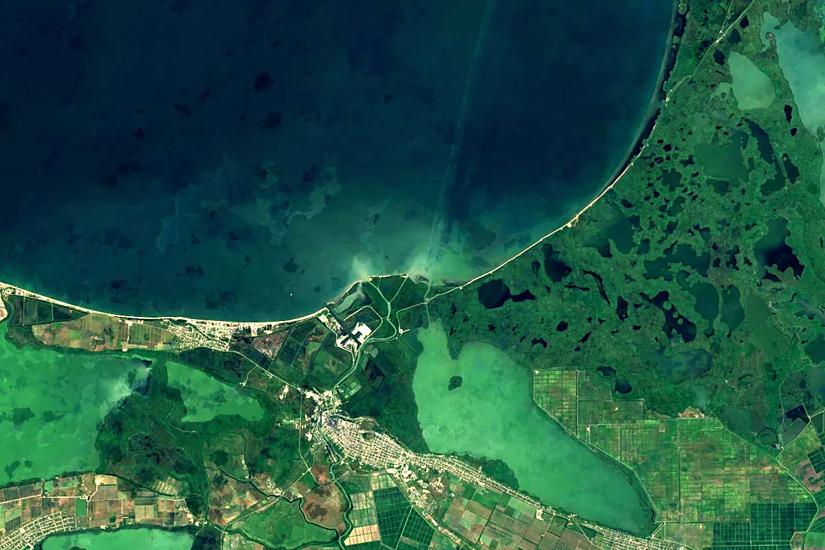
Sentinel-2 cloudless 2016 by EOX IT Services GmbH (contains modified Copernicus Sentinel data 2016), CC BY 4.0. The glowing line is the river as drawn by RiverATLAS.
Photos
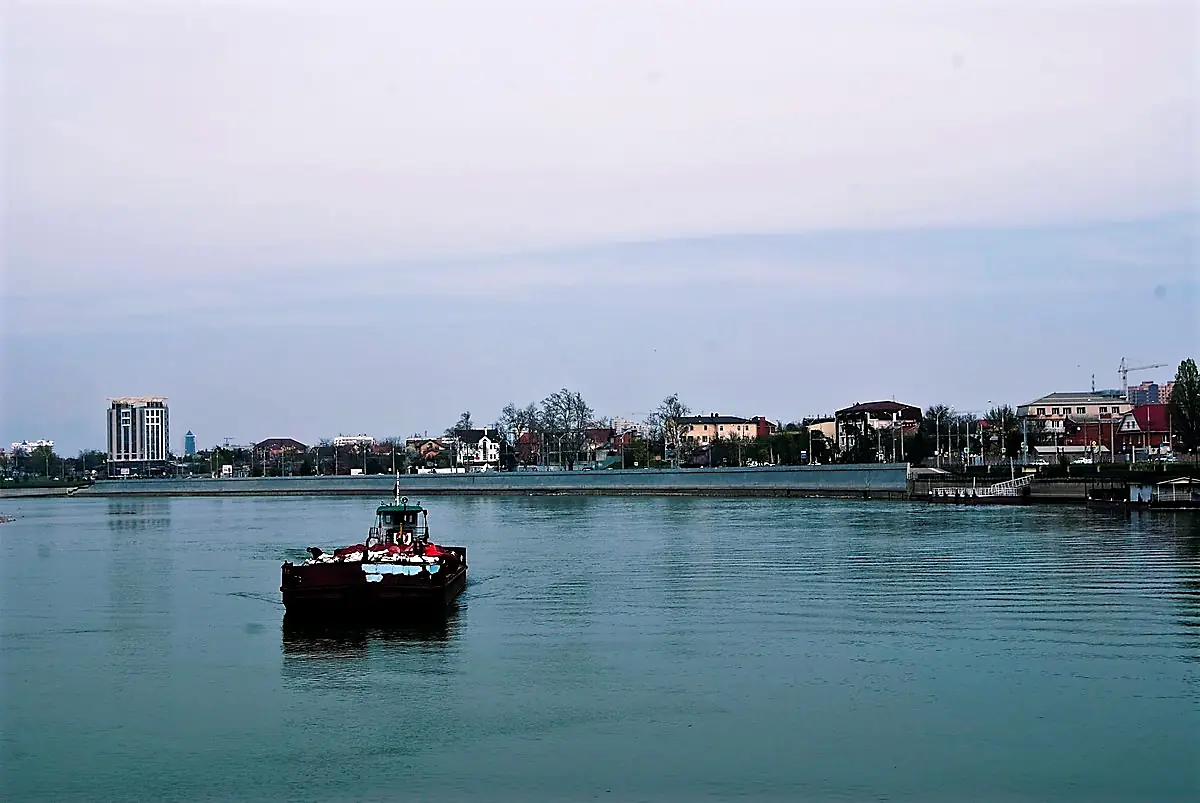
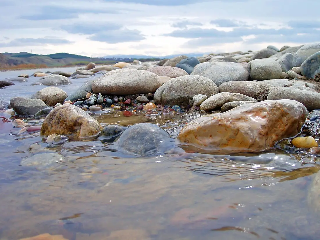
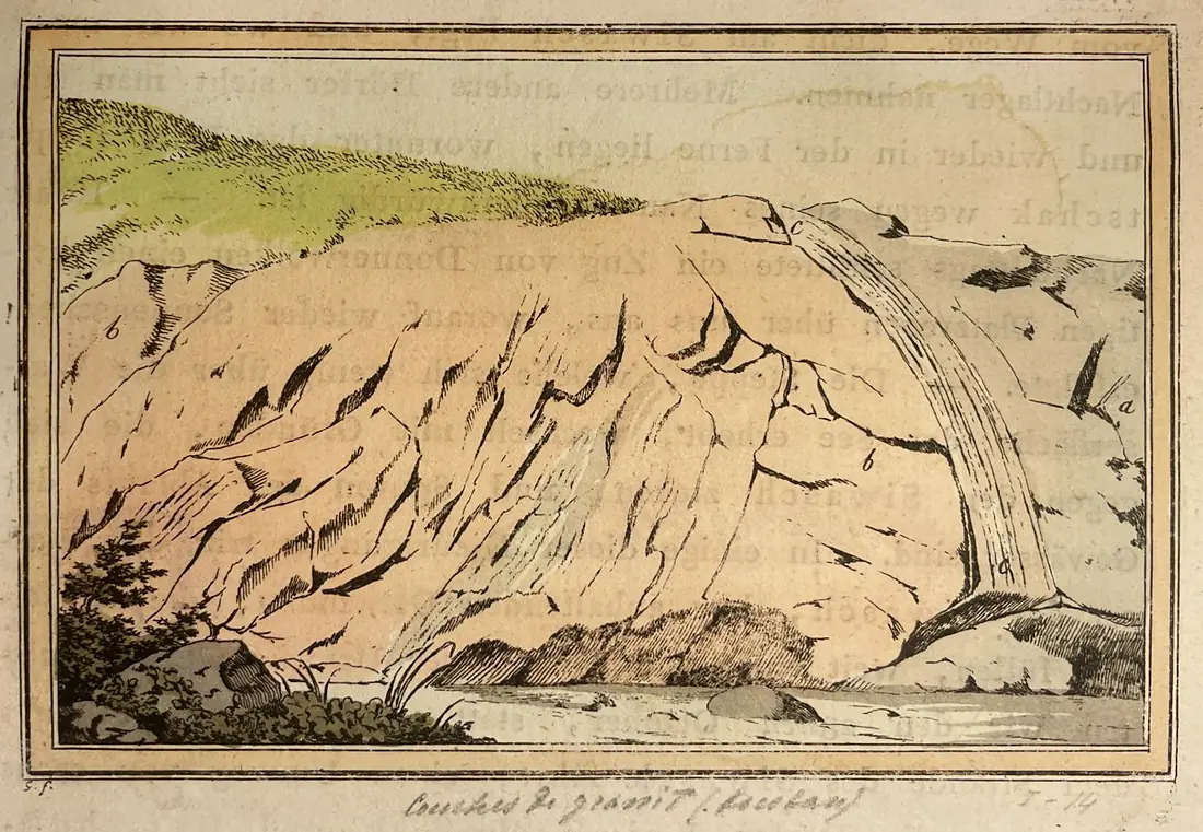
Kuban in pictures
Tributaries
Where it flows, and what flows into it
Tributaries (17)
Also: Laba River, Urup, Teberda River, Bolshoi Zelenchuk, Adagum, Afips, Maly Zelenchuk, Chiby, Karasun, Chekups, Singa, Abazinka, Samoylova Balka, Zelenchuk Vtoroy, Ovechka, Daut, Kapilyapsin
Nearby
Rivers nearby
 Ukraine
 Georgia
Where these numbers come from
| Name, length, places | Wikidata (Q82308) · CC0 |
|---|---|
| Course, profile, basin | RiverATLAS v1.0 (HydroATLAS, Linke et al. 2019) · CC BY 4.0 — followed from the source to the mouth given by Wikidata |
| Flow | WaterGAP (RiverATLAS), 1971–2000 · CC BY 4.0 |
| Climate along the river | WorldClim (RiverATLAS), 1970–2000 · CC BY 4.0 |
| Towns, bridges, dams | Wikidata · CC0; GeoNames · CC BY 4.0 |
| Along the river | © OpenStreetMap contributors · ODbL |
| Images | EOX Sentinel-2 cloudless 2016 · CC BY 4.0; Wikimedia Commons |
| Our other atlases | Lakeyas, Peakyas — Wikidata · CC0; © OpenStreetMap contributors · ODbL; GeoNames · CC BY 4.0; HydroLAKES · CC BY 4.0; NOAA OISST |
Every source and licence is on the data sources page.
The family
Do you prefer beaches, lakes, mountains, waterfalls, islands, rivers or canyons?
Same idea, other landscapes: field atlases built on open data, month by month, in seven languages.
 beaches
 Find your beach: sea temperature, sun and swimming month by month.Visit lakes
 Every lake on Earth: water temperature, ice, depth and the shore.Coming soonVisit mountains
 Every summit in 3D: summit weather, the 0 °C line, huts and trails.Visit
  waterfalls
 Every waterfall: height, flow month by month and when it roars.Coming soonVisit
  islands
 Every island from the sea up: size, sea temperature, ferries and 3D.Coming soonVisit
  rivers
 Every river from source to sea: the journey, the flow and the basin in numbers.You are here
 canyons
 Every canyon cut to scale: depth to the floor, rim and floor temperatures, trails and viewpoints.Coming soonVisit