River
Donets
1,053 km from source to mouth · Russia and Ukraine.
 Russia and UkraineFlows into Don
In numbers
Length
1,053km
Average flow
160m³/s
Basin
98,900km²
Drop
147m
from 151 m to 4 m
Countries
2
The journey
From source to mouth
1,053 km of river and 59 stops on the way: 29 towns and cities on its banks, dams, bridges and the tributaries that feed it.
- 0 kmCentral Russian Uplandat 151 m
- 70 kmGorod Shebekino39,680 people
- 70 kmShebekino45,194 people
- 81 kmNezhegol Rivertributary
- 98 kmVovchatributary
- 151 kmPechenihy Reservoir55 km²
- 154 kmVelykyi Burluk Rivertributary
- 183 kmChuhuyiv36,519 people
- 195 kmUdytributary
- 196 kmEskhar5,163 people
- 223 kmZmiyiv13,737 people
- 223 kmMzhatributary
- 256 kmDonets8,450 people
- 260 kmAndriyivka9,705 people
- 267 kmLebyazhe Ozero0.5 km²
- 287 kmSerednya Balakliikatributary
- 287 kmBalakliya26,334 people
- 357 kmPetrivske3,275 people
- 363 kmBereka Rivertributary
- 395 kmIzyum45,884 people
- 406 kmKamianka1,226 people
- 418 kmOskiltributary
- 442 kmNetryustributary
- 472 kmKazennyi Toretstributary
- 473 kmMykolaivka14,210 people
- 484 kmCzernećke ozero0.9 km²
- 501 kmBakhmutkatributary
- 503 kmZherebetstributary
- 509 kmSerebrianka1,111 people
- 530 kmKrasna Rivertributary
- 536 kmRubizhne59,951 people
- 542 kmOzero Peschanoye (lanaw sa Ukranya)0.3 km²
- 545 kmBorovatributary
- 550 kmLysychansk96,161 people
- 551 kmSiverskodonetsk40,000 people
- 553 kmMetolchyne788 people
- 576 kmBelen'kayatributary
- 599 kmZnamianka63 people
- 605 kmTrokhizbenka2,920 people
- 613 kmSlov`yanoserbsk8,065 people
- 641 kmAidartributary
- 642 kmShchastya11,411 people
- 650 kmYevsuhtributary
- 675 kmStanytsya-Luhanska12,258 people
- 681 kmStanytsia Luhanska12,258 people
- 682 kmLuhantributary
- 710 kmDerkultributary
- 753 kmDonetsk50,850 people
- 764 kmBolshaya Kamenkatributary
- 772 kmMalaya Kamenkatributary
- 784 kmKamensk-Shakhtinsky75,814 people
- 784 kmGlubokaya Rivertributary
- 785 kmStaraya Stanitsa8,284 people
- 843 kmKoksovyy8,458 people
- 869 kmKalitvatributary
- 869 kmBelaya Kalitva38,597 people
- 884 kmLikhayatributary
- 909 kmBystrayatributary
- 969 kmKundruchya Rivertributary
- 986 kmUst’-Donetskiy11,357 people
- 1,053 kmDonat 4 m
Water level along the river (RiverATLAS; the height is exaggerated). Towns: GeoNames and Wikidata; bridges, dams and tributaries: Wikidata.
River in Ukraine and Russia, tributary of the Don River
At the mouth it carries 159 m³/s on average: an Olympic pool every 16 seconds. It drops from 151 m to 4 m, 0.1 m per kilometre on average. Its basin covers 98,900 km², about the size of KR. 7.6 million people live in it. Highest water: from April to June; lowest: from December to March. Its dams hold back little of its water (7.1% of a year's flow).
Where to start
- LysychanskLargest city on its banks · 96,161 people
- On the water27 ferry piers, marinas, boat rentals and boat ramps along the river (OpenStreetMap)
- From May to SeptemberThe best months to visit
Donets, month by month
Highest water: from April to June
Lowest water: from December to March. Freezing months (average below −4 °C): from January to February. Best months to visit: from May to September.
From about 48 m³/s in the lowest month to 810 m³/s in the highest. An estimate: the monthly flow is modelled from the lowest and highest months of WaterGAP (RiverATLAS, 1971–2000) and the rain and snow along the river (WorldClim). Dams change the real rhythm. The chip is the average air temperature; below it, the month's rain.
Plan the trip
Plan the trip: boat trips, a bed by the river, a car
Some links above are affiliate links: if you book through them we may earn a commission, at no extra cost to you. It never changes what the data on this page says.
The basin
Donets: the basin in numbers
98,720 km² of land send their water to this river. This is what lives on it.
- 7.6millionpeople live in the basin
- 77/km²people per km²
- 147maverage altitude of the basin
- 515mmof rain a year (basin average)
- 7.6°Caverage air temperature
- 4%protected areas
- 0.5%covered by lakes
- 0.5km³held in reservoirs
What covers the basin
- 5% Forest
- 58% Cropland
- 23% Pasture
- 4% Towns and cities
RiverATLAS (HydroATLAS v1.0, CC BY 4.0): land cover, people, protected areas, glaciers and dams over the whole basin upstream of the mouth.
Along the river
Donets: what you find on the way
- 36Weirs
- 6Locks
- 1WaterfallsWaterfall
- 9Boat ramps
- 7Ferry piers
- 7Marinas
- 46River beachesCity beach, Vodna and 44 more
From OpenStreetMap, within 2.4 km of the river. Not mapped is not the same as not there.
Cross-checked with our atlases
Donets in our other atlases
What our sister atlases know about the waterfalls on this river, the lakes it flows through, the beaches at its mouth, the mountains where it rises and the islands off its mouth.
 4lakes on its wayLakeyas
Lakes and reservoirs (4)
Lakes it flows through, by Lakeyas
- Pechenihy Reservoirkm 13755km²
- Lebyazhe Ozerokm 2430.5km²
- Czernećke ozerokm 4400.9km²
- Ozero Peschanoye (lanaw sa Ukranya)km 4920.3km²
Lakeyas is coming soonOpen Lakeyas ↗
From space
The source and the mouth, seen from orbit
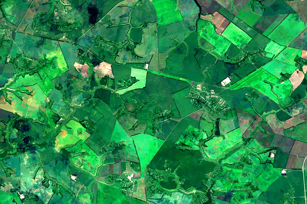
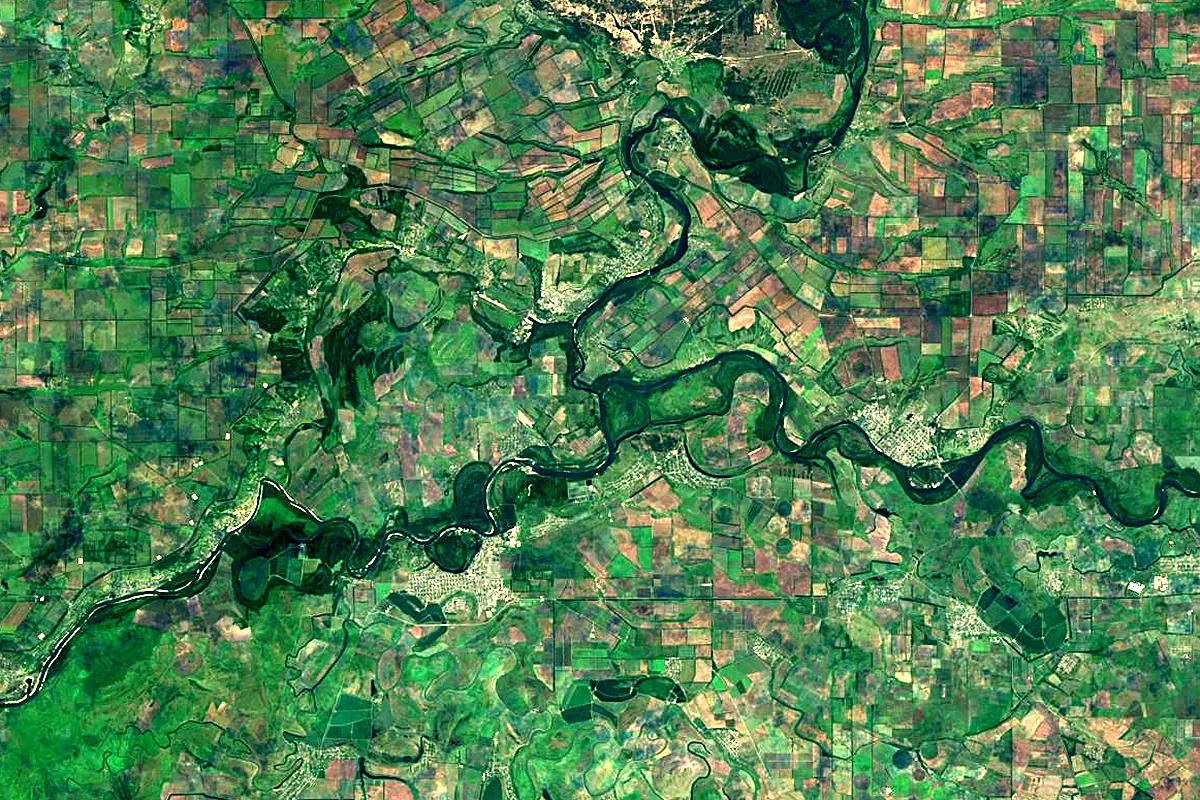
Sentinel-2 cloudless 2016 by EOX IT Services GmbH (contains modified Copernicus Sentinel data 2016), CC BY 4.0. The glowing line is the river as drawn by RiverATLAS.
Photos
Donets in pictures
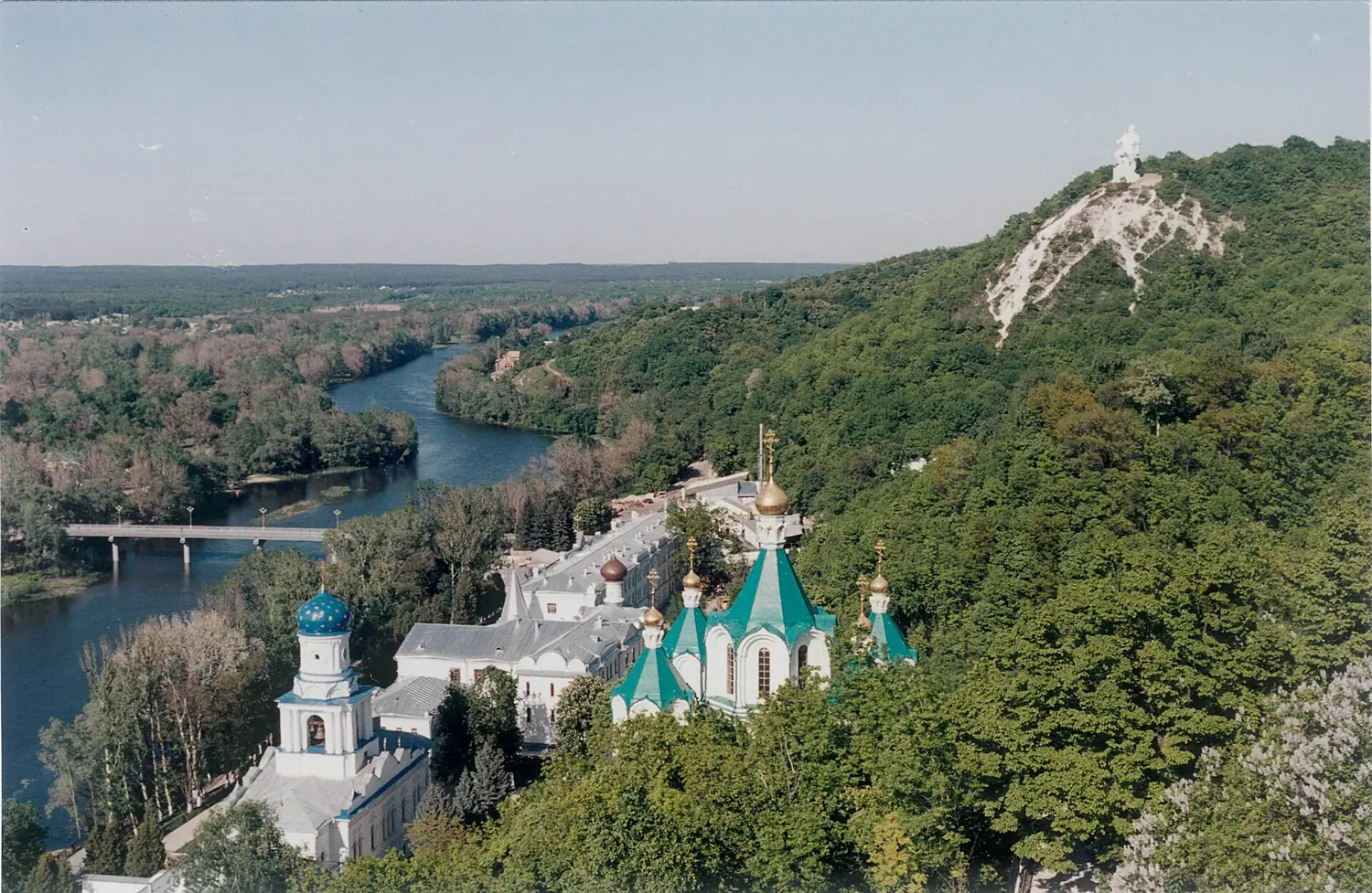
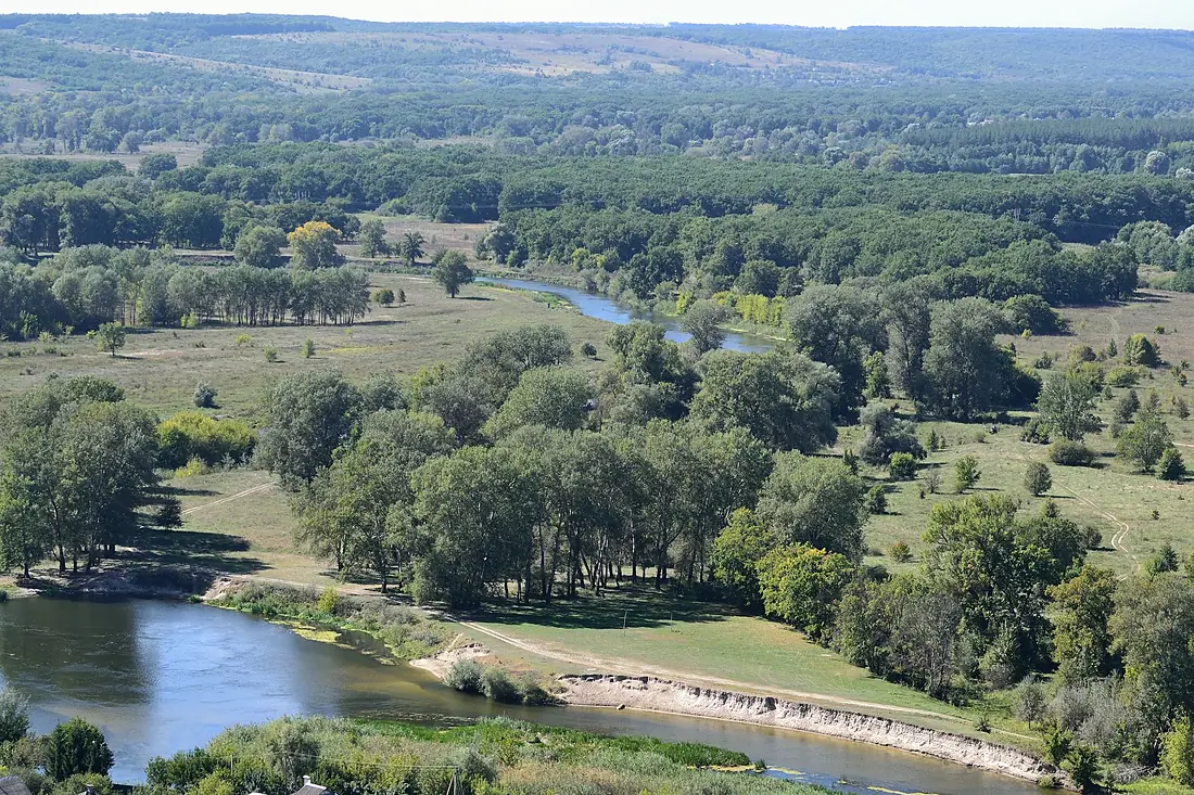
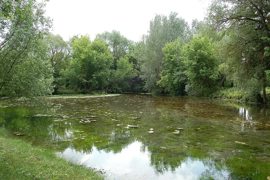
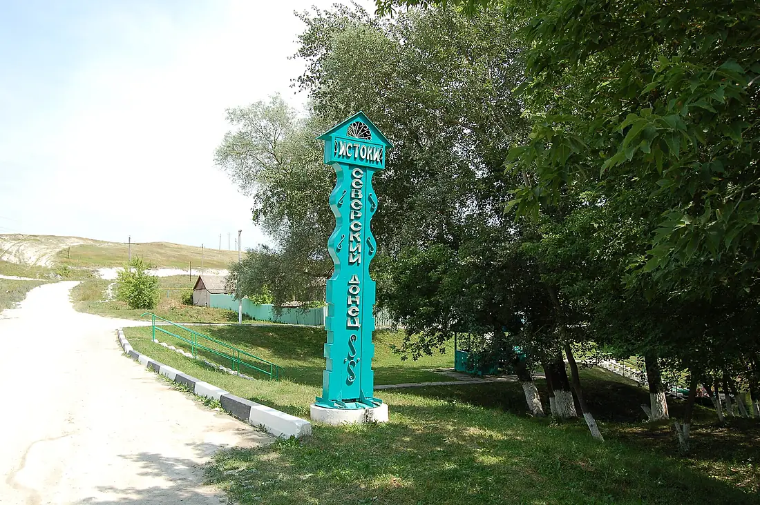
Tributaries
Where it flows, and what flows into it
It flows into
DonRussia1,870 km940 m³/sTributaries (48)
Ukraine472 km44 m³/sjoins at km 380AidarUkraine264 km15 m³/sjoins at km 583LuhanUkraine198 km14 m³/sjoins at km 619Also: Bakhmutka, Udy, Kundruchya River, Vovcha, Derkul, Kazennyi Torets, Nezhegol River, Kalitva, Bystraya, Krasna River, Lipovy Donets, Bereka River, Vezelka, Velykyi Burluk River, Zherebets, Toplinka, Bolshaya Kamenka, Borova, Yevsuh, Mzha, Razumnaya, Sazhnovsky Donets, Glubokaya River, Belaya Plita
In the same basin
Nearby
Rivers nearby
Where these numbers come from
| Name, length, places | Wikidata (Q191238) · CC0 |
|---|---|
| Course, profile, basin | RiverATLAS v1.0 (HydroATLAS, Linke et al. 2019) · CC BY 4.0 — followed from the source to the mouth given by Wikidata |
| Flow | WaterGAP (RiverATLAS), 1971–2000 · CC BY 4.0 |
| Climate along the river | WorldClim (RiverATLAS), 1970–2000 · CC BY 4.0 |
| Towns, bridges, dams | Wikidata · CC0; GeoNames · CC BY 4.0 |
| Along the river | © OpenStreetMap contributors · ODbL |
| Images | EOX Sentinel-2 cloudless 2016 · CC BY 4.0; Wikimedia Commons |
| Our other atlases | Lakeyas — Wikidata · CC0; © OpenStreetMap contributors · ODbL; GeoNames · CC BY 4.0; HydroLAKES · CC BY 4.0; NOAA OISST |
Every source and licence is on the data sources page.
The family
Do you prefer beaches, lakes, mountains, waterfalls, islands, rivers or canyons?
Same idea, other landscapes: field atlases built on open data, month by month, in seven languages.
 beaches
 Find your beach: sea temperature, sun and swimming month by month.Visit lakes
 Every lake on Earth: water temperature, ice, depth and the shore.Coming soonVisit
  mountains
 Every summit in 3D: summit weather, the 0 °C line, huts and trails.Visit
  waterfalls
 Every waterfall: height, flow month by month and when it roars.Coming soonVisit
  islands
 Every island from the sea up: size, sea temperature, ferries and 3D.Coming soonVisit
  rivers
 Every river from source to sea: the journey, the flow and the basin in numbers.You are here
 canyons
 Every canyon cut to scale: depth to the floor, rim and floor temperatures, trails and viewpoints.Coming soonVisit