River
Manzanares
92 km from source to mouth · Spain.
 SpainFlows into Jarama
In numbers
Length
92km
Average flow
5.7m³/s
Basin
1,245km²
Drop
357m
from 886 m to 529 m
Country
1
The journey
From source to mouth
92 km of river and 68 stops on the way: 49 towns and cities on its banks, dams, bridges and the tributaries that feed it.
- 0 kmVentisquero de la Condesaat 886 m
- 0 kmManzanares el Real6,231 people
- 6 kmSantillana reservoir6.8 km²
- 9 kmPuente del Batán, Colmenar Viejo
- 16 kmPuente del Grajal, Colmenar Viejo
- 34 kmEl Pardo Reservoir2.7 km²
- 39 kmEl Pardo3,656 people
- 39 kmArroyo de Maninatributary
- 45 kmArroyo de Trofastributary
- 48 kmPuente de San Fernando, Madrid
- 49 kmCiudad Universitaria16,364 people
- 52 kmCasa de Campo12,767 people
- 52 kmPuente de los Franceses
- 53 kmMoncloa-Aravaca121,757 people
- 54 kmGaztambide22,959 people
- 54 kmQueen Victoria's Bridge
- 54 kmPuente Verde
- 54 kmArapiles24,190 people
- 54 kmArgüelles24,997 people
- 55 kmUniversidad32,783 people
- 55 kmMadrid Centro149,718 people
- 55 kmMadrid3,506,730 people
- 55 kmSol8,164 people
- 56 kmPalacio23,501 people
- 56 kmCentro139,687 people
- 56 kmBridge of Segovia
- 56 kmLa Latina10,747 people
- 56 kmPuerta del Angel43,292 people
- 57 kmLatina241,672 people
- 57 kmCármenes17,903 people
- 57 kmBridge of the Principality of Andorra
- 57 kmPuente de San Isidro, Madrid
- 57 kmImperial22,385 people
- 58 kmSan Isidro40,368 people
- 59 kmBridge of Toledo
- 59 kmArganzuela Bridge
- 59 kmCarabanchel262,339 people
- 59 kmOpañel33,883 people
- 59 kmComillas22,721 people
- 59 kmAcacias36,069 people
- 60 kmEmbajadores46,204 people
- 60 kmLavapiés44,630 people
- 60 kmPalos de Moguer25,097 people
- 60 kmArganzuela153,304 people
- 60 kmPuente de Praga, Madrid
- 60 kmAtocha1,949 people
- 60 kmChopera19,761 people
- 61 kmMoscardó26,579 people
- 61 kmDelicias28,575 people
- 61 kmZofío14,382 people
- 61 kmPuente de la Princesa, Madrid
- 61 kmUsera142,746 people
- 62 kmAlmendrales22,834 people
- 62 kmPradolongo17,878 people
- 62 kmArroyo Meaquestributary
- 62 kmLegazpi19,468 people
- 62 kmPuente de Vallecas241,603 people
- 63 kmSan Diego45,104 people
- 63 kmOrcasur14,390 people
- 64 kmEntrevías35,399 people
- 64 kmVilla de Vallecas117,501 people
- 65 kmSan Fermín23,598 people
- 66 kmVillaverde159,038 people
- 66 kmLos Angeles34,827 people
- 66 kmLos Rosales37,808 people
- 68 kmSan Cristobal17,270 people
- 69 kmButarque21,316 people
- 90 kmRivas-Vaciamadrid68,405 people
- 92 kmLaguna del Campillo0.3 km²
- 92 kmJaramaat 529 m
Water level along the river (RiverATLAS; the height is exaggerated). Towns: GeoNames and Wikidata; bridges, dams and tributaries: Wikidata.
River in Spain
At the mouth it carries 5.7 m³/s on average: an Olympic pool every 438 seconds. It drops from 886 m to 529 m, 3.9 m per kilometre on average. Its basin covers 1,245 km², about the size of MQ. 3.2 million people live in it. Highest water: from November to December; lowest: from June to September. It is heavily dammed: reservoirs can hold 82% of a year's flow.
Where to start
- MadridLargest city on its banks · 3,506,730 people
- Adolfo Suárez Madrid–Barajas Airport (MAD)Nearest airport with scheduled flights, 14 km from the cityCar hire at MAD airport (Madrid)Discover Cars · Affiliate link↗
- On the water2 ferry piers, marinas, boat rentals and boat ramps along the river (OpenStreetMap)
- From May to SeptemberThe best months to visit
Manzanares, month by month
Highest water: from November to December
Lowest water: from June to September. Best months to visit: from May to September.
From about 1.1 m³/s in the lowest month to 14 m³/s in the highest. An estimate: the monthly flow is modelled from the lowest and highest months of WaterGAP (RiverATLAS, 1971–2000) and the rain and snow along the river (WorldClim). Dams change the real rhythm. The chip is the average air temperature; below it, the month's rain.
Plan the trip
Plan the trip: boat trips, a bed by the river, a car
Some links above are affiliate links: if you book through them we may earn a commission, at no extra cost to you. It never changes what the data on this page says.
The basin
Manzanares: the basin in numbers
1,245 km² of land send their water to this river. This is what lives on it.
- 3.2millionpeople live in the basin
- 2,611/km²people per km²
- 814maverage altitude of the basin
- 465mmof rain a year (basin average)
- 12.8°Caverage air temperature
- 35%protected areas
- 0.8%covered by lakes
- 0.1km³held in reservoirs
What covers the basin
- 18% Forest
- 14% Cropland
- 17% Pasture
- 51% Towns and cities
RiverATLAS (HydroATLAS v1.0, CC BY 4.0): land cover, people, protected areas, glaciers and dams over the whole basin upstream of the mouth.
Along the river
Manzanares: what you find on the way
- 27Weirs
- 1Waterfalls
- 1Boat ramps
- 1MarinasEmbarcadero Casa de Campo
From OpenStreetMap, within 1.3 km of the river. Not mapped is not the same as not there.
Cross-checked with our atlases
Manzanares in our other atlases
What our sister atlases know about the waterfalls on this river, the lakes it flows through, the beaches at its mouth, the mountains where it rises and the islands off its mouth.
 3lakes on its wayLakeyas
 15mountains at the sourcePeakyas
Lakes and reservoirs (3)
Lakes it flows through, by Lakeyas
- Santillana reservoirkm 46.8km²
- El Pardo Reservoirkm 252.7km²
- Laguna del Campillokm 670.3km²
Lakeyas is coming soonOpen Lakeyas ↗
Mountains at the source (15)
Within 15 km of the source, by Peakyas
- Bola del Mundo12 km away · prominence 102 m2,262m
- Cabezas de Hierro11 km away2,381m
- La Maliciosa10 km away · prominence 153 m2,227m
- Cerro de Valdemartín12 km away2,280m
- Cerro La Najarra11 km away2,119m
- Alto del Telégrafo14 km away1,975m
- Cerro de los Hoyos7.3 km away1,950m
- El Yelmo4.4 km away1,717m
7 more on PeakyasOpen Peakyas ↗
From space
The source and the mouth, seen from orbit
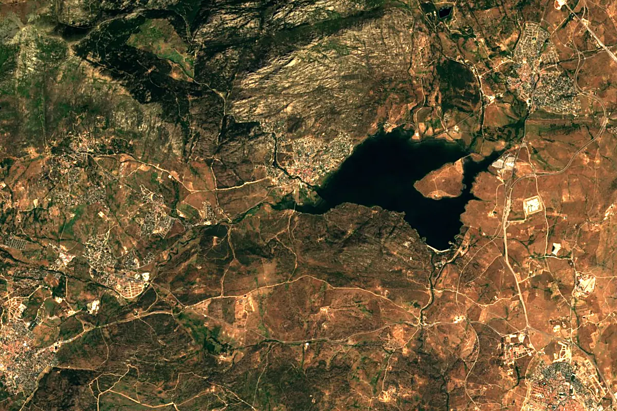
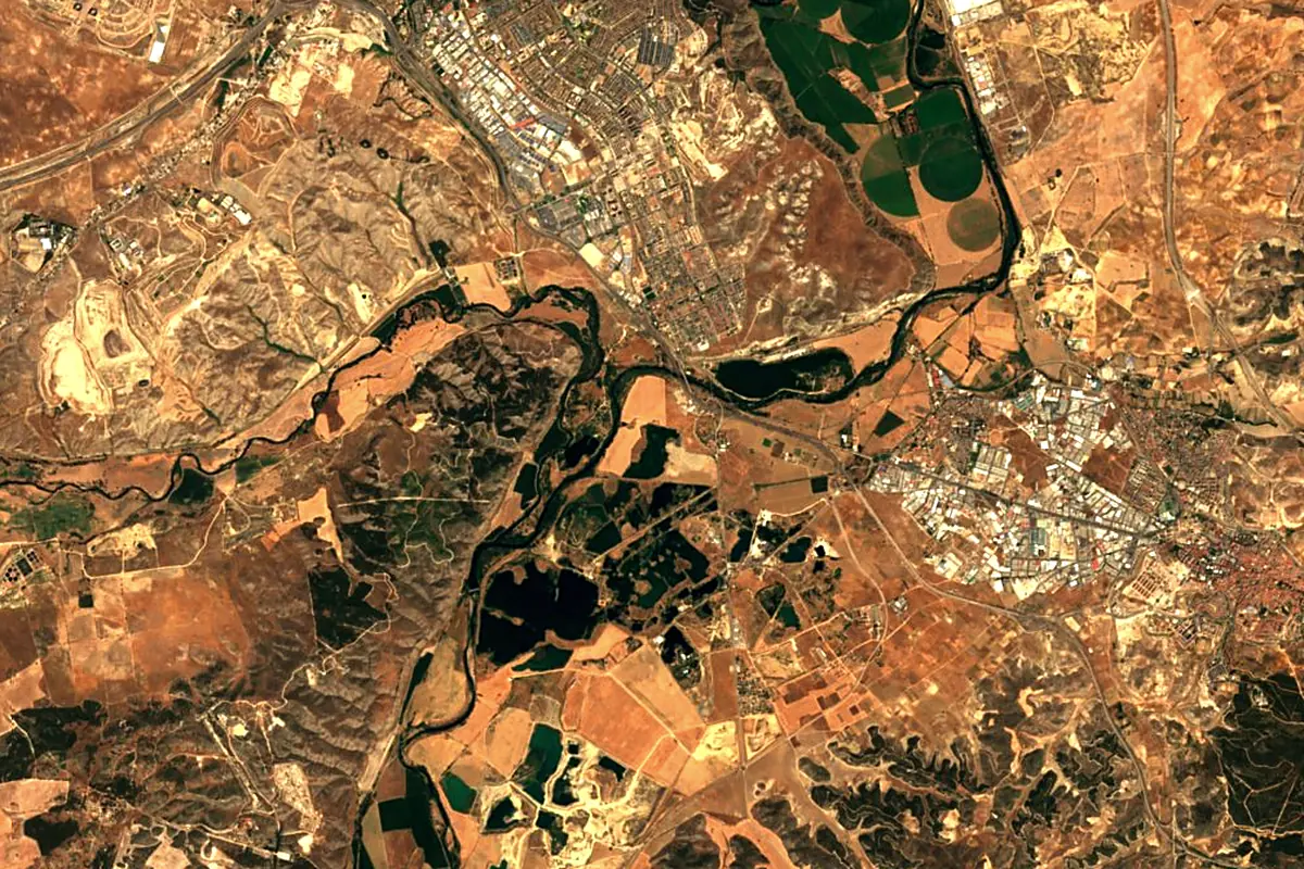
Sentinel-2 cloudless 2016 by EOX IT Services GmbH (contains modified Copernicus Sentinel data 2016), CC BY 4.0. The glowing line is the river as drawn by RiverATLAS.
Photos
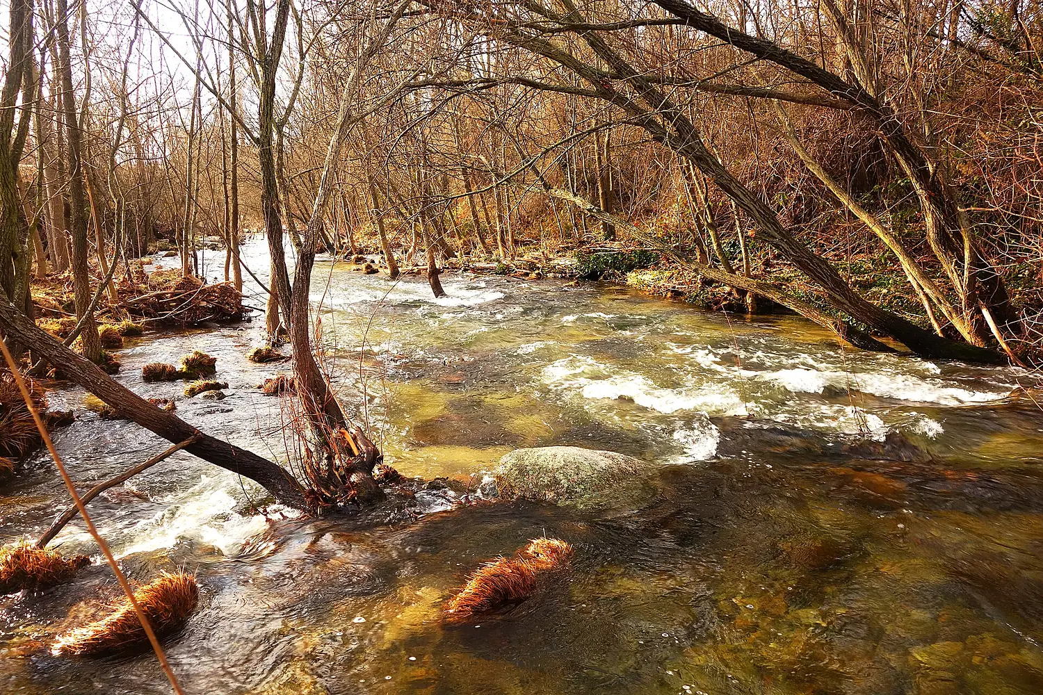
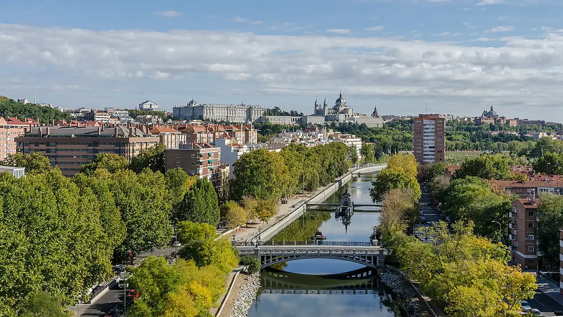
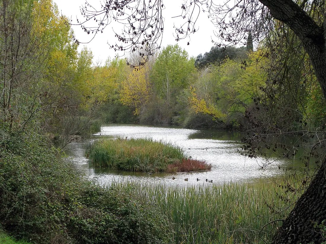
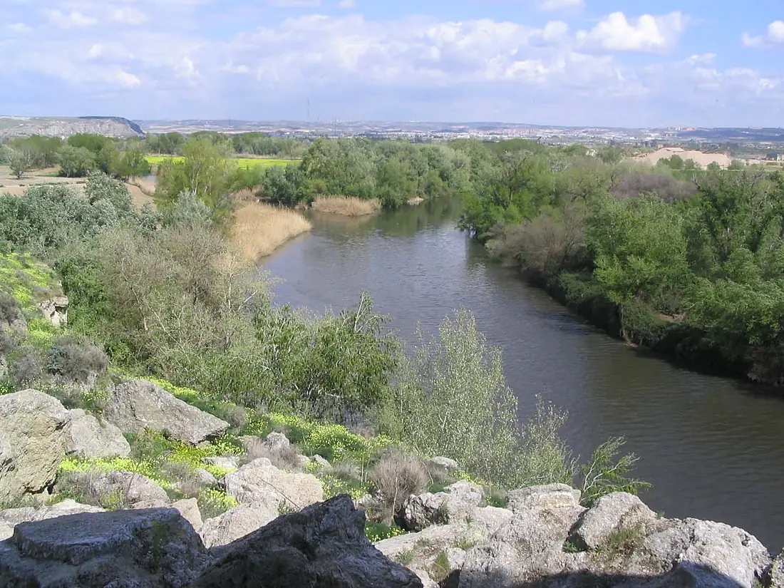
Manzanares in pictures
Tributaries
Where it flows, and what flows into it
It flows into
JaramaSpain194 km32 m³/sTributaries (7)
Also: Arroyo Abroñigal, Butarque, Arroyo Meaques, Culebro Stream, Arroyo de Trofas, Arroyo del Mediano, Arroyo de Manina
 Portugal
Nearby
Rivers nearby
Spain100 km15 m³/s113 km awayPisuerga RiverSpain283 km110 m³/s177 km awayEslaSpain285 km140 m³/s250 km awayAragónSpain195 km41 m³/s258 km awayJalón RiverSpain224 km21 m³/s241 km awayCarrión RiverSpain179 km21 m³/s239 km awayTormesSpain284 km42 m³/s272 km awayArgaSpain145 km60 m³/s262 km awayWhere these numbers come from
| Name, length, places | Wikidata (Q16512) · CC0 |
|---|---|
| Course, profile, basin | RiverATLAS v1.0 (HydroATLAS, Linke et al. 2019) · CC BY 4.0 — followed along the river network from the point given by Wikidata |
| Flow | WaterGAP (RiverATLAS), 1971–2000 · CC BY 4.0 |
| Climate along the river | WorldClim (RiverATLAS), 1970–2000 · CC BY 4.0 |
| Towns, bridges, dams | Wikidata · CC0; GeoNames · CC BY 4.0 |
| Along the river | © OpenStreetMap contributors · ODbL |
| Images | EOX Sentinel-2 cloudless 2016 · CC BY 4.0; Wikimedia Commons |
| Our other atlases | Lakeyas, Peakyas — Wikidata · CC0; © OpenStreetMap contributors · ODbL; GeoNames · CC BY 4.0; HydroLAKES · CC BY 4.0; NOAA OISST |
Every source and licence is on the data sources page.
The family
Do you prefer beaches, lakes, mountains, waterfalls, islands, rivers or canyons?
Same idea, other landscapes: field atlases built on open data, month by month, in seven languages.
 beaches
 Find your beach: sea temperature, sun and swimming month by month.Visit lakes
 Every lake on Earth: water temperature, ice, depth and the shore.Coming soonVisit mountains
 Every summit in 3D: summit weather, the 0 °C line, huts and trails.Visit
  waterfalls
 Every waterfall: height, flow month by month and when it roars.Coming soonVisit
  islands
 Every island from the sea up: size, sea temperature, ferries and 3D.Coming soonVisit
  rivers
 Every river from source to sea: the journey, the flow and the basin in numbers.You are here
 canyons
 Every canyon cut to scale: depth to the floor, rim and floor temperatures, trails and viewpoints.Coming soonVisit