River
Mekong River
4,350 km from source to mouth · 6 countries.
 Vietnam, China, Cambodia, Laos, Myanmar and ThailandFlows into South China Sea1st longest in Vietnam
In numbers
Length
4,350km
Average flow
15,000m³/s
Basin
810,000km²
Drop
4,842m
from 4,841 m to -1 m
Countries
6
The journey
From source to mouth
4,350 km of river and 68 stops on the way: 38 towns and cities on its banks, dams, bridges and the tributaries that feed it.
- 0 kmZha'a Quat 4,841 m
- 341 kmZiqu Rivertributary
- 432 kmNgom Qutributary
- 432 kmQamdo86,280 people
- 974 kmYingpan37,406 people
- 1,206 kmXiaowan Dam
- 1,472 kmWeiyuan Rivertributary
- 1,583 kmYunjinghong205,523 people
- 1,865 kmBan Khoan65,348 people
- 1,878 kmKok Rivertributary
- 1,921 kmBan Houayxay17,687 people
- 1,922 kmChiang Khong14,505 people
- 1,926 kmBan Houakhoua15,500 people
- 1,929 kmIng Rivertributary
- 2,153 kmNam Outributary
- 2,173 kmLuang Prabang55,027 people
- 2,174 kmNam Khantributary
- 2,434 kmHueang Rivertributary
- 2,442 kmLoei Rivertributary
- 2,565 kmVientiane948,487 people
- 2,565 kmSi Chiang Mai14,068 people
- 2,576 kmTha Bo35,292 people
- 2,595 kmFirst Thai–Lao Friendship Bridge
- 2,597 kmNong Khai63,609 people
- 2,648 kmNam Ngumtributary
- 2,726 kmPakxan21,967 people
- 2,751 kmAng Kep Nam Huai Bang Bat2.5 km²
- 2,765 kmNam Theuntributary
- 2,846 kmSongkhram Rivertributary
- 2,885 kmNakhon Phanom34,595 people
- 2,887 kmThakhèk70,000 people
- 2,933 kmWat Phra That Phanom
- 2,934 kmXe Bang Fai Rivertributary
- 2,934 kmThat Phanom14,424 people
- 2,967 kmSecond Thai–Lao Friendship Bridge
- 2,972 kmSavannakhet124,000 people
- 2,973 kmMukdahan40,480 people
- 3,049 kmBanghiang Rivertributary
- 3,164 kmMun Rivertributary
- 3,201 kmPakse77,900 people
- 3,202 kmXé Dôntributary
- 3,227 kmChampasak12,994 people
- 3,232 kmVat Phou
- 3,307 kmMuang Không15,000 people
- 3,330 kmKhone Phapheng Falls21 m
- 3,377 kmStung Treng25,000 people
- 3,378 kmTonlé Santributary
- 3,492 kmKratié19,975 people
- 3,505 kmPreaek Prasab64,466 people
- 3,558 kmBœ̆ng Prôhéar0.3 km²
- 3,576 kmBeng Tuol Anteas0.5 km²
- 3,588 kmPhumĭ Âmpĭl Leu16,110 people
- 3,590 kmKampong Cham118,242 people
- 3,591 kmBœ̆ng Ânsaông0.9 km²
- 3,639 kmBeng Khpop0.4 km²
- 3,643 kmBeng Kebal Krabey0.6 km²
- 3,676 kmPhnom Penh1,573,544 people
- 3,676 kmTonle Sap Rivertributary
- 3,680 kmVeal Sbov14,481 people
- 3,773 kmTân Châu175,211 people
- 3,778 kmẤp Long Thạnh34,198 people
- 3,783 kmHồng Ngự101,155 people
- 3,805 kmKiến An28,333 people
- 3,828 kmLong Xuyên286,140 people
- 3,843 kmThốt Nốt158,225 people
- 3,848 kmLai Vung80,649 people
- 3,871 kmBình Thủy113,565 people
- 3,878 kmBình Minh94,862 people
- 3,878 kmCần Thơ1,507,187 people
- 4,350 kmSouth China Seaat -1 m
Water level along the river (RiverATLAS; the height is exaggerated). Towns: GeoNames and Wikidata; bridges, dams and tributaries: Wikidata.
Major river in Southeast Asia
At the mouth it carries 15,000 m³/s on average: 6.0 Olympic pools every second. It drops from 4,841 m to -1 m, 1.1 m per kilometre on average. Its basin covers 810,000 km², about the size of PK. 53.1 million people live in it. Highest water: from August to September; lowest: from January to April. Its dams hold back little of its water (4.0% of a year's flow).
Where to start
- Phnom PenhLargest city on its banks · 1,573,544 people
- Techo International Airport (KTI)Nearest airport with scheduled flights, 22 km from the city
- On the water334 ferry piers, marinas, boat rentals and boat ramps along the river (OpenStreetMap)
- Kayak and canoe4 put-ins and rapids mapped (OpenStreetMap)
- From November to MarchThe best months to visit
Mekong River, month by month
Highest water: from August to September
Lowest water: from January to April. Best months to visit: from November to March.
From about 2,400 m³/s in the lowest month to 36,800 m³/s in the highest. An estimate: the monthly flow is modelled from the lowest and highest months of WaterGAP (RiverATLAS, 1971–2000) and the rain and snow along the river (WorldClim). Dams change the real rhythm. The chip is the average air temperature; below it, the month's rain.
Plan the trip
Plan the trip: boat trips, a bed by the river, a car
Some links above are affiliate links: if you book through them we may earn a commission, at no extra cost to you. It never changes what the data on this page says.
The basin
Mekong River: the basin in numbers
774,281 km² of land send their water to this river. This is what lives on it.
- 53.1millionpeople live in the basin
- 70/km²people per km²
- 960maverage altitude of the basin
- 1,535mmof rain a year (basin average)
- 21.5°Caverage air temperature
- 18%protected areas
- 0.8%covered by lakes
- 3%permafrost
- 19km³held in reservoirs
What covers the basin
- 22% Forest
- 18% Cropland
- 13% Pasture
- 2% Towns and cities
RiverATLAS (HydroATLAS v1.0, CC BY 4.0): land cover, people, protected areas, glaciers and dams over the whole basin upstream of the mouth.
Along the river
Mekong River: what you find on the way
- 16Weirs
- 1Locks
- 24WaterfallsHoi Khua Waterfall, Than Thong Waterfall, Wang Nam Mok Waterfall and 21 more
- 4Rapids
- 7Boat ramps
- 307Ferry piersGuanlei Port, Golden Triangle Port, Boat to Thailand (only for locals) and 304 more
- 19MarinasBến Kho, Bến du thuyền Cần Thơ and 17 more
- 7River beachesSida Beach, Mano Phirom Beach, Donxeng Beach and 4 more
From OpenStreetMap, within 2.9 km of the river. Not mapped is not the same as not there.
Cross-checked with our atlases
Mekong River in our other atlases
What our sister atlases know about the waterfalls on this river, the lakes it flows through, the beaches at its mouth, the mountains where it rises and the islands off its mouth.
 1waterfall on the riverCascadyas
 6lakes on its wayLakeyas
 1island off the mouthIslandyas
Waterfalls (1)
On the river, by Cascadyas
- Khone Phapheng Fallskm 3,69721m
Cascadyas is coming soonOpen Cascadyas ↗
Lakes and reservoirs (6)
Lakes it flows through, by Lakeyas
- Ang Kep Nam Huai Bang Batkm 3,0552.5km²
- Bœ̆ng Prôhéarkm 3,9510.3km²
- Beng Tuol Anteaskm 3,9700.5km²
- Bœ̆ng Ânsaôngkm 3,9870.9km²
- Beng Khpopkm 4,0400.4km²
- Beng Kebal Krabeykm 4,0450.6km²
Lakeyas is coming soonOpen Lakeyas ↗
Islands off the mouth (1)
Within 30 km of the mouth, by Islandyas
- Cù Lao Tròn8.0 km away106km²
Islandyas is coming soonOpen Islandyas ↗
From space
The source and the mouth, seen from orbit
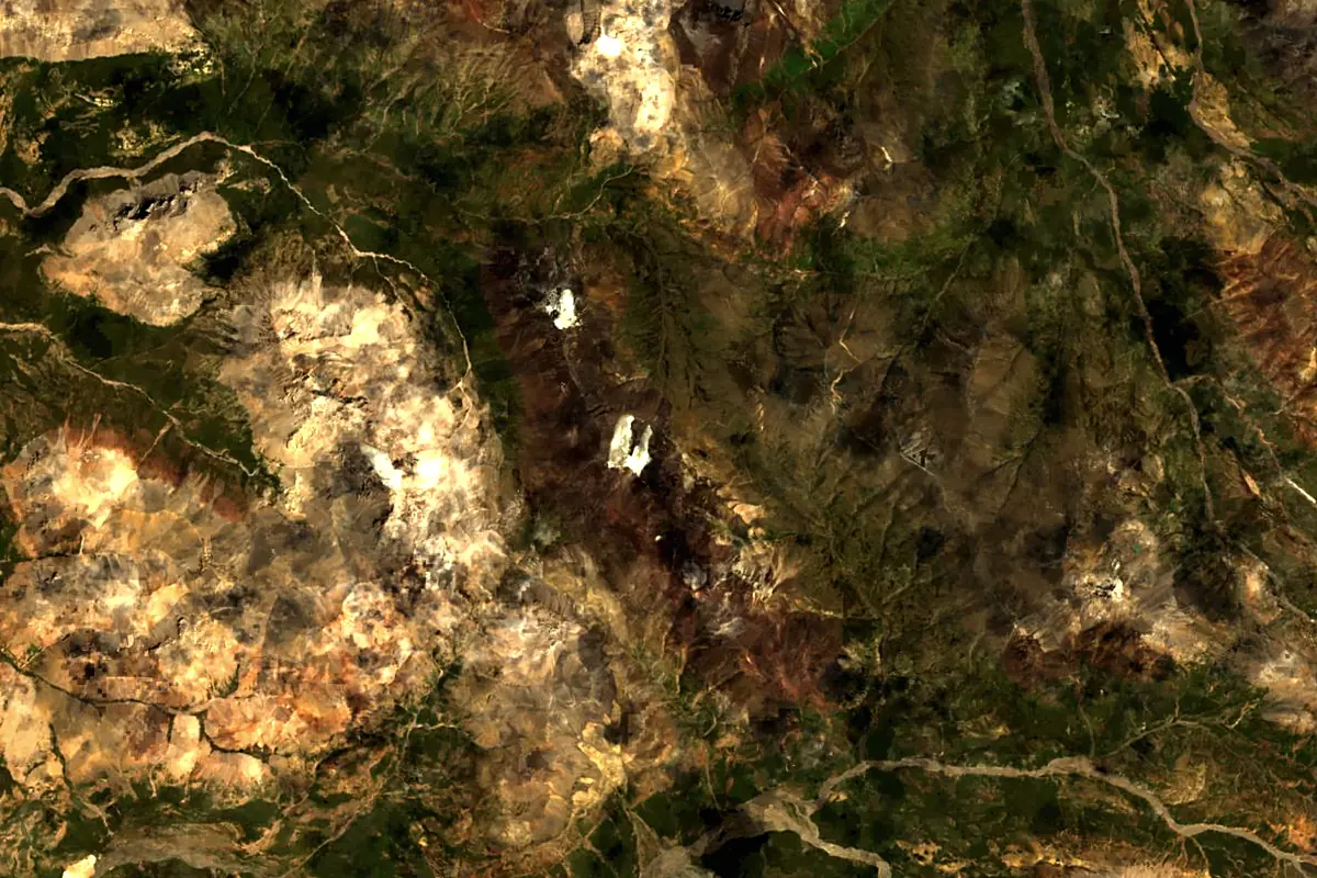
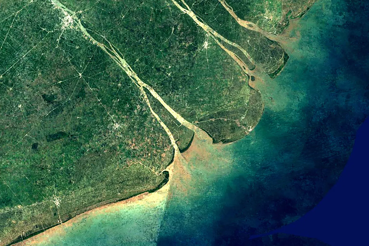
Sentinel-2 cloudless 2016 by EOX IT Services GmbH (contains modified Copernicus Sentinel data 2016), CC BY 4.0. The glowing line is the river as drawn by RiverATLAS.
Photos
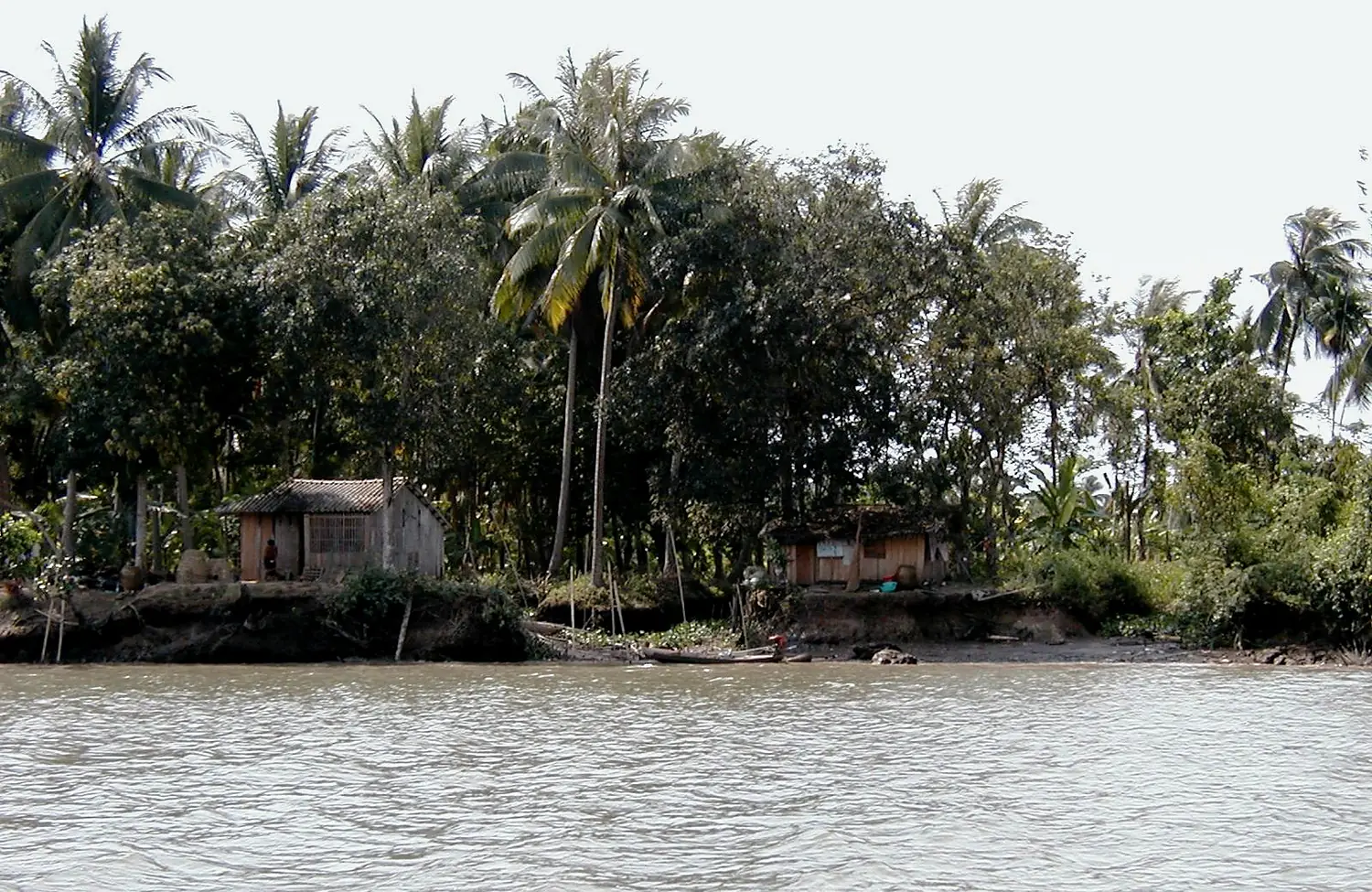
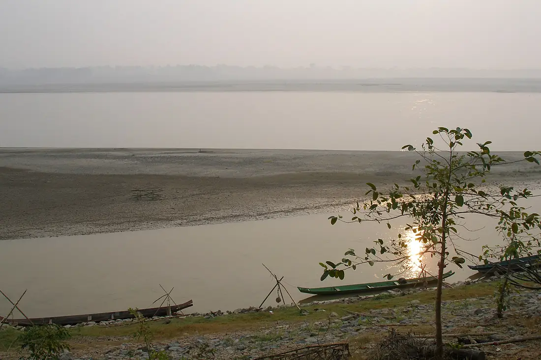
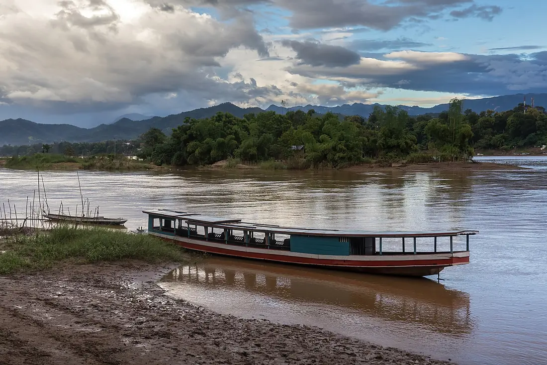
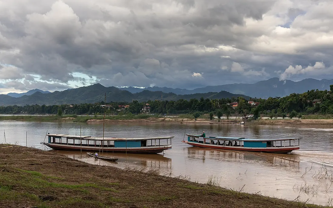
Mekong River in pictures
Tributaries
Where it flows, and what flows into it
Tributaries (23)
Thailand673 km720 m³/sjoins at km 3,513Nam OuLaos448 km390 m³/sjoins at km 2,391Tonlé SanCambodia372 km2,900 m³/sjoins at km 3,750Nam NgumLaos354 km670 m³/sjoins at km 2,940Kok RiverLaos285 km2,800 m³/sjoins at km 2,085Tonle Sap RiverCambodia112 km1,600 m³/sjoins at km 4,082Also: Ruak River, Tha River, Ing River, Songkhram River, Nam Khan, Nam Theun, Xé Dôn, Banghiang River, Hueang River, Xe Bang Fai River, Ngom Qu, Loei River, Ziqu River, Weiyuan River, Za Qu (rdza chu) of Lancang, Yongchun River, Tongdian River
In the same basin
Where these numbers come from
| Name, length, places | Wikidata (Q41179) · CC0 |
|---|---|
| Course, profile, basin | RiverATLAS v1.0 (HydroATLAS, Linke et al. 2019) · CC BY 4.0 — followed from the source to the mouth given by Wikidata |
| Flow | WaterGAP (RiverATLAS), 1971–2000 · CC BY 4.0 |
| Climate along the river | WorldClim (RiverATLAS), 1970–2000 · CC BY 4.0 |
| Towns, bridges, dams | Wikidata · CC0; GeoNames · CC BY 4.0 |
| Along the river | © OpenStreetMap contributors · ODbL |
| Images | EOX Sentinel-2 cloudless 2016 · CC BY 4.0; Wikimedia Commons |
| Our other atlases | Cascadyas, Lakeyas, Islandyas — Wikidata · CC0; © OpenStreetMap contributors · ODbL; GeoNames · CC BY 4.0; HydroLAKES · CC BY 4.0; NOAA OISST |
Every source and licence is on the data sources page.
The family
Do you prefer beaches, lakes, mountains, waterfalls, islands, rivers or canyons?
Same idea, other landscapes: field atlases built on open data, month by month, in seven languages.
 beaches
 Find your beach: sea temperature, sun and swimming month by month.Visit lakes
 Every lake on Earth: water temperature, ice, depth and the shore.Coming soonVisit
  mountains
 Every summit in 3D: summit weather, the 0 °C line, huts and trails.Visit waterfalls
 Every waterfall: height, flow month by month and when it roars.Coming soonVisit islands
 Every island from the sea up: size, sea temperature, ferries and 3D.Coming soonVisit
  rivers
 Every river from source to sea: the journey, the flow and the basin in numbers.You are here
 canyons
 Every canyon cut to scale: depth to the floor, rim and floor temperatures, trails and viewpoints.Coming soonVisit