River
Niger River
4,180 km from source to mouth · 5 countries.
 Nigeria, Guinea, Niger, Mali and BeninFlows into Gulf of Guinea1st longest in Nigeria
In numbers
Length
4,180km
Average flow
8,600m³/s
Basin
2,117,700km²
Drop
537m
from 543 m to 6 m
Countries
5
The journey
From source to mouth
4,180 km of river and 68 stops on the way: 45 towns and cities on its banks, dams, bridges and the tributaries that feed it.
- 0 kmFouta Djallonat 543 m
- 112 kmFaranah70,181 people
- 301 kmKouroussa36,295 people
- 327 kmNiandantributary
- 416 kmMilo Rivertributary
- 457 kmTinkisso Rivertributary
- 462 kmSiguiri148,018 people
- 589 kmSankarani Rivertributary
- 659 kmKabala24,241 people
- 664 kmKalaban Koro148,247 people
- 673 kmBamako4,227,569 people
- 688 kmMoribabougou24,085 people
- 736 kmKoulikoro64,128 people
- 909 kmSégou205,787 people
- 944 kmMarkala53,738 people
- 975 kmDiourou26,559 people
- 1,203 kmMopti186,187 people
- 1,205 kmBani Rivertributary
- 1,237 kmPouipo0.4 km²
- 1,349 kmLake Débo120 km²
- 1,527 kmDiré31,348 people
- 1,703 kmBangao0.8 km²
- 1,949 kmBourem42,371 people
- 2,040 kmGao133,110 people
- 2,285 kmAyérou33,527 people
- 2,285 kmAyorou26,290 people
- 2,290 kmBéli Rivertributary
- 2,334 kmMéhana40,593 people
- 2,377 kmTillabéri51,439 people
- 2,417 kmDargoltributary
- 2,420 kmGothèye93,264 people
- 2,424 kmKourteye61,670 people
- 2,439 kmSirba Rivertributary
- 2,447 kmNamaro55,094 people
- 2,458 kmKarma88,224 people
- 2,477 kmBitinkodji29,067 people
- 2,493 kmGoudel Barrage
- 2,498 kmNiamey1,323,691 people
- 2,513 kmLiboré26,243 people
- 2,523 kmN'Dounga22,341 people
- 2,523 kmYouri31,598 people
- 2,523 kmYouri Kourtéré31,598 people
- 2,534 kmKollo32,829 people
- 2,558 kmSay58,290 people
- 2,580 kmGoroubitributary
- 2,598 kmKirtachi39,693 people
- 2,632 kmTapoa Rivertributary
- 2,677 kmFalmey75,115 people
- 2,691 kmDallol Bossotributary
- 2,691 kmMékrou Rivertributary
- 2,722 kmSambéra50,820 people
- 2,770 kmTanda49,973 people
- 2,779 kmAlibori Rivertributary
- 2,790 kmMalanville64,639 people
- 2,794 kmSota Rivertributary
- 2,797 kmGaya45,465 people
- 2,816 kmTounouga42,849 people
- 2,902 kmSokoto Rivertributary
- 3,124 kmKainji Lake1,035 km²
- 3,355 kmPatigi28,285 people
- 3,358 kmKaduna Rivertributary
- 3,436 kmBaro26,821 people
- 3,505 kmGurara Rivertributary
- 3,547 kmLokoja60,579 people
- 3,549 kmBenue Rivertributary
- 3,627 kmIdah68,703 people
- 3,739 kmAsaba73,374 people
- 3,745 kmOnitsha1,553,000 people
- 3,764 kmAtani230,000 people
- 4,180 kmGulf of Guineaat 6 m
Water level along the river (RiverATLAS; the height is exaggerated). Towns: GeoNames and Wikidata; bridges, dams and tributaries: Wikidata.
River in West Africa
At the mouth it carries 8,630 m³/s on average: 3.5 Olympic pools every second. It drops from 543 m to 6 m, 0.1 m per kilometre on average. Its basin covers 2,117,700 km², about the size of MX. 99.7 million people live in it. Highest water: September; lowest: from January to April. Dams and reservoirs hold back a large share of its water (21% of a year's flow).
Where to start
- BamakoLargest city on its banks · 4,227,569 people
- Modibo Keita International Airport (BKO)Nearest airport with scheduled flights, 9 km from the cityCar hire in LagosDiscover Cars · Affiliate link↗
- On the water106 ferry piers, marinas, boat rentals and boat ramps along the river (OpenStreetMap)
- From December to JanuaryThe best months to visit
Niger River, month by month
Highest water: September
Lowest water: from January to April. Best months to visit: from December to January.
From about 1,300 m³/s in the lowest month to 17,700 m³/s in the highest. An estimate: the monthly flow is modelled from the lowest and highest months of WaterGAP (RiverATLAS, 1971–2000) and the rain and snow along the river (WorldClim). Dams change the real rhythm. The chip is the average air temperature; below it, the month's rain.
Plan the trip
Plan the trip: boat trips, a bed by the river, a car
Some links above are affiliate links: if you book through them we may earn a commission, at no extra cost to you. It never changes what the data on this page says.
The basin
Niger River: the basin in numbers
2,096,808 km² of land send their water to this river. This is what lives on it.
- 99.7millionpeople live in the basin
- 48/km²people per km²
- 410maverage altitude of the basin
- 654mmof rain a year (basin average)
- 27.2°Caverage air temperature
- 11%protected areas
- 0.2%covered by lakes
- 42km³held in reservoirs
What covers the basin
- 9% Forest
- 19% Cropland
- 29% Pasture
- 1% Towns and cities
RiverATLAS (HydroATLAS v1.0, CC BY 4.0): land cover, people, protected areas, glaciers and dams over the whole basin upstream of the mouth.
Along the river
Niger River: what you find on the way
- 9WeirsSeuil d'épandage des eaux du Fleuve à Niamey and 8 more
- 3LocksCanal de navigation de Markala
- 2WaterfallsCENTRALE Hydroélectrique de Sotuba, Pied de Coline Missabougou
- 19Boat ramps
- 83Ferry piersBac de Tiguibiry, Koulikoro, Ségou and 80 more
- 4MarinasPort de Mopti, Goro and 2 more
From OpenStreetMap, within 3.2 km of the river. Not mapped is not the same as not there.
Cross-checked with our atlases
Niger River in our other atlases
What our sister atlases know about the waterfalls on this river, the lakes it flows through, the beaches at its mouth, the mountains where it rises and the islands off its mouth.
 4lakes on its wayLakeyas
 18mountains at the sourcePeakyas
Lakes and reservoirs (4)
Lakes it flows through, by Lakeyas
- Pouipokm 1,1840.4km²
- Lake Débokm 1,291120km²
- Bangaokm 1,6300.8km²
- Kainji Lakekm 2,988 · 121 m deep1,035km²
Lakeyas is coming soonOpen Lakeyas ↗
Mountains at the source (18)
Within 15 km of the source, by Peakyas
- Kondewa12 km away615m
- Yarakoko13 km away
- Kouikonko14 km away
- Kouloufandi8.3 km away
- Kourouworo9.5 km away
- Ouroukonko7.3 km away
- Koddou14 km away
- Konkule4.9 km away
10 more on PeakyasOpen Peakyas ↗
From space
The source and the mouth, seen from orbit
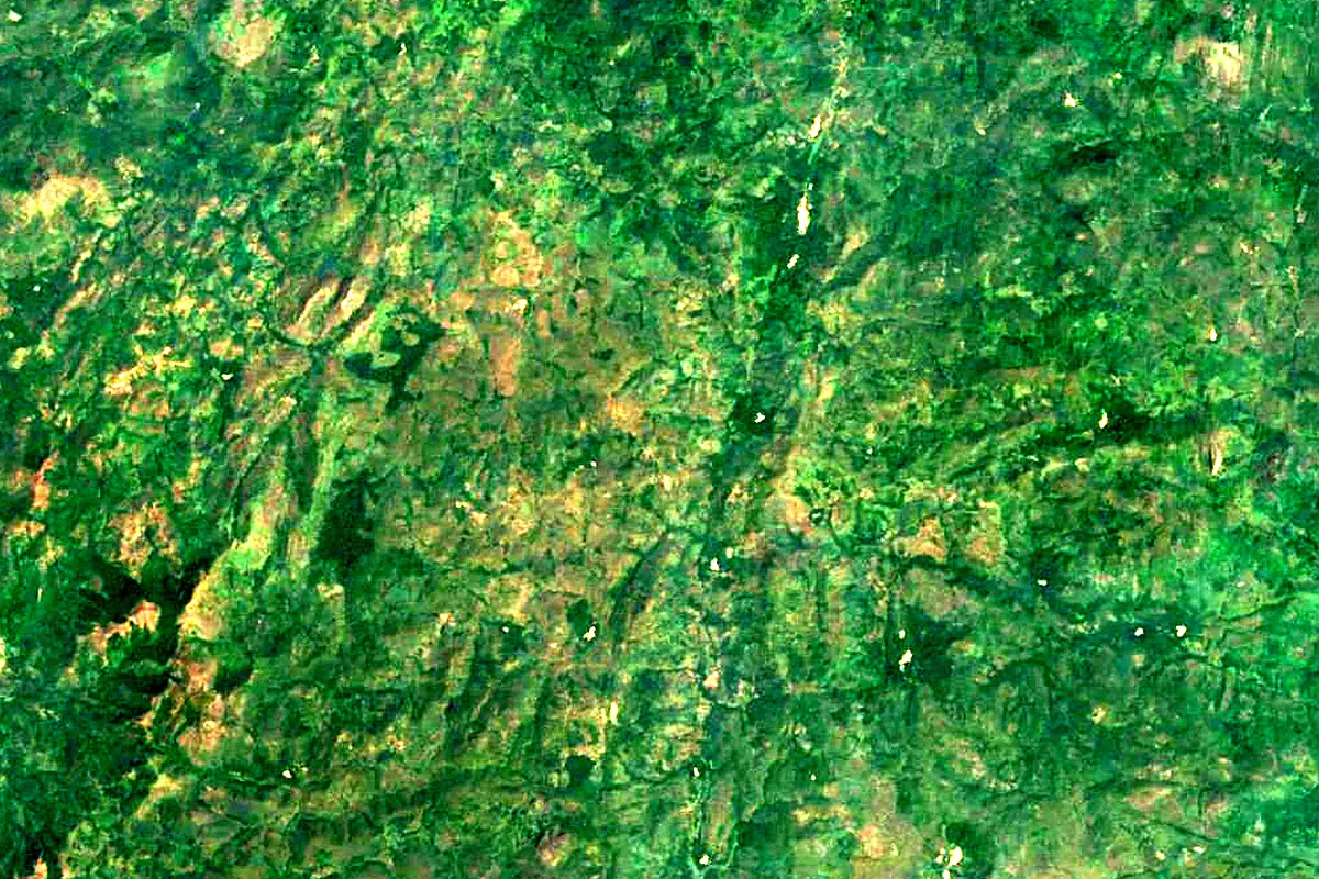
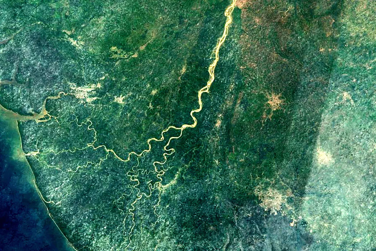
Sentinel-2 cloudless 2016 by EOX IT Services GmbH (contains modified Copernicus Sentinel data 2016), CC BY 4.0. The glowing line is the river as drawn by RiverATLAS.
Photos
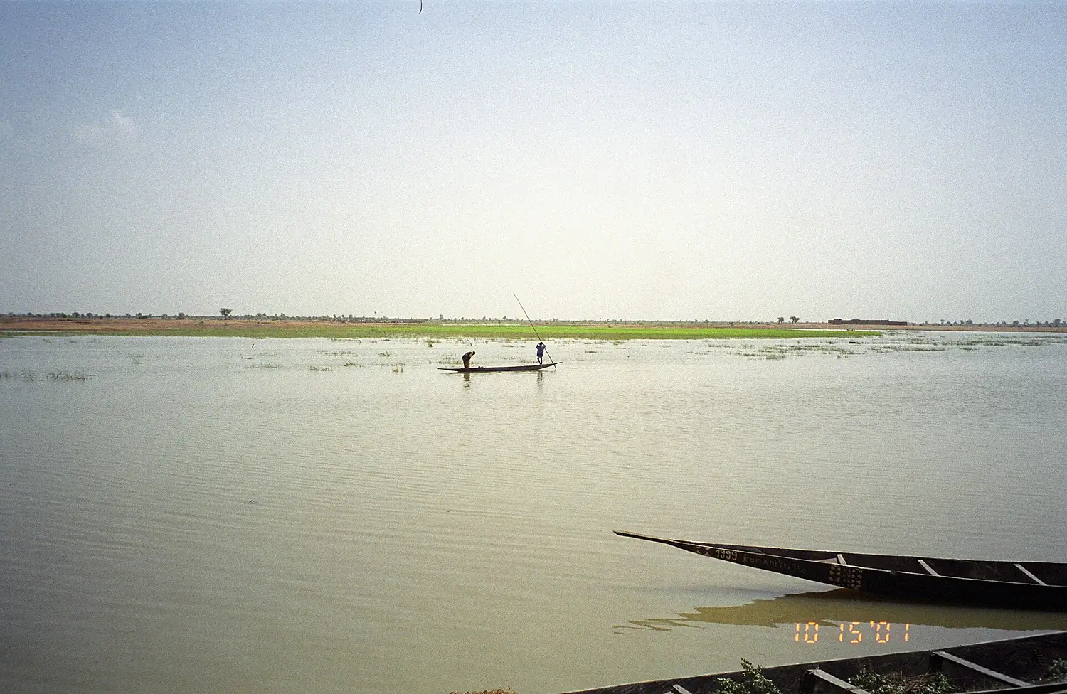
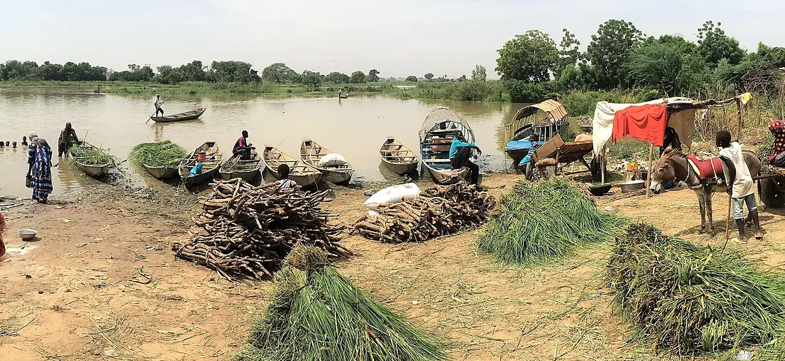
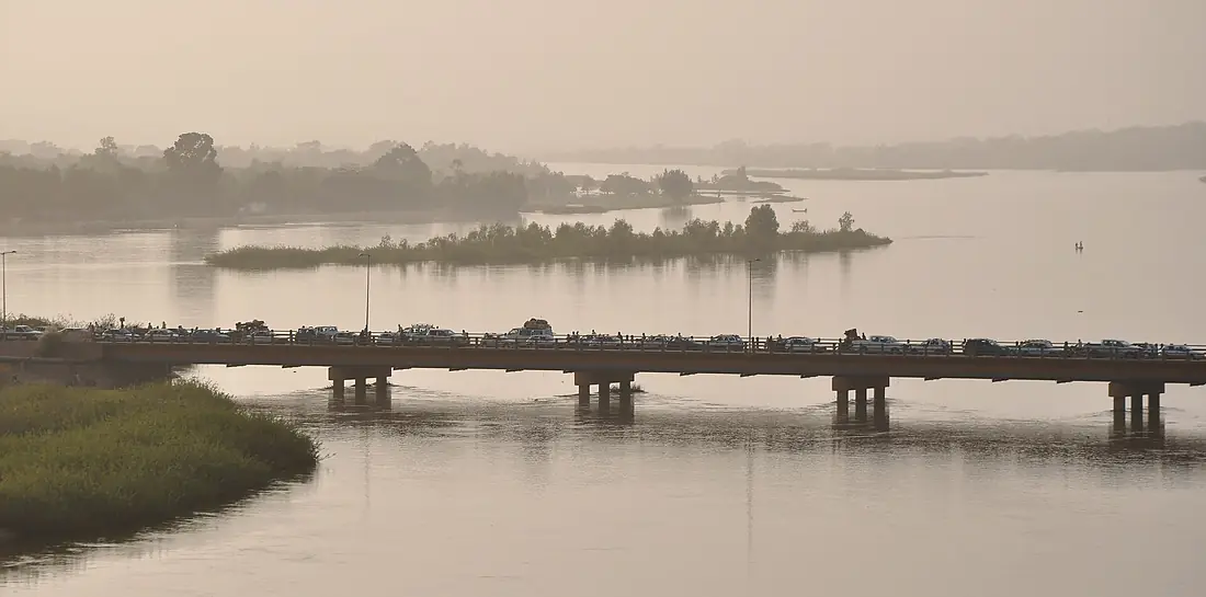
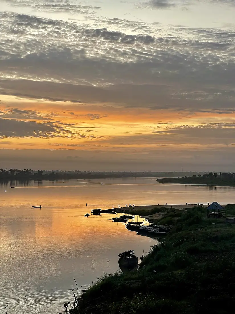
Niger River in pictures
Tributaries
Where it flows, and what flows into it
Tributaries (22)
Nigeria1,370 km3,200 m³/sjoins at km 3,396Sokoto RiverNigeria600 km290 m³/sjoins at km 2,777Kaduna RiverNigeria550 km640 m³/sjoins at km 3,213Bani RiverMali430 km510 m³/sjoins at km 1,153Mékrou RiverNiger410 km29 m³/sjoins at km 2,574Sankarani RiverMali400 km260 m³/sjoins at km 563Sirba RiverNiger350 km780 m³/sjoins at km 2,333Milo RiverGuinea330 km190 m³/sjoins at km 398Tinkisso RiverGuinea268 km180 m³/sjoins at km 438Tapoa RiverNiger260 km8.9 m³/sjoins at km 2,518Sota RiverBenin250 km46 m³/sjoins at km 2,673Also: Alibori River, Niandan, Anambra River, Dallol Bosso, Béli River, Goroubi, Gorouol, Dargol, Gurara River, In-Ates, Gounti Yéna
In the same basin
Nearby
Rivers nearby
Nigeria489 km170 m³/s207 km awayBenue RiverNigeria1,370 km3,200 m³/s274 km awaySanaga Cameroon918 km2,100 m³/s406 km awayKaduna RiverNigeria550 km640 m³/s387 km awayWouri RiverCameroon160 km620 m³/s385 km awayOuémé RiverBenin480 km170 m³/s459 km awayNyong RiverCameroon640 km450 m³/s446 km awayCampo River
 Equatorial Guinea460 km720 m³/s499 km away
Where these numbers come from
| Name, length, places | Wikidata (Q3542) · CC0 |
|---|---|
| Course, profile, basin | RiverATLAS v1.0 (HydroATLAS, Linke et al. 2019) · CC BY 4.0 — followed from the source to the mouth given by Wikidata |
| Flow | WaterGAP (RiverATLAS), 1971–2000 · CC BY 4.0 |
| Climate along the river | WorldClim (RiverATLAS), 1970–2000 · CC BY 4.0 |
| Towns, bridges, dams | Wikidata · CC0; GeoNames · CC BY 4.0 |
| Along the river | © OpenStreetMap contributors · ODbL |
| Images | EOX Sentinel-2 cloudless 2016 · CC BY 4.0; Wikimedia Commons |
| Our other atlases | Lakeyas, Peakyas — Wikidata · CC0; © OpenStreetMap contributors · ODbL; GeoNames · CC BY 4.0; HydroLAKES · CC BY 4.0; NOAA OISST |
Every source and licence is on the data sources page.
The family
Do you prefer beaches, lakes, mountains, waterfalls, islands, rivers or canyons?
Same idea, other landscapes: field atlases built on open data, month by month, in seven languages.
 beaches
 Find your beach: sea temperature, sun and swimming month by month.Visit lakes
 Every lake on Earth: water temperature, ice, depth and the shore.Coming soonVisit mountains
 Every summit in 3D: summit weather, the 0 °C line, huts and trails.Visit
  waterfalls
 Every waterfall: height, flow month by month and when it roars.Coming soonVisit
  islands
 Every island from the sea up: size, sea temperature, ferries and 3D.Coming soonVisit
  rivers
 Every river from source to sea: the journey, the flow and the basin in numbers.You are here
 canyons
 Every canyon cut to scale: depth to the floor, rim and floor temperatures, trails and viewpoints.Coming soonVisit