River
Po
652 km from source to mouth · Italy.
 ItalyFlows into Adriatic Sea1st longest in Italy
In numbers
Length
652km
Average flow
1,500m³/s
Basin
74,000km²
Drop
683m
from 677 m to -6 m
Country
1
The journey
From source to mouth
652 km of river and 68 stops on the way: 46 towns and cities on its banks, dams, bridges and the tributaries that feed it.
- 0 kmPian del Reat 677 m
- 35 kmCardè1,124 people
- 35 kmCardè Bridge
- 49 kmPellicetributary
- 69 kmLa Loggia8,433 people
- 76 kmNichelino47,760 people
- 76 kmMoncalieri56,134 people
- 79 kmFiladelfia45,531 people
- 79 kmNizza Millefonti26,487 people
- 80 kmLingotto49,705 people
- 81 kmCircoiscrizione VIII134,028 people
- 81 kmSanta Rita29,680 people
- 81 kmCircoiscrizione II141,344 people
- 82 kmPolo Nord16,983 people
- 83 kmSan Salvario35,591 people
- 83 kmCrocetta18,334 people
- 83 kmCenisia36,044 people
- 83 kmCit Turin12,502 people
- 84 kmQuadrilatero15,000 people
- 84 kmCircoiscrizione I78,523 people
- 84 kmSan Donato32,586 people
- 84 kmCentro20,285 people
- 84 kmPonte Vittorio Emanuele I
- 84 kmTurin841,600 people
- 84 kmPorta Palazzo19,000 people
- 85 kmAurora20,001 people
- 85 kmCircoiscrizione VII89,448 people
- 85 kmVanchiglia29,230 people
- 86 kmVanchiglietta18,300 people
- 88 kmCircoiscrizione VI107,369 people
- 88 kmDora Ripariatributary
- 88 kmBarriera di Milano50,354 people
- 88 kmRegio Parco9,117 people
- 89 kmStura di Lanzotributary
- 92 kmSan Mauro Torinese18,521 people
- 96 kmSettimo Torinese47,485 people
- 99 kmGassino Torinese8,211 people
- 103 kmBrandizzo8,373 people
- 107 kmChivasso23,017 people
- 122 kmDora Balteatributary
- 157 kmCasale Monferrato33,213 people
- 169 kmSesiatributary
- 184 kmValenza17,305 people
- 195 kmTanarotributary
- 209 kmAgognatributary
- 209 kmScriviatributary
- 217 kmStafforatributary
- 242 kmTicinotributary
- 274 kmLambrotributary
- 294 kmTrebbiatributary
- 297 kmPiacenza103,607 people
- 301 kmPiacenza cable-stayed bridge
- 324 kmSan Nazzaro703 people
- 330 kmAddatributary
- 342 kmCremona71,223 people
- 374 kmTarotributary
- 390 kmCasalmaggiore10,438 people
- 402 kmViadana20,013 people
- 414 kmGuastalla11,682 people
- 424 kmSuzzara16,571 people
- 431 kmOgliotributary
- 461 kmMinciotributary
- 468 kmSecchiatributary
- 510 kmRocca Possente
- 512 kmPanarotributary
- 528 kmSanta Maria Maddalena8,174 people
- 590 kmTaglio14,441 people
- 590 kmPorto Viro13,644 people
- 603 kmPorto Tolle10,666 people
- 652 kmAdriatic Seaat -6 m
Water level along the river (RiverATLAS; the height is exaggerated). Towns: GeoNames and Wikidata; bridges, dams and tributaries: Wikidata.
Longest river in Italy
At the mouth it carries 1,460 m³/s on average: an Olympic pool every 1.7 seconds. It drops from 677 m to -6 m, 1.0 m per kilometre on average. Its basin covers 74,000 km², about the size of SL. 17.2 million people live in it. Highest water: from November to December. Its dams hold back little of its water (3.5% of a year's flow).
Where to start
- TurinLargest city on its banks · 841,600 people
- Turin Airport (TRN)Nearest airport with scheduled flights, 14 km from the cityCar hire at TRN airport (Caselle Torinese)Discover Cars · Affiliate link↗
- On the water51 ferry piers, marinas, boat rentals and boat ramps along the river (OpenStreetMap)
- Kayak and canoe1 put-ins and rapids mapped (OpenStreetMap)
- From May to SeptemberThe best months to visit
Po, month by month
Highest water: from November to December
Best months to visit: from May to September.
From about 1,200 m³/s in the lowest month to 2,700 m³/s in the highest. An estimate: the monthly flow is modelled from the lowest and highest months of WaterGAP (RiverATLAS, 1971–2000) and the rain and snow along the river (WorldClim). Dams change the real rhythm. The chip is the average air temperature; below it, the month's rain.
Plan the trip
Plan the trip: boat trips, a bed by the river, a car
Some links above are affiliate links: if you book through them we may earn a commission, at no extra cost to you. It never changes what the data on this page says.
The basin
Po: the basin in numbers
73,289 km² of land send their water to this river. This is what lives on it.
- 17.2millionpeople live in the basin
- 239/km²people per km²
- 759maverage altitude of the basin
- 1,010mmof rain a year (basin average)
- 9.4°Caverage air temperature
- 7%protected areas
- 1.3%covered by lakes
- 2%permafrost
- 2.0km³held in reservoirs
What covers the basin
- 41% Forest
- 30% Cropland
- 8% Pasture
- 13% Towns and cities
RiverATLAS (HydroATLAS v1.0, CC BY 4.0): land cover, people, protected areas, glaciers and dams over the whole basin upstream of the mouth.
Along the river
Po: what you find on the way
- 414WeirsDiga Michelotti, Chiavica Cassino, Diga Isola Serafini and 411 more
- 22LocksPO-SX-50, Conca di Isola Serafini, Canale Milano-Cremona - Po and 19 more
- 1Waterfalls
- 1Rapids
- 25Boat rampsPontile Amici del Po, Scivolo di varo e di alaggio imbarcazioni del "Porti" di Morano sul Po and 23 more
- 4Ferry piersItalia '61, Borgo Medioevale, Murazzi and 1 more
- 22MarinasAmici del Po, Gite sul fiume, Porto Luzzara and 19 more
- 3River beachesLa Spiaggetta, Spiaggia del Meisino, I Sabbioni
From OpenStreetMap, within 2.3 km of the river. Not mapped is not the same as not there.
Cross-checked with our atlases
Po in our other atlases
What our sister atlases know about the waterfalls on this river, the lakes it flows through, the beaches at its mouth, the mountains where it rises and the islands off its mouth.
 3beaches at the mouth and on the banksCoastya
 64mountains at the sourcePeakyas
 1island off the mouthIslandyas
Beaches (3)
At the mouth (25 km) and on the banks, by Coastya
- Spiaggia Barricata14 km away26.1°C
- Spiaggia di Rosolina Mare24 km away25.9°C
- Spiaggia Libera Albarella20 km away25.9°C
Mountains at the source (64)
Within 15 km of the source, by Peakyas
- Viso3.8 km away · prominence 2,062 m3,841m
- Viso di Vallanta3.9 km away3,781m
- Visolotto2.9 km away3,348m
- Bric de Rubren14 km away3,340m
- Monte Granero2.8 km away · prominence 250 m3,171m
- Aiguillette5.6 km away3,298m
- Monte Salza14 km away · prominence 153 m3,326m
- Punta Gastaldi2.6 km away · prominence 204 m3,214m
56 more on PeakyasOpen Peakyas ↗
Islands off the mouth (1)
Within 30 km of the mouth, by Islandyas
- Albarella18 km away
Islandyas is coming soonOpen Islandyas ↗
From space
The source and the mouth, seen from orbit
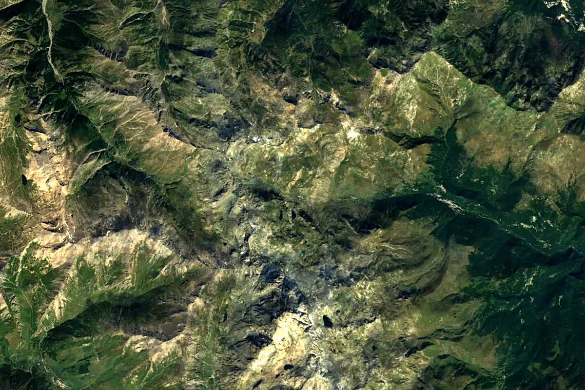
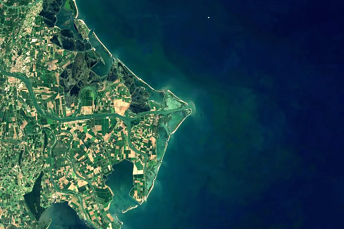
Sentinel-2 cloudless 2016 by EOX IT Services GmbH (contains modified Copernicus Sentinel data 2016), CC BY 4.0. The glowing line is the river as drawn by RiverATLAS.
Photos
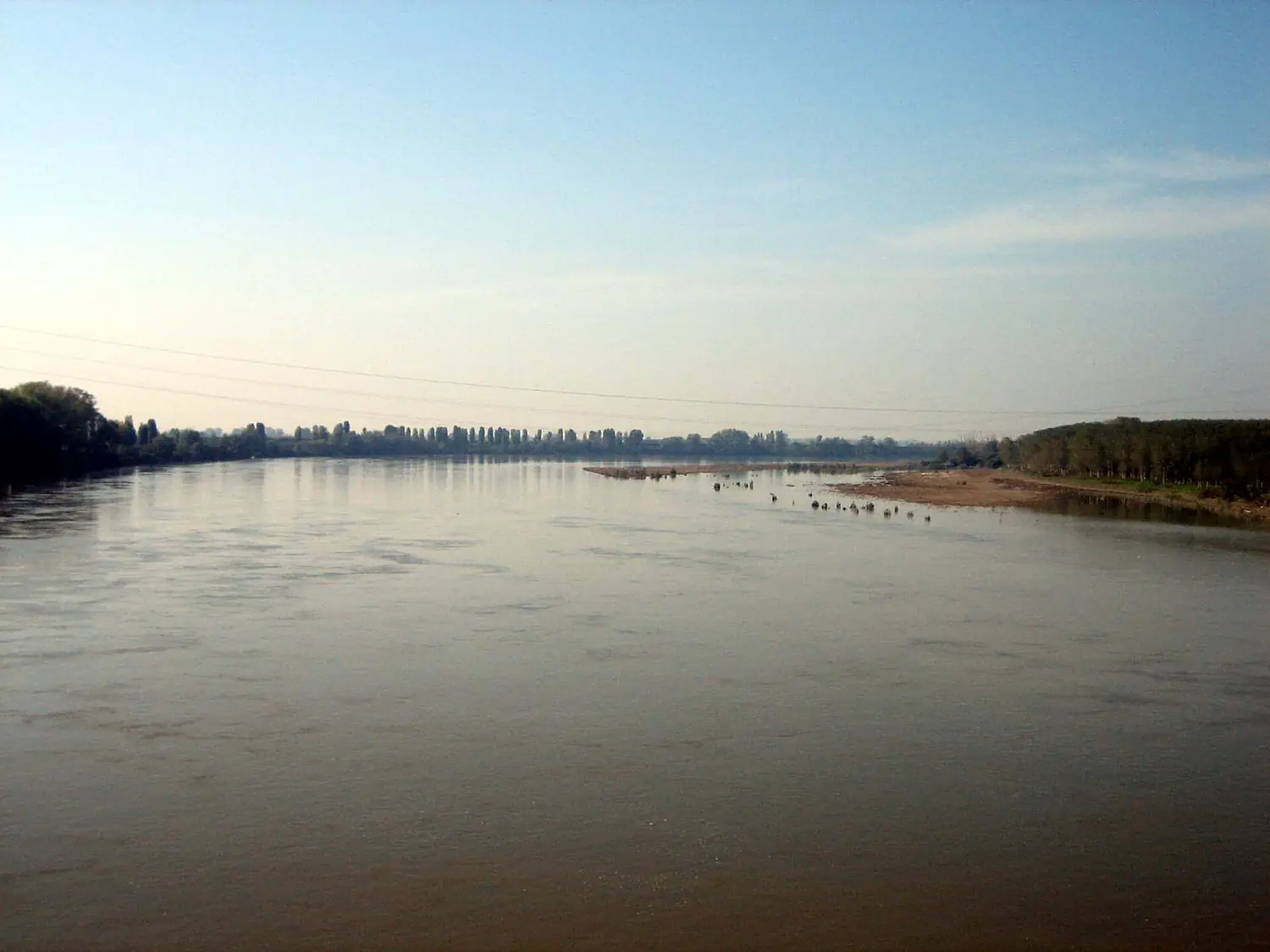
Po in pictures
Tributaries
Where it flows, and what flows into it
Tributaries (21)
Italy313 km190 m³/sjoins at km 329OglioItaly280 km140 m³/sjoins at km 428TanaroItaly276 km120 m³/sjoins at km 194TicinoItaly248 km1,000 m³/sjoins at km 241Dora BalteaItaly160 km110 m³/sjoins at km 121PanaroItaly148 km37 m³/sjoins at km 510SesiaItaly138 km70 m³/sjoins at km 168LambroItaly130 km5.8 m³/sjoins at km 273Dora RipariaItaly125 km28 m³/sjoins at km 88TrebbiaItaly105 km40 m³/sjoins at km 293MincioItaly75 km60 m³/sjoins at km 459Also: Agogna, Scrivia, Secchia, Taro, Arda, Stura di Lanzo, Pellice, Staffora, Bronda, Cantogno
Where these numbers come from
| Name, length, places | Wikidata (Q643) · CC0 |
|---|---|
| Course, profile, basin | RiverATLAS v1.0 (HydroATLAS, Linke et al. 2019) · CC BY 4.0 — followed from the source to the mouth given by Wikidata |
| Flow | WaterGAP (RiverATLAS), 1971–2000 · CC BY 4.0 |
| Climate along the river | WorldClim (RiverATLAS), 1970–2000 · CC BY 4.0 |
| Towns, bridges, dams | Wikidata · CC0; GeoNames · CC BY 4.0 |
| Along the river | © OpenStreetMap contributors · ODbL |
| Images | EOX Sentinel-2 cloudless 2016 · CC BY 4.0; Wikimedia Commons |
| Our other atlases | Coastya, Peakyas, Islandyas — Wikidata · CC0; © OpenStreetMap contributors · ODbL; GeoNames · CC BY 4.0; HydroLAKES · CC BY 4.0; NOAA OISST |
Every source and licence is on the data sources page.
The family
Do you prefer beaches, lakes, mountains, waterfalls, islands, rivers or canyons?
Same idea, other landscapes: field atlases built on open data, month by month, in seven languages.
beaches Find your beach: sea temperature, sun and swimming month by month.Visit
  lakes
lakes Every lake on Earth: water temperature, ice, depth and the shore.Coming soonVisit mountains
 Every summit in 3D: summit weather, the 0 °C line, huts and trails.Visit
  waterfalls
 Every waterfall: height, flow month by month and when it roars.Coming soonVisit islands
 Every island from the sea up: size, sea temperature, ferries and 3D.Coming soonVisit
  rivers
 Every river from source to sea: the journey, the flow and the basin in numbers.You are here
 canyons
 Every canyon cut to scale: depth to the floor, rim and floor temperatures, trails and viewpoints.Coming soonVisit