River
Red River of the North
890 km from source to mouth · Canada and United States.
 Canada and United StatesFlows into Lake Winnipeg
In numbers
Length
890km
Average flow
260m³/s
Basin
297,000km²
Drop
115m
from 330 m to 215 m
Countries
2
The journey
From source to mouth
890 km of river and 38 stops on the way: 12 towns and cities on its banks, dams, bridges and the tributaries that feed it.
- 0 kmOtter Tail Riverat 330 m
- 0 kmWest Toqua Lake1.2 km²
- 84 kmLake Traverse43 km²
- 103 kmRound Lake2.3 km²
- 159 kmOtter Tail Rivertributary
- 159 kmBois de Sioux Rivertributary
- 234 kmWild Rice Rivertributary
- 251 kmFargo118,523 people
- 252 kmMoorhead44,505 people
- 254 kmFargo-Moorhead Toll Bridge
- 280 kmSheyenne Rivertributary
- 385 kmSand Hill Rivertributary
- 419 kmRed Lake Rivertributary
- 420 kmSorlie Memorial Bridge
- 420 kmGrand Forks57,011 people
- 420 kmEast Grand Forks8,643 people
- 537 kmRed River1.2 km²
- 601 kmPembina Rivertributary
- 629 kmRoseau Rivertributary
- 734 kmLa Salle Rivertributary
- 736 kmRichmond West8,190 people
- 739 kmFort Richmond12,290 people
- 739 kmFort Garry South65,420 people
- 750 kmBDI Bridge
- 751 kmSt. Vital Bridge
- 751 kmElm Park1,715 people
- 752 kmGlenwood, Winnipeg3,880 people
- 757 kmNorwood Bridge
- 758 kmEsplanade Riel
- 758 kmProvencher Bridge
- 759 kmWaterfront Bridge
- 759 kmWinnipeg749,607 people
- 759 kmDowntown Winnipeg66,850 people
- 759 kmExchange District
- 761 kmAssiniboine Rivertributary
- 761 kmSeine Rivertributary
- 798 kmLower Fort Garry
- 808 kmSelkirk10,278 people
- 827 kmGoldeye Lake0.5 km²
- 890 kmLake Winnipegat 215 m
Water level along the river (RiverATLAS; the height is exaggerated). Towns: GeoNames and Wikidata; bridges, dams and tributaries: Wikidata.
River in central Canada and the United States
At the mouth it carries 256 m³/s on average: an Olympic pool every 9.7 seconds. It drops from 330 m to 215 m, 0.1 m per kilometre on average. Its basin covers 297,000 km², about the size of PH. 2.1 million people live in it. Highest water: from June to July; lowest: from December to March. It is heavily dammed: reservoirs can hold 100% of a year's flow.
Where to start
- WinnipegLargest city on its banks · 749,607 people
- Winnipeg / James Armstrong Richardson International Airport (YWG)Nearest airport with scheduled flights, 7 km from the cityCar hire at YWG airport (Winnipeg)Discover Cars · Affiliate link↗
- On the water49 ferry piers, marinas, boat rentals and boat ramps along the river (OpenStreetMap)
- From May to SeptemberThe best months to visit
Red River of the North, month by month
Highest water: from June to July
Lowest water: from December to March. Freezing months (average below −4 °C): from December to March. Best months to visit: from May to September.
From about 220 m³/s in the lowest month to 320 m³/s in the highest. An estimate: the monthly flow is modelled from the lowest and highest months of WaterGAP (RiverATLAS, 1971–2000) and the rain and snow along the river (WorldClim). Dams change the real rhythm. The chip is the average air temperature; below it, the month's rain.
Plan the trip
Plan the trip: boat trips, a bed by the river, a car
Some links above are affiliate links: if you book through them we may earn a commission, at no extra cost to you. It never changes what the data on this page says.
The basin
Red River of the North: the basin in numbers
264,771 km² of land send their water to this river. This is what lives on it.
- 2.1millionpeople live in the basin
- 8/km²people per km²
- 463maverage altitude of the basin
- 465mmof rain a year (basin average)
- 2.9°Caverage air temperature
- 8%protected areas
- 1.8%covered by lakes
- 8.1km³held in reservoirs
What covers the basin
- 11% Forest
- 66% Cropland
- 12% Pasture
RiverATLAS (HydroATLAS v1.0, CC BY 4.0): land cover, people, protected areas, glaciers and dams over the whole basin upstream of the mouth.
Along the river
Red River of the North: what you find on the way
- 14WeirsChristine Dam, Wild Rice Dam, Fargo Dam 2 and 11 more
- 3Locks
- 43Boat rampsMud Lake PWAS, Convent Boat Landing, Boat Launch and 40 more
- 4Marinaspritchard docs abandoned, Royal Manitoba Yacht Club and 2 more
From OpenStreetMap, within 2.7 km of the river. Not mapped is not the same as not there.
Cross-checked with our atlases
Red River of the North in our other atlases
What our sister atlases know about the waterfalls on this river, the lakes it flows through, the beaches at its mouth, the mountains where it rises and the islands off its mouth.
 5lakes on its wayLakeyas
Lakes and reservoirs (5)
Lakes it flows through, by Lakeyas
- West Toqua Lakekm 01.2km²
- Lake Traversekm 6743km²
- Round Lakekm 832.3km²
- Red Riverkm 4301.2km²
- Goldeye Lakekm 6630.5km²
Lakeyas is coming soonOpen Lakeyas ↗
From space
The source and the mouth, seen from orbit
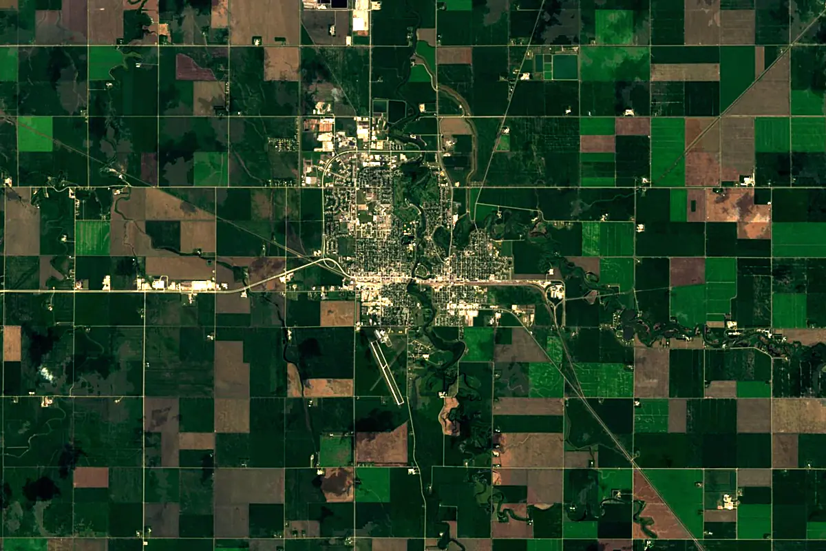
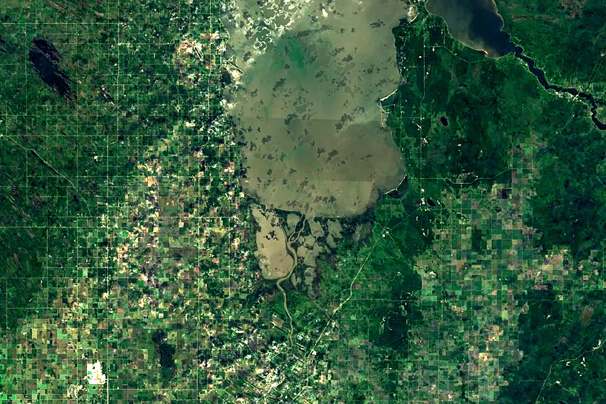
Sentinel-2 cloudless 2016 by EOX IT Services GmbH (contains modified Copernicus Sentinel data 2016), CC BY 4.0. The glowing line is the river as drawn by RiverATLAS.
Photos
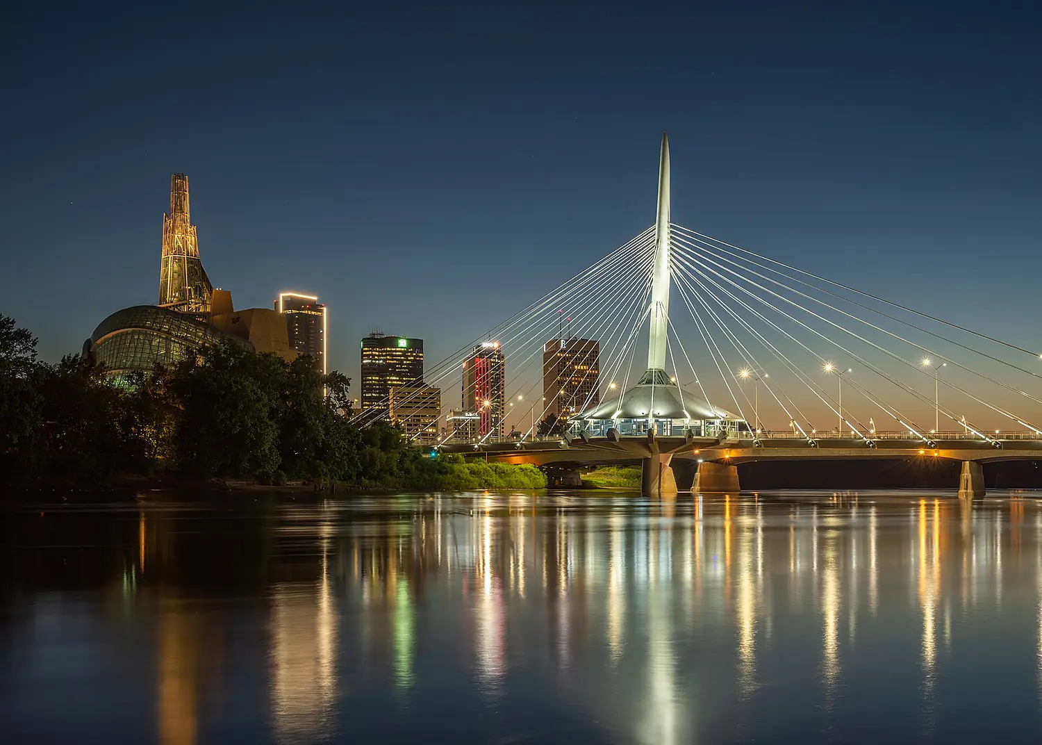
Red River of the North in pictures
Tributaries
Where it flows, and what flows into it
Tributaries (14)
Also: Sheyenne River, Otter Tail River, Bois de Sioux River, Roseau River, Seine River, Pembina River, La Salle River, Rat River, Red Lake River, Wild Rice River, Sand Hill River, Buffalo River, Whisky Creek
In the same basin
Canada644 km2,800 m³/sSaskatchewan RiverCanada547 km700 m³/sNorth Saskatchewan RiverCanada1,380 km240 m³/sSouth Saskatchewan RiverCanada1,000 km250 m³/sBow RiverCanada587 km130 m³/sRed Deer RiverCanada801 km70 m³/sOldman RiverCanada445 km95 m³/sWinnipeg RiverCanada298 km950 m³/sQu'Appelle RiverCanada743 km14 m³/sSouris RiverCanada1,240 km60 m³/sWhere these numbers come from
| Name, length, places | Wikidata (Q156006) · CC0 |
|---|---|
| Course, profile, basin | RiverATLAS v1.0 (HydroATLAS, Linke et al. 2019) · CC BY 4.0 — followed from the source to the mouth given by Wikidata |
| Flow | WaterGAP (RiverATLAS), 1971–2000 · CC BY 4.0 |
| Climate along the river | WorldClim (RiverATLAS), 1970–2000 · CC BY 4.0 |
| Towns, bridges, dams | Wikidata · CC0; GeoNames · CC BY 4.0 |
| Along the river | © OpenStreetMap contributors · ODbL |
| Images | EOX Sentinel-2 cloudless 2016 · CC BY 4.0; Wikimedia Commons |
| Our other atlases | Lakeyas — Wikidata · CC0; © OpenStreetMap contributors · ODbL; GeoNames · CC BY 4.0; HydroLAKES · CC BY 4.0; NOAA OISST |
Every source and licence is on the data sources page.
The family
Do you prefer beaches, lakes, mountains, waterfalls, islands, rivers or canyons?
Same idea, other landscapes: field atlases built on open data, month by month, in seven languages.
 beaches
 Find your beach: sea temperature, sun and swimming month by month.Visit lakes
 Every lake on Earth: water temperature, ice, depth and the shore.Coming soonVisit
  mountains
 Every summit in 3D: summit weather, the 0 °C line, huts and trails.Visit
  waterfalls
 Every waterfall: height, flow month by month and when it roars.Coming soonVisit
  islands
 Every island from the sea up: size, sea temperature, ferries and 3D.Coming soonVisit
  rivers
 Every river from source to sea: the journey, the flow and the basin in numbers.You are here
 canyons
 Every canyon cut to scale: depth to the floor, rim and floor temperatures, trails and viewpoints.Coming soonVisit