River
South Saskatchewan River
1,000 km from source to mouth · Canada.
 CanadaFlows into Saskatchewan River
In numbers
Length
1,000km
Average flow
250m³/s
Basin
146,100km²
Drop
319m
from 700 m to 381 m
Country
1
The journey
From source to mouth
1,000 km of river and 33 stops on the way: 10 towns and cities on its banks, dams, bridges and the tributaries that feed it.
- 0 kmOldman Riverat 700 m
- 1 kmOldman Rivertributary
- 1 kmBow Rivertributary
- 99 kmMedicine Hat63,138 people
- 99 kmFinlay Bridge
- 148 kmOld Channel Lake0.5 km²
- 281 kmRed Deer Rivertributary
- 467 kmSwift Current Creektributary
- 633 kmOutlook Bridge
- 635 kmSkytrail
- 692 kmPike Lake2.6 km²
- 705 kmMoon Lake0.9 km²
- 721 kmGrand Trunk Bridge
- 721 kmGordie Howe Bridge
- 724 kmSenator Sid Buckwold Bridge
- 724 kmCore Neighbourhoods36,088 people
- 724 kmConfederation70,192 people
- 724 kmSaskatoon266,141 people
- 725 kmTraffic Bridge (2018)
- 725 kmTraffic Bridge (1907)
- 725 kmBroadway Bridge
- 725 kmNutana Sector72,564 people
- 726 kmCentral Business District12,101 people
- 726 kmUniversity Bridge
- 727 kmSaskatoon Weir
- 727 kmCPR Bridge
- 729 kmCircle Drive Bridge
- 730 kmLawson34,620 people
- 731 kmUniversity Heights51,957 people
- 732 kmEvergreen10,495 people
- 732 kmSilverwood Heights10,716 people
- 735 kmChief Mistawasis Bridge
- 851 kmSt. Louis Bridge
- 887 kmMuskoday Bridge
- 1,000 kmSaskatchewan Riverat 381 m
Water level along the river (RiverATLAS; the height is exaggerated). Towns: GeoNames and Wikidata; bridges, dams and tributaries: Wikidata.
River in Alberta and Saskatchewan
At the mouth it carries 249 m³/s on average: an Olympic pool every 10 seconds. It drops from 700 m to 381 m, 0.3 m per kilometre on average. Its basin covers 146,100 km², about the size of BD. 2.2 million people live in it. Highest water: from June to July; lowest: from December to March. It is heavily dammed: reservoirs can hold 167% of a year's flow.
Where to start
- SaskatoonLargest city on its banks · 266,141 people
- Saskatoon John G. Diefenbaker International Airport (YXE)Nearest airport with scheduled flights, 5 km from the cityCar hire at YXE airport (Saskatoon)Discover Cars · Affiliate link↗
- On the water33 ferry piers, marinas, boat rentals and boat ramps along the river (OpenStreetMap)
- Kayak and canoe5 put-ins and rapids mapped (OpenStreetMap)
- From June to AugustThe best months to visit
South Saskatchewan River, month by month
Highest water: from June to July
Lowest water: from December to March. Freezing months (average below −4 °C): from November to March. Best months to visit: from June to August.
From about 190 m³/s in the lowest month to 400 m³/s in the highest. An estimate: the monthly flow is modelled from the lowest and highest months of WaterGAP (RiverATLAS, 1971–2000) and the rain and snow along the river (WorldClim). Dams change the real rhythm. The chip is the average air temperature; below it, the month's rain.
Plan the trip
Plan the trip: boat trips, a bed by the river, a car
Some links above are affiliate links: if you book through them we may earn a commission, at no extra cost to you. It never changes what the data on this page says.
The basin
South Saskatchewan River: the basin in numbers
131,442 km² of land send their water to this river. This is what lives on it.
- 2.2millionpeople live in the basin
- 17/km²people per km²
- 1,012maverage altitude of the basin
- 425mmof rain a year (basin average)
- 2.7°Caverage air temperature
- 10%protected areas
- 1.3%covered by lakes
- 2%permafrost
- 14km³held in reservoirs
What covers the basin
- 22% Forest
- 44% Cropland
- 28% Pasture
- 1% Towns and cities
RiverATLAS (HydroATLAS v1.0, CC BY 4.0): land cover, people, protected areas, glaciers and dams over the whole basin upstream of the mouth.
Along the river
South Saskatchewan River: what you find on the way
- 7WeirsThe Weir and 6 more
- 1LocksSouth Saskatchewan River
- 5Rapids
- 15Boat rampsWest Boat Launch, Boat Ramp, Canoe Launch and 12 more
- 18Ferry piersEstuary Ferry, Riverhurst Ferry - West Shore Terminal, Riverhurst Ferry - East Shore Terminal and 15 more
From OpenStreetMap, within 2.5 km of the river. Not mapped is not the same as not there.
Cross-checked with our atlases
South Saskatchewan River in our other atlases
What our sister atlases know about the waterfalls on this river, the lakes it flows through, the beaches at its mouth, the mountains where it rises and the islands off its mouth.
 3lakes on its wayLakeyas
 1mountain at the sourcePeakyas
Lakes and reservoirs (3)
Lakes it flows through, by Lakeyas
- Old Channel Lakekm 1500.5km²
- Pike Lakekm 7022.6km²
- Moon Lakekm 7150.9km²
Lakeyas is coming soonOpen Lakeyas ↗
Mountains at the source (1)
Within 15 km of the source, by Peakyas
- Cairn Hill6.7 km away
From space
The source and the mouth, seen from orbit
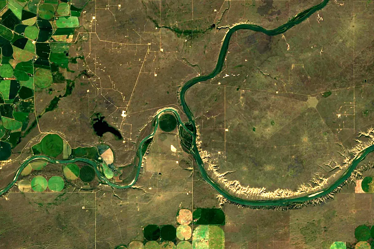
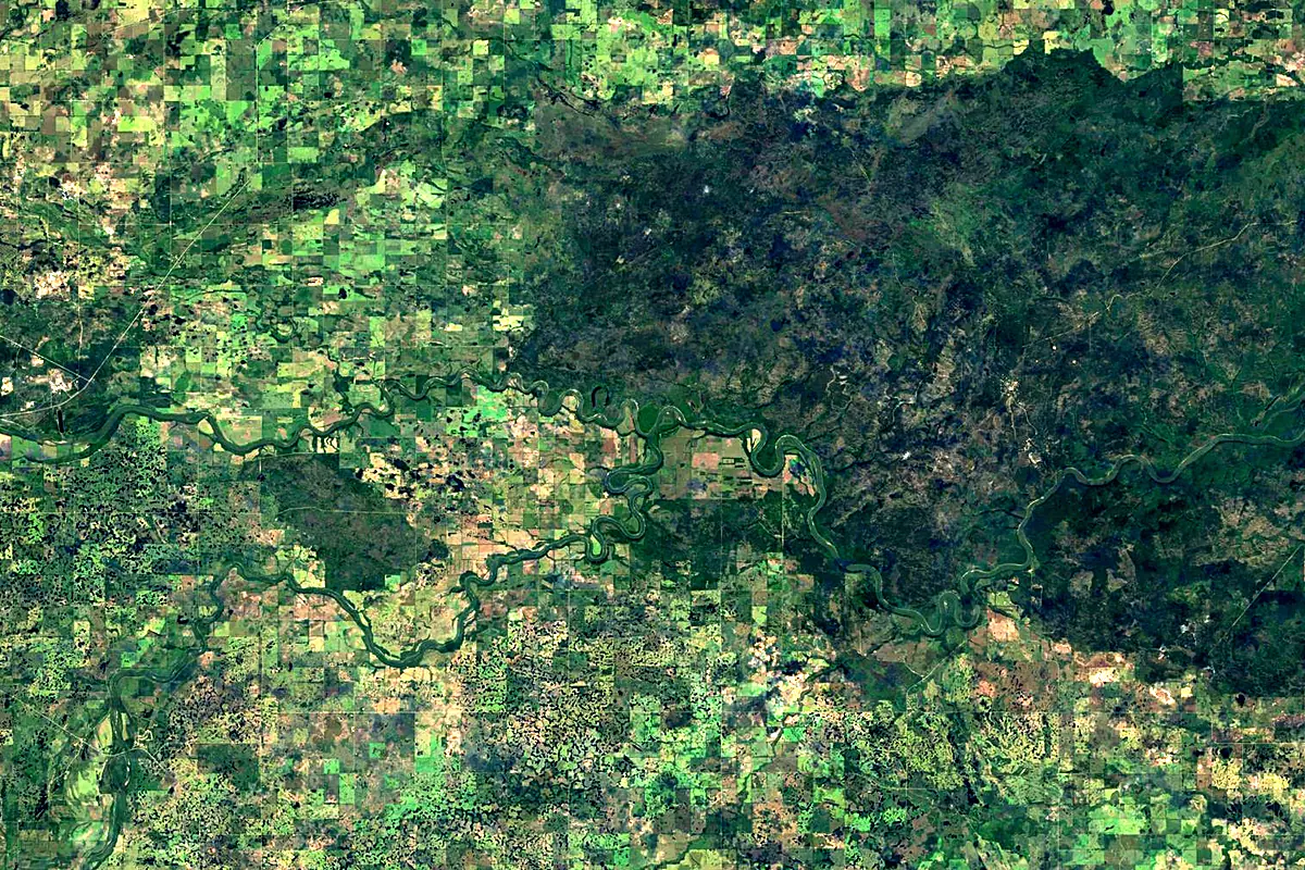
Sentinel-2 cloudless 2016 by EOX IT Services GmbH (contains modified Copernicus Sentinel data 2016), CC BY 4.0. The glowing line is the river as drawn by RiverATLAS.
Photos
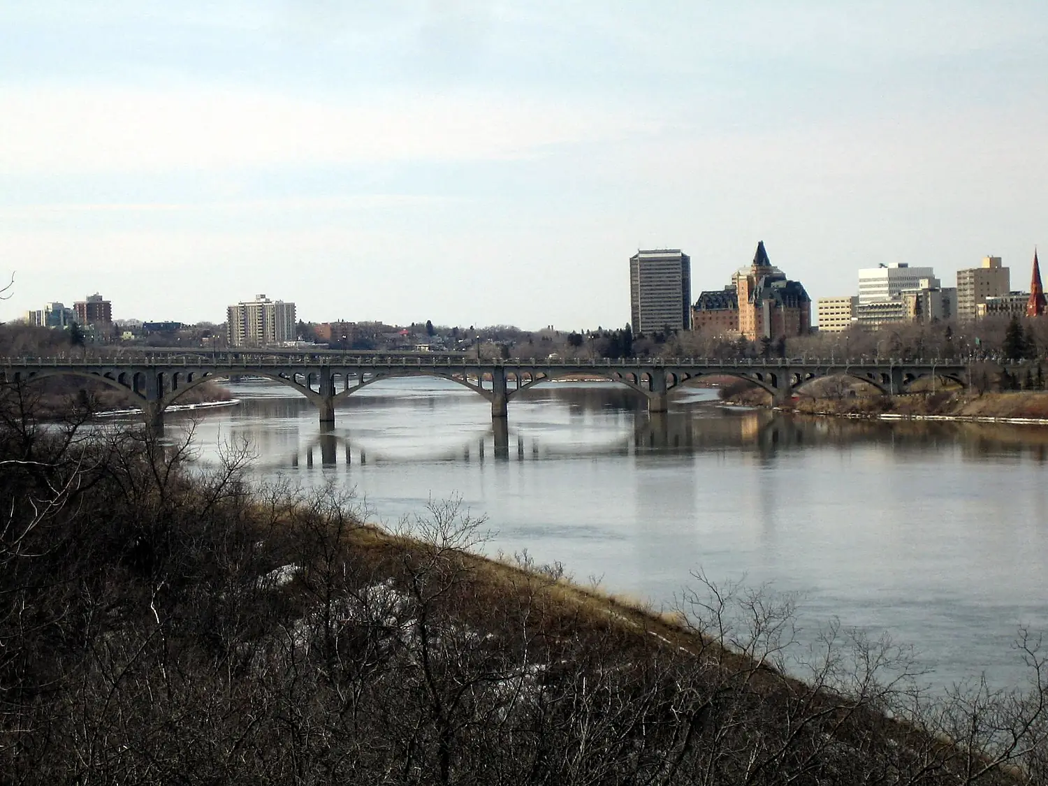
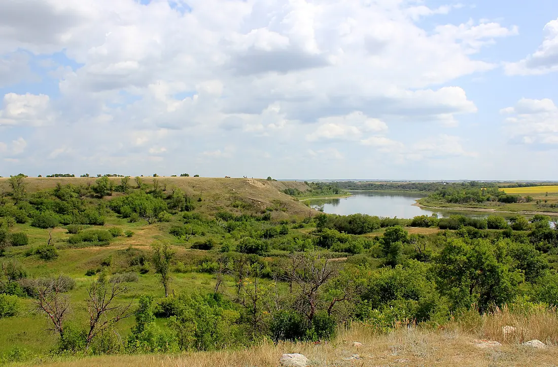
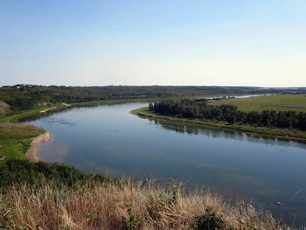
South Saskatchewan River in pictures
Tributaries
Where it flows, and what flows into it
It flows into
Saskatchewan RiverCanada547 km700 m³/sTributaries (4)
Canada801 km70 m³/sjoins at km 285Bow RiverCanada587 km130 m³/sjoins at km 1Oldman RiverCanada445 km95 m³/sjoins at km 1Also: Swift Current Creek
Where these numbers come from
| Name, length, places | Wikidata (Q2242) · CC0 |
|---|---|
| Course, profile, basin | RiverATLAS v1.0 (HydroATLAS, Linke et al. 2019) · CC BY 4.0 — followed from the source to the mouth given by Wikidata |
| Flow | WaterGAP (RiverATLAS), 1971–2000 · CC BY 4.0 |
| Climate along the river | WorldClim (RiverATLAS), 1970–2000 · CC BY 4.0 |
| Towns, bridges, dams | Wikidata · CC0; GeoNames · CC BY 4.0 |
| Along the river | © OpenStreetMap contributors · ODbL |
| Images | EOX Sentinel-2 cloudless 2016 · CC BY 4.0; Wikimedia Commons |
| Our other atlases | Lakeyas, Peakyas — Wikidata · CC0; © OpenStreetMap contributors · ODbL; GeoNames · CC BY 4.0; HydroLAKES · CC BY 4.0; NOAA OISST |
Every source and licence is on the data sources page.
The family
Do you prefer beaches, lakes, mountains, waterfalls, islands, rivers or canyons?
Same idea, other landscapes: field atlases built on open data, month by month, in seven languages.
 beaches
 Find your beach: sea temperature, sun and swimming month by month.Visit lakes
 Every lake on Earth: water temperature, ice, depth and the shore.Coming soonVisit mountains
 Every summit in 3D: summit weather, the 0 °C line, huts and trails.Visit
  waterfalls
 Every waterfall: height, flow month by month and when it roars.Coming soonVisit
  islands
 Every island from the sea up: size, sea temperature, ferries and 3D.Coming soonVisit
  rivers
 Every river from source to sea: the journey, the flow and the basin in numbers.You are here
 canyons
 Every canyon cut to scale: depth to the floor, rim and floor temperatures, trails and viewpoints.Coming soonVisit