River
River Great Ouse
240 km from source to mouth · United Kingdom.
 United KingdomFlows into North Sea4th longest in United Kingdom
In numbers
Length
240km
Average flow
66m³/s
Basin
8,530km²
Drop
78m
from 75 m to -3 m
Country
1
The journey
From source to mouth
240 km of river and 61 stops on the way: 34 towns and cities on its banks, dams, bridges and the tributaries that feed it.
- 0 kmWappenhamat 75 m
- 3 kmBrackley Viaduct
- 3 kmBrackley16,188 people
- 4 kmBuckingham14,294 people
- 16 kmDeanshanger3,817 people
- 19 kmStony Stratford7,872 people
- 19 kmBridge Over River Ouse (That Part In Old Stratford Civil Parish)
- 22 kmCosgrove Aqueduct
- 23 kmWolverton12,492 people
- 26 kmMilton Keynes264,349 people
- 26 kmNew Bradwell3,509 people
- 33 kmNewport Pagnell15,586 people
- 38 kmTyringham Bridge
- 45 kmOlney Bridge
- 46 kmOlney6,598 people
- 51 kmCold Brayfield91 people
- 53 kmTurvey1,225 people
- 58 kmHarrold Bridge
- 80 kmClapham4,560 people
- 84 kmBromham Bridge
- 84 kmBromham4,957 people
- 87 kmKempston20,736 people
- 91 kmBedford Bridge
- 91 kmBedford92,407 people
- 105 kmGreat Barford Bridge
- 105 kmGreat Barford2,252 people
- 107 kmRiver Iveltributary
- 113 kmSt Denys' Church, Little Barford
- 116 kmSaint Neots30,811 people
- 116 kmEaton Socon5,704 people
- 117 kmSt Neots bridge
- 117 kmSt Neots33,103 people
- 119 kmRiver Kymtributary
- 120 kmLittle Paxton3,244 people
- 131 kmBrampton4,862 people
- 133 kmGodmanchester7,889 people
- 133 kmGodmanchester Chinese Bridge
- 134 kmOld Bridge, Huntingdon
- 134 kmHuntingdon25,432 people
- 136 kmHartford464 people
- 138 kmHoughton2,559 people
- 138 kmHoughton Mill
- 141 kmHemingford Grey3,163 people
- 141 kmSt Ives16,934 people
- 143 kmSaint Ives16,815 people
- 158 kmNew Bedford Rivertributary
- 158 kmOld Bedford Rivertributary
- 167 kmCottenham5,903 people
- 176 kmStretham Old Engine
- 176 kmGreenways
- 179 kmRiver Camtributary
- 180 kmLittle Thetford744 people
- 183 kmHawk Bridge
- 184 kmEly railway bridge
- 185 kmEly20,256 people
- 192 kmRiver Larktributary
- 194 kmLittleport9,910 people
- 201 kmLittle Ouse Rivertributary
- 213 kmRiver Wisseytributary
- 216 kmDownham Market11,349 people
- 235 kmKing's Lynn42,800 people
- 239 kmRiver Babingleytributary
- 240 kmNorth Seaat -3 m
Water level along the river (RiverATLAS; the height is exaggerated). Towns: GeoNames and Wikidata; bridges, dams and tributaries: Wikidata.
River in the United Kingdom
At the mouth it carries 66 m³/s on average: an Olympic pool every 38 seconds. It drops from 75 m to -3 m, 0.3 m per kilometre on average. Its basin covers 8,530 km², about the size of PR. 1.8 million people live in it. Highest water: from December to January. Its dams hold back little of its water (2.8% of a year's flow).
Where to start
- Milton KeynesLargest city on its banks · 264,349 people
- London Luton Airport (LTN)Nearest airport with scheduled flights, 32 km from the cityCar hire at LTN airport (Luton, Luton)Discover Cars · Affiliate link↗
- On the water75 ferry piers, marinas, boat rentals and boat ramps along the river (OpenStreetMap)
- From June to SeptemberThe best months to visit
River Great Ouse, month by month
Highest water: from December to January
Best months to visit: from June to September.
From about 27 m³/s in the lowest month to 110 m³/s in the highest. An estimate: the monthly flow is modelled from the lowest and highest months of WaterGAP (RiverATLAS, 1971–2000) and the rain and snow along the river (WorldClim). Dams change the real rhythm. The chip is the average air temperature; below it, the month's rain.
Plan the trip
Plan the trip: boat trips, a bed by the river, a car
Some links above are affiliate links: if you book through them we may earn a commission, at no extra cost to you. It never changes what the data on this page says.
The basin
River Great Ouse: the basin in numbers
8,172 km² of land send their water to this river. This is what lives on it.
- 1.8millionpeople live in the basin
- 215/km²people per km²
- 49maverage altitude of the basin
- 584mmof rain a year (basin average)
- 9.6°Caverage air temperature
- 7%protected areas
- 0.2%covered by lakes
- 0.1km³held in reservoirs
What covers the basin
- 66% Cropland
- 11% Pasture
- 9% Towns and cities
RiverATLAS (HydroATLAS v1.0, CC BY 4.0): land cover, people, protected areas, glaciers and dams over the whole basin upstream of the mouth.
Along the river
River Great Ouse: what you find on the way
- 79WeirsGayhurst Weir, Kemspton Main Weir, Duckmill Weir and Sluice and 76 more
- 64LocksGrand Union Canal, Bedford Lock, River Great Ouse and 61 more
- 2Waterfalls
- 33Boat rampsLionhearts Cruising Club, Chain Road and 31 more
- 3Ferry piersKing’s Lynn Ferry Pier, West Lynn Ferry Pier
- 35MarinasThrupp Wharf Marina, Haversham sailing club, Lionhearts Cruising Club and 32 more
From OpenStreetMap, within 1.7 km of the river. Not mapped is not the same as not there.
Cross-checked with our atlases
River Great Ouse in our other atlases
What our sister atlases know about the waterfalls on this river, the lakes it flows through, the beaches at its mouth, the mountains where it rises and the islands off its mouth.
 1beach at the mouth or on the banksCoastya
 1mountain at the sourcePeakyas
 1island off the mouthIslandyas
Beaches (1)
At the mouth (25 km) and on the banks, by Coastya
- Snettisham Beach10 km away18.0°C
Mountains at the source (1)
Within 15 km of the source, by Peakyas
- Graven Hill14 km away
Islands off the mouth (1)
Within 30 km of the mouth, by Islandyas
- Outer Trial Bank11 km away
Islandyas is coming soonOpen Islandyas ↗
From space
The source and the mouth, seen from orbit
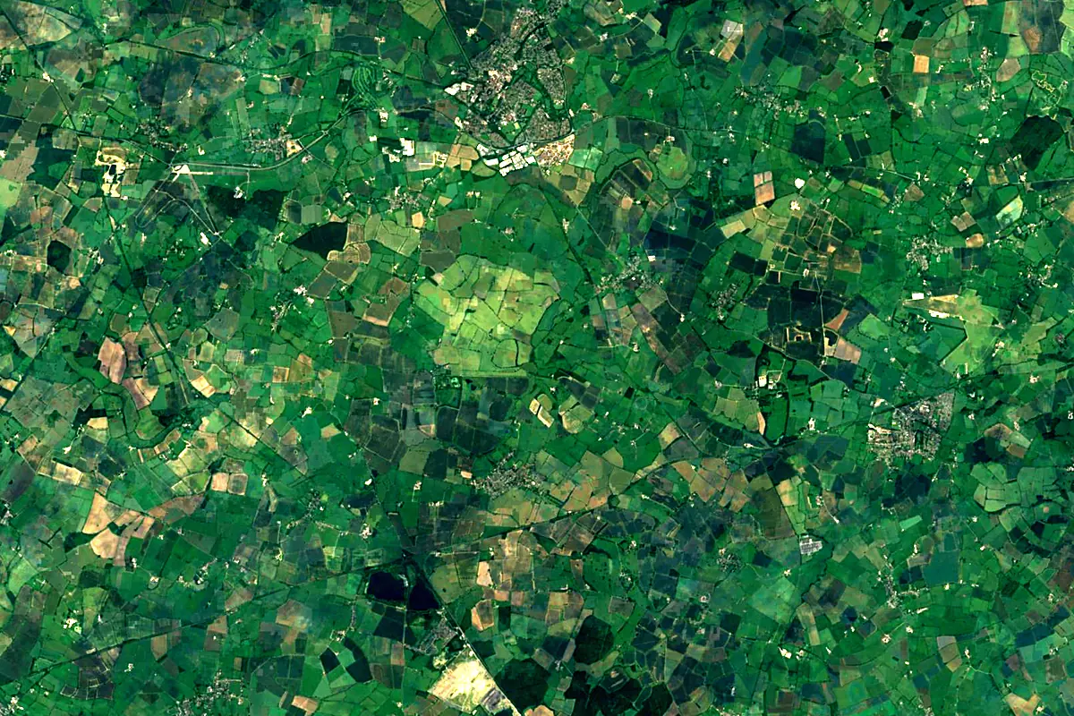
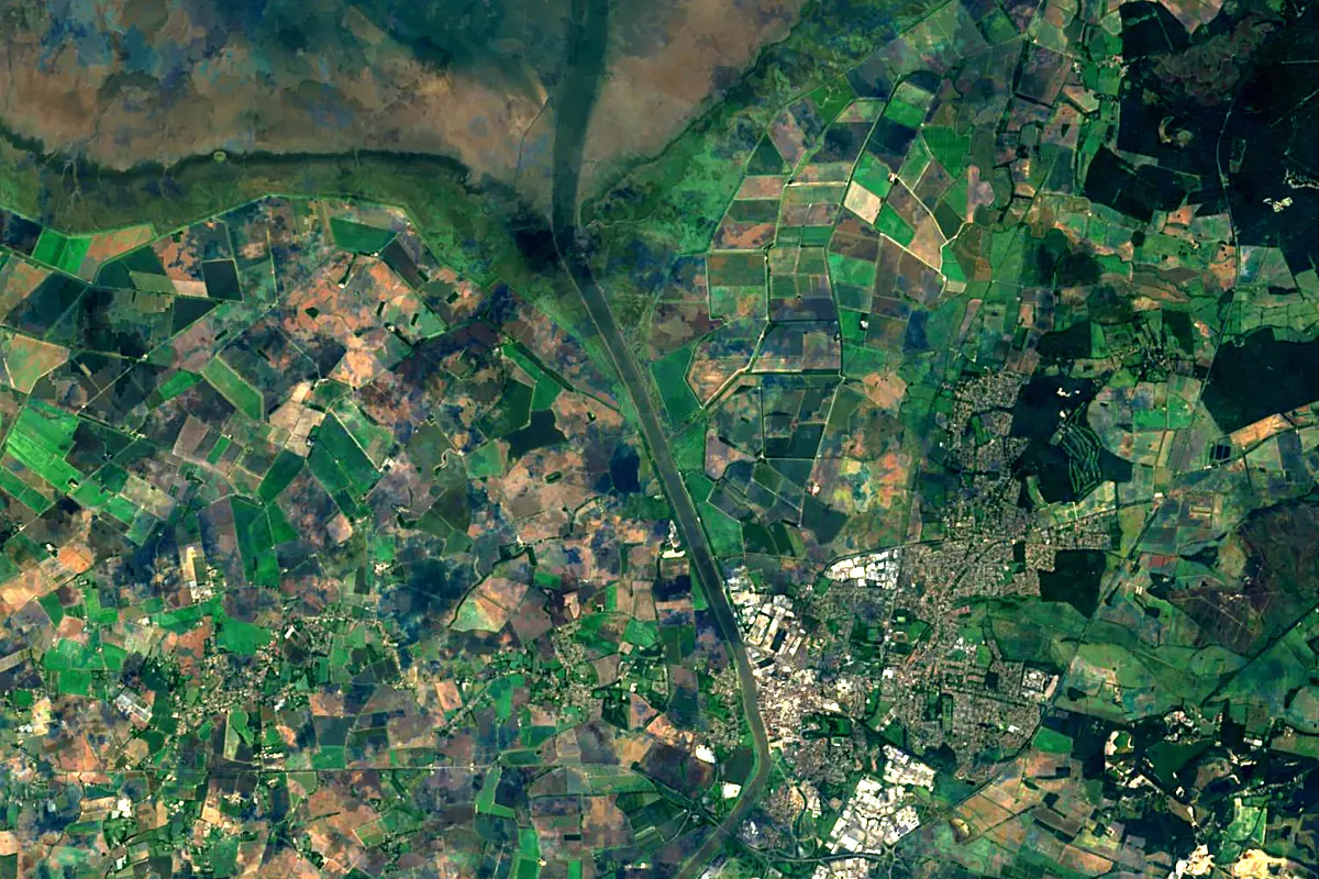
Sentinel-2 cloudless 2016 by EOX IT Services GmbH (contains modified Copernicus Sentinel data 2016), CC BY 4.0. The glowing line is the river as drawn by RiverATLAS.
Photos
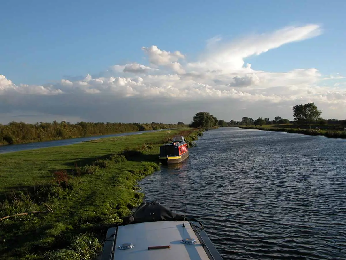
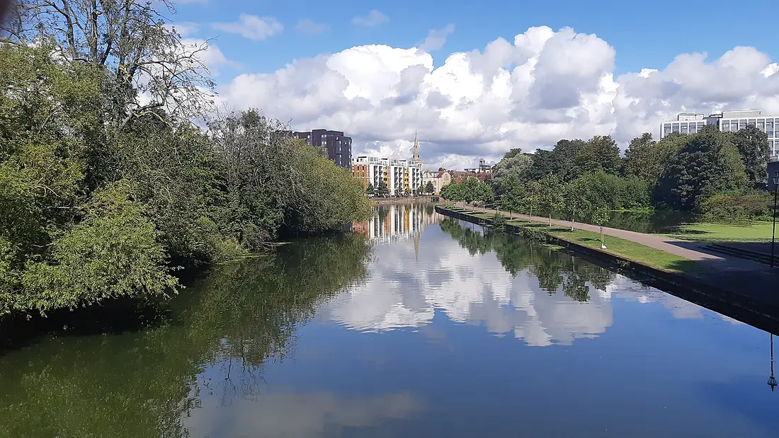
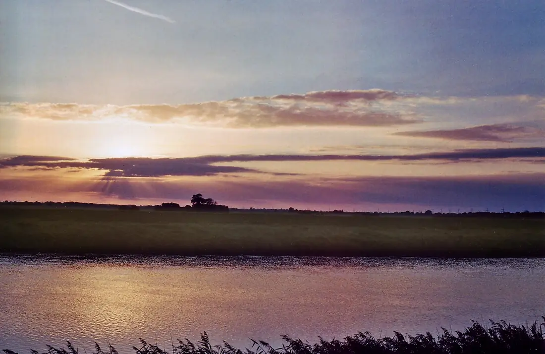
River Great Ouse in pictures
Tributaries
Where it flows, and what flows into it
Tributaries (14)
Also: River Cam, River Nar, River Ouzel, River Lark, New Bedford River, Little Ouse River, Gaywood River, Old Bedford River, River Ivel, River Tove, River Wissey, River Kym, River Babingley, River Leck
Nearby
Rivers nearby
United Kingdom146 km20 m³/s11 km awayRiver ThamesUnited Kingdom334 km66 m³/s147 km awayRiver TrentUnited Kingdom298 km95 m³/s121 km awayRiver OuseUnited Kingdom90 km50 m³/s126 km awayRiver DerwentUnited Kingdom80 km29 m³/s114 km awayRiver AireUnited Kingdom114 km36 m³/s135 km awayRiver LeaUnited Kingdom68 km38 m³/s144 km awayRhine The Netherlands1,233 km2,200 m³/s272 km away
Where these numbers come from
| Name, length, places | Wikidata (Q19716) · CC0 |
|---|---|
| Course, profile, basin | RiverATLAS v1.0 (HydroATLAS, Linke et al. 2019) · CC BY 4.0 — followed along the river network from the point given by Wikidata |
| Flow | WaterGAP (RiverATLAS), 1971–2000 · CC BY 4.0 |
| Climate along the river | WorldClim (RiverATLAS), 1970–2000 · CC BY 4.0 |
| Towns, bridges, dams | Wikidata · CC0; GeoNames · CC BY 4.0 |
| Along the river | © OpenStreetMap contributors · ODbL |
| Images | EOX Sentinel-2 cloudless 2016 · CC BY 4.0; Wikimedia Commons |
| Our other atlases | Coastya, Peakyas, Islandyas — Wikidata · CC0; © OpenStreetMap contributors · ODbL; GeoNames · CC BY 4.0; HydroLAKES · CC BY 4.0; NOAA OISST |
Every source and licence is on the data sources page.
The family
Do you prefer beaches, lakes, mountains, waterfalls, islands, rivers or canyons?
Same idea, other landscapes: field atlases built on open data, month by month, in seven languages.
beaches Find your beach: sea temperature, sun and swimming month by month.Visit
  lakes
lakes Every lake on Earth: water temperature, ice, depth and the shore.Coming soonVisit mountains
 Every summit in 3D: summit weather, the 0 °C line, huts and trails.Visit
  waterfalls
 Every waterfall: height, flow month by month and when it roars.Coming soonVisit islands
 Every island from the sea up: size, sea temperature, ferries and 3D.Coming soonVisit
  rivers
 Every river from source to sea: the journey, the flow and the basin in numbers.You are here
 canyons
 Every canyon cut to scale: depth to the floor, rim and floor temperatures, trails and viewpoints.Coming soonVisit