River
Rhine
1,233 km from source to mouth · 6 countries.



 The Netherlands, France, Germany, Liechtenstein, Switzerland and AustriaFlows into North Sea1st longest in The Netherlands
In numbers
Length
1,233km
Average flow
2,200m³/s
Basin
185,000km²
Drop
1,433m
from 1,429 m to -4 m
Countries
6
The journey
From source to mouth
1,233 km of river and 68 stops on the way: 39 towns and cities on its banks, dams, bridges and the tributaries that feed it.
- 0 kmTomaseeat 1,429 m
- 77 kmLake Lucerne110 km²
- 80 kmRotsee0.4 km²
- 160 kmKlingnauer Stausee0.9 km²
- 162 kmAaretributary
- 162 kmWutachtributary
- 163 kmWaldshut-Tiengen25,084 people
- 175 kmAlbtributary
- 181 kmKleiner Laufen bei Laufenburg
- 184 kmMurgtributary
- 211 kmRheinfelden13,528 people
- 230 kmBasel176,329 people
- 234 kmHuningue7,487 people
- 235 kmWeil am Rhein32,361 people
- 347 kmErstein10,790 people
- 370 kmKehl39,708 people
- 370 kmStrasbourg293,771 people
- 389 kmPeterhafen0.5 km²
- 407 kmKasjdböldj0.6 km²
- 411 kmPolder de la Moder0.7 km²
- 426 kmGoldkanal1.2 km²
- 439 kmFermasee0.3 km²
- 445 kmKarlsruhe309,247 people
- 488 kmSpeyer49,035 people
- 492 kmGänsedrecksee0.8 km²
- 508 kmAlt-Rhein0.4 km²
- 508 kmBlaue Adria0.5 km²
- 514 kmMannheim319,536 people
- 515 kmLudwigshafen am Rhein163,196 people
- 515 kmLudwigshafen177,355 people
- 518 kmMelm0.4 km²
- 534 kmWorms86,921 people
- 559 kmEicher See0.5 km²
- 571 kmRiedsee bei Leeheim0.4 km²
- 593 kmMainz223,888 people
- 600 kmWiesbaden288,584 people
- 608 kmEltville am Rhein16,939 people
- 626 kmRüdesheim am Rhein9,874 people
- 628 kmBingen am Rhein25,424 people
- 695 kmKoblenz113,020 people
- 741 kmRemagen17,563 people
- 750 kmBad Honnef24,930 people
- 763 kmStadtbezirk Bonn152,544 people
- 764 kmBonn323,587 people
- 790 kmPorz am Rhein113,415 people
- 795 kmRodenkirchen110,158 people
- 800 kmKöln1,024,621 people
- 801 kmCologne1,025,523 people
- 803 kmNippes113,487 people
- 813 kmLeverkusen162,738 people
- 817 kmFühlingen Lake0.6 km²
- 853 kmNeuss152,457 people
- 859 kmDüsseldorf619,444 people
- 882 kmLake Elfrath0.6 km²
- 891 kmWedau Regatta Course0.3 km²
- 893 kmDuisburg500,810 people
- 902 kmUettelsheimer See0.4 km²
- 936 kmAuesee1.6 km²
- 939 kmDiersfordter Waldsee0.9 km²
- 947 kmLange Renne0.4 km²
- 961 kmBotzelaerer Meer0.4 km²
- 973 kmEmmerich am Rhein31,736 people
- 979 kmKleve53,094 people
- 986 kmDe Bijland2.3 km²
- 1,007 kmArnhem164,096 people
- 1,031 kmNeder-Betuwe24,648 people
- 1,096 kmGorinchem37,410 people
- 1,132 kmKralingen Lake1.1 km²
- 1,133 kmRotterdam868,135 people
- 1,233 kmNorth Seaat -4 m
Water level along the river (RiverATLAS; the height is exaggerated). Towns: GeoNames and Wikidata; bridges, dams and tributaries: Wikidata.
River in Western Europe to the North Sea
At the mouth it carries 2,200 m³/s on average: an Olympic pool every 1.1 seconds. It drops from 1,429 m to -4 m, 1.2 m per kilometre on average. Its basin covers 185,000 km², about the size of SY. 49.6 million people live in it. Highest water: from December to February. Its dams hold back little of its water (3.5% of a year's flow).
Where to start
- CologneLargest city on its banks · 1,025,523 people
- Cologne Bonn Airport (CGN)Nearest airport with scheduled flights, 16 km from the cityCar hire at CGN airport (Köln)Discover Cars · Affiliate link↗
- On the water1,319 ferry piers, marinas, boat rentals and boat ramps along the river (OpenStreetMap)
- Kayak and canoe57 put-ins and rapids mapped (OpenStreetMap)
- From May to SeptemberThe best months to visit
Rhine, month by month
Highest water: from December to February
Best months to visit: from May to September.
From about 1,400 m³/s in the lowest month to 3,600 m³/s in the highest. An estimate: the monthly flow is modelled from the lowest and highest months of WaterGAP (RiverATLAS, 1971–2000) and the rain and snow along the river (WorldClim). Dams change the real rhythm. The chip is the average air temperature; below it, the month's rain.
Plan the trip
Plan the trip: boat trips, a bed by the river, a car
Some links above are affiliate links: if you book through them we may earn a commission, at no extra cost to you. It never changes what the data on this page says.
The basin
Rhine: the basin in numbers
163,008 km² of land send their water to this river. This is what lives on it.
- 49.6millionpeople live in the basin
- 308/km²people per km²
- 479maverage altitude of the basin
- 875mmof rain a year (basin average)
- 8.2°Caverage air temperature
- 26%protected areas
- 1.0%covered by lakes
- 2.7km³held in reservoirs
What covers the basin
- 43% Forest
- 23% Cropland
- 17% Pasture
- 18% Towns and cities
RiverATLAS (HydroATLAS v1.0, CC BY 4.0): land cover, people, protected areas, glaciers and dams over the whole basin upstream of the mouth.
Along the river
Rhine: what you find on the way
- 676WeirsWasserfassung Chärstelenbach, Wasserfassung Etzlibach, Nadelwehr and 673 more
- 177LocksSchleuse Augst, Rhein, Canal de Huningue and 174 more
- 89WaterfallsDreistäuberfälle, Lindenbach-Wasserfall, Wasserfall Tägerig and 86 more
- 12RapidsFällbaum, Bremgartner Welle and 10 more
- 45Canoe put-insBadi Brugg, Albbruck, Rheinwehr and 42 more
- 552Boat rampsKayak and Canoe Slipway, Benzenholz, Auswasserungsstelle and 549 more
- 361Ferry piersSeedorf UR (See), Flüelen (See), Flüelen and 358 more
- 383MarinasGenossenschaft Bootshafen Flüelen, Bootshafen Sisikon, Föhnhafen Brunnen and 380 more
- 57River beachesStrandbad Flüelen, Gruonbach, Badestrand Bauen and 54 more
From OpenStreetMap, within 2.5 km of the river. Not mapped is not the same as not there.
Cross-checked with our atlases
Rhine in our other atlases
What our sister atlases know about the waterfalls on this river, the lakes it flows through, the beaches at its mouth, the mountains where it rises and the islands off its mouth.
 1waterfall on the riverCascadyas
 24lakes on its wayLakeyas
 5beaches at the mouth and on the banksCoastya
 226mountains at the sourcePeakyas
Waterfalls (1)
On the river, by Cascadyas
- Kleiner Laufen bei Laufenburgkm 163
Cascadyas is coming soonOpen Cascadyas ↗
Lakes and reservoirs (24)
Lakes it flows through, by Lakeyas
- Lake Lucernekm 69 · 214 m deep110km²
- Rotseekm 72 · 16 m deep0.4km²
- Klingnauer Stauseekm 144 · 500 m deep0.9km²
- Eicher Seekm 5040.5km²
- Riedsee bei Leeheimkm 5150.4km²
- Lake Elfrathkm 7950.6km²
- Aueseekm 8431.6km²
- Kralingen Lakekm 1,0201.1km²
16 more on LakeyasLakeyas is coming soonOpen Lakeyas ↗
Beaches (5)
At the mouth (25 km) and on the banks, by Coastya
- Habana Beach13 km away18.7°C
- Ouddorp Beach24 km away18.7°C
- Badstrand Rockanje12 km away18.7°C
- Maasvlaktestrand12 km away18.7°C
- De Val25 km away · cove18.7°C
Mountains at the source (226)
Within 15 km of the source, by Peakyas
- Oberalpstock14 km away · prominence 709 m3,328m
- Scopi14 km away · prominence 792 m3,190m
- Bristen12 km away · prominence 567 m3,073m
- Maasplanggstock4.8 km away3,361m
- Piz Gannaretsch8.8 km away · prominence 934 m3,040m
- Piz Giuv7.8 km away · prominence 749 m3,096m
- Pizzo Centrale7.6 km away · prominence 451 m2,999m
- Piz Blas7.4 km away · prominence 312 m3,019m
218 more on PeakyasOpen Peakyas ↗
From space
The source and the mouth, seen from orbit
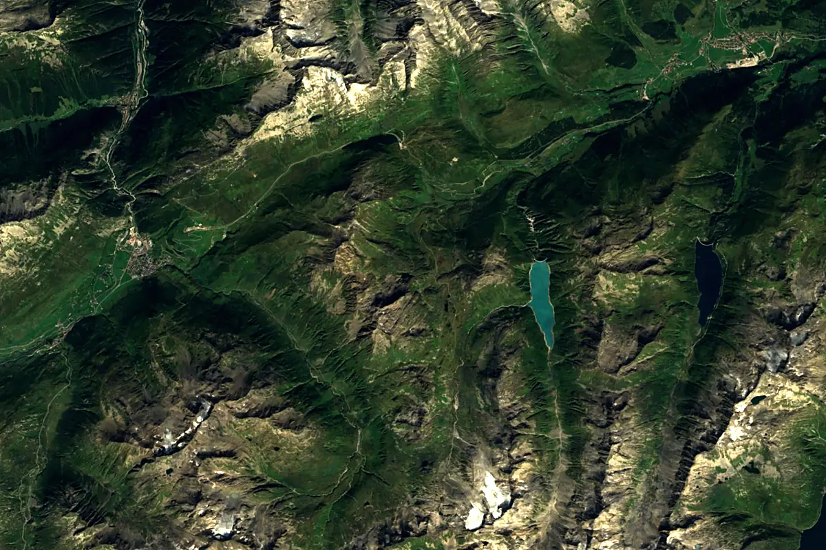
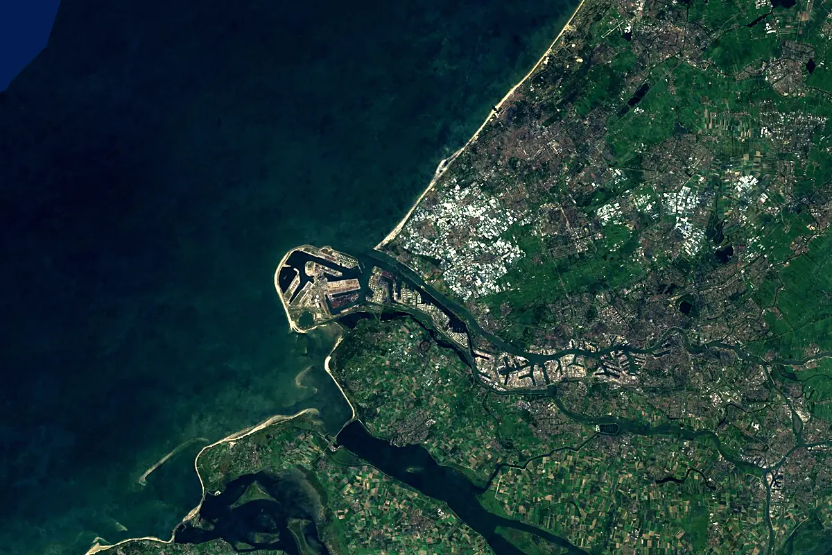
Sentinel-2 cloudless 2016 by EOX IT Services GmbH (contains modified Copernicus Sentinel data 2016), CC BY 4.0. The glowing line is the river as drawn by RiverATLAS.
Photos
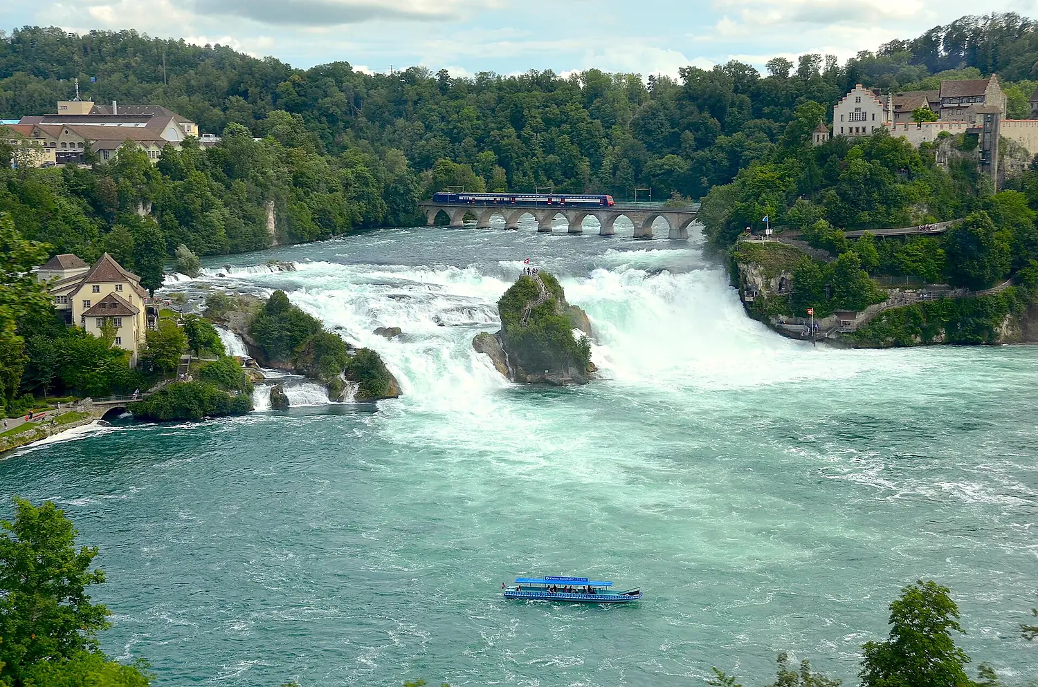
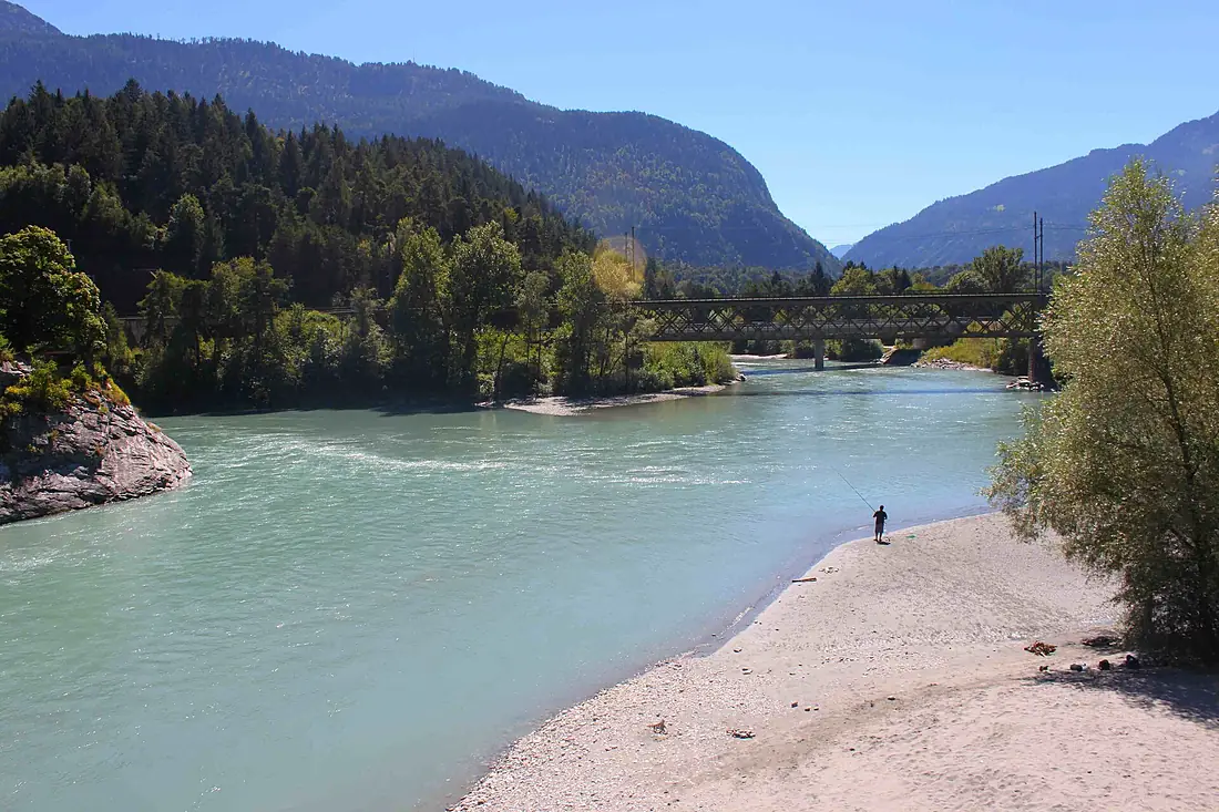
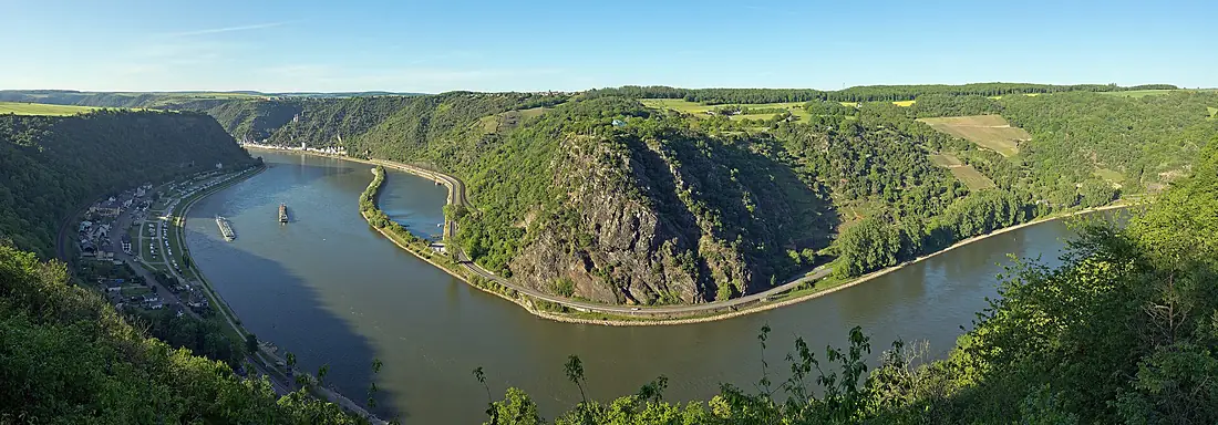
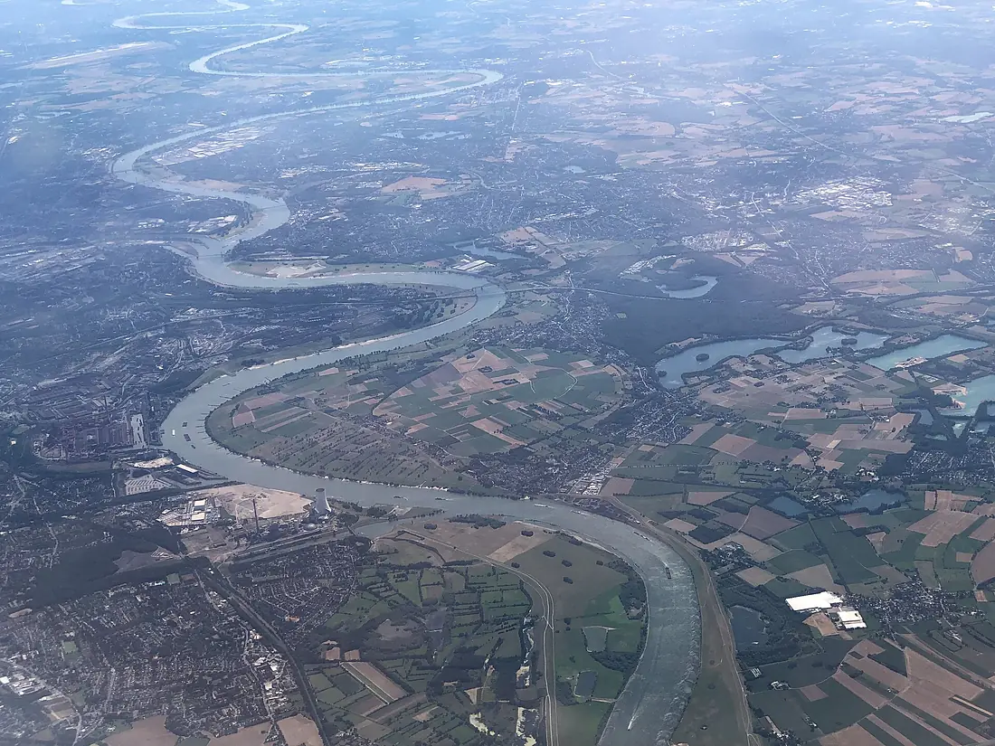
Rhine in pictures
Tributaries
Where it flows, and what flows into it
Tributaries (144)
Germany544 km320 m³/sjoins at km 629MainGermany524 km200 m³/sjoins at km 534NeckarGermany362 km140 m³/sjoins at km 467AareSwitzerland295 km560 m³/sjoins at km 146LippeGermany255 km240 m³/sjoins at km 841LahnGermany242 km54 m³/sjoins at km 691RuhrGermany217 km79 m³/sjoins at km 809IllFrance217 km54 m³/sjoins at km 354SiegGermany155 km52 m³/sjoins at km 696ThurSwitzerland135 km47 m³/sNaheGermany125 km32 m³/sjoins at km 566WupperGermany115 km17 m³/sjoins at km 736Also: Ahr, Emscher, Birs, Düssel, Wiese, Hinterrhein, Wied, Erft, Bregenzerach, Elz, Selz, Lauter, Kinzig, Syre, Alb, Nette, Plessur, Glatt, Töss, Sauer, Speyerbach, Pfrimm, Wutach, Landquart
 Luxembourg
Nearby
Rivers nearby
The Netherlands950 km230 m³/s44 km awayLys Belgium202 km22 m³/s106 km awayDommelBelgium80 km10 m³/s83 km awaySenneBelgium103 km5.5 m³/s99 km awayDenderBelgium65 km8.8 m³/s102 km awayDyle / DijleBelgium86 km69 m³/s100 km awayYserBelgium78 km15 m³/s133 km awayRurThe Netherlands164 km25 m³/s151 km away
Where these numbers come from
| Name, length, places | Wikidata (Q584) · CC0 |
|---|---|
| Course, profile, basin | RiverATLAS v1.0 (HydroATLAS, Linke et al. 2019) · CC BY 4.0 — followed from the source to the mouth given by Wikidata |
| Flow | WaterGAP (RiverATLAS), 1971–2000 · CC BY 4.0 |
| Climate along the river | WorldClim (RiverATLAS), 1970–2000 · CC BY 4.0 |
| Towns, bridges, dams | Wikidata · CC0; GeoNames · CC BY 4.0 |
| Along the river | © OpenStreetMap contributors · ODbL |
| Images | EOX Sentinel-2 cloudless 2016 · CC BY 4.0; Wikimedia Commons |
| Our other atlases | Cascadyas, Lakeyas, Coastya, Peakyas — Wikidata · CC0; © OpenStreetMap contributors · ODbL; GeoNames · CC BY 4.0; HydroLAKES · CC BY 4.0; NOAA OISST |
Every source and licence is on the data sources page.
The family
Do you prefer beaches, lakes, mountains, waterfalls, islands, rivers or canyons?
Same idea, other landscapes: field atlases built on open data, month by month, in seven languages.
beaches Find your beach: sea temperature, sun and swimming month by month.Visit lakes
 Every lake on Earth: water temperature, ice, depth and the shore.Coming soonVisit mountains
 Every summit in 3D: summit weather, the 0 °C line, huts and trails.Visit waterfalls
 Every waterfall: height, flow month by month and when it roars.Coming soonVisit
  islands
 Every island from the sea up: size, sea temperature, ferries and 3D.Coming soonVisit
  rivers
 Every river from source to sea: the journey, the flow and the basin in numbers.You are here
 canyons
 Every canyon cut to scale: depth to the floor, rim and floor temperatures, trails and viewpoints.Coming soonVisit