River
Neckar
362 km from source to mouth · Germany.
 GermanyFlows into Rhine8th longest in Germany
In numbers
Length
362km
Average flow
140m³/s
Basin
14,000km²
Drop
522m
from 614 m to 92 m
Country
1
The journey
From source to mouth
362 km of river and 68 stops on the way: 47 towns and cities on its banks, dams, bridges and the tributaries that feed it.
- 0 kmNeckarquelleat 614 m
- 0 kmVillingen-Schwenningen89,766 people
- 7 kmDeißlingen6,191 people
- 14 kmRottweil25,001 people
- 33 kmOberndorf am Neckar14,711 people
- 45 kmSulz am Neckar12,772 people
- 54 kmGlatttributary
- 63 kmHorb am Neckar25,687 people
- 69 kmEutingen im Gäu6,112 people
- 72 kmEyachtributary
- 80 kmStarzeltributary
- 85 kmSeltenbachtributary
- 88 kmRottenburg am Neckar45,579 people
- 89 kmBronnbachtributary
- 102 kmTübingen92,607 people
- 103 kmSteinlachtributary
- 106 kmAmmertributary
- 110 kmKirchentellinsfurt5,487 people
- 116 kmPliezhausen9,837 people
- 124 kmErmstributary
- 134 kmNürtingen40,898 people
- 139 kmAichtributary
- 139 kmUnterensingen4,938 people
- 142 kmKöngen9,656 people
- 143 kmWendlingen am Neckar16,002 people
- 146 kmLautertributary
- 146 kmWernau12,210 people
- 148 kmFilstributary
- 148 kmPlochingen14,503 people
- 151 kmDeizisau6,685 people
- 152 kmAltbach6,084 people
- 160 kmEsslingen am Neckar95,419 people
- 171 kmStuttgart609,365 people
- 172 kmNesenbachtributary
- 173 kmBad Cannstatt69,409 people
- 184 kmRemseck am Neckar26,089 people
- 187 kmRemstributary
- 199 kmMarbach am Neckar15,348 people
- 200 kmZipfelbachtributary
- 200 kmBenningen am Neckar6,260 people
- 204 kmFreiberg am Neckar15,482 people
- 218 kmBesigheim12,159 people
- 219 kmEnztributary
- 220 kmGemmrigheim4,597 people
- 226 kmNeckarwestheim3,979 people
- 229 kmLauffen am Neckar12,218 people
- 229 kmZabertributary
- 235 kmNordheim8,531 people
- 241 kmHeilbronn132,516 people
- 248 kmNeckarsulm26,470 people
- 251 kmUntereisesheim4,330 people
- 252 kmKochertributary
- 252 kmBad Friedrichshall19,910 people
- 254 kmJagsttributary
- 255 kmBad Wimpfen7,725 people
- 262 kmGundelsheim7,313 people
- 266 kmHaßmersheim5,129 people
- 285 kmElztributary
- 298 kmEberbach14,729 people
- 317 kmNeckarsteinach3,782 people
- 318 kmSteinachtributary
- 320 kmNeckargemünd13,323 people
- 333 kmHeidelberg156,092 people
- 335 kmElsenztributary
- 342 kmEdingen-Neckarhausen14,714 people
- 345 kmLadenburg12,820 people
- 349 kmIlvesheim9,231 people
- 358 kmMannheim319,536 people
- 359 kmLudwigshafen am Rhein163,196 people
- 362 kmRhineat 92 m
Water level along the river (RiverATLAS; the height is exaggerated). Towns: GeoNames and Wikidata; bridges, dams and tributaries: Wikidata.
Right tributary of Rhine river in Germany
At the mouth it carries 140 m³/s on average: an Olympic pool every 18 seconds. It drops from 614 m to 92 m, 1.4 m per kilometre on average. Its basin covers 14,000 km², about the size of ME. 5.4 million people live in it. Highest water: January and from June to August. No large dam holds it back: it is one of the world's free-flowing rivers.
Where to start
- StuttgartLargest city on its banks · 609,365 people
- Stuttgart Airport (STR)Nearest airport with scheduled flights, 10 km from the cityCar hire at STR airport (Stuttgart)Discover Cars · Affiliate link↗
- On the water144 ferry piers, marinas, boat rentals and boat ramps along the river (OpenStreetMap)
- Kayak and canoe9 put-ins and rapids mapped (OpenStreetMap)
- From May to SeptemberThe best months to visit
Neckar, month by month
Highest water: January and from June to August
Best months to visit: from May to September.
From about 59 m³/s in the lowest month to 340 m³/s in the highest. An estimate: the monthly flow is modelled from the lowest and highest months of WaterGAP (RiverATLAS, 1971–2000) and the rain and snow along the river (WorldClim). Dams change the real rhythm. The chip is the average air temperature; below it, the month's rain.
Plan the trip
Plan the trip: boat trips, a bed by the river, a car
Some links above are affiliate links: if you book through them we may earn a commission, at no extra cost to you. It never changes what the data on this page says.
The basin
Neckar: the basin in numbers
13,946 km² of land send their water to this river. This is what lives on it.
- 5.4millionpeople live in the basin
- 386/km²people per km²
- 434maverage altitude of the basin
- 775mmof rain a year (basin average)
- 8.8°Caverage air temperature
- 26%protected areas
What covers the basin
- 42% Forest
- 28% Cropland
- 13% Pasture
- 23% Towns and cities
RiverATLAS (HydroATLAS v1.0, CC BY 4.0): land cover, people, protected areas, glaciers and dams over the whole basin upstream of the mouth.
Along the river
Neckar: what you find on the way
- 186WeirsFischinger Wehr, Mühlener Wehr, Wehr bei der Mühle and 183 more
- 77LocksNeckar, Schleuse Hessigheim, Wilhelmskanal and 74 more
- 17WaterfallsSteinerne Rinne, Klingenteichfall and 15 more
- 1Rapids
- 8Canoe put-insOffizieller Einstieg Sulz am Neckar, Sulz am Neckar, Horb am Neckar and 5 more
- 55Boat rampsStocherkahnrampe, Ruderclub Nürtingen, MBC-Slip and 52 more
- 35Ferry piersUntertürkheim, NeckarPark/Mercedes-Benz-Welt, Wasen and 32 more
- 36MarinasPaddelfreunde Tübingen, Marina YC Plochingen, Marina MYC Esslingen and 33 more
- 4River beachesKanuanlegestelle, FKK-Strand, BuGa Beach and 1 more
From OpenStreetMap, within 1.9 km of the river. Not mapped is not the same as not there.
Cross-checked with our atlases
Neckar in our other atlases
What our sister atlases know about the waterfalls on this river, the lakes it flows through, the beaches at its mouth, the mountains where it rises and the islands off its mouth.
 13mountains at the sourcePeakyas
Mountains at the source (13)
Within 15 km of the source, by Peakyas
- Türnleberg11 km away793m
- Deutenberg8.1 km away714m
- Sulgener Berg12 km away764m
- Hubenloch11 km away
- Wieselsberg8.8 km away
- Hörnle3.2 km away
- Froschberg14 km away
- Herrenbühl3.4 km away
5 more on PeakyasOpen Peakyas ↗
From space
The source and the mouth, seen from orbit
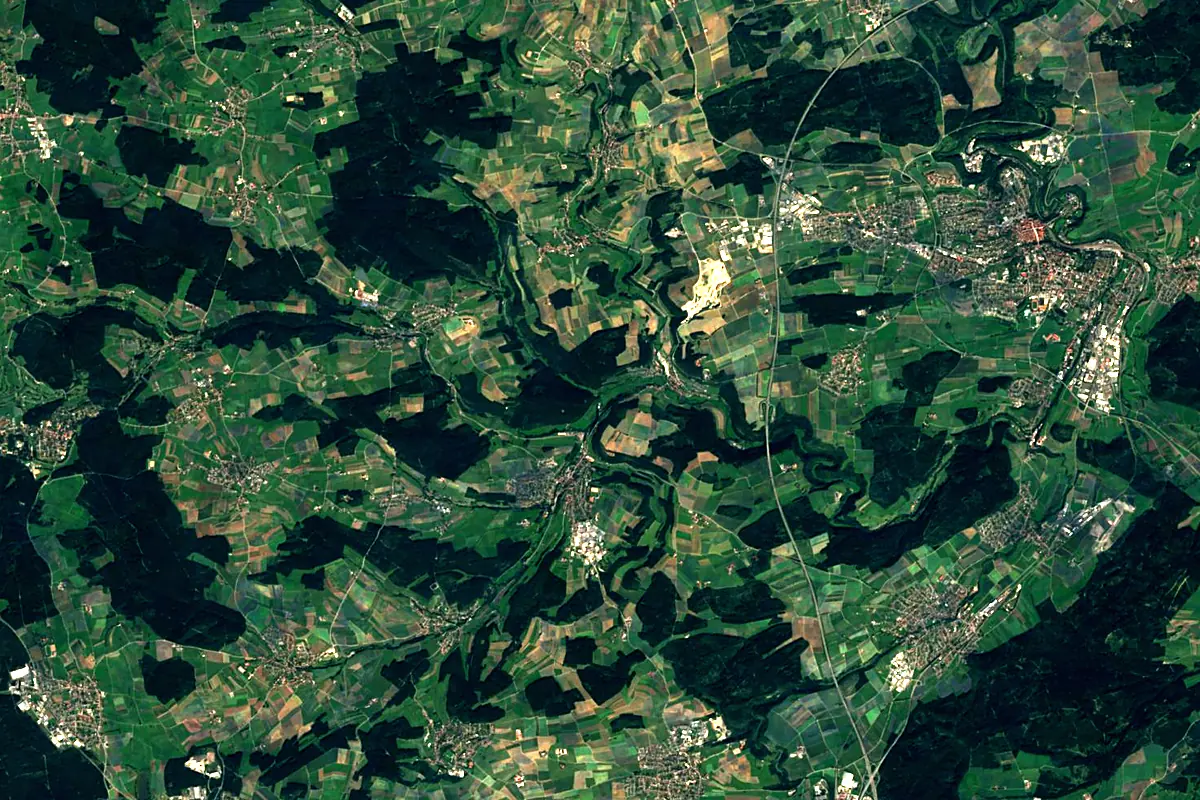
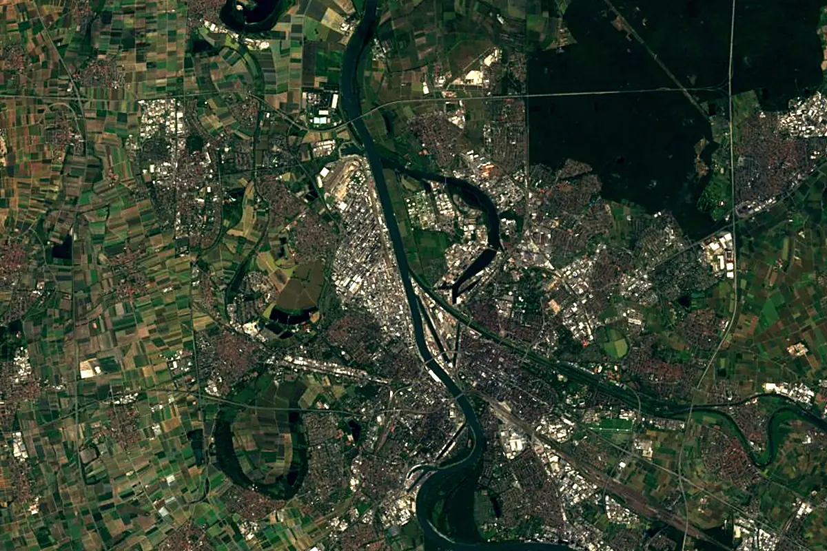
Sentinel-2 cloudless 2016 by EOX IT Services GmbH (contains modified Copernicus Sentinel data 2016), CC BY 4.0. The glowing line is the river as drawn by RiverATLAS.
Photos
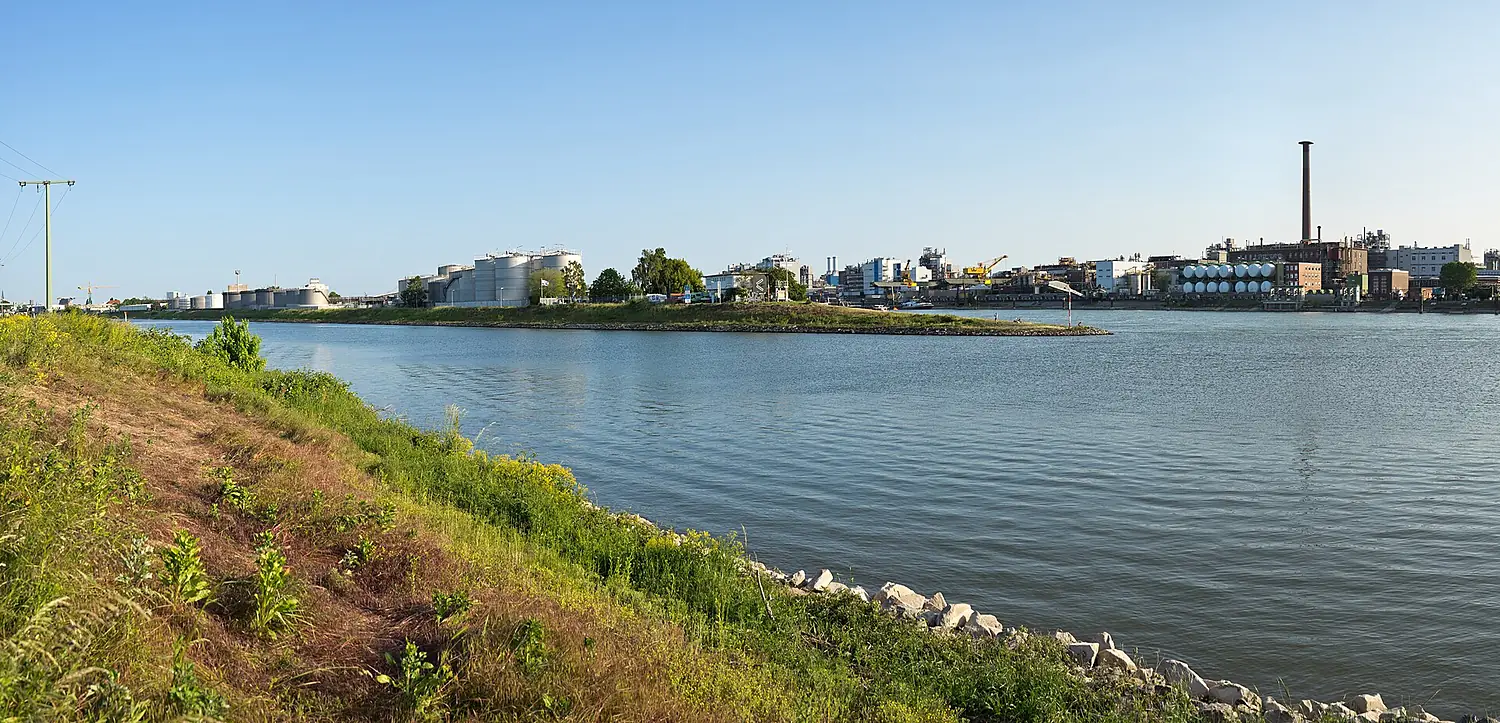
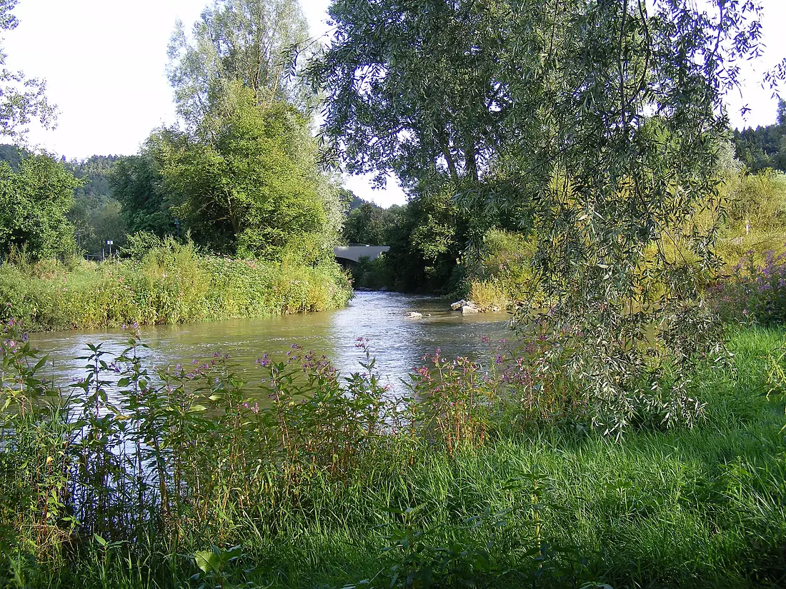
Neckar in pictures
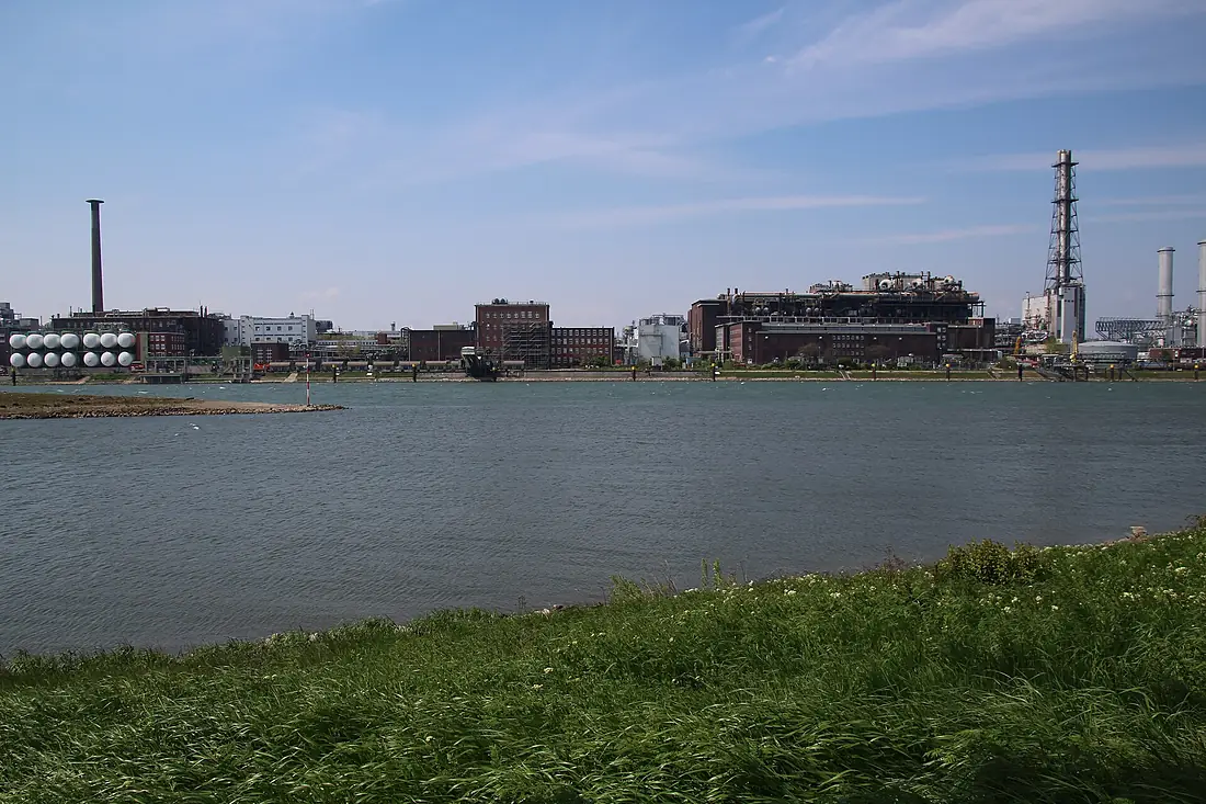
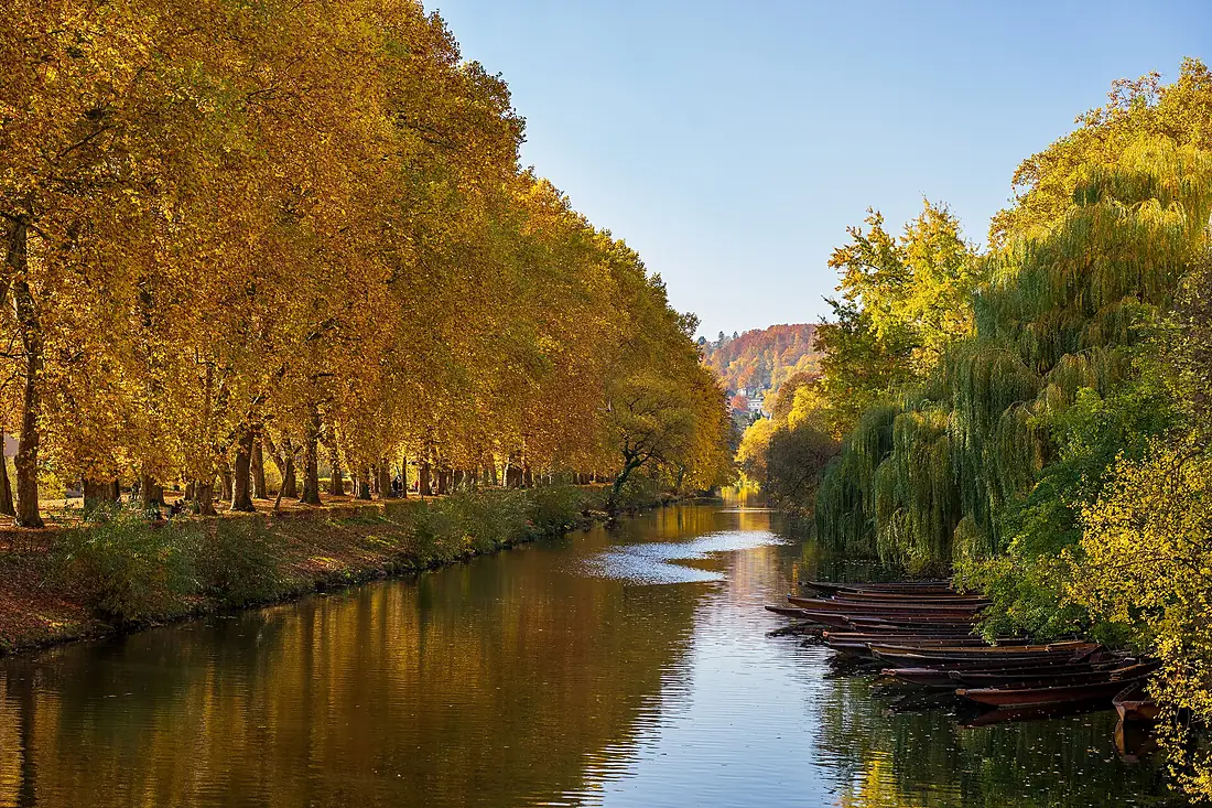
Tributaries
Where it flows, and what flows into it
It flows into
Rhine The Netherlands1,233 km2,200 m³/s
Tributaries (47)
Also: Jagst, Enz, Fils, Rems, Murr, Elsenz, Aich, Elz, Erms, Steinlach, Ammer, Glatt, Zaber, Nesenbach, Echaz, Steinach, Itter, Sulm, Zipfelbach, Katzenbach, Feuerbach, Starzel, Prim, Eyach
 Switzerland
 France
Nearby
Rivers nearby
Where these numbers come from
| Name, length, places | Wikidata (Q1673) · CC0 |
|---|---|
| Course, profile, basin | RiverATLAS v1.0 (HydroATLAS, Linke et al. 2019) · CC BY 4.0 — followed along the river network from the point given by Wikidata |
| Flow | WaterGAP (RiverATLAS), 1971–2000 · CC BY 4.0 |
| Climate along the river | WorldClim (RiverATLAS), 1970–2000 · CC BY 4.0 |
| Towns, bridges, dams | Wikidata · CC0; GeoNames · CC BY 4.0 |
| Along the river | © OpenStreetMap contributors · ODbL |
| Images | EOX Sentinel-2 cloudless 2016 · CC BY 4.0; Wikimedia Commons |
| Our other atlases | Peakyas — Wikidata · CC0; © OpenStreetMap contributors · ODbL; GeoNames · CC BY 4.0; HydroLAKES · CC BY 4.0; NOAA OISST |
Every source and licence is on the data sources page.
The family
Do you prefer beaches, lakes, mountains, waterfalls, islands, rivers or canyons?
Same idea, other landscapes: field atlases built on open data, month by month, in seven languages.
 beaches
 Find your beach: sea temperature, sun and swimming month by month.Visit
  lakes
lakes Every lake on Earth: water temperature, ice, depth and the shore.Coming soonVisit mountains
 Every summit in 3D: summit weather, the 0 °C line, huts and trails.Visit
  waterfalls
 Every waterfall: height, flow month by month and when it roars.Coming soonVisit
  islands
 Every island from the sea up: size, sea temperature, ferries and 3D.Coming soonVisit
  rivers
 Every river from source to sea: the journey, the flow and the basin in numbers.You are here
 canyons
 Every canyon cut to scale: depth to the floor, rim and floor temperatures, trails and viewpoints.Coming soonVisit