River
Ruhr
217 km from source to mouth · Germany.
 GermanyFlows into Rhine
In numbers
Length
217km
Average flow
79m³/s
Basin
4,485km²
Drop
312m
from 332 m to 20 m
Country
1
The journey
From source to mouth
217 km of river and 68 stops on the way: 35 towns and cities on its banks, dams, bridges and the tributaries that feed it.
- 0 kmSourceat 332 m
- 3 kmOlsberg14,596 people
- 11 kmBestwig9,976 people
- 18 kmValmetributary
- 22 kmMeschede29,446 people
- 23 kmHennetalsperre1.5 km²
- 29 kmHennetributary
- 35 kmFreienohl4,082 people
- 51 kmArnsberg74,479 people
- 58 kmWannetributary
- 61 kmNeheim23,000 people
- 64 kmRöhrtributary
- 64 kmMöhnetributary
- 70 kmEnse12,303 people
- 76 kmWickede11,254 people
- 86 kmMenden (Sauerland)52,121 people
- 86 kmMenden52,452 people
- 87 kmFröndenberg20,330 people
- 92 kmHönnetributary
- 97 kmHolzwickede17,543 people
- 98 kmAbbabachtributary
- 98 kmBaarbachtributary
- 100 kmIserlohn91,317 people
- 105 kmSchwerte45,794 people
- 109 kmWesthofen5,120 people
- 114 kmLennetributary
- 116 kmDortmund600,880 people
- 118 kmHengsteysee1.0 km²
- 120 kmHagen189,983 people
- 122 kmHerdecke22,704 people
- 122 kmVolmetributary
- 122 kmRuhr-Viadukt
- 125 kmHarkortsee1.1 km²
- 127 kmKraftwerk Harkort
- 128 kmWetter25,959 people
- 135 kmHohenstein power station
- 135 kmRuhr viaduct
- 136 kmBommern8,458 people
- 136 kmMühlengraben
- 137 kmWitten91,474 people
- 138 kmHeven11,674 people
- 141 kmHerbede13,111 people
- 143 kmBochum358,880 people
- 143 kmQuerenburg21,294 people
- 145 kmLake Kemnade1.1 km²
- 152 kmPleßbachtributary
- 152 kmHattingen52,969 people
- 154 kmBirschel-Mühle
- 158 kmNiederwenigern5,200 people
- 160 kmDahlhausen12,808 people
- 164 kmWasserkraftwerk Horster Mühle
- 168 kmSpillenburg's Weir
- 169 kmEssen573,618 people
- 171 kmÜberruhr-Holthausen8,176 people
- 182 kmBaldeneysee2.5 km²
- 185 kmWolfsbachtal waterworks
- 189 kmRailway bridge Kettwig
- 199 kmHaus Ruhrnatur
- 199 kmKahlenberg power station
- 200 kmStadthalle Mülheim an der Ruhr
- 200 kmMülheim an der Ruhr171,674 people
- 201 kmMülheim173,050 people
- 201 kmDeilbachtributary
- 203 kmNeickmannshof
- 205 kmRaffelberg power station
- 209 kmDuissern14,386 people
- 211 kmMeiderich45,297 people
- 212 kmDuisburg500,810 people
- 212 kmPort of Duisburg
- 217 kmRhineat 20 m
Water level along the river (RiverATLAS; the height is exaggerated). Towns: GeoNames and Wikidata; bridges, dams and tributaries: Wikidata.
River in Germany
At the mouth it carries 79 m³/s on average: an Olympic pool every 32 seconds. It drops from 332 m to 20 m, 1.4 m per kilometre on average. Its basin covers 4,485 km², about the size of CV. 3.9 million people live in it. Highest water: from December to February. Dams and reservoirs hold back a large share of its water (23% of a year's flow).
Where to start
- DortmundLargest city on its banks · 600,880 people
- Dortmund Airport (DTM)Nearest airport with scheduled flights, 10 km from the cityCar hire at DTM airport (Dortmund)Discover Cars · Affiliate link↗
- On the water101 ferry piers, marinas, boat rentals and boat ramps along the river (OpenStreetMap)
- Kayak and canoe5 put-ins and rapids mapped (OpenStreetMap)
- From May to SeptemberThe best months to visit
Ruhr, month by month
Highest water: from December to February
Best months to visit: from May to September.
From about 30 m³/s in the lowest month to 110 m³/s in the highest. An estimate: the monthly flow is modelled from the lowest and highest months of WaterGAP (RiverATLAS, 1971–2000) and the rain and snow along the river (WorldClim). Dams change the real rhythm. The chip is the average air temperature; below it, the month's rain.
Plan the trip
Plan the trip: boat trips, a bed by the river, a car
Some links above are affiliate links: if you book through them we may earn a commission, at no extra cost to you. It never changes what the data on this page says.
The basin
Ruhr: the basin in numbers
5,272 km² of land send their water to this river. This is what lives on it.
- 3.9millionpeople live in the basin
- 742/km²people per km²
- 306maverage altitude of the basin
- 949mmof rain a year (basin average)
- 8.3°Caverage air temperature
- 62%protected areas
- 0.6%covered by lakes
- 0.5km³held in reservoirs
What covers the basin
- 61% Forest
- 7% Cropland
- 11% Pasture
- 38% Towns and cities
RiverATLAS (HydroATLAS v1.0, CC BY 4.0): land cover, people, protected areas, glaciers and dams over the whole basin upstream of the mouth.
Along the river
Ruhr: what you find on the way
- 102WeirsWasserkraftwerk Steinhelle 2, Wasserkraftwerk Alfert, Wehr and 99 more
- 27LocksSchleuse Blankenstein, Ruhr, Bootsrutschentor and 24 more
- 4WaterfallsKleiner Wasserfall, Ehemaliger Wasserfall and 2 more
- 5Canoe put-ins
- 40Boat rampsSlipanlage für Rettungsboote, Kanu-Bootsrutsche, Slipanlage "Am Bört" and 37 more
- 16Ferry piersBootsanlegestelle Hennedamm, Berghausener Bucht/Spielplatz, Cafe Seeschlösschen and 13 more
- 36MarinasSV Hengsteysee, Kanu Club Hagen, Yachtclub Harkortsee e.V. and 33 more
- 1River beachesStranddeck
From OpenStreetMap, within 1.6 km of the river. Not mapped is not the same as not there.
Cross-checked with our atlases
Ruhr in our other atlases
What our sister atlases know about the waterfalls on this river, the lakes it flows through, the beaches at its mouth, the mountains where it rises and the islands off its mouth.
 5lakes on its wayLakeyas
 184mountains at the sourcePeakyas
Lakes and reservoirs (5)
Lakes it flows through, by Lakeyas
- Hennetalsperrekm 201.5km²
- Hengsteyseekm 1041.0km²
- Harkortseekm 1101.1km²
- Lake Kemnadekm 1271.1km²
- Baldeneyseekm 1602.5km²
Lakeyas is coming soonOpen Lakeyas ↗
Mountains at the source (184)
Within 15 km of the source, by Peakyas
- Langenberg6.7 km away · prominence 557 m844m
- Kahler Asten6.2 km away · prominence 196 m842m
- Ettelsberg7.6 km away · prominence 40 m838m
- Hegekopf6.5 km away843m
- Mühlenkopf7.2 km away815m
- Hoher Eimberg11 km away806m
- Hopperkopf4.7 km away832m
- Dreiskopf13 km away781m
176 more on PeakyasOpen Peakyas ↗
From space
The source and the mouth, seen from orbit
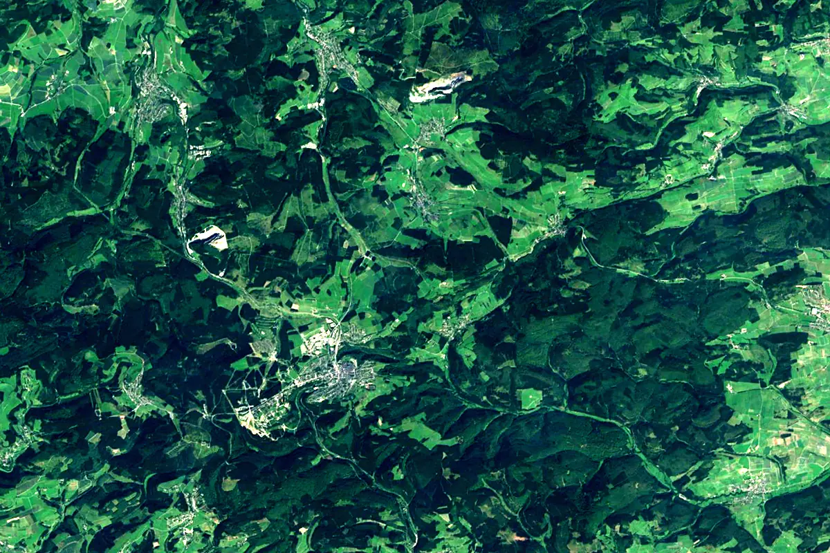
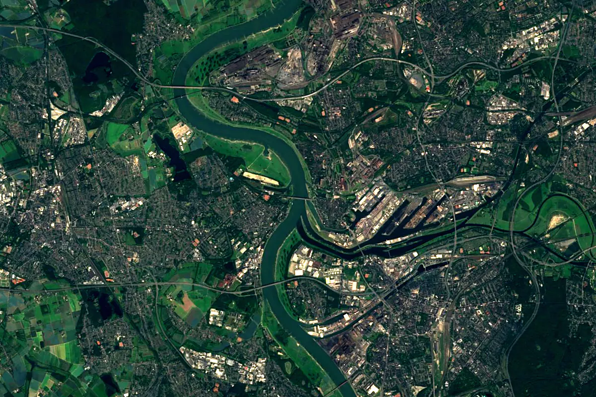
Sentinel-2 cloudless 2016 by EOX IT Services GmbH (contains modified Copernicus Sentinel data 2016), CC BY 4.0. The glowing line is the river as drawn by RiverATLAS.
Photos
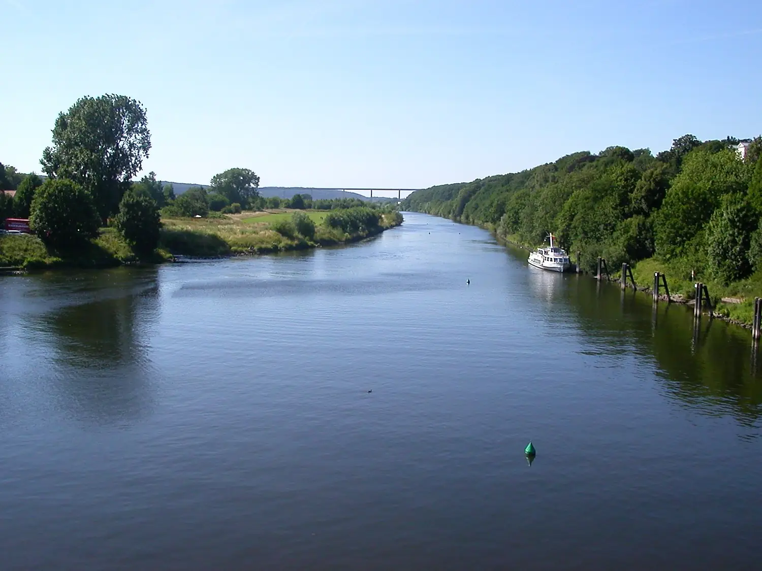
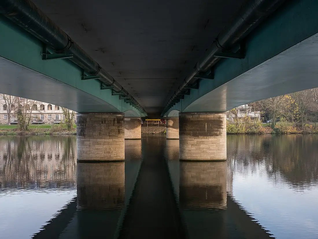
Ruhr in pictures
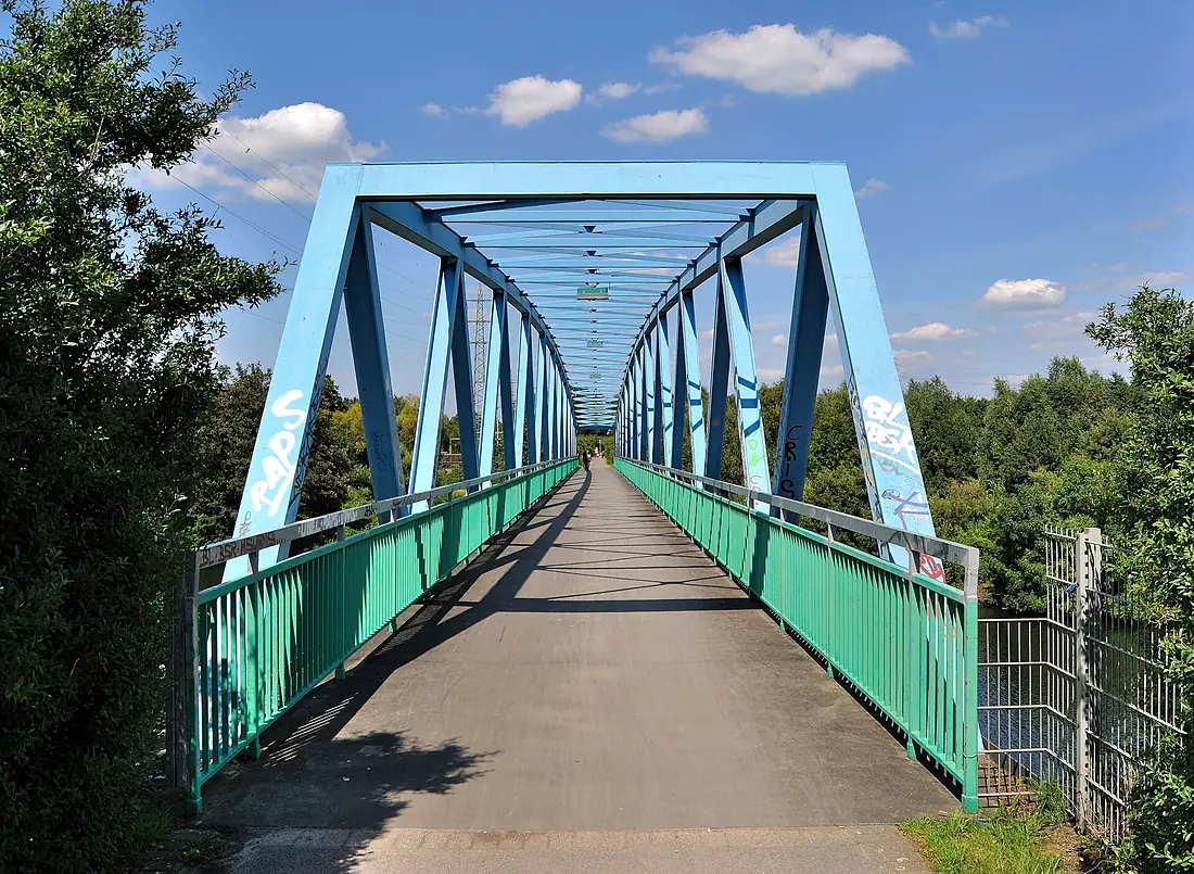
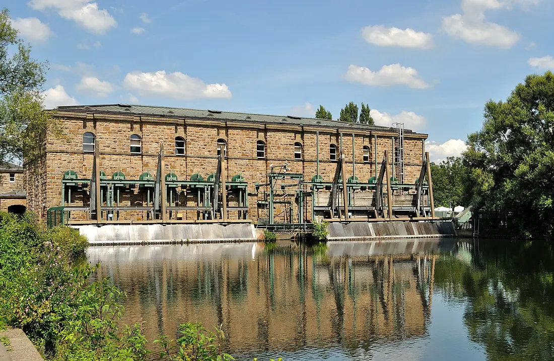
Tributaries
Where it flows, and what flows into it
It flows into
Rhine The Netherlands1,233 km2,200 m³/s
Tributaries (52)
Also: Lenne, Möhne, Volme, Hönne, Neger, Henne, Röhr, Abbabach, Baarbach, Elpe, Valme, Gebke, Gierskoppbach, Kelbke, Deilbach, Elsebach, Gebke, Nierbach, Wenne, Hillebach, Borbach, Wanne, Rinderbach, Rumbach
 Switzerland
 France
Nearby
Rivers nearby
Germany255 km240 m³/s23 km awayRurThe Netherlands164 km25 m³/s56 km awayLahnGermany242 km54 m³/s82 km awayWupperGermany115 km17 m³/s48 km awaySiegGermany155 km52 m³/s78 km awayMoselleGermany544 km320 m³/s135 km awayMeuseThe Netherlands950 km230 m³/s145 km awayOurthe Belgium165 km55 m³/s123 km away
Where these numbers come from
| Name, length, places | Wikidata (Q1664) · CC0 |
|---|---|
| Course, profile, basin | RiverATLAS v1.0 (HydroATLAS, Linke et al. 2019) · CC BY 4.0 — followed from the source to the mouth given by Wikidata |
| Flow | WaterGAP (RiverATLAS), 1971–2000 · CC BY 4.0 |
| Climate along the river | WorldClim (RiverATLAS), 1970–2000 · CC BY 4.0 |
| Towns, bridges, dams | Wikidata · CC0; GeoNames · CC BY 4.0 |
| Along the river | © OpenStreetMap contributors · ODbL |
| Images | EOX Sentinel-2 cloudless 2016 · CC BY 4.0; Wikimedia Commons |
| Our other atlases | Lakeyas, Peakyas — Wikidata · CC0; © OpenStreetMap contributors · ODbL; GeoNames · CC BY 4.0; HydroLAKES · CC BY 4.0; NOAA OISST |
Every source and licence is on the data sources page.
The family
Do you prefer beaches, lakes, mountains, waterfalls, islands, rivers or canyons?
Same idea, other landscapes: field atlases built on open data, month by month, in seven languages.
 beaches
 Find your beach: sea temperature, sun and swimming month by month.Visit lakes
 Every lake on Earth: water temperature, ice, depth and the shore.Coming soonVisit mountains
 Every summit in 3D: summit weather, the 0 °C line, huts and trails.Visit
  waterfalls
 Every waterfall: height, flow month by month and when it roars.Coming soonVisit
  islands
 Every island from the sea up: size, sea temperature, ferries and 3D.Coming soonVisit
  rivers
 Every river from source to sea: the journey, the flow and the basin in numbers.You are here
 canyons
 Every canyon cut to scale: depth to the floor, rim and floor temperatures, trails and viewpoints.Coming soonVisit