River
Rur
164 km from source to mouth · The Netherlands, Germany and Belgium.

 The Netherlands, Germany and BelgiumFlows into Meuse3rd longest in The Netherlands
In numbers
Length
164km
Average flow
25m³/s
Basin
2,340km²
Drop
362m
from 374 m to 12 m
Countries
3
The journey
From source to mouth
164 km of river and 68 stops on the way: 60 towns and cities on its banks, dams, bridges and the tributaries that feed it.
- 0 kmHigh Fensat 374 m
- 0 kmwaterfall of Reinhardstein60 m
- 0 kmLake Robertville0.3 km²
- 5 kmBévercé4,550 people
- 6 kmMalmédy12,654 people
- 15 kmStavelot6,646 people
- 22 kmWaterfalls of Coo15 m
- 39 kmwaterfall of Chaudière
- 44 kmSougné-Remouchamps4,437 people
- 46 kmAywaille10,636 people
- 53 kmComblain-au-Pont5,308 people
- 63 kmBoncelles5,578 people
- 65 kmEsneux13,497 people
- 69 kmTilff5,455 people
- 71 kmChaudfontaine20,960 people
- 74 kmEmbourg6,124 people
- 75 kmVaux-sous-Chèvremont6,503 people
- 75 kmChênée9,163 people
- 75 kmAngleur10,647 people
- 76 kmGrivegnée21,057 people
- 79 kmSaint-Nicolas22,586 people
- 79 kmLiège195,278 people
- 81 kmVottem7,478 people
- 82 kmBressoux12,588 people
- 83 kmHerstal36,503 people
- 84 kmJupille-sur-Meuse10,604 people
- 85 kmSaive4,771 people
- 86 kmWandre6,076 people
- 88 kmVivegnis4,369 people
- 88 kmCheratte4,689 people
- 90 kmOupeye23,594 people
- 92 kmDalhem6,391 people
- 93 kmHaccourt3,847 people
- 94 kmVisé17,054 people
- 99 kmEijsden11,795 people
- 103 kmDe Heeg6,255 people
- 103 kmHeugem4,620 people
- 104 kmHeer7,615 people
- 105 kmMaastricht122,378 people
- 106 kmScharn6,540 people
- 107 kmAmby6,535 people
- 108 kmMalberg5,345 people
- 109 kmLanaken24,771 people
- 112 kmRekem4,493 people
- 113 kmBunde5,500 people
- 118 kmElsloo7,220 people
- 119 kmStein11,290 people
- 122 kmMaasmechelen36,251 people
- 122 kmMechelen-aan-de-Maas15,374 people
- 123 kmVucht3,410 people
- 123 kmEisden10,152 people
- 126 kmUrmond3,560 people
- 130 kmStokkem3,722 people
- 130 kmLanklaar4,453 people
- 130 kmDilsen6,099 people
- 131 kmRotem3,710 people
- 138 kmMaaseik25,201 people
- 140 kmHeerenlaak0.9 km²
- 141 kmEcht7,760 people
- 143 kmOphoven3,104 people
- 149 kmMaasbracht5,680 people
- 151 kmHeel3,980 people
- 154 kmLinne3,645 people
- 157 kmOolderplas1.6 km²
- 158 kmHerten3,305 people
- 159 kmRothenbachtributary
- 159 kmECI-centrale
- 159 kmRoermond57,308 people
- 162 kmHaelen9,935 people
- 164 kmMeuseat 12 m
Water level along the river (RiverATLAS; the height is exaggerated). Towns: GeoNames and Wikidata; bridges, dams and tributaries: Wikidata.
River in Germany and the Netherlands
At the mouth it carries 25 m³/s on average: an Olympic pool every 100 seconds. It drops from 374 m to 12 m, 2.2 m per kilometre on average. Its basin covers 2,340 km², about the size of RE. 4.9 million people live in it. Highest water: from December to February. Its dams hold back little of its water (4.4% of a year's flow).
Where to start
- LiègeLargest city on its banks · 195,278 people
- Liège Airport (LGG)Nearest airport with scheduled flights, 9 km from the cityCar hire at LGG airport (Grâce-Hollogne)Discover Cars · Affiliate link↗
- On the water119 ferry piers, marinas, boat rentals and boat ramps along the river (OpenStreetMap)
- Kayak and canoe1 put-ins and rapids mapped (OpenStreetMap)
- From May to SeptemberThe best months to visit
Rur, month by month
Highest water: from December to February
Best months to visit: from May to September.
From about 110 m³/s in the lowest month to 510 m³/s in the highest. An estimate: the monthly flow is modelled from the lowest and highest months of WaterGAP (RiverATLAS, 1971–2000) and the rain and snow along the river (WorldClim). Dams change the real rhythm. The chip is the average air temperature; below it, the month's rain.
Plan the trip
Plan the trip: boat trips, a bed by the river, a car
Some links above are affiliate links: if you book through them we may earn a commission, at no extra cost to you. It never changes what the data on this page says.
The basin
Rur: the basin in numbers
25,386 km² of land send their water to this river. This is what lives on it.
- 4.9millionpeople live in the basin
- 194/km²people per km²
- 270maverage altitude of the basin
- 915mmof rain a year (basin average)
- 9.0°Caverage air temperature
- 22%protected areas
- 0.2%covered by lakes
- 0.4km³held in reservoirs
What covers the basin
- 29% Forest
- 24% Cropland
- 21% Pasture
- 12% Towns and cities
RiverATLAS (HydroATLAS v1.0, CC BY 4.0): land cover, people, protected areas, glaciers and dams over the whole basin upstream of the mouth.
Along the river
Rur: what you find on the way
- 142WeirsBarrage de Lixhe, Stuw Borgharen, Overlaatdam and 139 more
- 37LocksEcluse n°16, Ecluse n°15, Ecluse n°4 and 34 more
- 22WaterfallsCascade de Reinhardstein, Cascade du Bayehon, Cascade de Coo and 19 more
- 1Canoe put-ins
- 49Boat rampsClub Nautique Les Tchéroux, WSV MCC + WSV MWC, WSV Treech 42 and 46 more
- 23Ferry piersFragnée, Guillemins / Boverie, Pôle fluvial and 20 more
- 41MarinasPort des Yachts - Port autonome de Liège, Port de Marcatchous - Port autonome de Liège, Port de Croisière - Port autonome de Liège and 38 more
- 4River beachesSporta Spot, Dagstrand De Steenberg, Dagstrand De Grote Hegge and 1 more
From OpenStreetMap, within 2.0 km of the river. Not mapped is not the same as not there.
Cross-checked with our atlases
Rur in our other atlases
What our sister atlases know about the waterfalls on this river, the lakes it flows through, the beaches at its mouth, the mountains where it rises and the islands off its mouth.
 3waterfalls on the riverCascadyas
 3lakes on its wayLakeyas
 12mountains at the sourcePeakyas
Waterfalls (3)
On the river, by Cascadyas
- waterfall of Reinhardsteinkm 060m
- Waterfalls of Cookm 2515m
- waterfall of Chaudièrekm 45
Cascadyas is coming soonOpen Cascadyas ↗
Lakes and reservoirs (3)
Lakes it flows through, by Lakeyas
- Lake Robertvillekm 0 · 54 m deep0.3km²
- Heerenlaakkm 1610.9km²
- Oolderplaskm 1801.6km²
Lakeyas is coming soonOpen Lakeyas ↗
Mountains at the source (12)
Within 15 km of the source, by Peakyas
- Signal de Botrange1.4 km away · prominence 119 m694m
- Ardennes massif1.2 km away652m
- Steling11 km away658m
- Baraque Michel4.0 km away674m
- Hohe Mark10 km away609m
- Giesberg10 km away607m
- Dickelt11 km away569m
- Dickert10 km away562m
4 more on PeakyasOpen Peakyas ↗
From space
The source and the mouth, seen from orbit
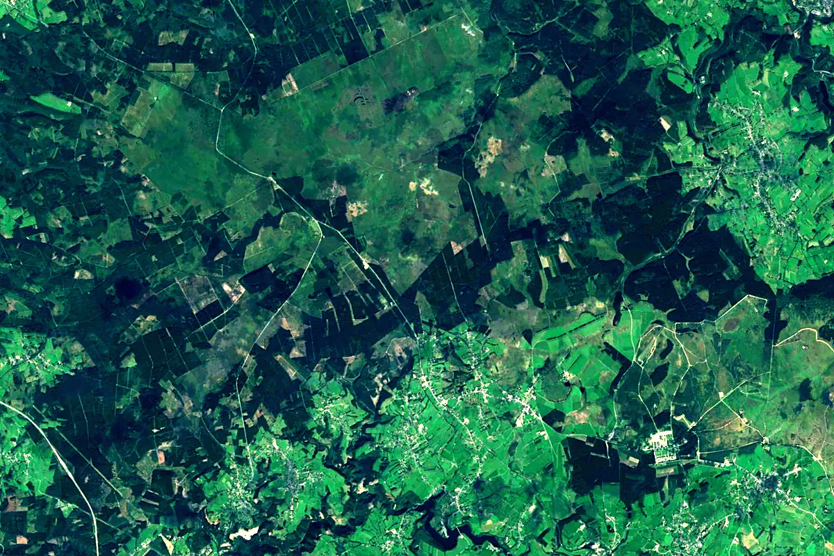
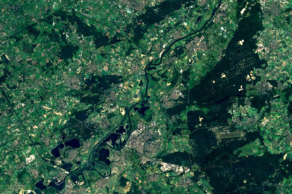
Sentinel-2 cloudless 2016 by EOX IT Services GmbH (contains modified Copernicus Sentinel data 2016), CC BY 4.0. The glowing line is the river as drawn by RiverATLAS.
Photos
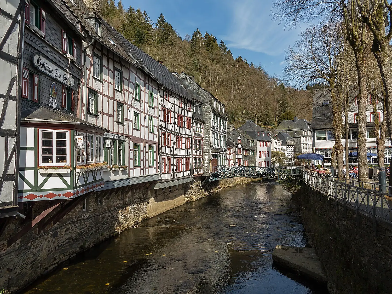
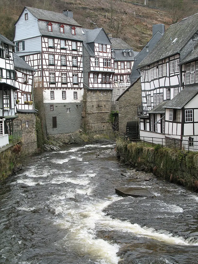
Rur in pictures
Tributaries
Where it flows, and what flows into it
It flows into
MeuseThe Netherlands950 km230 m³/sTributaries (18)
Also: Wurm, Inde, Urft, Kall, Merzbach, Perlenbach, Rothenbach, Malefinkbach, Belgenbach, Ellebach, Schaagbach, Linnicher Mühlenteich, Mühlbach, Nysterbach, Kitschbach, Laufenbach, Rinnebach, Bettebach
 France
Nearby
Rivers nearby
Where these numbers come from
| Name, length, places | Wikidata (Q152331) · CC0 |
|---|---|
| Course, profile, basin | RiverATLAS v1.0 (HydroATLAS, Linke et al. 2019) · CC BY 4.0 — followed from the source to the mouth given by Wikidata |
| Flow | WaterGAP (RiverATLAS), 1971–2000 · CC BY 4.0 |
| Climate along the river | WorldClim (RiverATLAS), 1970–2000 · CC BY 4.0 |
| Towns, bridges, dams | Wikidata · CC0; GeoNames · CC BY 4.0 |
| Along the river | © OpenStreetMap contributors · ODbL |
| Images | EOX Sentinel-2 cloudless 2016 · CC BY 4.0; Wikimedia Commons |
| Our other atlases | Cascadyas, Lakeyas, Peakyas — Wikidata · CC0; © OpenStreetMap contributors · ODbL; GeoNames · CC BY 4.0; HydroLAKES · CC BY 4.0; NOAA OISST |
Every source and licence is on the data sources page.
The family
Do you prefer beaches, lakes, mountains, waterfalls, islands, rivers or canyons?
Same idea, other landscapes: field atlases built on open data, month by month, in seven languages.
 beaches
 Find your beach: sea temperature, sun and swimming month by month.Visit lakes
 Every lake on Earth: water temperature, ice, depth and the shore.Coming soonVisit mountains
 Every summit in 3D: summit weather, the 0 °C line, huts and trails.Visit waterfalls
 Every waterfall: height, flow month by month and when it roars.Coming soonVisit
  islands
 Every island from the sea up: size, sea temperature, ferries and 3D.Coming soonVisit
  rivers
 Every river from source to sea: the journey, the flow and the basin in numbers.You are here
 canyons
 Every canyon cut to scale: depth to the floor, rim and floor temperatures, trails and viewpoints.Coming soonVisit