River
Sambre
190 km from source to mouth · Belgium and France.
 Belgium and FranceFlows into Meuse2nd longest in Belgium
In numbers
Length
190km
Average flow
36m³/s
Basin
2,740km²
Drop
66m
from 144 m to 78 m
Countries
2
The journey
From source to mouth
190 km of river and 67 stops on the way: 60 towns and cities on its banks, dams, bridges and the tributaries that feed it.
- 0 kmFontenelleat 144 m
- 39 kmLeval2,450 people
- 39 kmTarsytributary
- 39 kmHelpe Majeuretributary
- 42 kmBerlaimont3,314 people
- 43 kmAulnoye-Aymeries9,242 people
- 46 kmPont-sur-Sambre2,635 people
- 47 kmBachant2,415 people
- 56 kmHautmont15,540 people
- 60 kmLouvroil7,446 people
- 63 kmMaubeuge33,684 people
- 65 kmFerrière-la-Grande5,834 people
- 66 kmRousies4,459 people
- 69 kmRecquignies2,560 people
- 70 kmBoussois3,553 people
- 74 kmMarpent2,715 people
- 76 kmJeumont10,964 people
- 78 kmErquelinnes9,396 people
- 82 kmSolre-sur-Sambre2,650 people
- 84 kmMerbes-le-Château3,999 people
- 96 kmLobbes5,467 people
- 96 kmLobbes Bridge
- 99 kmThuin14,682 people
- 99 kmThuin Viaduct
- 113 kmLeernes3,414 people
- 116 kmMontigny-le-Tilleul8,938 people
- 117 kmMont-sur-Marchienne12,761 people
- 118 kmBiesmelletributary
- 118 kmGoutroux2,947 people
- 119 kmMonceau-sur-Sambre9,812 people
- 119 kmMarchienne-au-Pont15,154 people
- 121 kmEau d'Heuretributary
- 124 kmDampremy6,716 people
- 124 kmLodelinsart8,489 people
- 125 kmKing Baudouin Bridge
- 125 kmCharleroi200,132 people
- 126 kmGilly20,043 people
- 127 kmMarcinelle23,696 people
- 128 kmCouillet11,365 people
- 132 kmMontignies-sur-Sambre18,765 people
- 132 kmBouffioulx4,935 people
- 134 kmChâtelet35,238 people
- 135 kmChâtelineau17,166 people
- 136 kmPironchamps2,000 people
- 137 kmPont-de-Loup2,896 people
- 140 kmRoselies2,424 people
- 140 kmFarciennes11,247 people
- 142 kmLambusart3,060 people
- 144 kmMoignelée1,940 people
- 147 kmAiseau10,906 people
- 148 kmTamines7,526 people
- 148 kmFalisolle3,642 people
- 153 kmVelaine3,510 people
- 154 kmAuvelais8,456 people
- 157 kmArsimont2,343 people
- 160 kmJemeppe-sur-Sambre6,127 people
- 162 kmHam-sur-Sambre3,444 people
- 165 kmMoustier-sur-Sambre2,721 people
- 168 kmFranière1,900 people
- 172 kmFloreffe7,480 people
- 177 kmMalonne5,467 people
- 180 kmFlawinne4,541 people
- 184 kmBelgrade4,756 people
- 184 kmSaint-Servais9,516 people
- 187 kmNamur115,330 people
- 188 kmJambes19,658 people
- 189 kmErpent2,758 people
- 190 kmBouge4,486 people
- 190 kmMeuseat 78 m
Water level along the river (RiverATLAS; the height is exaggerated). Towns: GeoNames and Wikidata; bridges, dams and tributaries: Wikidata.
River in France and Belgium, mouth in Meuse river
At the mouth it carries 36 m³/s on average: an Olympic pool every 69 seconds. It drops from 144 m to 78 m, 0.3 m per kilometre on average. Its basin covers 2,740 km², about the size of LU. 1.7 million people live in it. Highest water: from December to February. No large dam holds it back: it is one of the world's free-flowing rivers.
Where to start
- CharleroiLargest city on its banks · 200,132 people
- Brussels South Charleroi Airport (CRL)Nearest airport with scheduled flights, 6 km from the cityCar hire at CRL airport (Charleroi)Discover Cars · Affiliate link↗
- On the water23 ferry piers, marinas, boat rentals and boat ramps along the river (OpenStreetMap)
- From May to SeptemberThe best months to visit
Sambre, month by month
Highest water: from December to February
Best months to visit: from May to September.
From about 62 m³/s in the lowest month to 300 m³/s in the highest. An estimate: the monthly flow is modelled from the lowest and highest months of WaterGAP (RiverATLAS, 1971–2000) and the rain and snow along the river (WorldClim). Dams change the real rhythm. The chip is the average air temperature; below it, the month's rain.
Plan the trip
Plan the trip: boat trips, a bed by the river, a car
Some links above are affiliate links: if you book through them we may earn a commission, at no extra cost to you. It never changes what the data on this page says.
The basin
Sambre: the basin in numbers
15,525 km² of land send their water to this river. This is what lives on it.
- 1.7millionpeople live in the basin
- 108/km²people per km²
- 278maverage altitude of the basin
- 906mmof rain a year (basin average)
- 9.1°Caverage air temperature
- 17%protected areas
- 0.1%covered by lakes
- 0.1km³held in reservoirs
What covers the basin
- 29% Forest
- 24% Cropland
- 21% Pasture
- 6% Towns and cities
RiverATLAS (HydroATLAS v1.0, CC BY 4.0): land cover, people, protected areas, glaciers and dams over the whole basin upstream of the mouth.
Along the river
Sambre: what you find on the way
- 43WeirsBief du Gallois, Barrage de la Plante, Barrage des Grands Malades and 40 more
- 63LocksLa Sambre Canalisée, Écluse d'Hachette, Écluse 4 Berlaimont and 60 more
- 2Waterfalls
- 12Boat ramps
- 5Ferry piersHalte Salzinnes, Halte Évêché, Halte Jambes and 2 more
- 6MarinasPort de Plaisance d'Erquelinnes, Port de plaisance, Le Port de Henry Hallet and 3 more
From OpenStreetMap, within 1.9 km of the river. Not mapped is not the same as not there.
From space
The source and the mouth, seen from orbit
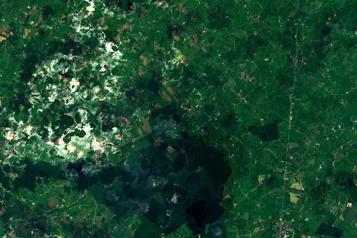
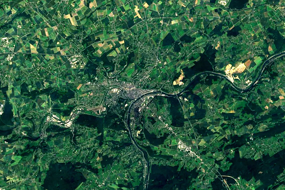
Sentinel-2 cloudless 2016 by EOX IT Services GmbH (contains modified Copernicus Sentinel data 2016), CC BY 4.0. The glowing line is the river as drawn by RiverATLAS.
Photos
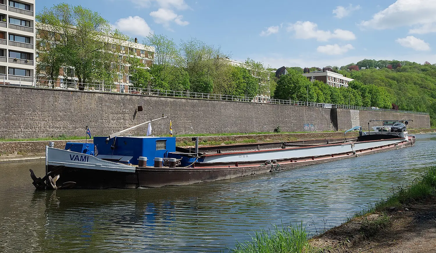
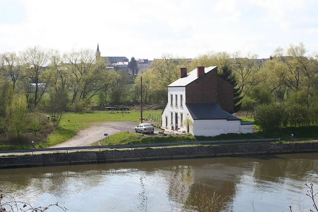
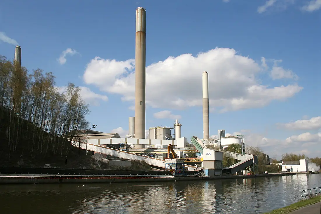
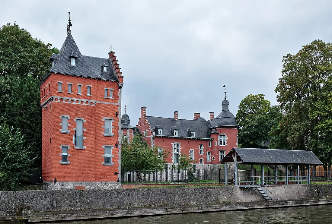
Sambre in pictures
Tributaries
Where it flows, and what flows into it
It flows into
Meuse The Netherlands950 km230 m³/s
Tributaries (15)
Also: Helpe Majeure, Orneau, Solre, Helpe Mineure, Hantes, Eau d'Heure, Piéton, Thure, Biesmelle, Biesme, Tarsy, Hanzinne, Riviérette, Ruisseau de la Fontaine Claus, Ruisseau de Lodelinsart
Nearby
Rivers nearby
Belgium165 km55 m³/s53 km awaySemoisFrance210 km35 m³/s66 km awayAmblèveBelgium93 km20 m³/s51 km awayRhineThe Netherlands1,233 km2,200 m³/s174 km awaySenneBelgium103 km5.5 m³/s77 km awayLysBelgium202 km22 m³/s102 km awayDyle / DijleBelgium86 km69 m³/s76 km awayDenderBelgium65 km8.8 m³/s84 km awayWhere these numbers come from
| Name, length, places | Wikidata (Q208267) · CC0 |
|---|---|
| Course, profile, basin | RiverATLAS v1.0 (HydroATLAS, Linke et al. 2019) · CC BY 4.0 — followed from the source to the mouth given by Wikidata |
| Flow | WaterGAP (RiverATLAS), 1971–2000 · CC BY 4.0 |
| Climate along the river | WorldClim (RiverATLAS), 1970–2000 · CC BY 4.0 |
| Towns, bridges, dams | Wikidata · CC0; GeoNames · CC BY 4.0 |
| Along the river | © OpenStreetMap contributors · ODbL |
| Images | EOX Sentinel-2 cloudless 2016 · CC BY 4.0; Wikimedia Commons |
Every source and licence is on the data sources page.
The family
Do you prefer beaches, lakes, mountains, waterfalls, islands, rivers or canyons?
Same idea, other landscapes: field atlases built on open data, month by month, in seven languages.
 beaches
 Find your beach: sea temperature, sun and swimming month by month.Visit
  lakes
lakes Every lake on Earth: water temperature, ice, depth and the shore.Coming soonVisit
  mountains
 Every summit in 3D: summit weather, the 0 °C line, huts and trails.Visit
  waterfalls
 Every waterfall: height, flow month by month and when it roars.Coming soonVisit
  islands
 Every island from the sea up: size, sea temperature, ferries and 3D.Coming soonVisit
  rivers
 Every river from source to sea: the journey, the flow and the basin in numbers.You are here
 canyons
 Every canyon cut to scale: depth to the floor, rim and floor temperatures, trails and viewpoints.Coming soonVisit