River
Lys
202 km from source to mouth · Belgium and France.
 Belgium and FranceFlows into Scheldt1st longest in Belgium
In numbers
Length
202km
Average flow
22m³/s
Basin
4,727km²
Drop
68m
from 71 m to 3 m
Countries
2
The journey
From source to mouth
202 km of river and 68 stops on the way: 53 towns and cities on its banks, dams, bridges and the tributaries that feed it.
- 0 kmLisbourgat 71 m
- 36 kmAire-sur-la-Lys10,397 people
- 44 kmIsbergues10,067 people
- 53 kmSaint-Venant3,356 people
- 59 kmClarencetributary
- 59 kmLawetributary
- 61 kmMerville9,104 people
- 65 kmLestrem3,925 people
- 68 kmLa Gorgue5,327 people
- 69 kmEstaires5,979 people
- 72 kmLaventie4,494 people
- 75 kmSailly-sur-la-Lys4,004 people
- 83 kmErquinghem-Lys4,581 people
- 85 kmAncienne brasserie Motte-Cordonnier
- 86 kmNieppe7,638 people
- 89 kmArmentières26,646 people
- 91 kmDouvetributary
- 91 kmHouplines8,119 people
- 97 kmDeûletributary
- 100 kmWarneton3,039 people
- 105 kmComines12,548 people
- 110 kmWervik17,340 people
- 110 kmWervicq-Sud4,354 people
- 113 kmBousbecque4,245 people
- 118 kmMenen33,982 people
- 118 kmHalluin20,171 people
- 121 kmRekkem4,938 people
- 123 kmLauwe8,392 people
- 124 kmWevelgem31,412 people
- 128 kmMarke7,575 people
- 130 kmBissegem5,310 people
- 131 kmHeule11,873 people
- 133 kmBudabrug
- 133 kmKortrijk77,741 people
- 133 kmBroelbrug
- 134 kmGroeningebrug
- 137 kmKuurne13,318 people
- 137 kmDe Gavers, West Flanders0.5 km²
- 138 kmDe Banmolens
- 138 kmOostelijke watermolens
- 138 kmHarelbeke25,978 people
- 141 kmBavikhove3,742 people
- 141 kmHulste3,338 people
- 143 kmBeveren5,219 people
- 143 kmBeveren-Leie5,331 people
- 144 kmOoigem3,429 people
- 145 kmDesselgem5,234 people
- 147 kmWielsbeke8,828 people
- 152 kmSint-Eloois-Vijve3,953 people
- 153 kmWakken3,165 people
- 155 kmZulte14,670 people
- 158 kmOlsene3,936 people
- 162 kmMachelen-aan-de-Leie4,153 people
- 169 kmPetegem-aan-de-Leie10,332 people
- 170 kmDeinze44,315 people
- 174 kmAstene4,935 people
- 176 kmVilla Landing
- 186 kmSint-Martens-Latem8,468 people
- 188 kmKasteel Beelaert
- 189 kmDrongen13,016 people
- 191 kmAfsnee1,445 people
- 191 kmSint-Denijs-Westrem6,419 people
- 197 kmGent265,086 people
- 197 kmSint-Michielsbrug
- 198 kmGhent272,657 people
- 198 kmExecution Bridge
- 200 kmSint-Amandsberg32,115 people
- 202 kmGentbrugge15,885 people
- 202 kmLedeberg8,454 people
- 202 kmScheldtat 3 m
Water level along the river (RiverATLAS; the height is exaggerated). Towns: GeoNames and Wikidata; bridges, dams and tributaries: Wikidata.
River in France and Belgium, and a left tributary of the Scheldt
At the mouth it carries 22 m³/s on average: an Olympic pool every 114 seconds. It drops from 71 m to 3 m, 0.3 m per kilometre on average. Its basin covers 4,727 km², about the size of TT. 2.4 million people live in it. Highest water: from November to January. No large dam holds it back: it is one of the world's free-flowing rivers.
Where to start
- GhentLargest city on its banks · 272,657 people
- Antwerp International Airport (Deurne) (ANR)Nearest airport with scheduled flights, 54 km from the cityCar hire at BRU airport (Zaventem)Discover Cars · Affiliate link↗
- On the water66 ferry piers, marinas, boat rentals and boat ramps along the river (OpenStreetMap)
- From May to SeptemberThe best months to visit
Lys, month by month
Highest water: from November to January
Best months to visit: from May to September.
From about 24 m³/s in the lowest month to 97 m³/s in the highest. An estimate: the monthly flow is modelled from the lowest and highest months of WaterGAP (RiverATLAS, 1971–2000) and the rain and snow along the river (WorldClim). Dams change the real rhythm. The chip is the average air temperature; below it, the month's rain.
Plan the trip
Plan the trip: boat trips, a bed by the river, a car
Some links above are affiliate links: if you book through them we may earn a commission, at no extra cost to you. It never changes what the data on this page says.
The basin
Lys: the basin in numbers
4,158 km² of land send their water to this river. This is what lives on it.
- 2.4millionpeople live in the basin
- 588/km²people per km²
- 40maverage altitude of the basin
- 689mmof rain a year (basin average)
- 10.1°Caverage air temperature
- 2%protected areas
- 0.1%covered by lakes
What covers the basin
- 46% Cropland
- 15% Pasture
- 38% Towns and cities
RiverATLAS (HydroATLAS v1.0, CC BY 4.0): land cover, people, protected areas, glaciers and dams over the whole basin upstream of the mouth.
Along the river
Lys: what you find on the way
- 28WeirsVannage de Thiennes (Melde), Barrage de Cense à Witz, Barrage de Saint-Venant and 25 more
- 42LocksLa Lys, Canal de la Nieppe, Canal d'Hazebrouck and 39 more
- 20Boat rampsCale de mise à l'eau (Deûlémont, Port de plaisance, Rive gauche) and 19 more
- 9Ferry piersVeerpont Sint-Martens-Latem, Veerpont Baarle, Veerpont Pontstraat and 6 more
- 27MarinasHalte Nautique d'Aire-sur-la-Lys, Halte Nautique de Saint-Venant, Port de Plaisance de Haverskerque and 24 more
- 3River beachesPlage aux catamarands, Sportstrand, Surfstrand
From OpenStreetMap, within 1.6 km of the river. Not mapped is not the same as not there.
Cross-checked with our atlases
Lys in our other atlases
What our sister atlases know about the waterfalls on this river, the lakes it flows through, the beaches at its mouth, the mountains where it rises and the islands off its mouth.
 1lake on its wayLakeyas
Lakes and reservoirs (1)
Lakes it flows through, by Lakeyas
- De Gavers, West Flanderskm 1120.5km²
Lakeyas is coming soonOpen Lakeyas ↗
From space
The source and the mouth, seen from orbit
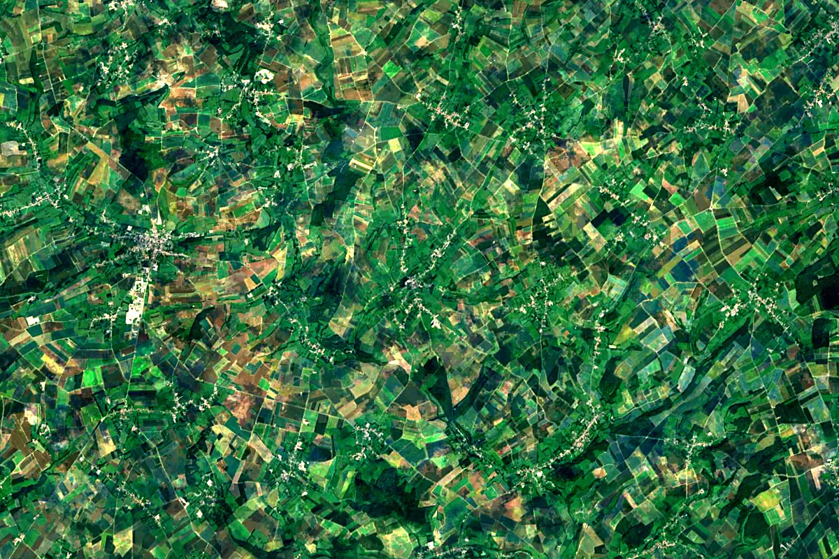
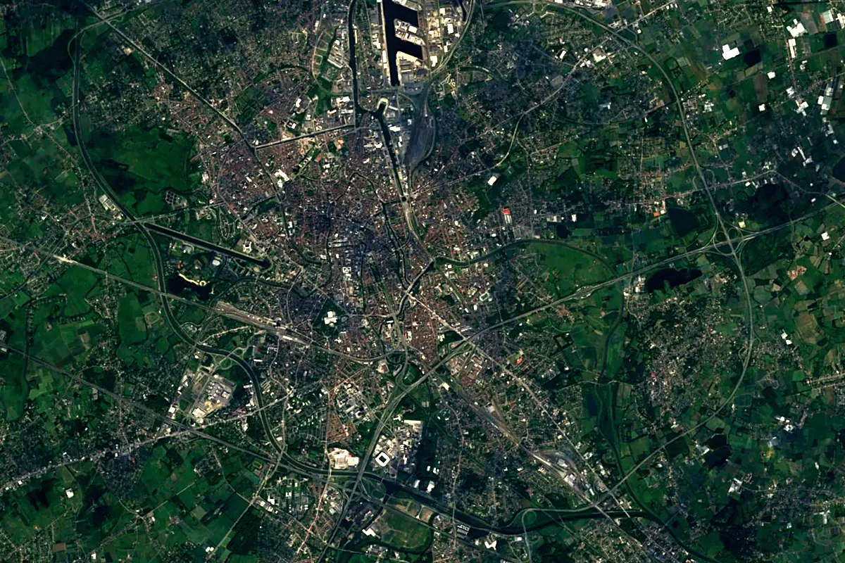
Sentinel-2 cloudless 2016 by EOX IT Services GmbH (contains modified Copernicus Sentinel data 2016), CC BY 4.0. The glowing line is the river as drawn by RiverATLAS.
Photos
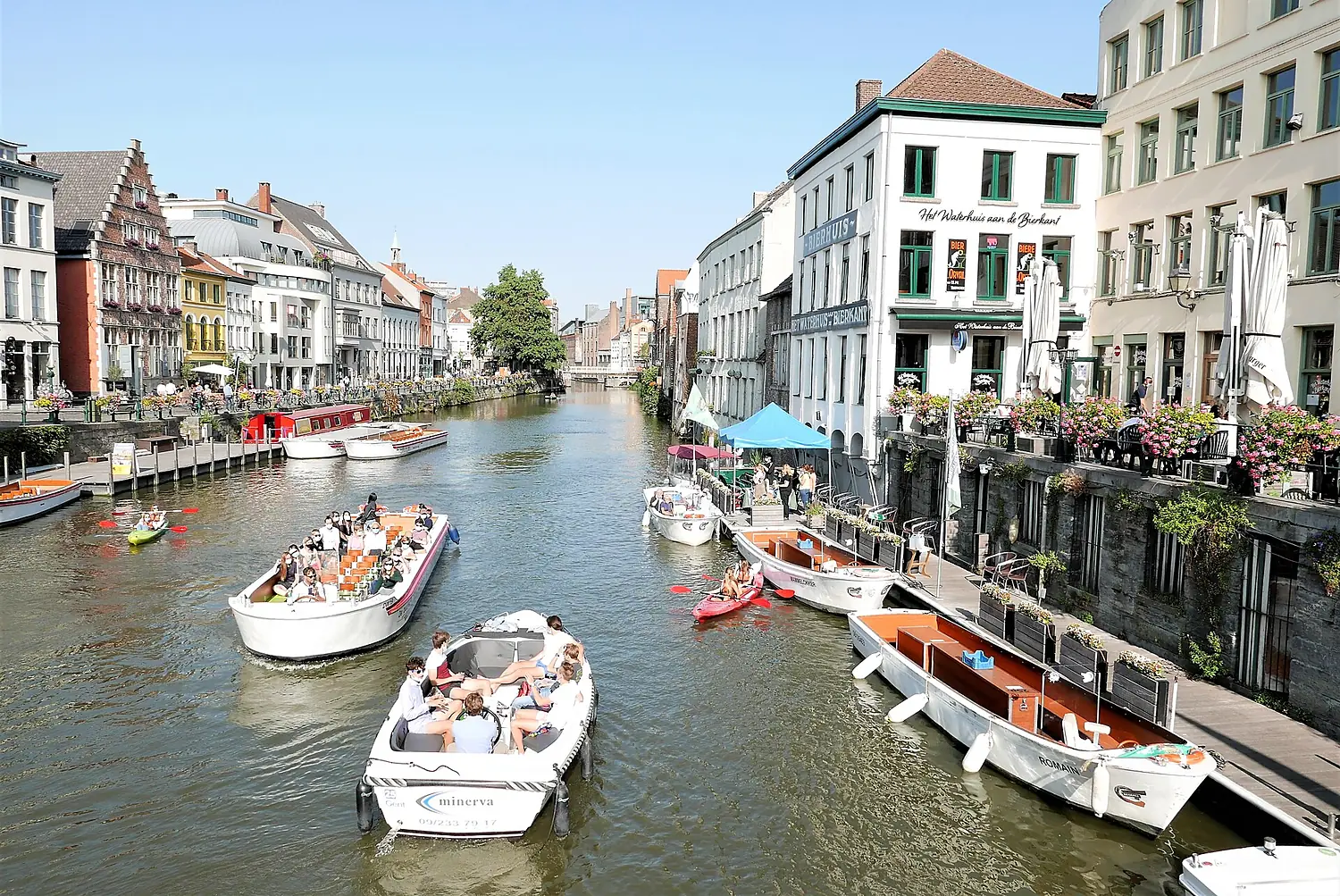
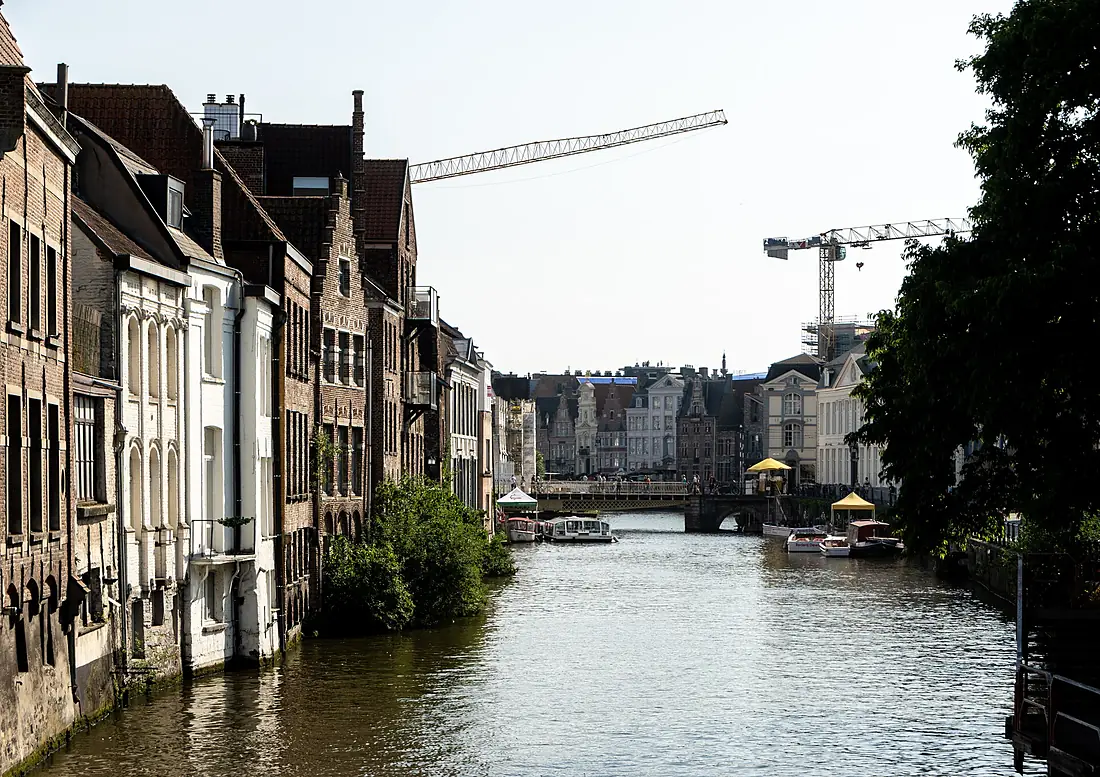
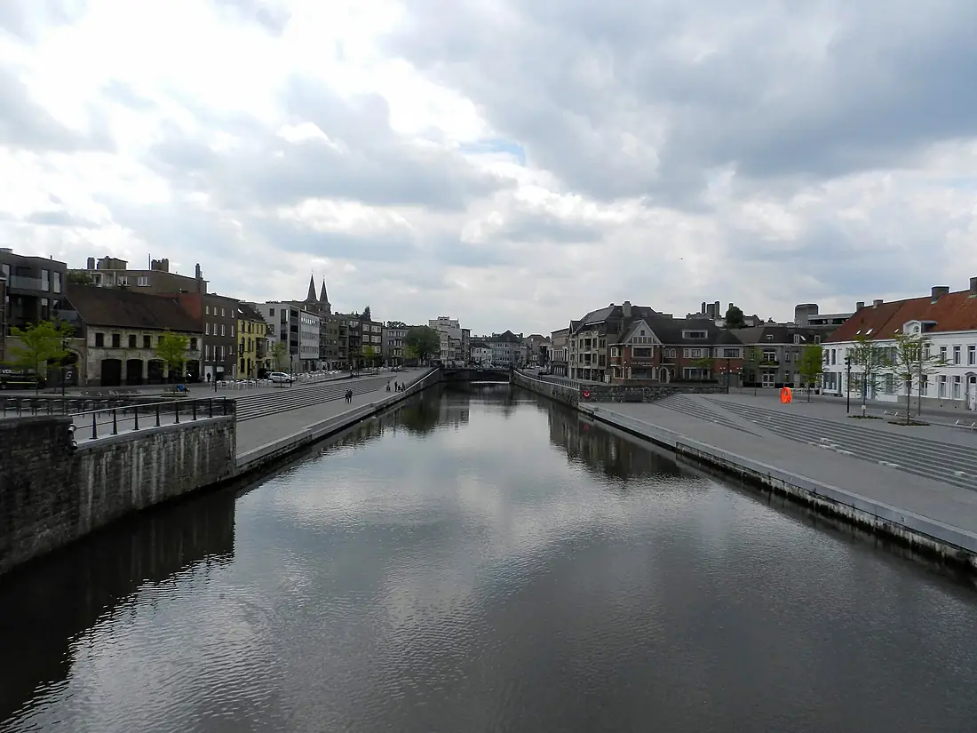
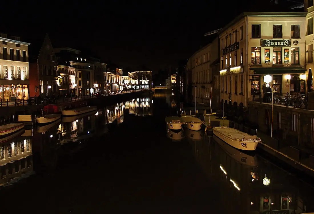
Lys in pictures
Tributaries
Where it flows, and what flows into it
Tributaries (10)
Also: Deûle, Lawe, Laquette, Mandel, Clarence, Heulebeek, Douve, Bourre, Meteren Becque, Guarbecque
Nearby
Rivers nearby
 The Netherlands1,233 km2,200 m³/s106 km awayDenderBelgium65 km8.8 m³/s25 km awayMeuseThe Netherlands950 km230 m³/s99 km awaySenneBelgium103 km5.5 m³/s44 km awayDyle / DijleBelgium86 km69 m³/s46 km awayYserBelgium78 km15 m³/s72 km awaySambreBelgium190 km36 m³/s102 km awayAa RiverFrance89 km10 m³/s115 km away
Where these numbers come from
| Name, length, places | Wikidata (Q208493) · CC0 |
|---|---|
| Course, profile, basin | RiverATLAS v1.0 (HydroATLAS, Linke et al. 2019) · CC BY 4.0 — followed from the source to the mouth given by Wikidata |
| Flow | WaterGAP (RiverATLAS), 1971–2000 · CC BY 4.0 |
| Climate along the river | WorldClim (RiverATLAS), 1970–2000 · CC BY 4.0 |
| Towns, bridges, dams | Wikidata · CC0; GeoNames · CC BY 4.0 |
| Along the river | © OpenStreetMap contributors · ODbL |
| Images | EOX Sentinel-2 cloudless 2016 · CC BY 4.0; Wikimedia Commons |
| Our other atlases | Lakeyas — Wikidata · CC0; © OpenStreetMap contributors · ODbL; GeoNames · CC BY 4.0; HydroLAKES · CC BY 4.0; NOAA OISST |
Every source and licence is on the data sources page.
The family
Do you prefer beaches, lakes, mountains, waterfalls, islands, rivers or canyons?
Same idea, other landscapes: field atlases built on open data, month by month, in seven languages.
 beaches
 Find your beach: sea temperature, sun and swimming month by month.Visit lakes
 Every lake on Earth: water temperature, ice, depth and the shore.Coming soonVisit
  mountains
 Every summit in 3D: summit weather, the 0 °C line, huts and trails.Visit
  waterfalls
 Every waterfall: height, flow month by month and when it roars.Coming soonVisit
  islands
 Every island from the sea up: size, sea temperature, ferries and 3D.Coming soonVisit
  rivers
 Every river from source to sea: the journey, the flow and the basin in numbers.You are here
 canyons
 Every canyon cut to scale: depth to the floor, rim and floor temperatures, trails and viewpoints.Coming soonVisit