River
Yangtze River
6,300 km from source to mouth · China.
 ChinaFlows into East China Sea1st longest in China
In numbers
Length
6,300km
Average flow
31,900m³/s
Basin
1,808,500km²
Drop
4,883m
from 4,881 m to -2 m
Country
1
The journey
From source to mouth
6,300 km of river and 68 stops on the way: 44 towns and cities on its banks, dams, bridges and the tributaries that feed it.
- 0 kmYangtze River sourceat 4,881 m
- 604 kmSewu Qutributary
- 770 kmDe Qutributary
- 2,043 kmBaishui Rivertributary
- 2,348 kmPanzhihua787,177 people
- 2,359 kmYalong Rivertributary
- 2,641 kmXiao Jiangtributary
- 2,678 kmYili Hetributary
- 3,073 kmShuifu102,143 people
- 3,102 kmYibin4,887,242 people
- 3,103 kmJinsha Rivertributary
- 3,103 kmMin Rivertributary
- 3,229 kmLuzhou4,254,149 people
- 3,231 kmTuo Rivertributary
- 3,298 kmHejiang137,437 people
- 3,299 kmChishui Rivertributary
- 3,365 kmBaisha115,761 people
- 3,404 kmJijiang196,787 people
- 3,444 kmBanan508,703 people
- 3,469 kmChongqing Shi12,135,000 people
- 3,469 kmChongqing22,000,000 people
- 3,475 kmJialing Rivertributary
- 3,541 kmYanjia100,000 people
- 3,546 kmFengcheng175,576 people
- 3,592 kmFuling268,658 people
- 3,592 kmLizhi156,753 people
- 3,593 kmWu Rivertributary
- 3,644 kmSanhe140,954 people
- 3,788 kmWanzhou1,545,900 people
- 3,792 kmPailou104,351 people
- 3,794 kmWanxian859,662 people
- 3,794 kmTaibai108,387 people
- 3,913 kmYong’an144,314 people
- 3,959 kmWushan117,873 people
- 4,085 kmThree Gorges Dam
- 4,086 kmThree Gorges Reservoir Region853 km²
- 4,126 kmYichang4,017,607 people
- 4,186 kmZhicheng159,383 people
- 4,218 kmZhijiang408,487 people
- 4,275 kmBuhe106,347 people
- 4,276 kmJingzhou5,570,100 people
- 4,361 kmXiulin240,082 people
- 4,503 kmXiang Rivertributary
- 4,503 kmBajiao Hu9.8 km²
- 4,510 kmSongchang Hu4.8 km²
- 4,556 kmXindi175,761 people
- 4,724 kmSouth Taizi Lake2.8 km²
- 4,731 kmMoshui Lake3.4 km²
- 4,735 kmWuchang1,102,188 people
- 4,740 kmWuhan12,326,518 people
- 4,825 kmHuangzhou122,563 people
- 4,830 kmHuanggang6,333,000 people
- 4,833 kmEzhou1,079,353 people
- 4,833 kmE’zhou668,727 people
- 4,868 kmHuangshi2,471,700 people
- 4,870 kmCi Hu8.9 km²
- 4,879 kmCe Hu8.7 km²
- 4,942 kmWuxue220,661 people
- 4,992 kmJiujiang1,164,268 people
- 4,994 kmBaishui Hu1.4 km²
- 5,015 kmPoyang Lake2,398 km²
- 5,052 kmPengze350,000 people
- 5,078 kmTaipo Lake23 km²
- 5,144 kmAnqing4,165,284 people
- 5,244 kmTongling1,311,726 people
- 5,345 kmWuhu3,644,420 people
- 5,497 kmZhenzhou176,006 people
- 5,525 kmZhenjiang950,516 people
- 5,637 kmJiangyin1,779,515 people
- 6,300 kmEast China Seaat -2 m
Water level along the river (RiverATLAS; the height is exaggerated). Towns: GeoNames and Wikidata; bridges, dams and tributaries: Wikidata.
Longest river in Asia, and the third-longest in the world
At the mouth it carries 31,900 m³/s on average: 13 Olympic pools every second. It drops from 4,881 m to -2 m, 0.8 m per kilometre on average. Its basin covers 1,808,500 km², about the size of LY. 481 million people live in it. Highest water: from July to September; lowest: from January to April. Dams and reservoirs hold back a large share of its water (20% of a year's flow).
Where to start
- ChongqingLargest city on its banks · 22,000,000 people
- Chongqing Jiangbei International Airport (CKG)Nearest airport with scheduled flights, 19 km from the city
- On the water287 ferry piers, marinas, boat rentals and boat ramps along the river (OpenStreetMap)
- From April to May and from August to OctoberThe best months to visit
Yangtze River, month by month
Highest water: from July to September
Lowest water: from January to April. Best months to visit: from April to May and from August to October.
From about 12,900 m³/s in the lowest month to 51,100 m³/s in the highest. An estimate: the monthly flow is modelled from the lowest and highest months of WaterGAP (RiverATLAS, 1971–2000) and the rain and snow along the river (WorldClim). Dams change the real rhythm. The chip is the average air temperature; below it, the month's rain.
Plan the trip
Plan the trip: boat trips, a bed by the river, a car
Some links above are affiliate links: if you book through them we may earn a commission, at no extra cost to you. It never changes what the data on this page says.
The basin
Yangtze River: the basin in numbers
1,909,199 km² of land send their water to this river. This is what lives on it.
- 481millionpeople live in the basin
- 258/km²people per km²
- 1,498maverage altitude of the basin
- 1,032mmof rain a year (basin average)
- 11.8°Caverage air temperature
- 17%protected areas
- 1.1%covered by lakes
- 6%permafrost
- 192km³held in reservoirs
What covers the basin
- 36% Forest
- 24% Cropland
- 28% Pasture
- 7% Towns and cities
RiverATLAS (HydroATLAS v1.0, CC BY 4.0): land cover, people, protected areas, glaciers and dams over the whole basin upstream of the mouth.
Along the river
Yangtze River: what you find on the way
- 48Weirsplunge pool weir and 47 more
- 42LocksChang Jiang, Gezhouba No. 1 Ship Lock, Yangtze River and 39 more
- 12WaterfallsWaterfall (small) and 11 more
- 22Boat ramps
- 235Ferry piersHuaneng Harbor, Maoping Port, Cruiseship Terminal and 232 more
- 30MarinasShigu Pier and 29 more
- 1River beaches
From OpenStreetMap, within 3.2 km of the river. Not mapped is not the same as not there.
Cross-checked with our atlases
Yangtze River in our other atlases
What our sister atlases know about the waterfalls on this river, the lakes it flows through, the beaches at its mouth, the mountains where it rises and the islands off its mouth.
 10lakes on its wayLakeyas
Lakes and reservoirs (10)
Lakes it flows through, by Lakeyas
- Three Gorges Reservoir Regionkm 3,819 · 113 m deep853km²
- Bajiao Hukm 4,2109.8km²
- Moshui Lakekm 4,4223.4km²
- Ci Hukm 4,5528.9km²
- Ce Hukm 4,5608.7km²
- Baishui Hukm 4,6681.4km²
- Poyang Lakekm 4,688 · 25 m deep2,398km²
- Taipo Lakekm 4,74623km²
2 more on LakeyasLakeyas is coming soonOpen Lakeyas ↗
From space
The source and the mouth, seen from orbit
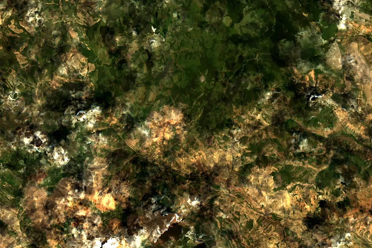
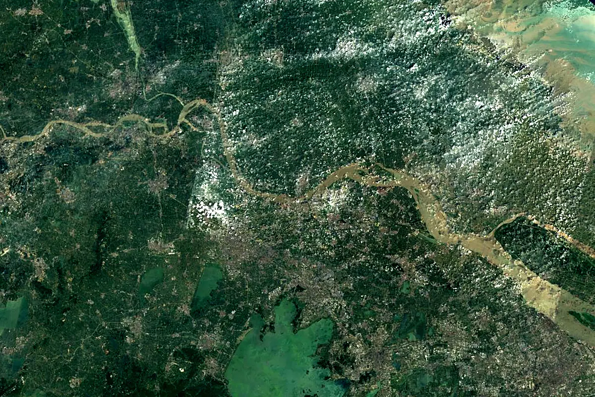
Sentinel-2 cloudless 2016 by EOX IT Services GmbH (contains modified Copernicus Sentinel data 2016), CC BY 4.0. The glowing line is the river as drawn by RiverATLAS.
Photos
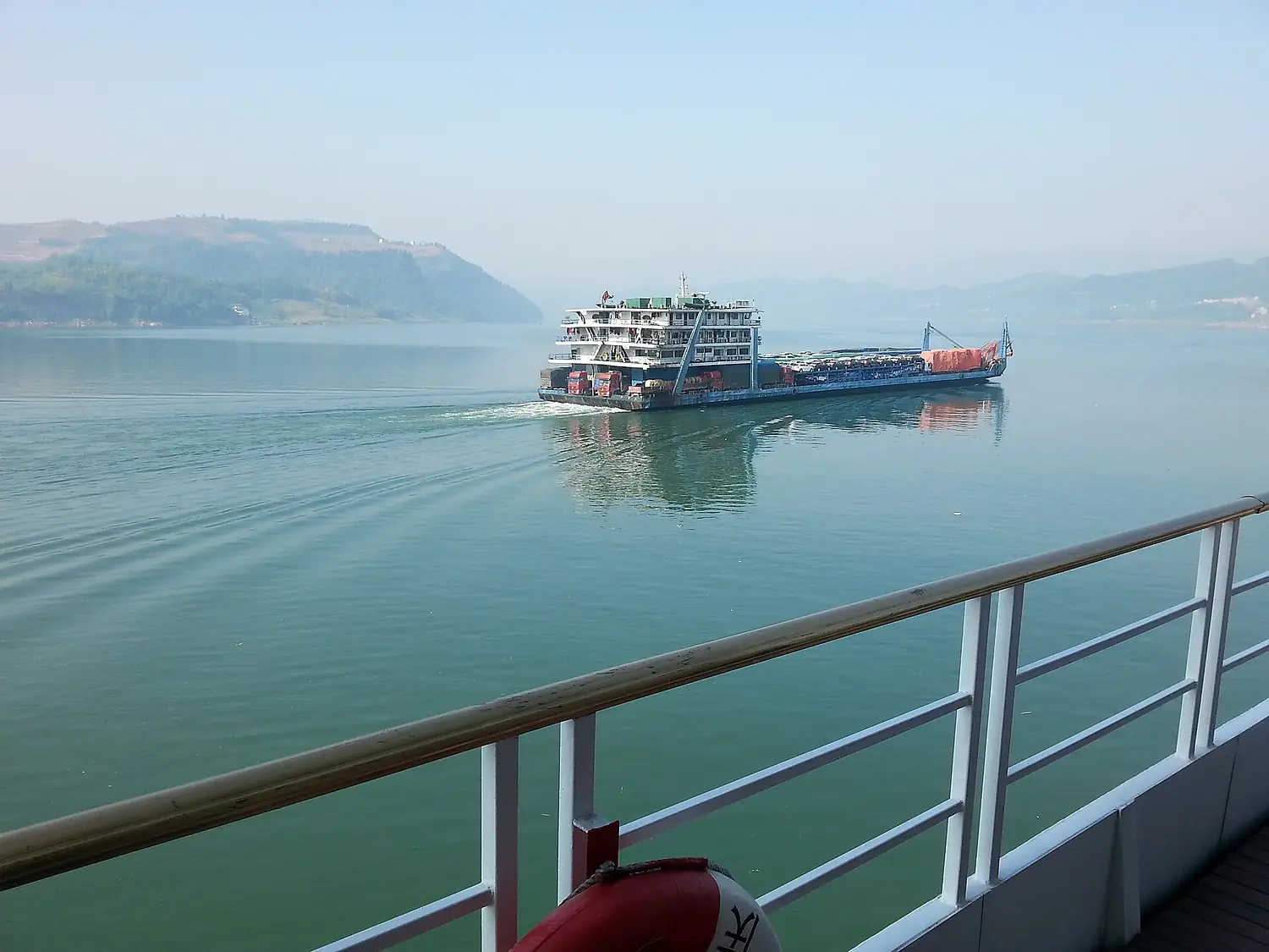
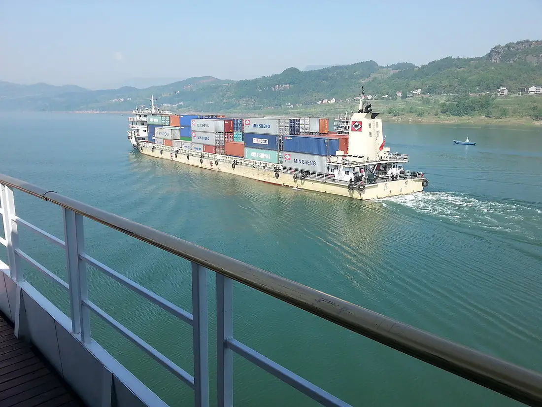
Yangtze River in pictures
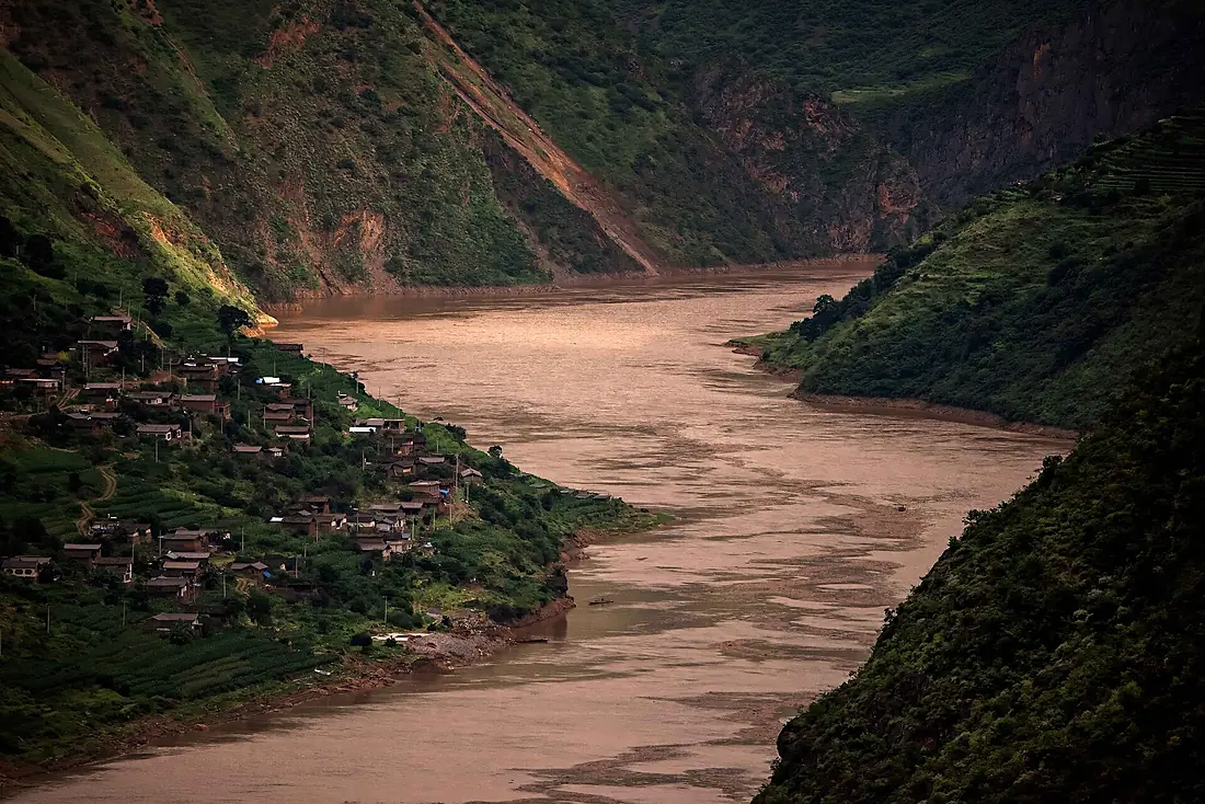
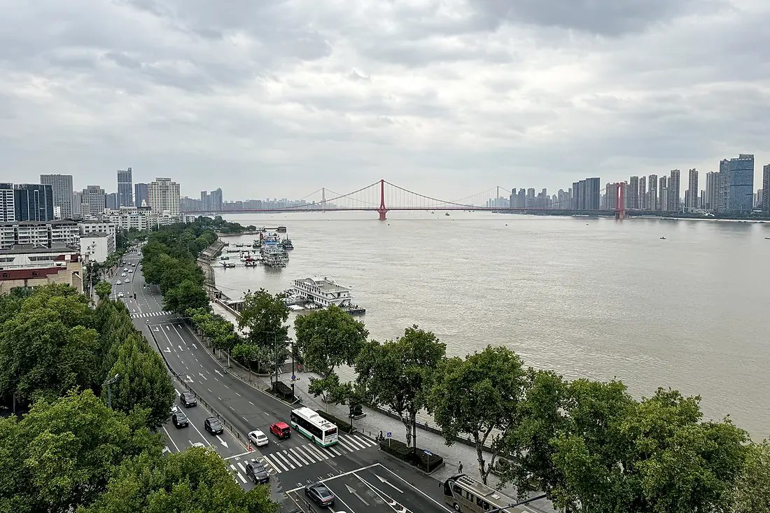
Tributaries
Where it flows, and what flows into it
Tributaries (34)
China3,005 km4,500 m³/sjoins at km 2,901Han RiverChina1,532 km2,200 m³/sjoins at km 4,432Yalong RiverChina1,323 km2,000 m³/sjoins at km 2,205Wu RiverChina1,150 km1,800 m³/sjoins at km 3,359Jialing RiverChina1,119 km2,100 m³/sjoins at km 3,249Huai RiverChina1,110 km1,200 m³/sYuan RiverChina993 km2,000 m³/sXiang RiverChina801 km6,400 m³/sjoins at km 4,209Gan RiverChina758 km1,700 m³/sjoins at km 4,690Min RiverChina711 km2,300 m³/sjoins at km 2,901Tuo RiverChina655 km460 m³/sjoins at km 3,020Huangpu RiverChina97 km370 m³/sAlso: Qinhuai River, Zi River, Chishui River, Qingyi River, Shuiyang River, Gong Jiang, Xiao Jiang, Fushui River, Yili He, She Shui, Ren He, De Qu, Niulan (rivière), Sewu Qu, Baishui River, Heng River, Ouqu, Muma River, Meigu River, Xixi River, Zengqu River, Songmai River
In the same basin
Where these numbers come from
| Name, length, places | Wikidata (Q5413) · CC0 |
|---|---|
| Course, profile, basin | RiverATLAS v1.0 (HydroATLAS, Linke et al. 2019) · CC BY 4.0 — followed from the source to the mouth given by Wikidata |
| Flow | WaterGAP (RiverATLAS), 1971–2000 · CC BY 4.0 |
| Climate along the river | WorldClim (RiverATLAS), 1970–2000 · CC BY 4.0 |
| Towns, bridges, dams | Wikidata · CC0; GeoNames · CC BY 4.0 |
| Along the river | © OpenStreetMap contributors · ODbL |
| Images | EOX Sentinel-2 cloudless 2016 · CC BY 4.0; Wikimedia Commons |
| Our other atlases | Lakeyas — Wikidata · CC0; © OpenStreetMap contributors · ODbL; GeoNames · CC BY 4.0; HydroLAKES · CC BY 4.0; NOAA OISST |
Every source and licence is on the data sources page.
The family
Do you prefer beaches, lakes, mountains, waterfalls, islands, rivers or canyons?
Same idea, other landscapes: field atlases built on open data, month by month, in seven languages.
 beaches
 Find your beach: sea temperature, sun and swimming month by month.Visit lakes
 Every lake on Earth: water temperature, ice, depth and the shore.Coming soonVisit
  mountains
 Every summit in 3D: summit weather, the 0 °C line, huts and trails.Visit
  waterfalls
 Every waterfall: height, flow month by month and when it roars.Coming soonVisit
  islands
 Every island from the sea up: size, sea temperature, ferries and 3D.Coming soonVisit
  rivers
 Every river from source to sea: the journey, the flow and the basin in numbers.You are here
 canyons
 Every canyon cut to scale: depth to the floor, rim and floor temperatures, trails and viewpoints.Coming soonVisit