River
Yenisei
3,487 km from source to mouth · Russia.
 RussiaFlows into Yenisei Gulf5th longest in Russia
In numbers
Length
3,487km
Average flow
19,800m³/s
Basin
2,580,000km²
Drop
805m
from 616 m to -189 m
Country
1
The journey
From source to mouth
3,487 km of river and 68 stops on the way: 13 towns and cities on its banks, dams, bridges and the tributaries that feed it.
- 0 kmIder Riverat 616 m
- 7 kmLittle Yeniseytributary
- 7 kmBolshoy Yeniseitributary
- 7 kmKyzyl116,983 people
- 30 kmErbektributary
- 43 kmElegesttributary
- 134 kmShagonar11,415 people
- 172 kmChaa-Khol'tributary
- 196 kmChingetributary
- 199 kmKhemchiktributary
- 265 kmUstributary
- 436 kmKantegirtributary
- 444 kmSayano–Shushenskaya Dam
- 466 kmMaina reservoir8.7 km²
- 483 kmSayanogorsk49,939 people
- 535 kmShushenskoye18,770 people
- 550 kmOyatributary
- 601 kmMinusinsk68,034 people
- 609 kmAbakantributary
- 623 kmUst’-Abakan14,696 people
- 839 kmUbeytributary
- 851 kmSisimtributary
- 898 kmDërbinatributary
- 976 kmKrasnoyarsk Reservoir1,630 km²
- 976 kmKrasnoyarsk Dam
- 984 kmDivnogorsk30,018 people
- 991 kmMana Rivertributary
- 998 kmKaraul'naya Rivertributary
- 999 kmBol'shaya Sliznëvatributary
- 1,012 kmBazaikha Rivertributary
- 1,019 kmKrasnoyarsk1,092,851 people
- 1,021 kmKacha Rivertributary
- 1,042 kmBerëzovka20,913 people
- 1,066 kmYesaulovkatributary
- 1,067 kmSosnovoborsk31,632 people
- 1,092 kmKantattributary
- 1,122 kmBol'shaya Tel'tributary
- 1,131 kmKantributary
- 1,162 kmBuzimtributary
- 1,268 kmShilkatributary
- 1,297 kmYagodkinatributary
- 1,364 kmAngaratributary
- 1,404 kmLesosibirsk65,945 people
- 1,446 kmYeniseysk19,920 people
- 1,458 kmKemtributary
- 1,548 kmBolshoy Pittributary
- 1,604 kmPucheglazikhatributary
- 1,691 kmKas Rivertributary
- 1,732 kmIsakovka Rivertributary
- 1,740 kmGalaktyonyha Rivertributary
- 1,746 kmSym Rivertributary
- 1,848 kmDubchestributary
- 1,945 kmPodkamennaya Tunguskatributary
- 2,088 kmBol'shaya Varlamovkatributary
- 2,097 kmBakhtatributary
- 2,223 kmKomsatributary
- 2,223 kmYeloguytributary
- 2,355 kmFat'yanikhatributary
- 2,392 kmPakulikhatributary
- 2,489 kmSukhaya Tunguskatributary
- 2,567 kmNizhnyaya Tunguskatributary
- 2,688 kmKureykatributary
- 2,869 kmBol'shaya Igarkatributary
- 2,966 kmKhantaykatributary
- 3,007 kmUboynaya Rivertributary
- 3,014 kmGryaznayatributary
- 3,032 kmFokinatributary
- 3,140 kmDudinka23,619 people
- 3,205 kmSukhaya Dudinkatributary
- 3,487 kmYenisei Gulfat -189 m
Water level along the river (RiverATLAS; the height is exaggerated). Towns: GeoNames and Wikidata; bridges, dams and tributaries: Wikidata.
River in Asia; the 5th-longest in the world
At the mouth it carries 19,800 m³/s on average: 7.9 Olympic pools every second. It drops from 616 m to -189 m, 0.2 m per kilometre on average. Its basin covers 2,580,000 km², about the size of KZ. 8.0 million people live in it. Highest water, with the snowmelt: from May to August; lowest: from January to April. It is heavily dammed: reservoirs can hold 66% of a year's flow.
Where to start
- KrasnoyarskLargest city on its banks · 1,092,851 people
- Krasnoyarsk Cheremshanka Airport (KCY)Nearest airport with scheduled flights, 28 km from the city
- On the water66 ferry piers, marinas, boat rentals and boat ramps along the river (OpenStreetMap)
- From June to AugustThe best months to visit
Yenisei, month by month
Highest water: from May to August
Lowest water: from January to April. Freezing months (average below −4 °C): from November to March. Melting snow makes up much of its water. Best months to visit: from June to August.
From about 5,500 m³/s in the lowest month to 55,500 m³/s in the highest. An estimate: the monthly flow is modelled from the lowest and highest months of WaterGAP (RiverATLAS, 1971–2000) and the rain and snow along the river (WorldClim). Dams change the real rhythm. The chip is the average air temperature; below it, the month's rain.
Plan the trip
Plan the trip: boat trips, a bed by the river, a car
Some links above are affiliate links: if you book through them we may earn a commission, at no extra cost to you. It never changes what the data on this page says.
The basin
Yenisei: the basin in numbers
2,489,340 km² of land send their water to this river. This is what lives on it.
- 8.0millionpeople live in the basin
- 3/km²people per km²
- 736maverage altitude of the basin
- 444mmof rain a year (basin average)
- -5.3°Caverage air temperature
- 5%protected areas
- 2.1%covered by lakes
- 51%permafrost
- 412km³held in reservoirs
What covers the basin
- 67% Forest
- 3% Cropland
- 8% Pasture
RiverATLAS (HydroATLAS v1.0, CC BY 4.0): land cover, people, protected areas, glaciers and dams over the whole basin upstream of the mouth.
Along the river
Yenisei: what you find on the way
- 7Weirs
- 4Boat ramps
- 47Ferry piersKargino and 46 more
- 10Marinas
- 1River beaches
From OpenStreetMap, within 3.2 km of the river. Not mapped is not the same as not there.
Cross-checked with our atlases
Yenisei in our other atlases
What our sister atlases know about the waterfalls on this river, the lakes it flows through, the beaches at its mouth, the mountains where it rises and the islands off its mouth.
 2lakes on its wayLakeyas
 1mountain at the sourcePeakyas
Lakes and reservoirs (2)
Lakes it flows through, by Lakeyas
- Maina reservoirkm 4228.7km²
- Krasnoyarsk Reservoirkm 883 · 105 m deep1,630km²
Lakeyas is coming soonOpen Lakeyas ↗
Mountains at the source (1)
Within 15 km of the source, by Peakyas
- Dogee Mountain3.6 km away1,002m
From space
The source and the mouth, seen from orbit
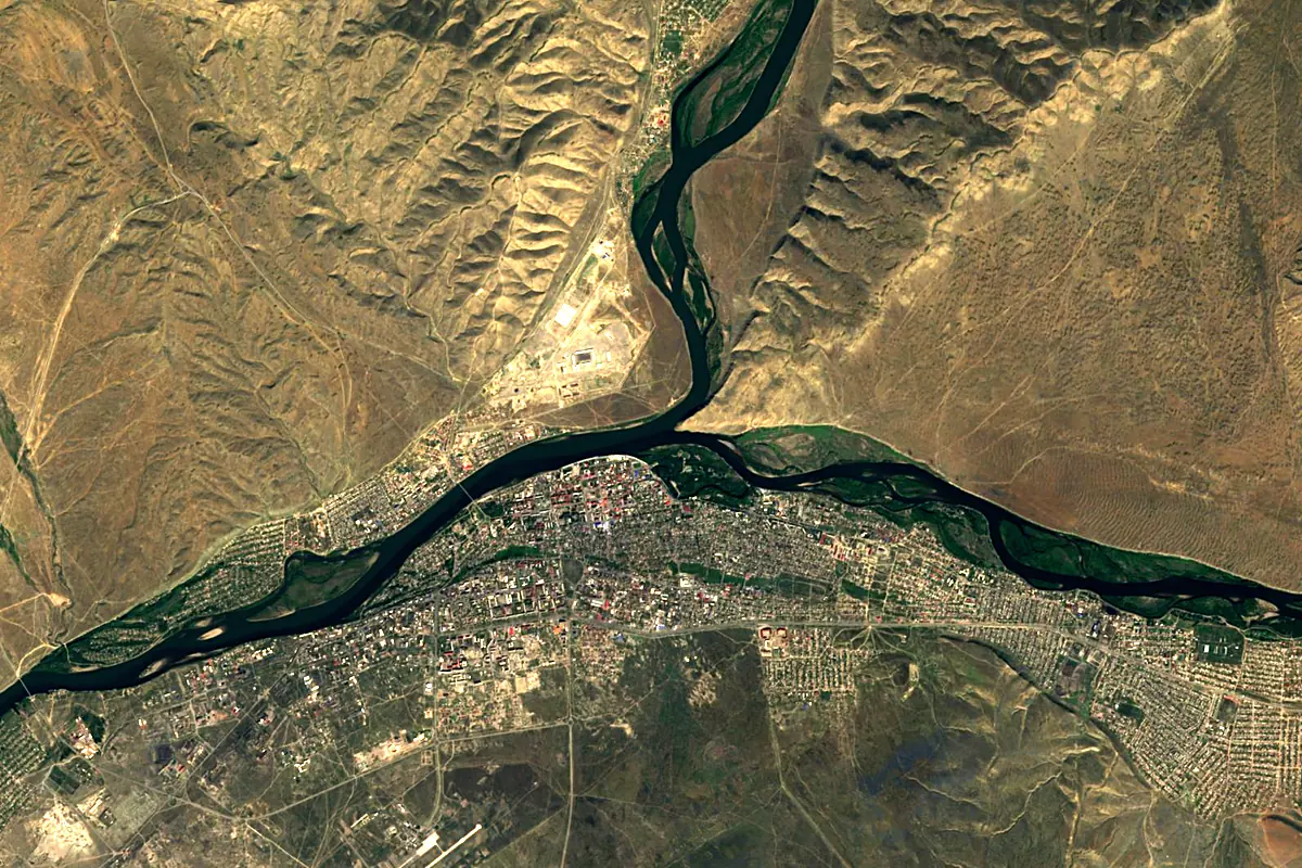
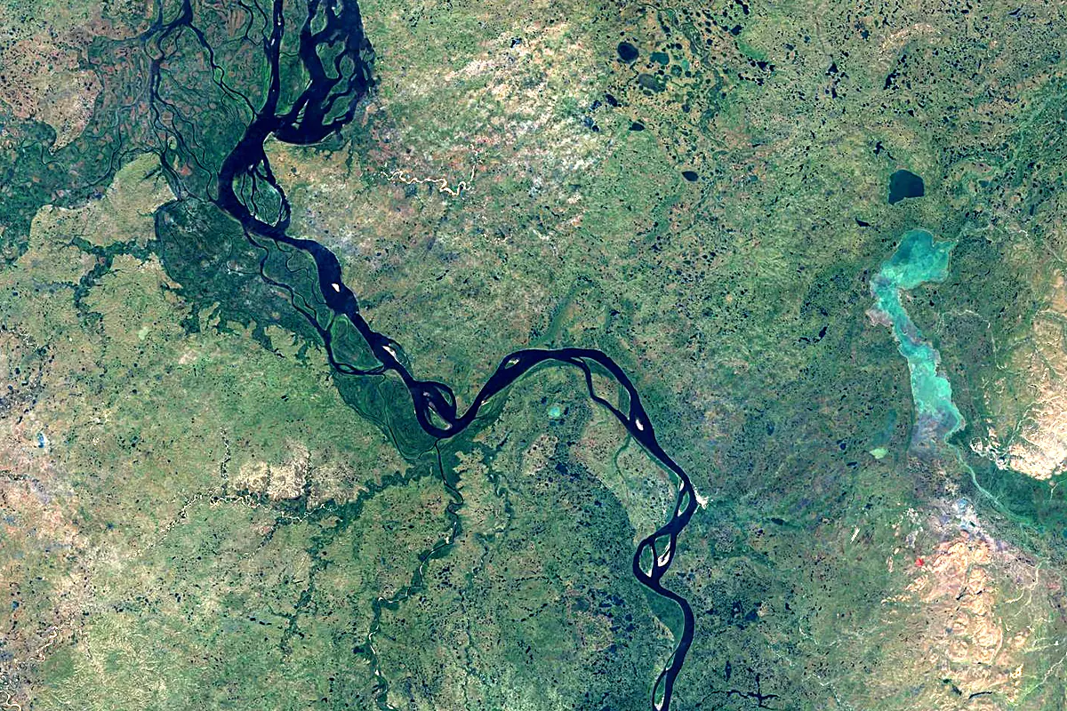
Sentinel-2 cloudless 2016 by EOX IT Services GmbH (contains modified Copernicus Sentinel data 2016), CC BY 4.0. The glowing line is the river as drawn by RiverATLAS.
Photos
Yenisei in pictures
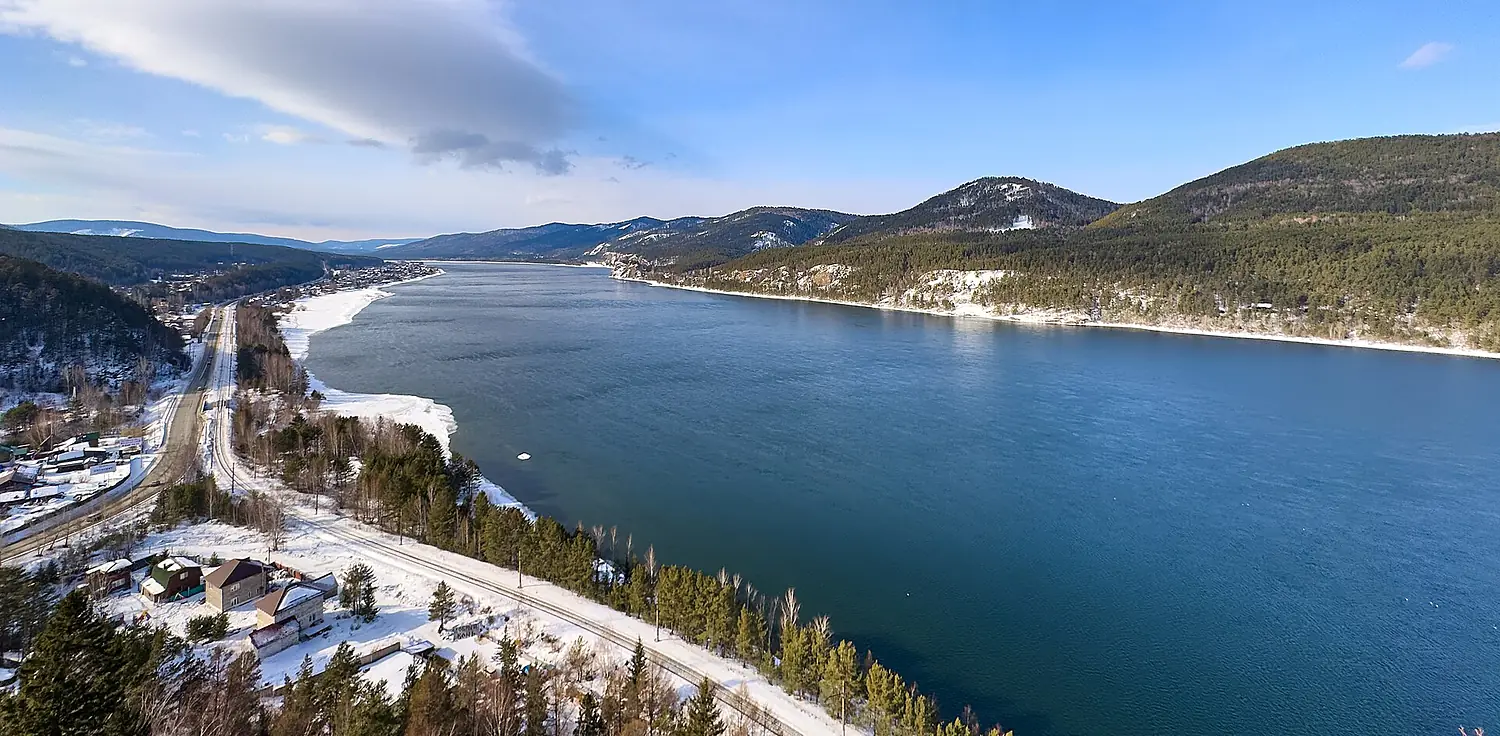
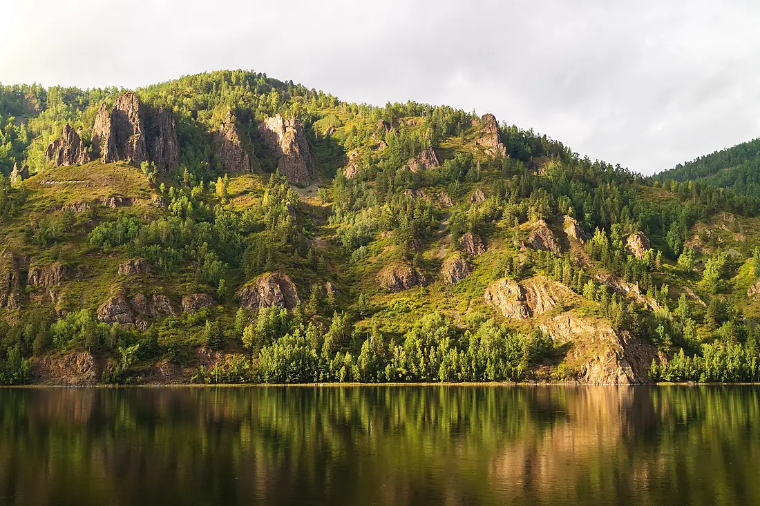
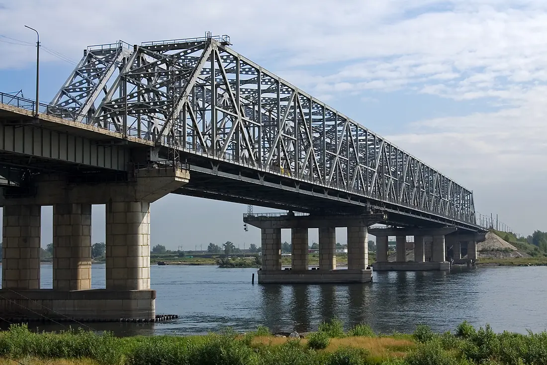
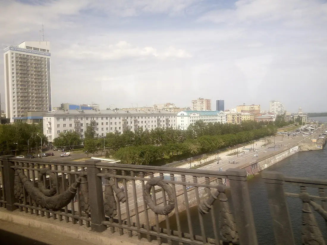
Tributaries
Where it flows, and what flows into it
Tributaries (123)
Russia2,989 km3,700 m³/sjoins at km 2,323Podkamennaya TunguskaRussia1,865 km1,600 m³/sjoins at km 1,760AngaraRussia1,779 km4,500 m³/sjoins at km 1,234AbakanRussia514 km380 m³/sjoins at km 551Also: Kan, Little Yenisey, Bolshoy Yenisei, Kureyka, Mana River, Khemchik, Turukhan, Sym River, Bolshaya Kheta River, Khantayka, Bakhta, Yeloguy, Kem, Bolshoy Pit, Tanama, Kas River, Kacha River, Bazaikha River, Kantegir, Us, Dubches, Oya, Sisim, Buzim
In the same basin
 Mongolia
Where these numbers come from
| Name, length, places | Wikidata (Q78707) · CC0 |
|---|---|
| Course, profile, basin | RiverATLAS v1.0 (HydroATLAS, Linke et al. 2019) · CC BY 4.0 — followed from the source to the mouth given by Wikidata |
| Flow | WaterGAP (RiverATLAS), 1971–2000 · CC BY 4.0 |
| Climate along the river | WorldClim (RiverATLAS), 1970–2000 · CC BY 4.0 |
| Towns, bridges, dams | Wikidata · CC0; GeoNames · CC BY 4.0 |
| Along the river | © OpenStreetMap contributors · ODbL |
| Images | EOX Sentinel-2 cloudless 2016 · CC BY 4.0; Wikimedia Commons |
| Our other atlases | Lakeyas, Peakyas — Wikidata · CC0; © OpenStreetMap contributors · ODbL; GeoNames · CC BY 4.0; HydroLAKES · CC BY 4.0; NOAA OISST |
Every source and licence is on the data sources page.
The family
Do you prefer beaches, lakes, mountains, waterfalls, islands, rivers or canyons?
Same idea, other landscapes: field atlases built on open data, month by month, in seven languages.
 beaches
 Find your beach: sea temperature, sun and swimming month by month.Visit lakes
 Every lake on Earth: water temperature, ice, depth and the shore.Coming soonVisit mountains
 Every summit in 3D: summit weather, the 0 °C line, huts and trails.Visit
  waterfalls
 Every waterfall: height, flow month by month and when it roars.Coming soonVisit
  islands
 Every island from the sea up: size, sea temperature, ferries and 3D.Coming soonVisit
  rivers
 Every river from source to sea: the journey, the flow and the basin in numbers.You are here
 canyons
 Every canyon cut to scale: depth to the floor, rim and floor temperatures, trails and viewpoints.Coming soonVisit