River
Adour
308 km from source to mouth · France.
 FranceFlows into Atlantic Ocean
In numbers
Length
308km
Average flow
350m³/s
Basin
16,912km²
Drop
769m
from 767 m to -2 m
Country
1
The journey
From source to mouth
308 km of river and 68 stops on the way: 57 towns and cities on its banks, dams, bridges and the tributaries that feed it.
- 0 kmLa Mongieat 767 m
- 0 kmArreau725 people
- 7 kmCampan1,245 people
- 11 kmAsté568 people
- 12 kmGerde1,196 people
- 14 kmBagnères-de-Bigorre7,114 people
- 18 kmPouzac1,099 people
- 29 kmBernac-Debat743 people
- 33 kmHorgues1,287 people
- 35 kmSoues2,988 people
- 38 kmSéméac5,236 people
- 39 kmAureilhan8,031 people
- 39 kmTarbes44,399 people
- 44 kmBours882 people
- 46 kmBazet1,858 people
- 48 kmAurensan764 people
- 60 kmVic-en-Bigorre4,845 people
- 62 kmArtagnan504 people
- 72 kmMaubourguet2,242 people
- 74 kmÉcheztributary
- 100 kmArrostributary
- 106 kmRiscle1,622 people
- 111 kmSaint-Germé515 people
- 113 kmSaint-Mont317 people
- 123 kmLéeztributary
- 124 kmBarcelonne-du-Gers1,401 people
- 126 kmAire-sur-l'Adour6,211 people
- 136 kmCazères-sur-l'Adour1,128 people
- 148 kmGrenade-sur-l'Adour2,398 people
- 164 kmSaint-Sever5,043 people
- 168 kmAurice633 people
- 176 kmGabastributary
- 177 kmSouprosse1,184 people
- 183 kmMugron1,348 people
- 192 kmAudon409 people
- 196 kmMidouzetributary
- 196 kmBégaar1,251 people
- 205 kmPontonx-sur-l'Adour3,021 people
- 216 kmHinx1,894 people
- 221 kmSaint-Vincent-de-Paul3,402 people
- 227 kmDax22,109 people
- 227 kmSaint-Paul-lès-Dax14,481 people
- 233 kmMées2,036 people
- 238 kmTercis-les-Bains1,359 people
- 239 kmRivière-Saas-et-Gourby1,476 people
- 241 kmLuytributary
- 244 kmOrist814 people
- 245 kmSaubusse1,093 people
- 247 kmSaint-Geours-de-Maremne3,089 people
- 249 kmPey838 people
- 249 kmJosse1,018 people
- 251 kmSaint-Jean-de-Marsacq1,840 people
- 254 kmSaint-Martin-de-Hinx1,808 people
- 260 kmPort-de-Lanne1,232 people
- 263 kmSainte-Marie-de-Gosse1,241 people
- 266 kmSames709 people
- 268 kmBidouzetributary
- 268 kmGave de Pau Rivertributary
- 268 kmGuiche1,075 people
- 277 kmUrt2,346 people
- 284 kmUrcuit3,047 people
- 288 kmSaint-Martin-de-Seignanx6,238 people
- 288 kmLahonce2,740 people
- 289 kmArdanabiatributary
- 294 kmMouguerre5,428 people
- 297 kmArantributary
- 297 kmBayonne54,306 people
- 299 kmAnglet43,271 people
- 305 kmNivetributary
- 308 kmAtlantic Oceanat -2 m
Water level along the river (RiverATLAS; the height is exaggerated). Towns: GeoNames and Wikidata; bridges, dams and tributaries: Wikidata.
River in France
At the mouth it carries 350 m³/s on average: an Olympic pool every 7.1 seconds. It drops from 767 m to -2 m, 2.5 m per kilometre on average. Its basin covers 16,912 km², about the size of SZ. 1.0 million people live in it. Highest water: from December to February. No large dam holds it back: it is one of the world's free-flowing rivers.
Where to start
- BayonneLargest city on its banks · 54,306 people
- Biarritz Pays Basque airport (BIQ)Nearest airport with scheduled flights, 5 km from the cityCar hire at BIQ airport (Biarritz)Discover Cars · Affiliate link↗
- On the water30 ferry piers, marinas, boat rentals and boat ramps along the river (OpenStreetMap)
- From May to SeptemberThe best months to visit
Adour, month by month
Highest water: from December to February
Best months to visit: from May to September.
From about 110 m³/s in the lowest month to 600 m³/s in the highest. An estimate: the monthly flow is modelled from the lowest and highest months of WaterGAP (RiverATLAS, 1971–2000) and the rain and snow along the river (WorldClim). Dams change the real rhythm. The chip is the average air temperature; below it, the month's rain.
Plan the trip
Plan the trip: boat trips, a bed by the river, a car
Some links above are affiliate links: if you book through them we may earn a commission, at no extra cost to you. It never changes what the data on this page says.
The basin
Adour: the basin in numbers
16,831 km² of land send their water to this river. This is what lives on it.
- 1.0millionpeople live in the basin
- 62/km²people per km²
- 412maverage altitude of the basin
- 1,025mmof rain a year (basin average)
- 11.3°Caverage air temperature
- 15%protected areas
- 0.2%covered by lakes
What covers the basin
- 47% Forest
- 26% Cropland
- 18% Pasture
- 3% Towns and cities
RiverATLAS (HydroATLAS v1.0, CC BY 4.0): land cover, people, protected areas, glaciers and dams over the whole basin upstream of the mouth.
Along the river
Adour: what you find on the way
- 85WeirsSeuil d'Alaric and 84 more
- 2Locks
- 22Boat rampsZone d'embarquement por canoë, Cale du Hayaou, Cale de Boucau and 19 more
- 2Ferry piersCale de Boucau, Anglet Brise Lames
- 3MarinasPort de la Cale, Port Bayonne Anglet, Port de Plaisance du Brise-Lames
- 9River beachesPlage de la Digue, Plage des Corsaires, Plages de la Petite Madrague and 6 more
From OpenStreetMap, within 1.9 km of the river. Not mapped is not the same as not there.
Cross-checked with our atlases
Adour in our other atlases
What our sister atlases know about the waterfalls on this river, the lakes it flows through, the beaches at its mouth, the mountains where it rises and the islands off its mouth.
 19beaches at the mouth and on the banksCoastya
 5mountains at the sourcePeakyas
 4islands off the mouthIslandyas
Beaches (19)
At the mouth (25 km) and on the banks, by Coastya
- Plage de la Diguekm 25922.1°C
- Plage d'Ilbarritz8.6 km away22.1°C
- Grande Plage5.5 km away22.1°C
- Plage Sud16 km away22.1°C
- Plage Nord18 km away22.1°C
- Plage de l'Océankm 26022.1°C
- Plage des Cavalierskm 26022.1°C
- Plage d'Ondres6.4 km away22.1°C
11 more on CoastyaOpen Coastya ↗
Mountains at the source (5)
Within 15 km of the source, by Peakyas
- Pic du Midi de Bigorre9.1 km away · prominence 761 m2,877m
- Arbizon13 km away2,831m
- Pic du Montaigu13 km away2,339m
- Pic d'Aste6.1 km away1,127m
- Pic de Pène Blanque9.8 km away
Islands off the mouth (4)
Within 30 km of the mouth, by Islandyas
- Amuitz island26 km away
- Bird Island27 km away
- Two Twins25 km away
- Roche Ronde, Biarritz5.0 km away
Islandyas is coming soonOpen Islandyas ↗
From space
The source and the mouth, seen from orbit
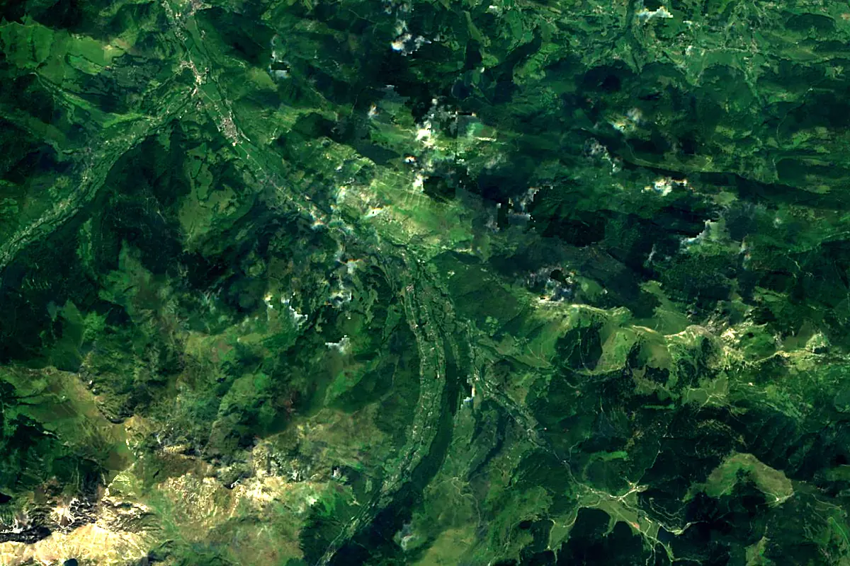
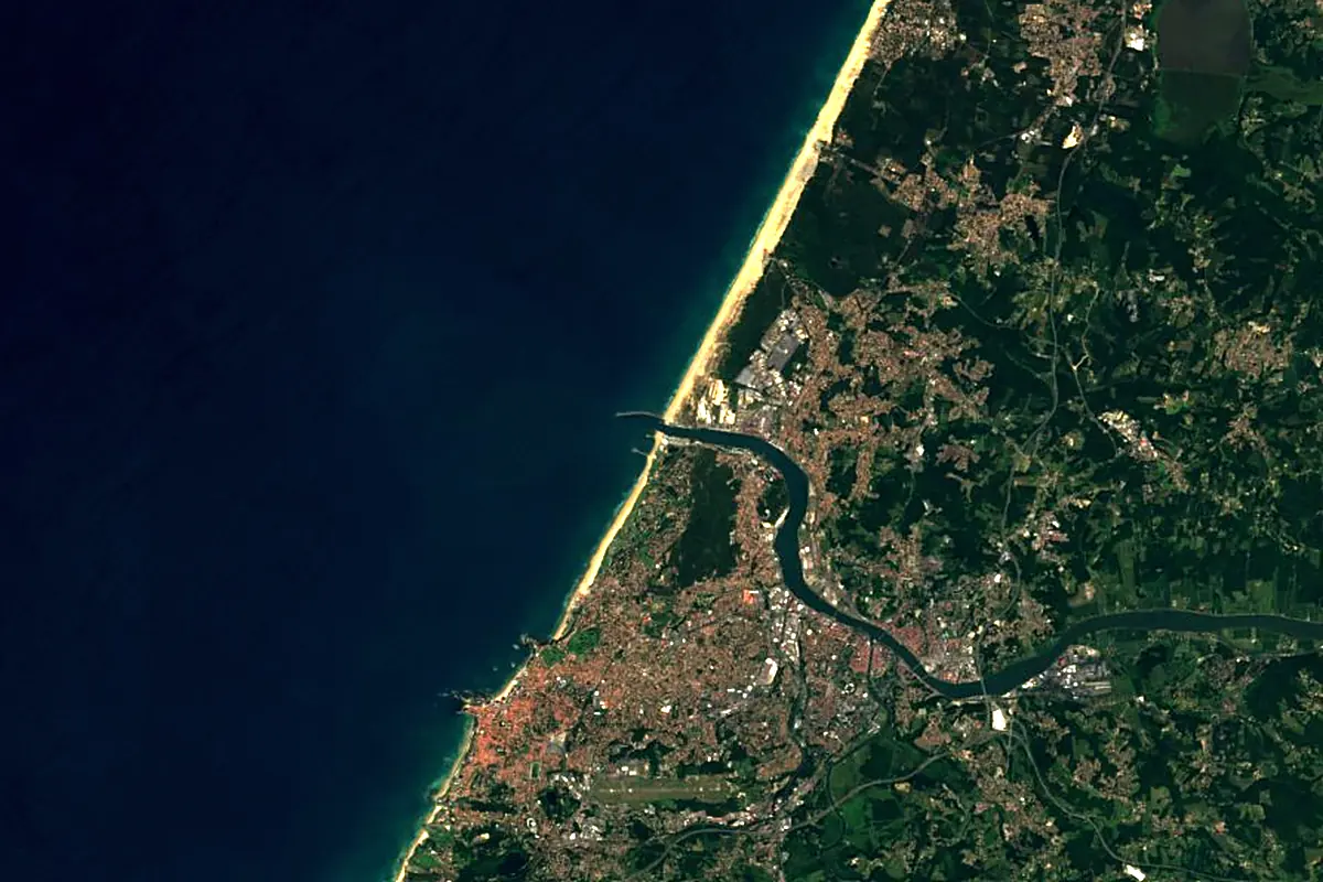
Sentinel-2 cloudless 2016 by EOX IT Services GmbH (contains modified Copernicus Sentinel data 2016), CC BY 4.0. The glowing line is the river as drawn by RiverATLAS.
Photos
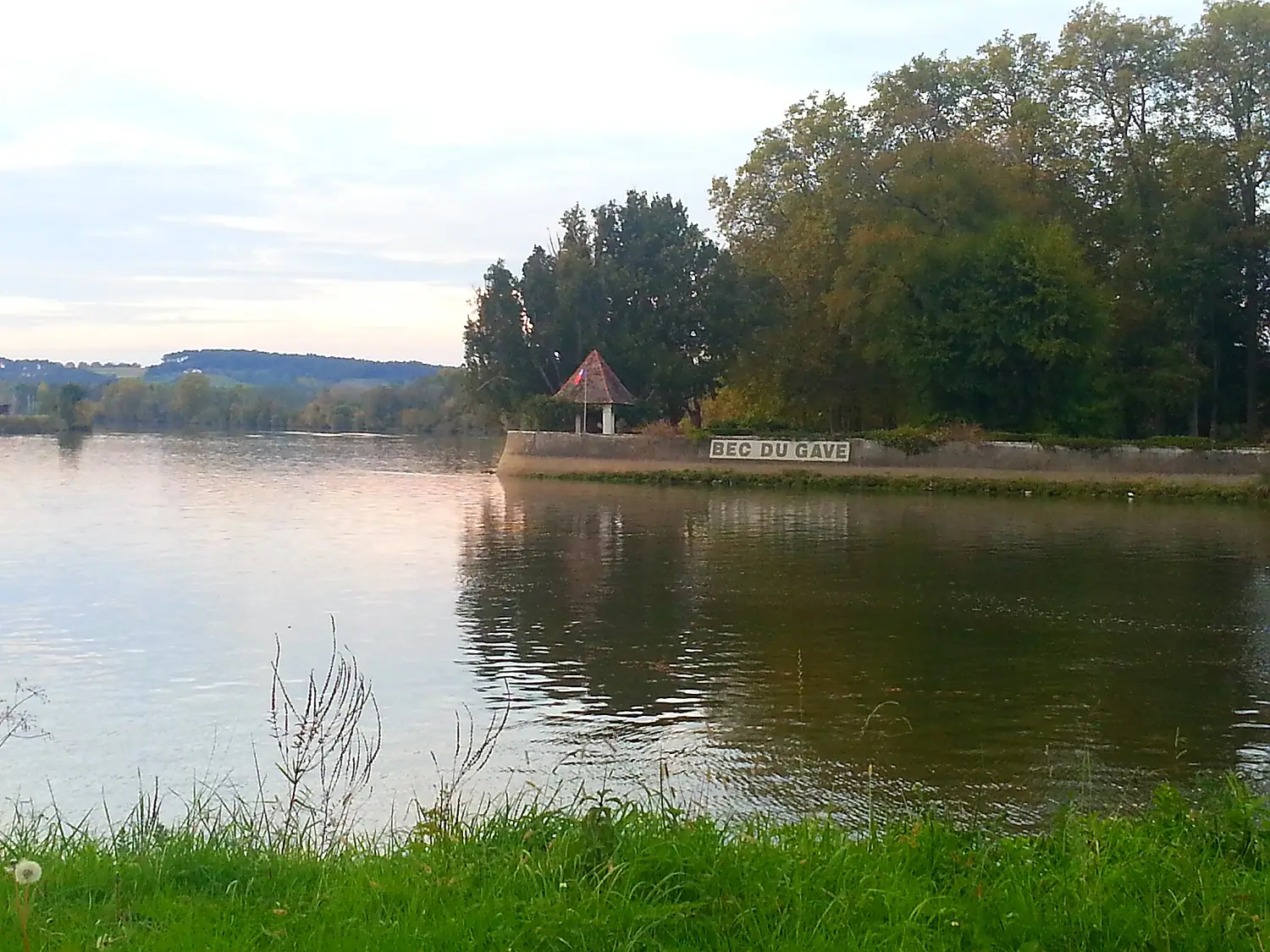
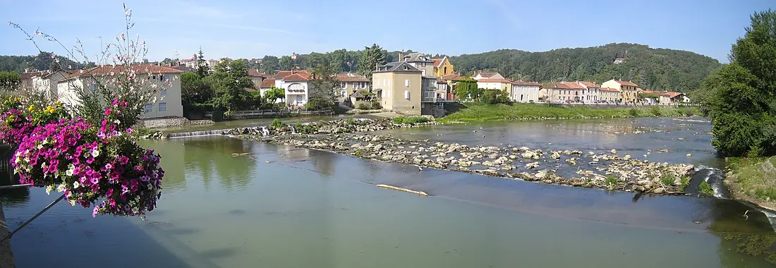
Adour in pictures
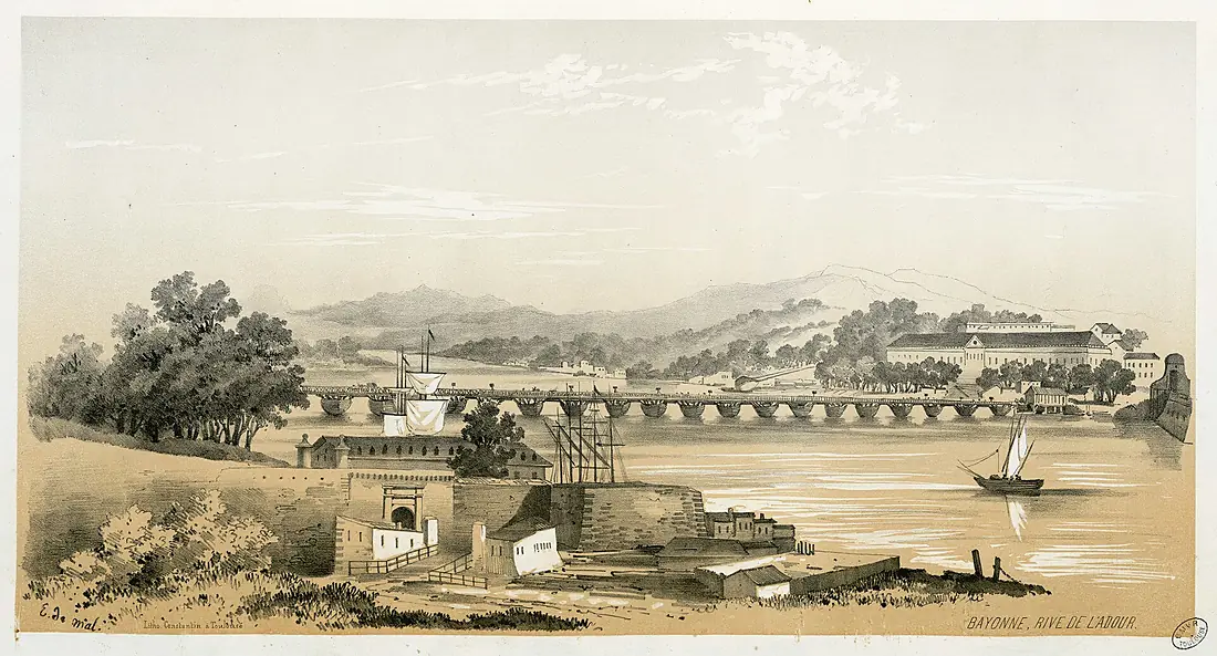
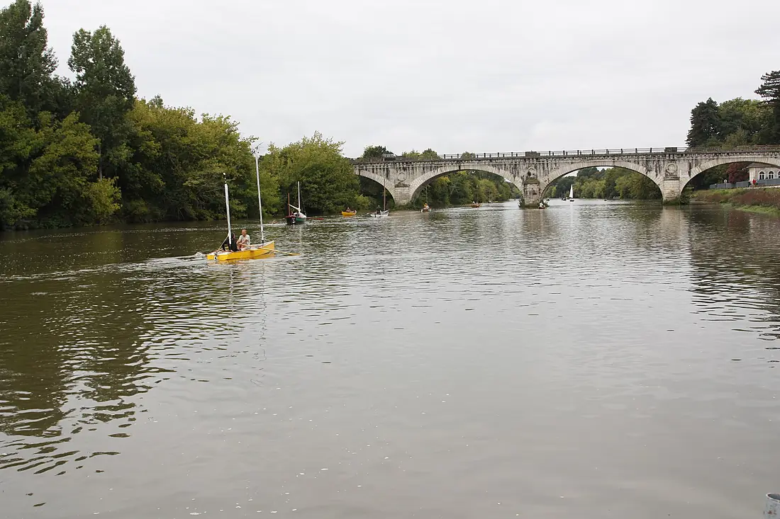
Tributaries
Where it flows, and what flows into it
Tributaries (25)
Also: Nive, Arros, Échez, Gabas, Bidouze, Midouze, Gaves réunis, Luy, Aran, Louts, Léez, Ardanabia, Estéous, Louet, Bahus, Bergons, Gailleste, Luzoû, Saint-Jean, Broussau, Gioulé, Lespontès, Ourden, Saget
In the same basin
Nearby
Rivers nearby
France193 km82 m³/s25 km awayBidasoaFrance68 km26 m³/s29 km awayGave d'OloronFrance149 km100 m³/s36 km awayNervión Spain76 km9.6 m³/s123 km awayAragónSpain195 km41 m³/s147 km awayGaronneFrance647 km660 m³/s181 km awayDordogneFrance483 km450 m³/s184 km awayArgaSpain145 km60 m³/s141 km away
Where these numbers come from
| Name, length, places | Wikidata (Q207366) · CC0 |
|---|---|
| Course, profile, basin | RiverATLAS v1.0 (HydroATLAS, Linke et al. 2019) · CC BY 4.0 — followed along the river network from the point given by Wikidata |
| Flow | WaterGAP (RiverATLAS), 1971–2000 · CC BY 4.0 |
| Climate along the river | WorldClim (RiverATLAS), 1970–2000 · CC BY 4.0 |
| Towns, bridges, dams | Wikidata · CC0; GeoNames · CC BY 4.0 |
| Along the river | © OpenStreetMap contributors · ODbL |
| Images | EOX Sentinel-2 cloudless 2016 · CC BY 4.0; Wikimedia Commons |
| Our other atlases | Coastya, Peakyas, Islandyas — Wikidata · CC0; © OpenStreetMap contributors · ODbL; GeoNames · CC BY 4.0; HydroLAKES · CC BY 4.0; NOAA OISST |
Every source and licence is on the data sources page.
The family
Do you prefer beaches, lakes, mountains, waterfalls, islands, rivers or canyons?
Same idea, other landscapes: field atlases built on open data, month by month, in seven languages.
beaches Find your beach: sea temperature, sun and swimming month by month.Visit
  lakes
lakes Every lake on Earth: water temperature, ice, depth and the shore.Coming soonVisit mountains
 Every summit in 3D: summit weather, the 0 °C line, huts and trails.Visit
  waterfalls
 Every waterfall: height, flow month by month and when it roars.Coming soonVisit islands
 Every island from the sea up: size, sea temperature, ferries and 3D.Coming soonVisit
  rivers
 Every river from source to sea: the journey, the flow and the basin in numbers.You are here
 canyons
 Every canyon cut to scale: depth to the floor, rim and floor temperatures, trails and viewpoints.Coming soonVisit