River
Lot
485 km from source to mouth · France.
 FranceFlows into Garonne6th longest in France
In numbers
Length
485km
Average flow
180m³/s
Basin
11,254km²
Drop
851m
from 879 m to 28 m
Country
1
The journey
From source to mouth
485 km of river and 68 stops on the way: 56 towns and cities on its banks, dams, bridges and the tributaries that feed it.
- 0 kmCévennesat 879 m
- 12 kmBadaroux930 people
- 20 kmMende12,464 people
- 34 kmBarjac806 people
- 43 kmChanac1,404 people
- 54 kmColagnetributary
- 59 kmSaint-Germain-du-Teil858 people
- 65 kmLa Canourgue2,074 people
- 75 kmSaint-Laurent-d'Olt623 people
- 96 kmSainte-Eulalie-d'Olt367 people
- 99 kmMerdansontributary
- 109 kmCastelnau-de-Mandailles565 people
- 116 kmSaint-Côme-d'Olt1,449 people
- 122 kmEspalion4,605 people
- 126 kmBessuéjouls222 people
- 128 kmCoubisou462 people
- 133 kmEstaing502 people
- 137 kmCoussannetributary
- 141 kmLe Nayrac555 people
- 145 kmGolinhac370 people
- 151 kmTruyèretributary
- 151 kmEntraygues-sur-Truyère964 people
- 157 kmEspeyrac247 people
- 171 kmCassaniouze505 people
- 175 kmAuzetributary
- 175 kmDourdou de Conquestributary
- 180 kmSaint-Parthem399 people
- 183 kmAlmont-les-Junies437 people
- 188 kmFlagnac1,084 people
- 188 kmSaint-Santin514 people
- 193 kmDecazeville5,020 people
- 194 kmLivinhac-le-Haut1,091 people
- 197 kmBoisse-Penchot514 people
- 203 kmBouillac375 people
- 206 kmAsprières753 people
- 213 kmCapdenac1,049 people
- 214 kmCapdenac-Gare4,440 people
- 222 kmCausse-et-Diège760 people
- 229 kmBalaguier-d'Olt179 people
- 232 kmAmbeyrac184 people
- 248 kmCajarc1,136 people
- 249 kmSalvagnac-Cajarc372 people
- 275 kmCélétributary
- 289 kmVerstributary
- 295 kmArcambal1,004 people
- 305 kmCahors20,050 people
- 313 kmPradines3,617 people
- 320 kmDouelle830 people
- 322 kmCaillac581 people
- 332 kmLuzech1,750 people
- 338 kmAlbas529 people
- 344 kmPrayssac2,519 people
- 363 kmPuy-l'Évêque1,860 people
- 382 kmMontayral2,654 people
- 384 kmThèzetributary
- 386 kmFumel4,690 people
- 388 kmLémancetributary
- 388 kmMonsempron-Libos2,122 people
- 408 kmPenne-d'Agenais2,496 people
- 409 kmSaint-Sylvestre-sur-Lot2,397 people
- 420 kmVilleneuve-sur-Lot22,350 people
- 426 kmBias2,977 people
- 431 kmMassetributary
- 431 kmLèdetributary
- 431 kmCasseneuil2,348 people
- 439 kmSainte-Livrade-sur-Lot6,541 people
- 447 kmCastelmoron-sur-Lot1,842 people
- 461 kmClairac2,606 people
- 470 kmAiguillon3,968 people
- 485 kmGaronneat 28 m
Water level along the river (RiverATLAS; the height is exaggerated). Towns: GeoNames and Wikidata; bridges, dams and tributaries: Wikidata.
River in France
At the mouth it carries 180 m³/s on average: an Olympic pool every 14 seconds. It drops from 879 m to 28 m, 1.8 m per kilometre on average. Its basin covers 11,254 km², about the size of GM. 375,000 people live in it. Highest water: from December to February. Dams and reservoirs hold back a large share of its water (15% of a year's flow).
Where to start
- Villeneuve-sur-LotLargest city on its banks · 22,350 people
- Bergerac Dordogne-Périgord airport (EGC)Nearest airport with scheduled flights, 49 km from the cityCar hire at EGC airport (Bergerac)Discover Cars · Affiliate link↗
- On the water68 ferry piers, marinas, boat rentals and boat ramps along the river (OpenStreetMap)
- From May to SeptemberThe best months to visit
Lot, month by month
Highest water: from December to February
Best months to visit: from May to September.
From about 43 m³/s in the lowest month to 240 m³/s in the highest. An estimate: the monthly flow is modelled from the lowest and highest months of WaterGAP (RiverATLAS, 1971–2000) and the rain and snow along the river (WorldClim). Dams change the real rhythm. The chip is the average air temperature; below it, the month's rain.
Plan the trip
Plan the trip: boat trips, a bed by the river, a car
Some links above are affiliate links: if you book through them we may earn a commission, at no extra cost to you. It never changes what the data on this page says.
The basin
Lot: the basin in numbers
11,538 km² of land send their water to this river. This is what lives on it.
- 375,000people live in the basin
- 32/km²people per km²
- 614maverage altitude of the basin
- 801mmof rain a year (basin average)
- 10.3°Caverage air temperature
- 16%protected areas
- 0.2%covered by lakes
- 0.7km³held in reservoirs
What covers the basin
- 38% Forest
- 16% Cropland
- 23% Pasture
- 1% Towns and cities
RiverATLAS (HydroATLAS v1.0, CC BY 4.0): land cover, people, protected areas, glaciers and dams over the whole basin upstream of the mouth.
Along the river
Lot: what you find on the way
- 96WeirsSeuil de la Vernède, Seuil Notre-Dame, Seuil de la Roubeyrolle and 93 more
- 109LocksEcluse de Marecenac, Écluse de Roquelongue, Écluse de Saint-Martin-de-Bouillac and 106 more
- 4WaterfallsFontaine de Bouyssac and 3 more
- 54Boat rampsPéche Aveyron, Laroque-des-Arcs, Calle de Caillac and 51 more
- 1Ferry piersL'Olt
- 5MarinasPort de plaisance de Castelmoron-sur-Lot and 4 more
- 3River beachesPlage de la Grave, Antinea, Plage de Gazaille
From OpenStreetMap, within 1.8 km of the river. Not mapped is not the same as not there.
Cross-checked with our atlases
Lot in our other atlases
What our sister atlases know about the waterfalls on this river, the lakes it flows through, the beaches at its mouth, the mountains where it rises and the islands off its mouth.
 10mountains at the sourcePeakyas
Mountains at the source (10)
Within 15 km of the source, by Peakyas
- Mont Lozère10 km away1,699m
- Sommet de Finiels10 km away1,699m
- Moure de la Gardille8.6 km away1,505m
- Montagne du Goulet3.2 km away1,497m
- La Tete de Boeuf15 km away1,587m
- Mont Lozere - Pic Cassini14 km away1,542m
- Mont Lozere - Roc des Laubies11 km away1,492m
- La Loubeire15 km away
2 more on PeakyasOpen Peakyas ↗
From space
The source and the mouth, seen from orbit
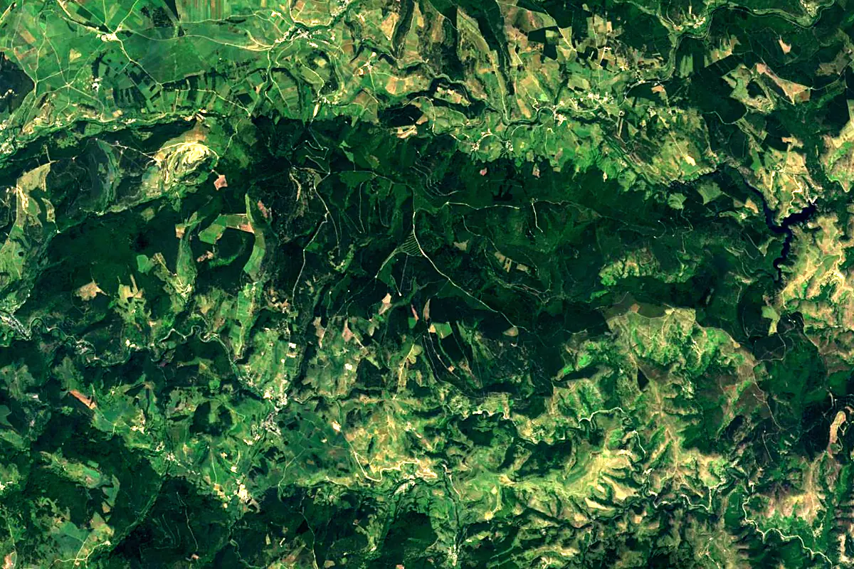
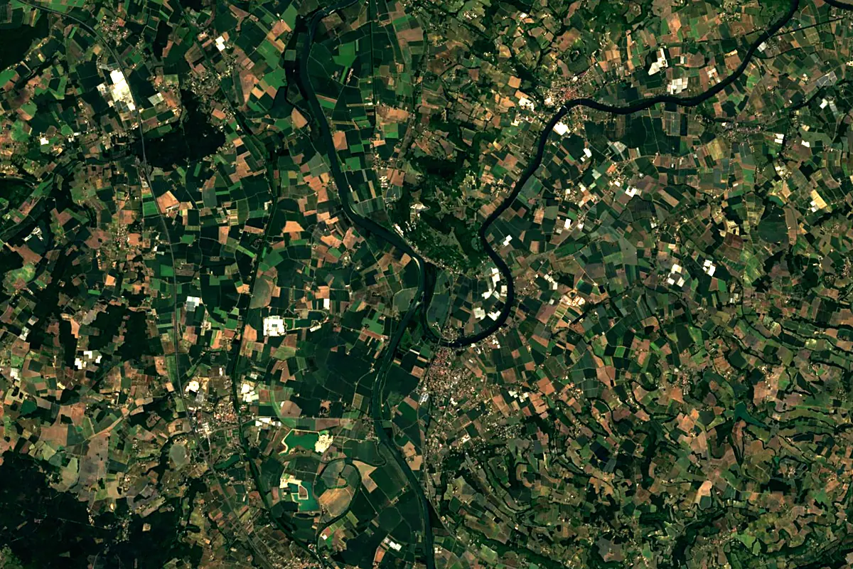
Sentinel-2 cloudless 2016 by EOX IT Services GmbH (contains modified Copernicus Sentinel data 2016), CC BY 4.0. The glowing line is the river as drawn by RiverATLAS.
Tributaries
Where it flows, and what flows into it
It flows into
GaronneFrance647 km660 m³/sTributaries (27)
Also: Truyère, Célé, Lède, Colagne, Dourdou de Conques, Lémance, Bramont, Boudouyssou, Boralde de Saint-Chély-d'Aubrac, Diège, Riou Mort, Thèze, Auze, Ruisseau des Mousseaux, Boralde de Flaujac, Vers, Vert, Coussanne, Masse, Merdanson, Doulou, Bausse, Mourjou, Ruisseau de Limou
Nearby
Rivers nearby
Where these numbers come from
| Name, length, places | Wikidata (Q211766) · CC0 |
|---|---|
| Course, profile, basin | RiverATLAS v1.0 (HydroATLAS, Linke et al. 2019) · CC BY 4.0 — followed from the source to the mouth given by Wikidata |
| Flow | WaterGAP (RiverATLAS), 1971–2000 · CC BY 4.0 |
| Climate along the river | WorldClim (RiverATLAS), 1970–2000 · CC BY 4.0 |
| Towns, bridges, dams | Wikidata · CC0; GeoNames · CC BY 4.0 |
| Along the river | © OpenStreetMap contributors · ODbL |
| Images | EOX Sentinel-2 cloudless 2016 · CC BY 4.0; Wikimedia Commons |
| Our other atlases | Peakyas — Wikidata · CC0; © OpenStreetMap contributors · ODbL; GeoNames · CC BY 4.0; HydroLAKES · CC BY 4.0; NOAA OISST |
Every source and licence is on the data sources page.
The family
Do you prefer beaches, lakes, mountains, waterfalls, islands, rivers or canyons?
Same idea, other landscapes: field atlases built on open data, month by month, in seven languages.
 beaches
 Find your beach: sea temperature, sun and swimming month by month.Visit
  lakes
lakes Every lake on Earth: water temperature, ice, depth and the shore.Coming soonVisit mountains
 Every summit in 3D: summit weather, the 0 °C line, huts and trails.Visit
  waterfalls
 Every waterfall: height, flow month by month and when it roars.Coming soonVisit
  islands
 Every island from the sea up: size, sea temperature, ferries and 3D.Coming soonVisit
  rivers
 Every river from source to sea: the journey, the flow and the basin in numbers.You are here
 canyons
 Every canyon cut to scale: depth to the floor, rim and floor temperatures, trails and viewpoints.Coming soonVisit