River
Tarn
380 km from source to mouth · France.
 FranceFlows into Garonne
In numbers
Length
380km
Average flow
140m³/s
Basin
15,753km²
Drop
709m
from 770 m to 61 m
Country
1
The journey
From source to mouth
380 km of river and 68 stops on the way: 51 towns and cities on its banks, dams, bridges and the tributaries that feed it.
- 0 kmMont Lozèreat 770 m
- 76 kmLumensonesquetributary
- 76 kmJonte Rivertributary
- 79 kmMostuéjouls333 people
- 84 kmRivière-sur-Tarn1,069 people
- 86 kmLa Cresse333 people
- 90 kmAguessac929 people
- 90 kmCompeyre526 people
- 98 kmMillau22,044 people
- 99 kmCreissels1,568 people
- 104 kmMillau Viaduct
- 107 kmSaint-Georges-de-Luzençon1,565 people
- 111 kmComprégnac227 people
- 121 kmCascade des Baumes
- 121 kmSaint-Rome-de-Tarn904 people
- 125 kmViala-du-Tarn529 people
- 134 kmAyssènes225 people
- 138 kmLe Truel350 people
- 146 kmBroquiès613 people
- 147 kmGostributary
- 147 kmDourdoutributary
- 155 kmBrousse-le-Château164 people
- 162 kmRéquista1,924 people
- 170 kmRancetributary
- 170 kmAlrancetributary
- 185 kmAmbialet471 people
- 191 kmVillefranche-d'Albigeois1,224 people
- 206 kmSaint-Juéry6,564 people
- 206 kmArthès2,528 people
- 211 kmLescure-d'Albigeois4,590 people
- 215 kmAlbi51,290 people
- 217 kmCausselstributary
- 223 kmCastelnau-de-Lévis1,603 people
- 224 kmTerssac1,195 people
- 228 kmMarssac-sur-Tarn3,518 people
- 233 kmLagrave2,305 people
- 235 kmSaudronnetributary
- 243 kmBrens2,423 people
- 244 kmGaillac16,162 people
- 249 kmMontans1,558 people
- 256 kmLisle-sur-Tarn4,939 people
- 268 kmRabastens5,867 people
- 268 kmCoufouleux3,057 people
- 274 kmSaint-Sulpice-la-Pointe9,719 people
- 274 kmRuisseau de Passetributary
- 274 kmAgouttributary
- 274 kmDourbietributary
- 279 kmBuzet-sur-Tarn2,963 people
- 283 kmBessières4,310 people
- 287 kmMirepoix-sur-Tarn1,139 people
- 289 kmLa Magdelaine-sur-Tarn1,254 people
- 292 kmVillematier1,133 people
- 293 kmBondigoux766 people
- 296 kmVillemur-sur-Tarn6,345 people
- 305 kmNohic1,388 people
- 307 kmOrgueil1,720 people
- 312 kmLabastide-Saint-Pierre3,745 people
- 314 kmCorbarieu1,725 people
- 318 kmBressols4,036 people
- 323 kmRiver Tescoutributary
- 323 kmRieu Torttributary
- 324 kmMontauban62,945 people
- 337 kmBarry-d'Islemade940 people
- 337 kmAveyrontributary
- 342 kmLafrançaise2,865 people
- 352 kmLemboulastributary
- 358 kmCastelsarrasin14,343 people
- 360 kmMoissac13,419 people
- 367 kmSaint-Nicolas-de-la-Grave2,281 people
- 380 kmGaronneat 61 m
Water level along the river (RiverATLAS; the height is exaggerated). Towns: GeoNames and Wikidata; bridges, dams and tributaries: Wikidata.
River in southern France
At the mouth it carries 140 m³/s on average: an Olympic pool every 18 seconds. It drops from 770 m to 61 m, 1.9 m per kilometre on average. Its basin covers 15,753 km², about the size of TL. 2.3 million people live in it. Highest water: from December to February. Its dams hold back little of its water (5.4% of a year's flow).
Where to start
- MontaubanLargest city on its banks · 62,945 people
- Toulouse-Blagnac Airport (TLS)Nearest airport with scheduled flights, 43 km from the cityCar hire at TLS airport (Toulouse/Blagnac)Discover Cars · Affiliate link↗
- On the water40 ferry piers, marinas, boat rentals and boat ramps along the river (OpenStreetMap)
- Kayak and canoe1 put-ins and rapids mapped (OpenStreetMap)
- From May to SeptemberThe best months to visit
Tarn, month by month
Highest water: from December to February
Best months to visit: from May to September.
From about 96 m³/s in the lowest month to 510 m³/s in the highest. An estimate: the monthly flow is modelled from the lowest and highest months of WaterGAP (RiverATLAS, 1971–2000) and the rain and snow along the river (WorldClim). Dams change the real rhythm. The chip is the average air temperature; below it, the month's rain.
Plan the trip
Plan the trip: boat trips, a bed by the river, a car
Some links above are affiliate links: if you book through them we may earn a commission, at no extra cost to you. It never changes what the data on this page says.
The basin
Tarn: the basin in numbers
30,720 km² of land send their water to this river. This is what lives on it.
- 2.3millionpeople live in the basin
- 74/km²people per km²
- 579maverage altitude of the basin
- 826mmof rain a year (basin average)
- 11.0°Caverage air temperature
- 30%protected areas
- 0.2%covered by lakes
- 0.6km³held in reservoirs
What covers the basin
- 36% Forest
- 37% Cropland
- 16% Pasture
- 3% Towns and cities
RiverATLAS (HydroATLAS v1.0, CC BY 4.0): land cover, people, protected areas, glaciers and dams over the whole basin upstream of the mouth.
Along the river
Tarn: what you find on the way
- 44WeirsChaussée de Corbarieu, Chaussée de Moissac and 42 more
- 39LocksCanal de Montech, Le Tarn, Écluse du Cacor and 36 more
- 11WaterfallsCascade de Runes, Cascade de l'Homède, Cascade des Baumes and 8 more
- 1Canoe put-ins
- 20Boat ramps
- 7MarinasCanoë trebas (départ), Canoë trebas (arrivée), Halte Nautique de Montauban and 4 more
- 10River beachesLa Rode, Plage communale, Gourg de bade and 7 more
From OpenStreetMap, within 2.1 km of the river. Not mapped is not the same as not there.
Cross-checked with our atlases
Tarn in our other atlases
What our sister atlases know about the waterfalls on this river, the lakes it flows through, the beaches at its mouth, the mountains where it rises and the islands off its mouth.
 1waterfall on the riverCascadyas
 17mountains at the sourcePeakyas
Waterfalls (1)
On the river, by Cascadyas
- Cascade des Baumeskm 111
Cascadyas is coming soonOpen Cascadyas ↗
Mountains at the source (17)
Within 15 km of the source, by Peakyas
- Mont Lozère6.3 km away1,699m
- Sommet de Finiels6.1 km away1,699m
- Montagne du Goulet14 km away1,497m
- La Tete de Boeuf4.9 km away1,587m
- Mont Lozere - Pic Cassini3.0 km away1,542m
- Mont Lozere - Roc des Laubies9.4 km away1,492m
- Signal de Ventalon11 km away1,350m
- Montagne du Bouges13 km away
9 more on PeakyasOpen Peakyas ↗
From space
The source and the mouth, seen from orbit
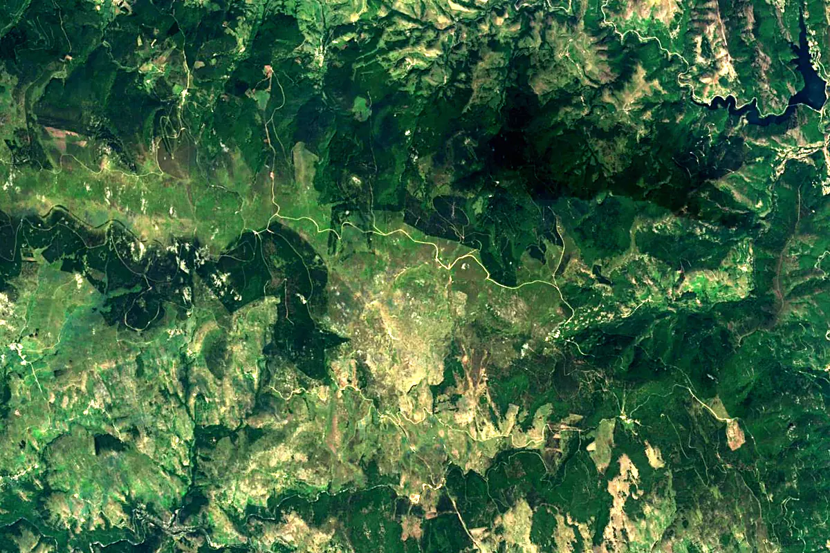
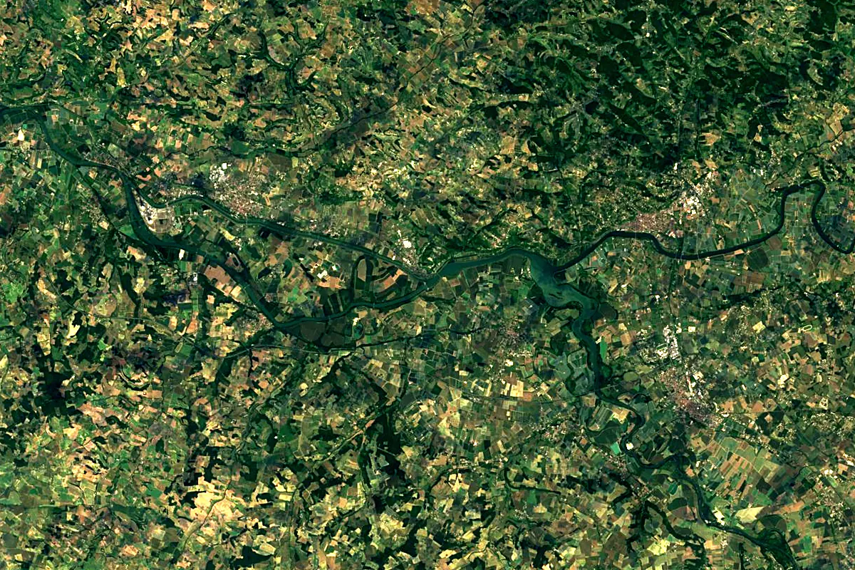
Sentinel-2 cloudless 2016 by EOX IT Services GmbH (contains modified Copernicus Sentinel data 2016), CC BY 4.0. The glowing line is the river as drawn by RiverATLAS.
Photos
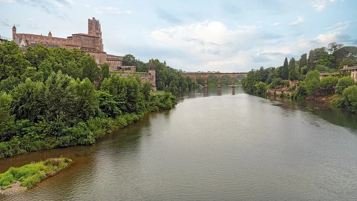
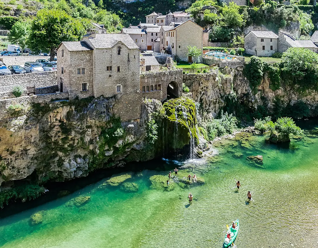
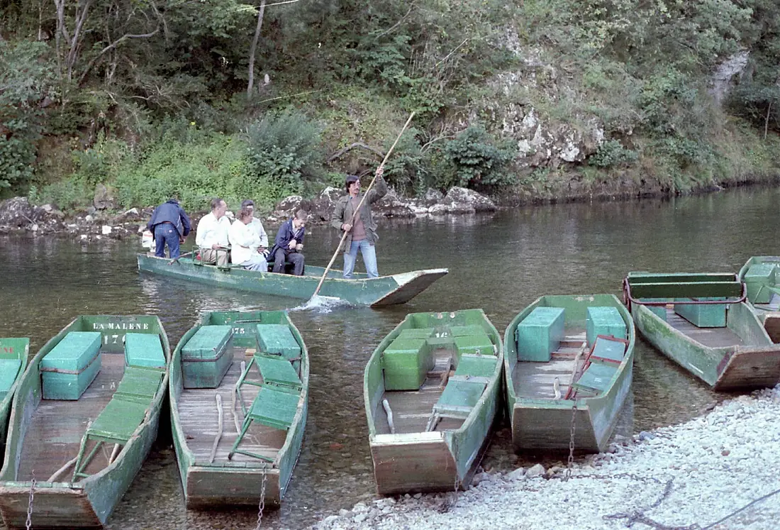
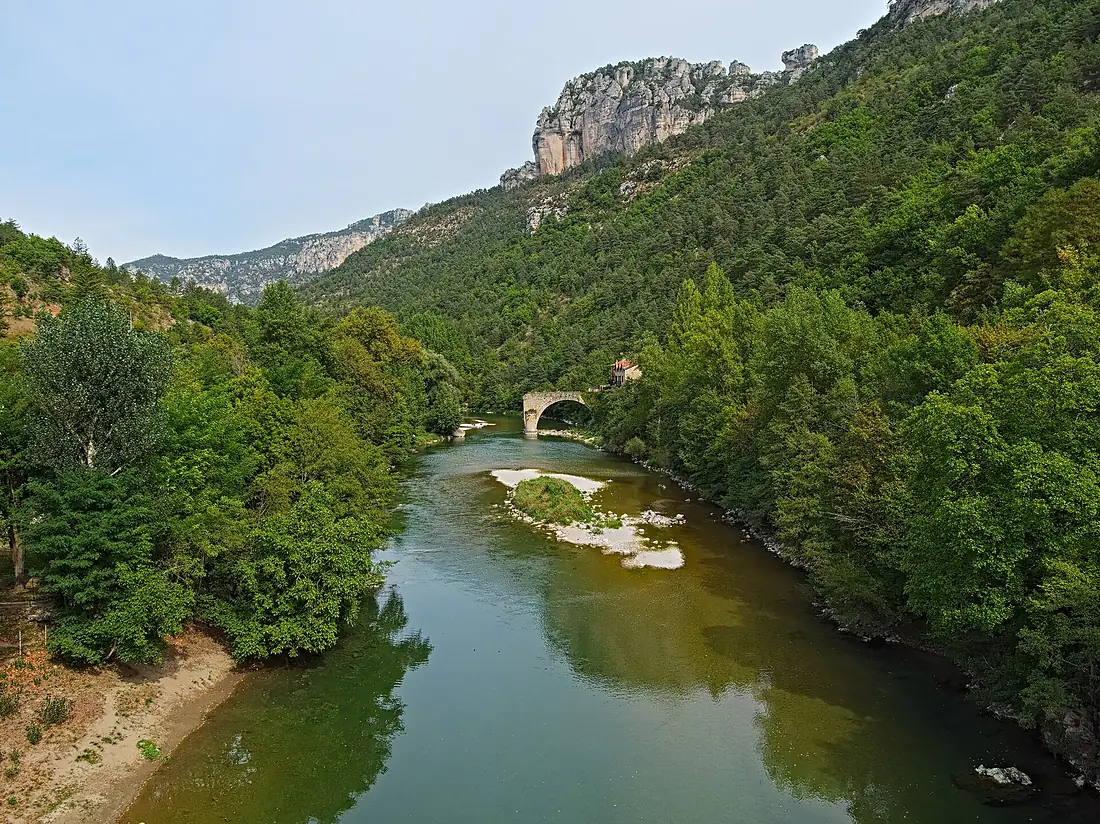
Tarn in pictures
Tributaries
Where it flows, and what flows into it
It flows into
GaronneFrance647 km660 m³/sTributaries (29)
Also: Dourbie, Dourdou, Tarnon, Jonte River, River Tescou, Cernon, Rance, Alrance, Muze, Lemboulas, Lumensonesque, Rûnes, Gos, Caussels, Gaycre, moulin de Trouche, Saudronne, Rieu Tort, Ruisseau de Coules, Ruisseau de Passe, Coudols, Rieumalet, Souhet, Luzert
Nearby
Rivers nearby
Where these numbers come from
| Name, length, places | Wikidata (Q215653) · CC0 |
|---|---|
| Course, profile, basin | RiverATLAS v1.0 (HydroATLAS, Linke et al. 2019) · CC BY 4.0 — followed from the source to the mouth given by Wikidata |
| Flow | WaterGAP (RiverATLAS), 1971–2000 · CC BY 4.0 |
| Climate along the river | WorldClim (RiverATLAS), 1970–2000 · CC BY 4.0 |
| Towns, bridges, dams | Wikidata · CC0; GeoNames · CC BY 4.0 |
| Along the river | © OpenStreetMap contributors · ODbL |
| Images | EOX Sentinel-2 cloudless 2016 · CC BY 4.0; Wikimedia Commons |
| Our other atlases | Cascadyas, Peakyas — Wikidata · CC0; © OpenStreetMap contributors · ODbL; GeoNames · CC BY 4.0; HydroLAKES · CC BY 4.0; NOAA OISST |
Every source and licence is on the data sources page.
The family
Do you prefer beaches, lakes, mountains, waterfalls, islands, rivers or canyons?
Same idea, other landscapes: field atlases built on open data, month by month, in seven languages.
 beaches
 Find your beach: sea temperature, sun and swimming month by month.Visit
  lakes
lakes Every lake on Earth: water temperature, ice, depth and the shore.Coming soonVisit mountains
 Every summit in 3D: summit weather, the 0 °C line, huts and trails.Visit waterfalls
 Every waterfall: height, flow month by month and when it roars.Coming soonVisit
  islands
 Every island from the sea up: size, sea temperature, ferries and 3D.Coming soonVisit
  rivers
 Every river from source to sea: the journey, the flow and the basin in numbers.You are here
 canyons
 Every canyon cut to scale: depth to the floor, rim and floor temperatures, trails and viewpoints.Coming soonVisit