River
Garonne
647 km from source to mouth · France and Spain.

 France and SpainFlows into Gironde estuary4th longest in France
In numbers
Length
647km
Average flow
660m³/s
Basin
56,000km²
Drop
1,168m
from 1,168 m to 0 m
Countries
2
The journey
From source to mouth
647 km of river and 68 stops on the way: 42 towns and cities on its banks, dams, bridges and the tributaries that feed it.
- 0 kmLa Bonaigua de Baixat 1,168 m
- 8 kmVal d'Aran10,565 people
- 17 kmVielha e Mijaran5,865 people
- 61 kmPiquetributary
- 87 kmNestetributary
- 108 kmSaint-Gaudens12,139 people
- 144 kmSalattributary
- 160 kmCazères4,854 people
- 181 kmCarbonne5,563 people
- 182 kmArizetributary
- 211 kmMuret26,079 people
- 212 kmLougetributary
- 221 kmRoques5,436 people
- 226 kmAriègetributary
- 226 kmPortet-sur-Garonne9,782 people
- 239 kmToulouse514,819 people
- 245 kmTouchtributary
- 247 kmBlagnac27,604 people
- 253 kmBeauzelle8,713 people
- 263 kmSaint-Jory8,662 people
- 266 kmMerville6,760 people
- 272 kmHers-Morttributary
- 275 kmGrenade9,062 people
- 276 kmMarguestaudtributary
- 284 kmSavetributary
- 294 kmRuisseau la Nadessetributary
- 319 kmGimonetributary
- 319 kmLambontributary
- 327 kmCastelsarrasin14,343 people
- 345 kmTarntributary
- 364 kmArratstributary
- 365 kmBarguelonnetributary
- 385 kmSéounetributary
- 391 kmGerstributary
- 398 kmAgen32,801 people
- 428 kmAuvignontributary
- 439 kmBaïsetributary
- 443 kmLottributary
- 455 kmTonneins9,459 people
- 485 kmMarmande17,328 people
- 491 kmAvancetributary
- 518 kmLa Réole4,487 people
- 526 kmDropttributary
- 540 kmSaint-Macaire1,981 people
- 543 kmLangon7,674 people
- 552 kmCirontributary
- 553 kmBarsac2,058 people
- 558 kmCadillac-sur-Garonne2,670 people
- 563 kmPodensac3,269 people
- 574 kmLangoiran2,215 people
- 578 kmCastres-Gironde2,695 people
- 578 kmGuat morttributary
- 578 kmBeautiran2,488 people
- 589 kmCadaujac6,909 people
- 591 kmCamblanes-et-Meynac3,181 people
- 592 kmLatresne3,714 people
- 595 kmVillenave-d'Ornon42,545 people
- 598 kmBègles31,831 people
- 598 kmBouliac3,804 people
- 600 kmFloirac18,300 people
- 604 kmBordeaux267,991 people
- 611 kmLormont25,769 people
- 614 kmBassens8,435 people
- 615 kmJalle de Blanqueforttributary
- 618 kmBlanquefort17,215 people
- 619 kmParempuyre10,672 people
- 629 kmAmbès3,313 people
- 629 kmMacau4,576 people
- 629 kmLudon-Médoc5,578 people
- 647 kmGironde estuaryat 0 m
Water level along the river (RiverATLAS; the height is exaggerated). Towns: GeoNames and Wikidata; bridges, dams and tributaries: Wikidata.
River in southwest France and northern Spain
At the mouth it carries 658 m³/s on average: an Olympic pool every 3.8 seconds. It drops from 1,168 m to 0 m, 1.8 m per kilometre on average. Its basin covers 56,000 km², about the size of HR. 4.0 million people live in it. Highest water: from December to February. Its dams hold back little of its water (6.5% of a year's flow).
Where to start
- ToulouseLargest city on its banks · 514,819 people
- Toulouse-Blagnac Airport (TLS)Nearest airport with scheduled flights, 7 km from the cityCar hire at TLS airport (Toulouse/Blagnac)Discover Cars · Affiliate link↗
- On the water93 ferry piers, marinas, boat rentals and boat ramps along the river (OpenStreetMap)
- From May to SeptemberThe best months to visit
Garonne, month by month
Highest water: from December to February
Best months to visit: from May to September.
From about 210 m³/s in the lowest month to 950 m³/s in the highest. An estimate: the monthly flow is modelled from the lowest and highest months of WaterGAP (RiverATLAS, 1971–2000) and the rain and snow along the river (WorldClim). Dams change the real rhythm. The chip is the average air temperature; below it, the month's rain.
Plan the trip
Plan the trip: boat trips, a bed by the river, a car
Some links above are affiliate links: if you book through them we may earn a commission, at no extra cost to you. It never changes what the data on this page says.
The basin
Garonne: the basin in numbers
55,940 km² of land send their water to this river. This is what lives on it.
- 4.0millionpeople live in the basin
- 73/km²people per km²
- 476maverage altitude of the basin
- 825mmof rain a year (basin average)
- 11.2°Caverage air temperature
- 21%protected areas
- 0.2%covered by lakes
- 1.3km³held in reservoirs
What covers the basin
- 33% Forest
- 39% Cropland
- 15% Pasture
- 3% Towns and cities
RiverATLAS (HydroATLAS v1.0, CC BY 4.0): land cover, people, protected areas, glaciers and dams over the whole basin upstream of the mouth.
Along the river
Garonne: what you find on the way
- 95WeirsBarratge deth Garona, Saut de Cledes, La Cavaletade and 92 more
- 135LocksÉcluse Saint-Michel, Canal du Midi, Écluse Saint-Pierre and 132 more
- 3Waterfalls
- 59Boat rampsCale de la Garonnelle, Cale d'Embarquement Garonne, Cale de Mise à l'Eau and 56 more
- 3Ferry piersCité du Vin
- 27MarinasPort Saint-Sauveur, Port Jacques-Yves Cousteau, Halte nautique de Castelsarrasin and 24 more
- 7River beachesLe 15, Garonne Plage, Le Ponton and 4 more
From OpenStreetMap, within 2.2 km of the river. Not mapped is not the same as not there.
Cross-checked with our atlases
Garonne in our other atlases
What our sister atlases know about the waterfalls on this river, the lakes it flows through, the beaches at its mouth, the mountains where it rises and the islands off its mouth.
 247mountains at the sourcePeakyas
 2islands off the mouthIslandyas
Mountains at the source (247)
Within 15 km of the source, by Peakyas
- Comaloforno12 km away · prominence 689 m3,029m
- Besiberri Sud12 km away · prominence 36 m3,023m
- Punta Alta de Comalesbienes8.1 km away · prominence 540 m3,014m
- Besiberri Nord12 km away · prominence 101 m3,008m
- Pic de Peguera9.2 km away · prominence 560 m2,983m
- Besiberri del Mig12 km away · prominence 64 m2,995m
- Gran Tuc de Colomers4.0 km away · prominence 185 m2,933m
- Pic de la Pala Alta de Sarradé8.0 km away · prominence 165 m2,983m
239 more on PeakyasOpen Peakyas ↗
Islands off the mouth (2)
Within 30 km of the mouth, by Islandyas
- île Paté16 km away
- Île de Patiras24 km away
Islandyas is coming soonOpen Islandyas ↗
From space
The source and the mouth, seen from orbit
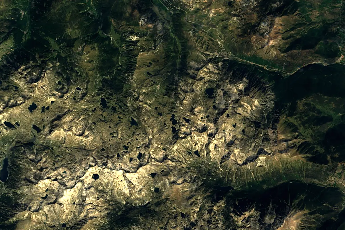
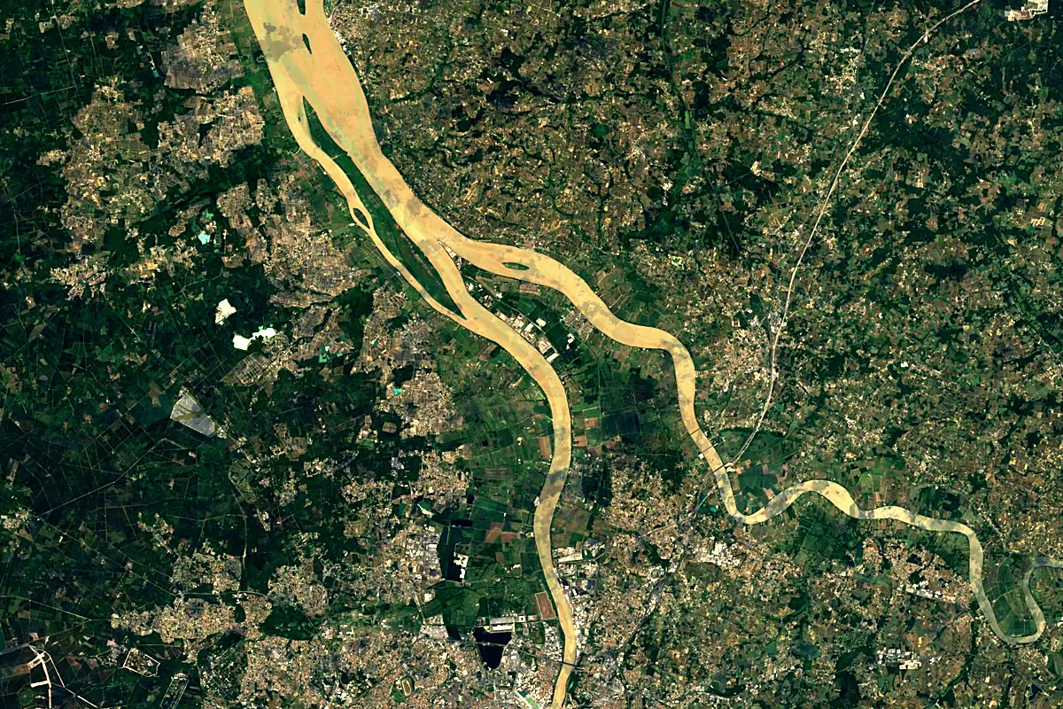
Sentinel-2 cloudless 2016 by EOX IT Services GmbH (contains modified Copernicus Sentinel data 2016), CC BY 4.0. The glowing line is the river as drawn by RiverATLAS.
Photos
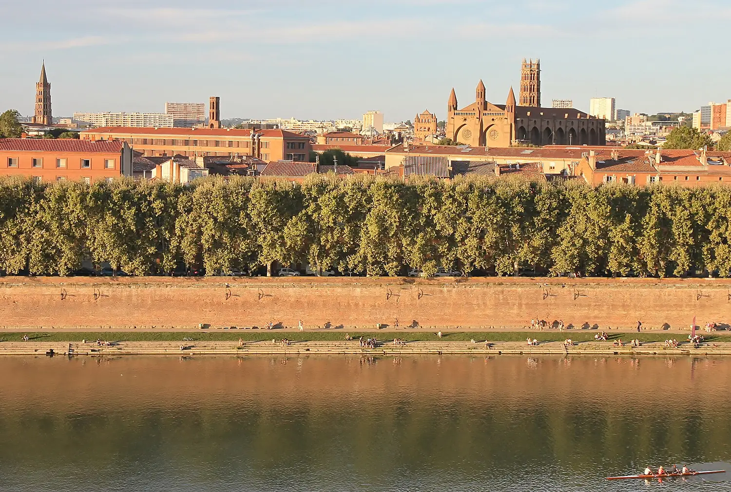
Garonne in pictures
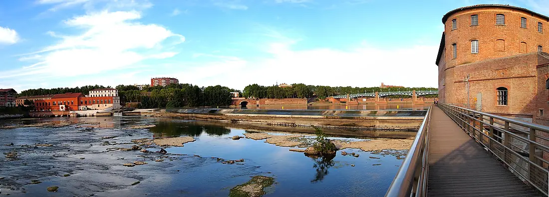
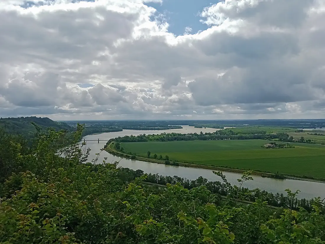
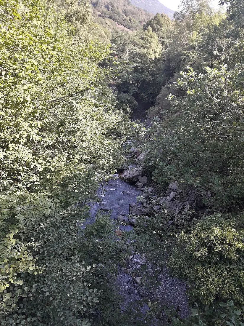
Tributaries
Where it flows, and what flows into it
Tributaries (72)
France485 km180 m³/sjoins at km 339TarnFrance380 km140 m³/sjoins at km 264BaïseFrance188 km5.0 m³/sjoins at km 336GersFrance175 km720 m³/sjoins at km 300AriègeFrance163 km76 m³/sjoins at km 173Also: Salat, Gimone, Save, Louge, Arrats, Hers-Mort, Arize, Touch, Ciron, Neste, Volp, Dropt, Barguelonne, Pique, Auroue, Séoune, Avance, Ourse, Auvignon, Guat mort, Jalle de Blanquefort, Ger, Arriu Unhòla, Aussonnelle
In the same basin
Nearby
Rivers nearby
Where these numbers come from
| Name, length, places | Wikidata (Q5077) · CC0 |
|---|---|
| Course, profile, basin | RiverATLAS v1.0 (HydroATLAS, Linke et al. 2019) · CC BY 4.0 — followed from the source to the mouth given by Wikidata |
| Flow | WaterGAP (RiverATLAS), 1971–2000 · CC BY 4.0 |
| Climate along the river | WorldClim (RiverATLAS), 1970–2000 · CC BY 4.0 |
| Towns, bridges, dams | Wikidata · CC0; GeoNames · CC BY 4.0 |
| Along the river | © OpenStreetMap contributors · ODbL |
| Images | EOX Sentinel-2 cloudless 2016 · CC BY 4.0; Wikimedia Commons |
| Our other atlases | Peakyas, Islandyas — Wikidata · CC0; © OpenStreetMap contributors · ODbL; GeoNames · CC BY 4.0; HydroLAKES · CC BY 4.0; NOAA OISST |
Every source and licence is on the data sources page.
The family
Do you prefer beaches, lakes, mountains, waterfalls, islands, rivers or canyons?
Same idea, other landscapes: field atlases built on open data, month by month, in seven languages.
 beaches
 Find your beach: sea temperature, sun and swimming month by month.Visit
  lakes
lakes Every lake on Earth: water temperature, ice, depth and the shore.Coming soonVisit mountains
 Every summit in 3D: summit weather, the 0 °C line, huts and trails.Visit
  waterfalls
 Every waterfall: height, flow month by month and when it roars.Coming soonVisit islands
 Every island from the sea up: size, sea temperature, ferries and 3D.Coming soonVisit
  rivers
 Every river from source to sea: the journey, the flow and the basin in numbers.You are here
 canyons
 Every canyon cut to scale: depth to the floor, rim and floor temperatures, trails and viewpoints.Coming soonVisit